SlideShare ist ein Scribd-Unternehmen logo
1 von 40
Town of Dennis Multi-Hazard Mitigation Plan Draft  November 5, 2009
The purpose of this plan is to fulfill the federal regulations for the  Federal Emergency Management Agency’s (FEMA) Mitigation Planning,  under the Code of Federal Regulations (CFR) Title 44 Part 201. All cities and towns are required to adopt local multiple-hazard mitigation plan in order to remain eligible for the Federal Emergency Management Agency (FEMA) Hazard Mitigation Grant funds (available after a disaster is declared) and to be eligible for other federal hazard mitigation funds.  The plan attempts to provide a process for the Town of Dennis to accomplish the following: ,[object Object],[object Object],[object Object],[object Object],[object Object],[object Object],[object Object],[object Object],[object Object]
Hazard Mitigation Preparedness Process
Section 2: Hazard Analysis and Risk Assessment Section 201.6(C)(2) of the regulations requires the Town of Dennis to provide a hazard and risk assessment.  This process will include a description of the town, a discussion of “at-risk” communities and an analysis of relative risk.
FLOODING
[object Object],[object Object],[object Object]
We Really Need To Worry About This Larger Flood Potential Area Photos from the Chase’s Ocean Grove Homeowner’s Association Website
STORMS
Storms
New England Hurricane of 1938 “ 1938 storm's greatest killer and what caught most people off guard: storm surge.” “ To the east, the surge left Falmouth and New Bedford under eight feet of water. Two-thirds of all the boats in New Bedford harbor sank.” Storm Surge - Tidal Departures Fairhaven, MA - 25 feet above MLW Pocasset, MA - 20 feet above MLW Nobska Point Light Station (Woods Hole, MA) - 15 feet above MLW Fall River, MA - 18 feet above MLW
 
Hurricane Storm Surge
 
EROSION
Erosion and Sedimentation
Erosion
Erosion
BLIZZARD
BLIZZARD
WILD FIRE
WILD FIRE WILDLAND FIRE PROTECTION AND PREPAREDNESS PLAN FOR PLASHES CONSERVATION AREA AND SURROUNDING OPEN SPACE TRACTS; WILDLAND FIRE PROTECTION AND PREPAREDNESS PLAN FOR RALPH AND FLORENCE SHOOP MEMORIAL WILDLAND FIRE PROTECTION AND PREPAREDNESS PLAN FOR GREEN BELT WELL FIELD; WILDLAND FIRE PROTECTION AND PREPAREDNESS PLAN FOR PRINCESS BEACH CONSERVATION AREA AND ADJACENT SCARGO HILL
SEA LEVEL RISE
SEA LEVEL RISE
HAZARD MAPPING
Other Hazards Limited Small Possible Sink holes Limited Small Possible Landslides Negligible Local Unlikely Earthquakes Geologic Hazards Limited Local Possible Flooding Critical Local Possible Urban Fires Limited Local Likely Wildfires Limited Medium Possible Drought Fire-Related Hazards Critical Small Possible Tornadoes Limited Small Possible Downspouts Critical Regional High Winter Storms Critical Regional High Coastal Storms Critical Large Possible Hurricanes Wind-Related Hazards Critical Large Possible Hurricanes Critical Regional High Coastal Storms or nor’easters Critical Regional High Winter Storms Limited Small High Thunderstorms Negligible Local Unlikely Dam Failures Limited Southern Coastline Limited Northern Coastline Critical Chapin Beach, West Dennis Beach High Erosion Critical West Dennis, Dennisport High Coastal Limited Swan River, Bass River, Sesuit Creek, Chase Garden Creek Possible Riverine Flood-Related Hazards Impacts (i.e. catastrophic, critical, limited, negligible) Location (i.e. local or small, medium or regional, multiple communities or large) Likelihood of Occurrence(i.e. highly, likely, possible, unlikely) Natural Hazard
No Real estate disclosure requirements  No A post-disaster recovery plan  Yes, maintained by Police and Fire Dept. An emergency response plan  As part of Comprehensive Plan An economic development plan  Somewhat A capital improvements plan  Adopted 2002, under revision Comprehensive plan  Planning Board conducts Site Plan Review Site plan review requirements  Village Centers adopted, land acquisition Growth management ordinances (also called “smart growth” or anti-sprawl programs)  Floodplain Management: Zoning and Wetlands Regulation; Stormwater: Town By-law; Hazard Setback: Zoning By-law and Wetlands Regulation; Hillside or Steep Slope:  Crowe’s Pasture only; Wildfire: none Special purpose ordinances (floodplain management, stormwater management, hillside or steep slope ordinances, wildfire ordinances, hazard setback requirements)  Last Amended 1993 Subdivision ordinance or regulations  First Adopted 1951 Zoning ordinance  State Building Code Building code  Status Regulatory Tools (ordinances, codes, plans)
  Section 3.6, estimates potential dollar losses to vulnerable structures.  Assessing Vulnerability: Estimating Potential Losses §201.6(c)(2)(ii)(B) The plan  should  describe vulnerability in terms of an estimate of the potential dollar losses to vulnerable structures identified in paragraph (c)(2)(ii)(A) of this section and a description of the methodology used to prepare the estimate.    Section 3.2, identifies critical facilities located in the profiled hazard areas.  Assessing Vulnerability: Identifying Structures §201.6(c)(2)(ii)(A) The plan  should  describe vulnerability in terms of the types and number of existing and future buildings, infrastructure, and critical facilities located in the identified hazard areas.    The Town of Dennis participates in the NFIP, Repetitive Loss information is provided to the extent feasible given privacy concerns.  Assessing Vulnerability: Addressing Repetitive Loss Properties §201.6(c)(2)(ii)  The risk assessment in all plans approved after October 1, 2008 must also address National Flood Insurance Program (NFIP) insured structures that have been repetitively damaged floods.    Section 3, Assessing Vulnerabilities contains overall summaries of each hazard and the impacts on the community are contained in each hazard specific section in Section 3.3.  Assessing Vulnerability: Overview §201.6(c)(2)(i) The risk assessment  shall  include a description of the jurisdiction’s vulnerability to the hazards described in paragraph (c)(2)(i) of this section. This description shall include an overall summary of each hazard and its impact on the community.    Section 2, Risk Assessment, includes hazard-specific sections in the. The MHMP profiles the natural hazards that may affect the area. The MHMP includes  location, extent, probability, impact and previous occurrences  for each natural hazard identified. .  Profiling Hazards §201.6(c)(2)(i) The risk assessment  shall  include a description of the . . . location and extent of all natural hazards that can affect the jurisdiction. The plan shall include information on previous occurrences of hazard events and on the probability of future hazard events.  Section 2, identifies severe weather (hurricanes, blizzards, thunderstorms and tornadoes), wildfire, and erosion as natural hazards to be profiled in the Dennis MHMP.  Identifying Hazards §201.6(c)(2)(i) The risk assessment  shall  include a description of the type . . . of all natural hazards that can affect the jurisdiction . . .  Multi-Jurisdictional Hazard Mitigation Plan Where it is Addressed in Plan  Section §201.6(c)(2) Requirement
[object Object],[object Object],[object Object],[object Object],[object Object],[object Object],Hurricanes  Northeasters  Tornadoes Roofs Blowing Off  Trees Downed WIND Areas of Coastal Flooding   •  West Dennis Beach  • Chapin Beach •  Mayflower Beach  • North Side Marina •  Haigis Beach  • South Village Beach •  Glendon Road Beach • Sea Street Beach •  Cold Storage Beach  • Sea Street Beach •  Corporation Beach Areas of River Flooding  •  Upper County Road Bridge over the Swan River •  Bass River Marina  • Mayfair Boatyard Areas of Episodic Erosion  •  Mayflower Beach  • Chapin’s Beach •  Crowe’s Pasture  • West Dennis Beach Areas of Episodic Siltation  •  Sesuit Harbor  • Bass River •  Swan River  • Chase Garden Creek Deficient Infrastructure •  Upper County Road Bridge over the Swan River •  Route 28 Bridge over Swan River ,[object Object],[object Object],[object Object],[object Object],[object Object],[object Object],[object Object],[object Object],[object Object],[object Object],[object Object],[object Object],[object Object],[object Object],[object Object],[object Object],FLOOD LOCATION CAUSE & EFFECT NATURAL HAZARD
Structural Damage -  Locations proximal to seismic activity:  According to Regional Hazard Risk Map II geologic activities have not been recorded.  Loss of Land Dennis, as is all of Cape Cod, is a sandbar.  There is always significant risk to the town due to coastal erosion.  Some portions of town have experienced significant areas of erosion over the town’s history.  Major storms, such as the Blizzard of 78 vastly altered the coastline.  Lesser storms, including a Northeaster in June of 2009 also have had significant impacts.  Barrier Beach erosion at places like West Dennis Beach or Chapin’s Beach could severely affect the lands behind these barrier beaches. Wave Inundation Dennis has several areas protected by barrier beaches.  These barrier beaches protect lands in Dennis, Yarmouth and Brewster from normal wave action.  These barrier beach areas are at risk both to wind erosion as well as wave inundation.  All three barrier beaches in town, West Dennis Beach, Chapin’s Beach and Crowe’s Pasture are all considered to be located within velocity zones and would be exposed to tremendous wave action and could be totally inundated in a 1% storm event. Earthquakes  Landslides  Sink Holes     GEOLOGIC Wildfire  Developed land / forested area interfaces: •  Crowes Pasture •  Princess Beach/Scargo Hill •  Old Chatham Rd Water District Lands •  The Plashes •  Shoop Gardens Urban Fire •  Dennisport Village Center is blessed with many old buildings placed close together.  The Village was the scene of a major urban fire in the 1920’s which destroyed an entire block.  Construction standards of the 1920’s do not match modern fire safety standards, leaving this area once again at risk of an Urban Fire. •  West Dennis, while not as compact as Dennisport shares many of the same urban fire concerns.  The older portions of town still bear resemblance to the original village settlement with shared, wood, walls.  This area is at significant risk should a fire begin in one of these older connected structures. Drought  Wildfire  Lightening Strikes Urban Fire FIRE
Table 12:  Vulnerable and Evacuating Populations *Information derived from the GIS layers as maintained by the Dennis Planning Dept., U.S. Census Block Group Data, Assessors Information on Residential Units, Motel Units and Seasonal Cottages. . 17,022* 11,935* 5,087 53,488* 37,475* 15,973 2000 Total Seasonal Permanent Total Seasonal Permanent Census Vulnerable Population** Population   Population
  $425,103.95 39 TOTALS   V8 (EL 15) Single Family $108,882.36 4 Dennisport   Single Family $9,716.94 2 Dennisport   V13 (EL 13) Single Family $12,980.73 2 West Dennis   A11 (EL 11) Single Family $12,917.80 2 West Dennis   V13 (EL 12) Single Family $9,158.65 2 West Dennis   V13 (EL 13) Single Family $32,603.71 2 West Dennis   V13 (EL 12) Condo $66,506.24 4 West Dennis   A11 (EL 11) Single Family $26,335.25 2 Dennisport   V13 (EL 13) Other Residential $9,634.74 2 Dennisport   V13 (EL 15) Other Residential $31,379.70 3 Dennisport   V13 (EL 13) Single Family $55,925.15 2 West Dennis   A11 (EL11) Single Family $3,240.00 2 West Dennis   V13 (EL 12) Single Family $18,090.41 2 West Dennis   A8 (EL 10) Single Family $5,142.15 2 Dennisport   V13 (EL 13) Single Family $11,373.15 3 West Dennis   A3 (EL 11) Single Family $11,216.97 3 East Dennis   FLOOD ZONE TYPE PAID LOSSES VILLAGE Information provided by MEMA 1/14/04; 2003 data not yet available Table 14:  Repetitive Flood Losses (current through Dec. 2002)
POTENTIAL LOSSES ,[object Object],[object Object],[object Object],[object Object],[object Object]
Board of Health, Conservation Commission Areas with high water tables, proximate to wetlands, or located within flood zones Ensures proper design of septic systems located in areas designated as environmentally sensitive (high water table, proximity to wetlands, flood zones) Environmentally Sensitive Area Waste Water Requirements Planning Board, Building Commissioner Quivet Neck and Crowe’s Pasture in north east Dennis Special Zoning to protect the Quivet Neck/Crowe’s Pasture Resource Protection Area from inappropriate development. Quivet Neck/Crowe’s Pasture Resource Protection District  Community Preservation Committee, Dennis Conservation Trust Town-Wide Acquisition of critical land areas for resource management. Land Acquisition Barrier Beach Committee (est. Aug. 4, 2009) Chapin Beach, West Dennis Beach, Crowe’s Pasture Management Plan for the protection and nurturing of the three Barrier Beaches in Dennis. Barrier Beaches Management Building Commissioner   Building Code Enforcement Building Permits FEMA / Building Commissioner 100 Year Floodplain Areas as designated by FIRM Federally backed flood insurance available to homeowners, renters & businesses National Flood Insurance Program (NFIP) Conservation Commission 100 Year Floodplain Areas as designated by FIRM Dock Regulations Barnstable County Cooperative Extension Service,  Fire Department Dept of Natural Resources & Conservation Commission Shoop Community Gardens, Princess Beach/Scargo Hill, The Plashes, Water District Greenbelt Area County grant program to reduce wildfires Wildfire Assessment & Preparedness Program Planning Board Commercial Districts Review of development projects for storm water control in accordance with Storm Water by-law Site Plan Review Planning Board Residential and Commercial Districts Requires utilities to be placed underground, drainage designed in accordance with town Storm Water By-law Subdivision Regulations Building Commissioner with review by Engineering Department (Adopted October 2009) Town wide Provides for proper storm water system design to control volume and rate of storm water run-off Storm Water By-law Local Emergency Planning Committee Town wide Provides a framework wherein the community can plan and perform respective emergency functions during a disaster or emergency situation on the local, state or national level.   Comprehensive Management Emergency Plan Department of Public Works Beach and Recreation Dept. Town Beaches Raking and cleaning beaches of debris Beach Maintenance Program Conservation Commission Wetland Resource Areas Regulates development within wetland resource areas including Special Flood Hazard Areas Local Wetlands Protection Bylaw Building Commissioner  As designated by the Flood Insurance Rate Map (FIRM) for the Town of Dennis, Community # 250005 (Zones A’s & V’s) Floodplain Compliance Regulations Flood Plain Zoning – Section 6 Floodplain District  Enforcement and/or Effectiveness Area Covered Description Existing Protection
2 In the past questions have been raised about acquiring flood zone properties.  Questions have arisen as to what level of benefit was the town receiving from acquiring properties which provided “limited” public benefits.  There have been greater levels of support for properties which can support public access and recreational uses. POLITICAL SUPPORT POLITICAL 1 Maintenance (picking up litter) will be an issue on any empty parcel. MAINTENANCE OPERATIONS 2 The Community Preservation Funds have been committed to a number of open space projects.  Funding is presently limited, however the funding is dedicated to open space, historic preservation and affordable housing, and provides a long term dedicated funding stream. FUNDING ALLOCATED 1 The town has limited staffing to maintain existing town land holdings.  In that lands taken for flood prevention may not impose a tremendous burden on town staff, passive acquisitions do not pose the staffing issues that may go along with active open areas. STAFFING ADMINISTRATIVE 1 Land is removed from the Dennis Tax Rolls, thereby increasing the tax load on other properties SECONDARY IMPACTS 3 Land Acquisition of flood prone properties provides for permanently protected lands, preserving these areas from ill advised construction and providing long term flood management. LONG TERM SOLUTION 3 Land acquisition has been accomplished on many sites in town and remains a feasible alternative. TECHNICAL FEASIBIITY TECHNICAL 3 The land acquired to date, except for one instance, has all been vacant land.  The acquisition of vacant land that is subject will not displace homeowners and will provide flood storage for nearby properties. EFFECTS ON SEGMENT OF POPULATION 3 The town has adopted the Community Preservation Act and has used this funding source and state grants to acquire properties through-out town.  The funds have been used within the floodplain along Swan Pond River, Quivet Creek, Sesuit Creek, Chase Garden Creek and Bass River. COMMUNITY ACCEPTANCE SOCIAL 52 Land Acquisition within floodplain/Ongoing. SCORE ACTION/TIMEFRAME PREVENTION Flood (coastal storm surge, storm tides & wave action, erosion, and sea level rise) HAZARD
3 Yes CONSISTENT WITH FEDERAL LAWS 3 Yes CONSISTENT WITH COMMUNITY ENVIRONMENTAL GOALS 1 None EFFECTS OF HAZMAT WASTE SITES 3 Protects land and water. EFFECTS ON LAND/WATER ENVIRONMENTAL 1 Yes, as match for local funds OUTSIDE FUNDING REQUIRED 3 The protection of the flood prone areas from inappropriate development protects scenic vistas of the town, preserving views that attract tourists to the town. CONTRIBUTES TO ECONOMIC GOALS 2 Varies by site. COST OF ACTION 3 Land is acquired for flood storage, thereby protecting adjacent properties from flooding and preventing structures from being built on flood prone properties. BENEFIT OF ACTION ECONOMIC 3 The town only acquires land from willing sellers, no eminent domain proceedings are contemplated POTENTIAL LEGAL CHALLENGE 3 The town is authorized to acquire property and has adopted the CPA for such acquisitions. EXISTING LOCAL AUTHORITY 3 State law authorizes the town to acquire property. STATE AUTHORITY LEGAL 3 Town Meeting has supported land acquisitions PUBLIC SUPPORT 3 The town leaders have generally supported land acquisitions LOCAL SUPPORT Flood (coastal storm surge, storm tides & wave action, erosion, and sea level rise) HAZARD
Implementation and Adoption of this Plan   ,[object Object],[object Object],[object Object],[object Object],[object Object]

Weitere ähnliche Inhalte

Was ist angesagt?

Clean Water Act, Oil Spills Comparison Animated
Clean Water Act, Oil Spills Comparison AnimatedClean Water Act, Oil Spills Comparison Animated
Clean Water Act, Oil Spills Comparison AnimatedAfonte4
 
S2 GE Slides - Floods (Part 2)
S2 GE Slides - Floods (Part 2)S2 GE Slides - Floods (Part 2)
S2 GE Slides - Floods (Part 2)LEEENNA
 
Deep Water Horizon Oil Spill (B. P. Oil Spill)
Deep Water Horizon Oil Spill (B. P. Oil Spill)Deep Water Horizon Oil Spill (B. P. Oil Spill)
Deep Water Horizon Oil Spill (B. P. Oil Spill)Syed Ali Roshan
 
S2 GE Slides - Floods (Part 1)
S2 GE Slides - Floods (Part 1)S2 GE Slides - Floods (Part 1)
S2 GE Slides - Floods (Part 1)LEEENNA
 
Technical Guidelines For Management Of Flood Affected
Technical Guidelines   For  Management Of Flood AffectedTechnical Guidelines   For  Management Of Flood Affected
Technical Guidelines For Management Of Flood Affectedqaddy
 
Planning scheme flood provisions - avoidance v risk management and context is...
Planning scheme flood provisions - avoidance v risk management and context is...Planning scheme flood provisions - avoidance v risk management and context is...
Planning scheme flood provisions - avoidance v risk management and context is...Developing InSight
 
Geology Based Natural Disasters in Sri Lanka
Geology Based Natural Disasters in Sri LankaGeology Based Natural Disasters in Sri Lanka
Geology Based Natural Disasters in Sri LankaAshan Dilshan
 
T1w6 flood management
T1w6   flood managementT1w6   flood management
T1w6 flood managementYanjie Luo
 
Assignment 2_Alex Bradley_Flooding in Collin County
Assignment 2_Alex Bradley_Flooding in Collin CountyAssignment 2_Alex Bradley_Flooding in Collin County
Assignment 2_Alex Bradley_Flooding in Collin CountyAlexandria Bradley
 
A021201001014
A021201001014A021201001014
A021201001014theijes
 
Sri Lanka; Domestic Rainwater Harvesting as a Water Supply Option in Sri Lanka
Sri Lanka;  Domestic Rainwater Harvesting as a Water Supply Option in Sri LankaSri Lanka;  Domestic Rainwater Harvesting as a Water Supply Option in Sri Lanka
Sri Lanka; Domestic Rainwater Harvesting as a Water Supply Option in Sri LankaV9X
 
Impact of urbanization of regi lalma housing scheme on future floods in downs...
Impact of urbanization of regi lalma housing scheme on future floods in downs...Impact of urbanization of regi lalma housing scheme on future floods in downs...
Impact of urbanization of regi lalma housing scheme on future floods in downs...Nabi Luster
 
Understanding Coastal Vulnerability Kutner and Pollack
Understanding Coastal Vulnerability Kutner and PollackUnderstanding Coastal Vulnerability Kutner and Pollack
Understanding Coastal Vulnerability Kutner and PollackNew Jersey Future
 

Was ist angesagt? (20)

backgrounder_lmfls
backgrounder_lmflsbackgrounder_lmfls
backgrounder_lmfls
 
Clean Water Act, Oil Spills Comparison Animated
Clean Water Act, Oil Spills Comparison AnimatedClean Water Act, Oil Spills Comparison Animated
Clean Water Act, Oil Spills Comparison Animated
 
S2 GE Slides - Floods (Part 2)
S2 GE Slides - Floods (Part 2)S2 GE Slides - Floods (Part 2)
S2 GE Slides - Floods (Part 2)
 
Deep Water Horizon Oil Spill (B. P. Oil Spill)
Deep Water Horizon Oil Spill (B. P. Oil Spill)Deep Water Horizon Oil Spill (B. P. Oil Spill)
Deep Water Horizon Oil Spill (B. P. Oil Spill)
 
Criminal damage
Criminal damageCriminal damage
Criminal damage
 
S2 GE Slides - Floods (Part 1)
S2 GE Slides - Floods (Part 1)S2 GE Slides - Floods (Part 1)
S2 GE Slides - Floods (Part 1)
 
Technical Guidelines For Management Of Flood Affected
Technical Guidelines   For  Management Of Flood AffectedTechnical Guidelines   For  Management Of Flood Affected
Technical Guidelines For Management Of Flood Affected
 
Planning scheme flood provisions - avoidance v risk management and context is...
Planning scheme flood provisions - avoidance v risk management and context is...Planning scheme flood provisions - avoidance v risk management and context is...
Planning scheme flood provisions - avoidance v risk management and context is...
 
Floods in sri lanka
Floods in sri lankaFloods in sri lanka
Floods in sri lanka
 
Geology Based Natural Disasters in Sri Lanka
Geology Based Natural Disasters in Sri LankaGeology Based Natural Disasters in Sri Lanka
Geology Based Natural Disasters in Sri Lanka
 
T1w6 flood management
T1w6   flood managementT1w6   flood management
T1w6 flood management
 
Assignment 2_Alex Bradley_Flooding in Collin County
Assignment 2_Alex Bradley_Flooding in Collin CountyAssignment 2_Alex Bradley_Flooding in Collin County
Assignment 2_Alex Bradley_Flooding in Collin County
 
A021201001014
A021201001014A021201001014
A021201001014
 
Sri Lanka; Domestic Rainwater Harvesting as a Water Supply Option in Sri Lanka
Sri Lanka;  Domestic Rainwater Harvesting as a Water Supply Option in Sri LankaSri Lanka;  Domestic Rainwater Harvesting as a Water Supply Option in Sri Lanka
Sri Lanka; Domestic Rainwater Harvesting as a Water Supply Option in Sri Lanka
 
Climate change vulnerability and the identification of least developed countr...
Climate change vulnerability and the identification of least developed countr...Climate change vulnerability and the identification of least developed countr...
Climate change vulnerability and the identification of least developed countr...
 
Unit ii drought
Unit ii droughtUnit ii drought
Unit ii drought
 
Impact of urbanization of regi lalma housing scheme on future floods in downs...
Impact of urbanization of regi lalma housing scheme on future floods in downs...Impact of urbanization of regi lalma housing scheme on future floods in downs...
Impact of urbanization of regi lalma housing scheme on future floods in downs...
 
Understanding Coastal Vulnerability Kutner and Pollack
Understanding Coastal Vulnerability Kutner and PollackUnderstanding Coastal Vulnerability Kutner and Pollack
Understanding Coastal Vulnerability Kutner and Pollack
 
Climate Change and the Caribbean
Climate Change and the CaribbeanClimate Change and the Caribbean
Climate Change and the Caribbean
 
CaseStudyFinalReport.docx
CaseStudyFinalReport.docxCaseStudyFinalReport.docx
CaseStudyFinalReport.docx
 

Ähnlich wie Multi-Hazard Mitigation Presentation

Slovinsky Coastal Resiliency
Slovinsky Coastal ResiliencySlovinsky Coastal Resiliency
Slovinsky Coastal ResiliencyWellsReserve
 
Exploring Natural Hazards
Exploring Natural HazardsExploring Natural Hazards
Exploring Natural HazardsPhilwood
 
Climate change preparedness and engagement in southwest florida 10 21-19
Climate change preparedness and engagement in southwest florida 10 21-19Climate change preparedness and engagement in southwest florida 10 21-19
Climate change preparedness and engagement in southwest florida 10 21-19David Silverberg
 
ICLR Friday Forum: Flood Mitigation Planning in BC's Lower Mainland (April 20...
ICLR Friday Forum: Flood Mitigation Planning in BC's Lower Mainland (April 20...ICLR Friday Forum: Flood Mitigation Planning in BC's Lower Mainland (April 20...
ICLR Friday Forum: Flood Mitigation Planning in BC's Lower Mainland (April 20...glennmcgillivray
 
Adam whelchel great marsh 2013 sm
Adam whelchel great marsh 2013 smAdam whelchel great marsh 2013 sm
Adam whelchel great marsh 2013 smgreenbelt82
 
Each presentation should rely on lots of impressive visual photos an.docx
Each presentation should rely on lots of impressive visual photos an.docxEach presentation should rely on lots of impressive visual photos an.docx
Each presentation should rely on lots of impressive visual photos an.docxbrownliecarmella
 
Disaster management landslide
Disaster management landslideDisaster management landslide
Disaster management landslidePramoda Raj
 
The Disaster Risk Landscape for Small Island Developing States (SIDS), James ...
The Disaster Risk Landscape for Small Island Developing States (SIDS), James ...The Disaster Risk Landscape for Small Island Developing States (SIDS), James ...
The Disaster Risk Landscape for Small Island Developing States (SIDS), James ...Global Risk Forum GRFDavos
 
Queens chamber of commerce vision 2020
Queens chamber of commerce vision 2020Queens chamber of commerce vision 2020
Queens chamber of commerce vision 2020Eric Abrams
 
Visions for a Flood Resilient Waterfront: Examples from the Kingston Floodin...
Visions for a Flood Resilient Waterfront: Examples from the Kingston Floodin...Visions for a Flood Resilient Waterfront: Examples from the Kingston Floodin...
Visions for a Flood Resilient Waterfront: Examples from the Kingston Floodin...Libby Zemaitis
 
Visions for a flood resilient waterfront: examples from the Kingston Flooding...
Visions for a flood resilient waterfront: examples from the Kingston Flooding...Visions for a flood resilient waterfront: examples from the Kingston Flooding...
Visions for a flood resilient waterfront: examples from the Kingston Flooding...Climate Resilience in the Hudson Valley
 
SLR Vulnerability and Adaptation
SLR Vulnerability and AdaptationSLR Vulnerability and Adaptation
SLR Vulnerability and Adaptationnlrussell
 
2017 MAIREINFRA Conference, Seoul, South Korea, July 19-21.
2017 MAIREINFRA Conference, Seoul, South Korea, July 19-21.2017 MAIREINFRA Conference, Seoul, South Korea, July 19-21.
2017 MAIREINFRA Conference, Seoul, South Korea, July 19-21.Waheed Uddin
 
Coastal Defense Management : A Group Report
Coastal Defense Management : A Group ReportCoastal Defense Management : A Group Report
Coastal Defense Management : A Group ReportRavi Nakulan
 
Earthquake Risk In Santo Domingo, Dominican Republic
Earthquake Risk In Santo Domingo, Dominican RepublicEarthquake Risk In Santo Domingo, Dominican Republic
Earthquake Risk In Santo Domingo, Dominican Republicguestc204eba
 
Nj future redevelopment forum 2014 climate holtzman
Nj future redevelopment forum 2014 climate holtzmanNj future redevelopment forum 2014 climate holtzman
Nj future redevelopment forum 2014 climate holtzmanNew Jersey Future
 
Nichi.11 12-13.nasa.cynthia rosenzweig
Nichi.11 12-13.nasa.cynthia rosenzweigNichi.11 12-13.nasa.cynthia rosenzweig
Nichi.11 12-13.nasa.cynthia rosenzweigNICHI_USA
 
A Review Paper on Coastal Hazard
A Review Paper on Coastal HazardA Review Paper on Coastal Hazard
A Review Paper on Coastal HazardIJERA Editor
 

Ähnlich wie Multi-Hazard Mitigation Presentation (20)

Slovinsky Coastal Resiliency
Slovinsky Coastal ResiliencySlovinsky Coastal Resiliency
Slovinsky Coastal Resiliency
 
Coastal Processes ppt
Coastal Processes pptCoastal Processes ppt
Coastal Processes ppt
 
Coastal processes ref
Coastal processes refCoastal processes ref
Coastal processes ref
 
Exploring Natural Hazards
Exploring Natural HazardsExploring Natural Hazards
Exploring Natural Hazards
 
Climate change preparedness and engagement in southwest florida 10 21-19
Climate change preparedness and engagement in southwest florida 10 21-19Climate change preparedness and engagement in southwest florida 10 21-19
Climate change preparedness and engagement in southwest florida 10 21-19
 
ICLR Friday Forum: Flood Mitigation Planning in BC's Lower Mainland (April 20...
ICLR Friday Forum: Flood Mitigation Planning in BC's Lower Mainland (April 20...ICLR Friday Forum: Flood Mitigation Planning in BC's Lower Mainland (April 20...
ICLR Friday Forum: Flood Mitigation Planning in BC's Lower Mainland (April 20...
 
Adam whelchel great marsh 2013 sm
Adam whelchel great marsh 2013 smAdam whelchel great marsh 2013 sm
Adam whelchel great marsh 2013 sm
 
Each presentation should rely on lots of impressive visual photos an.docx
Each presentation should rely on lots of impressive visual photos an.docxEach presentation should rely on lots of impressive visual photos an.docx
Each presentation should rely on lots of impressive visual photos an.docx
 
Disaster management landslide
Disaster management landslideDisaster management landslide
Disaster management landslide
 
The Disaster Risk Landscape for Small Island Developing States (SIDS), James ...
The Disaster Risk Landscape for Small Island Developing States (SIDS), James ...The Disaster Risk Landscape for Small Island Developing States (SIDS), James ...
The Disaster Risk Landscape for Small Island Developing States (SIDS), James ...
 
Queens chamber of commerce vision 2020
Queens chamber of commerce vision 2020Queens chamber of commerce vision 2020
Queens chamber of commerce vision 2020
 
Visions for a Flood Resilient Waterfront: Examples from the Kingston Floodin...
Visions for a Flood Resilient Waterfront: Examples from the Kingston Floodin...Visions for a Flood Resilient Waterfront: Examples from the Kingston Floodin...
Visions for a Flood Resilient Waterfront: Examples from the Kingston Floodin...
 
Visions for a flood resilient waterfront: examples from the Kingston Flooding...
Visions for a flood resilient waterfront: examples from the Kingston Flooding...Visions for a flood resilient waterfront: examples from the Kingston Flooding...
Visions for a flood resilient waterfront: examples from the Kingston Flooding...
 
SLR Vulnerability and Adaptation
SLR Vulnerability and AdaptationSLR Vulnerability and Adaptation
SLR Vulnerability and Adaptation
 
2017 MAIREINFRA Conference, Seoul, South Korea, July 19-21.
2017 MAIREINFRA Conference, Seoul, South Korea, July 19-21.2017 MAIREINFRA Conference, Seoul, South Korea, July 19-21.
2017 MAIREINFRA Conference, Seoul, South Korea, July 19-21.
 
Coastal Defense Management : A Group Report
Coastal Defense Management : A Group ReportCoastal Defense Management : A Group Report
Coastal Defense Management : A Group Report
 
Earthquake Risk In Santo Domingo, Dominican Republic
Earthquake Risk In Santo Domingo, Dominican RepublicEarthquake Risk In Santo Domingo, Dominican Republic
Earthquake Risk In Santo Domingo, Dominican Republic
 
Nj future redevelopment forum 2014 climate holtzman
Nj future redevelopment forum 2014 climate holtzmanNj future redevelopment forum 2014 climate holtzman
Nj future redevelopment forum 2014 climate holtzman
 
Nichi.11 12-13.nasa.cynthia rosenzweig
Nichi.11 12-13.nasa.cynthia rosenzweigNichi.11 12-13.nasa.cynthia rosenzweig
Nichi.11 12-13.nasa.cynthia rosenzweig
 
A Review Paper on Coastal Hazard
A Review Paper on Coastal HazardA Review Paper on Coastal Hazard
A Review Paper on Coastal Hazard
 

Mehr von Town of Dennis, MA

Exit 9 economic center kick off
Exit 9 economic center kick offExit 9 economic center kick off
Exit 9 economic center kick offTown of Dennis, MA
 
Dennis Flood Map Zoning Amendment Discussion
Dennis Flood Map Zoning Amendment DiscussionDennis Flood Map Zoning Amendment Discussion
Dennis Flood Map Zoning Amendment DiscussionTown of Dennis, MA
 
FEMA Flood Zone Update Slideshow
FEMA Flood Zone Update SlideshowFEMA Flood Zone Update Slideshow
FEMA Flood Zone Update SlideshowTown of Dennis, MA
 
Town of Dennis August 7, 2013 Flood Zone Map Update Presentation
Town of Dennis August 7, 2013 Flood Zone Map Update PresentationTown of Dennis August 7, 2013 Flood Zone Map Update Presentation
Town of Dennis August 7, 2013 Flood Zone Map Update PresentationTown of Dennis, MA
 
Dennisport cottages before spring break 2012
Dennisport cottages before spring break 2012Dennisport cottages before spring break 2012
Dennisport cottages before spring break 2012Town of Dennis, MA
 
May 2012 Cottage Size Petition Review
May 2012 Cottage Size Petition ReviewMay 2012 Cottage Size Petition Review
May 2012 Cottage Size Petition ReviewTown of Dennis, MA
 
Heritage sands edc january 2012
Heritage sands   edc january 2012Heritage sands   edc january 2012
Heritage sands edc january 2012Town of Dennis, MA
 
Revitalizing Main Street Dennisport Chapter H Relief Presentation
Revitalizing Main Street Dennisport Chapter H Relief PresentationRevitalizing Main Street Dennisport Chapter H Relief Presentation
Revitalizing Main Street Dennisport Chapter H Relief PresentationTown of Dennis, MA
 
Town of Dennis Chapter h Higher DRI Threshold
Town of Dennis Chapter h Higher DRI ThresholdTown of Dennis Chapter h Higher DRI Threshold
Town of Dennis Chapter h Higher DRI ThresholdTown of Dennis, MA
 
Dennis MA Land Use Vision Proposal CCC Transmittal
Dennis MA Land Use Vision Proposal CCC TransmittalDennis MA Land Use Vision Proposal CCC Transmittal
Dennis MA Land Use Vision Proposal CCC TransmittalTown of Dennis, MA
 
Proposed hotel resort zoning august 30 2010
Proposed hotel resort zoning august 30 2010Proposed hotel resort zoning august 30 2010
Proposed hotel resort zoning august 30 2010Town of Dennis, MA
 
Dennis ma land use vision proposal 7 12-2010
Dennis ma land use vision proposal 7 12-2010Dennis ma land use vision proposal 7 12-2010
Dennis ma land use vision proposal 7 12-2010Town of Dennis, MA
 
Seasonal resort zoning concept edc
Seasonal resort zoning concept edcSeasonal resort zoning concept edc
Seasonal resort zoning concept edcTown of Dennis, MA
 
Proposed seasonal tourist zoning
Proposed seasonal tourist zoningProposed seasonal tourist zoning
Proposed seasonal tourist zoningTown of Dennis, MA
 
Public participation in the electronic age
Public participation in the electronic agePublic participation in the electronic age
Public participation in the electronic ageTown of Dennis, MA
 
Affordable Housing Presentation
Affordable Housing  PresentationAffordable Housing  Presentation
Affordable Housing PresentationTown of Dennis, MA
 
Dennis Ma Land Use Vision Proposal
Dennis Ma Land Use Vision ProposalDennis Ma Land Use Vision Proposal
Dennis Ma Land Use Vision ProposalTown of Dennis, MA
 

Mehr von Town of Dennis, MA (20)

Zoning act amendments part 1
Zoning act amendments part 1Zoning act amendments part 1
Zoning act amendments part 1
 
Exit 9 economic center kick off
Exit 9 economic center kick offExit 9 economic center kick off
Exit 9 economic center kick off
 
Dennis Flood Map Zoning Amendment Discussion
Dennis Flood Map Zoning Amendment DiscussionDennis Flood Map Zoning Amendment Discussion
Dennis Flood Map Zoning Amendment Discussion
 
FEMA Flood Zone Update Slideshow
FEMA Flood Zone Update SlideshowFEMA Flood Zone Update Slideshow
FEMA Flood Zone Update Slideshow
 
Town of Dennis August 7, 2013 Flood Zone Map Update Presentation
Town of Dennis August 7, 2013 Flood Zone Map Update PresentationTown of Dennis August 7, 2013 Flood Zone Map Update Presentation
Town of Dennis August 7, 2013 Flood Zone Map Update Presentation
 
Dennisport cottages before spring break 2012
Dennisport cottages before spring break 2012Dennisport cottages before spring break 2012
Dennisport cottages before spring break 2012
 
May 2012 Cottage Size Petition Review
May 2012 Cottage Size Petition ReviewMay 2012 Cottage Size Petition Review
May 2012 Cottage Size Petition Review
 
Wayfinding signs
Wayfinding signsWayfinding signs
Wayfinding signs
 
Heritage sands edc january 2012
Heritage sands   edc january 2012Heritage sands   edc january 2012
Heritage sands edc january 2012
 
Revitalizing Main Street Dennisport Chapter H Relief Presentation
Revitalizing Main Street Dennisport Chapter H Relief PresentationRevitalizing Main Street Dennisport Chapter H Relief Presentation
Revitalizing Main Street Dennisport Chapter H Relief Presentation
 
Town of Dennis Chapter h Higher DRI Threshold
Town of Dennis Chapter h Higher DRI ThresholdTown of Dennis Chapter h Higher DRI Threshold
Town of Dennis Chapter h Higher DRI Threshold
 
Chaper 40 R Presentation
Chaper 40 R PresentationChaper 40 R Presentation
Chaper 40 R Presentation
 
Dennis MA Land Use Vision Proposal CCC Transmittal
Dennis MA Land Use Vision Proposal CCC TransmittalDennis MA Land Use Vision Proposal CCC Transmittal
Dennis MA Land Use Vision Proposal CCC Transmittal
 
Proposed hotel resort zoning august 30 2010
Proposed hotel resort zoning august 30 2010Proposed hotel resort zoning august 30 2010
Proposed hotel resort zoning august 30 2010
 
Dennis ma land use vision proposal 7 12-2010
Dennis ma land use vision proposal 7 12-2010Dennis ma land use vision proposal 7 12-2010
Dennis ma land use vision proposal 7 12-2010
 
Seasonal resort zoning concept edc
Seasonal resort zoning concept edcSeasonal resort zoning concept edc
Seasonal resort zoning concept edc
 
Proposed seasonal tourist zoning
Proposed seasonal tourist zoningProposed seasonal tourist zoning
Proposed seasonal tourist zoning
 
Public participation in the electronic age
Public participation in the electronic agePublic participation in the electronic age
Public participation in the electronic age
 
Affordable Housing Presentation
Affordable Housing  PresentationAffordable Housing  Presentation
Affordable Housing Presentation
 
Dennis Ma Land Use Vision Proposal
Dennis Ma Land Use Vision ProposalDennis Ma Land Use Vision Proposal
Dennis Ma Land Use Vision Proposal
 

Kürzlich hochgeladen

EMPOWERMENT TECHNOLOGY GRADE 11 QUARTER 2 REVIEWER
EMPOWERMENT TECHNOLOGY GRADE 11 QUARTER 2 REVIEWEREMPOWERMENT TECHNOLOGY GRADE 11 QUARTER 2 REVIEWER
EMPOWERMENT TECHNOLOGY GRADE 11 QUARTER 2 REVIEWERMadyBayot
 
Mcleodganj Call Girls 🥰 8617370543 Service Offer VIP Hot Model
Mcleodganj Call Girls 🥰 8617370543 Service Offer VIP Hot ModelMcleodganj Call Girls 🥰 8617370543 Service Offer VIP Hot Model
Mcleodganj Call Girls 🥰 8617370543 Service Offer VIP Hot ModelDeepika Singh
 
presentation ICT roal in 21st century education
presentation ICT roal in 21st century educationpresentation ICT roal in 21st century education
presentation ICT roal in 21st century educationjfdjdjcjdnsjd
 
Rising Above_ Dubai Floods and the Fortitude of Dubai International Airport.pdf
Rising Above_ Dubai Floods and the Fortitude of Dubai International Airport.pdfRising Above_ Dubai Floods and the Fortitude of Dubai International Airport.pdf
Rising Above_ Dubai Floods and the Fortitude of Dubai International Airport.pdfOrbitshub
 
Platformless Horizons for Digital Adaptability
Platformless Horizons for Digital AdaptabilityPlatformless Horizons for Digital Adaptability
Platformless Horizons for Digital AdaptabilityWSO2
 
FWD Group - Insurer Innovation Award 2024
FWD Group - Insurer Innovation Award 2024FWD Group - Insurer Innovation Award 2024
FWD Group - Insurer Innovation Award 2024The Digital Insurer
 
ProductAnonymous-April2024-WinProductDiscovery-MelissaKlemke
ProductAnonymous-April2024-WinProductDiscovery-MelissaKlemkeProductAnonymous-April2024-WinProductDiscovery-MelissaKlemke
ProductAnonymous-April2024-WinProductDiscovery-MelissaKlemkeProduct Anonymous
 
DEV meet-up UiPath Document Understanding May 7 2024 Amsterdam
DEV meet-up UiPath Document Understanding May 7 2024 AmsterdamDEV meet-up UiPath Document Understanding May 7 2024 Amsterdam
DEV meet-up UiPath Document Understanding May 7 2024 AmsterdamUiPathCommunity
 
Apidays New York 2024 - The Good, the Bad and the Governed by David O'Neill, ...
Apidays New York 2024 - The Good, the Bad and the Governed by David O'Neill, ...Apidays New York 2024 - The Good, the Bad and the Governed by David O'Neill, ...
Apidays New York 2024 - The Good, the Bad and the Governed by David O'Neill, ...apidays
 
MS Copilot expands with MS Graph connectors
MS Copilot expands with MS Graph connectorsMS Copilot expands with MS Graph connectors
MS Copilot expands with MS Graph connectorsNanddeep Nachan
 
Repurposing LNG terminals for Hydrogen Ammonia: Feasibility and Cost Saving
Repurposing LNG terminals for Hydrogen Ammonia: Feasibility and Cost SavingRepurposing LNG terminals for Hydrogen Ammonia: Feasibility and Cost Saving
Repurposing LNG terminals for Hydrogen Ammonia: Feasibility and Cost SavingEdi Saputra
 
Apidays New York 2024 - APIs in 2030: The Risk of Technological Sleepwalk by ...
Apidays New York 2024 - APIs in 2030: The Risk of Technological Sleepwalk by ...Apidays New York 2024 - APIs in 2030: The Risk of Technological Sleepwalk by ...
Apidays New York 2024 - APIs in 2030: The Risk of Technological Sleepwalk by ...apidays
 
Modular Monolith - a Practical Alternative to Microservices @ Devoxx UK 2024
Modular Monolith - a Practical Alternative to Microservices @ Devoxx UK 2024Modular Monolith - a Practical Alternative to Microservices @ Devoxx UK 2024
Modular Monolith - a Practical Alternative to Microservices @ Devoxx UK 2024Victor Rentea
 
Vector Search -An Introduction in Oracle Database 23ai.pptx
Vector Search -An Introduction in Oracle Database 23ai.pptxVector Search -An Introduction in Oracle Database 23ai.pptx
Vector Search -An Introduction in Oracle Database 23ai.pptxRemote DBA Services
 
Polkadot JAM Slides - Token2049 - By Dr. Gavin Wood
Polkadot JAM Slides - Token2049 - By Dr. Gavin WoodPolkadot JAM Slides - Token2049 - By Dr. Gavin Wood
Polkadot JAM Slides - Token2049 - By Dr. Gavin WoodJuan lago vázquez
 
How to Troubleshoot Apps for the Modern Connected Worker
How to Troubleshoot Apps for the Modern Connected WorkerHow to Troubleshoot Apps for the Modern Connected Worker
How to Troubleshoot Apps for the Modern Connected WorkerThousandEyes
 
AWS Community Day CPH - Three problems of Terraform
AWS Community Day CPH - Three problems of TerraformAWS Community Day CPH - Three problems of Terraform
AWS Community Day CPH - Three problems of TerraformAndrey Devyatkin
 
DBX First Quarter 2024 Investor Presentation
DBX First Quarter 2024 Investor PresentationDBX First Quarter 2024 Investor Presentation
DBX First Quarter 2024 Investor PresentationDropbox
 

Kürzlich hochgeladen (20)

EMPOWERMENT TECHNOLOGY GRADE 11 QUARTER 2 REVIEWER
EMPOWERMENT TECHNOLOGY GRADE 11 QUARTER 2 REVIEWEREMPOWERMENT TECHNOLOGY GRADE 11 QUARTER 2 REVIEWER
EMPOWERMENT TECHNOLOGY GRADE 11 QUARTER 2 REVIEWER
 
Mcleodganj Call Girls 🥰 8617370543 Service Offer VIP Hot Model
Mcleodganj Call Girls 🥰 8617370543 Service Offer VIP Hot ModelMcleodganj Call Girls 🥰 8617370543 Service Offer VIP Hot Model
Mcleodganj Call Girls 🥰 8617370543 Service Offer VIP Hot Model
 
presentation ICT roal in 21st century education
presentation ICT roal in 21st century educationpresentation ICT roal in 21st century education
presentation ICT roal in 21st century education
 
Rising Above_ Dubai Floods and the Fortitude of Dubai International Airport.pdf
Rising Above_ Dubai Floods and the Fortitude of Dubai International Airport.pdfRising Above_ Dubai Floods and the Fortitude of Dubai International Airport.pdf
Rising Above_ Dubai Floods and the Fortitude of Dubai International Airport.pdf
 
+971581248768>> SAFE AND ORIGINAL ABORTION PILLS FOR SALE IN DUBAI AND ABUDHA...
+971581248768>> SAFE AND ORIGINAL ABORTION PILLS FOR SALE IN DUBAI AND ABUDHA...+971581248768>> SAFE AND ORIGINAL ABORTION PILLS FOR SALE IN DUBAI AND ABUDHA...
+971581248768>> SAFE AND ORIGINAL ABORTION PILLS FOR SALE IN DUBAI AND ABUDHA...
 
Platformless Horizons for Digital Adaptability
Platformless Horizons for Digital AdaptabilityPlatformless Horizons for Digital Adaptability
Platformless Horizons for Digital Adaptability
 
FWD Group - Insurer Innovation Award 2024
FWD Group - Insurer Innovation Award 2024FWD Group - Insurer Innovation Award 2024
FWD Group - Insurer Innovation Award 2024
 
ProductAnonymous-April2024-WinProductDiscovery-MelissaKlemke
ProductAnonymous-April2024-WinProductDiscovery-MelissaKlemkeProductAnonymous-April2024-WinProductDiscovery-MelissaKlemke
ProductAnonymous-April2024-WinProductDiscovery-MelissaKlemke
 
DEV meet-up UiPath Document Understanding May 7 2024 Amsterdam
DEV meet-up UiPath Document Understanding May 7 2024 AmsterdamDEV meet-up UiPath Document Understanding May 7 2024 Amsterdam
DEV meet-up UiPath Document Understanding May 7 2024 Amsterdam
 
Apidays New York 2024 - The Good, the Bad and the Governed by David O'Neill, ...
Apidays New York 2024 - The Good, the Bad and the Governed by David O'Neill, ...Apidays New York 2024 - The Good, the Bad and the Governed by David O'Neill, ...
Apidays New York 2024 - The Good, the Bad and the Governed by David O'Neill, ...
 
Understanding the FAA Part 107 License ..
Understanding the FAA Part 107 License ..Understanding the FAA Part 107 License ..
Understanding the FAA Part 107 License ..
 
MS Copilot expands with MS Graph connectors
MS Copilot expands with MS Graph connectorsMS Copilot expands with MS Graph connectors
MS Copilot expands with MS Graph connectors
 
Repurposing LNG terminals for Hydrogen Ammonia: Feasibility and Cost Saving
Repurposing LNG terminals for Hydrogen Ammonia: Feasibility and Cost SavingRepurposing LNG terminals for Hydrogen Ammonia: Feasibility and Cost Saving
Repurposing LNG terminals for Hydrogen Ammonia: Feasibility and Cost Saving
 
Apidays New York 2024 - APIs in 2030: The Risk of Technological Sleepwalk by ...
Apidays New York 2024 - APIs in 2030: The Risk of Technological Sleepwalk by ...Apidays New York 2024 - APIs in 2030: The Risk of Technological Sleepwalk by ...
Apidays New York 2024 - APIs in 2030: The Risk of Technological Sleepwalk by ...
 
Modular Monolith - a Practical Alternative to Microservices @ Devoxx UK 2024
Modular Monolith - a Practical Alternative to Microservices @ Devoxx UK 2024Modular Monolith - a Practical Alternative to Microservices @ Devoxx UK 2024
Modular Monolith - a Practical Alternative to Microservices @ Devoxx UK 2024
 
Vector Search -An Introduction in Oracle Database 23ai.pptx
Vector Search -An Introduction in Oracle Database 23ai.pptxVector Search -An Introduction in Oracle Database 23ai.pptx
Vector Search -An Introduction in Oracle Database 23ai.pptx
 
Polkadot JAM Slides - Token2049 - By Dr. Gavin Wood
Polkadot JAM Slides - Token2049 - By Dr. Gavin WoodPolkadot JAM Slides - Token2049 - By Dr. Gavin Wood
Polkadot JAM Slides - Token2049 - By Dr. Gavin Wood
 
How to Troubleshoot Apps for the Modern Connected Worker
How to Troubleshoot Apps for the Modern Connected WorkerHow to Troubleshoot Apps for the Modern Connected Worker
How to Troubleshoot Apps for the Modern Connected Worker
 
AWS Community Day CPH - Three problems of Terraform
AWS Community Day CPH - Three problems of TerraformAWS Community Day CPH - Three problems of Terraform
AWS Community Day CPH - Three problems of Terraform
 
DBX First Quarter 2024 Investor Presentation
DBX First Quarter 2024 Investor PresentationDBX First Quarter 2024 Investor Presentation
DBX First Quarter 2024 Investor Presentation
 

Multi-Hazard Mitigation Presentation

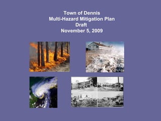
  • 1. Town of Dennis Multi-Hazard Mitigation Plan Draft November 5, 2009
  • 2.
  • 4. Section 2: Hazard Analysis and Risk Assessment Section 201.6(C)(2) of the regulations requires the Town of Dennis to provide a hazard and risk assessment. This process will include a description of the town, a discussion of “at-risk” communities and an analysis of relative risk.
  • 6.
  • 7. We Really Need To Worry About This Larger Flood Potential Area Photos from the Chase’s Ocean Grove Homeowner’s Association Website
  • 10. New England Hurricane of 1938 “ 1938 storm's greatest killer and what caught most people off guard: storm surge.” “ To the east, the surge left Falmouth and New Bedford under eight feet of water. Two-thirds of all the boats in New Bedford harbor sank.” Storm Surge - Tidal Departures Fairhaven, MA - 25 feet above MLW Pocasset, MA - 20 feet above MLW Nobska Point Light Station (Woods Hole, MA) - 15 feet above MLW Fall River, MA - 18 feet above MLW
  • 11.  
  • 17.  
  • 25. WILD FIRE WILDLAND FIRE PROTECTION AND PREPAREDNESS PLAN FOR PLASHES CONSERVATION AREA AND SURROUNDING OPEN SPACE TRACTS; WILDLAND FIRE PROTECTION AND PREPAREDNESS PLAN FOR RALPH AND FLORENCE SHOOP MEMORIAL WILDLAND FIRE PROTECTION AND PREPAREDNESS PLAN FOR GREEN BELT WELL FIELD; WILDLAND FIRE PROTECTION AND PREPAREDNESS PLAN FOR PRINCESS BEACH CONSERVATION AREA AND ADJACENT SCARGO HILL
  • 29. Other Hazards Limited Small Possible Sink holes Limited Small Possible Landslides Negligible Local Unlikely Earthquakes Geologic Hazards Limited Local Possible Flooding Critical Local Possible Urban Fires Limited Local Likely Wildfires Limited Medium Possible Drought Fire-Related Hazards Critical Small Possible Tornadoes Limited Small Possible Downspouts Critical Regional High Winter Storms Critical Regional High Coastal Storms Critical Large Possible Hurricanes Wind-Related Hazards Critical Large Possible Hurricanes Critical Regional High Coastal Storms or nor’easters Critical Regional High Winter Storms Limited Small High Thunderstorms Negligible Local Unlikely Dam Failures Limited Southern Coastline Limited Northern Coastline Critical Chapin Beach, West Dennis Beach High Erosion Critical West Dennis, Dennisport High Coastal Limited Swan River, Bass River, Sesuit Creek, Chase Garden Creek Possible Riverine Flood-Related Hazards Impacts (i.e. catastrophic, critical, limited, negligible) Location (i.e. local or small, medium or regional, multiple communities or large) Likelihood of Occurrence(i.e. highly, likely, possible, unlikely) Natural Hazard
  • 30. No Real estate disclosure requirements No A post-disaster recovery plan Yes, maintained by Police and Fire Dept. An emergency response plan As part of Comprehensive Plan An economic development plan Somewhat A capital improvements plan Adopted 2002, under revision Comprehensive plan Planning Board conducts Site Plan Review Site plan review requirements Village Centers adopted, land acquisition Growth management ordinances (also called “smart growth” or anti-sprawl programs) Floodplain Management: Zoning and Wetlands Regulation; Stormwater: Town By-law; Hazard Setback: Zoning By-law and Wetlands Regulation; Hillside or Steep Slope: Crowe’s Pasture only; Wildfire: none Special purpose ordinances (floodplain management, stormwater management, hillside or steep slope ordinances, wildfire ordinances, hazard setback requirements) Last Amended 1993 Subdivision ordinance or regulations First Adopted 1951 Zoning ordinance State Building Code Building code Status Regulatory Tools (ordinances, codes, plans)
  • 31.   Section 3.6, estimates potential dollar losses to vulnerable structures. Assessing Vulnerability: Estimating Potential Losses §201.6(c)(2)(ii)(B) The plan should describe vulnerability in terms of an estimate of the potential dollar losses to vulnerable structures identified in paragraph (c)(2)(ii)(A) of this section and a description of the methodology used to prepare the estimate.   Section 3.2, identifies critical facilities located in the profiled hazard areas. Assessing Vulnerability: Identifying Structures §201.6(c)(2)(ii)(A) The plan should describe vulnerability in terms of the types and number of existing and future buildings, infrastructure, and critical facilities located in the identified hazard areas.   The Town of Dennis participates in the NFIP, Repetitive Loss information is provided to the extent feasible given privacy concerns. Assessing Vulnerability: Addressing Repetitive Loss Properties §201.6(c)(2)(ii) The risk assessment in all plans approved after October 1, 2008 must also address National Flood Insurance Program (NFIP) insured structures that have been repetitively damaged floods.   Section 3, Assessing Vulnerabilities contains overall summaries of each hazard and the impacts on the community are contained in each hazard specific section in Section 3.3. Assessing Vulnerability: Overview §201.6(c)(2)(i) The risk assessment shall include a description of the jurisdiction’s vulnerability to the hazards described in paragraph (c)(2)(i) of this section. This description shall include an overall summary of each hazard and its impact on the community.   Section 2, Risk Assessment, includes hazard-specific sections in the. The MHMP profiles the natural hazards that may affect the area. The MHMP includes location, extent, probability, impact and previous occurrences for each natural hazard identified. . Profiling Hazards §201.6(c)(2)(i) The risk assessment shall include a description of the . . . location and extent of all natural hazards that can affect the jurisdiction. The plan shall include information on previous occurrences of hazard events and on the probability of future hazard events. Section 2, identifies severe weather (hurricanes, blizzards, thunderstorms and tornadoes), wildfire, and erosion as natural hazards to be profiled in the Dennis MHMP. Identifying Hazards §201.6(c)(2)(i) The risk assessment shall include a description of the type . . . of all natural hazards that can affect the jurisdiction . . . Multi-Jurisdictional Hazard Mitigation Plan Where it is Addressed in Plan Section §201.6(c)(2) Requirement
  • 32.
  • 33. Structural Damage - Locations proximal to seismic activity: According to Regional Hazard Risk Map II geologic activities have not been recorded. Loss of Land Dennis, as is all of Cape Cod, is a sandbar. There is always significant risk to the town due to coastal erosion. Some portions of town have experienced significant areas of erosion over the town’s history. Major storms, such as the Blizzard of 78 vastly altered the coastline. Lesser storms, including a Northeaster in June of 2009 also have had significant impacts. Barrier Beach erosion at places like West Dennis Beach or Chapin’s Beach could severely affect the lands behind these barrier beaches. Wave Inundation Dennis has several areas protected by barrier beaches. These barrier beaches protect lands in Dennis, Yarmouth and Brewster from normal wave action. These barrier beach areas are at risk both to wind erosion as well as wave inundation. All three barrier beaches in town, West Dennis Beach, Chapin’s Beach and Crowe’s Pasture are all considered to be located within velocity zones and would be exposed to tremendous wave action and could be totally inundated in a 1% storm event. Earthquakes Landslides Sink Holes   GEOLOGIC Wildfire Developed land / forested area interfaces: • Crowes Pasture • Princess Beach/Scargo Hill • Old Chatham Rd Water District Lands • The Plashes • Shoop Gardens Urban Fire • Dennisport Village Center is blessed with many old buildings placed close together. The Village was the scene of a major urban fire in the 1920’s which destroyed an entire block. Construction standards of the 1920’s do not match modern fire safety standards, leaving this area once again at risk of an Urban Fire. • West Dennis, while not as compact as Dennisport shares many of the same urban fire concerns. The older portions of town still bear resemblance to the original village settlement with shared, wood, walls. This area is at significant risk should a fire begin in one of these older connected structures. Drought Wildfire Lightening Strikes Urban Fire FIRE
  • 34. Table 12: Vulnerable and Evacuating Populations *Information derived from the GIS layers as maintained by the Dennis Planning Dept., U.S. Census Block Group Data, Assessors Information on Residential Units, Motel Units and Seasonal Cottages. . 17,022* 11,935* 5,087 53,488* 37,475* 15,973 2000 Total Seasonal Permanent Total Seasonal Permanent Census Vulnerable Population** Population   Population
  • 35.   $425,103.95 39 TOTALS   V8 (EL 15) Single Family $108,882.36 4 Dennisport   Single Family $9,716.94 2 Dennisport   V13 (EL 13) Single Family $12,980.73 2 West Dennis   A11 (EL 11) Single Family $12,917.80 2 West Dennis   V13 (EL 12) Single Family $9,158.65 2 West Dennis   V13 (EL 13) Single Family $32,603.71 2 West Dennis   V13 (EL 12) Condo $66,506.24 4 West Dennis   A11 (EL 11) Single Family $26,335.25 2 Dennisport   V13 (EL 13) Other Residential $9,634.74 2 Dennisport   V13 (EL 15) Other Residential $31,379.70 3 Dennisport   V13 (EL 13) Single Family $55,925.15 2 West Dennis   A11 (EL11) Single Family $3,240.00 2 West Dennis   V13 (EL 12) Single Family $18,090.41 2 West Dennis   A8 (EL 10) Single Family $5,142.15 2 Dennisport   V13 (EL 13) Single Family $11,373.15 3 West Dennis   A3 (EL 11) Single Family $11,216.97 3 East Dennis   FLOOD ZONE TYPE PAID LOSSES VILLAGE Information provided by MEMA 1/14/04; 2003 data not yet available Table 14: Repetitive Flood Losses (current through Dec. 2002)
  • 36.
  • 37. Board of Health, Conservation Commission Areas with high water tables, proximate to wetlands, or located within flood zones Ensures proper design of septic systems located in areas designated as environmentally sensitive (high water table, proximity to wetlands, flood zones) Environmentally Sensitive Area Waste Water Requirements Planning Board, Building Commissioner Quivet Neck and Crowe’s Pasture in north east Dennis Special Zoning to protect the Quivet Neck/Crowe’s Pasture Resource Protection Area from inappropriate development. Quivet Neck/Crowe’s Pasture Resource Protection District Community Preservation Committee, Dennis Conservation Trust Town-Wide Acquisition of critical land areas for resource management. Land Acquisition Barrier Beach Committee (est. Aug. 4, 2009) Chapin Beach, West Dennis Beach, Crowe’s Pasture Management Plan for the protection and nurturing of the three Barrier Beaches in Dennis. Barrier Beaches Management Building Commissioner   Building Code Enforcement Building Permits FEMA / Building Commissioner 100 Year Floodplain Areas as designated by FIRM Federally backed flood insurance available to homeowners, renters & businesses National Flood Insurance Program (NFIP) Conservation Commission 100 Year Floodplain Areas as designated by FIRM Dock Regulations Barnstable County Cooperative Extension Service, Fire Department Dept of Natural Resources & Conservation Commission Shoop Community Gardens, Princess Beach/Scargo Hill, The Plashes, Water District Greenbelt Area County grant program to reduce wildfires Wildfire Assessment & Preparedness Program Planning Board Commercial Districts Review of development projects for storm water control in accordance with Storm Water by-law Site Plan Review Planning Board Residential and Commercial Districts Requires utilities to be placed underground, drainage designed in accordance with town Storm Water By-law Subdivision Regulations Building Commissioner with review by Engineering Department (Adopted October 2009) Town wide Provides for proper storm water system design to control volume and rate of storm water run-off Storm Water By-law Local Emergency Planning Committee Town wide Provides a framework wherein the community can plan and perform respective emergency functions during a disaster or emergency situation on the local, state or national level.   Comprehensive Management Emergency Plan Department of Public Works Beach and Recreation Dept. Town Beaches Raking and cleaning beaches of debris Beach Maintenance Program Conservation Commission Wetland Resource Areas Regulates development within wetland resource areas including Special Flood Hazard Areas Local Wetlands Protection Bylaw Building Commissioner As designated by the Flood Insurance Rate Map (FIRM) for the Town of Dennis, Community # 250005 (Zones A’s & V’s) Floodplain Compliance Regulations Flood Plain Zoning – Section 6 Floodplain District Enforcement and/or Effectiveness Area Covered Description Existing Protection
  • 38. 2 In the past questions have been raised about acquiring flood zone properties. Questions have arisen as to what level of benefit was the town receiving from acquiring properties which provided “limited” public benefits. There have been greater levels of support for properties which can support public access and recreational uses. POLITICAL SUPPORT POLITICAL 1 Maintenance (picking up litter) will be an issue on any empty parcel. MAINTENANCE OPERATIONS 2 The Community Preservation Funds have been committed to a number of open space projects. Funding is presently limited, however the funding is dedicated to open space, historic preservation and affordable housing, and provides a long term dedicated funding stream. FUNDING ALLOCATED 1 The town has limited staffing to maintain existing town land holdings. In that lands taken for flood prevention may not impose a tremendous burden on town staff, passive acquisitions do not pose the staffing issues that may go along with active open areas. STAFFING ADMINISTRATIVE 1 Land is removed from the Dennis Tax Rolls, thereby increasing the tax load on other properties SECONDARY IMPACTS 3 Land Acquisition of flood prone properties provides for permanently protected lands, preserving these areas from ill advised construction and providing long term flood management. LONG TERM SOLUTION 3 Land acquisition has been accomplished on many sites in town and remains a feasible alternative. TECHNICAL FEASIBIITY TECHNICAL 3 The land acquired to date, except for one instance, has all been vacant land. The acquisition of vacant land that is subject will not displace homeowners and will provide flood storage for nearby properties. EFFECTS ON SEGMENT OF POPULATION 3 The town has adopted the Community Preservation Act and has used this funding source and state grants to acquire properties through-out town. The funds have been used within the floodplain along Swan Pond River, Quivet Creek, Sesuit Creek, Chase Garden Creek and Bass River. COMMUNITY ACCEPTANCE SOCIAL 52 Land Acquisition within floodplain/Ongoing. SCORE ACTION/TIMEFRAME PREVENTION Flood (coastal storm surge, storm tides & wave action, erosion, and sea level rise) HAZARD
  • 39. 3 Yes CONSISTENT WITH FEDERAL LAWS 3 Yes CONSISTENT WITH COMMUNITY ENVIRONMENTAL GOALS 1 None EFFECTS OF HAZMAT WASTE SITES 3 Protects land and water. EFFECTS ON LAND/WATER ENVIRONMENTAL 1 Yes, as match for local funds OUTSIDE FUNDING REQUIRED 3 The protection of the flood prone areas from inappropriate development protects scenic vistas of the town, preserving views that attract tourists to the town. CONTRIBUTES TO ECONOMIC GOALS 2 Varies by site. COST OF ACTION 3 Land is acquired for flood storage, thereby protecting adjacent properties from flooding and preventing structures from being built on flood prone properties. BENEFIT OF ACTION ECONOMIC 3 The town only acquires land from willing sellers, no eminent domain proceedings are contemplated POTENTIAL LEGAL CHALLENGE 3 The town is authorized to acquire property and has adopted the CPA for such acquisitions. EXISTING LOCAL AUTHORITY 3 State law authorizes the town to acquire property. STATE AUTHORITY LEGAL 3 Town Meeting has supported land acquisitions PUBLIC SUPPORT 3 The town leaders have generally supported land acquisitions LOCAL SUPPORT Flood (coastal storm surge, storm tides & wave action, erosion, and sea level rise) HAZARD
  • 40.