SlideShare ist ein Scribd-Unternehmen logo
1 von 2
Downloaden Sie, um offline zu lesen
Special Weather Statement issued May 28 at 8:11AM MDT
until further notice by NWS
NOAA-NWS-ALER-
S-
WY1253A912672C.SpecialWeatherStatement.1253A921E0E4WY.RIWSPSRIW.afab7dc6fa118eb3a32
31727b30abbfbw-nws.webmaster@noaa.gov2015-05-28T08:11:00-06:00ActualAlertPublicAlert for
Absaroka Mountains; Bighorn Mountains West; Casper Mountain; Cody Foothills; Jackson Hole;
Lander Foothills; North Big Horn Basin; Northeast Johnson County; Owl Creek and Bridger
Mountains; Salt River and Wyoming Ranges; Southeast Big Horn Basin; Southwest Big Horn Basin;
Star Valley; Teton and Gros Ventre Mountains; Upper Green River Basin Foothills; Upper Wind River
Basin; Wind River Basin; Wind River Mountains East; Wind River Mountains West; Yellowstone
National Park (Wyoming) Issued by the National Weather ServiceMetSpecial Weather
StatementExpectedMinorObservedSAME2015-05-28T08:11:00-06:00201-
-05-29T09:53:00-06:00NWS Riverton (Western Wyoming)Special Weather Statement issued May 28
at 8:11AM MDT until further notice by NWS Riverton...COLD AIR FUNNELS POSSIBLE TODAY...
THE ENVIRONMENT WILL BECOME FAVORABLE FOR COLD AIR FUNNEL
CLOUDS TODAY...AS AN UPPER LEVEL LOW PRESSURE SYSTEM MOVES THROUGH.
COLD AIR FUNNELS RARELY REACH THE GROUND...HOWEVER...TOUCH DOWN IS
REMOTELY POSSIBLE. THIS SITUATION COULD CAUSE WINDS SIMILAR TO A
WEAK TORNADO. IF WITNESSED...USE THE SAME PRECAUTIONS YOU WOULD
FOR ANY FUNNEL CLOUD OR TORNADO. TAKE SHELTER IN A STURDY BUILDING...
AWAY FROM WINDOWS.WMOHEADERUGCWYZ001020-022030VTECTIME...MOT...LOCAbsaroka
Mountains; Bighorn Mountains West; Casper Mountain; Cody Foothills; Jackson Hole; Lander
Foothills; North Big Horn Basin; Northeast Johnson County; Owl Creek and Bridger Mountains; Salt
River and Wyoming Ranges; Southeast Big Horn Basin; Southwest Big Horn Basin; Star Valley;
Teton and Gros Ventre Mountains; Upper Green River Basin Foothills; Upper Wind River Basin;
Wind River Basin; Wind River Mountains East; Wind River Mountains West; Yellowstone National
ParkFIPS6016043FIPS6030031FIPS6030067FIPS6056003FIPS6056013FIPS6056017FIPS6056019F
IPS6056023FIPS6056025FIPS6056029FIPS6056035FIPS6056039FIPS6056043UGCWYZ001UGCWY
Z002UGCWYZ003UGCWYZ004UGCWYZ005UGCWYZ006UGCWYZ007UGCWYZ008UGCWYZ010UG
CWYZ012UGCWYZ013UGCWYZ014UGCWYZ015UGCWYZ016UGCWYZ017UGCWYZ018UGCWYZ02
2UGCWYZ023UGCWYZ024UGCWYZ025
http://alerts.weather.gov/cap/wwacapget.php?x=WY1253A912672C.SpecialWeatherStatement.1253
A921E0E4WY.RIWSPSRIW.afab7dc6fa118eb3a3231727b30abbfb

Weitere ähnliche Inhalte

Mehr von dallasnewscast

Collaborative Surf Table
Collaborative Surf TableCollaborative Surf Table
Collaborative Surf Tabledallasnewscast
 
Local Storm Report Issued At 800 PM EST TUE MAR 03 2015
Local Storm Report Issued At 800 PM EST TUE MAR 03 2015Local Storm Report Issued At 800 PM EST TUE MAR 03 2015
Local Storm Report Issued At 800 PM EST TUE MAR 03 2015dallasnewscast
 
Molokai Weather Radar Scheduled Service Outage through June 30, 2015
Molokai Weather Radar Scheduled Service Outage through June 30, 2015Molokai Weather Radar Scheduled Service Outage through June 30, 2015
Molokai Weather Radar Scheduled Service Outage through June 30, 2015dallasnewscast
 
SPC PDS Tornado Watch 303
SPC PDS Tornado Watch 303SPC PDS Tornado Watch 303
SPC PDS Tornado Watch 303dallasnewscast
 
SPC Day 2 Fire Weather Outlook
SPC Day 2 Fire Weather OutlookSPC Day 2 Fire Weather Outlook
SPC Day 2 Fire Weather Outlookdallasnewscast
 
SPC PDS Tornado Watch 303
SPC PDS Tornado Watch 303SPC PDS Tornado Watch 303
SPC PDS Tornado Watch 303dallasnewscast
 
SPC Severe Thunderstorm Watch 236
SPC Severe Thunderstorm Watch 236SPC Severe Thunderstorm Watch 236
SPC Severe Thunderstorm Watch 236dallasnewscast
 
Safe Boating Week - Thunderstorm Safety
Safe Boating Week - Thunderstorm SafetySafe Boating Week - Thunderstorm Safety
Safe Boating Week - Thunderstorm Safetydallasnewscast
 
Local Storm Report Issued At 800 PM EST TUE MAR 03 2015
Local Storm Report Issued At 800 PM EST TUE MAR 03 2015Local Storm Report Issued At 800 PM EST TUE MAR 03 2015
Local Storm Report Issued At 800 PM EST TUE MAR 03 2015dallasnewscast
 
Daily climate summary issued at 130 AM EDT MON MAR 30 2015
Daily climate summary issued at 130 AM EDT MON MAR 30 2015Daily climate summary issued at 130 AM EDT MON MAR 30 2015
Daily climate summary issued at 130 AM EDT MON MAR 30 2015dallasnewscast
 
Advancements Result from 2004 Indian Ocean Tsunami
Advancements Result from 2004 Indian Ocean TsunamiAdvancements Result from 2004 Indian Ocean Tsunami
Advancements Result from 2004 Indian Ocean Tsunamidallasnewscast
 
RECORD HIGH TEMPERATURE SET AT KAHULUI HI
RECORD HIGH TEMPERATURE SET AT KAHULUI HIRECORD HIGH TEMPERATURE SET AT KAHULUI HI
RECORD HIGH TEMPERATURE SET AT KAHULUI HIdallasnewscast
 
There are no active watches, warnings or advisories
There are no active watches, warnings or advisoriesThere are no active watches, warnings or advisories
There are no active watches, warnings or advisoriesdallasnewscast
 

Mehr von dallasnewscast (17)

Outlook
OutlookOutlook
Outlook
 
Collaborative Surf Table
Collaborative Surf TableCollaborative Surf Table
Collaborative Surf Table
 
Local Storm Report Issued At 800 PM EST TUE MAR 03 2015
Local Storm Report Issued At 800 PM EST TUE MAR 03 2015Local Storm Report Issued At 800 PM EST TUE MAR 03 2015
Local Storm Report Issued At 800 PM EST TUE MAR 03 2015
 
Molokai Weather Radar Scheduled Service Outage through June 30, 2015
Molokai Weather Radar Scheduled Service Outage through June 30, 2015Molokai Weather Radar Scheduled Service Outage through June 30, 2015
Molokai Weather Radar Scheduled Service Outage through June 30, 2015
 
SPC PDS Tornado Watch 303
SPC PDS Tornado Watch 303SPC PDS Tornado Watch 303
SPC PDS Tornado Watch 303
 
SPC Day 2 Fire Weather Outlook
SPC Day 2 Fire Weather OutlookSPC Day 2 Fire Weather Outlook
SPC Day 2 Fire Weather Outlook
 
SPC PDS Tornado Watch 303
SPC PDS Tornado Watch 303SPC PDS Tornado Watch 303
SPC PDS Tornado Watch 303
 
SPC Severe Thunderstorm Watch 236
SPC Severe Thunderstorm Watch 236SPC Severe Thunderstorm Watch 236
SPC Severe Thunderstorm Watch 236
 
SPC MD 821
SPC MD 821SPC MD 821
SPC MD 821
 
SPC MD 819
SPC MD 819SPC MD 819
SPC MD 819
 
Safe Boating Week - Thunderstorm Safety
Safe Boating Week - Thunderstorm SafetySafe Boating Week - Thunderstorm Safety
Safe Boating Week - Thunderstorm Safety
 
Aviation
AviationAviation
Aviation
 
Local Storm Report Issued At 800 PM EST TUE MAR 03 2015
Local Storm Report Issued At 800 PM EST TUE MAR 03 2015Local Storm Report Issued At 800 PM EST TUE MAR 03 2015
Local Storm Report Issued At 800 PM EST TUE MAR 03 2015
 
Daily climate summary issued at 130 AM EDT MON MAR 30 2015
Daily climate summary issued at 130 AM EDT MON MAR 30 2015Daily climate summary issued at 130 AM EDT MON MAR 30 2015
Daily climate summary issued at 130 AM EDT MON MAR 30 2015
 
Advancements Result from 2004 Indian Ocean Tsunami
Advancements Result from 2004 Indian Ocean TsunamiAdvancements Result from 2004 Indian Ocean Tsunami
Advancements Result from 2004 Indian Ocean Tsunami
 
RECORD HIGH TEMPERATURE SET AT KAHULUI HI
RECORD HIGH TEMPERATURE SET AT KAHULUI HIRECORD HIGH TEMPERATURE SET AT KAHULUI HI
RECORD HIGH TEMPERATURE SET AT KAHULUI HI
 
There are no active watches, warnings or advisories
There are no active watches, warnings or advisoriesThere are no active watches, warnings or advisories
There are no active watches, warnings or advisories
 

Special Weather Statement issued May 28 at 8:11AM MDT until further notice by NWS

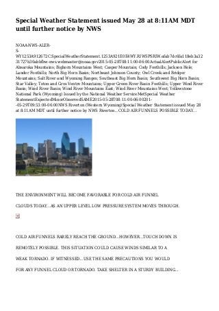
  • 1. Special Weather Statement issued May 28 at 8:11AM MDT until further notice by NWS NOAA-NWS-ALER- S- WY1253A912672C.SpecialWeatherStatement.1253A921E0E4WY.RIWSPSRIW.afab7dc6fa118eb3a32 31727b30abbfbw-nws.webmaster@noaa.gov2015-05-28T08:11:00-06:00ActualAlertPublicAlert for Absaroka Mountains; Bighorn Mountains West; Casper Mountain; Cody Foothills; Jackson Hole; Lander Foothills; North Big Horn Basin; Northeast Johnson County; Owl Creek and Bridger Mountains; Salt River and Wyoming Ranges; Southeast Big Horn Basin; Southwest Big Horn Basin; Star Valley; Teton and Gros Ventre Mountains; Upper Green River Basin Foothills; Upper Wind River Basin; Wind River Basin; Wind River Mountains East; Wind River Mountains West; Yellowstone National Park (Wyoming) Issued by the National Weather ServiceMetSpecial Weather StatementExpectedMinorObservedSAME2015-05-28T08:11:00-06:00201- -05-29T09:53:00-06:00NWS Riverton (Western Wyoming)Special Weather Statement issued May 28 at 8:11AM MDT until further notice by NWS Riverton...COLD AIR FUNNELS POSSIBLE TODAY... THE ENVIRONMENT WILL BECOME FAVORABLE FOR COLD AIR FUNNEL CLOUDS TODAY...AS AN UPPER LEVEL LOW PRESSURE SYSTEM MOVES THROUGH. COLD AIR FUNNELS RARELY REACH THE GROUND...HOWEVER...TOUCH DOWN IS REMOTELY POSSIBLE. THIS SITUATION COULD CAUSE WINDS SIMILAR TO A WEAK TORNADO. IF WITNESSED...USE THE SAME PRECAUTIONS YOU WOULD FOR ANY FUNNEL CLOUD OR TORNADO. TAKE SHELTER IN A STURDY BUILDING...
  • 2. AWAY FROM WINDOWS.WMOHEADERUGCWYZ001020-022030VTECTIME...MOT...LOCAbsaroka Mountains; Bighorn Mountains West; Casper Mountain; Cody Foothills; Jackson Hole; Lander Foothills; North Big Horn Basin; Northeast Johnson County; Owl Creek and Bridger Mountains; Salt River and Wyoming Ranges; Southeast Big Horn Basin; Southwest Big Horn Basin; Star Valley; Teton and Gros Ventre Mountains; Upper Green River Basin Foothills; Upper Wind River Basin; Wind River Basin; Wind River Mountains East; Wind River Mountains West; Yellowstone National ParkFIPS6016043FIPS6030031FIPS6030067FIPS6056003FIPS6056013FIPS6056017FIPS6056019F IPS6056023FIPS6056025FIPS6056029FIPS6056035FIPS6056039FIPS6056043UGCWYZ001UGCWY Z002UGCWYZ003UGCWYZ004UGCWYZ005UGCWYZ006UGCWYZ007UGCWYZ008UGCWYZ010UG CWYZ012UGCWYZ013UGCWYZ014UGCWYZ015UGCWYZ016UGCWYZ017UGCWYZ018UGCWYZ02 2UGCWYZ023UGCWYZ024UGCWYZ025 http://alerts.weather.gov/cap/wwacapget.php?x=WY1253A912672C.SpecialWeatherStatement.1253 A921E0E4WY.RIWSPSRIW.afab7dc6fa118eb3a3231727b30abbfb