Remote Sensing of Wildfires - Why and How?
•
1 gefällt mir•572 views

A gentle introduction / 15 min talk given in August 2013 in front of a group of undergraduate interns at the Department for Geology and Geophysics, University of Alaska Fairbanks.

Empfohlen
Weitere ähnliche Inhalte
Kürzlich hochgeladen
Kürzlich hochgeladen (20)
Empfohlen
Empfohlen (20)
Remote Sensing of Wildfires - Why and How?
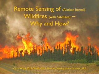
- 1. Remote Sensing of (Alaskan boreal) Wildfires (with Satellites) – Why and How? Chris Waigl 2013-08-08, GG Remote Sensing lunch seminar UAF
- 2. Chris Waigl,– cwaigl@alaska.edu – Remote sensing of (boreal) wildfires (with satellites):Why and how? – 2013-08-08 2 What’s special about Alaska (and the whole boreal zone)? Image:Alaska Climate Research Center
- 3. Chris Waigl,– cwaigl@alaska.edu – Remote sensing of (boreal) wildfires (with satellites):Why and how? – 2013-08-08 3 Why? Global (or regional) fire maps NASA MODIS Global Firemap - July 10-19, 2013
- 4. Chris Waigl,– cwaigl@alaska.edu – Remote sensing of (boreal) wildfires (with satellites):Why and how? – 2013-08-08 4 How is it spreading? Where does the smoke go? Steward Creek 2 fire 2013- Alaska Fire Service
- 5. Chris Waigl,– cwaigl@alaska.edu – Remote sensing of (boreal) wildfires (with satellites):Why and how? – 2013-08-08 5 How severe is it? How is it impacting the ecosystem? à Ecology Steward Creek 2 fire 2013- Image Alaska State Parks
- 6. Chris Waigl,– cwaigl@alaska.edu – Remote sensing of (boreal) wildfires (with satellites):Why and how? – 2013-08-08 6 How? Passive remote sensing from polar-orbiting satellites For example, MODIS ! 36 bands: 20 reflective visible and short-wave infrared (250-500m resolution), 16 emissive mid and thermal IR1000m ! Up to 8 good images of Alaska / day Trade-off between resolution in time and space: http://www.youtube.com/watch?v=V0hsCD4qZMk
- 7. Chris Waigl,– cwaigl@alaska.edu – Remote sensing of (boreal) wildfires (with satellites):Why and how? – 2013-08-08 7 We measure the intensity of radiation emitted by the fire
- 8. Chris Waigl,– cwaigl@alaska.edu – Remote sensing of (boreal) wildfires (with satellites):Why and how? – 2013-08-08 8 Landsat (July 7, 2009)
- 9. Chris Waigl,– cwaigl@alaska.edu – Remote sensing of (boreal) wildfires (with satellites):Why and how? – 2013-08-08 9 Zooming in…
- 10. Chris Waigl,– cwaigl@alaska.edu – Remote sensing of (boreal) wildfires (with satellites):Why and how? – 2013-08-08 10 Time series: July 4-7, 2009, MODIS over Landsat
- 11. Chris Waigl,– cwaigl@alaska.edu – Remote sensing of (boreal) wildfires (with satellites):Why and how? – 2013-08-08 11 2004 Boundary Fire – MODIS Terra What’s in a pixel? • shape • overlap • distortion 1 px = 1 x 1 km at nadir (= looking straight down)
- 12. Chris Waigl,– cwaigl@alaska.edu – Remote sensing of (boreal) wildfires (with satellites):Why and how? – 2013-08-08 2004 Boundary Fire – simultaneous ASTER image 12 1 px = 30 x 30 m
- 13. Chris Waigl,– cwaigl@alaska.edu – Remote sensing of (boreal) wildfires (with satellites):Why and how? – 2013-08-08 2004 Boundary Fire – sub-pixel fire temperature = temperature of the portion of the pixel that is actually on fire 13
- 14. Chris Waigl,– cwaigl@alaska.edu – Remote sensing of (boreal) wildfires (with satellites):Why and how? – 2013-08-08 Different method: Active remote sensing with microwaves (radar backscatter - SAR) 14 new burn old fire scar
- 15. Chris Waigl,– cwaigl@alaska.edu – Remote sensing of (boreal) wildfires (with satellites):Why and how? – 2013-08-08 Overlaying MODIS hotspot pixels on SAR 15
- 16. Chris Waigl,– cwaigl@alaska.edu – Remote sensing of (boreal) wildfires (with satellites):Why and how? – 2013-08-08 Different method: Thermal aerial imagery 16
- 17. Chris Waigl,– cwaigl@alaska.edu – Remote sensing of (boreal) wildfires (with satellites):Why and how? – 2013-08-08 Thanks! 17 Lime River fire 2013- Alaska Fire Service Data and imagery courtesy of: • Alaska Fire Service/AICC • U.S. Geological Survey • NASA’s Earth-Sun System Division • Martin Stuefer • Alaska Climate Research Center • Alaska Satellite Facility/SAR Data Center • Alaska State Parks