Experiències i resultats d'estudis de subsidències mitjançant DInSAR
•
0 gefällt mir•402 views

Presentació realitzada a la jornada sobre l'estudi de subsidències mitjançant tècniques DInSAR (25/04/2013)

Empfohlen
Weitere ähnliche Inhalte
Ähnlich wie Experiències i resultats d'estudis de subsidències mitjançant DInSAR
Ähnlich wie Experiències i resultats d'estudis de subsidències mitjançant DInSAR (20)
Mehr von Institut Cartogràfic de Catalunya
Mehr von Institut Cartogràfic de Catalunya (20)
Experiències i resultats d'estudis de subsidències mitjançant DInSAR
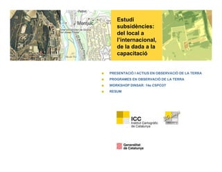
- 1. Estudi subsidències: d l l ldel local a l’internacional, de la dada a la capacitaciócapacitació PRESENTACIÓ I ACTIUS EN OBSERVACIÓ DE LA TERRA PROGRAMES EN OBSERVACIÓ DE LA TERRA WORKSHOP DINSAR: 14e CSPCOT RESUM
- 2. 2 Presentació i actius en Observació de la Terra Millor Millora en la qualitat de les Increment beneficis Societat competitiva i geoinformació sobre el territori q decisions i polítiques a aplicar econòmics, efectivitat, benestar p competent afrontar nous reptes CS_PCOT 2013 all rights reserved, no part of this document may be reproduced, stored or transmitted, without permission of the Institute Cartographic of Catalonia
- 3. 3 Presentació i actius en Observació de la TerraObservació de la Terra CSI Partenavia P68 Cessna Caravan Beechcraft B200GT ISGEOMÈTRI RADAR Avions Sensors CASI √ √ √ ODELSPRÒPI CS,ÒPTICSIR TASI √ √ SATÈL.LIT:MO RADIOMÈTRIC DMC √ √ √ LID √ √ √ SEGMENTS R DAR √ √ √ CS_PCOT 2013 all rights reserved, no part of this document may be reproduced, stored or transmitted, without permission of the Institute Cartographic of Catalonia
- 4. 4 ICC i ELS PETITS SATÈL·LITS - MEDIMAP Q iSATÈL LITS MEDIMAP 3 Que perseguim 3 Seg. Terra Seg. Espai Seg. Sensors Planif. Vols Avions Cal/Val + Valor f it Repetitivitat afegit Arquitectura TTC i DM Satèl.lits Cal/Val + Valor afegit p Reactius R i t Capacitat de Gestió i Explotació a l’espai: els petits satèl.lits Requeriment CS_PCOT 2013 all rights reserved, no part of this document may be reproduced, stored or transmitted, without permission of the Institute Cartographic of Catalonia
- 5. 5 Programes en Observació de la Terra 1 Illa de calor1- Illa de calor CS_PCOT 2013 all rights reserved, no part of this document may be reproduced, stored or transmitted, without permission of the Institute Cartographic of Catalonia
- 6. 6 Programes en Observació de la Terra 2- Contaminació Atmosfèrica CS_PCOT 2013 all rights reserved, no part of this document may be reproduced, stored or transmitted, without permission of the Institute Cartographic of Catalonia
- 7. 7 Programes en Observació de la Terra 3- Contaminació Lumínica 50000 60000 70000 Radiàncies 545 435 619,620 Radiances 0 10000 20000 30000 40000 50000 400 450 500 550 600 650 700 750 800 850 900 950 1000 579 698 703 nanometres CS_PCOT 2013 all rights reserved, no part of this document may be reproduced, stored or transmitted, without permission of the Institute Cartographic of Catalonia
- 8. 8 Programes en Observació de la Terra 4- Detecció de Canvis i materials CS_PCOT 2013 all rights reserved, no part of this document may be reproduced, stored or transmitted, without permission of the Institute Cartographic of Catalonia
- 9. 9 Programes en Observació de la Terra 5- Metabolisme- urban green a molt alta resolució Integració realitzada per BCNREGIONAL amb dades NDVI i LIDAR de l’ICC CS_PCOT 2013 all rights reserved, no part of this document may be reproduced, stored or transmitted, without permission of the Institute Cartographic of Catalonia
- 10. 10 Programes en Observació de la Terra 6- Captació CO2 CS_PCOT 2013 all rights reserved, no part of this document may be reproduced, stored or transmitted, without permission of the Institute Cartographic of Catalonia
- 11. 11 Programes en Observació de la Terra 7- Fertilització conreus GPS Data processing SPOT, CASI Ground DataProducts XSTARFertilitzation Assesment Service Agronomic model adjustment Recomendations S d Protection CS_PCOT 2013 all rights reserved, no part of this document may be reproduced, stored or transmitted, without permission of the Institute Cartographic of Catalonia g j Seed
- 12. 12 Programes en Observació de la Terra 8- Abocadors CS_PCOT 2013 all rights reserved, no part of this document may be reproduced, stored or transmitted, without permission of the Institute Cartographic of Catalonia
- 13. 13 Programes en Observació de la Terra 9- Eficiència energètica- tèrmic CS_PCOT 2013 all rights reserved, no part of this document may be reproduced, stored or transmitted, without permission of the Institute Cartographic of Catalonia
- 14. 14 Programes en Observació de la Terra 10- Seguiment litoral i costa Z (m) 2.5 1.8 1.2 0.5 -0.2 -0.8 -1.5 V l f it 23884 3Volum afegit: 23884 m3 Volum retirat: 4320 m3 CS_PCOT 2013 all rights reserved, no part of this document may be reproduced, stored or transmitted, without permission of the Institute Cartographic of Catalonia
- 15. 15 Programes en Observació de la Terra 11- Contaminació, plomes, estat aigua CS_PCOT 2013 all rights reserved, no part of this document may be reproduced, stored or transmitted, without permission of the Institute Cartographic of Catalonia
- 16. 16 Programes en Observació de la Terra 12- Incendis CS_PCOT 2013 all rights reserved, no part of this document may be reproduced, stored or transmitted, without permission of the Institute Cartographic of Catalonia
- 17. 17 Aplicacions i Medi urbà 13- Anàlisi de missió petits satèl.lits •To evaluate initiatives from an Earth Observation usabilityy point of view •To simulate imagery based on proposed payload •To carry out a range of recomendations in terms of potencial case estudies •To ellaborate processing added value chainp g •To develop Spatial Data Infrastructures for mission data CS_PCOT 2013 all rights reserved, no part of this document may be reproduced, stored or transmitted, without permission of the Institute Cartographic of Catalonia
- 18. 18 Programes demostradors en Observació de la Terra 14- Subsidències CS_PCOT 2013 all rights reserved, no part of this document may be reproduced, stored or transmitted, without permission of the Institute Cartographic of Catalonia
- 19. 19 Programes en Observació de la Terra Capacitació i formació (capacity building programs) www.iccartotechnology.com CS_PCOT 2013 all rights reserved, no part of this document may be reproduced, stored or transmitted, without permission of the Institute Cartographic of Catalonia
- 20. 20 La Jornada (1/2)La Jornada (1/2) Desenvolupar Capacitat generació capes geoinformació en projectes i programes a escala local – regional – internacional Capacitats en tota la cadena de valor: de la captura primària a la capacitació i formació ProduirAprendre USUARI Distribuir Proposta d’agenda: 9:00 – 9:30 Lliurament d’acreditacions als assistents 9:30 – 10:00 Benvinguda i presentació de la jornada: De l’escala regional al projecte Internacional, del desenvolupament a la capacitació Jordi Corbera, Cap del CSPCOT 10:00 – 10:30 Ponència 1Experiències i resultats: Pablo Blanco, CSPCOT 10:30 – 11:00 Ponència 2 Noves plataformes, tecnologies i tècniques P bl Bl CSPCOTPablo Blanco, CSPCOT 11:00 – 11:30 Ponència 3. Les tècniques DINSAR en el camp de la geologia Jordi Marturia, IGC 11:30 – 12:00 Debat i qüestions 12:00 – 12:30 Conclusions CS_PCOT 2013 all rights reserved, no part of this document may be reproduced, stored or transmitted, without permission of the Institute Cartographic of Catalonia
- 21. 21 La Jornada (2/2)La Jornada (2/2) Generant capes de geoinformació ..... ..... Per un anàlisi temporal, espacial i temàtic GRÀCIES PER LA SEVA ATENCIÓ CS_PCOT 2013 all rights reserved, no part of this document may be reproduced, stored or transmitted, without permission of the Institute Cartographic of Catalonia