SlideShare ist ein Scribd-Unternehmen logo
1 von 23
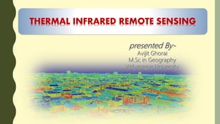
THERMAL INFRARED REMOTE SENSING
INTRODUCTION
Thermal Remote Sensing is the branch of remote sensing that deals with the
acquisition, processing and interpretation of data acquired primarily in the thermal
infrared(TIR) region of the Electromagnetic Spectrum. In thermal remote sensing we
measure the radiation “emitted” from the surface of the target, as opposed to
optical remote sensing where we measured the radiation ‘reflected’ by the target
under consideration.
And the black areas in denote the region of spectrum where the
atmosphere absorbs most of the infrared energy. Water vapor(H2O),CO2
and O3 are responsible for most of the absorption.
In the Thermal Infrared region has two primary thermal infrared
windows: 3-5µm. And 8-14µm.
Kinetic Heat, Radiant Temperature and Emissivity
Thermal Remote Sensing it’s basically depends upon Kinetic
Heat and Radiant Temperature..
Kinetic Heat
All objects in the real world having a
temperature above absolute zero. The
energy of particles of molecular matter in
random motion is called kinetic heat. Also
it is called internal,real,or true heat.
Concentration of kinetic temperature is
measure by thermometer.
Radiant Temperature/Energy
The internal kinetic heat also converted
to radiant energy, it is also called the
external or apparent energy.
We can utilize the “Radiometer” for
measuring the Radiant temperature
placed at a some distance from the
object.
Fig. Radiant energy exiting. a) water, b) granite, c) dunite
heated to 350K compared with a blackbody to the same
temperature (Jensen,2003).
Emissivity
The relationship between kinetic temperature and radiant temperature is not
perfect. The remote measurement of the radiant temperature always less than
the true kinetic temperature. So it is the ratio between of Radiant temperature
and the True Kinetic temperature.
Emissivity is differ by the different objects on the earth surface.
Factors
1.Colour
2.Moisture content
3.Comcaction
4.Field of view
5.Wave length
6.Viewing angle
7.Surface Ruggedness
Why do we need to know about
Emissivity?
Two objects laying next to one another
(e.g:two rocks) could have the same kinetic
temperature but different
apparent/radiant temperature because
their emissivities vary,,
Material Emissivity
Clear water 0.98-0.99
Wet snow 0.98-0.99
Human skin 0.97-0.99
Rough ice 0.97-0.98
vegetation 0.96-0.99
Wet soil 0.95-0.98
Asphalt concrete 0.94-0.97
Brick 0.93-0.94
wood 0.93-0.94
Basalt rock 0.92-0.96
Dry mineral soil 0.92-0.94
paint 0.90-0.96
Dry Vegetation 0.88-0.94
Dry snow 0.85-0.90
Emissivity of the different
objects-
Black Body
• Blackbody is a theoretical construct that absorbs all the
radiant energy striking it and radiates energy at the
maximum possible rate per unit area at each
wavelength for any given temp.
• No objects in nature are true blackbodies.
• Emissivity of blackbody is always ‘1’.
• Several objects like clean water or deep water which are
near to the blackbody concept. But they are not the
black body.
Grey body
• Its reflects a small fraction of the total energy
stored by them
• Its depends upon on the wavelength of different
bands.
Is a type of radiation emitted by a surface
whose emissivity is distinctly varied for
different wavelengths..
Selective Radiation
A)Spectral emissivity of
a blackbody, a
graybody and a
selective radiator.
B) Spectral radiance
exitance distribution of
the blackbody,
graybody and
hypothetical selective
radiator.
THERMAL RADIATION LAWS
THERMAL PORPERTIES OF TERRAIN
Thermal Infrared Data Collection
Thermal infrared remote sensor data may be collected
by:
• across-track thermal scanners, and
• push-broom linear and area array charge-
coupled
device (CCD) detectors.
across-track/whiskbroom thermal scanners
• Use a rotating mirror to sweep along a line
or a series of adjacent lines traversing the
ground.
• The incoming energy is separated into
several spectral components that are
independently sensed.
• To separate thermal and non thermal energy
forms
push-broom linear and area array charge-coupled
device (CCD) detectors.
• It is possible to make both linear and area
arrays that are sensitive to mid- and thermal
infrared radiation.
• Linear array of detectors aligned across-track.
• Image build up by satellite movement in flight
direction.
• No scanning mirror
• 2D detector arrays can acquire multispectral or
hyperspectral data.
Application
Agricultural purpose
Identification of water condition in the crop field.
Estimation of moisture amount in the crop
To find the appropriate time for irrigation
Detect the different types of disease in the agricultural
field
Crop maturity time identification, etc.
Identifying of natural
hazard
Volcanocity
Border security purposes
Weather forecasting
• Temperature
• Pressure
• Movement of the wind
• Prediction of Amount of rainfall
• Prediction of cyclone and tsunami
• Prediction of cloudiness
Others
• Identification of building materials
• Moisture condition of building
• Coal mining identify.
• Urban heat island effect.
URBAN HEAT ISLAND EFFECT
An urban heat island (UHI) is an urban
area or metropolitan area that is
significantly warmer than its
surrounding rural areas due to human
activities.
Thermal infrared image sources
 FLIR
 ATLAS
 LANDSAT ETM+
 LANDSAT 8 OLI
 ASTER
 AVHRR
 COASTAL ZONE COLOUR SCANNER(CZCS)
 OCEANSAT(ISRO)
Reference
Thermal remote sensing

Weitere ähnliche Inhalte

Was ist angesagt?

Chapter 1 (Introduction to remote sensing)
Chapter 1 (Introduction to remote sensing)Chapter 1 (Introduction to remote sensing)
Chapter 1 (Introduction to remote sensing)Shankar Gangaju
 
Thermal remote sensing and its applications
Thermal remote sensing and its applicationsThermal remote sensing and its applications
Thermal remote sensing and its applicationschandan00781
 
Microwave remote sensing
Microwave remote sensingMicrowave remote sensing
Microwave remote sensingRohit Kumar
 
REMOTE SENSING
REMOTE SENSINGREMOTE SENSING
REMOTE SENSINGKANNAN
 
Fundamentals of Remote Sensing
Fundamentals of Remote SensingFundamentals of Remote Sensing
Fundamentals of Remote SensingShah Naseer
 
Thermal remote sensing
Thermal remote sensingThermal remote sensing
Thermal remote sensingSakthivel R
 
Radar remote sensing, P K MANI
Radar remote sensing, P K MANIRadar remote sensing, P K MANI
Radar remote sensing, P K MANIP.K. Mani
 
Chapter 5: Remote sensing
Chapter 5: Remote sensingChapter 5: Remote sensing
Chapter 5: Remote sensingShankar Gangaju
 
Optical and infrared remote sensing
Optical and infrared remote sensingOptical and infrared remote sensing
Optical and infrared remote sensingNeha Sharma
 
Thermal remote sensing
Thermal remote sensing   Thermal remote sensing
Thermal remote sensing Rahat Malik
 
Band ratioing presentation
Band ratioing presentationBand ratioing presentation
Band ratioing presentationsk asadul haque
 
Introduction to aerial photography and photogrammetry.ppt
Introduction to aerial photography and photogrammetry.pptIntroduction to aerial photography and photogrammetry.ppt
Introduction to aerial photography and photogrammetry.pptsrinivas2036
 
Surveying ii ajith sir class3
Surveying ii ajith sir class3Surveying ii ajith sir class3
Surveying ii ajith sir class3SHAMJITH KM
 
Platforms of Remote sensing and GIS
Platforms of Remote sensing and GISPlatforms of Remote sensing and GIS
Platforms of Remote sensing and GISMouna Guru
 
Types of scanners
Types of scannersTypes of scanners
Types of scannersPramoda Raj
 

Was ist angesagt? (20)

Chapter 1 (Introduction to remote sensing)
Chapter 1 (Introduction to remote sensing)Chapter 1 (Introduction to remote sensing)
Chapter 1 (Introduction to remote sensing)
 
Thermal remote sensing and its applications
Thermal remote sensing and its applicationsThermal remote sensing and its applications
Thermal remote sensing and its applications
 
Microwave remote sensing
Microwave remote sensingMicrowave remote sensing
Microwave remote sensing
 
Introduction to Remote Sensing
Introduction to Remote SensingIntroduction to Remote Sensing
Introduction to Remote Sensing
 
REMOTE SENSING
REMOTE SENSINGREMOTE SENSING
REMOTE SENSING
 
Fundamentals of Remote Sensing
Fundamentals of Remote SensingFundamentals of Remote Sensing
Fundamentals of Remote Sensing
 
Thermal remote sensing
Thermal remote sensingThermal remote sensing
Thermal remote sensing
 
Digital Elevation Model (DEM)
Digital Elevation Model (DEM)Digital Elevation Model (DEM)
Digital Elevation Model (DEM)
 
Radar remote sensing, P K MANI
Radar remote sensing, P K MANIRadar remote sensing, P K MANI
Radar remote sensing, P K MANI
 
Chapter 5: Remote sensing
Chapter 5: Remote sensingChapter 5: Remote sensing
Chapter 5: Remote sensing
 
Optical and infrared remote sensing
Optical and infrared remote sensingOptical and infrared remote sensing
Optical and infrared remote sensing
 
Thermal remote sensing
Thermal remote sensing   Thermal remote sensing
Thermal remote sensing
 
Geographic information system
Geographic information systemGeographic information system
Geographic information system
 
Microwave remote sensing
Microwave remote sensingMicrowave remote sensing
Microwave remote sensing
 
Band ratioing presentation
Band ratioing presentationBand ratioing presentation
Band ratioing presentation
 
Introduction to aerial photography and photogrammetry.ppt
Introduction to aerial photography and photogrammetry.pptIntroduction to aerial photography and photogrammetry.ppt
Introduction to aerial photography and photogrammetry.ppt
 
Remote Sensing
Remote SensingRemote Sensing
Remote Sensing
 
Surveying ii ajith sir class3
Surveying ii ajith sir class3Surveying ii ajith sir class3
Surveying ii ajith sir class3
 
Platforms of Remote sensing and GIS
Platforms of Remote sensing and GISPlatforms of Remote sensing and GIS
Platforms of Remote sensing and GIS
 
Types of scanners
Types of scannersTypes of scanners
Types of scanners
 

Ähnlich wie Thermal remote sensing

Thermal remote sensing BY Hariom Ahlawat
Thermal remote sensing BY Hariom AhlawatThermal remote sensing BY Hariom Ahlawat
Thermal remote sensing BY Hariom AhlawatHariom Ahlawat
 
Future approaches to cope with spontaneous combustion
Future approaches to cope with spontaneous combustionFuture approaches to cope with spontaneous combustion
Future approaches to cope with spontaneous combustionSujit Surendran
 
Henry presentation1
Henry presentation1Henry presentation1
Henry presentation1Henry Okpala
 
Explore Your Environment with an Infrared Thermometer!
Explore Your Environment with an Infrared Thermometer!Explore Your Environment with an Infrared Thermometer!
Explore Your Environment with an Infrared Thermometer!NCIL - STAR_Net
 
Presentation 1 (1)
Presentation 1 (1)Presentation 1 (1)
Presentation 1 (1)jnaoe
 
Solar radiation measurements
Solar radiation measurements Solar radiation measurements
Solar radiation measurements Sammy Jamar
 
Advances in Instrumentation for Micrometeorological Studies
Advances in Instrumentation for Micrometeorological StudiesAdvances in Instrumentation for Micrometeorological Studies
Advances in Instrumentation for Micrometeorological StudiesAbhilash Singh Chauhan
 
Sensors and its type by ss
Sensors and its type by ssSensors and its type by ss
Sensors and its type by sssundas Shabbir
 
Modes of energy transfer in soil
Modes  of energy  transfer  in soilModes  of energy  transfer  in soil
Modes of energy transfer in soilShaheenPraveen1
 
Diuranal heat effects, thermal
Diuranal heat effects, thermalDiuranal heat effects, thermal
Diuranal heat effects, thermalSuresh L
 
Thermal remote sensing
Thermal remote sensingThermal remote sensing
Thermal remote sensingDANISHKHAN576
 
Thermal Remote Sensing
Thermal Remote SensingThermal Remote Sensing
Thermal Remote SensingRohit Kumar
 
Radiation pyrometry and temperature sensor
Radiation pyrometry and temperature sensorRadiation pyrometry and temperature sensor
Radiation pyrometry and temperature sensorYasin Latif
 
Principles of remote sensing
Principles of remote sensingPrinciples of remote sensing
Principles of remote sensingPramoda Raj
 

Ähnlich wie Thermal remote sensing (20)

Thermal remote sensing BY Hariom Ahlawat
Thermal remote sensing BY Hariom AhlawatThermal remote sensing BY Hariom Ahlawat
Thermal remote sensing BY Hariom Ahlawat
 
Future approaches to cope with spontaneous combustion
Future approaches to cope with spontaneous combustionFuture approaches to cope with spontaneous combustion
Future approaches to cope with spontaneous combustion
 
Sst from space
Sst from spaceSst from space
Sst from space
 
PYROMETER
PYROMETER PYROMETER
PYROMETER
 
Henry presentation1
Henry presentation1Henry presentation1
Henry presentation1
 
Ndtm 3-thermography
Ndtm 3-thermographyNdtm 3-thermography
Ndtm 3-thermography
 
Explore Your Environment with an Infrared Thermometer!
Explore Your Environment with an Infrared Thermometer!Explore Your Environment with an Infrared Thermometer!
Explore Your Environment with an Infrared Thermometer!
 
14 webinar-basics-of-infrared
14 webinar-basics-of-infrared14 webinar-basics-of-infrared
14 webinar-basics-of-infrared
 
Basics Of Pyrometers
Basics Of PyrometersBasics Of Pyrometers
Basics Of Pyrometers
 
Presentation 1 (1)
Presentation 1 (1)Presentation 1 (1)
Presentation 1 (1)
 
Solar radiation measurements
Solar radiation measurements Solar radiation measurements
Solar radiation measurements
 
Advances in Instrumentation for Micrometeorological Studies
Advances in Instrumentation for Micrometeorological StudiesAdvances in Instrumentation for Micrometeorological Studies
Advances in Instrumentation for Micrometeorological Studies
 
Pyrometer
PyrometerPyrometer
Pyrometer
 
Sensors and its type by ss
Sensors and its type by ssSensors and its type by ss
Sensors and its type by ss
 
Modes of energy transfer in soil
Modes  of energy  transfer  in soilModes  of energy  transfer  in soil
Modes of energy transfer in soil
 
Diuranal heat effects, thermal
Diuranal heat effects, thermalDiuranal heat effects, thermal
Diuranal heat effects, thermal
 
Thermal remote sensing
Thermal remote sensingThermal remote sensing
Thermal remote sensing
 
Thermal Remote Sensing
Thermal Remote SensingThermal Remote Sensing
Thermal Remote Sensing
 
Radiation pyrometry and temperature sensor
Radiation pyrometry and temperature sensorRadiation pyrometry and temperature sensor
Radiation pyrometry and temperature sensor
 
Principles of remote sensing
Principles of remote sensingPrinciples of remote sensing
Principles of remote sensing
 

Kürzlich hochgeladen

Accessible design: Minimum effort, maximum impact
Accessible design: Minimum effort, maximum impactAccessible design: Minimum effort, maximum impact
Accessible design: Minimum effort, maximum impactdawncurless
 
Interactive Powerpoint_How to Master effective communication
Interactive Powerpoint_How to Master effective communicationInteractive Powerpoint_How to Master effective communication
Interactive Powerpoint_How to Master effective communicationnomboosow
 
IGNOU MSCCFT and PGDCFT Exam Question Pattern: MCFT003 Counselling and Family...
IGNOU MSCCFT and PGDCFT Exam Question Pattern: MCFT003 Counselling and Family...IGNOU MSCCFT and PGDCFT Exam Question Pattern: MCFT003 Counselling and Family...
IGNOU MSCCFT and PGDCFT Exam Question Pattern: MCFT003 Counselling and Family...PsychoTech Services
 
Arihant handbook biology for class 11 .pdf
Arihant handbook biology for class 11 .pdfArihant handbook biology for class 11 .pdf
Arihant handbook biology for class 11 .pdfchloefrazer622
 
Software Engineering Methodologies (overview)
Software Engineering Methodologies (overview)Software Engineering Methodologies (overview)
Software Engineering Methodologies (overview)eniolaolutunde
 
Explore beautiful and ugly buildings. Mathematics helps us create beautiful d...
Explore beautiful and ugly buildings. Mathematics helps us create beautiful d...Explore beautiful and ugly buildings. Mathematics helps us create beautiful d...
Explore beautiful and ugly buildings. Mathematics helps us create beautiful d...christianmathematics
 
9548086042 for call girls in Indira Nagar with room service
9548086042  for call girls in Indira Nagar  with room service9548086042  for call girls in Indira Nagar  with room service
9548086042 for call girls in Indira Nagar with room servicediscovermytutordmt
 
Q4-W6-Restating Informational Text Grade 3
Q4-W6-Restating Informational Text Grade 3Q4-W6-Restating Informational Text Grade 3
Q4-W6-Restating Informational Text Grade 3JemimahLaneBuaron
 
Ecosystem Interactions Class Discussion Presentation in Blue Green Lined Styl...
Ecosystem Interactions Class Discussion Presentation in Blue Green Lined Styl...Ecosystem Interactions Class Discussion Presentation in Blue Green Lined Styl...
Ecosystem Interactions Class Discussion Presentation in Blue Green Lined Styl...fonyou31
 
Presentation by Andreas Schleicher Tackling the School Absenteeism Crisis 30 ...
Presentation by Andreas Schleicher Tackling the School Absenteeism Crisis 30 ...Presentation by Andreas Schleicher Tackling the School Absenteeism Crisis 30 ...
Presentation by Andreas Schleicher Tackling the School Absenteeism Crisis 30 ...EduSkills OECD
 
Measures of Dispersion and Variability: Range, QD, AD and SD
Measures of Dispersion and Variability: Range, QD, AD and SDMeasures of Dispersion and Variability: Range, QD, AD and SD
Measures of Dispersion and Variability: Range, QD, AD and SDThiyagu K
 
BASLIQ CURRENT LOOKBOOK LOOKBOOK(1) (1).pdf
BASLIQ CURRENT LOOKBOOK  LOOKBOOK(1) (1).pdfBASLIQ CURRENT LOOKBOOK  LOOKBOOK(1) (1).pdf
BASLIQ CURRENT LOOKBOOK LOOKBOOK(1) (1).pdfSoniaTolstoy
 
Sports & Fitness Value Added Course FY..
Sports & Fitness Value Added Course FY..Sports & Fitness Value Added Course FY..
Sports & Fitness Value Added Course FY..Disha Kariya
 
Introduction to Nonprofit Accounting: The Basics
Introduction to Nonprofit Accounting: The BasicsIntroduction to Nonprofit Accounting: The Basics
Introduction to Nonprofit Accounting: The BasicsTechSoup
 
Nutritional Needs Presentation - HLTH 104
Nutritional Needs Presentation - HLTH 104Nutritional Needs Presentation - HLTH 104
Nutritional Needs Presentation - HLTH 104misteraugie
 
Z Score,T Score, Percential Rank and Box Plot Graph
Z Score,T Score, Percential Rank and Box Plot GraphZ Score,T Score, Percential Rank and Box Plot Graph
Z Score,T Score, Percential Rank and Box Plot GraphThiyagu K
 
SOCIAL AND HISTORICAL CONTEXT - LFTVD.pptx
SOCIAL AND HISTORICAL CONTEXT - LFTVD.pptxSOCIAL AND HISTORICAL CONTEXT - LFTVD.pptx
SOCIAL AND HISTORICAL CONTEXT - LFTVD.pptxiammrhaywood
 
Holdier Curriculum Vitae (April 2024).pdf
Holdier Curriculum Vitae (April 2024).pdfHoldier Curriculum Vitae (April 2024).pdf
Holdier Curriculum Vitae (April 2024).pdfagholdier
 
Kisan Call Centre - To harness potential of ICT in Agriculture by answer farm...
Kisan Call Centre - To harness potential of ICT in Agriculture by answer farm...Kisan Call Centre - To harness potential of ICT in Agriculture by answer farm...
Kisan Call Centre - To harness potential of ICT in Agriculture by answer farm...Krashi Coaching
 

Kürzlich hochgeladen (20)

Accessible design: Minimum effort, maximum impact
Accessible design: Minimum effort, maximum impactAccessible design: Minimum effort, maximum impact
Accessible design: Minimum effort, maximum impact
 
Interactive Powerpoint_How to Master effective communication
Interactive Powerpoint_How to Master effective communicationInteractive Powerpoint_How to Master effective communication
Interactive Powerpoint_How to Master effective communication
 
IGNOU MSCCFT and PGDCFT Exam Question Pattern: MCFT003 Counselling and Family...
IGNOU MSCCFT and PGDCFT Exam Question Pattern: MCFT003 Counselling and Family...IGNOU MSCCFT and PGDCFT Exam Question Pattern: MCFT003 Counselling and Family...
IGNOU MSCCFT and PGDCFT Exam Question Pattern: MCFT003 Counselling and Family...
 
INDIA QUIZ 2024 RLAC DELHI UNIVERSITY.pptx
INDIA QUIZ 2024 RLAC DELHI UNIVERSITY.pptxINDIA QUIZ 2024 RLAC DELHI UNIVERSITY.pptx
INDIA QUIZ 2024 RLAC DELHI UNIVERSITY.pptx
 
Arihant handbook biology for class 11 .pdf
Arihant handbook biology for class 11 .pdfArihant handbook biology for class 11 .pdf
Arihant handbook biology for class 11 .pdf
 
Software Engineering Methodologies (overview)
Software Engineering Methodologies (overview)Software Engineering Methodologies (overview)
Software Engineering Methodologies (overview)
 
Explore beautiful and ugly buildings. Mathematics helps us create beautiful d...
Explore beautiful and ugly buildings. Mathematics helps us create beautiful d...Explore beautiful and ugly buildings. Mathematics helps us create beautiful d...
Explore beautiful and ugly buildings. Mathematics helps us create beautiful d...
 
9548086042 for call girls in Indira Nagar with room service
9548086042  for call girls in Indira Nagar  with room service9548086042  for call girls in Indira Nagar  with room service
9548086042 for call girls in Indira Nagar with room service
 
Q4-W6-Restating Informational Text Grade 3
Q4-W6-Restating Informational Text Grade 3Q4-W6-Restating Informational Text Grade 3
Q4-W6-Restating Informational Text Grade 3
 
Ecosystem Interactions Class Discussion Presentation in Blue Green Lined Styl...
Ecosystem Interactions Class Discussion Presentation in Blue Green Lined Styl...Ecosystem Interactions Class Discussion Presentation in Blue Green Lined Styl...
Ecosystem Interactions Class Discussion Presentation in Blue Green Lined Styl...
 
Presentation by Andreas Schleicher Tackling the School Absenteeism Crisis 30 ...
Presentation by Andreas Schleicher Tackling the School Absenteeism Crisis 30 ...Presentation by Andreas Schleicher Tackling the School Absenteeism Crisis 30 ...
Presentation by Andreas Schleicher Tackling the School Absenteeism Crisis 30 ...
 
Measures of Dispersion and Variability: Range, QD, AD and SD
Measures of Dispersion and Variability: Range, QD, AD and SDMeasures of Dispersion and Variability: Range, QD, AD and SD
Measures of Dispersion and Variability: Range, QD, AD and SD
 
BASLIQ CURRENT LOOKBOOK LOOKBOOK(1) (1).pdf
BASLIQ CURRENT LOOKBOOK  LOOKBOOK(1) (1).pdfBASLIQ CURRENT LOOKBOOK  LOOKBOOK(1) (1).pdf
BASLIQ CURRENT LOOKBOOK LOOKBOOK(1) (1).pdf
 
Sports & Fitness Value Added Course FY..
Sports & Fitness Value Added Course FY..Sports & Fitness Value Added Course FY..
Sports & Fitness Value Added Course FY..
 
Introduction to Nonprofit Accounting: The Basics
Introduction to Nonprofit Accounting: The BasicsIntroduction to Nonprofit Accounting: The Basics
Introduction to Nonprofit Accounting: The Basics
 
Nutritional Needs Presentation - HLTH 104
Nutritional Needs Presentation - HLTH 104Nutritional Needs Presentation - HLTH 104
Nutritional Needs Presentation - HLTH 104
 
Z Score,T Score, Percential Rank and Box Plot Graph
Z Score,T Score, Percential Rank and Box Plot GraphZ Score,T Score, Percential Rank and Box Plot Graph
Z Score,T Score, Percential Rank and Box Plot Graph
 
SOCIAL AND HISTORICAL CONTEXT - LFTVD.pptx
SOCIAL AND HISTORICAL CONTEXT - LFTVD.pptxSOCIAL AND HISTORICAL CONTEXT - LFTVD.pptx
SOCIAL AND HISTORICAL CONTEXT - LFTVD.pptx
 
Holdier Curriculum Vitae (April 2024).pdf
Holdier Curriculum Vitae (April 2024).pdfHoldier Curriculum Vitae (April 2024).pdf
Holdier Curriculum Vitae (April 2024).pdf
 
Kisan Call Centre - To harness potential of ICT in Agriculture by answer farm...
Kisan Call Centre - To harness potential of ICT in Agriculture by answer farm...Kisan Call Centre - To harness potential of ICT in Agriculture by answer farm...
Kisan Call Centre - To harness potential of ICT in Agriculture by answer farm...
 

Thermal remote sensing

  • 2. INTRODUCTION Thermal Remote Sensing is the branch of remote sensing that deals with the acquisition, processing and interpretation of data acquired primarily in the thermal infrared(TIR) region of the Electromagnetic Spectrum. In thermal remote sensing we measure the radiation “emitted” from the surface of the target, as opposed to optical remote sensing where we measured the radiation ‘reflected’ by the target under consideration.
  • 3. And the black areas in denote the region of spectrum where the atmosphere absorbs most of the infrared energy. Water vapor(H2O),CO2 and O3 are responsible for most of the absorption. In the Thermal Infrared region has two primary thermal infrared windows: 3-5µm. And 8-14µm.
  • 4. Kinetic Heat, Radiant Temperature and Emissivity Thermal Remote Sensing it’s basically depends upon Kinetic Heat and Radiant Temperature.. Kinetic Heat All objects in the real world having a temperature above absolute zero. The energy of particles of molecular matter in random motion is called kinetic heat. Also it is called internal,real,or true heat. Concentration of kinetic temperature is measure by thermometer. Radiant Temperature/Energy The internal kinetic heat also converted to radiant energy, it is also called the external or apparent energy. We can utilize the “Radiometer” for measuring the Radiant temperature placed at a some distance from the object.
  • 5. Fig. Radiant energy exiting. a) water, b) granite, c) dunite heated to 350K compared with a blackbody to the same temperature (Jensen,2003).
  • 6. Emissivity The relationship between kinetic temperature and radiant temperature is not perfect. The remote measurement of the radiant temperature always less than the true kinetic temperature. So it is the ratio between of Radiant temperature and the True Kinetic temperature. Emissivity is differ by the different objects on the earth surface. Factors 1.Colour 2.Moisture content 3.Comcaction 4.Field of view 5.Wave length 6.Viewing angle 7.Surface Ruggedness Why do we need to know about Emissivity? Two objects laying next to one another (e.g:two rocks) could have the same kinetic temperature but different apparent/radiant temperature because their emissivities vary,,
  • 7. Material Emissivity Clear water 0.98-0.99 Wet snow 0.98-0.99 Human skin 0.97-0.99 Rough ice 0.97-0.98 vegetation 0.96-0.99 Wet soil 0.95-0.98 Asphalt concrete 0.94-0.97 Brick 0.93-0.94 wood 0.93-0.94 Basalt rock 0.92-0.96 Dry mineral soil 0.92-0.94 paint 0.90-0.96 Dry Vegetation 0.88-0.94 Dry snow 0.85-0.90 Emissivity of the different objects-
  • 8. Black Body • Blackbody is a theoretical construct that absorbs all the radiant energy striking it and radiates energy at the maximum possible rate per unit area at each wavelength for any given temp. • No objects in nature are true blackbodies. • Emissivity of blackbody is always ‘1’. • Several objects like clean water or deep water which are near to the blackbody concept. But they are not the black body.
  • 9. Grey body • Its reflects a small fraction of the total energy stored by them • Its depends upon on the wavelength of different bands. Is a type of radiation emitted by a surface whose emissivity is distinctly varied for different wavelengths.. Selective Radiation
  • 10. A)Spectral emissivity of a blackbody, a graybody and a selective radiator. B) Spectral radiance exitance distribution of the blackbody, graybody and hypothetical selective radiator.
  • 12.
  • 13.
  • 15. Thermal Infrared Data Collection Thermal infrared remote sensor data may be collected by: • across-track thermal scanners, and • push-broom linear and area array charge- coupled device (CCD) detectors.
  • 16. across-track/whiskbroom thermal scanners • Use a rotating mirror to sweep along a line or a series of adjacent lines traversing the ground. • The incoming energy is separated into several spectral components that are independently sensed. • To separate thermal and non thermal energy forms
  • 17. push-broom linear and area array charge-coupled device (CCD) detectors. • It is possible to make both linear and area arrays that are sensitive to mid- and thermal infrared radiation. • Linear array of detectors aligned across-track. • Image build up by satellite movement in flight direction. • No scanning mirror • 2D detector arrays can acquire multispectral or hyperspectral data.
  • 18. Application Agricultural purpose Identification of water condition in the crop field. Estimation of moisture amount in the crop To find the appropriate time for irrigation Detect the different types of disease in the agricultural field Crop maturity time identification, etc. Identifying of natural hazard Volcanocity
  • 19. Border security purposes Weather forecasting • Temperature • Pressure • Movement of the wind • Prediction of Amount of rainfall • Prediction of cyclone and tsunami • Prediction of cloudiness Others • Identification of building materials • Moisture condition of building • Coal mining identify. • Urban heat island effect.
  • 20. URBAN HEAT ISLAND EFFECT An urban heat island (UHI) is an urban area or metropolitan area that is significantly warmer than its surrounding rural areas due to human activities.
  • 21. Thermal infrared image sources  FLIR  ATLAS  LANDSAT ETM+  LANDSAT 8 OLI  ASTER  AVHRR  COASTAL ZONE COLOUR SCANNER(CZCS)  OCEANSAT(ISRO)