What is Openness in OGC, OSGeo and OSM
•Als ODP, PDF herunterladen•
0 gefällt mir•726 views

A short introduction to the term "Openness" as it is used by three different organizations in the geospatial domain, the OGC, OSGeo and OSM - plus an outlook where we should be going.
![Content ,[object Object]](data:image/gif;base64,R0lGODlhAQABAIAAAAAAAP///yH5BAEAAAAALAAAAAABAAEAAAIBRAA7)
Empfohlen
Weitere ähnliche Inhalte
Ähnlich wie What is Openness in OGC, OSGeo and OSM
Ähnlich wie What is Openness in OGC, OSGeo and OSM (20)
Mehr von Arnulf Christl
Mehr von Arnulf Christl (20)
Kürzlich hochgeladen
Kürzlich hochgeladen (20)
What is Openness in OGC, OSGeo and OSM
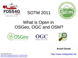
- 1. SOTM 2011 What is Open in OSGeo, OGC and OSM? Download slide sets: http://arnulf.us/publications/what_is_openness.odp http://arnulf.us/publications/what_is_openness.pdf Arnulf Christl http://www.metaspatial.net
- 4. Open Source
- 6. Transparency
- 8. Current President of OSGeo
- 9. OpenStreetMap advocate My alter ego Seven is an Ex-Borg
- 12. Offenheit {f}
- 16. candor
- 17. directness
- 18. forthrightness
- 19. frankness
- 20. ingenuousness
- 23. receptiveness
- 24. receptivity
- 27. baffle
- 28. bother
- 29. break up
- 30. bug
- 32. disturb
- 33. faze
- 34. incommode
- 35. interfere
- 37. perturb
- 38. trouble
- 39. violate
- 41. INSPIRE & Public Sector Information (EU)
- 42. Data Liberation Front (Google internal initiative)
- 43. Linked Open Data (W3C definition)
- 45. Freedom of Information Act ( USA gov )
- 46. Maps for OSM (Imports, Microsoft Bing Maps, ...)
- 47. WikiLeaks ( Global Transparancy , mirror )
- 50. TCP/IP, TLS
- 51. HTTP
- 52. URI
- 53. ...
- 54. Simple Mail Transfer Protocol (SMTP) http://en.wikipedia.org/wiki/Internet How Open is the Internet?
- 55. Open Definition http://www.opendefinition.org/software-service/ http://www.opendefinition.org/okd/
- 57. Open (Source) Software http://osgeo.org
- 58. Open (Free) Data http://openstreetmap.org
- 59. OGC's Word Cloud Courtsey by Paul Ramsey
- 60. Vision: Realization of the full societal, economic and scientific benefits of integrating electronic location resources into commercial and institutional processes worldwide. Mission: To serve as a global forum for the collaboration of developers and users of spatial data products and services, and to advance the development of international standards for geospatial interoperability. http://www.opengeospatial.org/ogc/vision
- 62. All standards can be used royalty free (without cost) by anybody.
- 63. All can comment on the standards during the public (open) discussion period.
- 64. All can propose change requests
- 65. OGC Change Requests http://www.opengeospatial.org/standards/cr
- 66. Where was that again?
- 69. Go back to start …
- 70. Courtsey by Paul Ramsey
- 72. All software must be Open Source / Free Software licensed.
- 73. All processes of the organization are open to public scrutiny.
- 75. Not like "Free beer" but as in Fre Speech
- 78. pass on to anybody else
- 79. provide services and grow a business around ...today and tomorrow! Free Software!
- 81. End users typially use the machine readbale (binary) version (the executable)
- 82. Dvelopers prefer open soce code because it makes reuse of algorithms and extending functionality much easier.
- 83. Do-ocracy A do-ocracy [...] is an organizational structure in which individuals choose roles and tasks for themselves and execute them. Responsibilities attach to people who do the work, rather than elected or selected officials. http://wiki.osgeo.org/wiki/Logo (2011-04-03)
- 84. But: Your software is worthless … … without data! Schuyler Erle
- 85. Courtsey by Paul Ramsey
- 86. OpenStreetMap
- 87. OpenStreetMap OpenStreetMap is a free editable map of the whole world. It is made by people like you.
- 89. Crowd Sourced Data (how) Other terms can be used to describe parts of the phenomenon, for example: "Volunteered Geographic Information" (Goodchild, 2007) … but it lacks the all important aspect of free reusability of the data.
- 91. All can create maps
- 92. All can use and get the maps
- 94. Semantics
- 95. …
- 96. .
- 97. …
- 98. Fully Open
- 99. The Five Stars for Linked Open Data ★ make your stuff available on the Web (whatever format) under an open license ★★ make it available as structured data (e.g., Excel instead of image scan of a table) ★★★ use non-proprietary formats (e.g., CSV instead of Excel) ★★★★ use URIs to identify things, so that people can point at your structured data (make data adressable) ★★★★★ Link your data with other data to create new information From an idea by Tim Berners Lee: Slide set: http://inkdroid.org/journal/2010/06/04/the-5-stars-of-open-linked-data/ Online example: http://lab.linkeddata.deri.ie/2010/star-scheme-by-example/
- 100. Geo Data
- 101. Map Images Swisstopo – the national map agency of Switzerland makes 500.000.000 tiles available through a cloud infrastructure for it's citizens. The underlying Data is not available freely (yet). http://map.geo.admin.ch/
- 102. Ordnance Survey Open Data http://data.ordnancesurvey.co.uk/
- 104. The Five Stars for Linked Open Data ★ make your stuff available on the Web (whatever format) under an open license ★★ make it available as structured data (e.g., Excel instead of image scan of a table) ★★★ use non-proprietary formats (e.g., CSV instead of Excel) ★★★★ use URIs to identify things, so that people can point at your structured data (make data adressable) ★★★★★ Link your data with other data to create new information From an idea by Tim Berners Lee: Slide set: http://inkdroid.org/journal/2010/06/04/the-5-stars-of-open-linked-data/ Online example: http://lab.linkeddata.deri.ie/2010/star-scheme-by-example/
- 105. Many Thanks for your attention! Dieser Foliensatz darf zu jedem Zweck kopiert, verändert und weitergegeben werden. Siehe auch: Copystraight . Copyright: Arnulf Christl 2011 Download slide sets: http://arnulf.us/publications/what_is_openness.odp http://arnulf.us/publications/what_is_openness.pdf Mit freundlicher Unterstützung von:
- 107. http://www.ffii.org/
- 110. http://www.osgeo.org
- 111. http://opendata.org