Google App Inventor - Location update
•
0 gefällt mir•200 views

This document describes a location update application developed using Google App Inventor that allows nodes to send and receive GPS coordinates and calculate distances between locations. The application collects GPS data, calculates distances from a target location, and sends location updates and distance messages to other nodes every 5 minutes or when a location changes by a specified range. It uses maps to guide nodes to target locations and includes classes for text handling, GPS data parsing, distance calculation, message sending/receiving, and timer functions.

Empfohlen
Empfohlen
Weitere ähnliche Inhalte
Was ist angesagt?
Was ist angesagt? (12)
Ähnlich wie Google App Inventor - Location update
Ähnlich wie Google App Inventor - Location update (20)
Kürzlich hochgeladen
Kürzlich hochgeladen (20)
Google App Inventor - Location update
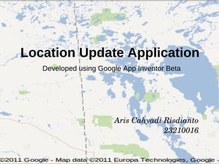
- 1. Location Update Application Developed using Google App Inventor Beta Aris Cahyadi Risdianto 23210016
- 2. Background Utilize GPS Location Based Identification GPS Coordinate can be sent, received or parsed (including through SMS) GPS Coordinate can be used for distance calculation between two points One node can send location update and current distance to other nodes Additional Map can guide one node to other
- 3. Overview Set Location Application Collect GPS coordinate information (GPS sensor or Manual Input) Send the information to the Target Location Update Application Collect GPS coordinate Calculate the distance between current location and target location Send SMS every 5 minutes or specific range Guide through Maps the direction
- 4. Illustration Get Target Location Get Current Location Collect GPS Coordinate Collect GPS Coordinate Calculate The Distance Send Message Send Message the range Set Destination Application Location Update Application
- 5. Flow Diagram Set Destination Location Update
- 6. Class Diagram Text Handling Parsing and Combining GPS Coordinate Get Location Get Coordinate from the Sensor Distance Calculation Calculate between two GPS Coordinate Send/Receive Message Including read and write messages Clausal (If-Then-Else) Decide range and when send message Timer Calculate the distance every 30 seconds
- 7. Block Diagram (Set Destination)
- 8. Block Diagram (Location Update)
- 9. Screen Shot (Set Destination)
- 10. Screen Shot (Location Update)
- 11. Screen Shot (Location Update)
- 12. Application Used
- 13. THANK YOU