SlideShare ist ein Scribd-Unternehmen logo
1 von 29
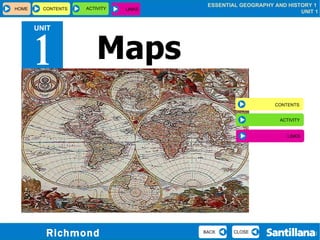
Maps UNIT 1 HOME CONTENTS  ACTIVITY CLOSE BACK CONTENTS ACTIVITY LINKS LINKS
Contents MAPS  REPRESENTATIONS  OF THE EARTH TYPES OF MAPS DIRECTION AND LOCATING PLACES ON MAPS REPRESENTING SCALE ON A MAP OTHER REPRESENTATIONS OF THE EARTH ANCIENT MAPS CLOSE BACK HOME CONTENTS  ACTIVITY LINKS
Globe Representations of the Earth Map CLOSE BACK HOME CONTENTS  ACTIVITY LINKS
Types of maps Thematic map   ENLARGE Political map  ENLARGE Physical map  ENLARGE CLOSE BACK HOME CONTENTS  ACTIVITY LINKS
Thematic map   CLOSE BACK HOME CONTENTS  ACTIVITY LINKS
Political map   CLOSE BACK HOME CONTENTS  ACTIVITY LINKS
Physical map CLOSE BACK HOME CONTENTS  ACTIVITY LINKS
Direction and locating places on maps Cardinal points  ENLARGE Meridians  ENLARGE Parallels ENLARGE Northern and southern hemispheres ENLARGE Western and eastern hemispheres ENLARGE Latitude and longitude   ENLARGE CLOSE BACK HOME CONTENTS  ACTIVITY LINKS
Cardinal points   We use the cardinal points to establish direction.   CLICK HERE  TO START CLOSE HOME CONTENTS  ACTIVITY LINKS BACK
W E Cardinal points   N NE NW SW SE S The Sun rises. The Sun sets. We use the cardinal points to establish direction.   GO BACK  CLOSE HOME CONTENTS  ACTIVITY LINKS BACK
Meridians   CLOSE BACK HOME CONTENTS  ACTIVITY LINKS
Parallels   CLOSE BACK HOME CONTENTS  ACTIVITY LINKS
Western and eastern hemispheres CLOSE BACK HOME CONTENTS  ACTIVITY LINKS
Northern and southern hemispheres   CLOSE BACK HOME CONTENTS  ACTIVITY LINKS
Latitude and longitude   CLICK HERE CLOSE BACK HOME CONTENTS  ACTIVITY LINKS
What is Saint Petersburg’s latitude? What is its longitude? Latitude and longitude   CLOSE HOME CONTENTS  ACTIVITY LINKS BACK
Representing scale on a map   Map on a scale of 1/200,000 CLICK HERE TO SEE SCALE 1 / 600,000 CLOSE BACK HOME CONTENTS  ACTIVITY LINKS
Representing scale on a map   Map on a scale of 1/600,000 CLOSE HOME CONTENTS  ACTIVITY LINKS BACK
Other representations of the Earth: satellite images Other representations of the Earth: orthoimages The Earth at night ENLARGE Colour orthoimage ENLARGE Black and white orthoimage ENLARGE United Kingdom ENLARGE CLOSE BACK HOME CONTENTS  ACTIVITY LINKS
Satellite image of the United Kingdom CLOSE BACK HOME CONTENTS  ACTIVITY LINKS
The Earth at night: a combination of hundreds of pictures CLOSE BACK HOME CONTENTS  ACTIVITY LINKS
Colour orthoimage CLOSE BACK HOME CONTENTS  ACTIVITY LINKS
Black and white orthoimage CLOSE BACK HOME CONTENTS  ACTIVITY LINKS
Ancient maps Ptolemy’s map ENLARGE Navigation chart ENLARGE Map from the 18th century ENLARGE CLOSE BACK HOME CONTENTS  ACTIVITY LINKS
Ptolemy’s Map – 150 AD CLOSE BACK HOME CONTENTS  ACTIVITY LINKS
Navigation chart CLOSE BACK HOME CONTENTS  ACTIVITY LINKS
Map from the eighteenth century CLOSE BACK HOME CONTENTS  ACTIVITY LINKS
Online interactive activity   CLOSE BACK Crack the code GO TO WEBSITE HOME CONTENTS  ACTIVITY LINKS
Links CLOSE BACK Compass points GO TO WEBSITE Map skills GO TO WEBSITE HOME CONTENTS  ACTIVITY LINKS

Weitere ähnliche Inhalte

Was ist angesagt?

GEOG101 Chapt02 lecture
GEOG101 Chapt02 lectureGEOG101 Chapt02 lecture
GEOG101 Chapt02 lectureRichard Smith
 
The tricky bits map skills
The tricky bits  map skillsThe tricky bits  map skills
The tricky bits map skillsparrym
 
The tricky bits map skills
The tricky bits  map skillsThe tricky bits  map skills
The tricky bits map skillsfelicianoe
 
The tricky bits map skills
The tricky bits  map skillsThe tricky bits  map skills
The tricky bits map skillsrenaoregan
 
Geo Skills 2 - Parts of a Map
Geo Skills 2 - Parts of a MapGeo Skills 2 - Parts of a Map
Geo Skills 2 - Parts of a MapTriciaMowat
 
Interpreting maps
Interpreting mapsInterpreting maps
Interpreting mapsrrodri37
 
Interpreting maps
Interpreting mapsInterpreting maps
Interpreting mapsrrodri37
 
Damian McCloud: Measuring Perceptions of Place
Damian McCloud: Measuring Perceptions of PlaceDamian McCloud: Measuring Perceptions of Place
Damian McCloud: Measuring Perceptions of PlaceAGI Geocommunity
 
GEOG100--Lecture 03--Maps
GEOG100--Lecture 03--MapsGEOG100--Lecture 03--Maps
GEOG100--Lecture 03--Mapsangelaorr
 
What is a map- Introduction to Map Skills Presentation
What is a map- Introduction to Map Skills PresentationWhat is a map- Introduction to Map Skills Presentation
What is a map- Introduction to Map Skills Presentationesample458
 

Was ist angesagt? (19)

Maps
Maps Maps
Maps
 
GEOG101 Chapt02 lecture
GEOG101 Chapt02 lectureGEOG101 Chapt02 lecture
GEOG101 Chapt02 lecture
 
The tricky bits map skills
The tricky bits  map skillsThe tricky bits  map skills
The tricky bits map skills
 
The tricky bits map skills
The tricky bits  map skillsThe tricky bits  map skills
The tricky bits map skills
 
The tricky bits map skills
The tricky bits  map skillsThe tricky bits  map skills
The tricky bits map skills
 
The tricky bits map skills
The tricky bits  map skillsThe tricky bits  map skills
The tricky bits map skills
 
Geo Skills 2 - Parts of a Map
Geo Skills 2 - Parts of a MapGeo Skills 2 - Parts of a Map
Geo Skills 2 - Parts of a Map
 
The Mapping Skills
The Mapping SkillsThe Mapping Skills
The Mapping Skills
 
Geography 1
Geography 1Geography 1
Geography 1
 
Interpreting maps
Interpreting mapsInterpreting maps
Interpreting maps
 
Parts of a Map
Parts of a MapParts of a Map
Parts of a Map
 
Interpreting maps
Interpreting mapsInterpreting maps
Interpreting maps
 
Damian McCloud: Measuring Perceptions of Place
Damian McCloud: Measuring Perceptions of PlaceDamian McCloud: Measuring Perceptions of Place
Damian McCloud: Measuring Perceptions of Place
 
GEOG100--Lecture 03--Maps
GEOG100--Lecture 03--MapsGEOG100--Lecture 03--Maps
GEOG100--Lecture 03--Maps
 
Workshop one
Workshop oneWorkshop one
Workshop one
 
What is a map- Introduction to Map Skills Presentation
What is a map- Introduction to Map Skills PresentationWhat is a map- Introduction to Map Skills Presentation
What is a map- Introduction to Map Skills Presentation
 
Maps, Maps, Maps
Maps, Maps, MapsMaps, Maps, Maps
Maps, Maps, Maps
 
Geography Skills
Geography SkillsGeography Skills
Geography Skills
 
PIA, fall 2010 schedule, May 5, 2010
PIA, fall 2010 schedule, May 5, 2010PIA, fall 2010 schedule, May 5, 2010
PIA, fall 2010 schedule, May 5, 2010
 

Ähnlich wie Unit 1 Maps

MAPS AND MAP READING - Copy.pptx
MAPS AND MAP READING - Copy.pptxMAPS AND MAP READING - Copy.pptx
MAPS AND MAP READING - Copy.pptxTarunyaV
 
maps & symbols which is use in india and other parts of world also
maps & symbols which is use in india and other parts of world alsomaps & symbols which is use in india and other parts of world also
maps & symbols which is use in india and other parts of world alsoLakshya Sharma
 
ONTAP - Map and Compass
ONTAP - Map and CompassONTAP - Map and Compass
ONTAP - Map and CompassWRDSB
 
BOLTSS - Mapping Geography
BOLTSS - Mapping GeographyBOLTSS - Mapping Geography
BOLTSS - Mapping GeographyYaryalitsa
 
Cartography – plotting the world
Cartography – plotting the worldCartography – plotting the world
Cartography – plotting the worldNishant Sinha
 
Ss3 m1 u01_presentation
Ss3 m1 u01_presentationSs3 m1 u01_presentation
Ss3 m1 u01_presentationdfr4591
 
SOCIAL SCIENCE WORLD
SOCIAL SCIENCE WORLDSOCIAL SCIENCE WORLD
SOCIAL SCIENCE WORLDLuciaAbalos
 
5 themes and map skills
5 themes and map skills 5 themes and map skills
5 themes and map skills Úcar Marian
 
Maps as Models of Earth
Maps as Models of EarthMaps as Models of Earth
Maps as Models of Earthmlong24
 
Graphic representation of the earth . maps and globe
Graphic representation of the earth . maps and globeGraphic representation of the earth . maps and globe
Graphic representation of the earth . maps and globeFerdinand Agdoro Jr.
 
Social Science - Review unit 1
Social Science - Review unit 1Social Science - Review unit 1
Social Science - Review unit 1Oliva Sanz
 
Social Science - Review unit 1
Social Science - Review unit 1Social Science - Review unit 1
Social Science - Review unit 1Oliva Sanz
 

Ähnlich wie Unit 1 Maps (20)

MAPS AND MAP READING - Copy.pptx
MAPS AND MAP READING - Copy.pptxMAPS AND MAP READING - Copy.pptx
MAPS AND MAP READING - Copy.pptx
 
Maps and globes
Maps and globesMaps and globes
Maps and globes
 
maps & symbols which is use in india and other parts of world also
maps & symbols which is use in india and other parts of world alsomaps & symbols which is use in india and other parts of world also
maps & symbols which is use in india and other parts of world also
 
ONTAP - Map and Compass
ONTAP - Map and CompassONTAP - Map and Compass
ONTAP - Map and Compass
 
BOLTSS - Mapping Geography
BOLTSS - Mapping GeographyBOLTSS - Mapping Geography
BOLTSS - Mapping Geography
 
Cartography – plotting the world
Cartography – plotting the worldCartography – plotting the world
Cartography – plotting the world
 
Ss3 m1 u01_presentation
Ss3 m1 u01_presentationSs3 m1 u01_presentation
Ss3 m1 u01_presentation
 
SOCIAL SCIENCE WORLD
SOCIAL SCIENCE WORLDSOCIAL SCIENCE WORLD
SOCIAL SCIENCE WORLD
 
5 themes and map skills
5 themes and map skills 5 themes and map skills
5 themes and map skills
 
Location ppt
Location pptLocation ppt
Location ppt
 
Location ppt
Location pptLocation ppt
Location ppt
 
Map & globes
Map & globesMap & globes
Map & globes
 
Maps
MapsMaps
Maps
 
Readingmaps
ReadingmapsReadingmaps
Readingmaps
 
Maps as Models of Earth
Maps as Models of EarthMaps as Models of Earth
Maps as Models of Earth
 
Graphic representation of the earth . maps and globe
Graphic representation of the earth . maps and globeGraphic representation of the earth . maps and globe
Graphic representation of the earth . maps and globe
 
Social Science - Review unit 1
Social Science - Review unit 1Social Science - Review unit 1
Social Science - Review unit 1
 
Unit 1 Maps
Unit 1 MapsUnit 1 Maps
Unit 1 Maps
 
Geography
GeographyGeography
Geography
 
Social Science - Review unit 1
Social Science - Review unit 1Social Science - Review unit 1
Social Science - Review unit 1
 

Kürzlich hochgeladen

Privatization and Disinvestment - Meaning, Objectives, Advantages and Disadva...
Privatization and Disinvestment - Meaning, Objectives, Advantages and Disadva...Privatization and Disinvestment - Meaning, Objectives, Advantages and Disadva...
Privatization and Disinvestment - Meaning, Objectives, Advantages and Disadva...RKavithamani
 
Web & Social Media Analytics Previous Year Question Paper.pdf
Web & Social Media Analytics Previous Year Question Paper.pdfWeb & Social Media Analytics Previous Year Question Paper.pdf
Web & Social Media Analytics Previous Year Question Paper.pdfJayanti Pande
 
Industrial Policy - 1948, 1956, 1973, 1977, 1980, 1991
Industrial Policy - 1948, 1956, 1973, 1977, 1980, 1991Industrial Policy - 1948, 1956, 1973, 1977, 1980, 1991
Industrial Policy - 1948, 1956, 1973, 1977, 1980, 1991RKavithamani
 
Arihant handbook biology for class 11 .pdf
Arihant handbook biology for class 11 .pdfArihant handbook biology for class 11 .pdf
Arihant handbook biology for class 11 .pdfchloefrazer622
 
Contemporary philippine arts from the regions_PPT_Module_12 [Autosaved] (1).pptx
Contemporary philippine arts from the regions_PPT_Module_12 [Autosaved] (1).pptxContemporary philippine arts from the regions_PPT_Module_12 [Autosaved] (1).pptx
Contemporary philippine arts from the regions_PPT_Module_12 [Autosaved] (1).pptxRoyAbrique
 
Mastering the Unannounced Regulatory Inspection
Mastering the Unannounced Regulatory InspectionMastering the Unannounced Regulatory Inspection
Mastering the Unannounced Regulatory InspectionSafetyChain Software
 
The basics of sentences session 2pptx copy.pptx
The basics of sentences session 2pptx copy.pptxThe basics of sentences session 2pptx copy.pptx
The basics of sentences session 2pptx copy.pptxheathfieldcps1
 
1029-Danh muc Sach Giao Khoa khoi 6.pdf
1029-Danh muc Sach Giao Khoa khoi  6.pdf1029-Danh muc Sach Giao Khoa khoi  6.pdf
1029-Danh muc Sach Giao Khoa khoi 6.pdfQucHHunhnh
 
Beyond the EU: DORA and NIS 2 Directive's Global Impact
Beyond the EU: DORA and NIS 2 Directive's Global ImpactBeyond the EU: DORA and NIS 2 Directive's Global Impact
Beyond the EU: DORA and NIS 2 Directive's Global ImpactPECB
 
Hybridoma Technology ( Production , Purification , and Application )
Hybridoma Technology  ( Production , Purification , and Application  ) Hybridoma Technology  ( Production , Purification , and Application  )
Hybridoma Technology ( Production , Purification , and Application ) Sakshi Ghasle
 
Grant Readiness 101 TechSoup and Remy Consulting
Grant Readiness 101 TechSoup and Remy ConsultingGrant Readiness 101 TechSoup and Remy Consulting
Grant Readiness 101 TechSoup and Remy ConsultingTechSoup
 
Kisan Call Centre - To harness potential of ICT in Agriculture by answer farm...
Kisan Call Centre - To harness potential of ICT in Agriculture by answer farm...Kisan Call Centre - To harness potential of ICT in Agriculture by answer farm...
Kisan Call Centre - To harness potential of ICT in Agriculture by answer farm...Krashi Coaching
 
URLs and Routing in the Odoo 17 Website App
URLs and Routing in the Odoo 17 Website AppURLs and Routing in the Odoo 17 Website App
URLs and Routing in the Odoo 17 Website AppCeline George
 
mini mental status format.docx
mini    mental       status     format.docxmini    mental       status     format.docx
mini mental status format.docxPoojaSen20
 
Nutritional Needs Presentation - HLTH 104
Nutritional Needs Presentation - HLTH 104Nutritional Needs Presentation - HLTH 104
Nutritional Needs Presentation - HLTH 104misteraugie
 
Paris 2024 Olympic Geographies - an activity
Paris 2024 Olympic Geographies - an activityParis 2024 Olympic Geographies - an activity
Paris 2024 Olympic Geographies - an activityGeoBlogs
 
Q4-W6-Restating Informational Text Grade 3
Q4-W6-Restating Informational Text Grade 3Q4-W6-Restating Informational Text Grade 3
Q4-W6-Restating Informational Text Grade 3JemimahLaneBuaron
 

Kürzlich hochgeladen (20)

Privatization and Disinvestment - Meaning, Objectives, Advantages and Disadva...
Privatization and Disinvestment - Meaning, Objectives, Advantages and Disadva...Privatization and Disinvestment - Meaning, Objectives, Advantages and Disadva...
Privatization and Disinvestment - Meaning, Objectives, Advantages and Disadva...
 
TataKelola dan KamSiber Kecerdasan Buatan v022.pdf
TataKelola dan KamSiber Kecerdasan Buatan v022.pdfTataKelola dan KamSiber Kecerdasan Buatan v022.pdf
TataKelola dan KamSiber Kecerdasan Buatan v022.pdf
 
Web & Social Media Analytics Previous Year Question Paper.pdf
Web & Social Media Analytics Previous Year Question Paper.pdfWeb & Social Media Analytics Previous Year Question Paper.pdf
Web & Social Media Analytics Previous Year Question Paper.pdf
 
Industrial Policy - 1948, 1956, 1973, 1977, 1980, 1991
Industrial Policy - 1948, 1956, 1973, 1977, 1980, 1991Industrial Policy - 1948, 1956, 1973, 1977, 1980, 1991
Industrial Policy - 1948, 1956, 1973, 1977, 1980, 1991
 
Arihant handbook biology for class 11 .pdf
Arihant handbook biology for class 11 .pdfArihant handbook biology for class 11 .pdf
Arihant handbook biology for class 11 .pdf
 
Contemporary philippine arts from the regions_PPT_Module_12 [Autosaved] (1).pptx
Contemporary philippine arts from the regions_PPT_Module_12 [Autosaved] (1).pptxContemporary philippine arts from the regions_PPT_Module_12 [Autosaved] (1).pptx
Contemporary philippine arts from the regions_PPT_Module_12 [Autosaved] (1).pptx
 
Código Creativo y Arte de Software | Unidad 1
Código Creativo y Arte de Software | Unidad 1Código Creativo y Arte de Software | Unidad 1
Código Creativo y Arte de Software | Unidad 1
 
Mastering the Unannounced Regulatory Inspection
Mastering the Unannounced Regulatory InspectionMastering the Unannounced Regulatory Inspection
Mastering the Unannounced Regulatory Inspection
 
The basics of sentences session 2pptx copy.pptx
The basics of sentences session 2pptx copy.pptxThe basics of sentences session 2pptx copy.pptx
The basics of sentences session 2pptx copy.pptx
 
1029-Danh muc Sach Giao Khoa khoi 6.pdf
1029-Danh muc Sach Giao Khoa khoi  6.pdf1029-Danh muc Sach Giao Khoa khoi  6.pdf
1029-Danh muc Sach Giao Khoa khoi 6.pdf
 
Beyond the EU: DORA and NIS 2 Directive's Global Impact
Beyond the EU: DORA and NIS 2 Directive's Global ImpactBeyond the EU: DORA and NIS 2 Directive's Global Impact
Beyond the EU: DORA and NIS 2 Directive's Global Impact
 
Hybridoma Technology ( Production , Purification , and Application )
Hybridoma Technology  ( Production , Purification , and Application  ) Hybridoma Technology  ( Production , Purification , and Application  )
Hybridoma Technology ( Production , Purification , and Application )
 
Grant Readiness 101 TechSoup and Remy Consulting
Grant Readiness 101 TechSoup and Remy ConsultingGrant Readiness 101 TechSoup and Remy Consulting
Grant Readiness 101 TechSoup and Remy Consulting
 
Kisan Call Centre - To harness potential of ICT in Agriculture by answer farm...
Kisan Call Centre - To harness potential of ICT in Agriculture by answer farm...Kisan Call Centre - To harness potential of ICT in Agriculture by answer farm...
Kisan Call Centre - To harness potential of ICT in Agriculture by answer farm...
 
URLs and Routing in the Odoo 17 Website App
URLs and Routing in the Odoo 17 Website AppURLs and Routing in the Odoo 17 Website App
URLs and Routing in the Odoo 17 Website App
 
mini mental status format.docx
mini    mental       status     format.docxmini    mental       status     format.docx
mini mental status format.docx
 
Mattingly "AI & Prompt Design: Structured Data, Assistants, & RAG"
Mattingly "AI & Prompt Design: Structured Data, Assistants, & RAG"Mattingly "AI & Prompt Design: Structured Data, Assistants, & RAG"
Mattingly "AI & Prompt Design: Structured Data, Assistants, & RAG"
 
Nutritional Needs Presentation - HLTH 104
Nutritional Needs Presentation - HLTH 104Nutritional Needs Presentation - HLTH 104
Nutritional Needs Presentation - HLTH 104
 
Paris 2024 Olympic Geographies - an activity
Paris 2024 Olympic Geographies - an activityParis 2024 Olympic Geographies - an activity
Paris 2024 Olympic Geographies - an activity
 
Q4-W6-Restating Informational Text Grade 3
Q4-W6-Restating Informational Text Grade 3Q4-W6-Restating Informational Text Grade 3
Q4-W6-Restating Informational Text Grade 3
 

Unit 1 Maps

  • 1. Maps UNIT 1 HOME CONTENTS ACTIVITY CLOSE BACK CONTENTS ACTIVITY LINKS LINKS
  • 2. Contents MAPS REPRESENTATIONS OF THE EARTH TYPES OF MAPS DIRECTION AND LOCATING PLACES ON MAPS REPRESENTING SCALE ON A MAP OTHER REPRESENTATIONS OF THE EARTH ANCIENT MAPS CLOSE BACK HOME CONTENTS ACTIVITY LINKS
  • 3. Globe Representations of the Earth Map CLOSE BACK HOME CONTENTS ACTIVITY LINKS
  • 4. Types of maps Thematic map ENLARGE Political map ENLARGE Physical map ENLARGE CLOSE BACK HOME CONTENTS ACTIVITY LINKS
  • 5. Thematic map CLOSE BACK HOME CONTENTS ACTIVITY LINKS
  • 6. Political map CLOSE BACK HOME CONTENTS ACTIVITY LINKS
  • 7. Physical map CLOSE BACK HOME CONTENTS ACTIVITY LINKS
  • 8. Direction and locating places on maps Cardinal points ENLARGE Meridians ENLARGE Parallels ENLARGE Northern and southern hemispheres ENLARGE Western and eastern hemispheres ENLARGE Latitude and longitude ENLARGE CLOSE BACK HOME CONTENTS ACTIVITY LINKS
  • 9. Cardinal points We use the cardinal points to establish direction. CLICK HERE TO START CLOSE HOME CONTENTS ACTIVITY LINKS BACK
  • 10. W E Cardinal points N NE NW SW SE S The Sun rises. The Sun sets. We use the cardinal points to establish direction. GO BACK CLOSE HOME CONTENTS ACTIVITY LINKS BACK
  • 11. Meridians CLOSE BACK HOME CONTENTS ACTIVITY LINKS
  • 12. Parallels CLOSE BACK HOME CONTENTS ACTIVITY LINKS
  • 13. Western and eastern hemispheres CLOSE BACK HOME CONTENTS ACTIVITY LINKS
  • 14. Northern and southern hemispheres CLOSE BACK HOME CONTENTS ACTIVITY LINKS
  • 15. Latitude and longitude CLICK HERE CLOSE BACK HOME CONTENTS ACTIVITY LINKS
  • 16. What is Saint Petersburg’s latitude? What is its longitude? Latitude and longitude CLOSE HOME CONTENTS ACTIVITY LINKS BACK
  • 17. Representing scale on a map Map on a scale of 1/200,000 CLICK HERE TO SEE SCALE 1 / 600,000 CLOSE BACK HOME CONTENTS ACTIVITY LINKS
  • 18. Representing scale on a map Map on a scale of 1/600,000 CLOSE HOME CONTENTS ACTIVITY LINKS BACK
  • 19. Other representations of the Earth: satellite images Other representations of the Earth: orthoimages The Earth at night ENLARGE Colour orthoimage ENLARGE Black and white orthoimage ENLARGE United Kingdom ENLARGE CLOSE BACK HOME CONTENTS ACTIVITY LINKS
  • 20. Satellite image of the United Kingdom CLOSE BACK HOME CONTENTS ACTIVITY LINKS
  • 21. The Earth at night: a combination of hundreds of pictures CLOSE BACK HOME CONTENTS ACTIVITY LINKS
  • 22. Colour orthoimage CLOSE BACK HOME CONTENTS ACTIVITY LINKS
  • 23. Black and white orthoimage CLOSE BACK HOME CONTENTS ACTIVITY LINKS
  • 24. Ancient maps Ptolemy’s map ENLARGE Navigation chart ENLARGE Map from the 18th century ENLARGE CLOSE BACK HOME CONTENTS ACTIVITY LINKS
  • 25. Ptolemy’s Map – 150 AD CLOSE BACK HOME CONTENTS ACTIVITY LINKS
  • 26. Navigation chart CLOSE BACK HOME CONTENTS ACTIVITY LINKS
  • 27. Map from the eighteenth century CLOSE BACK HOME CONTENTS ACTIVITY LINKS
  • 28. Online interactive activity CLOSE BACK Crack the code GO TO WEBSITE HOME CONTENTS ACTIVITY LINKS
  • 29. Links CLOSE BACK Compass points GO TO WEBSITE Map skills GO TO WEBSITE HOME CONTENTS ACTIVITY LINKS