Physical Geography Lecture 12 - Plate Tectonics 111616
•Als PPT, PDF herunterladen•
5 gefällt mir•781 views

Rigid Earth Theory. Plasticity. Isostacy. Alfred Wegener and Continental Drift. Wegener's lines of evidence. Harry Hess and more evidence. Power source = convection currents in the mantle. Theory of Plate Tectonics. Plate boundaries: Divergent (spreading centers), Convergent (subduction zones), Lateral (transform faults). Three types of subduction zones. Hot spots. Accreted Terranes. Cratons. Continental Shields. Topography. (maps for lab)

Empfohlen
Weitere ähnliche Inhalte
Was ist angesagt?
Was ist angesagt? (20)
Andere mochten auch
Andere mochten auch (20)
Ähnlich wie Physical Geography Lecture 12 - Plate Tectonics 111616
Ähnlich wie Physical Geography Lecture 12 - Plate Tectonics 111616 (20)
Mehr von angelaorr
Mehr von angelaorr (20)
Kürzlich hochgeladen
Kürzlich hochgeladen (20)
Physical Geography Lecture 12 - Plate Tectonics 111616
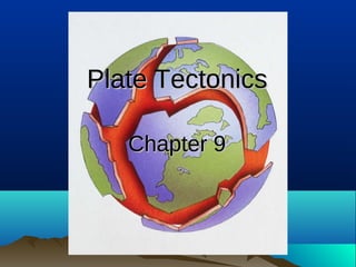
- 1. Plate TectonicsPlate Tectonics Chapter 9Chapter 9
- 2. Rigid Earth TheoryRigid Earth Theory It was once believed that Earth’s crust was hard and brittle and could not bend Plasticity We now know that Earth’s crust can bend (like a tough plastic) before breaking
- 3. 33 IsostacyIsostacy • Maintaining equilibrium in the crust • Addition or removal of crustal material causes a sinking or rebounding of crust –A glacier growing or remelting, crust eroding off the surface, sediment deposits, water bodies on land, esp. those created by dams, etc.
- 5. Alfred Wegener andAlfred Wegener and His Continental Drift TheoryHis Continental Drift Theory German meteorologist, 1920s--Pangaea (Gk. “whole land”) “The present continents were originally connected as one enormous landmass that has broken up and drifted apart over the last few 100 million years. The drifting continues….” What evidence led him to this theory?
- 6. 66
- 7. 77
- 8. 88
- 10. 1010 Wegener’s Lines of EvidenceWegener’s Lines of Evidence Similar geology (rocks and rock structures)… …petrology (rock chemistry), …matching glacial features (U-shaped valleys, glacial deposits, etc.) on continents separated by oceans, …continent shapes that seem to fit together, …patterns in the locations of volcanoes, …paleontology (fossilized plants and animals)... Ex.: S. America/Africa, Madagascar/India, Australia/Antarctica
- 11. 1111 ……but no one bought it.but no one bought it. What do you mean, “The continents are floating???” So why don’t we see the crust ripping apart right now? And hey, what’s the power source driving these movements of all the land masses, anyway??? The crust is too rigid! What a knucklehead.
- 12. Then along came OceanographerThen along came Oceanographer Harry Hess in the 1960s…Harry Hess in the 1960s…
- 15. The evidence continued to mount…The evidence continued to mount… • Military seafloor mapping: Seafloor geology—structure,Military seafloor mapping: Seafloor geology—structure, chemistry, and agechemistry, and age – Oceanic crust: only 100 m.y.oOceanic crust: only 100 m.y.o – Continental crust: 4.1 b.y.o.Continental crust: 4.1 b.y.o. • Core samplingCore sampling • Seafloor sedimentSeafloor sediment • Rigid Earth folks retired—paradigm shift to plasticityRigid Earth folks retired—paradigm shift to plasticity • Geologists, geophysicists, seismologists,Geologists, geophysicists, seismologists, oceanographers, physicists, and paleontologists alloceanographers, physicists, and paleontologists all agree the theory fits the evidence gathered within theiragree the theory fits the evidence gathered within their respective fieldsrespective fields • Convection currents as mechanism/power sourceConvection currents as mechanism/power source
- 16. 1616 Convection CurrentsConvection Currents Slow-moving convection currents within the mantle transfer heat from the outer core to the upper mantle Finally, there was a mechanism and a process for moving all those pieces of crust!
- 17. 17171717
- 18. The Theory of Plate TectonicsThe Theory of Plate Tectonics Tectonic (crustal) plates Pulling apart (diverging) = Spreading centers Slamming together, sinking (converging) = Subduction zones Sliding laterally (sideways) = Transform fault boundaries
- 19. 1919 African Rift ValleyAfrican Rift Valley 1919
- 21. Divergent Plate BoundariesDivergent Plate Boundaries Spreading centers –Crust pulling apart, magma rising to the surface
- 22. Convergent Plate BoundariesConvergent Plate Boundaries Subduction zones –Crust being forced together –Lightest material rises (mountain-building) while the heaviest stuff sinks (pushed back into the mantle) –Remelting (mostly from friction) creates volcanoes –Intense, deep-focus earthquakes
- 23. 2323
- 24. 2424 Three Types of Subduction ZonesThree Types of Subduction Zones 1. Continental crust meets oceanic crust Oceanic crust sinks Big trench offshore Volcanoes on the continental margin Big earthquakes (potential for tsunamis)
- 26. 2626 Three Types of Subduction ZonesThree Types of Subduction Zones 2. Oceanic crust meets oceanic crust The older and colder crust will probably sink Big earthquakes and volcanic islands (“island arcs”) Deep ocean trench Potential for tsunamis
- 28. 2828 Three Types of Subduction ZonesThree Types of Subduction Zones 3. Continental crust meets continental crust Too light to subduct Mountain-building Big earthquakes Little if any volcanism (mostly intrusive)
- 30. Transform Fault BoundariesTransform Fault Boundaries Tectonic plates slide past one another Earthquakes are less intense than subduction No volcanoes Little or no mountain-building
- 34. 3434 ““Hot spots”Hot spots” • Also called magma plumes • Generally occur some distance from any other type of plate boundary • Unrelated to convergent, divergent, or transform boundaries • Anomalous (odd) “balloons” of rising magma Hot spot stays in one position as the moving, island- covered crustal plate rides away from it
- 35. 3535
- 36. 3636
- 37. 3737 Accreted TerranesAccreted Terranes A moving continent may pick up new land material as lighter (felsic) material scrapes off of a subducting plate
- 40. 4040 CratonCraton • These terranes were added to the original material first formed from magma that rose out of Earth’s earliest crust –Craton--the name given to these ancient proto- continents 4040 cratons
- 41. 4141 Continental ShieldsContinental Shields More magma material was added to the cratons, forming continents. Continental shields: Where the earliest continental material still exists intact and is exposed at the surface. 4141
- 42. 4242 TopographyTopography • Right from the very beginning, the crust was affected by stresses and strains that caused crustal deformations • Over time, the crust has continued to be folded, faulted, broken, eroded and further built upon, creating the topography, the ups and downs of land relief, that we see today