
Empfohlen
Weitere ähnliche Inhalte
Was ist angesagt?
Was ist angesagt? (20)
Ähnlich wie Geog. of africa.ppt shortened
Ähnlich wie Geog. of africa.ppt shortened (20)
Mehr von amymurray1
Mehr von amymurray1 (20)
Kürzlich hochgeladen
Kürzlich hochgeladen (20)
Geog. of africa.ppt shortened
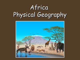
- 2. The Four Regions of Africa • Africa can be divided into four regions: (1) North; (2) West; (3) East; and (4) Central and Southern.
- 3. • North Africa’s physical features include rocky mountains and the Sahara, the world’s largest desert. Sahara
- 4. • West Africa is Africa’s most populated region; its grasslands provide good soil for farming.
- 5. • East Africa is marked by mountains, hills, and plateaus, plateaus large raised areas of mostly level land.
- 6. • Central and Southern Africa has grasslands, rain forests, mountains, swamps, and deserts, including the Namib and the Kalahari. Kalahari
- 7. Africa’s Major Landforms • Africa is called the “plateau continent” because of its high elevation—the height of land above sea level. • Each of Africa’s regions has mountains. The highest are in East Africa. • There, the continent’s highest mountain, Mount Kilimanjaro, rises to a height of more than 19,000 feet.
- 8. • Coastal plains lie along much Africa’s coastline. In some places, the plains end in an escarpment, or steep cliff. • The 4,000-mile-long Great Rift Valley in East Africa was formed millions of years ago as continents pulled apart. • A rift is a deep trench. • Major lakes are in or near the Great Rift Valley.
- 9. The Great Rift Valley The Great Rift Valley is so large that more than 30 Grand Canyons could fit inside it.
- 10. Africa’s Rivers • The Nile: The world’s longest river, it runs more than 4,000 miles. • From its two sources, the White Nile and the Blue Nile, it flows north into the Mediterranean Sea. • Its floods deposit silt, bits of rock and soil that make the land fertile, or nourishing, to plants. • The Aswan High Dam controls flooding and provides electric power from the rushing water.
- 11. • The Congo: Africa’s second-longest Congo river runs through Central Africa into the Atlantic Ocean, fed by tributaries, small rivers and streams that flow into a larger river. • The Niger: Africa’s third-longest river Niger begins in Guinea, running about 2,600 miles and ending in the Gulf of Guinea. • The Zambezi: Africa’s fourth-longest Zambezi river is about 2,200 miles long and runs through six countries in Southern Africa.
- 12. Climate and Vegetation • What types of climates and vegetation are found in Africa? • How do climate and vegetation affect how Africans make a living?
- 13. What Influences Climate? • The climate in most of Africa is warm because the continent lies along the Equator. • The seasons above the Equator are the opposite of those below the Equator.
- 14. • Countries with higher elevation, such as Ethiopia, tend to have a cooler, moister climate than those at a low elevation.
- 15. • Lower countries such as Somalia tend to be hot and dry.
- 16. • Their farmers must irrigate, or artificially water, their crops. • Or they must farm near an oasis, a place with springs and underground water. • Rainfall in Africa varies greatly, from more than 100 inches per year to almost no rain.
- 17. • Between the Sahara and the savanna is a region called the Sahel, which is hot and dry. • Nomads are people who move around to various places to make a living. • Nomadic traders, hunters, and herders live in the Sahara.
- 18. Building Good Health • Climate affects the health of people and livestock throughout Africa. • The moisture in the rain forest breeds disease-carrying insects.
- 19. • The tsetse fly is found in nearly one fifth of Africa. • The bite of the tsetse fly kills cattle and causes humans to get sleeping sickness. • Herders in various countries use poisons and traps to try to control the spread of the tsetse fly.
- 20. Agricultural Resources • Much of Africa’s land is used for subsistence farming, or raising crops to support one’s own family. • Some subsistence farmers also grow a few crops to sell or trade.
- 21. • Crops raised to be sold are called cash crops. • African cash crops include coffee, cacao, and tea. • When too much land is used for cash crops and those crops fail, food shortages can occur.