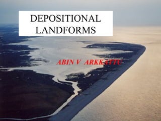
SlideShare ist ein Scribd-Unternehmen logo
1 von 16
DEPOSITIONAL
LANDFORMS
ABIN V ARKKATTU
Spit
• A Spit is a long, narrow
accumulation of sand or
shingle, one end attached to
the land the other projecting
out to sea or across a river
estuary. Many spits have
hooked or curved ends. They
are formed where longshore
drift moves large quantities of
sand & shingle along the coast
& where the coastline
suddenly changes direction to
leave a shallow sheltered area
of water. In the diagram X to
Y represents the original
coastline.
Da Nong, Vietnam
Spit
• As the fetch & prevailing winds
are from the south west, in this
diagram, longshore drift will be
moved eastward along the
coastline. At headland X the
coastline changes direction &
shingle will be deposited in
water sheltered by the headland
(B). Further deposition of sand
enables the feature to build up to
sea level (C) & extends its
length (D). The spits growth is
limited by river currents
scouring its end & transporting
sediment out to sea.Spurn point.
Spit (Salt Marsh)
• Behind the spit a quiet
tranquil lagoon forms &
sediment (brought in both by
sea currents & from rivers) is
deposited there. Eventually
the sediment builds up to sea
level & a Salt marsh forms.
Hooked (Recurved) Spit
• Occasionally storms
come in from the south
east or east & move
sediment in a different
direction forming the
curve or hook (E).When
the wind returns to
normal the spit resumes
its growth eastward (F).
Sand is blown on land
(G), forming sand dunes.
• Hurst Castle Spit, Hants.
Hooked (Recurved) Spit
The hooks & salt Marsh are well
displayed on the slide above.
Animation
Double Spit
• Formed from a breach
of a pre existing spit
or bar.
• Usually by a river or
storm.
• Christchurch Harbour,
Dorset
• Laudhelm Beach,
Maine.
Barrier Beach (Bar)
• The spits growth is limited
by river currents scouring
its end & transporting
sediment out to sea. If there
is no river the spit may
grow across the estuary and
form a Bar.
• Slapton Sands, Devon
Barrier Island
• These are formed by rising sea level.
As the sea rose at the end of the last ice
age large quantities of sediment (beach)
were pushed upward in front of the
rising sea level (bulldozerisation),
forming a ridge or island.
• The barriers move inland by
“overwash” as sediment is eroded off
the seaward side of the barrier &
redeposited on the landward side.
• North Carolina, USA.
Barrier Island
Wave Refraction
• As waves approach the
coastline, they come in
contact with the sea bed &
slow down, this happens
first off the headlands.
• The wave is still in deep
water off the bays.
• The wave is therefore bent.
• The energy is concentrated
on the headlands (erosion)
• Energy is dissipated in the
bays (deposition)
Click Here
Tombolo
• The waves are refracted
around the island & set up 2
opposing LSD directions.
• These merge behind the
island & sand is deposited
linking the mainland & the
island
• Goat Island, California
• San Antonia, Costa Rica
Tombolo
• Hafun Penninsula,
Somalia
• St. Ninian Island,
Western Scotland.
LSD
LSD
Cuspate Foreland
• A complex structure formed in a variety of ways
• Deposition behind a spit.
• LSD in 2 directions (Tombolo)
• Dungeness, Kent.
Bayhead Beach
• In bays there is little
energy (wave
refraction).
• Sediment that drifts
in is trapped & a
beach develops.
• Pett Levels, Kent.

Weitere ähnliche Inhalte

Was ist angesagt?

Fluvial landforms
Fluvial landformsFluvial landforms
Fluvial landforms
Ms Geoflake
 
Lesson 4 river features
Lesson 4 river featuresLesson 4 river features
Lesson 4 river features
Ned Baring
 
Fluvial landforms-for-site-docx
Fluvial landforms-for-site-docxFluvial landforms-for-site-docx
Fluvial landforms-for-site-docx
Abay Mossa
 
Depositional coastal landforms
Depositional coastal landformsDepositional coastal landforms
Depositional coastal landforms
Will Williams
 
The work of rivers
The work of riversThe work of rivers
The work of rivers
Moses Lutta
 

Was ist angesagt? (20)

Fluvial landforms
Fluvial landformsFluvial landforms
Fluvial landforms
 
Fluvial Geomorphology
Fluvial GeomorphologyFluvial Geomorphology
Fluvial Geomorphology
 
River processes
River processesRiver processes
River processes
 
Lesson 4 river features
Lesson 4 river featuresLesson 4 river features
Lesson 4 river features
 
Fluvial landforms-for-site-docx
Fluvial landforms-for-site-docxFluvial landforms-for-site-docx
Fluvial landforms-for-site-docx
 
V shaped valleys and interlocking spurs
V shaped valleys and interlocking spursV shaped valleys and interlocking spurs
V shaped valleys and interlocking spurs
 
Depositional coastal landforms
Depositional coastal landformsDepositional coastal landforms
Depositional coastal landforms
 
Fluvial
FluvialFluvial
Fluvial
 
River Profiles
River ProfilesRiver Profiles
River Profiles
 
The work of rivers
The work of riversThe work of rivers
The work of rivers
 
Dam design
Dam designDam design
Dam design
 
Deltaic Systems
Deltaic SystemsDeltaic Systems
Deltaic Systems
 
Geological action of river
Geological action of riverGeological action of river
Geological action of river
 
Coastal land forms .erosional and depositional landforms
Coastal land forms .erosional and depositional landformsCoastal land forms .erosional and depositional landforms
Coastal land forms .erosional and depositional landforms
 
Day 2 Presentation: Kinematic Analysis
Day 2 Presentation: Kinematic AnalysisDay 2 Presentation: Kinematic Analysis
Day 2 Presentation: Kinematic Analysis
 
GEOGRAPHY IGCSE: THE HOLDERNESS COASTLINE
GEOGRAPHY IGCSE: THE HOLDERNESS COASTLINEGEOGRAPHY IGCSE: THE HOLDERNESS COASTLINE
GEOGRAPHY IGCSE: THE HOLDERNESS COASTLINE
 
Coastal environments - A level Geography
Coastal environments - A level GeographyCoastal environments - A level Geography
Coastal environments - A level Geography
 
Natural Disasters Topic 11 (Coastal Hazards)
Natural Disasters Topic 11 (Coastal Hazards)Natural Disasters Topic 11 (Coastal Hazards)
Natural Disasters Topic 11 (Coastal Hazards)
 
Saltwater intrusion
Saltwater intrusionSaltwater intrusion
Saltwater intrusion
 
River Presentation
River PresentationRiver Presentation
River Presentation
 

Andere mochten auch (14)

Erosional and depositional landforms
Erosional and depositional landformsErosional and depositional landforms
Erosional and depositional landforms
 
4. longshore drift
4. longshore drift4. longshore drift
4. longshore drift
 
L5 Distictive Coastal Deposition Features
L5 Distictive Coastal Deposition FeaturesL5 Distictive Coastal Deposition Features
L5 Distictive Coastal Deposition Features
 
Depositional landforms
Depositional landformsDepositional landforms
Depositional landforms
 
Fluvioglaciation
FluvioglaciationFluvioglaciation
Fluvioglaciation
 
What are fluvioglacial processes?
What are fluvioglacial processes?What are fluvioglacial processes?
What are fluvioglacial processes?
 
Fluvioglacial Processes And Landforms
Fluvioglacial Processes And LandformsFluvioglacial Processes And Landforms
Fluvioglacial Processes And Landforms
 
The Holderness Coastline
The Holderness CoastlineThe Holderness Coastline
The Holderness Coastline
 
Spit, bar or tombolo
Spit, bar or tomboloSpit, bar or tombolo
Spit, bar or tombolo
 
Holderness case study
Holderness case studyHolderness case study
Holderness case study
 
Metal forming processes
Metal forming processesMetal forming processes
Metal forming processes
 
River Channel Processes & Landforms
River Channel Processes & LandformsRiver Channel Processes & Landforms
River Channel Processes & Landforms
 
Granite Tor
Granite TorGranite Tor
Granite Tor
 
Formation of spits, tombolos and bars
Formation of spits, tombolos and barsFormation of spits, tombolos and bars
Formation of spits, tombolos and bars
 

Ähnlich wie Depositional landforms

The work of the sea a.kearon
The work of the sea a.kearonThe work of the sea a.kearon
The work of the sea a.kearon
Noel Hogan
 
Lithosphere Coasts
Lithosphere   CoastsLithosphere   Coasts
Lithosphere Coasts
Tom McLean
 
Coastal Processes and Landforms
Coastal Processes and LandformsCoastal Processes and Landforms
Coastal Processes and Landforms
dumouchelle
 
COASTS ENM 142 Lecture 7.pptx
COASTS ENM 142 Lecture 7.pptxCOASTS ENM 142 Lecture 7.pptx
COASTS ENM 142 Lecture 7.pptx
CheDillon1
 
Revision lesson 40 minutes
Revision lesson 40 minutesRevision lesson 40 minutes
Revision lesson 40 minutes
eshuttleworth
 
Marine Systems
Marine SystemsMarine Systems
Marine Systems
shoaib1982
 

Ähnlich wie Depositional landforms (20)

The work of the sea a.kearon
The work of the sea a.kearonThe work of the sea a.kearon
The work of the sea a.kearon
 
Lithosphere Coasts
Lithosphere   CoastsLithosphere   Coasts
Lithosphere Coasts
 
Coastal processes and features by shirin
Coastal processes and features by shirinCoastal processes and features by shirin
Coastal processes and features by shirin
 
The Geography of the Sea and Coasts
The Geography of the Sea and CoastsThe Geography of the Sea and Coasts
The Geography of the Sea and Coasts
 
The sea
The seaThe sea
The sea
 
Coastal Processes and Landforms
Coastal Processes and LandformsCoastal Processes and Landforms
Coastal Processes and Landforms
 
Coastal Geomorphology Landforms Of Wave Erosion & Deposition
Coastal Geomorphology Landforms Of Wave Erosion & DepositionCoastal Geomorphology Landforms Of Wave Erosion & Deposition
Coastal Geomorphology Landforms Of Wave Erosion & Deposition
 
Coastal Land form
Coastal Land form Coastal Land form
Coastal Land form
 
Spits
SpitsSpits
Spits
 
Coastlines.pptx
Coastlines.pptxCoastlines.pptx
Coastlines.pptx
 
COASTS ENM 142 Lecture 7.pptx
COASTS ENM 142 Lecture 7.pptxCOASTS ENM 142 Lecture 7.pptx
COASTS ENM 142 Lecture 7.pptx
 
Factors that Contribute to Coastal Processes
Factors that Contribute to Coastal ProcessesFactors that Contribute to Coastal Processes
Factors that Contribute to Coastal Processes
 
COASTAL LANDFORMS.pptx
COASTAL LANDFORMS.pptxCOASTAL LANDFORMS.pptx
COASTAL LANDFORMS.pptx
 
Coastal
CoastalCoastal
Coastal
 
Revision lesson 40 minutes
Revision lesson 40 minutesRevision lesson 40 minutes
Revision lesson 40 minutes
 
Marine Systems
Marine SystemsMarine Systems
Marine Systems
 
GEOGRAPHY IGCSE: COASTAL PROCESSES
GEOGRAPHY IGCSE: COASTAL PROCESSESGEOGRAPHY IGCSE: COASTAL PROCESSES
GEOGRAPHY IGCSE: COASTAL PROCESSES
 
GEOGRAPHY YEAR 10: COASTAL PROCESSES
GEOGRAPHY YEAR 10: COASTAL PROCESSESGEOGRAPHY YEAR 10: COASTAL PROCESSES
GEOGRAPHY YEAR 10: COASTAL PROCESSES
 
Revision lesson 40 minutes
Revision lesson 40 minutesRevision lesson 40 minutes
Revision lesson 40 minutes
 
Coasts Revision GCSE
Coasts Revision GCSECoasts Revision GCSE
Coasts Revision GCSE
 

Mehr von abinarkt (6)

Solid waste management
Solid waste managementSolid waste management
Solid waste management
 
Flatbed scanner
Flatbed scannerFlatbed scanner
Flatbed scanner
 
Chorographical Maps
Chorographical Maps Chorographical Maps
Chorographical Maps
 
Faults
FaultsFaults
Faults
 
Spatial enhancement
Spatial enhancement Spatial enhancement
Spatial enhancement
 
Cpu
CpuCpu
Cpu
 

Kürzlich hochgeladen

Seal of Good Local Governance (SGLG) 2024Final.pptx
Seal of Good Local Governance (SGLG) 2024Final.pptxSeal of Good Local Governance (SGLG) 2024Final.pptx
Seal of Good Local Governance (SGLG) 2024Final.pptx
negromaestrong
 

Kürzlich hochgeladen (20)

ComPTIA Overview | Comptia Security+ Book SY0-701
ComPTIA Overview | Comptia Security+ Book SY0-701ComPTIA Overview | Comptia Security+ Book SY0-701
ComPTIA Overview | Comptia Security+ Book SY0-701
 
Unit-IV- Pharma. Marketing Channels.pptx
Unit-IV- Pharma. Marketing Channels.pptxUnit-IV- Pharma. Marketing Channels.pptx
Unit-IV- Pharma. Marketing Channels.pptx
 
Unit-IV; Professional Sales Representative (PSR).pptx
Unit-IV; Professional Sales Representative (PSR).pptxUnit-IV; Professional Sales Representative (PSR).pptx
Unit-IV; Professional Sales Representative (PSR).pptx
 
Web & Social Media Analytics Previous Year Question Paper.pdf
Web & Social Media Analytics Previous Year Question Paper.pdfWeb & Social Media Analytics Previous Year Question Paper.pdf
Web & Social Media Analytics Previous Year Question Paper.pdf
 
Basic Civil Engineering first year Notes- Chapter 4 Building.pptx
Basic Civil Engineering first year Notes- Chapter 4 Building.pptxBasic Civil Engineering first year Notes- Chapter 4 Building.pptx
Basic Civil Engineering first year Notes- Chapter 4 Building.pptx
 
Explore beautiful and ugly buildings. Mathematics helps us create beautiful d...
Explore beautiful and ugly buildings. Mathematics helps us create beautiful d...Explore beautiful and ugly buildings. Mathematics helps us create beautiful d...
Explore beautiful and ugly buildings. Mathematics helps us create beautiful d...
 
Micro-Scholarship, What it is, How can it help me.pdf
Micro-Scholarship, What it is, How can it help me.pdfMicro-Scholarship, What it is, How can it help me.pdf
Micro-Scholarship, What it is, How can it help me.pdf
 
Z Score,T Score, Percential Rank and Box Plot Graph
Z Score,T Score, Percential Rank and Box Plot GraphZ Score,T Score, Percential Rank and Box Plot Graph
Z Score,T Score, Percential Rank and Box Plot Graph
 
INDIA QUIZ 2024 RLAC DELHI UNIVERSITY.pptx
INDIA QUIZ 2024 RLAC DELHI UNIVERSITY.pptxINDIA QUIZ 2024 RLAC DELHI UNIVERSITY.pptx
INDIA QUIZ 2024 RLAC DELHI UNIVERSITY.pptx
 
PROCESS RECORDING FORMAT.docx
PROCESS      RECORDING        FORMAT.docxPROCESS      RECORDING        FORMAT.docx
PROCESS RECORDING FORMAT.docx
 
How to Give a Domain for a Field in Odoo 17
How to Give a Domain for a Field in Odoo 17How to Give a Domain for a Field in Odoo 17
How to Give a Domain for a Field in Odoo 17
 
Key note speaker Neum_Admir Softic_ENG.pdf
Key note speaker Neum_Admir Softic_ENG.pdfKey note speaker Neum_Admir Softic_ENG.pdf
Key note speaker Neum_Admir Softic_ENG.pdf
 
Energy Resources. ( B. Pharmacy, 1st Year, Sem-II) Natural Resources
Energy Resources. ( B. Pharmacy, 1st Year, Sem-II) Natural ResourcesEnergy Resources. ( B. Pharmacy, 1st Year, Sem-II) Natural Resources
Energy Resources. ( B. Pharmacy, 1st Year, Sem-II) Natural Resources
 
Grant Readiness 101 TechSoup and Remy Consulting
Grant Readiness 101 TechSoup and Remy ConsultingGrant Readiness 101 TechSoup and Remy Consulting
Grant Readiness 101 TechSoup and Remy Consulting
 
Seal of Good Local Governance (SGLG) 2024Final.pptx
Seal of Good Local Governance (SGLG) 2024Final.pptxSeal of Good Local Governance (SGLG) 2024Final.pptx
Seal of Good Local Governance (SGLG) 2024Final.pptx
 
2024-NATIONAL-LEARNING-CAMP-AND-OTHER.pptx
2024-NATIONAL-LEARNING-CAMP-AND-OTHER.pptx2024-NATIONAL-LEARNING-CAMP-AND-OTHER.pptx
2024-NATIONAL-LEARNING-CAMP-AND-OTHER.pptx
 
Mixin Classes in Odoo 17 How to Extend Models Using Mixin Classes
Mixin Classes in Odoo 17  How to Extend Models Using Mixin ClassesMixin Classes in Odoo 17  How to Extend Models Using Mixin Classes
Mixin Classes in Odoo 17 How to Extend Models Using Mixin Classes
 
Unit-V; Pricing (Pharma Marketing Management).pptx
Unit-V; Pricing (Pharma Marketing Management).pptxUnit-V; Pricing (Pharma Marketing Management).pptx
Unit-V; Pricing (Pharma Marketing Management).pptx
 
ICT Role in 21st Century Education & its Challenges.pptx
ICT Role in 21st Century Education & its Challenges.pptxICT Role in 21st Century Education & its Challenges.pptx
ICT Role in 21st Century Education & its Challenges.pptx
 
Presentation by Andreas Schleicher Tackling the School Absenteeism Crisis 30 ...
Presentation by Andreas Schleicher Tackling the School Absenteeism Crisis 30 ...Presentation by Andreas Schleicher Tackling the School Absenteeism Crisis 30 ...
Presentation by Andreas Schleicher Tackling the School Absenteeism Crisis 30 ...
 

Depositional landforms

  • 2. Spit • A Spit is a long, narrow accumulation of sand or shingle, one end attached to the land the other projecting out to sea or across a river estuary. Many spits have hooked or curved ends. They are formed where longshore drift moves large quantities of sand & shingle along the coast & where the coastline suddenly changes direction to leave a shallow sheltered area of water. In the diagram X to Y represents the original coastline. Da Nong, Vietnam
  • 3. Spit • As the fetch & prevailing winds are from the south west, in this diagram, longshore drift will be moved eastward along the coastline. At headland X the coastline changes direction & shingle will be deposited in water sheltered by the headland (B). Further deposition of sand enables the feature to build up to sea level (C) & extends its length (D). The spits growth is limited by river currents scouring its end & transporting sediment out to sea.Spurn point.
  • 4. Spit (Salt Marsh) • Behind the spit a quiet tranquil lagoon forms & sediment (brought in both by sea currents & from rivers) is deposited there. Eventually the sediment builds up to sea level & a Salt marsh forms.
  • 5. Hooked (Recurved) Spit • Occasionally storms come in from the south east or east & move sediment in a different direction forming the curve or hook (E).When the wind returns to normal the spit resumes its growth eastward (F). Sand is blown on land (G), forming sand dunes. • Hurst Castle Spit, Hants.
  • 6. Hooked (Recurved) Spit The hooks & salt Marsh are well displayed on the slide above. Animation
  • 7.
  • 8. Double Spit • Formed from a breach of a pre existing spit or bar. • Usually by a river or storm. • Christchurch Harbour, Dorset • Laudhelm Beach, Maine.
  • 9. Barrier Beach (Bar) • The spits growth is limited by river currents scouring its end & transporting sediment out to sea. If there is no river the spit may grow across the estuary and form a Bar. • Slapton Sands, Devon
  • 10. Barrier Island • These are formed by rising sea level. As the sea rose at the end of the last ice age large quantities of sediment (beach) were pushed upward in front of the rising sea level (bulldozerisation), forming a ridge or island. • The barriers move inland by “overwash” as sediment is eroded off the seaward side of the barrier & redeposited on the landward side. • North Carolina, USA.
  • 12. Wave Refraction • As waves approach the coastline, they come in contact with the sea bed & slow down, this happens first off the headlands. • The wave is still in deep water off the bays. • The wave is therefore bent. • The energy is concentrated on the headlands (erosion) • Energy is dissipated in the bays (deposition) Click Here
  • 13. Tombolo • The waves are refracted around the island & set up 2 opposing LSD directions. • These merge behind the island & sand is deposited linking the mainland & the island • Goat Island, California • San Antonia, Costa Rica
  • 14. Tombolo • Hafun Penninsula, Somalia • St. Ninian Island, Western Scotland. LSD LSD
  • 15. Cuspate Foreland • A complex structure formed in a variety of ways • Deposition behind a spit. • LSD in 2 directions (Tombolo) • Dungeness, Kent.
  • 16. Bayhead Beach • In bays there is little energy (wave refraction). • Sediment that drifts in is trapped & a beach develops. • Pett Levels, Kent.