

Empfohlen
Weitere ähnliche Inhalte
Was ist angesagt?
Was ist angesagt? (19)
Andere mochten auch
Andere mochten auch (15)
Ähnlich wie Vm
Ähnlich wie Vm (20)
Kürzlich hochgeladen
Kürzlich hochgeladen (20)
Vm
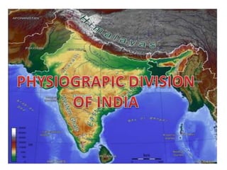
- 1. PHYSIOGRAPIC DIVISION OF INDIA
- 3. The Northern most part of the Himalayas is known as the Great or Inner himalayas or ‘Himadari’.It is the most continuous range consisting of the loftiest peaks with an average of 6000 metres. It contains all the prominent himalayan peaks.
- 4. The range lying to the south of the himadri forms the most rugged mountain system and is known as Himachal or Lesser himalaya.The altitude varies between 3,700 and 4,500 metres and the average width is of 50 km. While the PirPanjal range forms the longest and the most important range,theDhaulaDhar and the Mahabharat ranges are also prominent ones
- 5. The outer most range of the himalayas is called the Shiwaliks.Theyextented over the width of 10-50 km and have an altitude varying between 900 and 1100 metres. The longitudinal valley lying between lesser himalaya and the shiwaliksae known as Duns.Dehra dun, Kolti dun and Palti dun are some of the well known dunes. The Eastern Boundary of India, the Purvanchal comprises the Patkai hills, the Naga hills etc.
- 7. The northern plain has been formed by the interplay of the threat along with the major river systems namely- the Indus, the Ganga and the Brahmaputra along with their tributaries. This plain is formed of alluvial soil. The plain is about 2400 km long and 240 to 320 km broad,is a densely populated physiographic division . It spreads over an area of 7 lakh sq. km.
- 8. The soil in this region contains calcareous deposits to the largest part of the northern plain is formed o f older alluvium.They lie above the flood plains the rivers and present a terrace like feature. This part is known as bhangar. cally known as kankar. The newer younger deposits of the of the flood plains are called khadar.
- 10. The Peninsular plateau is a tableland composed of the old crystalline.igneous and metamorphic rocks. This plateau consist of two broad divisions,namely the Central highlands and the Deccan plateau. The part of the Peninsular plateau lying to the north of the Narmada river covering a major area of the Malwa plateau is known as the Central Highlands. The eastwards extensions of this plateau ars locally known as the Bundelkhand and Baghelkhand,example-the Chotanagpur plateau.
- 11. The Deccan Plateau is a triangular landmass that lies to the south of the river Narmada. An extension of the Plateau is also visible in the northeast- locally known as Meghalaya. Karbi-Anglong Plateau and North Cachar Hills. The Western Ghats and the Eastern Ghats make the western and the eastern edges of the Deccan Plateau respectively.
- 13. The Indian desert lies towards the western margins of the Aravali Hills. It is an undulalting sandy plain covered with sand dunes. This region receives very low rainfall below 150 mm per year. It arid climate with low vegetation cover. Luni is the only large river this region.
- 15. The western coast, sandwiched between the Western Ghats and the Arabian Sea, is a narrow plain.It consists of three sections. The northern part of the coast is called the Konkan,the central strech is called the Kannad Plain while the southern strech is reffered to the Malabar coast. In the Northern Circar ,while the southern part is known as the Coromandel Coast. Large rivers such as the Mahanadi ,the Godavari,the Krishna and the Kaveri have formed extensive delta on this delta on this coast.
- 16. THE ISLANDS
- 17. The lakshadweep Islands group lying close to the Malabar coast of Kerela.It covers small area of 32 sq km. In the Bay of Bengal lie Andaman and Nicobar Islands.They are bigger in size and are numerous and scattered . The entire islands is divided into two broad categories-the Andaman in the north and the Nicobar in the south.