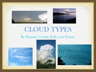
2. CIRRUS CLOUDS
Cirrus clouds are the type of cloud that is very wispy and large. Cirrus clouds usually do not
associate with rain. They are as high as 20,000 feet in the air. This kind of cloud is usually
white.
Cirrus Cloud
From Weather Wiz Kids
Small Cirrus
From Wiz kids
Wispy Cloud
From Cloud Types
3. CUMULUS CLOUDS
Did you know that the Cumulus cloud is the puffy clouds you see? The Cumulus clouds
may be 1,000 meters (about 3,000 ft) high.
Cumulus Clouds
from Wikipedia
4. THE CUMULUS CLOUD
SOMETIMES LOOK LIKE THIS:
The Cumulus cloud mostly looks
like a big ball of a puffy clouds all
in one. You would usually see a
Cumulus cloud is on a sunny day.
Cumulus clouds the top right is from
Wikipedia bottom one from USA today
top left from USA today
5. CUMULONIMBUS
Cumulonimbus are thunderstorm clouds. Made by cumulus clouds. They produce lightning,
tornados and thunder. These clouds mean bad weather. Cumulonimbus clouds are about 300
meters off the ground to their dark bases. A large amounts of energy is made by the
condensation of water vapor inside the cumulonimbus cloud.
Cumulonimbus Pic
Cumulonimbus cloud from From Cloud Types
Wikipedia
6. CUMULONIMBUS
High winds can flatten the top of a cumulonimbus cloud. When that happens it looks like
a anvil like shape. The anvil shaped cloud usually points in the way it is moving.
Cumulonimbus clouds are bigger and more vertical looking than cumulus.
Cumulonimbus from Cloud
Cumulonimbus cloud pic Types Classification
from Weather Wiz Kids
anvil
7. STRATUS CLOUDS
Stratus clouds are clouds that usually cover the whole sky. They resemble fog, and are one
of the “lower” clouds. They can be up to 6,000 feet in the air. They sometimes produce a
slight drizzle or sprinkle. This type of cloud is mostly grey.
Stratus Cloud
From Weather Wiz Kids
Fog Another Stratus
From Cloud Types
From Cloud Types