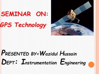
3. What is GPS?
GPS stands for Global Positioning
System.
It is a U.S. space-based radio-
navigation system.
It provides reliable & accurate
positioning, navigation, and timing
services all over the world for an
unlimited number of people in all
weather, day and night, anywhere in
the world.
Introduction
4. CHARACTERISTICS OF GPS
Free
Precise
Reliable
All Weather
Anytime
Unlimited user capacity
6. SEGMENTS OF GPS
1. Space Segment
A Group of 24 GPS
satellites, orbit at 20,200
kilometers above the Earth.
Space Segment Control Segment User Segment
GPS
7. 2. Control Segment
The satellites are continuously
monitored by ground stations
located at Hawaii and Kwajalein
in the Pacific Ocean.
3. User Segment
The satellites transmit
signals that can be
detected by anyone with a
GPS receiver. Using the
receiver, we can determine
our location with great
precision
8. GPS Master Control &
Monitoring Station
Monitoring Station
Monitoring Station
Monitoring Station
Monitoring
Station
Master Control &
Monitoring Station
10. Determining GPS Position
• Suppose the distance from
Satellite A in the sky to our
position is 11miles
• At this point we could be located
anywhere on the specified sphere
Satellite A
+
• Suppose we also know we are 15 miles
from a second satellite, Satellite BSatellite B
+
• Now our position is narrowed down to the
intersection of these two sphere
To be contd ……
11. Satellite C
+
Determining GPS Position
Satellite A
Satellite B
+
+
• Taking another measurement
from a 3rd satellite C narrows our
position down even further, to the
two points
• So by ranging from 3 satellites we can
narrow our position to just two points
• These points are located where
the 3rd sphere cuts through the
intersection of first two spheres
To be contd ……
12. •We could make a 4th
measurement from another
satellite to determine the true
point
•Thus GPS receivers use a 4th
satellite to precisely locate our
position
Determining GPS Position
The whole process is known
as Trilateration…….
13. In order to make this simple calculation,
the GPS receiver has to know two things:
The location of at least three satellites
The distance between us and each of
those satellites
The GPS receiver figures
both of these things by analyzing high-
frequency & low power radio signals from
the satellites
How GPS Receiver works
14. It determines where
we are, as it works
with the satellites,
providing latitude,
longitude, and altitude.
It receives radio
signals from the
satellites to help in
getting this
information.
15.
16. The applications of GPS mainly fall into 5
categories: location, navigation, timing,
mapping & tracking.
Moreover some other applications are:
1) Precision Farming
2) Open-pit mining
3) Oil exploration
4) Animal migration and population studies
5) Vehicle tracking
6) Construction-(tunnels, roads, etc)
7) Archaeological Explorations
8) Recreational activities-(camping,
boating, etc)
17. USES OF GPS
•Military
•Search & Rescue
•Automobile (for
navigation)
•Satellite positioning &
tracking
•Geographic Information
System (GIS).
•Surveying
•Fishing
•Hunting
•Get Directions
18. Common use of GPS
A. GIS data collection & mapping
B. Navigation
C. Recreation
21. GPS in Farmland
GPS found its way
into agricultural
production, with
farmers utilizing the
technology to manage
their cropland.
GPS-based systems
can be found on a
variety of
agricultural machinery,
assisting farmers with
day-to-day
activities.
22. ADVANTAGES
It is extremely easy to navigate as it
tell the direction for each turn
It works in all weather
It costs very low in comparison to
other navigation systems
It also helps us to search the nearby
restaurants, hotels, etc.
To be contd ……
23. Due to its low cost, it is very easy to
integrate into other technologies like
mobile
The system is updated regularly by
the US govt. & hence is very advance
Time saving
Satellite communication is done
accurately
24. DISADVANTAGES
Sometimes the GPS
signals are not accurate
due to some obstacles like
buildings, trees or cloudy
weather
Does not work
underground & underwater
In case of ionosphere &
troposphere some amount
of signal is delay
25. FUTURE MODIFICATION
In the future, all the transportation
systems will have GPS installed
Used for
• Route navigation
• Safety (collision avoidance)
• Automated vehicle navigation
26. CONCLUSION
Thus GPS is widely used for its
beneficial purposes. Nowadays, all
the smart phones have this system
inbuilt. Using this we can determine
Where we are?, Where are we going?,
In which direction are we going?,
How much we have travelled
?........Thus GPS is one of the most
powerful technology serving people
all over the world.