
Empfohlen
Empfohlen
Weitere ähnliche Inhalte
Ähnlich wie Tanzania Flying Labs Newsletter 2019
Ähnlich wie Tanzania Flying Labs Newsletter 2019 (20)
Mehr von Uyangaa Munkhbat
Mehr von Uyangaa Munkhbat (11)
Kürzlich hochgeladen
Kürzlich hochgeladen (20)
Tanzania Flying Labs Newsletter 2019
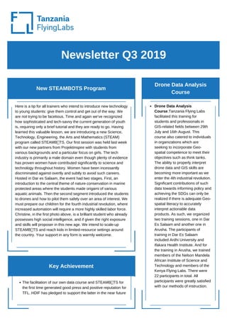
- 1. Newsletter Q3 2019 New STEAMBOTS Program Drone Data Analysis Course Here is a tip for all trainers who intend to introduce new technology to young students: give them control and get out of the way. We are not trying to be facetious. Time and again we’ve recognized how sophisticated and tech-savvy the current generation of youth is, requiring only a brief tutorial and they are ready to go. Having learned this valuable lesson, we are introducing a new Science, Technology, Engineering, the Arts and Mathematics (STEAM) program called STEAMB TS. Our first session was held last week with our new partners from Projektinspire with students from various backgrounds and a particular focus on girls. The tech industry is primarily a male domain even though plenty of evidence has proven women have contributed significantly to science and technology throughout history. Women have been incessantly discriminated against overtly and subtly to avoid such careers. Hosted in Dar es Salaam, the event had two stages. First, an introduction to the central theme of nature conservation in marine protected areas where the students made origami of various aquatic animals. Then the second segment introduced the students to drones and how to pilot them safely over an area of interest. We must prepare our children for the fourth industrial revolution, where increased automation will require a more highly skilled labor force. Christine, in the first photo above, is a brilliant student who already possesses high social intelligence, and if given the right exposure and skills will proposer in this new age. We intend to scale-up STEAMB TS and reach kids in limited-resource settings around the country. Your support in any form is warmly welcome. The facilitation of our own data course and STEAMB TS for the first time generated good press and positive reputation for TFL. HDIF has pledged to support the latter in the near future Drone Data Analysis Course.Tanzania Flying Labs facilitated this training for students and professionals in GIS-related fields between 29th July and 16th August. This course also catered to individuals in organizations which are seeking to incorporate Geo- spatial competence to meet their objectives such as think tanks. The ability to properly interpret drone data and GIS skills are becoming more important as we enter the 4th industrial revolution. Significant contributions of such data towards informing policy and achieving the SDGs can only be realized if there is adequate Geo- spatial literacy to accurately interpret actionable data products. As such, we organized two training sessions, one in Dar Es Salaam and another one in Arusha. The participants of training in Dar Es Salaam included Ardhi University and Ifakara Health Institute. And for the training in Arusha, we trained members of the Nelson Mandela African Institute of Science and Technology and members of the Kenya Flying Labs. There were 22 participants in total. All participants were greatly satisfied with our methods of instruction. Key Achievement
- 2. Newsletter April, 2019 Drone Mapping Training Drone Mapping Training in Mnazi- Bay Ruvuma Estuary Marine Park, Mtwara: The Drone and Data Training in Mtwara, Tanzania was held from August 26th to August 30th. There were 17 participants from different organizations with varying experience in drone mapping. Participants ranged from community representatives, local park officers, Mtwara municipal Fishery officers to representatives from World Wildlife Fund (WWF), Tanzania. The training was divided into three core sections: theory, hands-on flying, and an actual full-on pilot project. The first section aimed at educating the participants on the kinds of drone data that can be collected and the related works that have been done so far in Tanzania. Then came the practical session where participants learned how to fly drones by actually flying a quadcopter both manually and semi-autonomously. This session also included flight planning, collecting and processing drone data and finally generating data analytics. Finally, with the new-found knowledge, the participants mapped out the mangroves in the nearby MBREMP area. Everything from flight planning to collecting data and processing were done solely by the participants. On-going projects Photo Gallery tanzania@flyinglabs.org https://flyinglabs.org/tanzania/ https://twitter.com/tzflyinglabs https://www.facebook.com/TanzaniaFlyingLabs/ Decreasing mortality and increasing food production by using Anti-Malaria Drones in Tanzanian rice agro-ecosystems Poverty Mapping w/Drones proposal with REPOA Drone Data Analysis Course STEAMB TS Program Follow us and Contact us
- 3. Newsletter May 2019 Projects Projects and trainings Topographic Survey for Solar Power Plant in Kahama. The client is in-country and Tanzania Flying Labs is awaiting project approval from the Energy and Water Utilities Regulatory Authority (EWURA) to proceed with mapping for the moment. Our client, a company from the UK in Tanzania is putting together mini-solar power plant for the local community in Kahama. They are planning to build more than 10 installations in the future. Thus, we also envisage to incubate new companies who can participate in their solar power installations projects using drones for mapping and surveying to make sure the power plants work properly. Land Management Pilot: Participatory mapping exercise in Meatu District. This was after collecting the data last year and this year, we brought back the data to the local community. We traced eleven farms- eleven households- 55 people. The objective of this exercise was to trial and fine- tune a methodology for mapping farms rapidly and accurately using drone data. This was a dress rehearsal for phase 2 which is now in the hands of the ESRF and the Meatu District Council. As a side benefit, since it was done in a participatory manner, it will help eliminate land conflict in the local community. Key Achievement The participatory mapping exercise in Simiyu Region was a success. We were able to take drone data which was collected last year back to the community and prove how it could be useful in improving their land rights The drone training course in Zambia will open new doors and strengthen regional integration in robotics Decreasing mortality and increasing food production by using Anti-Malaria Drones in Tanzanian rice agro- ecosystems. It is two-fold project in the sense that it’s about ending hunger and improving the health of farmers. The idea is that less rate of disease would lead to more production, hence less hunger and higher income. We will manage the trial of AMDs in Tanzania and organize a training workshop for Tanzanian pilots to learn how to fly the same drone. DJI will be directly engaged in this project. Lusaka City Council Drone Training Course. Zambia has initiated a land titling program. Lusaka City Council has requested to update the valuation roll through application of drone mapping. Tanzania Flying Labs facilitated a 5-day drone mapping course which included students from the University of Zambia and members of the new Zambia Flying Labs. Zanzibar Malaria and Elimination Program (ZAMEP) Drone Training Course. ZAMEP staff were trained to fly drones and map mosquito breeding sites using GIS software. This training was offered in partnership with Aberystwyth University from Wales.
- 4. Newsletter April, 2019 Other activities Country Environmental Analysis Workshop: Meeting with the Minister of Environment to demonstrate how geospatial data can contribute towards environmental protection Lake Victoria Challenge Organizing Committee Working Meeting and Unmanned Aircraft Traffic Management Systems Workshop: Tanzania Flying labs attended this meeting in Mwanza as part of the LVC organizing committee REPOA Annual Conference on local economic development: This year’s focus was on frugal innovation and TFL was there to add a voice and promote jobs for the youth in the drone ecosystem Introduction to LiDAR and comparison to photogrammetry at the World Bank (https://bit.ly/2LMY3Ij): A Dutch company given a job by the World Bank and TFL was asked to demonstrate and show the results of using LiDAR in flood resilience mapping and effort. The presentation lasted for half a day Upcoming projects and training Photo Gallery Follow us and Contact us tanzania@flyinglabs.org https://flyinglabs.org/tanzania/ https://twitter.com/tzflyinglabs A spatial analysis of land conflicts between farmers and herders in Morogoro Region Drone data interpretation course, Dar es Salaam, July 2019 Ghati Marwa of Tanzania Flying Labs leading a training on drone data analysis in Zambia Yussuf of Tanzania Flying Labs with the participants of a training in Zambia
- 5. Newsletter April 2019 Project: Use of Drones for Land Survey and Mapping Training: ZAMEP Drone Training Zanzibar’s vision is to have no locally-acquired malaria cases. One of the challenges is to manage the water bodies where malaria mosquitos breed. Having spatial records will help the Zanzibar Malaria Elimination program (ZAMEP) team and partners move a huge step towards malaria elimination on the island. ZAMEP is now exploring the use of drones towards malaria elimination efforts. The training took place at the State University of Zanzibar and a case study for data collection will take place in rice paddies nearby. The participants sequentially studied the mapping workflow from mission planning, data acquisition, data processing, and analysis. The Use of Drones for Land Survey and Mapping for Improving Livestock Grazing and Farming: Participatory mapping in Simiyu Region Drone data was used to try new innovative ways of identifying and demarcating farms with the local community using drone data. This was our second visit to this area after mapping the entire village with drones last year. We initiated a pilot study to 1) understand how drone data can add value to existing methods of data collection and management; 2) determine the cost of drone data collection; 3) determine what additional value drone data can contribute; and 4) to determine where the challenges lie, both in acquiring drone data for land management applications and in combining it with other data sources. This time around we brought a high-resolution base map created from the drone data and asked 10 random households, to trace their farms. It was amazing to see the immediate recognition of their property considering the area was semi-arid with very few visual markers when we initially collected the data. What was equally revealing was the mutual recognition of boundaries amongst the local community. All the farms were positively identified and nine out of the ten farms were correctly traced. It is prudent to conduct such exercises in the shortest time possible after data acquisition, as recommended by Its4Land in this report: https://bit.ly/2Y1fp5C. Follow this link to view the web maps: https://arcg.is/0eejC Key Achievement Alignment with the Tanzanian government and local community stakeholders on the objectives of the Simiyu Land Management Pilot through the participatory mapping exercise conducted in Meatu District.
- 6. Newsletter April, 2019 Other activities Strategy workshop with WeRobotics in Dar es Salaam: We developed a 6-month activity plan, a new value proposition, vision and mission for TFL. REPOA Annual Conference on local economic development: TFL participated in this conference that was organized between 9th and 12th April. The focus of the conference was on frugal innovation. TFL was there to add a voice and promote jobs for the youth in the drone ecosystem. And other activities that Tanzania Flying Labs participated include Msimbazi Topographical Survey Results Workshop and Introduction to LiDAR and comparison to photogrammetry at the World Bank. Upcoming projects and training Topographic Survey for Solar Power Plant in Kahama. Drone training course in Lusaka, Zambia. Photo Gallery Citizens of Ng’hoboko Village assisting us and each other to identify their farms Follow us and Contact us tanzania@flyinglabs.org https://flyinglabs.org/tanzania/ https://twitter.com/tzflyinglabs TFL team with local community in Simiyu Region