SlideShare ist ein Scribd-Unternehmen logo
1 von 40
CONCEPT OF REMOTE SENSING
PRESENTED BY:-
UTTAM KUMAR PARIDA
M.P.C. AUTONOMOUS COLEGE,
TAKHATPUR, BARIPADA,
MAYURBHANJ
What is remote sensing ?
 Remote – away
from or at a
distance
 Sensing – detecting
a property or
characteristic
Remote Sensing
The term "remote
sensing," first used in the
United States in the
1950s by Ms. Evelyn
Pruitt of the U.S. Office
of Naval Research
Definitions
"Remote sensing is teaching us a
new way of seeing".
Remote sensing has been defined in
many ways.
Definition (1)
Remote sensing is
"the acquisition of
information about
an object, without
being in physical
contact with that
object"
Definition (2)
Remote sensing is "the ability to measure
the properties of an object without
touching it".
Definition (3)
Remote sensing can be defined as "the
collection of data about an object from
a distance. Humans and many other
types of animals accomplish this task
with aid of eyes or by the sense of
smell or hearing".
Definition (4)
Remote sensing is "the examination,
measurement, and analysis of an object
without being in contact with it".
Definition (5)
Remote sensing is "the science and art of
obtaining information about an object,
area, or phenomenon through the
analysis of data acquired by a device
not in contact with the object, area, or
phenomenon in question".
Brief History of Remote
Sensing
 1839, the first
photographs.
 1849, used photography
in topographic mapping.
 1858, balloons were
being used to acquire
photography of large
areas.
1925-1945
 Mid 1930s, color photography.
 Aerial photography became
widespread during World War II, with
improved lenses and platform stability,
enemy positions and military
installations could be identified from
aircraft.
 Radar
1945-1960
 Cameras were launched on rockets as
this science expanded in the post-World
War II era.
 In 1957, the Russians launched the first
successful Earth satellite, Sputnik 1
 In 1958, the US launched its first
satellite, Explorer 1.
 In 1959, the first satellite with a
meteorological instrument (Vanguard 2)
was launched.
 In 1960, the first satellite images ever
made of the earth comes from the
TIROS 1
1960-1972
 This was the age of instrument development.
 In 1964, the Nimbus satellite series of
experimental meteorological remote sensing
was initiated.
 By 1966, meteorological satellites moved from
being experimental to being operational with
the introduction of the ESSA series of satellites
which included Automatic Picture.
 The Defense Meteorological Satellite Program
(DMSP) was started by the U.S. Air Force in
1966.
 1972, Landsat 1 (also referred to as Earth
Resources Technology Satellite.
1972-present
 1975: The Synchronous Meteorological Satellites.
 1976: Laser Geodynamic Satellite I.
 1978: The Heat Capacity Mapping Mission.
 1978: Seasat demonstrated techniques for global monitoring of
the Earth's oceans.
 1978: Nimbus 7, the final satellite in that series, was launched.
 1984: The Earth Radiation Budget (ERBE) satellite began its
study of how the Earth absorbs and reflects the Sun's energy.
 1991: The Upper Atmosphere Research Satellite (UARS) began
its study of the chemistry and physics of the Earth's
atmosphere.
 Today, the GOES (Geostationary Operational Environmental
Satellite) system of satellites provides most of the remotely
sensed weather information for North America.
Remote sensing: Art and/or Science?
SCIENCE;
 Remote sensing is a tool or technique similar to mathematics.
 Using sophisticated sensor to measure the amount of electromagnetic energy existing an object or
geographic area from a distance and then extracting valuable information from the data using mathematically
and statistically based algorithms is a scientific activity.
 It functions in harmony with other spatial data-collection techniques or tools of the mapping science,
including cartography and geographical information system(GIS).
ART:
 It is a fact that some image analysts are much superior to other image analysts because they—
 Understand the scientific principles better
 They have more widely traveled and have seen many landscape objects and geographic areas.
 They can synthesize scientific principles and real world knowledge to reach logical and correct
conclusions.
So, Remote Sensing is both an art and a science.
Uses of Remote Sensing
 Weather: It is possible
now to get immediate
information on climate
and weather conditions
from remote sensing
satellites. Images over
time allow us to predict
weather behavior.
Uses of Remote Sensing
 Agriculture: Crop
mapping and
yield prediction;
crop damage due
to storm, drought
or disease and
insect outbreaks.
Uses of Remote Sensing
 Environmental
Impacts: Remote
Sensing to
determine oil spill
size, location,
direction and
magnitude of
movement.Coastal oil spill, Wales, England
Uses of Remote Sensing
 Forestry Inventory:
Remote Sensing
used for forest
inventory, mapping
cut-overs, forest fire
mapping, species
identification.
Burned and burning forest near Norman Wells, NWT , Canada
Uses of Remote Sensing
 Geological Mapping:
Mapping faults, folds,
lineaments and rock
types.
Syncline/Anticline structures in the Applachians of Pennsylvania.
The element of the remote sensing
process
1) Energy Source or
Illumination
2) Radiation and the
Atmosphere
3) Interaction with the
Target
4) Recording of Energy by
the Sensor
5) Transmission, Reception,
and Processing
6) Interpretation and
Analysis
7) Application
Advantages of Remote Sensing:-
• Passive remote sensing does not disturb the object or area of interest.
• Remote sensing data collection can remove the sampling bias introduced in some in
situ investigations.
• Provide fundamental biophysical data, x-y location, z elevation or depth, temperature,
moisture content, etc.
• Remotely sensed data may be obtained systematically over very large geographic
areas.
• Remotely sensed data can create Digital Elevation Model (DEM).
• Computer processing is possible in many cases
Limitation of Remote Sensing:-
• Does not provide all the information needed for conducting physical, biological, or social
science. It simply provides some spatial, spectral, and temporal information of value.
• Various human interaction in remote sensing process may produce errors.
• Active remote sensor system, such as lasers or radars can affect the phenomenon being
investigated.
• Instruments often become uncelebrated, resulting in uncelebrated remote sensing data.
• Expensive to collect and interpret or analyze.
CONCLUSION
Remote sensing technology has developed from balloon photography to aerial
photography to multi-spectral satellite imaging.
Some of the benefits that can be gained from the use of remote sensing-
Early identification of crop health and stress.
Ability to use this information to do remediation work on the problem.
Improve crop yield.
Crop yield predictions.
Reduce costs.
Reduce environmental impacts.
Crop management to maximize returns through the season.
Crop management to maximize returns during harvest time.
ANY QUESTION?
Concept of remote sensing

Weitere ähnliche Inhalte

Was ist angesagt?

History of remote sensing
History of remote sensingHistory of remote sensing
History of remote sensingSumant Diwakar
 
Geometry of Aerial photograph
Geometry of Aerial photographGeometry of Aerial photograph
Geometry of Aerial photographApoorva Mathur
 
Introduction to Landsat
Introduction to LandsatIntroduction to Landsat
Introduction to LandsatNizam GIS
 
Principles of Remote Sensing
Principles of Remote Sensing Principles of Remote Sensing
Principles of Remote Sensing Ariful Islam
 
Basics of Remote Sensing
Basics of Remote SensingBasics of Remote Sensing
Basics of Remote SensingAkash Tikhe
 
Digital image processing
Digital image processingDigital image processing
Digital image processinglakhveer singh
 
Microwave remote sensing
Microwave remote sensingMicrowave remote sensing
Microwave remote sensingMohsin Siddique
 
Remote Sensing PPT
Remote Sensing PPTRemote Sensing PPT
Remote Sensing PPTAmal Murali
 
Advantages and disadvantages of Remote Sensing
Advantages and disadvantages of Remote SensingAdvantages and disadvantages of Remote Sensing
Advantages and disadvantages of Remote SensingEr Abhi Vashi
 
Fundamentals of Remote Sensing
Fundamentals of Remote SensingFundamentals of Remote Sensing
Fundamentals of Remote SensingShah Naseer
 
Remote sensing - Sensors, Platforms and Satellite orbits
Remote sensing - Sensors, Platforms and Satellite orbitsRemote sensing - Sensors, Platforms and Satellite orbits
Remote sensing - Sensors, Platforms and Satellite orbitsAjay Singh Lodhi
 
Fundamentals of Remote Sensing
Fundamentals of Remote Sensing Fundamentals of Remote Sensing
Fundamentals of Remote Sensing Pallab Jana
 
Aerial photography.pptx
Aerial photography.pptxAerial photography.pptx
Aerial photography.pptxPramoda Raj
 
Geometry and types of aerial photographs
Geometry and types of aerial photographsGeometry and types of aerial photographs
Geometry and types of aerial photographsPooja Kumari
 
Image classification, remote sensing, P K MANI
Image classification, remote sensing, P K MANIImage classification, remote sensing, P K MANI
Image classification, remote sensing, P K MANIP.K. Mani
 
Application of remote sensing
Application of remote sensingApplication of remote sensing
Application of remote sensingAnurag Kumar
 
Remote Sensing Platforms and Sensors
Remote Sensing Platforms and SensorsRemote Sensing Platforms and Sensors
Remote Sensing Platforms and SensorsUday kumar Devalla
 
Components of Remote Sensing
Components of Remote SensingComponents of Remote Sensing
Components of Remote SensingAbby Varghese
 

Was ist angesagt? (20)

History of remote sensing
History of remote sensingHistory of remote sensing
History of remote sensing
 
Geometry of Aerial photograph
Geometry of Aerial photographGeometry of Aerial photograph
Geometry of Aerial photograph
 
Introduction to Landsat
Introduction to LandsatIntroduction to Landsat
Introduction to Landsat
 
Principles of Remote Sensing
Principles of Remote Sensing Principles of Remote Sensing
Principles of Remote Sensing
 
Basics of Remote Sensing
Basics of Remote SensingBasics of Remote Sensing
Basics of Remote Sensing
 
Digital image processing
Digital image processingDigital image processing
Digital image processing
 
Microwave remote sensing
Microwave remote sensingMicrowave remote sensing
Microwave remote sensing
 
Remote Sensing PPT
Remote Sensing PPTRemote Sensing PPT
Remote Sensing PPT
 
Advantages and disadvantages of Remote Sensing
Advantages and disadvantages of Remote SensingAdvantages and disadvantages of Remote Sensing
Advantages and disadvantages of Remote Sensing
 
Fundamentals of Remote Sensing
Fundamentals of Remote SensingFundamentals of Remote Sensing
Fundamentals of Remote Sensing
 
Remote sensing - Sensors, Platforms and Satellite orbits
Remote sensing - Sensors, Platforms and Satellite orbitsRemote sensing - Sensors, Platforms and Satellite orbits
Remote sensing - Sensors, Platforms and Satellite orbits
 
Fundamentals of Remote Sensing
Fundamentals of Remote Sensing Fundamentals of Remote Sensing
Fundamentals of Remote Sensing
 
Remote sensing
Remote sensingRemote sensing
Remote sensing
 
Visual Interpretation
Visual InterpretationVisual Interpretation
Visual Interpretation
 
Aerial photography.pptx
Aerial photography.pptxAerial photography.pptx
Aerial photography.pptx
 
Geometry and types of aerial photographs
Geometry and types of aerial photographsGeometry and types of aerial photographs
Geometry and types of aerial photographs
 
Image classification, remote sensing, P K MANI
Image classification, remote sensing, P K MANIImage classification, remote sensing, P K MANI
Image classification, remote sensing, P K MANI
 
Application of remote sensing
Application of remote sensingApplication of remote sensing
Application of remote sensing
 
Remote Sensing Platforms and Sensors
Remote Sensing Platforms and SensorsRemote Sensing Platforms and Sensors
Remote Sensing Platforms and Sensors
 
Components of Remote Sensing
Components of Remote SensingComponents of Remote Sensing
Components of Remote Sensing
 

Ähnlich wie Concept of remote sensing

Remote Sensing_2020-21 (1).pdf
Remote Sensing_2020-21  (1).pdfRemote Sensing_2020-21  (1).pdf
Remote Sensing_2020-21 (1).pdfBAGARAGAZAROMUALD2
 
Module 5 Remote Sensing in Civil Engineering.pptx
Module 5 Remote Sensing in Civil Engineering.pptxModule 5 Remote Sensing in Civil Engineering.pptx
Module 5 Remote Sensing in Civil Engineering.pptxsurekha1287
 
Remote sensing by abhishek mahajan
Remote sensing by abhishek mahajanRemote sensing by abhishek mahajan
Remote sensing by abhishek mahajanAbhishek Mahajan
 
rsgis-unitii-160731062950.pdf
rsgis-unitii-160731062950.pdfrsgis-unitii-160731062950.pdf
rsgis-unitii-160731062950.pdfBSuresh26
 
Remote Sensing and its Applications in Agriculture
Remote Sensing and its Applications in AgricultureRemote Sensing and its Applications in Agriculture
Remote Sensing and its Applications in AgricultureVikas Kashyap
 
Remote Sensing - by Ashwini
Remote Sensing - by AshwiniRemote Sensing - by Ashwini
Remote Sensing - by AshwiniSanthosh Sundar
 
Remote Sensing: Meaning, Concept and Components | Geography
Remote Sensing: Meaning, Concept and Components | GeographyRemote Sensing: Meaning, Concept and Components | Geography
Remote Sensing: Meaning, Concept and Components | GeographySrimantaKarak
 
remote sensing for study.docx
remote sensing for study.docxremote sensing for study.docx
remote sensing for study.docxbbc37142
 
Concepts of Remote Sensing: Process and Stages of Remote Sensing, Remote Sens...
Concepts of Remote Sensing: Process and Stages of Remote Sensing, Remote Sens...Concepts of Remote Sensing: Process and Stages of Remote Sensing, Remote Sens...
Concepts of Remote Sensing: Process and Stages of Remote Sensing, Remote Sens...ShavnamMehta
 
remote sensing
remote sensingremote sensing
remote sensing78harshith
 
Remote sensing and application by Nikhil Pakwanne
Remote sensing and application by Nikhil PakwanneRemote sensing and application by Nikhil Pakwanne
Remote sensing and application by Nikhil PakwanneNIKHIL PAKWANNE
 
A Brief Introduction to Remote Sensing Satellites
A Brief Introduction to Remote Sensing Satellites A Brief Introduction to Remote Sensing Satellites
A Brief Introduction to Remote Sensing Satellites Alireza Rahimzadeganasl
 
REMOTE SENSING
REMOTE SENSINGREMOTE SENSING
REMOTE SENSINGijsrd.com
 

Ähnlich wie Concept of remote sensing (20)

Remote Sensing_2020-21 (1).pdf
Remote Sensing_2020-21  (1).pdfRemote Sensing_2020-21  (1).pdf
Remote Sensing_2020-21 (1).pdf
 
Module 5 Remote Sensing in Civil Engineering.pptx
Module 5 Remote Sensing in Civil Engineering.pptxModule 5 Remote Sensing in Civil Engineering.pptx
Module 5 Remote Sensing in Civil Engineering.pptx
 
Remote sensing
Remote sensingRemote sensing
Remote sensing
 
Remote sensing
Remote sensingRemote sensing
Remote sensing
 
Ch 5 b remote sensing
Ch 5 b remote sensingCh 5 b remote sensing
Ch 5 b remote sensing
 
Remote sensing by abhishek mahajan
Remote sensing by abhishek mahajanRemote sensing by abhishek mahajan
Remote sensing by abhishek mahajan
 
Remote sensing
Remote sensingRemote sensing
Remote sensing
 
rsgis-unitii-160731062950.pdf
rsgis-unitii-160731062950.pdfrsgis-unitii-160731062950.pdf
rsgis-unitii-160731062950.pdf
 
Remote Sensing and its Applications in Agriculture
Remote Sensing and its Applications in AgricultureRemote Sensing and its Applications in Agriculture
Remote Sensing and its Applications in Agriculture
 
Introduction to Remote Sensing
Introduction to Remote SensingIntroduction to Remote Sensing
Introduction to Remote Sensing
 
Report
ReportReport
Report
 
Remote Sensing - by Ashwini
Remote Sensing - by AshwiniRemote Sensing - by Ashwini
Remote Sensing - by Ashwini
 
Remote Sensing: Meaning, Concept and Components | Geography
Remote Sensing: Meaning, Concept and Components | GeographyRemote Sensing: Meaning, Concept and Components | Geography
Remote Sensing: Meaning, Concept and Components | Geography
 
remote sensing for study.docx
remote sensing for study.docxremote sensing for study.docx
remote sensing for study.docx
 
Concepts of Remote Sensing: Process and Stages of Remote Sensing, Remote Sens...
Concepts of Remote Sensing: Process and Stages of Remote Sensing, Remote Sens...Concepts of Remote Sensing: Process and Stages of Remote Sensing, Remote Sens...
Concepts of Remote Sensing: Process and Stages of Remote Sensing, Remote Sens...
 
remote sensing
remote sensingremote sensing
remote sensing
 
Remote sensing and application by Nikhil Pakwanne
Remote sensing and application by Nikhil PakwanneRemote sensing and application by Nikhil Pakwanne
Remote sensing and application by Nikhil Pakwanne
 
A Brief Introduction to Remote Sensing Satellites
A Brief Introduction to Remote Sensing Satellites A Brief Introduction to Remote Sensing Satellites
A Brief Introduction to Remote Sensing Satellites
 
Remote sensing
Remote sensingRemote sensing
Remote sensing
 
REMOTE SENSING
REMOTE SENSINGREMOTE SENSING
REMOTE SENSING
 

Kürzlich hochgeladen

The Most Excellent Way | 1 Corinthians 13
The Most Excellent Way | 1 Corinthians 13The Most Excellent Way | 1 Corinthians 13
The Most Excellent Way | 1 Corinthians 13Steve Thomason
 
Arihant handbook biology for class 11 .pdf
Arihant handbook biology for class 11 .pdfArihant handbook biology for class 11 .pdf
Arihant handbook biology for class 11 .pdfchloefrazer622
 
The basics of sentences session 2pptx copy.pptx
The basics of sentences session 2pptx copy.pptxThe basics of sentences session 2pptx copy.pptx
The basics of sentences session 2pptx copy.pptxheathfieldcps1
 
microwave assisted reaction. General introduction
microwave assisted reaction. General introductionmicrowave assisted reaction. General introduction
microwave assisted reaction. General introductionMaksud Ahmed
 
Key note speaker Neum_Admir Softic_ENG.pdf
Key note speaker Neum_Admir Softic_ENG.pdfKey note speaker Neum_Admir Softic_ENG.pdf
Key note speaker Neum_Admir Softic_ENG.pdfAdmir Softic
 
Class 11th Physics NEET formula sheet pdf
Class 11th Physics NEET formula sheet pdfClass 11th Physics NEET formula sheet pdf
Class 11th Physics NEET formula sheet pdfAyushMahapatra5
 
Explore beautiful and ugly buildings. Mathematics helps us create beautiful d...
Explore beautiful and ugly buildings. Mathematics helps us create beautiful d...Explore beautiful and ugly buildings. Mathematics helps us create beautiful d...
Explore beautiful and ugly buildings. Mathematics helps us create beautiful d...christianmathematics
 
Sanyam Choudhary Chemistry practical.pdf
Sanyam Choudhary Chemistry practical.pdfSanyam Choudhary Chemistry practical.pdf
Sanyam Choudhary Chemistry practical.pdfsanyamsingh5019
 
social pharmacy d-pharm 1st year by Pragati K. Mahajan
social pharmacy d-pharm 1st year by Pragati K. Mahajansocial pharmacy d-pharm 1st year by Pragati K. Mahajan
social pharmacy d-pharm 1st year by Pragati K. Mahajanpragatimahajan3
 
Holdier Curriculum Vitae (April 2024).pdf
Holdier Curriculum Vitae (April 2024).pdfHoldier Curriculum Vitae (April 2024).pdf
Holdier Curriculum Vitae (April 2024).pdfagholdier
 
Russian Escort Service in Delhi 11k Hotel Foreigner Russian Call Girls in Delhi
Russian Escort Service in Delhi 11k Hotel Foreigner Russian Call Girls in DelhiRussian Escort Service in Delhi 11k Hotel Foreigner Russian Call Girls in Delhi
Russian Escort Service in Delhi 11k Hotel Foreigner Russian Call Girls in Delhikauryashika82
 
General AI for Medical Educators April 2024
General AI for Medical Educators April 2024General AI for Medical Educators April 2024
General AI for Medical Educators April 2024Janet Corral
 
Grant Readiness 101 TechSoup and Remy Consulting
Grant Readiness 101 TechSoup and Remy ConsultingGrant Readiness 101 TechSoup and Remy Consulting
Grant Readiness 101 TechSoup and Remy ConsultingTechSoup
 
BAG TECHNIQUE Bag technique-a tool making use of public health bag through wh...
BAG TECHNIQUE Bag technique-a tool making use of public health bag through wh...BAG TECHNIQUE Bag technique-a tool making use of public health bag through wh...
BAG TECHNIQUE Bag technique-a tool making use of public health bag through wh...Sapna Thakur
 
Nutritional Needs Presentation - HLTH 104
Nutritional Needs Presentation - HLTH 104Nutritional Needs Presentation - HLTH 104
Nutritional Needs Presentation - HLTH 104misteraugie
 
Sports & Fitness Value Added Course FY..
Sports & Fitness Value Added Course FY..Sports & Fitness Value Added Course FY..
Sports & Fitness Value Added Course FY..Disha Kariya
 
Kisan Call Centre - To harness potential of ICT in Agriculture by answer farm...
Kisan Call Centre - To harness potential of ICT in Agriculture by answer farm...Kisan Call Centre - To harness potential of ICT in Agriculture by answer farm...
Kisan Call Centre - To harness potential of ICT in Agriculture by answer farm...Krashi Coaching
 

Kürzlich hochgeladen (20)

The Most Excellent Way | 1 Corinthians 13
The Most Excellent Way | 1 Corinthians 13The Most Excellent Way | 1 Corinthians 13
The Most Excellent Way | 1 Corinthians 13
 
Arihant handbook biology for class 11 .pdf
Arihant handbook biology for class 11 .pdfArihant handbook biology for class 11 .pdf
Arihant handbook biology for class 11 .pdf
 
The basics of sentences session 2pptx copy.pptx
The basics of sentences session 2pptx copy.pptxThe basics of sentences session 2pptx copy.pptx
The basics of sentences session 2pptx copy.pptx
 
microwave assisted reaction. General introduction
microwave assisted reaction. General introductionmicrowave assisted reaction. General introduction
microwave assisted reaction. General introduction
 
Key note speaker Neum_Admir Softic_ENG.pdf
Key note speaker Neum_Admir Softic_ENG.pdfKey note speaker Neum_Admir Softic_ENG.pdf
Key note speaker Neum_Admir Softic_ENG.pdf
 
Class 11th Physics NEET formula sheet pdf
Class 11th Physics NEET formula sheet pdfClass 11th Physics NEET formula sheet pdf
Class 11th Physics NEET formula sheet pdf
 
Explore beautiful and ugly buildings. Mathematics helps us create beautiful d...
Explore beautiful and ugly buildings. Mathematics helps us create beautiful d...Explore beautiful and ugly buildings. Mathematics helps us create beautiful d...
Explore beautiful and ugly buildings. Mathematics helps us create beautiful d...
 
Sanyam Choudhary Chemistry practical.pdf
Sanyam Choudhary Chemistry practical.pdfSanyam Choudhary Chemistry practical.pdf
Sanyam Choudhary Chemistry practical.pdf
 
INDIA QUIZ 2024 RLAC DELHI UNIVERSITY.pptx
INDIA QUIZ 2024 RLAC DELHI UNIVERSITY.pptxINDIA QUIZ 2024 RLAC DELHI UNIVERSITY.pptx
INDIA QUIZ 2024 RLAC DELHI UNIVERSITY.pptx
 
Código Creativo y Arte de Software | Unidad 1
Código Creativo y Arte de Software | Unidad 1Código Creativo y Arte de Software | Unidad 1
Código Creativo y Arte de Software | Unidad 1
 
social pharmacy d-pharm 1st year by Pragati K. Mahajan
social pharmacy d-pharm 1st year by Pragati K. Mahajansocial pharmacy d-pharm 1st year by Pragati K. Mahajan
social pharmacy d-pharm 1st year by Pragati K. Mahajan
 
Holdier Curriculum Vitae (April 2024).pdf
Holdier Curriculum Vitae (April 2024).pdfHoldier Curriculum Vitae (April 2024).pdf
Holdier Curriculum Vitae (April 2024).pdf
 
Russian Escort Service in Delhi 11k Hotel Foreigner Russian Call Girls in Delhi
Russian Escort Service in Delhi 11k Hotel Foreigner Russian Call Girls in DelhiRussian Escort Service in Delhi 11k Hotel Foreigner Russian Call Girls in Delhi
Russian Escort Service in Delhi 11k Hotel Foreigner Russian Call Girls in Delhi
 
General AI for Medical Educators April 2024
General AI for Medical Educators April 2024General AI for Medical Educators April 2024
General AI for Medical Educators April 2024
 
Mattingly "AI & Prompt Design: Structured Data, Assistants, & RAG"
Mattingly "AI & Prompt Design: Structured Data, Assistants, & RAG"Mattingly "AI & Prompt Design: Structured Data, Assistants, & RAG"
Mattingly "AI & Prompt Design: Structured Data, Assistants, & RAG"
 
Grant Readiness 101 TechSoup and Remy Consulting
Grant Readiness 101 TechSoup and Remy ConsultingGrant Readiness 101 TechSoup and Remy Consulting
Grant Readiness 101 TechSoup and Remy Consulting
 
BAG TECHNIQUE Bag technique-a tool making use of public health bag through wh...
BAG TECHNIQUE Bag technique-a tool making use of public health bag through wh...BAG TECHNIQUE Bag technique-a tool making use of public health bag through wh...
BAG TECHNIQUE Bag technique-a tool making use of public health bag through wh...
 
Nutritional Needs Presentation - HLTH 104
Nutritional Needs Presentation - HLTH 104Nutritional Needs Presentation - HLTH 104
Nutritional Needs Presentation - HLTH 104
 
Sports & Fitness Value Added Course FY..
Sports & Fitness Value Added Course FY..Sports & Fitness Value Added Course FY..
Sports & Fitness Value Added Course FY..
 
Kisan Call Centre - To harness potential of ICT in Agriculture by answer farm...
Kisan Call Centre - To harness potential of ICT in Agriculture by answer farm...Kisan Call Centre - To harness potential of ICT in Agriculture by answer farm...
Kisan Call Centre - To harness potential of ICT in Agriculture by answer farm...
 

Concept of remote sensing

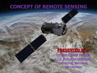
  • 1. CONCEPT OF REMOTE SENSING PRESENTED BY:- UTTAM KUMAR PARIDA M.P.C. AUTONOMOUS COLEGE, TAKHATPUR, BARIPADA, MAYURBHANJ
  • 2. What is remote sensing ?  Remote – away from or at a distance  Sensing – detecting a property or characteristic
  • 3. Remote Sensing The term "remote sensing," first used in the United States in the 1950s by Ms. Evelyn Pruitt of the U.S. Office of Naval Research
  • 4. Definitions "Remote sensing is teaching us a new way of seeing". Remote sensing has been defined in many ways.
  • 5. Definition (1) Remote sensing is "the acquisition of information about an object, without being in physical contact with that object"
  • 6. Definition (2) Remote sensing is "the ability to measure the properties of an object without touching it".
  • 7. Definition (3) Remote sensing can be defined as "the collection of data about an object from a distance. Humans and many other types of animals accomplish this task with aid of eyes or by the sense of smell or hearing".
  • 8. Definition (4) Remote sensing is "the examination, measurement, and analysis of an object without being in contact with it".
  • 9. Definition (5) Remote sensing is "the science and art of obtaining information about an object, area, or phenomenon through the analysis of data acquired by a device not in contact with the object, area, or phenomenon in question".
  • 10. Brief History of Remote Sensing  1839, the first photographs.  1849, used photography in topographic mapping.  1858, balloons were being used to acquire photography of large areas.
  • 11. 1925-1945  Mid 1930s, color photography.  Aerial photography became widespread during World War II, with improved lenses and platform stability, enemy positions and military installations could be identified from aircraft.  Radar
  • 12. 1945-1960  Cameras were launched on rockets as this science expanded in the post-World War II era.  In 1957, the Russians launched the first successful Earth satellite, Sputnik 1  In 1958, the US launched its first satellite, Explorer 1.  In 1959, the first satellite with a meteorological instrument (Vanguard 2) was launched.  In 1960, the first satellite images ever made of the earth comes from the TIROS 1
  • 13. 1960-1972  This was the age of instrument development.  In 1964, the Nimbus satellite series of experimental meteorological remote sensing was initiated.  By 1966, meteorological satellites moved from being experimental to being operational with the introduction of the ESSA series of satellites which included Automatic Picture.  The Defense Meteorological Satellite Program (DMSP) was started by the U.S. Air Force in 1966.  1972, Landsat 1 (also referred to as Earth Resources Technology Satellite.
  • 14. 1972-present  1975: The Synchronous Meteorological Satellites.  1976: Laser Geodynamic Satellite I.  1978: The Heat Capacity Mapping Mission.  1978: Seasat demonstrated techniques for global monitoring of the Earth's oceans.  1978: Nimbus 7, the final satellite in that series, was launched.  1984: The Earth Radiation Budget (ERBE) satellite began its study of how the Earth absorbs and reflects the Sun's energy.  1991: The Upper Atmosphere Research Satellite (UARS) began its study of the chemistry and physics of the Earth's atmosphere.  Today, the GOES (Geostationary Operational Environmental Satellite) system of satellites provides most of the remotely sensed weather information for North America.
  • 15. Remote sensing: Art and/or Science? SCIENCE;  Remote sensing is a tool or technique similar to mathematics.  Using sophisticated sensor to measure the amount of electromagnetic energy existing an object or geographic area from a distance and then extracting valuable information from the data using mathematically and statistically based algorithms is a scientific activity.  It functions in harmony with other spatial data-collection techniques or tools of the mapping science, including cartography and geographical information system(GIS). ART:  It is a fact that some image analysts are much superior to other image analysts because they—  Understand the scientific principles better  They have more widely traveled and have seen many landscape objects and geographic areas.  They can synthesize scientific principles and real world knowledge to reach logical and correct conclusions. So, Remote Sensing is both an art and a science.
  • 16.
  • 17.
  • 18.
  • 19.
  • 20.
  • 21.
  • 22.
  • 23.
  • 24.
  • 25.
  • 26.
  • 27. Uses of Remote Sensing  Weather: It is possible now to get immediate information on climate and weather conditions from remote sensing satellites. Images over time allow us to predict weather behavior.
  • 28. Uses of Remote Sensing  Agriculture: Crop mapping and yield prediction; crop damage due to storm, drought or disease and insect outbreaks.
  • 29. Uses of Remote Sensing  Environmental Impacts: Remote Sensing to determine oil spill size, location, direction and magnitude of movement.Coastal oil spill, Wales, England
  • 30. Uses of Remote Sensing  Forestry Inventory: Remote Sensing used for forest inventory, mapping cut-overs, forest fire mapping, species identification. Burned and burning forest near Norman Wells, NWT , Canada
  • 31. Uses of Remote Sensing  Geological Mapping: Mapping faults, folds, lineaments and rock types. Syncline/Anticline structures in the Applachians of Pennsylvania.
  • 32. The element of the remote sensing process 1) Energy Source or Illumination 2) Radiation and the Atmosphere 3) Interaction with the Target 4) Recording of Energy by the Sensor 5) Transmission, Reception, and Processing 6) Interpretation and Analysis 7) Application
  • 33.
  • 34.
  • 35.
  • 36. Advantages of Remote Sensing:- • Passive remote sensing does not disturb the object or area of interest. • Remote sensing data collection can remove the sampling bias introduced in some in situ investigations. • Provide fundamental biophysical data, x-y location, z elevation or depth, temperature, moisture content, etc. • Remotely sensed data may be obtained systematically over very large geographic areas. • Remotely sensed data can create Digital Elevation Model (DEM). • Computer processing is possible in many cases
  • 37. Limitation of Remote Sensing:- • Does not provide all the information needed for conducting physical, biological, or social science. It simply provides some spatial, spectral, and temporal information of value. • Various human interaction in remote sensing process may produce errors. • Active remote sensor system, such as lasers or radars can affect the phenomenon being investigated. • Instruments often become uncelebrated, resulting in uncelebrated remote sensing data. • Expensive to collect and interpret or analyze.
  • 38. CONCLUSION Remote sensing technology has developed from balloon photography to aerial photography to multi-spectral satellite imaging. Some of the benefits that can be gained from the use of remote sensing- Early identification of crop health and stress. Ability to use this information to do remediation work on the problem. Improve crop yield. Crop yield predictions. Reduce costs. Reduce environmental impacts. Crop management to maximize returns through the season. Crop management to maximize returns during harvest time.