SlideShare ist ein Scribd-Unternehmen logo
1 von 23
WM10 Making Connectivity a Part of Your Smart Growth Washington Chapter APA October 2010
CONNECTIVITY’S GREATEST  HITS
Love Thy Neighbor
Ross Racine
Ross Racine
Driving & the Built Environment – the 5 D’s Density           Population & employment by geographic unit (e.g., per square mile, per developed acre). Diversity       Mix of land uses, typically residential and commercial development, and the degree to which they are balanced in an area (e.g., jobs–housing balance). Design          Neighborhood layout and street characteristics, particularly connectivity, presence of sidewalks, and other design features (e.g., shade, scenery, presence of attractive homes and stores) that enhance the pedestrian- and bicycle-friendliness of an area. Destination accessibility                                    Ease or convenience of trip destinations from point of origin, often measured at the zonal level in terms of distance from the central business district or other major centers. Distance to transit                                    Ease of access to transit from home/work (e.g., bus/rail stop within ¼ to ½ mile). Ewing & Cervero, JAPA, Summer 2010 | TRB Report #298
DOT – HUD – EPA  Partnership for Sustainable Communities ,[object Object]
Improve access to affordable housing
More transportation options
Lower transportation costs while protecting environment
Partnership Agreement
Develop livability measures and tools
Undertake joint research & data collection,[object Object]
Los Angeles and San Diego Counties
Applied 9 measures of street connectivity
Identified positive correlation between connected street system and the propensity and duration of leisure walking and cycling,[object Object]
Current Planning Guides for Connectivity
Rail Station Connectivity –Comparing Metrics Before After Change Parcel Impact Route Directness Index 2,300 0.63 0.77 23% Intersection Density 146 1.4% -- 144 Link-Node Ratio -- 1.29 1.30 < 1% Walk Score -- -- -- 89 of 100

Weitere ähnliche Inhalte

Was ist angesagt?

CUTA 2008: Matti S. Presentation
CUTA 2008: Matti S. PresentationCUTA 2008: Matti S. Presentation
CUTA 2008: Matti S. Presentation
cuta_dn
 
ESCI 1110_Dinesh Adhikari_Light Rail Project
ESCI 1110_Dinesh Adhikari_Light Rail ProjectESCI 1110_Dinesh Adhikari_Light Rail Project
ESCI 1110_Dinesh Adhikari_Light Rail Project
Dinesh Adhikari
 

Was ist angesagt? (19)

Congestion, Carbon & Cost Management in Mass Transit Planning with Efficient ...
Congestion, Carbon & Cost Management in Mass Transit Planning with Efficient ...Congestion, Carbon & Cost Management in Mass Transit Planning with Efficient ...
Congestion, Carbon & Cost Management in Mass Transit Planning with Efficient ...
 
ATS-16: Connecting the Dots: Trails and Transportation, Reed Dunbar
ATS-16: Connecting the Dots: Trails and Transportation, Reed DunbarATS-16: Connecting the Dots: Trails and Transportation, Reed Dunbar
ATS-16: Connecting the Dots: Trails and Transportation, Reed Dunbar
 
Smart City Principles - Rogier van den Berg
Smart City Principles - Rogier van den BergSmart City Principles - Rogier van den Berg
Smart City Principles - Rogier van den Berg
 
Grid Un-Locked - Week 4
Grid Un-Locked - Week 4Grid Un-Locked - Week 4
Grid Un-Locked - Week 4
 
A brief look at Gear Change and LTN 1/20
A brief look at Gear Change and LTN 1/20A brief look at Gear Change and LTN 1/20
A brief look at Gear Change and LTN 1/20
 
Transit oriented development
Transit oriented developmentTransit oriented development
Transit oriented development
 
Metro Update on the Regional Transportation Plan
Metro Update on the Regional Transportation Plan Metro Update on the Regional Transportation Plan
Metro Update on the Regional Transportation Plan
 
CUTA 2008: Matti S. Presentation
CUTA 2008: Matti S. PresentationCUTA 2008: Matti S. Presentation
CUTA 2008: Matti S. Presentation
 
Vision for UDOT's Future
Vision for UDOT's FutureVision for UDOT's Future
Vision for UDOT's Future
 
2015 trails bondprog-presentation-fulltest-2
2015 trails bondprog-presentation-fulltest-22015 trails bondprog-presentation-fulltest-2
2015 trails bondprog-presentation-fulltest-2
 
Improving Transport Demand Management of Cities
Improving Transport Demand Management of CitiesImproving Transport Demand Management of Cities
Improving Transport Demand Management of Cities
 
San Jose Transit first policy nomination
San Jose Transit first policy nominationSan Jose Transit first policy nomination
San Jose Transit first policy nomination
 
Access Nashville 2040
Access Nashville 2040Access Nashville 2040
Access Nashville 2040
 
GeoWeb2009 presentation: Long Island Index &amp; OASIS
GeoWeb2009 presentation: Long Island Index &amp; OASISGeoWeb2009 presentation: Long Island Index &amp; OASIS
GeoWeb2009 presentation: Long Island Index &amp; OASIS
 
Ramsay wright
Ramsay wrightRamsay wright
Ramsay wright
 
Transit Development for Central Texas
Transit Development for Central TexasTransit Development for Central Texas
Transit Development for Central Texas
 
ESCI 1110_Dinesh Adhikari_Light Rail Project
ESCI 1110_Dinesh Adhikari_Light Rail ProjectESCI 1110_Dinesh Adhikari_Light Rail Project
ESCI 1110_Dinesh Adhikari_Light Rail Project
 
Participatory tool and results of the Boston implementation / Pilot on smartp...
Participatory tool and results of the Boston implementation / Pilot on smartp...Participatory tool and results of the Boston implementation / Pilot on smartp...
Participatory tool and results of the Boston implementation / Pilot on smartp...
 
Grid Un-Locked - Week 3
Grid Un-Locked - Week 3Grid Un-Locked - Week 3
Grid Un-Locked - Week 3
 

Andere mochten auch (8)

APA Washington RDI Presentation
APA Washington RDI PresentationAPA Washington RDI Presentation
APA Washington RDI Presentation
 
Connecting Olympia
Connecting OlympiaConnecting Olympia
Connecting Olympia
 
Connecting Lakewood Station
Connecting Lakewood StationConnecting Lakewood Station
Connecting Lakewood Station
 
Integrating Green Infrastructure into Regional Planning
Integrating Green Infrastructure into Regional PlanningIntegrating Green Infrastructure into Regional Planning
Integrating Green Infrastructure into Regional Planning
 
Connecting Bellingham
Connecting BellinghamConnecting Bellingham
Connecting Bellingham
 
Case Studies -- Measuring Connectivity
Case Studies -- Measuring ConnectivityCase Studies -- Measuring Connectivity
Case Studies -- Measuring Connectivity
 
Connecting Transit Corridors
Connecting Transit CorridorsConnecting Transit Corridors
Connecting Transit Corridors
 
Andy Mortenson-Measuring Transportation Connectivity by RDI
Andy Mortenson-Measuring Transportation Connectivity by RDIAndy Mortenson-Measuring Transportation Connectivity by RDI
Andy Mortenson-Measuring Transportation Connectivity by RDI
 

Ähnlich wie Connectivity Intro

20100407 kostelec green_infrastructure_web
20100407 kostelec green_infrastructure_web20100407 kostelec green_infrastructure_web
20100407 kostelec green_infrastructure_web
Transpo Group
 
CO2 Reduction through Better Urban Design: Portland's Story - Rex Burkholder
CO2 Reduction through Better Urban Design: Portland's Story - Rex BurkholderCO2 Reduction through Better Urban Design: Portland's Story - Rex Burkholder
CO2 Reduction through Better Urban Design: Portland's Story - Rex Burkholder
WRI Ross Center for Sustainable Cities
 
Imagine Austin - Existing Conditions
Imagine Austin - Existing ConditionsImagine Austin - Existing Conditions
Imagine Austin - Existing Conditions
gclaxton
 

Ähnlich wie Connectivity Intro (20)

Transit Oriented Development - JAKARTA
Transit Oriented Development - JAKARTATransit Oriented Development - JAKARTA
Transit Oriented Development - JAKARTA
 
C N U17 S T N Pleasant
C N U17    S T N    PleasantC N U17    S T N    Pleasant
C N U17 S T N Pleasant
 
18th Annual Congress of the New Urbanism "Building Safer Streets for Healthie...
18th Annual Congress of the New Urbanism "Building Safer Streets for Healthie...18th Annual Congress of the New Urbanism "Building Safer Streets for Healthie...
18th Annual Congress of the New Urbanism "Building Safer Streets for Healthie...
 
20100407 kostelec green_infrastructure_web
20100407 kostelec green_infrastructure_web20100407 kostelec green_infrastructure_web
20100407 kostelec green_infrastructure_web
 
Climate Change and Health Impacts of Transportation Network Design
Climate Change and Health Impacts of Transportation Network DesignClimate Change and Health Impacts of Transportation Network Design
Climate Change and Health Impacts of Transportation Network Design
 
travel demand 3 D's.pdf
travel demand 3 D's.pdftravel demand 3 D's.pdf
travel demand 3 D's.pdf
 
9/10 SAT 8:30 | Planning for Walkable Multimodal Neighborhoods
9/10 SAT 8:30 | Planning for Walkable Multimodal Neighborhoods9/10 SAT 8:30 | Planning for Walkable Multimodal Neighborhoods
9/10 SAT 8:30 | Planning for Walkable Multimodal Neighborhoods
 
Measure for Measure: Boston-based Technical Toolkits for Measuring Walkabilit...
Measure for Measure: Boston-based Technical Toolkits for Measuring Walkabilit...Measure for Measure: Boston-based Technical Toolkits for Measuring Walkabilit...
Measure for Measure: Boston-based Technical Toolkits for Measuring Walkabilit...
 
Complete Streets workshop presentation
Complete Streets workshop presentationComplete Streets workshop presentation
Complete Streets workshop presentation
 
CNU Summit 2009 RDI
CNU Summit 2009 RDICNU Summit 2009 RDI
CNU Summit 2009 RDI
 
CNU Summit 2009 RDI
CNU Summit 2009 RDICNU Summit 2009 RDI
CNU Summit 2009 RDI
 
CO2 Reduction through Better Urban Design: Portland's Story - Rex Burkholder
CO2 Reduction through Better Urban Design: Portland's Story - Rex BurkholderCO2 Reduction through Better Urban Design: Portland's Story - Rex Burkholder
CO2 Reduction through Better Urban Design: Portland's Story - Rex Burkholder
 
Maximizing Biking and Walking Access to Transit
Maximizing Biking and Walking Access to TransitMaximizing Biking and Walking Access to Transit
Maximizing Biking and Walking Access to Transit
 
Imagine Austin - Existing Conditions
Imagine Austin - Existing ConditionsImagine Austin - Existing Conditions
Imagine Austin - Existing Conditions
 
Beyond Mobility
Beyond MobilityBeyond Mobility
Beyond Mobility
 
ENHANCING URBAN ROAD NETWORK EFFICIENCY IN KERALA, INDIA: A COMPREHENSIVE ANA...
ENHANCING URBAN ROAD NETWORK EFFICIENCY IN KERALA, INDIA: A COMPREHENSIVE ANA...ENHANCING URBAN ROAD NETWORK EFFICIENCY IN KERALA, INDIA: A COMPREHENSIVE ANA...
ENHANCING URBAN ROAD NETWORK EFFICIENCY IN KERALA, INDIA: A COMPREHENSIVE ANA...
 
Transportation planning
Transportation planningTransportation planning
Transportation planning
 
Mapping mobility Piyushimita Thakuriah
Mapping mobility Piyushimita ThakuriahMapping mobility Piyushimita Thakuriah
Mapping mobility Piyushimita Thakuriah
 
Complete Streets
Complete StreetsComplete Streets
Complete Streets
 
Cleveland Peer Exchange - National Perspective
Cleveland Peer Exchange - National PerspectiveCleveland Peer Exchange - National Perspective
Cleveland Peer Exchange - National Perspective
 

Connectivity Intro

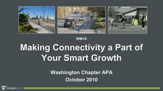
  • 1. WM10 Making Connectivity a Part of Your Smart Growth Washington Chapter APA October 2010
  • 3.
  • 4.
  • 5.
  • 6.
  • 10.
  • 11. Driving & the Built Environment – the 5 D’s Density Population & employment by geographic unit (e.g., per square mile, per developed acre). Diversity Mix of land uses, typically residential and commercial development, and the degree to which they are balanced in an area (e.g., jobs–housing balance). Design Neighborhood layout and street characteristics, particularly connectivity, presence of sidewalks, and other design features (e.g., shade, scenery, presence of attractive homes and stores) that enhance the pedestrian- and bicycle-friendliness of an area. Destination accessibility Ease or convenience of trip destinations from point of origin, often measured at the zonal level in terms of distance from the central business district or other major centers. Distance to transit Ease of access to transit from home/work (e.g., bus/rail stop within ¼ to ½ mile). Ewing & Cervero, JAPA, Summer 2010 | TRB Report #298
  • 12.
  • 13. Improve access to affordable housing
  • 15. Lower transportation costs while protecting environment
  • 18.
  • 19. Los Angeles and San Diego Counties
  • 20. Applied 9 measures of street connectivity
  • 21.
  • 22. Current Planning Guides for Connectivity
  • 23. Rail Station Connectivity –Comparing Metrics Before After Change Parcel Impact Route Directness Index 2,300 0.63 0.77 23% Intersection Density 146 1.4% -- 144 Link-Node Ratio -- 1.29 1.30 < 1% Walk Score -- -- -- 89 of 100
  • 25. Basic RDI Calculation A B straight-line distance “A” actual route distance “B” RDI = A / B
  • 26. RDI Example: Pre Neighborhood Connector 375 ft 1850 ft RDI: .20 1850 ft .20 375 ft Route Directness Index Crow Flight / Walk Distance = RDI Existing Shared-Use Path
  • 27. RDI Example: Post Neighborhood Connector 375 ft RDI: .83 450 ft .83 375 ft 450 ft Route Directness Index Crow Flight / Walk Distance New Neighborhood Connectors = RDI Existing Shared-Use Path
  • 29. Connectivity & Smart Growth Panel Dan Penrose, AICP City of Lakewood Sophie Stimson City of Olympia Thera Black Thurston Regional Planning Council Chris Comeau, AICP City of Bellingham
  • 30.
  • 31. M.F. DU’s within 15-minute walk-to-school, by Household Income and Auto Ownership
  • 34.

Hinweis der Redaktion

  1. Circle Drive
  2. Fractal Acres
  3. Fairmeadow Estates: Palo Alto