We NSG India, a ESRI Gold Partner, have been working with many companies on a collaborative mode and delivering solutions on ESRI platform configured to their businesses.
NSG has global presence in India, UAE, NewZealand, United states and we offer services in the following ESRI and Microsoft technology areas: NSGI has a special focus on application development, geo-database implementation and web deployment. We develop applications across the entire ESRI suite of products – from ArcPad to ArcGIS Server and ArcGIS Online,
ArcFM Desktop and ArcFM Server based application customisation using.NET, Java using SQL Server and Oracle spatial databases.
We are ESRI-Centric working on Strategic GIS Consulting, Enterprise GIS Implementations catering to specific vertical markets and domains like Ports, Building Inspection Management and Citizen centric incident and complaints management system for Local Government (Municipal Councils, Counties), Climate Change, Marine, Utilities and Spatial Data Infrastructure.
We have expertise in small to medium to large scale ESRI and Microsoft Based projects. We specialize in offshore-based application development & have proven track record in providing turnkey solution to GIS Companies and Governments. We provide offshore technical and development support on Geocortex Spatial application infrastructure with future proof technologies with minimum custom code requirements. Our offshore development model has a proven cost saving and enable the organization to:
1. Create GIS applications that meet the demand for maps and applications for administrators and project stakeholders;
2. Provide end-users with simple and repeatable processes for accessing information, inside applications tailored to their needs.
3. Reduce the cost of development, support, maintaining/administering applications.
4. Share geospatial information with internal or external stakeholders on an array of desktop/mobile devices.
I have also attached a brief presentation on our corporate background and service capabilities. If you need any additional information or have a query, please do feel free to contact us.
Scaling API-first – The story of a global engineering organization
North South GIS India
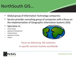
1. NorthSouth GIS…
• Global group of Information Technology companies
• Service provider consulting group of companies with a focus on
the implementation of Geographic Information Systems (GIS)
• Specialise in;
–
–
–
–
–
system design
application development
implementation
application training
support
Focus on delivering GIS solutions
in specific vertical markets worldwide
NorthSouth GIS
4. NSG INDIA - END TO END GIS Mapping SERVICES
NorthSouth GIS
5. United States
• Ports
– Port of Los Angeles
– Port of Stockton
• Local Government
– City of Los Angeles
– Other cities, counties
NSG wins Esri Business Partner of the year 2009
NorthSouth GIS
6. Middle East
•
•
•
Marine GIS (ROPME, Kuwait)
Local Government (UAE - Abu
Dhabi, RAK)
Royal Commission for Jubail
and Yanbu ( RCJY), Saudi
Arabia
Managed by NorthSouth GIS NZ
•Kuwait / Saudi Border
Mapping Project
NorthSouth GIS
7. Asia - Pacific
Managed by NorthSouth GIS India
Singapore Land Transport Authority
Geospatial data verification systems
India and Thailand
NorthSouth GIS
8. Aerial Data Acquisition
Why is This Technology Exciting
Digital Photogrammetry ( GPS Geodetic cadatsral control + Image + Topographic features+map)
Almost 200 Sq.Km survey in one hour with aircraft
GPS Satellites
GPS
Receivers
Base Station
NorthSouth GIS
27. Strong inUtilities-Arc FM Solution
Development Capabilities
One of the key requirements of an Electric Utility is to be able to trace the Electric
Distribution Network. Using the core functionalities of ArcFM Server 10.0.3 from Miner
and Miner we were able to provide a full-fledged electric trace module on the Silverlight
Viewer of Geocortex.
Even though ArcFM Server 10.0.3 provides their own API for Silverlight, it lacks some
key functionality like adding barriers, which is why we developed Custom SOEs (Server
Object Extensions), accessed using the REST APIs of ArcGIS Server to meet the
requirements.
Key features of this module
•Supports Trace by Phase(RYB)
•Supports adding multiple Barriers
•Supports Upstream, Downstream, Distribution
and Trace with Protective Devices
•Provides Trace Length of Lines and Cables
•Allows saving and loading flag and barriers
•Allows starting a trace from a feature in the Active Collection(Results)
NorthSouth GIS
28. Discover Denver (FiGSS)
•
•
•
•
•
•
Historic Denver, Inc. in collaboration with
the City and County of Denver launched
Discover Denver, a citywide historic
preservation survey (funded in part by the
State Historic Fund). The goals of Discover
Denver are:
Engage and educate the community.
Provide tools and information that have
long term value to the City, State, property
owners and overall community.
Make the best use of technology.
The Field Guide Survey (FiGSS) application is
an extension to ArcGIS for Desktop 10.1
ArcMap application to facilitate collection
of such Historic geographic data.
It is a simple wizard based application which
makes collection of extensive data and
photos manageable.
NorthSouth GIS
29. Port of Oakland Field Inspection Application
•
•
•
•
•
A web based Incident Reporting and Security
Inspection field application for handheld
devices and tablets.
The application is built using Geocortex
HTML5 Viewer 1.2.1 libraries and Geocortex
Essentials 3.14.0 Workflows.
The application uses Geocortex Essentials
Security using SQL Server based membership
and role providers for Site and Application
security.
Administration Tool
The Administration tool allows configuration
and setup for the Incident Reporting and
Security Inspection functions. The application
will allow configuration of dynamic Inspection
forms and Inspection parameters and to
define role based permissions on Incident
Types and Inspection Layers.
NorthSouth GIS
31. Tree Asset Management for Treescape
•
•
•
•
•
•
•
A web based application built using Geocortex
Silverlight Viewer 1.7, Geocortex HTML5 Viewer 1.0
libraries and Geocortex Essentials 3.11.0 Workflows.
Provides integrated solutions with both in-theoffice and in-the-field functionality
Provides capability to interact and communicate with
Auckland Council
Provides capability to plan, schedule record, edit
and manage tree asset information
Provides mobile capability to record asset
establishment,
maintenance
and
removal
information in the field
Provides simple query and reporting capability for
export to Microsoft Excel to support work
scheduling and business planning
Provides capability to query and report on asset:
establishment, maintenance and removal activities
NorthSouth GIS
32. Service Request and Work Order Management System for LA
Department of Transport
•
•
•
A comprehensive work order management system to
manage public service requests, installation and removal
of sign boards, curb paintings etc. with a public web GIS
application to find addresses, streets, intersections or
blocks and request for services or register complaints, an
in-office application to view service requests, vet
requests, assign them to field crew and monitor the
status, and a field application for the field crew to view
and act on the work orders assigned. The application
manages workflows of different user groups called
Clerical Users, Engineers, Field Crew and Supervisors
The application is built using Geocortex Silverlight Viewer
1.9.1, Geocortex HTML5 Viewer 1.2.1 libraries and
Geocortex Essentials 3.14.0 Workflows.
The application has a Silverlight Viewer with advanced
capabilities for inter departmental users and a HTML5
based mobile and tablet compliant web GIS application
for public users to request for services.
NorthSouth GIS