TGS Arcis Canada Processing Services brochure
•
1 gefällt mir•512 views

Arcis Seismic Solutions provides 2D and 3D seismic data processing services for domestic and international clients. They have an experienced team with expertise in processing data from all basin types using modern proprietary systems. Their services include time, depth and reservoir analysis with in-house research and development of innovative algorithms.

Empfohlen
Empfohlen
Weitere ähnliche Inhalte
Was ist angesagt?
Was ist angesagt? (19)
Ähnlich wie TGS Arcis Canada Processing Services brochure
Ähnlich wie TGS Arcis Canada Processing Services brochure (20)
Mehr von TGS
Mehr von TGS (20)
Kürzlich hochgeladen
Kürzlich hochgeladen (20)
TGS Arcis Canada Processing Services brochure
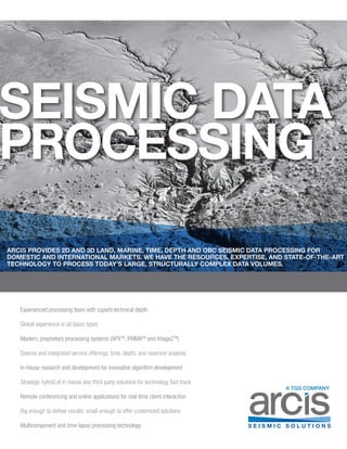
- 1. SEISMIC DATA PROCESSING Experienced processing team with superb technical depth Global experience in all basin types Modern, proprietary processing systems (APXTM , PRIMATM and ImageZTM ) Diverse and integrated service offerings: time, depth, and reservoir analysis In-house research and development for innovative algorithm development Strategic hybrid of in-house and third party solutions for technology fast track Remote conferencing and online applications for real-time client interaction Big enough to deliver results; small enough to offer customized solutions Multicomponent and time-lapse processing technology A TGS COMPANY ARCIS PROVIDES 2D AND 3D LAND, MARINE, TIME, DEPTH AND OBC SEISMIC DATA PROCESSING FOR DOMESTIC AND INTERNATIONAL MARKETS. WE HAVE THE RESOURCES, EXPERTISE, AND STATE-OF-THE-ART TECHNOLOGY TO PROCESS TODAY’S LARGE, STRUCTURALLY COMPLEX DATA VOLUMES.
- 2. www.arcis.com 3D Merge Land P Wave 2D / 3D Processing Technology Interactive PSTM Offset Class Selection Range limited fold for offsets 0-‐480 m Autocomputed accordion offsets Offset distribu3on histogram 0 1000 2000 3000 4000 5000 Offset (m) 480 m 120 m Curvature (ms at far offset) Pass Reject Input Transform Output Cursor connec/vity between Radon and data domains Fast and slow interbeds in ZOI Interactive Radon Domain Picker Input A(er SToneTM SToneTM Random Noise Attenuation Input A(er dip-‐scan interpola3on A(er dip-‐scan plus 5D interpola3on Pre-stack Interpolation Stack pane movie Composite gather Semblance %vel gather panel PSTM Velocity Scanning Interactive Geometry QC Accurate and efficient geometry generation and QC Interactive 3D Merge QC Seamless pre-stack 3D merging using powerful interactive tool Powerful Noise Attenuation Algorithms ICone™: Linear noise suppression via time-space trajectory-scan STone™: Random noise suppression via dip-scan Many additional options including FXY prediction, Radial trace, FK 5D Interpolation And Leakage QC Leading edge implementation of Fournier reconstruction approach Dip-scan Interpolation Powerful coherence guided algorithm Interactive PSTM Parameter Selection Tools Results from critical diagnostics derived from using our proprietary tools AVO Compliant Processing Robust noise attenuation without distortion of primary energy
- 3. Seismic Data Processing Coherence attributes Multicomponent Processing Technology Interactive Statics Analysis Arcis Seismic Solutions’ multicomponent processing technology consists of a comprehensive toolkit of algorithms and workflows up to anisotropic PS PSTM. These are used in conjunction with many years of experience in processing challenging land 3C (PP & PS), and 9C (PP, PS & SS), and ocean bottom 4C (PZ & PS) datasets. PS Stack before 5D Interpolation PS Stack after 5D Interpolation 5D Leakage Before layer-‐stripping A2er layer-‐stripping Radial Layer-‐stripped Radial Transverse Layer-‐stripped Transverse Shear-wave splitting: fracture magnitude and orientation Interactive PP/PS Registration and VP/VS Analysis Combining Fracture Detection Approaches Arcis has the unique ability to compute and display multiple fracture attributes: • Shear-wave splitting from converted wave data • Azimuthal AVO and NMO from wide-azimuth P wave data • Curvature from post-stack volumes We thank China University and Mining Technology, Beijing, Peng, Suping, Seismic Prospecting Research Group for permission to show these examples. Comprehensive Multicomponent Toolkit
- 4. www.arcis.com Marine 2D / 3D Processing Clari-FiTM The industry is increasingly recognizing the benefits of broadband data. Broadband seismic provides greater richness of both robust low frequencies - ideal for deep structure imaging and inversion stability, and high frequencies - which aid temporal resolution. TGS’ Clari-FiTM is a proprietary three-step processing solution which allows broadband pre-stack seismic data to be generated from conventionally acquired seismic data, (i.e. using single sensor streamers towed at a constant depth.) Enhancing Deep Data A focused approach on spectrum enrichment and denoise that sharpens the overall image and raises confidence on interpreting deeper data. Useful on both newly acquired data and in improving legacy data. Noise Attenuation A variety of noise types can be found within each seismic data set. After analysis, these are removed using the proper method. TGS has a complete suite of denoise routines that operate in different domains and are efficient at removing: • Swell noise • Spike noise • Seismic interference • Linear noise • Random noise • Ship or stationary noise Multiple Removal Each project presents unique challenges for multiple removal. TGS’ range of versatile multiple removal algorithms ensure that a solution can be found for even the most challenging problem. Techniques include: • TAMETM (3D SRME) • SMELT (Stepwise Multiple Elimination by Linear Transforms) • High-resolution Radon multiple attenuation • Apex-shifted Radon • Diffracted multiple attenuation • Post-migration multiple modeling and subtraction Gathers link with all other windows in the project Depth slice QC 3D viewer 2A 2B Results of applying Clari-FiTM to a 2D line from West Africa. The increase in resolution can be clearly seen after Clari-FiTM .Timeslice before regularization Timeslice after regularization Regularization / Interpolation Data regularization / interpolation is an essential step in the preparation of data sets for pre-stack time and depth migrations. TGS offers a range of regularization solutions including: • Local frequency-wave number regularization (3D) • Tau-P along dominant dips (3D) • Wavefield downward continuation Additional Pre-Processing Techniques • Refraction statics, water column statics • Survey merging • Footprint attenuation - available as both pre-stack and post-stack implementations • Q compensation • Spherical divergence corrections Data from West Africa PSTM before Clari-FiTM PSTM after Clari-FiTM
- 5. Seismic Data Processing Depth 2D / 3D Imaging Depth Imaging Arcis uses TGS’ depth imaging software, ImageZTM , built upon extensive experience in high-end imaging with the most advanced computer power. TGS provides industry leading migration algorithms, including Reverse Time (RTM), Kirchhoff Pre-stack Depth (KPSDM), Wave Extrapolation (WEM) and beam. TGS’ velocity model building tools include full azimuth ray-tracing tomography as well as anisotropic parameter estimation tools for Vertical Transverse Isotropic (VTI) and Tilted Transverse Isotropic (TTI) media. TGS has developed interactive well-editing and calibration tools to tie the seismic velocity to the vertical velocity from well information. Leading-edge anisotropy estimation tools and auto-picking routines are used to derive epsilon and delta (plus theta and phi for TTI imaging) from the seismic or Vertical Seismic Profile (VSP) data where available. Additionally, TGS offers velocity model building tools such as Delayed Imaging Time (DIT) scans and subsalt tomography for salt model refinement and complex land data modeling. Depth Imaging Key Capabilities: • 3D PSDM algorithms to meet all imaging needs • Kirchhoff pre-stack depth migration • Beam migration (rapid testing of velocity models and salt interpretation) • Common shot (and common P) one-way WEM • Reverse time migration (FD and pseudo spectral methods) • Mirror migration (Kirchhoff and RTM) • Q Tomography • Q Migration • Full Waveform Inversion (FWI) • RTM & Kirchhoff surface referenced for land depth projects • Tomography and Subsalt velocity model building tools • Full azimuth ray-tracing tomography • Fault constrained tomography • Simultaneous inversion for velocity, delta and epsilon • DIT Scans (RTM or WEM) • Interactive beam migration and layer- stripping RTM for salt model refinement • Variable salt (dirty salt) velocity modeling and updates • Specialized Model Building Tools • Interpretation driven modeling • Directional imaging stacks (for WAZ data) • 3D RTM gathers for tomography updates in complex areas Claymore Cyclops Europa MarsSlammerSturgis GR RES GR RES Claymore Cyclops EuSturgis GR RES G ClaymoreSturgis GR RES Claymore Cyclops Europa MarsSlammerSturgis GR RES GR RES Claymore CyclopsSturgis GR RES
- 6. www.arcis.com Reservoir Analysis 3D Cross-plotting of Lambda-Rho, Mu-Rho and Fluid Stack. Clusters associated with gas anomalies (yellow) separated out. Coherence (Energy Ratio) after PC-filtering. HIGHLOW Coherence Attributes Curvature Attributes Multi-Spectral Estimates of Curvatures Reflector Convergence Reflector Rotation Fracture Analysis Using Curvature Attributes Visualization of Attributes Thin-Bed Reflectivity Correction for Spurious Phase Via Estimation of Non-Minimum Phase Wavelet Rock Physics Analysis AVO/LMR Analysis Spectral Decomposition Impedance Inversion PP-PS Post-stack Inversion Horizon slice through merged volume comprising coherence, most-positive curvature, and most-negative curvature volumes using transparency Seismic Reflectivity
- 7. Seismic Data Processing Arcis Seismic Solutions, a wholly owned subsidiary of TGS-NOPEC Geophysical Company, offers seismic solutions to the energy industry including seismic data processing, reservoir analysis, advanced imaging, multi-client surveys, geotechnical services, project management, data management and access to an extensive data library. Arcis offers one of the most current 2D and 3D seismic data libraries for the Western Canadian Sedimentary Basin, including Northeast British Columbia. We are committed to exceptional customer service, superior data quality, innovation, and integrity; while maintaining a focus on health, safety, and environmental stewardship. We think different. We think seismic.
- 8. 2100, 250 - 5TH Street SW Calgary, Alberta, Canada T2P 0R4 403.781.1700 or 888.269.6840 info@arcis.com www.arcis.com Printed in Canada A TGS COMPANY