SlideShare ist ein Scribd-Unternehmen logo
1 von 33
AusCover
  The National Satellite Image-based
Biophysical Data and Ground Validation
                Facility
AusCover Facility
Production and delivery of nationally consistent long‐time series of
satellite‐based biophysical map products and next generation remote
sensing research data that is validated for Australian conditions.
Capabilities to be Delivered
Remote Sensing Data Delivery Backbone
  • Solving data formats, interoperability, data-policy,
  • Physical storage, efficient delivery to end-users etc.


  Data Production Network (via Central Console and 7 Regional “Nodes”)
    • Nationally-consistent, standard biophysical data products,
    • Metadata and technical support documents
    • Specialised space-borne, airborne & in-situ research-grade data


         Ground Validation Program and Instrumentation
           • Set national standards & field validation protocols,
           • TERN SuperSites and Environmental transects etc.
           • International Benchmarking (eg CEOS WGCV LPV)
The AusCover Team & Network
                                                                               Securing Data and Collaborations
                                                                               via Links to International Agencies and
                                                                               Networks
                                    Darwin Node
                                    Stefan Maier (CDU)


                                                                               Brisbane Node
                                                                               Kasper Johansen UQ)
                                                                               Peter Scarth (DSITIA


           Perth Node
           Merv Lynch (Curtin)


                                                                                           Sydney Node
                                                                                           Alfredo Huete (UTS)


                                 Adelaide Node
                                 Megan Lewis (Adel. U.)                               Canberra Node
                                                                                      Alex Held (CSIRO)
7 Regional Nodes                                          Melbourne Node              Medhavy Thankappan (GA)
                                                          Ian Grant (BoM)
11 Institutions                                           Simon Jones (RMIT)
28+ Researchers and
Students
..over 500 TBytes of
ground, airborne and
 satellite data
Progress
• Extensive field campaigns and airborne data acquisitions in
  2012. Six out of eight AusCover Test-sites covered
• Drafting first field validation manual “Green Book”.
• Consolidation of continental-scale datasets, associated
  metadata, and portal across AusCover data system.
• Held several agency briefings across “TERN Themes” (Carbon,
  Fire, Biodiversity..)
• Collaboration with Google Earth Outreach (“Earth Engine and
  Smartphone apps) and IIASA (GEOwiki)
• Initiated establishment of demonstration “forest sensing and
  phenocam network”
• Field validation program continuing for key data products (e.g.
  aboveground biomass and GEOSS Ecosystems)
& many others..
Field Team Activities
      Selected photos source © Charles Tambiah and members of the AusCover team


• TERN Supersites and AusCover field calibration
  sites
• New TERN Field Instrumentation & testing
• New data acquisition for key in-situ
  measurements (e.g. leaf chemistry, canopy
  structure, reflectance, leaf-area index, etc.)
• Validation and calibration of airborne and
  satellite images
AusCover Good Practice Guidelines, Contents
•   Review of Validation Campaigns
•   Representativeness and Sampling Design
•   Sensor Calibration
     – Vicarious calibration
     – Atmospheric correction
     – Radiometric
     – Optical sensors
     – Best practice guidelines for calibration and validation of SAR data and derived
         biophysical products
•   Validation of AusCover Biophysical RS products
     – LAI, Fpar
     – Fractional Cover
•   Validation of key variables derived from biophysical RS products
     – Phenology
     – Leaf spectroscopy
     – Foliar chemistry
     – Persistent green vegetation index
     – Biomass
•   AusCover specifications and quality assurance steps for hyperspectral and LIDAR data
•   Good Practice Field Data Management and Delivery
•   National examples of spectral dataset exchange
•   National examples of CalVal
•   Appendices with protocols for field spectroscopy, FPC, LAI, etc.
Satellite and Airborne-Derived Data Products for
         use in Ecosystem Science and NRM
National/Regional Scale Time-series
  • Green Land-Cover (NDVI-EVI)
  • Fractional Cover (green vegetation, non-photosynthetic
    vegetation, bare ground)
  • Fraction Absorbed PAR (Photosynthetically Active Radiation)
  • Burnt Area
  • Forest cover
  • Land Surface Temperature
  • Broad Ecosystem Maps
State-based (to be extended nationally)
  • Fraction Projected Cover (FPC)
In-Situ Validation and TERN SuperSite Information
  • Leaf-Area Index
  • Vegetation 3D Structure & biomass
  • Spectral Reflectance (nadir-corrected)
Science Data
  • Airborne + Spaceborne hyperspectral
  • Lidar
  • SAR
Data Access
Via http://data.auscover.au (inter connected servers)
Early Data Use Examples
   and Opportunities
Linking Climate and Land-Cover
                                Dynamics


Gridded Climate Data: http://data.auscover.org.au/xwiki/bin/view/Product+pages/WebHome
Dynamics of Fractional Cover Validation
                    (a CSIRO, ABARES C4C, and TERN AusCover Project)


•   “Fractional Cover Product”                            –   Used for land condition and trends, soil erosion
     – Vegetation indices based unmixing of                   monitoring
         photosynthetic vegetation, non- photosynthetic   –   Available from http://www-data.iwis.csiro.au/
         vegetation and bare soil                         –   Guerschman et al, 2009 (RSE)
     – Based on MODIS reflectance (MCD43A4)
     – Australia, 8-day, 500 meter, 2000-2012
     – Semi-operational, updated weekly
Adoption by South
               Australia of remotely
               sensed soil exposure
               data to improve soil
               erosion risk monitoring
Green vegetation / non-photosynthetic vegetation
/ soil from a dry to a wet time, as measured by
the Relative Spectral Mixture Analysis index
(originally by Greg Okin, developed by AusCover
facilitated collaboration between Greg Okin and
AusCover SA)
Tracking of Land-Cover Dynamics and Drying


                                          WARRA Enhanced Vegetation Index
0.5
0.4
0.3
0.2
0.1
  0
 2/17/96   2/17/97    2/17/98   2/17/99     2/17/00   2/17/01   2/17/02    2/17/03    2/17/04    2/17/05     2/17/06     2/17/07


                                                Alice Springs mean_evi
0.6

0.4

0.2

  0
  3/4/96   3/4/97     3/4/98    3/4/99      3/4/00    3/4/01    3/4/02    3/4/03     3/4/04     3/4/05     3/4/06      3/4/07
Comparing Land-Cover dynamics with known land-
 management practices across Australian Wildlife
          Conservancy Sanctuary sites

                                                                           NVIS classes
                                                                           (protected and
                                                                           non-protected)


                                                                        MODIS satellite
                                                                        data (protected
                                                                        and non-protected)


                                                                      Hummock Grassland
                                                                 protected and non-
                                                                 protected


                                                   MODIS EVI
  Decadal MODIS time series


                                                               2000         2006      2011
Using International Data to Monitor Land-cover and productivity: e.g. Southern
            Hemisphere Crop NDVI Anomaly, September 15th, 2012


                                                                              Australia: Wheat
       Brazil/Argentina:
       Wheat

                 Crop NDVI Anomaly
                                                South Africa: Wheat
                                             Non Cropland
          -0.4         0        0.4
      Worse than      normal   Better than
       normal                    normal


                                     Current season crop development (2012)
                                     Median season development (2000-2011)
Sensing Australia’s Landscapes
New Ecosystem Science with High-
Resolution Data and Ground Sensors
Text…
• Text...
Use of Terrestrial Scanning Lidar
          to Characterise 3D Structure of Canopies


•   Evaluating Ground-based lidar technologies designed specifically for forest and
    vegetation assessment
•   The CSIRO-patented Echidna® has key differences from scanning rangefinders
     –   Digitizes the full return waveform
     –   Has variable beam divergence
     –   Uses full hemispherical scanning and beyond
     –   Linear response and calibration
                 AGU 2012                                   22
Visualisation of Echidna Forest
          Measurements in California


Gap probability to range (dark = 1, light = 0, green indicates partial return


           Plate Carré (equal-angle, “Andrieu”) projection

                  AGU 2012                                23
Canopy Lidar Data Robson Creek - QLD
25
Demonstration of In-Situ Sensor Network at
         Whroo Flux Tower Site - Victoria
• Ten-node wireless sensor network measuring
  Photosynthetically Active Radiation (PAR),
  temperature and humidity
• Five minute sample frequency
Following through the Fire
     TERN Theme….


  Dr Geoff Garrett (photo at left) speaks at the opening of the TERN–Queensland Government briefing on
  fire risk, which was attended (photo at right) by Fergus Adrian (left) and Bernard Trembath (right) from the
  Queensland Department of Fire and Emergency Services
Sample: TERN/AusCover Fire Products

Product Name                                                                                                          Availability              Validation
Burned Area – MODIS (CDU 250m), Australia                                                                             Partial                   2
Fire Frequency – MODIS (CDU 250m), Australia                                                                          2013/Q4
Fire Frequency – AVHRR (1km), Australia                                                                               Available                 1
Fire Severity – MODIS (CDU 250m), Australia                                                                           2013/Q4
Sub-pixel Fire Patchiness – MODIS (CDU 250m), Australia                                                               2013/Q4
TOA Reflectance Red/NIR – MODIS (for manual burned area                                                               Partial                   3
mapping), North and Central Australia
Thermal Anomalies (Fire Hotspots) – MODIS (LPDAAC                                                                     Available                 2
MOD14A2 1km), Australia – not near real-time
Burned Area – MODIS (LPDAAC MCD45A1 500m), Australia                                                                  Available                 1
Burned Area – MODIS (University of Maryland MCD64A1                                                                   Available                 1
500m), Australia
    1 Product accuracy is assessed from a small (typically < 30) set of locations and time periods by comparison with in-situ or other suitable reference data.
    2 Product accuracy is estimated over a significant set of locations and time periods by comparison with reference in situ or other suitable reference data.
    3 Uncertainties are characterized in a statistically robust way over multiple locations and time periods representing the complete range of environmental conditions.
Grassland curing
                         (Bureau of Meteorology)
• Bushfire CRC curing project maps (A, B, C, D)
• National maps and state cut-outs
Experimental Live Fuel Moisture Content
              Product (WA Landgate)


July 2009                   November 2009
GHG Emissions due to Fire
Sample: Fire Research Enabled through TERN

Oliveira et al. (in preparation). Characterization of fire in tropical savannas of northern Australia using
satellite measurements of fire radiative power.

Edwards et al. (accepted). Remote sensing of fire severity in north Australian tropical savannas.


Price et al 2013. Role of weather and fuel in stopping fire spread in tropical savannas.


Maier et al. 2013. Sensitivity of the MODIS fire detection algorithm (MOD14) in the savanna region of the
Northern Territory, Australia.


Maier & Russell-Smith 2012. Measuring and Monitoring of Contemporary Fire Regimes in Australia using
Satellite Remote Sensing.

Maier et al. 2011. Characterising Bush Fires in Australia’s Top End using MODIS Active Fire Observations.
AusCover Facility Coordination Office
Contact Details


Alex Held – Facility Director
Rowena Smith – Facility Coordinator
Matt Paget – Data and Systems Coordinator

CSIRO Marine and Atmospheric Research
GPO Box 3023
Canberra, ACT 2601
Australia
Tel.: 61-2-6246 5630
Fax: 61-2-6246 5988
Email: alex.held@csiro.au / rowena.smith@csiro.au / matt.paget@csiro.au

Weitere ähnliche Inhalte

Andere mochten auch (9)

Ecoinformatics Portal presentation
Ecoinformatics Portal presentationEcoinformatics Portal presentation
Ecoinformatics Portal presentation
 
Apresentação Eng Carlos Martins
Apresentação Eng Carlos MartinsApresentação Eng Carlos Martins
Apresentação Eng Carlos Martins
 
Apresentação Dr. HoráCio Fernandes
Apresentação Dr. HoráCio FernandesApresentação Dr. HoráCio Fernandes
Apresentação Dr. HoráCio Fernandes
 
FOIPOP Presentation Richard Rosenberg
FOIPOP Presentation Richard RosenbergFOIPOP Presentation Richard Rosenberg
FOIPOP Presentation Richard Rosenberg
 
Richard Thackway_A system for tracking anthropogenic changes in condition of ...
Richard Thackway_A system for tracking anthropogenic changes in condition of ...Richard Thackway_A system for tracking anthropogenic changes in condition of ...
Richard Thackway_A system for tracking anthropogenic changes in condition of ...
 
Lifelong learning and the role of trainers
Lifelong learning and the role of trainersLifelong learning and the role of trainers
Lifelong learning and the role of trainers
 
Comunicacion Interna
Comunicacion Interna Comunicacion Interna
Comunicacion Interna
 
Saregune
SareguneSaregune
Saregune
 
Executive | 131007 | Leren Transformeren | Presentatie | Tim Schoonbergen
Executive | 131007 | Leren Transformeren | Presentatie | Tim SchoonbergenExecutive | 131007 | Leren Transformeren | Presentatie | Tim Schoonbergen
Executive | 131007 | Leren Transformeren | Presentatie | Tim Schoonbergen
 

Ähnlich wie Alex Held_Achievements of AusCover - TERN's remote sensing data facility

Remote sensing of biophysical parameters: linking field, airborne and contine...
Remote sensing of biophysical parameters: linking field, airborne and contine...Remote sensing of biophysical parameters: linking field, airborne and contine...
Remote sensing of biophysical parameters: linking field, airborne and contine...
TERN Australia
 
Recent developments in the availability and delivery of biogeochemical datase...
Recent developments in the availability and delivery of biogeochemical datase...Recent developments in the availability and delivery of biogeochemical datase...
Recent developments in the availability and delivery of biogeochemical datase...
TERN Australia
 
Kasper Johansen_Field and airborne data collection by AusCover: a tropical ra...
Kasper Johansen_Field and airborne data collection by AusCover: a tropical ra...Kasper Johansen_Field and airborne data collection by AusCover: a tropical ra...
Kasper Johansen_Field and airborne data collection by AusCover: a tropical ra...
TERN Australia
 
CLIM Program: Remote Sensing Workshop, Satellites and Stovepipes - Jay Morris...
CLIM Program: Remote Sensing Workshop, Satellites and Stovepipes - Jay Morris...CLIM Program: Remote Sensing Workshop, Satellites and Stovepipes - Jay Morris...
CLIM Program: Remote Sensing Workshop, Satellites and Stovepipes - Jay Morris...
The Statistical and Applied Mathematical Sciences Institute
 
3 IGARSSWkshp_July2011_Csiszar_Fire_V1.pptx
3 IGARSSWkshp_July2011_Csiszar_Fire_V1.pptx3 IGARSSWkshp_July2011_Csiszar_Fire_V1.pptx
3 IGARSSWkshp_July2011_Csiszar_Fire_V1.pptx
grssieee
 
Matthew Purss_"Skinning the multi-dimensional cat": how TERN and the Unlockin...
Matthew Purss_"Skinning the multi-dimensional cat": how TERN and the Unlockin...Matthew Purss_"Skinning the multi-dimensional cat": how TERN and the Unlockin...
Matthew Purss_"Skinning the multi-dimensional cat": how TERN and the Unlockin...
TERN Australia
 
4 ROMAN_IGARSS'11.ppt
4 ROMAN_IGARSS'11.ppt4 ROMAN_IGARSS'11.ppt
4 ROMAN_IGARSS'11.ppt
grssieee
 
Radar and optical remote sensing data evaluation and fusion; a case study for...
Radar and optical remote sensing data evaluation and fusion; a case study for...Radar and optical remote sensing data evaluation and fusion; a case study for...
Radar and optical remote sensing data evaluation and fusion; a case study for...
rsmahabir
 
AusCover portal presentation
AusCover portal presentationAusCover portal presentation
AusCover portal presentation
TERN Australia
 

Ähnlich wie Alex Held_Achievements of AusCover - TERN's remote sensing data facility (20)

Remote sensing of biophysical parameters: linking field, airborne and contine...
Remote sensing of biophysical parameters: linking field, airborne and contine...Remote sensing of biophysical parameters: linking field, airborne and contine...
Remote sensing of biophysical parameters: linking field, airborne and contine...
 
AusCover
AusCoverAusCover
AusCover
 
Recent developments in the availability and delivery of biogeochemical datase...
Recent developments in the availability and delivery of biogeochemical datase...Recent developments in the availability and delivery of biogeochemical datase...
Recent developments in the availability and delivery of biogeochemical datase...
 
20090521 Dv Brief
20090521 Dv Brief20090521 Dv Brief
20090521 Dv Brief
 
Day 1_Session3_TRIPS_WASDS_ICRISAT
Day 1_Session3_TRIPS_WASDS_ICRISATDay 1_Session3_TRIPS_WASDS_ICRISAT
Day 1_Session3_TRIPS_WASDS_ICRISAT
 
Kasper Johansen_Field and airborne data collection by AusCover: a tropical ra...
Kasper Johansen_Field and airborne data collection by AusCover: a tropical ra...Kasper Johansen_Field and airborne data collection by AusCover: a tropical ra...
Kasper Johansen_Field and airborne data collection by AusCover: a tropical ra...
 
TERN Ecosystem Surveillance Plots South Australian Murray Darling Basin NRM R...
TERN Ecosystem Surveillance Plots South Australian Murray Darling Basin NRM R...TERN Ecosystem Surveillance Plots South Australian Murray Darling Basin NRM R...
TERN Ecosystem Surveillance Plots South Australian Murray Darling Basin NRM R...
 
CLIM Program: Remote Sensing Workshop, Satellites and Stovepipes - Jay Morris...
CLIM Program: Remote Sensing Workshop, Satellites and Stovepipes - Jay Morris...CLIM Program: Remote Sensing Workshop, Satellites and Stovepipes - Jay Morris...
CLIM Program: Remote Sensing Workshop, Satellites and Stovepipes - Jay Morris...
 
DRI and UAS Applications Research
DRI and UAS Applications ResearchDRI and UAS Applications Research
DRI and UAS Applications Research
 
Aus cover perth 6 june 2016
Aus cover perth 6 june 2016Aus cover perth 6 june 2016
Aus cover perth 6 june 2016
 
3 IGARSSWkshp_July2011_Csiszar_Fire_V1.pptx
3 IGARSSWkshp_July2011_Csiszar_Fire_V1.pptx3 IGARSSWkshp_July2011_Csiszar_Fire_V1.pptx
3 IGARSSWkshp_July2011_Csiszar_Fire_V1.pptx
 
Matthew Purss_"Skinning the multi-dimensional cat": how TERN and the Unlockin...
Matthew Purss_"Skinning the multi-dimensional cat": how TERN and the Unlockin...Matthew Purss_"Skinning the multi-dimensional cat": how TERN and the Unlockin...
Matthew Purss_"Skinning the multi-dimensional cat": how TERN and the Unlockin...
 
4 ROMAN_IGARSS'11.ppt
4 ROMAN_IGARSS'11.ppt4 ROMAN_IGARSS'11.ppt
4 ROMAN_IGARSS'11.ppt
 
Why The Historic Environment Needs A Spatial Data Infrastructure
Why The Historic Environment Needs A Spatial Data InfrastructureWhy The Historic Environment Needs A Spatial Data Infrastructure
Why The Historic Environment Needs A Spatial Data Infrastructure
 
OBIS introduction-for-i marine
OBIS introduction-for-i marineOBIS introduction-for-i marine
OBIS introduction-for-i marine
 
Radar and optical remote sensing data evaluation and fusion; a case study for...
Radar and optical remote sensing data evaluation and fusion; a case study for...Radar and optical remote sensing data evaluation and fusion; a case study for...
Radar and optical remote sensing data evaluation and fusion; a case study for...
 
Land Health Surveillance Information for decision making
Land Health Surveillance Information for decision makingLand Health Surveillance Information for decision making
Land Health Surveillance Information for decision making
 
Remote sensing ang GIS
Remote sensing ang GISRemote sensing ang GIS
Remote sensing ang GIS
 
Grassland Mowing Events Detection
Grassland Mowing Events DetectionGrassland Mowing Events Detection
Grassland Mowing Events Detection
 
AusCover portal presentation
AusCover portal presentationAusCover portal presentation
AusCover portal presentation
 

Mehr von TERN Australia

Mehr von TERN Australia (20)

Careers Grounded in Soils
Careers Grounded in SoilsCareers Grounded in Soils
Careers Grounded in Soils
 
TERN Australia Soil & Herbarium Collection Brochure
TERN Australia Soil & Herbarium Collection BrochureTERN Australia Soil & Herbarium Collection Brochure
TERN Australia Soil & Herbarium Collection Brochure
 
Summary of TERN monitoring plots in the Pilbara WA, Apr2015 - Jun2021
Summary of TERN monitoring plots in the Pilbara WA, Apr2015 - Jun2021Summary of TERN monitoring plots in the Pilbara WA, Apr2015 - Jun2021
Summary of TERN monitoring plots in the Pilbara WA, Apr2015 - Jun2021
 
Summary of TERN plots on Kangaroo Island, SA, Oct 2018 - Oct 2021
Summary of TERN plots on Kangaroo Island, SA, Oct 2018 - Oct 2021Summary of TERN plots on Kangaroo Island, SA, Oct 2018 - Oct 2021
Summary of TERN plots on Kangaroo Island, SA, Oct 2018 - Oct 2021
 
MER Pilot Network flyer 2020
MER Pilot Network flyer 2020MER Pilot Network flyer 2020
MER Pilot Network flyer 2020
 
Australia's Environmental Predictive Capability
Australia's Environmental Predictive CapabilityAustralia's Environmental Predictive Capability
Australia's Environmental Predictive Capability
 
Biodiversity Management in Tasmania's Temperate Native Forests
Biodiversity Management in Tasmania's Temperate Native ForestsBiodiversity Management in Tasmania's Temperate Native Forests
Biodiversity Management in Tasmania's Temperate Native Forests
 
Observing Environmental Change in Australia: Conversations for Sustainability
Observing Environmental Change in Australia: Conversations for SustainabilityObserving Environmental Change in Australia: Conversations for Sustainability
Observing Environmental Change in Australia: Conversations for Sustainability
 
Observing Environmental Change in Australia: Conversations for Sustainability
Observing Environmental Change in Australia: Conversations for SustainabilityObserving Environmental Change in Australia: Conversations for Sustainability
Observing Environmental Change in Australia: Conversations for Sustainability
 
Dr Michael Mirtl (ILTER Chair) presenting at the AusLTER Forum 2018
Dr Michael Mirtl  (ILTER Chair) presenting at the AusLTER Forum 2018Dr Michael Mirtl  (ILTER Chair) presenting at the AusLTER Forum 2018
Dr Michael Mirtl (ILTER Chair) presenting at the AusLTER Forum 2018
 
Prof Bob Scholes (Wits University, South Africa) presenting at the AusLTER Fo...
Prof Bob Scholes (Wits University, South Africa) presenting at the AusLTER Fo...Prof Bob Scholes (Wits University, South Africa) presenting at the AusLTER Fo...
Prof Bob Scholes (Wits University, South Africa) presenting at the AusLTER Fo...
 
Prof Phil Robertson (Michigan State University, USA) presenting at the AusLTE...
Prof Phil Robertson (Michigan State University, USA) presenting at the AusLTE...Prof Phil Robertson (Michigan State University, USA) presenting at the AusLTE...
Prof Phil Robertson (Michigan State University, USA) presenting at the AusLTE...
 
Dr Manuel Maass (National Autonomous University of Mexico) presenting at the ...
Dr Manuel Maass (National Autonomous University of Mexico) presenting at the ...Dr Manuel Maass (National Autonomous University of Mexico) presenting at the ...
Dr Manuel Maass (National Autonomous University of Mexico) presenting at the ...
 
Yuxia Liu Phenology 2018 poster on tracking grass phenology
Yuxia Liu Phenology 2018 poster on tracking grass phenologyYuxia Liu Phenology 2018 poster on tracking grass phenology
Yuxia Liu Phenology 2018 poster on tracking grass phenology
 
Qiaoyun Xie Phenology 2018 presentation on agricultural phenology
Qiaoyun Xie Phenology 2018 presentation on agricultural phenologyQiaoyun Xie Phenology 2018 presentation on agricultural phenology
Qiaoyun Xie Phenology 2018 presentation on agricultural phenology
 
Ha Nguyen Phenology 2018 presentation on Melbourne pollen trends
Ha Nguyen Phenology 2018 presentation on Melbourne pollen trendsHa Nguyen Phenology 2018 presentation on Melbourne pollen trends
Ha Nguyen Phenology 2018 presentation on Melbourne pollen trends
 
Paul Beggs Phenology 2018 presentation on AusPollen
Paul Beggs Phenology 2018 presentation on AusPollenPaul Beggs Phenology 2018 presentation on AusPollen
Paul Beggs Phenology 2018 presentation on AusPollen
 
GEOSS Ecosystem Mapping for Australia
GEOSS Ecosystem Mapping for AustraliaGEOSS Ecosystem Mapping for Australia
GEOSS Ecosystem Mapping for Australia
 
TERN Ecosystem Surveillance Plots Roy Hill Station
TERN Ecosystem Surveillance Plots Roy Hill StationTERN Ecosystem Surveillance Plots Roy Hill Station
TERN Ecosystem Surveillance Plots Roy Hill Station
 
TERN Ecosystem Surveillance Plots Kakadu National Park
TERN Ecosystem Surveillance Plots Kakadu National ParkTERN Ecosystem Surveillance Plots Kakadu National Park
TERN Ecosystem Surveillance Plots Kakadu National Park
 

Alex Held_Achievements of AusCover - TERN's remote sensing data facility

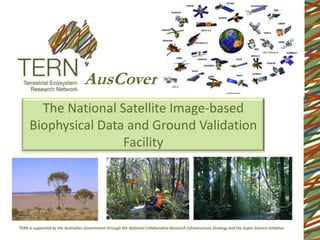
  • 1. AusCover The National Satellite Image-based Biophysical Data and Ground Validation Facility
  • 2. AusCover Facility Production and delivery of nationally consistent long‐time series of satellite‐based biophysical map products and next generation remote sensing research data that is validated for Australian conditions.
  • 3. Capabilities to be Delivered Remote Sensing Data Delivery Backbone • Solving data formats, interoperability, data-policy, • Physical storage, efficient delivery to end-users etc. Data Production Network (via Central Console and 7 Regional “Nodes”) • Nationally-consistent, standard biophysical data products, • Metadata and technical support documents • Specialised space-borne, airborne & in-situ research-grade data Ground Validation Program and Instrumentation • Set national standards & field validation protocols, • TERN SuperSites and Environmental transects etc. • International Benchmarking (eg CEOS WGCV LPV)
  • 4. The AusCover Team & Network Securing Data and Collaborations via Links to International Agencies and Networks Darwin Node Stefan Maier (CDU) Brisbane Node Kasper Johansen UQ) Peter Scarth (DSITIA Perth Node Merv Lynch (Curtin) Sydney Node Alfredo Huete (UTS) Adelaide Node Megan Lewis (Adel. U.) Canberra Node Alex Held (CSIRO) 7 Regional Nodes Melbourne Node Medhavy Thankappan (GA) Ian Grant (BoM) 11 Institutions Simon Jones (RMIT) 28+ Researchers and Students ..over 500 TBytes of ground, airborne and satellite data
  • 5. Progress • Extensive field campaigns and airborne data acquisitions in 2012. Six out of eight AusCover Test-sites covered • Drafting first field validation manual “Green Book”. • Consolidation of continental-scale datasets, associated metadata, and portal across AusCover data system. • Held several agency briefings across “TERN Themes” (Carbon, Fire, Biodiversity..) • Collaboration with Google Earth Outreach (“Earth Engine and Smartphone apps) and IIASA (GEOwiki) • Initiated establishment of demonstration “forest sensing and phenocam network” • Field validation program continuing for key data products (e.g. aboveground biomass and GEOSS Ecosystems) & many others..
  • 6. Field Team Activities Selected photos source © Charles Tambiah and members of the AusCover team • TERN Supersites and AusCover field calibration sites • New TERN Field Instrumentation & testing • New data acquisition for key in-situ measurements (e.g. leaf chemistry, canopy structure, reflectance, leaf-area index, etc.) • Validation and calibration of airborne and satellite images
  • 7.
  • 8. AusCover Good Practice Guidelines, Contents • Review of Validation Campaigns • Representativeness and Sampling Design • Sensor Calibration – Vicarious calibration – Atmospheric correction – Radiometric – Optical sensors – Best practice guidelines for calibration and validation of SAR data and derived biophysical products • Validation of AusCover Biophysical RS products – LAI, Fpar – Fractional Cover • Validation of key variables derived from biophysical RS products – Phenology – Leaf spectroscopy – Foliar chemistry – Persistent green vegetation index – Biomass • AusCover specifications and quality assurance steps for hyperspectral and LIDAR data • Good Practice Field Data Management and Delivery • National examples of spectral dataset exchange • National examples of CalVal • Appendices with protocols for field spectroscopy, FPC, LAI, etc.
  • 9. Satellite and Airborne-Derived Data Products for use in Ecosystem Science and NRM National/Regional Scale Time-series • Green Land-Cover (NDVI-EVI) • Fractional Cover (green vegetation, non-photosynthetic vegetation, bare ground) • Fraction Absorbed PAR (Photosynthetically Active Radiation) • Burnt Area • Forest cover • Land Surface Temperature • Broad Ecosystem Maps State-based (to be extended nationally) • Fraction Projected Cover (FPC) In-Situ Validation and TERN SuperSite Information • Leaf-Area Index • Vegetation 3D Structure & biomass • Spectral Reflectance (nadir-corrected) Science Data • Airborne + Spaceborne hyperspectral • Lidar • SAR
  • 10. Data Access Via http://data.auscover.au (inter connected servers)
  • 11.
  • 12. Early Data Use Examples and Opportunities
  • 13. Linking Climate and Land-Cover Dynamics Gridded Climate Data: http://data.auscover.org.au/xwiki/bin/view/Product+pages/WebHome
  • 14. Dynamics of Fractional Cover Validation (a CSIRO, ABARES C4C, and TERN AusCover Project) • “Fractional Cover Product” – Used for land condition and trends, soil erosion – Vegetation indices based unmixing of monitoring photosynthetic vegetation, non- photosynthetic – Available from http://www-data.iwis.csiro.au/ vegetation and bare soil – Guerschman et al, 2009 (RSE) – Based on MODIS reflectance (MCD43A4) – Australia, 8-day, 500 meter, 2000-2012 – Semi-operational, updated weekly
  • 15. Adoption by South Australia of remotely sensed soil exposure data to improve soil erosion risk monitoring Green vegetation / non-photosynthetic vegetation / soil from a dry to a wet time, as measured by the Relative Spectral Mixture Analysis index (originally by Greg Okin, developed by AusCover facilitated collaboration between Greg Okin and AusCover SA)
  • 16. Tracking of Land-Cover Dynamics and Drying WARRA Enhanced Vegetation Index 0.5 0.4 0.3 0.2 0.1 0 2/17/96 2/17/97 2/17/98 2/17/99 2/17/00 2/17/01 2/17/02 2/17/03 2/17/04 2/17/05 2/17/06 2/17/07 Alice Springs mean_evi 0.6 0.4 0.2 0 3/4/96 3/4/97 3/4/98 3/4/99 3/4/00 3/4/01 3/4/02 3/4/03 3/4/04 3/4/05 3/4/06 3/4/07
  • 17. Comparing Land-Cover dynamics with known land- management practices across Australian Wildlife Conservancy Sanctuary sites NVIS classes (protected and non-protected) MODIS satellite data (protected and non-protected) Hummock Grassland protected and non- protected MODIS EVI Decadal MODIS time series 2000 2006 2011
  • 18. Using International Data to Monitor Land-cover and productivity: e.g. Southern Hemisphere Crop NDVI Anomaly, September 15th, 2012 Australia: Wheat Brazil/Argentina: Wheat Crop NDVI Anomaly South Africa: Wheat Non Cropland -0.4 0 0.4 Worse than normal Better than normal normal Current season crop development (2012) Median season development (2000-2011)
  • 20. New Ecosystem Science with High- Resolution Data and Ground Sensors
  • 22. Use of Terrestrial Scanning Lidar to Characterise 3D Structure of Canopies • Evaluating Ground-based lidar technologies designed specifically for forest and vegetation assessment • The CSIRO-patented Echidna® has key differences from scanning rangefinders – Digitizes the full return waveform – Has variable beam divergence – Uses full hemispherical scanning and beyond – Linear response and calibration AGU 2012 22
  • 23. Visualisation of Echidna Forest Measurements in California Gap probability to range (dark = 1, light = 0, green indicates partial return Plate Carré (equal-angle, “Andrieu”) projection AGU 2012 23
  • 24. Canopy Lidar Data Robson Creek - QLD
  • 25. 25
  • 26. Demonstration of In-Situ Sensor Network at Whroo Flux Tower Site - Victoria • Ten-node wireless sensor network measuring Photosynthetically Active Radiation (PAR), temperature and humidity • Five minute sample frequency
  • 27. Following through the Fire TERN Theme…. Dr Geoff Garrett (photo at left) speaks at the opening of the TERN–Queensland Government briefing on fire risk, which was attended (photo at right) by Fergus Adrian (left) and Bernard Trembath (right) from the Queensland Department of Fire and Emergency Services
  • 28. Sample: TERN/AusCover Fire Products Product Name Availability Validation Burned Area – MODIS (CDU 250m), Australia Partial 2 Fire Frequency – MODIS (CDU 250m), Australia 2013/Q4 Fire Frequency – AVHRR (1km), Australia Available 1 Fire Severity – MODIS (CDU 250m), Australia 2013/Q4 Sub-pixel Fire Patchiness – MODIS (CDU 250m), Australia 2013/Q4 TOA Reflectance Red/NIR – MODIS (for manual burned area Partial 3 mapping), North and Central Australia Thermal Anomalies (Fire Hotspots) – MODIS (LPDAAC Available 2 MOD14A2 1km), Australia – not near real-time Burned Area – MODIS (LPDAAC MCD45A1 500m), Australia Available 1 Burned Area – MODIS (University of Maryland MCD64A1 Available 1 500m), Australia 1 Product accuracy is assessed from a small (typically < 30) set of locations and time periods by comparison with in-situ or other suitable reference data. 2 Product accuracy is estimated over a significant set of locations and time periods by comparison with reference in situ or other suitable reference data. 3 Uncertainties are characterized in a statistically robust way over multiple locations and time periods representing the complete range of environmental conditions.
  • 29. Grassland curing (Bureau of Meteorology) • Bushfire CRC curing project maps (A, B, C, D) • National maps and state cut-outs
  • 30. Experimental Live Fuel Moisture Content Product (WA Landgate) July 2009 November 2009
  • 31. GHG Emissions due to Fire
  • 32. Sample: Fire Research Enabled through TERN Oliveira et al. (in preparation). Characterization of fire in tropical savannas of northern Australia using satellite measurements of fire radiative power. Edwards et al. (accepted). Remote sensing of fire severity in north Australian tropical savannas. Price et al 2013. Role of weather and fuel in stopping fire spread in tropical savannas. Maier et al. 2013. Sensitivity of the MODIS fire detection algorithm (MOD14) in the savanna region of the Northern Territory, Australia. Maier & Russell-Smith 2012. Measuring and Monitoring of Contemporary Fire Regimes in Australia using Satellite Remote Sensing. Maier et al. 2011. Characterising Bush Fires in Australia’s Top End using MODIS Active Fire Observations.
  • 33. AusCover Facility Coordination Office Contact Details Alex Held – Facility Director Rowena Smith – Facility Coordinator Matt Paget – Data and Systems Coordinator CSIRO Marine and Atmospheric Research GPO Box 3023 Canberra, ACT 2601 Australia Tel.: 61-2-6246 5630 Fax: 61-2-6246 5988 Email: alex.held@csiro.au / rowena.smith@csiro.au / matt.paget@csiro.au