Travel guide-to-native-american-tribal-destinations---68pages
•
1 gefällt mir•1,602 views


Empfohlen
Weitere ähnliche Inhalte
Andere mochten auch
Andere mochten auch (11)
Ähnlich wie Travel guide-to-native-american-tribal-destinations---68pages
Ähnlich wie Travel guide-to-native-american-tribal-destinations---68pages (10)
Mehr von Vacation Side Travel
Mehr von Vacation Side Travel (20)
Travel guide-to-native-american-tribal-destinations---68pages
- 1. 2004 Governor’s Award Recipient
- 3. 1 welcome Take a moment, and look up from where you are right now. If you are gazing across the waters of Puget Sound, realize that Indian peoples thrived all along her shoreline in intimate balance with the natural world, long before Europeans arrived here. If Mount Rainier stands in your view, realize that Indian peoples named it “Tahoma,” long before it was “discovered” by white explorers. Every mountain that you see on the horizon, every stand of forest, every lake and river, every desert vista in eastern Washington, all of these beautiful places are part of our Indian heritage, and carry the songs of our ancestors in the wind. As we have always known, all of Washington State is Indian Country. To get a sense of our connection to these lands, you need only to look at a map of Washington. Over 75 rivers, 13 counties, and hundreds of cities and towns all bear traditional Indian names – Seattle, Tacoma, Yakima, and Spokane among them. Indian peoples guided Lewis and Clark to the Pacific, and pointed them safely back to the east. Indian trails became Washington’s earliest roads. Wild salmon, delicately grilled and smoked in Alderwood, has become the hallmark of Washington State cuisine. Come visit our lands, and come learn about our cultures and our peoples. Our families continue to be intimately woven into the world around us. As Tribes, we will always fight for preservation of our natural resources. As Tribes, we will always hold our elders and our ancestors in respect. As Tribes, we will always protect our treaty rights and sovereignty, because these are rights preserved, at great sacrifice, by our ancestors. This publication is an invitation to visit Indian Country. It is a collaboration of more than 50 member Tribes of the Affiliated Tribes of Northwest Indians (ATNI), in partnership with the ATNI Economic Development Corporation (ATNI-EDC). The more you learn about our peoples and our places, the better you will be able to understand our connection to the land, and to our creator. Come visit Indian Country. We are waiting. Ernie Stensgar, Coeur D’Alene ATNI President Dave Tovey, Umatilla/Cayuse ATNI-EDC President Mike Marchand, Colville ATNI 1st Vice President/Alternate Tourism Chair Walter Jackson, Quileute ATNI Tourism Committee Chair ABOUTATNI/EDC In 1953,a group of tribal leaders from across the region gathered together to develop a collaborative organization that would work nationally,to protect,and strengthen their tribal communities. This meeting marked the creation of the Affiliated Tribes of Northwest Indians (ATNI). ATNI, located in Portland,Oregon, has become one of the most respected regional tribal organizations in the nation; working to protect the interests of over 50 member Tribes from Oregon,Washington,Idaho,Southeast Alaska,Western Montana,and Northern California. In 1996,the ATNI General Assembly created the ATNI Economic Development Corporation (ATNI-EDC),a wholly owned,public benefit,subsidiary of ATNI. The ATNI-EDC, located in Edmonds,Washington,was directed to work on the collective economic interests of ATNI member Tribes, including culturally appropriate tourism development, access to technology,energy,a Revolving Loan Fund (RLF),and financial and business planning services.ATNI-EDC is dedicated to preserving and protecting tribal sovereignty and treaty rights,through culturally sensitive economic development. www.antiedc.com to Indian Country
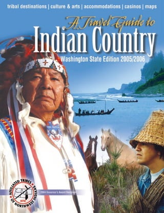
- 4. 2 | A Travel Guide to Indian Country—Washington State | www.tribaltourism.com This publication was supported in part by a Grant from the Administration for Native Americans (ANA). ABOUT THE COVER: The photos on the cover were selected to represent various aspects of tribal culture as it has existed since the dawn of time. Joe Jay Pinkham (left), a tribal elder from the Yakama Nation (profiled on page 41) is shown in traditional regalia using animal hides and eagle feathers common to the deserts and plains of eastern Washington. On the right, a Quileute tribal member is wearing a hat and cloak made from cedar bark, which was also used for basket weaving and housing by coastal tribes throughout the Pacific Northwest. Canoes played a daily role in the life of Tribes who depended on the resources of the sea and coastal rivers for survival. Exceptional horses were bred and raised by inland Tribes who depended on the durability of these fine animals for hunting, transportation and defense. Cover photo credits: Joe Jay Pinkham, courtesy of Darla C. Leslie of the Yakama Nation Review; Cedar clothing, courtesy Swinomish Tribe; Ocean canoes courtesy Quinault Indian Nation; Horses courtesy of Ed Arthur and the Cowlitz Indian Tribe. A Travel Guide to Indian Country™ is an official publication of the Affiliated Tribes of Northwest Indians—Economic Development Corporation (ATNI-EDC) ©2005 All rights reserved. Reproduction of any part of this publication without express written consent of ATNI-EDC is strictly prohibited. Every effort was made to ensure accuracy of the information in the guide as of press time. However, neither ATNI-EDC nor Visitors Guide Publications (VGP), including all staff and contracted agencies, assume any responsibility for errors, changes or omissions. A Travel Guide to Indian Country™ is published annually by Visitors Guide Publications in partnership with the ATNI-EDC. Affiliated Tribes of Northwest Indians—Economic Development Corporation and Visitors Guide Publications make no endorsement, representation or warranty regarding the suitability, quality or availability of any goods or services advertised or listed in this publication. Listings and advertisements are provided by the subject companies and ATNI—EDC and VGP shall not be responsible or liable for any inaccuracy, omission or infringement of any third party’s rights therein, or for personal injury of any other damage or injury whatsoever. Concept Development ATNI-EDC President J. David Tovey, Cayuse/ Umatilla;*ANTI 1st Vice President Mike Marchand, Colville; ANTI Tourism Committee Chair Walter Jackson,Quileute; ATNI-EDC Executive Director Mark L. Ufkes ATNI-EDC Publications Director Victoriah Arsenian ATNI Executive Board Members Ernie Stensgar, Coeur D’Alene*; Mike Marchand, Colville; Davis Washines, Yakama; Lloyd Irvine, Salish- Kootenai; Norma Jean Louie, Coeur D’Alene; Doris J. Miller, Warm Springs; Virginia Brings Yellow, Quinault ATNI-EDC Board of Directors J. David Tovey, Jr., Cayuse/Umatilla; Mike Marchand, Colville; Sharon Goudy, Yakama; Jolene Atencio, Warm Springs; Walter Jackson, Quileute; Antone Minthorn Cayuse/Umatilla, and Lee Shannon, Cowichan. * denotes tribal affiliation Published by Visitors Guide Publications 215 W. Holly St., Suite H-24 Bellingham, WA 98225 360-676-8625 www.visitorsguide.com Publisher Marcus Yearout Writers & Editors Jan Halliday Victoriah Arsenian Audrey Fraggalosch M. Yearout Maisie MacKinnon Sales & Marketing Staff Audrey Fraggalosch Pia Fischer Tribal Liason/ATNI Portland Exec. Director Lyn Dennis (Lummi) Graphic Design J. DeFoer Maps Julia Martin Production Assistance Heather Steele ATNI-EDC: www.antiedc.com (866) 222-ATNI representation or warranty regarding the suitability, quality or availability of any goods or services advertised or listed in this publication. Listings and or infringement of any third party’s rights therein, or for personal injury of any other damage or injury whatsoever. Etiquette• • • • • Please be attentive to signage, and obey our individual tribal rules and regulations. Alcohol, weapons, and drugs will not be tolerated. Please respect the privacy of residential communities. Ask before photographing or recording an individual, an event, or activity. Do not pick up or remove artifacts or objects. Burial grounds and religious ceremonies are sacred and are not to be entered. • Indian Country Etiquette Each tribal nation in the state of Washington makes the decision on how best to balance community and tradition,whileprovidingvisitorswith enjoyable experiences. However, in an effort to avoid misunderstandings or violations of our customs, we ask that visitors follow basic procedures for conduct. In doing so, we can ensure the protection of our sacred and ceremonial areas, including the preservation of historical artifacts. Traditionally, our people are hospitable and generous in nature. However, spiritual teachings, sacred ceremonies and burial grounds, are not openly shared with the public. We are proud of our teachings, and our heritage. They have been passed to us by our ancestors, and represent thousands of years of our individual histories. Your patience and understanding of our traditions and cultures is appreciated.
- 5. 3 Contents “There are 29 sovereign nations within the exterior boundaries of Washington State, each with its own tribal government and bylaws. We are responsible governments and work hard to provide a stable environment for our people.” —John McCoy, Tulalip Tribes Washington State Representative (38th Legislative District) Riders stroll through a grassy meadow in the shadow of Mt. Adams. Photo: John Marshall Welcome Letter..................................................................1 Introduction.......................................................................5 Fish & Wildlife...................................................................6 Battlefields & Treaties .......................................................11 Tribal Art & Petroglyphs..................................................13 Galleries, Museums & Cultural Centers ........................15 Indian Gaming/Casinos...................................................18 Driving Tour Overview....................................................21 Destination: Seattle to Kitsap Peninsula........................21 Destination: Olympic Peninsula to Pacific Coast .........25 Destination: Pacific Coast, North to South ...................28 Destination: South Pacific Coast to Mt. St. Helens.......31 Washington State Map .....................................................32 Destination: Lower Puget Sound ....................................34 Destination: Lower Columbia River. ..............................40 Destination: Upper Columbia River Basin ....................44 Destination: Upper Puget Sound Tribes .......................50 Canoe Journey ...................................................................61 Powwows & Festivals........................................................63
- 6. 4 | A Travel Guide to Indian Country—Washington State | www.tribaltourism.com Welcome to Indian Country, Washington State
- 7. 5 If you walk up to the average American and ask how old their country is, you may get answers ranging from the pilgrim landing at Plymouth Rock in 1620, or perhaps they’ll choose sometime between 1776 when America declared its independence and 1788, when the constitution of the United States was ratified. Regardless, you’re looking at a very brief period of history of less than 400 years — and of course, you’re also looking at the world through the eyes of most contemporary historians and educators who use these benchmarks of European expansion into the “new world” to define our beginning. Ask the same question of a Native American, and the answer will be quite different. The Tribes have been on this earth and using the gifts of the creator since time immemorial. Our respect for this land and its bounty has no limit. As we have lived in harmony with nature—along the seashores, in the lush forests, in high plains deserts, and on our mighty rivers—we have been blessed by nature’s resources and gratefully accepted our role as a guardian and protector of this land and all it has provided to us for untold millennia. While we have always honored the hunting, fishing and ceremonial grounds of our ancestors and neighboring Tribes, our people have never recognized boundaries in the European sense. Lines on paper have no significance whatsoever, and in fact, there is no record of anything resembling a map in petroglyphs, pictographs or other ancient art that provide the few written records of our long history. We have always followed the trails and signs provided by the creator to find the resources necessary to sustain us and to trade with other Tribes. This is the way we have lived for centuries, and the reason we are surviving and thriving in today’s world. As you travel through Indian Country, you will get glimpses of a cultural heritage that has been carefully handed down over centuries through our oral traditions—elders teaching the youth to respect the ways of countless generations. You’ll also discover several thriving Indian communities, with modern hotels, resorts, gaming casinos, shopping centers, recreational developments, and a wide variety of massive industrial enterprises. Even though our world has changed, we continue to create a better future for the generations to come—just as we have always done. This Travel Guide to Indian Country will help you become more acquainted with the first nations who have lived, for thousands of years, on the land that is today known as Washington State. You are our guest and are welcome to journey through some of the most beautiful regions of the Northwest. We invite you to see our lands; learn of our diverse cultures, and respect our traditions.
- 8. 6 | A Travel Guide to Indian Country—Washington State | www.tribaltourism.com Fish & Wildlife Hunting and Fishing Rights Are Sacred Fishandwildlifehavealwaysbeenacentralpart of our culture. That is why we reserved our right to hunt, fish and gather the natural resources of this region, secured by signed treaties with the United States government. In return for the guarantee to continue to hunt and fish, as we always have, we gave up, or “ceded”, most of the land in what is today Washington State. Tribal hunters do not hunt for sport. Hunting is a spiritual and personal undertaking for each hunter, as it has been for thousands of years. There are many important family and tribal traditions that are a part of hunting. As traditional foods, deer and elk meat, for example, are important elements of funerals, potlatches, and naming ceremonies. Hooves and antlers are still used as traditional ceremonial items and clothing. As co-managers with the State of Washington, the health of the wildlife resource is the primary concern of the treaty Indian Tribes. We all understand that harvest management is essential but that loss of habitat, more than any other factor, is the biggest threat to the fish and wildlife resources of this region. That’s why tribal governments have made strides to protect and restorehabitat,bothontheirreservationsthrough land use and water resource authorities; and off- reservation by collaborating with non-Indian neighbors to protect and restore watersheds that support salmon and other species. Thewildliferesourcesofthisregionareasmuch a part of us as the air we breathe, and hunting and fishing is central to our spiritual and cultural identity. Like you, we want the wildlife resources of this region to thrive. Source: Northwest Indian Fisheries Commission, www.nwifc.org Razor Clams Razor clams are found primarily on the intertidal coastal beaches (those that are exposed at low tide) from a +3 foot level to a -2 foot tide level. The Washington Department of Fish and Wildlife (WDFW) divides the harvest areas into five major management zones: Long Beach Twin Harbors Copalis Beach Mocrocks Kalaloch These areas are clearly marked and can be viewed at www.wdfw. wa.gov. You can also find out information about procurring a license, bag limits, allowable gear, harvest seasons, and beach use restrictions. Buy Fresh Seafood Many of our tribal fisher families rely on salmon harvests, just as our people have for thousands of years. ATNI member Tribes, along with the Northwest Indian Fisheries Commission, and the Columbia River Inter- Tribal Fisheries Commission, encourage you to support our tribal fishers by purchasing the finest local, fresh salmon, marine fish, and shellfish. Please call ahead for location, hours of operation, fishery tours, and available stock. Tribal Fisheries: Jamestown Seafood ...........360-683-2482 Lower Elwha Klallam........360-452-4848 Lummi Nation.................... 360-384-1489 Puyallup Tribe.................... 253-597-6200 Quileute Tribe......................360-374-6163 Quinault Nation..................360-276-8211 Skokomish Nation...............360-877-5213 Squaxin Island....................360-426-9781 Tulalip Tribes......................360-651-4600 For information on restoration programs and fishery management, visit www.nwifc.wa.gov Dip Net Fisherman— Harvesting salmon with a dip net was a traditional practice at Celilo Falls for thousands of years. Then, on the morning of March 10, 1957, the massive steel and concrete gates of The Dalles Dam closed and choked back the downstream surge of the Columbia River. Six hours later and eight miles upstream, the deafening roar of Wy-am (Celilo Falls), the age-old Indian salmon fishery was under water–silenced forever. The tribal people who gathered there did not believe it possible.
- 9. 7 Pacific Northwest Salmon The Puget Sound and Coast Pacific salmon has great cultural importance to Tribes throughout the Northwest. The salmon are sacred to our people and remain an intricate part of life spiritually, culturally and economically. A celebration is held annually by many tribal communities to welcome the returning salmon. As natural resource managers, Tribes operate Indian fisheries to protect weak stocks while enabling harvest opportunities on healthy stocks. The harvesting of salmon is an inherent right protected by treaties with the US government. Tribes and the state share in 50 percent each of the harvested salmon. TherearefivespeciesofPacificsalmon, each varying in flavor, color of meat, size and weight. Chinook (King or Blackmouth) Chinook spawn in rivers and large streams, and commonly are found in the Snoqualmie, Cedar, Green, and White Rivers. They are olive brown to deep brown in color, with spots on its upper back and tail fin. Chinook are a white meat fish, and range from 24-60 inches in length. Average Weight: 20 lbs. (up to 135 lbs.) Flavor: Rich Available: May – Oct. Sockeye (Red Salmon) Sockeye spend their early lifecycle in a lake, and will later spawn in a connected body of water. They range from 20- 28 inches in length, and have a firm, dark red meat. They are a bright-red to reddish-gray (Puget Sound) Average Weight: 7 lbs. (Coastal) Average Weight: 3 lbs. Flavor: Rich Available: June–July Coho (Silver Salmon) Coho is sometimes confused with Sockeye because they spawn in the same streams; are similar in size and although they are bright silver, this salmon can turn red during spawning. Spots are found only on their back and upper tail fin lobe. They range from 17-38 inches in length, and color of meat is usually red. Weight: 15 lb. Flavor: Full Available: Jul–Oct. (Puget Sound) Available: Jun–Oct. (Coastal) Pink Salmon (Humpback Salmon) Commonlyfoundinriversthroughout northwest Washington, Pink salmon are silver with several oval spots. The smallest of the five species, they are also the most abundant. They primarily stay in freshwater and near-shore habitats during their life cycle, spawning in the lower reaches of coastal rivers. Pink salmon range from 17-19 inches in length, and meat is light in color. For fishing license requirements, visit the Washington Department of Fish and Wildlife at fishhunt.dfw. wa.gov or call 1-866-246-9453. Fish & Wildlife “We take pride in, and value, our natural resources, our families and our communities. We are a unique partofAmericawithuniquegovernmentsrecognized by the United States Constitution.” Honorable Ron Allen, Jamestown S’Klallam Average Weight: 5 lb (up to 12 lbs.) Flavor: Very Mild Available: Aug–Sept. (odd yrs. only) Chum (Dog Salmon) Chum resemble Sockeye, but have silver sides with small black spots. They live in watersheds near salt water, and are sometimes seen spawning in creeks that run into Puget Sound. The second largest of the species, Chum range from 30-42 inches in length, and have light pink to medium red meat. Weight: 10 lb. Flavor: Mild Available: Sept–Nov. Note: Rare to Lake Washington and King County streams. Habitat Restoration—Tribal government is working hand-in-hand with state agencies to restore salmon habitat, the leading cause of the decline of salmon runs in the Pacific Northwest.
- 10. 8 | A Travel Guide to Indian Country—Washington State | www.tribaltourism.com Fish & Wildlife Watchable Wildlife in Indian Country From resident birds and mammals that abound in our woodlands, deserts and along our rivers and seashores, to migratory species that use Washington as a “stopover” between destinations, Indian Country is rich in watchable wildlife. Forcenturies,theTribeshavehonored,respected and nurtured the habitat for these critical sources of life. Spiritual lessons from coyote, raven and the salmon have been handed down, providing guidance for countless generations. Here is a brief sampling of the kind of natural experiences you can enjoy during your visit to Indian Country. Bald Eagles on Nooksack and Skagit Rivers The Skagit and Nooksack River located along the I-5 corridor in northwest Washington are the wintering home for hundred of bald eagles that are drawn to thousands of spawned out salmon along the rivers. The best time of year to see eagles is mid-December through mid-February. Located in Whatcom County, the Deming Homestead Eagle Park on the Nooksack River is a good place to observe eagles feed on the salmon that wash up on sandbars. The parks department has constructed salmon habitat structures that provide a great environment for the salmon to spawn and the young to hatch. The concentration of bald eagles and spawning salmon in the Skagit River basin is a spectacular site, with as many as 400 eagles spotted during peak times. One of the best ways to view eagles is on the water from a raft, drift boat, or kayak. Trumpeter Swans and Birds of Prey on Skagit Flats One of the rarest birds in North America, the trumpeterswan,canbeseenontheSkagitFlatsoff I-5 just north of Burlington between November and April. Trumpeters frequent the same area each year and the Skagit Flats is an excellent place to spot flocks of them. While on the Skagit Flats, look for birds of prey—from bald eagles to rough-legged hawks to peregrine falcons and wintering gyrfalcon— numerous raptor species make western Washington their winter home. Shorebird Migration—Grays Harbor Estuary Each spring, shorebirds come from as far south as Argentina and concentrate at the muddy tide flats of Grays Harbor Estuary near Hoquiam. Up to one million shorebirds gather here in the spring to feed, store up fat reserves, and rest for the non-stop flight to their northern breeding grounds. These Arctic-bound shorebirds are among the world’s greatest migrants; many travel over 15,000 miles round trip! The five most abundant species are the western sandpiper, dunlin, short- billed and long-billed dowitcher, and the semi- palmated plover. Dungeness Spit and National Wildlife Refuge The Dungeness NWR provides habitat for many different species. More than 250 species of birds, 41 species of land mammals, and eight species of marine mammals have been recorded in the refuge. It provides critical habitat for a number of species, some of them threatened or endangered, and is an important stop for many birds during migration. Cycle of Life The sight of an eagle snatching a salmon from coastal rivers or Pacific shores is one of the most dramatic glimpses of the cycle of life you can witness in Indian Country.
- 11. 9 Fish & Wildlife The black brant is one of the refuge’s most important inhabitants as it depends on the refuge’s eelgrass for its survival. The black brant is a true sea goose and is able to drink salt water and eat saltwater plants. The tip of Dungeness Spit is also a traditional haul-out and pupping site for the harbor seal. It is used year after year when seals leave the water and form colonies. During these essential periods, the seals rest, sleep, mate, give birth, and nurse their pups. Columbia National Wildlife Refuge Ducks & Sandhill Cranes The Columbia National Wildlife Refuge, located about 8 miles northwest of Othello, is a wintering area for an average population of more than 100,000 ducks (mostly mallards) and Canada geese. Here you’ll observe mallards, redheads, and cinnamon teal nest on the refuge along with various song, water, marsh, and shore Kayaking and Rafting One of the best ways to view birds and other wildlife is from our rivers and streams. There are several excellent outfitters and guides who can help you plan a water journey, from a quiet rubber raft or drift boat excursion, to kayaking or whitewater adventure. You choose the level of excitement and they’ll handle the details. birds, as well as many hawks and owls. Thousands of sandhill cranes migrate through on the Pacific flyway in spring and fall. Dry Falls Overlook This geologic wonder, located on Hwy 17 just south of Grand Coulee Dam and the Colville Reservation, was created when a prehistoric ice dam gave way causing a cataclysmic flood. This is thesiteofawaterfallthatwas ten times the size of Niagara Falls. Here you’ll witness the aerial ballet performed by white-throated swifts, and violet-green and barn swallows. During winter, check utility lines for raptors and northern shrikes. (Source: Great Washington State Birding Trail. Audubon Washington) Along the Great Washington State Birding Trail, you’ll find the best places for bird watching in the Evergreen State. The first two routes, the Cascade Loop and the Coulee Corridor, feature sites for birders, novice to expert, to find our feathered friends in every season. Call 1-866-WA-BIRDS (1-866-922-4737) or online at http://wa.audubon. org to order a map. Left: A great blue heron gazes across a grassy wetland in northwest Washington. photo: John Marshall.
- 12. 10 | A Travel Guide to Indian Country—Washington State | www.tribaltourism.com Fish & Wildlife Whale Watching Orca Whales (San Juan Islands) May-September is peak orca whale watching in the San Juan Islands. The return of the first salmon runs in May signals the highly anticipated return of orca whales. There is nothing quite as spectacular as the sight of a pod of orca whales splashing and cavorting along the protected coastlines of the San Juan Islands. You will also see harbor seals, porpoises, otters, bald eagles and various shorebirds and ducks. Numerous private companies offer whale- watching expeditions. Gray Whales (off Washington Coast & Cape Flattery) Whale watching peaks during March, April and MayasgraywhalescruisealongWashington’scoast during migration. Gray whales make the longest journey of any mammal, traveling 10,000 to 14,000 miles round trip every year — from breeding lagoons in the Baja to their feeding grounds in North Pacific (Alaska). Because gray whales migrate close to the coast, they can often be seen from shore. Good places to watch whales include the Westport observation tower; Olympic National Park, Cape Alava; LaPush; Cape Flattery; and the Lewis and Clark Interpretive Center, Fort Canby State Park. Other Indigenous Mammals If you are interested in any experience in Washington that involves outdoor recreation, hiking or camping, you’re in for a treat. You will find it very easy to locate scenic wildflower meadows and forest trails winding into the Cascade Mountains, along the Pacific coastline or through the semi-arid deserts and plains of eastern Washington. Besuretokeepyoureyesopenforsightingsofour state’s active population of Roosevelt elk and black- tailed deer. And use caution, you could encounter a black bear lumbering through a mountain meadow or rummaging through a campsite. And remember to keep a sharp lookout for the elusive mountain goats you’ll observe casually grazing on the crags and cliffs high above. Information Resources For more information on birding, the Audubon Society of Washington has a good website, www. wa.audubon.org. You can order birding trail maps and other information that will help you plan your itinerary. Contact the State Department of Fish and Wildlife (wdfw.wa.gov) or the US Forest Service (www.fs.fed.us) for general wildlife viewing and salmon spawning information. Excellent information on tribal fisheries and habitat management can be found at the Northwest Indian Fisheries Commission site, www.nwifc.wa.gov. Whale watching— Resident and migrating whale pods can frequently be seen frolicking in Pacific Northwest waters from the Pacific Ocean and into Puget Sound and throughout the San Juan Islands. Call a local visitors bureau to find out more.
- 13. 11 Battlefields & Treaties Indian Wars & Battlefields The reasons for going to war are rarely simple to isolate—but the basic story almost never changes. Social, economic and territorial disputes lead to arguments that in turn lead to violence and murder. In the case of the Indian wars of the mid- 19th century, the issues are very clear. Spurred in part by information gathered during the Lewis & Clark expedition, the United States government had encouraged a westward expansion movement and land giveaway with no regard for the Tribes who had occupied the continent for thousands of years. While freedom was the founding principle of a new nation, it was quite simply not applied equally to all — and the tribal presence did not present any moral obstacle to the aspirations of those seeking wealth and a new beginning west of the Mississippi. Land-hungry settlers began to encroach upon the Washington territory in the 1840s and as their numbers increased, tensions between the cultures rapidly mounted. In the mid-1850s, the responsibility for securing treaties with the local Tribes fell on the willing shoulders of Isaac Stevens who had been appointed territorial governor and Indian agent representing the US government. It is important to note that the concept of defining boundaries and signing over land from one person to another was an alien concept to the Tribes. As Chief Sealth stated in 1854, “The earth does not belong to man; man belongs to the earth.” The terms of the treaties were pretty straightforward. In exchange for ceding nearly all their traditional land, the Tribes would receive small amounts of money and guarantees that they would always be able to hunt, fish and harvest crops in the areas they had used for centuries. The US government also agreed to provide primary healthcare and other limited aid. All Tribes did not sign these treaties, and those who did enter into the agreement, often did so under duress and threat of military action. It was soon discovered that the terms of the treaties were only upheld insomuch as they did not interfere with the rights of white settlers. When new farmland, timber or grazing areas were wanted, the government defended the settlers’ rights even though they encroached on land that had been set aside or “reserved” in the treaties for the Tribes. The “Language” of Treaty Negotiations Many of the treaties between the northwest tribal nations and US Government were negotiated in Chinook Jargon, a trade language consisting of only about 300 words which was inadequate to convey the complex issues of treaty making. This, combined with a lack of cultural understanding on both sides, makes it easy to see why so many treaty rights are still being disputed to this day. Imagine an attorney of today, being able to negotiate a contract that transfers ownership and use rights of thousands of square miles of land from one party to another with only 300 words to describe all the related details, terms and conditions of such a massive transaction. Especially given the fact that the concept of “land ownership,” in the Euro-American sense, had never been a part of tribal culture. Fort Simcoe State Park— A cannon sits as a silent reminder of the military presence at Fort Simcoe State Park.
- 14. 12 | A Travel Guide to Indian Country—Washington State | www.tribaltourism.com Battlefields & Treaties Our ancestors defended our homeland, our children and our way of life. The Indian wars from the 1850s and into the 1870s were a direct response to attacks and encroachments resulting from government policies toward Native Americans. There are still a few battlefields of note that you can visit in Washington State. The best way to fully appreciate these sites is to do your homework. A battlefield can look like any other pasture or meadow until you know the story. Discover who the primary participants were and the facts that led to the confrontation. Make a point to get information from tribal books, museums, websites and other tribal information sources. Since our history is based on an oral tradition, it’s not always easy to get the native perspective, but you’ll find that the effort is well worth the rewards. Fort Simcoe Located in south central Washington on the present-day Yakama Reservation, is a 200-acre state park. Originally, the site was an Indian campground and trade route that, in 1856, became a military installation. The park is set near natural springs and the Cascade Mountains, providing hikers, birdwatchers and wildlife seekers ample opportunities to explore nature. An interpretive center and museum provides insight to the lifestyles of the First Peoples of the land and those who served at the fort. Open to the public Apr 1 to Oct 1, Wed–Sun. Tours are offered. For more information call 509-874-2372. Fort Steilacoom Park In 1855 a battle occurred east of present day Tacoma between the territorial militia and members of the Nisqually Tribe. During that skirmish, volunteer militiaman Colonel Abrams Benton Moses was shot and killed. Territorial Governor Isaac Stevens wrongly accused Nisqually Chief Leschi for Moses’ “murder,” and ordered his arrest and execution. A one-mile walking trail encircles tranquil Waughop Lake and a U.S. military fort where Leschi had been taken after capture and hanged at the gallows near Lake Steilacoom. In Thunderbird Square, a monument stands marking the place where Chief Leschi was hanged. On December 10, 2004 —146 years after the execution—Chief Justice Gerry Alexander helped organize a Historical Court of Inquiry and Justice to retry Leschi in absentia. The Court concluded, “The killing was a legitimate act of war, immune from prosecution.” Consequently, LeschiwasdeclaredexoneratedofMoses’murder. For information call 253-756-3928. Four Lakes Sites Visit the battlefields among the Four Lakes: Silver, Granite, Meadow, Willow, and on the plain between the hills to the northeast of Silver Lake. The site where the battle ended is nine miles west of Spokane on Hwy 2, just west of the entrance to Fairchild Airforce Base. The Four Lakes Monument can be seen from the highway. Horse Slaughter Camp Drive east on I-90 to the Washington/Idaho border and take the State Line exit. At the stop sign go left under the freeway, and then go west from there to the State Patrol weigh station and then walk west on the Centennial Trail to the monument which is just west of the 2 mile marker. It is about one mile west of the State Patrol weigh station. Walk or ride your bike west on the Centennial Trail. Just west of the two-mile marker rests the site where hundreds of Palouse horseswereshottodeath.Theareaoffersbeautiful scenery, kayaking, hiking, mountain biking and 4WDoffroad.Foradditionalinformationcontact the Appaloosa Museum & Heritage Center 208- 882-5578, ext. 279. Steptoe Memorial In 1914, a 25’ tall memorial was erected to commemorate the last defeat of the U.S. Army by northwest Native Americans. There are picnic tables at the monument site and a good territorial view of the battlefield, located in Rosalia, WA. To find Rosalia, travel south of Spokane about 40 miles on Hwy 195. For details, contact the Visitor Information Center in Rosalia at 509-523-5991. DID YOU KNOW? Native people have served at the fronts voluntarily and many have made heroic sacrifices to protect and preserve the freedoms of this country and its citizens. For some, joining the military has been a way of showing patriotism to protect their cultural freedoms. For others, it has been an opportunity to see the world. • There are more than 190,000 Native American Veterans, more than 50,000 fought in Vietnam, 90 percent of them as volunteers. • When compared to other ethnic groups, American Indians have the highest record of military service per-capita. • Tribal people give generously to the Red Cross and the Army and Navy Relief societies. • American Indians have invested more than $50 million in war bonds.
- 15. 13 Art/Petroglyphs Ancient Art and Culture Our first nations have inhabited the Pacific Northwest region for thousands of years. The record of this heritage is found in archaeological sites, museums and in the present practice of traditional culture by many tribal members. One of the most fascinating records of early Native American life can be found through an observation of artifacts, ancient petroglyphs—images carved into rocks, and pictographs—images painted onto stone. Since most tribal history has been handed down orally, from generation to generation, this precious rock art—along with totems, basket and weaving patterns—represents some of the only written and visual documentation available of our ancient cultures. Ozette Village & Hoko River Artifacts In 1970, tidal erosion uncovered an ancient whaling village at Ozette, parts of which had been covered by a mudslide hundreds of years ago. The subsequent artifacts that were found have now classified Ozette as one the most significant archaeological discoveries ever made in North America. These artifacts are between 300-500 years old. Location: The Ozette village is located off the Washington coast of the Strait of Juan de Fuca. It is about fourteen miles south of Neah Bay on the Pacific Ocean side of the peninsula. The site is now closed and marked with a small sign. Another significant site in this region has yielded a wealth of primitive artifacts. Three thousand years ago, Native Americans on Washington’s Olympic Peninsula occupied a key seasonal fishing camp on a bar of the Hoko River, close to the south shore of the Strait of Juan de Fuca. Over the centuries, these ocean-oriented peoples discarded cordage, basketry, bentwood fishhooks, woodworking tools, faunal and floral remains, and other cultural materials into a bend of the Hoko River. Where you can view the artifacts: In 1979, the Makah Cultural and Research Center opened to the public in order to share the great finds from the Ozette Village and Hoko River sites. This nationally recognized museum features full scale replicas of cedar long houses as well as whaling, sealing and fishing canoes. On display are about one percent of the 55,000 artifacts recovered from Ozette. Free Guided Tours, Wednesday through Sunday. For more information call 360-645-2711. Petroglyphs at Wedding Rock - Lake Ozette Approximately three hundred years ago the Ozette people carved petroglyphs into Wedding Rock with bone, antler, and metal. There are 44 ancient petroglyphs at the site. Location: Take one of two trails to the beach, which is a three-mile hike around Lake Ozette. Much of the trail is a slippery boardwalk. You can walk along the beach and check out the tide pool life on your way to Wedding Rocks headland. Just make sure to leave the tide pool life and the rock art as you found it. Please help to protect the rock art by using only natural light and not your flash when taking pictures! Horsethief Lake State Park - Bingen The best location in Washington to experience rock art is Horsethief Lake State Park, (100 pictographs in this area), which is just downstream of the inundated Celilo Falls on the Columbia. The Dalles Dam flooded this tribal site in 1957, which up to this time, provided the biggest single aboriginal fishing location on the Columbia. Tribes from all over the Northwest came each year to catch salmon and trade here. “My great-grandmother married in the mid-1800s at a time when many of our traditional celebrations were being outlawed by the U.S. government. This was the last traditional wedding. The ceremony lasted three days. The bride came by canoe on the Pacific Ocean from Ozette to Cape Alava, then to Sooez and Makkaw Bay dressed in veils of dentalium shell, which was valued as currency to the Coastal Tribes. Following the ceremony, the groom, my great grandfather, had to split a thick cedar door with the throw of a harpoon to enter the marriage house before the marriage could be consummated.” Donna Wilkie, Makah Nation She Who Watches—The famous Native American rock art known as “She Who Watches” is located in the Columbia Gorge on the Washington side of the river east of The Dalles. It is a combination of two styles, a petroglyph (carved into the rock) and pictograph (art drawn or painted onto rock). photo: Sharon Grainger
- 16. 14 | A Travel Guide to Indian Country—Washington State | www.tribaltourism.com Art/Petroglyphs The Horsethief Lake area was a major village site, and over the centuries, dozen of images were painted and chipped into the volcanic basalt that lines that part of the Columbia River Gorge. Rangers at Horsethief Lake offer guided tours of extensive rock images high above the Columbia River. Location: Take SR 14 along the Columbia River. The park is located at milepost 85 between Bingen and the Goldendale (Hwy 97) cut-off — directly across the Columbia from The Dalles, Oregon. Ginkgo Petrified Forest State Park - Vantage The park consists of three major areas. The Heritage Area houses the park’s Interpretive Center, the Natural Area has a hiking and interpretive trail, and the Wanapum Recreation Area which has camping and is located 7 kilometers (4.5 miles) south of Ginkgo on the west side of the Columbia River. Just below the Interpretive Center is a collection of Native American petroglyphsmovedtothecenterfromanowsubmerged site along the Columbia. Open year-round, the park offers a wide variety of recreational activities including sightseeing, picnicking, hiking, fishing, boating, water-skiing, swimming and camping. Location: Ginkgo Petrified Forest State Park and the Wanapum Recreation Area Vantage, WA 98950 Phone: (509) 856-2700. Ginkgo State Park is located near the geographic center of the state in Kittitas County, where Interstate 90 crosses the Columbia River at Vantage. Long Lake Pictographs - Tumtum Red pictographs, likely by ancestors of the Spokane Tribe, can be seen on granite cliffs and a separate boulder on a wide terrace above the Spokane River. The area offers great hiking and views. Location: The site is on the north side of the road between the towns of Tumtum and Ford near the intersection of SR 291 and SR 231. Follow the signs to Long Lake Dam. Note: If you see the dam, you have passed the pictographs by a few miles. The State Park is right after the pictographs and before the dam. Caution: Take the trail to the left of the large rocks. Do not attempt to climb the face unless you are an experienced rock climber. The direct face of the rocks becomes more dangerous the higher up you go. Marmes Rock Shelter - Palouse Falls Within a short distance of Palouse Falls State Park, is the Marmes Rock Shelter, the site of an important 1968 archeological dig. Geologists unearthed remains of the “Marmes Man,” estimated to be 10,000 years old and among the oldest human remains ever found in the Western Hemisphere. Location: At Palouse Falls State Park—south of Washtucna on SR 261—the Palouse River roars over a basalt cliff higher than Niagara Falls, dropping 198 feet into a steep-walled basin on its way to the Snake River. A hiking trail leads to an overlook above the spectacular falls. Downstream is the Marmes Rock Shelter. Granite Canyon Rock Art - Omak In 1886, a mission was established directly in front of an ancient cave that hid rocks carved with petroglyphs. Today, the old mission is used as an Indian Boarding School, known as the Pascal Sherman Indian School. Location: Take Hwy 155, east of Omak, WA, approximately 50 miles north of Grand Coulee Dam. Visitors should call ahead for information and register at the school’s administration office–509-826-2097. Cliffside Painted Rocks - Yakima These ancient pictographs are said to have been painted on a 70-foot high cliff of columnar basalt, when a prehistoric lake submerged the valley floor. The local Natives painted the cliffs from canoes, using a mixture of fish oil, minerals and other organic materials that has survived public and environmental abuse. Location: The site is located off Hwy 12 toward Naches, between Gleed and Fruitvale, WA. Park on the shoulder of the road and follow the trail to the cliffside to view the pictographs, which extend 400-feet across the basalt wall. Rock Art Etiquette, Rules & Law 1. Pictographs and petroglyphs on public lands are considered sacred historical artifacts and their theft, destruction or alteration violates federal law. 2. Do not touch rock art, since oils from fingers can damage pigments that may be thousands of years old. 3. Taking rubbings of petroglyphs, making block prints of pictographs, or using chalk to highlight images has damaged many rock art sites. Take a photograph instead — and only use natural available light as flash will eventually cause these priceless images to fade. Leave no trace of your visit. 4. Defacing or damaging petroglyphs, pictographs, caves, or caverns is a Class II misdemeanor. Palouse Falls—Located in Lyons State Park, on Hwy 261 in southwest Washington, Palouse Falls, with a height of 198 feet, is most spectacular in the spring and early summer. At the heart of a rock-rimmed amphitheater, the Palouse River takes a precipitous plunge into a deep green pool, creating one of the most spectacular natural sights in the state.
- 17. 15 Galleries & Museums Indian Art Is It Authentic? Indian artists put an enormous amount of passion into their craft. Whether your interest is jewelry, beadwork, baskets, paintings, or carving, the craftsmanship of authentic Indian art is incomparable to copycat reproductions. Under the Indian Arts and Crafts Enforcement Act of 2000, Federal law requires that art marketed as ‘Indian Art’, be created by an enrolled member of a federally or state recognized Tribe. Galleries featuring Authentic Native Art Ancestral Spirits Gallery 701 Water St., Port Townsend 360-385-0078 www.ancestralspirits.com Northwest Coast Native carvings, prints, jewelry, crafts. Legends 705 First Street, La Conner 360-466-5240 Large collection of NW Coast prints, carvings, jewelry and book collection Northwest Native Expressions Art Gallery 270756 Hwy. 101E, Sequim (Inside 7 Cedars Casino) 360-681-6757 and 1033 Old Blyn Hwy. Sequim, 360-681-4640 A Jamestown S’Klallam tribal enterprise featuring a large selection of Native Indian art. Pacific Traditions 637 Water Street, Port Townsend 360-385-4770 www.pacifictraditions.com An eclectic collection featuring local and nationally recognized native artists of distinction. Works available are created by generations of tradition as well as creative contemporaries’ visions for native art today. Paddler’s Sun La Push 360-374-9033 Gifts of basketry, carvings, prints and jewelry made by elders and students of Quileute Tribe. The Jeffrey Moose Gallery 1333 5th Avenue, Suite 511, Rainier Square, Seattle, 206-467-6951 www.jeffreymoosegallery.com Shows the work of Suquamish sculptor, Larry Ahvakana. The Legacy 1003 First Avenue, Seattle 206-624-6350 www.thelegacyltd.com Renowned source of Northwest Indian & Alaskan Eskimo art, contemporary and historic. Summer Song Gallery 600 19th Avenue East, Seattle 206-329-1377 Makah art, including basketry and serigraphs. Photo by Sharon Grainger
- 18. 16 | A Travel Guide to Indian Country—Washington State | www.tribaltourism.com Galleries & Museums Charles Funk Chinook Illustrator, painter 360-748-8718/Email: hulitin@cen.quik.com Charles Funk has painted in oils and watercolors for thirty years, recently illustrating a book for the U.S. Fish and Wildlife Department on the Cathlapotle archaeological dig. In addition to his murals, he now offers a series of coastal wildlife images of his own design on t- shirts and sweatshirts. James grew up with and was influenced by well- known artists and friends Randy Capoeman, and Stanley Black. After moving in 2002, to the Skokomish reservation, he began a one-on-one apprenticeship with master carver Pete Peterson, Sr. His work includes traditional and contemporary style masks and totems. Northwest T-shirt designs by Charles Funk Mask by James DeLaCruz/ photo by Maisie MacKinnon © 2004 James DeLaCruz Quinault Carver 360-877-9659/Email: gilannedelacruz@ yahoo.com PROFILE Kwakwaka’waka masks, dances, songs and stories come to life in our living history programs. Visit the Lelooska Museum’s extensive collection of Indian artifacts. Admission fee. Call for reservations to evening dance programs. Makah Cultural and Research Center Makah Reservation, Hwy 112, Neah Bay | 360 645 2711 www.makah.com/museum.htm This museum is centered on the archeological digs of the Ozette village, including perfectly preserved items from the every day life of the Makah. Included are ancient fishing tools and netting, ornamental art works and household items. Open Wed—Sun 10 a.m. -5 p.m. Admission fee. Northwest Museum of Arts & Culture (Cheney Cowles) 2316 W 1st Ave, Spokane 509-456-3931 www.cheneycowles.org The largest cultural institution in the inland northwest, this museum has 35,000 items from Spokane, Coeur d’Alene, Kalispel, Colville, Nez Perce, Kootenai, Flathead, Yakama, Umatilla, and Warm Springs Reservations, as well as artifacts from around the world. Open Tues—Sat, 11 a.m. -5 p.m., Wed., 11 a.m. -8 p.m. Admission fee. Museums & Cultural Heritage Centers With 29 federally recognized Tribes, Washington is extremely rich in Indian heritage and culture. The museums mentioned below provide an excellent way to get information, an overview of tribal history, and a chance to see authentic native art and rare artifacts. Burke Museum of Natural History and Culture N.E. 45th Street and 17th Ave., Seattle 206-543-5590 / www.washington. edu/burkemuseum Located at the University of Washington, the Burke has a wide collection of Northwest Coast art from British Columbia to southwestern Alaska. Group tours available by reservation. Admission fee. Open daily 1 a.m. - 5 p.m. Colville Confederated Tribes Museum 502 6th Street, Coulee Dam 509-633-0751 This museum features a collection of basketry, fishing gear and archival photographs. Open daily, Mon—Sat. Donations are appreciated. Daybreak Star Indian Cultural Center Discovery Park West, Government Way 36th Ave, Seattle | 206-285-4425 www.unitedindians.com The Center contains a permanent collection of work by Native artists. Open May—Jul; Mon—Sat, 10 a.m.—5 p.m; Sun: Noon-5 p.m. Free admission. Ilwaco Heritage Museum 115 SE Lake St, Ilwaco | 360-642-3446 www.ilwacoheritagemuseum.org On the Washington coast, this museum has exhibits including an 800-year old dugout canoe, stone tools, basketry, cedar handwork, and turn-of-the-century photographs. Lelooska Foundation Museum 165 Merwin Village Road, Ariel 360-225-9522/www.lelooska.org Magnificent Northwest Coast Photo by Sharon Grainger NATIVE ARTISTS
- 19. 17 Galleries & Museums Marie Griswold Chehalis Basketmaker 360-456-3400 Marie’s inspiration was her grandmother, Melinda Benn, a master basket maker. “I want the world to know our basket heritage lives on, both in traditional and creative contemporary form,” she says. The materials for her woven and coiled baskets include sweetgrass, cedar bark, beargrass cattails and raffia. Photo by Sharon Grainger Photo by Sharon Grainger Coil & woven baskets by Marie Griswold/photo: Maisie MacKinnon © 2004Puyallup Tribal Museum 2002 East 28th Street, Tacoma 253-573-7901 On the grounds of the Cushman Indian Hospital, which was formerly used as a sanitarium for Native Americans stricken with tuberculosis, this small museum has a large collection of Native Basketry, and sells local Native artwork. Monday-Friday 9 a.m. -5 p.m. Quinault Cultural Center & Museum 807 5th Ave. Quinault Plaza, Ste. 1, Taholah | 360-276-8211 (ext. 245) www.quinaultnation.com Museum displays include baskets, carvings, tribal library, and photographic archives from several coastal Tribes. There is a small gift shop with items for sale. Tours are welcome. Open year-round. Mon- Fri, 9 a.m. -4 p.m. No Admission fee. Squaxin Island Museum Library & Research Center Located 2 miles east of Little Creek Casino off Old Olympic Highway at 150 S.E. Kwuh-Deegs-Altxw, Shelton 360-432-3839 www.squaxinisland.org Explore the captivating story of the “People of the Water” and their timeless relationship with the inland sea. Known to the Tribe as the Home of Sacred Belongings, the museum has exhibits, workshops, special events and cultural performances. Open Wed—Sat 9 a.m. -5 p.m., Sun: 1 a.m. -5 p.m. Admission fee. Group Tours Monday & Tuesdays. Steilacoom Tribal Cultural Center 1515 Layfayette Street, Steilacoom 253 584-6308 The Steilacoom Tribal Cultural Center is nestled along the shores of Puget Sound in the historic town of Steilacoom. It is a proud commemoration of the Tribe’s ancestors and contains a tribal office, museum, snack bar, archives and café. The museum’s collection dates from Pre-Colombian era to the present and includes traditional clothing, baskets, and tools. Open to the public Tues-Sun 10 a.m.–4 p.m. Suquamish Museum 15838 Sandy Hook Road 360-598-3311 ext. 422 www.suquamish.nsn.us/museum This museum houses two permanent displays, “The People and Way of Life at D’Suq’Wub” and “The Eyes of Chief Seattle.” Maps are provided for self guided tours. Located a quarter mile past the Agate Bridge. Open daily, May through Sept, 10 a.m.-5 p.m., Winter hours are Fri.–Sun, 11 a.m.–4 p.m. Admission fee. PROFILE NATIVE ARTISTS Skokomish Tribal Museum N. 80 Tribal Center Road, Shelton 360-426-4232 Museum features Skokomish artists and craftspeople. Displays include carvings, bentwood boxes, baskets, and paintings. Washington State History Museum 1911 Pacific Avenue, Tacoma 253-272-WSHS www.wshs.org/wshm Features, among many other exhibits, a traditional Southern Coast Salish plank house, a conversation with a basket maker and her granddaughter, and interactive exhibits and walk- through dioramas depict the natural setting, lifestyle and culture of the first inhabitants. Admission fee. Yakama Nation Cultural Heritage Center Hwy 97, Exit 37, Toppenish 509-865-2800 / www. yakamamuseum.com Located on the ancestral grounds of the Yakama reservation, featuring a museum, restaurant, library, theatre and gift shop. Donation to museum is accepted.
- 20. 18 | A Travel Guide to Indian Country—Washington State | www.tribaltourism.com Indian Gaming/Casinos A Gaming Tradition For centuries, gambling has been a traditional form of entertainment, intertribal competition and a means of “wealth redistribution” among Tribes throughout the continent. The earliest journals by European explorers to North America describe that Tribes routinely engaged in a wide variety of games of chance, such as string and dice games and bone and stick guessing games. In the 19th and early 20th century, the federal government outlawed many traditional Indian practices and resources, resulting in tribal poverty. To revitalize and promote tribal economic development, in 1988, Congress enacted the Indian Gaming Regulatory Act (IGRA), as a formal guideline to address gaming development for Tribes and states. Today, tribal gaming revenues allow us to provide needed services, such as healthcare and housing to our members, while contributing $1 billion annually to the state’s economy and decreasing the unemployment rate for tribal members and non-Indiansalike.Infact,non-Indiansresidinginsurrounding communities hold over one-half of the jobs created by tribal gaming. Job creation, healthcare, social and economic growth, education, and contributions to our non-tribal community neighbors is what tribal gaming is all about. This itinerary offers two casino driving tours along I-5: south Seattle Loop, and north Seattle Loop.
- 21. 19 Indian Gaming/Casinos Casino Driving Tour (I-5 Corridor) South Seattle Loop (4-Day Trip) Day 1 Muckleshoot Casino - Auburn The Muckleshoot Casino offers Las Vegas-style gaming in a relaxing tropi- cal atmosphere with restaurants, night- clubs, sushi bar and more. (Smoke-free gaming area.) 800-804-4944 Driving Directions: From Seattle, travel south on I-5 22.5 miles to Hwy 18 toward Auburn/North Bend then go 4 miles into Auburn; turn left onto Auburn Way S/WA- 164 1.5 miles. Distance & time: 29 miles/46 kms/32 minutes Day 2 Red Wind Casino - Yelm The Nisqually Tribe’s Red Wind Casino offers table games, keno, pro- gressive slots and dining. 360-412-5000 Driving Directions: From Auburn, travel on I-5 S 25 miles, toward Tacoma/Portland; Exit at 116; Turn left on Nisqually Rd / Old Pacific Hwy.; travel 5.5 miles on Old Pacific Hwy SE. Turn left on WA-510 and travel 9 miles to Yelm. Distance & travel time: 45 miles/72 kms/1 hr The Lucky Eagle Casino provides a variety of slot machines and table games, restaurants and entertainment. Free bus shuttle available. Overnight at the tribal RV Park. (Area hotels $85–up.) 360-273-2000 Driving Directions: Travel on 1st St. S/WA-507 for 14 miles; Turn left onto Wichman ST S/WA 507and continue for 13 miles. Distance & travel time: 47 miles/75 kms/1 hr Day 3 The Lucky Dog Casino offers the highest payout percentages available. Enjoy made to order food at The Café. 360-877-5656 Driving Directions: Travel on I-5 N for 16 miles; merge onto US 101 N via exit 104; stay on US 101 N for 18 miles; exit at WA-3 N and turn right onto Olympic Hwy; travel on Olympic Hwy. for 3 miles and turn right on East Pine St. Distance & travel time: 49 miles/ 79 kilometers/1 hr The Little Creek Casino and Squaxin Island Casino Hotel offers slot machines, table games and live keno. Hotel features fine dining, en- tertainment, hot tub, pool, and more. (Rates: Sun-Thurs. $89, Fri-Sat $109. Discount packages available.) 800-667- 7711 Driving Directions: Travel N on US 101 for 5.5 miles. Distance & travel time: 6 miles/ 9.6 kilometers / 7 minutes Day 4 The Emerald Queen Casino and the EQC Riverboat (3-story sternwheeler) offer video slots and table games. Features international style foods and entertainment. Overnight at the Best Western (ask for EQC rates) or return to Seattle (30 minutes). 888-831-7655 Driving Directions: Travel on I-5 N for 30 miles; exit at 133, stay left toward City Center; Merge onto I-705 N via the left exit continue for 1 mile; take the A Street exit toward WA-509 N; From A Street turn left onto S 11th St.; turn right onto S Fawcett Ave. Distance & travel time: 53 miles/85 kilometers/1 hr. North Seattle Loop (5-Day Trip) Day 1 The Tulalip Casino houses the largest variety of games in the Northwest. Visit nearby Quil Ceda Village shopping center, just a few miles South. Shuttle service available from The Best Western Tulalip Inn and five other local hotels. ($55-$99) 888-272-1111 Driving Directions: From Seattle take I-5 N 33.5 miles to exit 199; Turn left at 4th St./ WA-528; 4th St. turns to Marine Dr. NE travel 7 miles on Marine Dr. into Tulalip. Distance & travel time: 40 miles/64 kms/48 minutes Day 2 TheSwinomishNorthernLightsCasino features a cascading waterfall and fountain, live music and comedy acts. Overnight at the RV Park located direct- ly behind casino (along the Swinomish Channel) with mountain and bay views ($37) or, continue 16 miles to the Skagit Valley Casino Resort. 360-293-2691 Driving Directions: Take I-5 N 31 miles to exit 230; follow Hwy. 20 west 5 miles. Distance & time: 36 miles/58 kms/1 hr.
- 22. 20 | A Travel Guide to Indian Country—Washington State | www.tribaltourism.com Indian Gaming/Casinos Chewelah Casino Spokane Tribe 255 Smith Rd | Chewelah 800-322-2788 www.chewelahcasino.com Coulee Dam Casino Colville Confederated Tribes 515 Birch Street | Coulee Dam 800-556-7492 www.colvillecasinos.com Emerald Queen Casino Puyallup Tribe Riverboat: 2102 Alexander Ave I-5 Location: 2024 E 29th Street Tacoma | 888-831-7655 www.emeraldqueen.com Legends Casino Yakama Nation 580 E Fort Road | Toppenish 509-865-8800 or 877-7COME11 www.legendscasino.com Little Creek Casino Squaxin Island Tribe West 91 State Route 108 Shelton | 360-427-7711 or 888-667-7711 www.little-creek.com Lucky Dog Casino Skokomish Tribe 19330 North Highway 101 Shelton | 360-877-5656 www.theluckydogcasino.com Lucky Eagle Casino Confdrtd. Tribes of the Chehalis 12888 188th Ave SW | Rochester 360-273-2000 or 800-720-1788 www.luckyeagle.com Makah Bingo Makah Tribe Bldg #26, Makah Tribal Center 201 Resort Drive | Neah Bay 360-645-2264 www.makah.com/bingo.htm Mill Bay Casino Colville Confederated Tribes 455 E Wapato Lake Road Manson | 800-648-2946 www.millbaycasino.com Muckleshoot Casino Muckleshoot Tribe 2602 Auburn Way So. | Auburn 253-735-2404 or 800-804-4944 www.muckleshootcasino.com Nisqually Red Wind Casino Nisqually Tribe 12819 Yelm Hwy SE | Olympia 360-412-5000 www.redwindcasino.net Nooksack River Casino Nooksack Tribe 5048 Mt Baker Hwy | Deming 360-592-5472 www.nooksackcasino.com Northern Quest Casino Kalispel Tribe 100 N Hayford Road Airway Heights 509-242-7000 or 888-603-7051 www.northernquest.net Okanogan Bingo-Casino Colville Confederated Tribes 41 Appleway Rd | Okanogan 800-559-4643 www.okanoganbingocasino.com The Point Casino Port Gamble S’Klallam Tribe 7989 Salish Lane NE | Kingston 360-297-0070 www.pointnopointcasino.com Quinault Beach Resort Quinault Nation 78 State Rte 115 | Ocean Shores 360-289-9466 or 888-461-2214 www.quinaultbchresort.com Shoalwater Bay Casino Shoalwater Bay Tribe 412 Hwy 105 | Tokeland 360-267-2048 or 888-332-2048 Two Rivers Casino Spokane Tribe 6828-B Hwy 25 So. | Davenport 800-722-4031 tworiverscasinoandresort.com 7 Cedars Casino Jamestown S’Klallam Tribe 270756 Hwy 101 | Sequim 360-683-7777 www.7cedarscasino.com Silver Reef Casino Lummi Nation 4876 Haxton Way at Slater Road Ferndale 360-383-0777 or 866-383-0777 www.silverreefcasino.com Skagit Valley Casino Resort Upper Skagit Tribe 5984 N Darrk Lane | Bow 360-724-7777 or 877-275-2448 www.svcasinoresort.com Swinomish Northern Lights Casino Swinomish Tribe 12885 Casino Drv. | Anacortes 360-293-2691 www.swinomishcasino.com Suquamish Clearwater Casino Suquamish Tribe 15437 Suquamish Way Suquamish 360-598-8700 or 800-375-6073 www.clearwatercasino.com Tulalip Casino Tulalip Tribe 10200 Quil Ceda Blvd. Exit 202 Marysville 360-651-1111 or 888-272-1111 www.tulalipcasino.com Directory of Tribal Casinos Day 3 The Skagit Valley Casino Resort offers slot machines, table games and exciting cash giveaways. Hotel features luxuri- ous rooms and suites with jetted spas and fireplaces. Bus tours available. (Call for rates.) 877-275-2448 Driving Directions: Take Hwy. 20 to I-5 N 6 miles to exit 236. Distance & travel time: 16.5 miles / 26.5 ki- lometers / 28 minutes Day 4 The Silver Reef Casino features excep- tional dining and entertainment; over 40 varieties of popular video slots, and Las Vegas-style table games. Stay at Ferndale Campground and RV Park, only 5 miles from casino on Portal Way. (Call for rates.) 1-866-383-0777.DrivingDirections:Travel North on I-5 26 miles and exit at 260; follow the signs to the Silver Reef Casino. Distance & travel time: 28.5 miles / 46 kilometers / 45 minutes Day 5 The Nooksack River Casino is known as one of the areas top visitor destina- tions with over 400 slots, table games, keno, and 2 restaurants. Visit the nearby Market Centre. Follow Mt. Baker Hwy to I-5 S to Seattle. 1-877-935-9300 Driving Directions: Take I-5 S 7.4 miles to exit 255; travel east on Mt. Baker Hwy (542) for 14 miles. Distance & travel time: 24 miles / 38.4 kilome- ters / 40 minutes
- 23. 21 Seattle/Kitsap/Olympic Peninsula How to use this Guide The Travel Guide to Indian Country has been organized into five regional sections to help you plan your travel itinerary. In western Washington, you’ll find Tribes on the Pacific Coast & Olympic Peninsula; Lower Puget Sound (from Seattle south); and Upper Puget Sound (north of Seattle). In eastern Washington, you’ll encounter tribal communities in the Columbia River Basin; and the Lower Columbia Gorge, Central Basin. We will indicate driving distances, travel times and suggested routes whenever possible. Imbedded within these regional descriptions, you will find several cultural points of interest, events or activities that you will want to work into your plan. When possible, we will provide a recommended time to schedule during these stops in order to fully enjoy these opportunities. NOTE: This is very important. The directions, distances and timelines indicated in this guide are intended for general planning information only. Please refer to local area maps for specific driving directions. destination:destination: Kitsap & Olympic PeninsulaKitsap & Olympic PeninsulaKitsap & Olympic Peninsula Begin in Seattle. Take the Bainbridge Island ferry from downtown to Winslow; drive Hwy 305 to the Agate Pass Bridge (15 minutes). Cross the bridge to the Point Madison Reservation, home to the Suquamish Tribe. Continue north through the town of Suquamish to the Port Gamble S’Klallam Reservation. Return to Hwy104 and go west through the town of Port Gamble to the Hood Canal floating bridge; follow Hwy 104 to Hwy 101 and the Jamestown S’Klallam Tribe at the south end of Sequim Bay (Blyn) (40 minutes). Follow Hwy 101 to signs to the Lower Elwha S’Klallam Tribe (20 minutes). You will find lodging in the communities of Sequim or Port Angeles. Distance: 159 mi/256 km Approximate Driving Time: 3 hr Allow a full day to visit museums, galleries and casinos. Plan a 4-hour side trip to Tillicum Village on Blake Island State Park where you will enjoy a traditional salmon bake and see northwest coastal dances. Depart at Pier 55 from Seattle’s downtown waterfront. A side trip to Port Townsend will add an additional 2-3 hours to your day. “The tradition of tribal generosity and the willingness to share our culture is something that has been handed down through the countless generations and will continue through our children. Come visit us and take good memories home with you, until you come again.” —Davis Washines, Yakama Nation
- 24. 22 | A Travel Guide to Indian Country—Washington State | www.tribaltourism.com Seattle/Kitsap/Olympic Peninsula Suquamish people from their villages to the reservation, but his worst fears were realized after his death in 1866. In an effort to force the Suquamish to give up their lands and their traditions, Old Man House, approximately 400 years old, was burned down by the U.S. military. Twenty years later, the Army forced tribal members to leave their land for assigned allotments upland. The U.S. government sold the remaining reservationlandtoThePacificNorthwest Land Company for summer homes. See the Old Man House replica and the original real-estate advertisement at the Suquamish Museum. Hear boarding school stories about Indian children taken from their families, punished for speaking their native Lashootseed Suquamish Tribe ThesovereignnationoftheSuquamish is located near the waterfront village of Suquamish on the Port Madison Reservation. Cross the Agate Pass Bridge on the Kitsap Peninsula and look to the right toward a residential area along the beach—the site of Chief Sealth’s home (known today as Chief Seattle) and what we call ‘Old Man’s House’. Made of hand hewn cedar planks, this was one of the largest longhouses in the Pacific Northwest. Sealth spoke at the 1854 Point-No- Point Treaty signing. Quoted today in many languages, his speech described the relationship of tribal people to the land. Sealth lived to see the removal of language and for practicing traditions. The cost of eradicating the 15,000-year Suquamish way of life was borne by the children of this generation. Boarding schools utilized student labor and served as infirmaries during disease outbreaks where children died of diseases. Clearwater Casino proceeds help us buy-back our reservation lands; fund watershedandfishrestorationprograms; and funds youth programs that teach traditional culture. Visit the Grover Creek Hatchery on Miller Bay Road between Suquamish and Indianola. See Sealth’s gravesite in the tribal cemetery behind St. Peter’s Catholic Church in Suquamish, marked by two suspended canoes. www.suquamish.nsn.us
- 25. 23 Seattle/Kitsap/Olympic Peninsula Port Gamble S’Klallam Tribe TheS’KlallamNation,oncepeacefullyoccupied a large portion of what is now the Olympic Peninsula, where the S’Klallam, meaning “Strong People”, enjoyed a prosperous existence. White explorers to the S’Klallam region in the late 1700s described a land of plenty, the beaches teeming with shellfish, and rivers abundant with many different species of fish. When Isaac Stevens came to the Pacific Northwest in the mid-1800s, his focus was to establish treaties with tribal nations. By this time, the S’Klallam were greatly weakened by diseases brought by the settlers. In this weakened state, our ancestors agreed to cede approximately 400,000 acres of the Olympic Peninsula and the Olympic mountains to the U.S. government under the terms of the 1855 Treaty of Point No Point. Our proud ancestors insisted that their fishing, hunting, and gathering practices would continue forever, because these were priceless. The terms of the Treaty of Point No Point directed that the many bands of the S’Klallam Nation move to the Skokomish Reservation at the south end of Hood Canal. Very few of the S’Klallam people took this offer seriously. The majority of S’Klallam people settled, instead, into three villages located in Port Angeles, Sequim and Port Gamble. All three communities eventually received federal recognition as separate individual Tribes. The S’Klallams that settled on Port Gamble Bay in the early 1800s were dislocated from their village site when Pope and Talbot decided to build a sawmill there in 1853. The Tribe agreed to relocate to Point Julia after they were promised assistance in building homes, and were hired at the mill. The S’Klallam men became the backbone of the mill’s workforce for nearly 150 years until its closure in 1995. Point Julia, and the surrounding 1400 acres, eventually became the Port Gamble S’Klallam Reservation. Our people are traditionally fishermen, and traveled long distances to the various rivers to harvest salmon. It became difficult to maintain these practices, when white settlers would claim prime property and place “no trespassing,” signs on traditional harvesting sites. For that reason, the shellfish of Hood Canal became a more important economic resource for our people who then made a greater part of their livelihood harvesting and selling shellfish. Today the Port Gamble S’Klallam Tribe is enjoying a time of prosperity, and its rich culture is being resurrected in language, art, and the social interactions with the neighboring “canoe culture” Tribes. The Tribe owns The Point Casino located on the north end of the Kitsap Peninsula on the Port Gamble S’Klallam Reservation, just minutes away from majestic Kingston and less than an hour away from downtown Seattle and Edmonds. With over 400 slot machines, various table games, and a wonderful restaurant, The Point Casino is the place to enjoy exceptional northwest cuisine and have fun seven days a week. Come and visit the Gliding Eagle Market Place, a new full service convenience store that offers enormous product variety, gasoline and diesel fuel, a delicatessen and a drive-thru espresso operation. 360-297-2646/www.pgst.nsn.us Tribal Logo—The logo of the Port Gamble S’Klallam Tribe depicts a whale, a staple of their culture and economy for several centuries. photo: Audrey Fraggalosch Totem figure—The totem located near the tribal headquarters contains this figure of a man with a canoe paddle, the primary traditional means of transportation used by the Tribes of the coast. photo: Audrey Fraggalosch
- 26. 24 | A Travel Guide to Indian Country—Washington State | www.tribaltourism.com Seattle/Kitsap/Olympic Peninsula Jamestown S’Klallam Tribe The S’Klallam people, living along the Strait of Juan de Fuca, have occupied the region for thousands of years. An unearthed campsite near Sequim is carbon-dated by archeologists to be 2,500-8,000-years old. This hunting and gathering camp with a pit house, the oldest ever found in western Washington, was used until about 1870. After white contact in the early 1800s, genocide and epidemics decimated families. In 1874, continuing trouble with white settlers prompted the few remaining families to pool their money and purchase land at the mouth of Dungeness Bay along the Strait of Juan de Fuca. The Tribe named the area Jamestown in honor of their leader James Balch who organized the land purchase. In 1981 the Tribe was recognized as having aboriginal and governmental rights by the federal government. Today the Jamestown S’Klallam tribal headquarters are in Blyn at the head of Sequim Bay where our natural resource department administers more than a million dollars in watershed restoration grants to return salmon to the region. At Blyn, you are welcome to visit our tribal center where you’ll learn about current projects and are welcome to visit our Northwest Native Expressions fine art gallery. Evenifyouaren’tagambler,havelunchordinner inside Seven Cedars Casino. We specialize in fresh seafood. The building, commanding a large presenceatBlyn,isbasedonimpressiveNorthwest Coast longhouse design with seven gorgeously carved cedar totem poles at the entrance. We’re easy to find—watch for our distinctive signs and our handsome information kiosk and viewpoint at Blyn overlooking the bay on Highway 101. The beautiful waterfront Jamestown S’Klallam Community Center is the site of many of the Tribe’s events and family gatherings.
- 27. 25 Makah Tribe The Makah Indian Reservation,locatedonthe most extreme northwest corner of the contiguous United States, at Cape Flattery,isascenicjourney from Hwy 101 along SR 112 (a National Scenic By- way). Drive through hills, mountains and forested landscapes while traveling along the Strait of Juan de Fuca, where you may be able to watch whales, see eagles, and view countless other wildlife forms. See thousands of centuries-old artifacts at our nationally recognized museum, the Makah Cultural & Research Center, which features full- scale replicas of cedar longhouses and whaling, sealing, and fishing canoes. Sport fishers and boaters will enjoy our surrounding waters, considered to be among the best in the U.S. Salmon and bottom fish abound… charter boats, private fishing and pleasure craft dot the harbor in the summer months. The Makah Marina safely harbors over 200 vessels. Olympic Peninsula/Pacific Coast RECOMMENDED STOPS Ancestral Spirits Gallery 701 Water Street, Port Townsend 360-385-0078 www.ancestralspirits.com Northwest Coast Native (Washington- Alaska) carvings, prints, and crafts. Masks, totem poles, drums, button blankets, bentwood boxes, jewelry, etc. Arctic sculpture in stone, bone, ivory and wood. Open daily. Kitsap Peninsula Visitor & Convention Bureau 32220 Rainier Ave NE, Port Gamble 800-416-5615/www.visitkitsap.com Beautiful Kitsap Peninsula offers miles of accessible shoreline, world-class golf courses, an eclectic collection of quaint and unhurried communities and endless recreational, cultural and scenic wonders Mike’s Beach Resort N 38470 Highway 101, Lilliwaup 800-231-5324 www.mikesbeachresort.com Mike’s Beach Resort is a getaway for the whole family. Accommodations include tent sites, waterfront cabins, studio apartments and dormitories. There’s kayaking, boating, scuba diving, hiking and more. whileyou’rethere destination: Olympic Peninsula/Pacific Coast From Port Angeles, continue north on Hwy 101 and follow it west to Lake Crescent and Olympic National Park. When you reach Sappho (40 min), turn north on Hwy 113 to Clallam Bay. At Clallam Bay, turn left on Hwy 112 (30 min) to Neah Bay, Cape Flattery and the Makah Indian Nation (40 min). Retrace your way to Hwy 101 and at Sappho turn right and head south to Hwy 110 to visit the Quileute Tribe in LaPush. Overnight at Quileute Oceanside Beach Resort Cabins and don’t miss a fish-hash dinner at the local restaurant. Driving Distance: 135 mi / 217 km / Approximate Driving Time: 2 hrs. 50 min Allow a full day to visit Cape Flattery and the Makah Museum. A side trip to Ozette Lake, site where the museum’s artifacts were uncovered will take an additional 3-4 hours but is worth the time. Lower Elwha Klallam Tribe We are the descendents of the original inhabitants of the Elwha Watershed. Our upper village was located at the confluence of Indian Creek and the main stem of the Elwha. The lower village was at the mouth of the river. The land was purchased to establish a hydroelectric project. In 1910, construction began at river mile 4.5 on the present-day Elwha Dam. The Glines Canyon Dam was built at river mile 13. Both projects closed access for the anadromous fisheries stocks utilizing the river. Restoration of the Elwha’s fisheries stocks continues to be a goal of the Tribe. See the mouth of the beautiful Elwha, or visit the upper Elwha. www.elwha.org Cape Flattery Lighthouse— Located on Tatoosh Island in Cape Flattery, a lighthouse has stood guard to protect and guide ships since 1857. Most of the original buildings were demolished in 1966 and were replaced or renovated in 1999. Photo by Eric Long
- 28. 26 | A Travel Guide to Indian Country—Washington State | www.tribaltourism.com Cape Flattery “Land of the Makah” drive it! Route: Cape Loop Rd, Cape Flattery Rd, Sooes Beach Rd Distance:36 miles (57.9 kil) Drive Time: 55 min experience it! Makah Cultural & Resource Center Witness the history of the Makah and see artifacts of a 3,000- year-old Indian fishing village in this 10,000-square-foot museum. 360-645-2711 Gallery Exhibit - $70 (apprx. 2 hrs.) Neah Bay Home of the Makah Nation for thousands of years, this extensive coastline is a popular destination with sandy beaches and picturesque views of Vancouver Island. Neah Bay Marina One of the oldest fishing spots that continues to be used today by the region’s first people. Makah National Fish Hatchery Tour the hatchery in October and November when the Chinook salmon return to spawn. Hours: 7:30 am to 4:00 pm For Tours: (360) 645-2521 Cape Flattery Trail For thousands of years, the Makah people monitored the weather from the tip of the Olympic Peninsula. There are picnic tables and 4 observation decks, including views of the Olympic Coast National Marine Sanctuary and the Tatoosh Island lighthouse. Moderate Hike: ¾-mile Tatoosh Island & Lighthouse Located at the entrance of the Strait of Juan de Fuca, Tatoosh Island is an ancient viewing area for orca, gray whales, and sea lions. Olympic Coast National Marine Sanctuary The Olympic Coast Marine Sanctuary covers more than 3,300 square miles, encompasses some of the last wilderness beaches in the country and provides habitat for rare and spectacular marine mammals and shorebirds. Shi Shi Beach Shi Shi is a 3.3 mile hike from Neah Bay extending south to Point of Arches with views of sea stacks rising from the ocean. Parking is available near the trail head. Note: A Recreation Permit is needed on entering the reservation, and can be purchased for $7 per car at the Makah Marina, Washburn’s General Store, Makah Tribal Center, Makah Museum, Neah Bay Charter & Tackle, Makah Fuel Co. and the Makah Smoke shop. Permits are valid for the duration of the year purchased. Olympic Peninsula/Pacific Coast For a breathtaking view of Tatoosh Island and the Strait of Juan de Fuca coastline, make a short 1/2-mile trek to CapeFlattery. TheOlympicCoastNational Marine Sanctuary and the Flattery Rocks National Wildlife Refuge harbor a diverse collection of animals, especially birds, of which over 239 species are found. Hike to Shi Shi beach, which connects the Makah Reservation to the Olympic National Forest. Join us for our annual Makah Days celebration, held August 22nd-24th, which signifies our U.S. Citizenship and is an affirmation of our traditional culture. 360-645-2711/www.makah.com local tours Ethnobotanical Garden $35 (1-hr.) Demonstrations (storytelling, carving, basketry) $35 (1-hr.) Local Beaches $40 and up Cape Flattery Trail, aprx. 1.5 - 2 hrs $75 Local Village Sites $80 and up Ozette Archaeological Site full-day tour $125 Reservations: 360-645-2711 Photo: John Marshall
- 29. 27 Quileute Tribe The home of the Quileute people is a place of spellbinding beauty—surrounded by Olympic National Park and bordered by the expansive Pacific Ocean. Our traditional tribal teachings tell of our existence in this region for thousands of years. Before the arrival of the White Drifting-House people (ho-qwats), our People and the spirits of our ancestors lived and hunted on Washington’s Coast.Forcenturies,weflourishedintheterritory, which originally stretched from the isle-strewn Pacific coastlands, to the frosty glaciers of Mt. Olympus. Today, our People need only lift their eyes to see the burial place of our chiefs atop James Island, or A-Ka-Lat (meaning, “Top of the Rock”). Our current village of La Push, on the one-square-mile Quileute Reservation, lies at the mouth of the Quillayute River and faces towering sea stack rocks, abundant wildlife and crashing waves. Early in the morning, and again at dusk, tribal fishing boats and canoes can be seen traversing through the water searching for the day’s catch. Our People feel at home here—and we hope visitors will too. La Push is a sanctuary for visitors, who often say they feel a spiritual calmness surrounding the area. It’s no wonder, for right on the mystical beach sits the Quileute Oceanside Resort and RV Park. Guests here enjoy the relaxed, easy- going atmosphere. Accommodations range from camping and RV sites to luxury suites complete with picture windows overlooking the Pacific Ocean, gas fireplaces and deep Jacuzzi tubs. Adjacent to the RV Park is the Quileute Lonesome Creek Store—offering RV Park guests restrooms and showers, as well as groceries and gas. Visitors can’t forget to visit Quileute River’s Edge Restaurant. River’s Edge features the freshest seafood available—usually just off the boat the day you order it—and a full breakfast, lunch and dinner menu. The family-friendly restaurant overlooks the Quillayute River as it meets the sea—offering diners a front-row seat to watch marine life feed and play at the mouth of the river, while birds swoop overhead. Follow Highway 101 as it loops around the Olympic Peninsula to Highway 110. Our village of La Push lies at the end of 110. Come see us! 1- 800-487-1267 (Quileute Resort) or 360-374-6163 (tribal activities). www.quileuteoceanside.com Olympic Peninsula/Pacific Coast Below: Second Beach, near the Village of LaPush, is an exceptional stretch of wilderness coastline on Olympic National Park. The broad sandy beach and picturesque sea stacks, relics of ancient rocky headlands, make it a perfect place to observe the grandeur of the primal forces of nature. Photo: Matt Brown Bottom: The Quileute Tribe has built beautiful beachfront accommodations appropriately called Oceanside Resort.
- 30. 28 | A Travel Guide to Indian Country—Washington State | www.tribaltourism.com Olympic Peninsula/Pacific Coast Forks Chamber of Commerce 1411 S Forks Ave, Forks 800-443-6757/360-374-2531 www.forkswa.com With nearly 60 miles of wilderness coastline, world-class rivers, temperate rainforests and a great variety of visible wildlife, Forks on the Olympic Peninsula is an ideal year-round destination. North Olympic Peninsula Visitors & Convention Bureau 800-942-4042/www. olympicpeninsula.org Washington’s Olympic Peninsula! Free maps, lodging, travel information! Experience Native American culture, visit quaint coastal communities, trek the lush temperate rain forest, view snow capped peaks, stroll lavender fields, enjoy a world-class golf course, cruise a Victorian style seaport. Get all the details you need for a great visit! whileyou’rethere Hoh Tribe Our people live at the mouth of the Hoh River, surrounded by the spectacularly beautiful Olympic National Forest. Our village was accessible only on foot or by canoe until the mid-1950s when a logging road was constructed, linking villagers to Highway 101. Elders continued to hunt seals by canoe until recent years, and in the late 1980s, younger tribal members brought their oldest canoe to join the other canoe Tribes for annual journeysandcelebrationsofNorthwest Coast culture. Visit our tribal center where tribal artists sell their work. 360-374-6501 Quileute Oceanside Resort 330 Ocean Drive, La Push 800-487-1267/360-374-5267 www.quileuteoceanside.com Come away. A unique experience awaits you at Quileute Oceanside Resort. This oceanfront resort features fireplace units, restaurant/ lounge, spa suites, meeting and retreat space, kitchenette units and much more. Quileute River’s Edge Restaurant 41 Main Street, La Push 360-374-5777 Offering fresh seafood, hearty steaks and family-style dining, all while admiring the beauty of the Pacific Ocean right outside the window! “The halibut was delicious at the tidy restaurant and the service was good…. And the best part was they didn’t even charge a cover for the bird entertainment.” – Jeff Larsen, Seattle P-I RECOMMENDED STOPS destination: LaPush to Quinault Beach Resort Return to Hwy 101 from LaPush, and turn south on Hwy 101 past the Hoh Reservation to Queets, then follow Hwy 101 south along the eastern boundary of the Quinault Indian Nation past Lake Quinault. Take a right after going through Neilton (watch for signs) to Moclips (30 minutes). At Moclips travel north on Hwy 109 to the Quinault Indian Nation headquarters at Taholah (10 minutes). Return on Hwy 109 south to Quinault Beach Resort near Ocean Shores (50 minutes). Driving Distance: 120 mi / 193 km / Driving Time: 2 hrs. 30 min. Allow a full day if you plan to take a stroll along one of the spectacular ocean beaches in LaPush or a hike in the beautiful Hoh Rainforest. hike it! Hoh Rainforest: One of the country’s untouched rainforests where some trees date back to over 1,000 years. Popular, relatively easy hikes include: Spruce Nature Trail: One of the two trails that start at the Hoh Visitor Center, it offers great views of the rainforest vegetation. Total Distance 1.3 miles round trip / Time Required: up to 1.5 hours Hall of Mosses: Trail loops through the Hoh Rainforest where 300 year- old cedar trees still stand. Total Distance 0.8 miles round trip / Time Required: up to 60 minutes Pacific Coast, North to South Seastacks dot the coastal waters off northwest Washington’s Pacific shores. Photo: John Marshall
- 31. 29 North Pacific Coast Quinault Indian Nation We are among the small number of Americans who can walk the same beaches, paddle the same waters, and hunt the same lands our ancestors did centuries ago. The Quinault Reservation, created by the Quinault River Treaty in 1873, consists of the Quinault Tribe and descendants of six other coastal Tribes: the Hoh, Quileute, Queets, Chehalis, Chinook, and the Cowlitz. Our ancestors lived on a major physical and cultural dividing line. Beaches to the south are wide and sandy, while to the north, they are rugged and cliff-lined. We shared in the cultures of the people to the south as well as those to the north. Living in family groups in longhouses up and down the clear Quinault River, all our needs were met by the land and trade with neighboring Tribes. VisitorsarewelcomeatTahola,acontemporary town on a long-occupied village site at the mouth of the Quinault river where longhouses once faced the ocean. Tahola is 30 miles west of Highway 101. On the way here you can observe our replanted experimental forest and stop at our hatchery to learn about salmon and to see historic photographs. You can also learn about our history at our small cultural museum at Tahola. At Quinault Pride Seafood, our fish processing plant overlooking the river at Tahola, you can purchase fresh seafood delivered daily by our fishermen, or fast-frozen, canned or smoked seafood. Our alderwood-smoked salmon is sold throughouttheNorthwest;lookforourdistinctive red and white packages. Our gift packages of smoked razor clams, sturgeon, albacore tuna and These Quinault dancers are preparing to do a welcoming “paddle dance” on the beach for a group that was visiting from China. Photo: Larry Workman, QIN
- 32. 30 | A Travel Guide to Indian Country—Washington State | www.tribaltourism.com North Pacific Coast Come to the beach and discover Washington’s only first-class coastalresortandcasino.Seeour oceanfront lodge with its fine dining, intimate spa and pool plus exciting casino games. Play slots,blackjack,rouletteorpoker for big-league action. Taste the Northwest’s Quinault Pride Seafood – our tribally owned seafood company. We offer all-natural seafood from pristine waters: wild king and coho salmon, steelhead, line- caughtsablefish,halibut,rockfish, Dungenesscrabandrazorclams. Stay,Play &DineThe Quinault Indian Nation presents the very best. Reservations: 1-888-461-2214 www.quinaultbchresort.com Sales: 1-800-821-8650 www.quinaultprideseafood.com Quinault Pride Seafood salmon can be ordered at quinaultpride.com or by calling 360-276-4431. In 2000 we proudly opened our 159-room Quinault Beach Resort right on the beach near Ocean Shores. Located on 200 acres of wetlands and dunes, our beautifully-appointed rooms overlook the Pacific ocean. All rooms have 9-foot ceilings, gas fireplaces and large screen televisions; our day spa offers massage, wraps, aroma-therapy and we have a full sized indoor pool. In our restaurant and lounge is a fine selection of microbrews, wines and fine dining. Six miles of flat sandy beach, a nearby golf course and our adjacent casino offer visitors a wide variety of entertainment. Take a look at our resort online at quinaultbchresort.com or see our history and links at quinaultindiannation.com. We welcome you to the Quinault Indian Nation! Grays Harbor Tourism 800-621-9625/www. tourismgraysharbor.com Nestled between the mountains and the sea, Grays Harbor invites you to experience a vacation as diverse as the terrain. Listen to the surf pound the jagged shoreline. Hike into the ancient timbers of the rainforest. Experience yesteryear in a charming fishing village. No matter what you seek, Grays Harbor always guarantees an UNFORGETTABLE experience. whileyou’rethere RECOMMENDED STOPS The sound of a small boat motor breaks the silence as two Quinault fishermen return to Taholah at sunset. Photo: Larry Workman, QIN
- 33. 31 South Pacific Coast Beginning from Ocean Shores, take Hwy 109 east to Aberdeen and around Grays Harbor by taking Hwy 105 west towards Westport. Follow Hwy 105 south to Tokeland (Shoalwater Bay Tribe) (1 hr 15 minutes). Continue on Hwy 105 until it joins Hwy 101 and travel south past Willapa Bay to Ilawaco and the Chinook Tribe headquarters (1 hr 30 min.). Go east until you connect with Hwy 4; follow it along the lower Columbia River to Longview. At Longview/Kelso (Cowlitz Tribe headquarters) follow signs to I-5 (once a trade passageway between the Tribes of the Columbia River and Southern Puget Sound) to Castle Rock, then head east on 504 on Hwy 4 to Mount St. Helens National Volcanic Monument. (1 hr). The Silver Lake and Coldwater Ridge visitor centers are open year round. All of the merchants are also open year-round for your convenience. The Johnston Ridge Observatory and Forest Learning Center are open May through October. Dates with Johnston Ridge are variable, depending upon snow conditions. Accommodations are available in Chehalis, Centralia or the Longview/ Kelso area. Campgrounds are located outside Mount St. Helens Park. Driving Distance: 200 mi/321km/ Approximate Driving Time: 4 hrs. 40 min. Allow 3-4 hours if you plan to visit the Mount St. Helens interpretive centers. destination: South Pacific Coast & Mount St. Helens Shoalwater Bay Tribe Our reservation is where Willapa Bay meets the Pacific on the southwest coast. Drive west from Raymond to Westport on SR 105 off Highway 101, enjoying breathtaking views. This rich shoreline, forests and benevolent weather sustained the Shoalwater Bay people for thousands of years. Our ancestors “The Welcomers” were known for their friendly hospitality; a continued tradition that guests experience when visiting our casino. We are proud of our progress and of our natural setting, recognized for its beauty, moderate climate, fishing and wildlife, antiquing and more.Come visit this unique region and attend our annual powwow held in our new gymnasium. Cowlitz Tribe Our aboriginal villages were along the Cowlitz and Lewis River drainages, extending up to the crest of the Cascade Mountains near Mount Saint Helens; a recorded subject of our legends. This was an important passageway for Indians and later, Hudson Bay Company traders and American settlers. Today I-5 parallels this route. Our ancestors listened with interest to treaty councils in the 1850s, but did not feel the proposals suitable to their needs. We endured over 140- year state of limbo, before the federal government acknowledged our existence.WearelocatedinLongview. 360-577-8140/www.Cowlitz.org King Oscar – Centralia 1049 Eckerson Rd, Centralia 888-254-5464/360-736-1661 www.koscar.net Accommodations fit for a king without paying a king’s ransom. The King Oscar Motel-Centralia features meeting facilities, complimentary breakfast, indoor pool, local shuttle and so much more. Shoalwater Bay Casino 4112 State Route 105, Tokeland 888-332-2048/360-267-2048 www.shoalwaterbaycasino.com Play by the Bay! Slots, Blackjack, Super Payouts, Cash Drawings, Rocket Bingo, Seniors Day, Ladies Day, Great Parties, Delicious Deli, Entertainment & Exciting Special Events. Open Daily for your Gaming Pleasures! whileyou’rethere RECOMMENDED STOPS Curious onlookers Horses were an important means of transportation for the Cowlitz Tribe in southwestern Washington. Today, tribal members still breed and train riding stock.
- 34. 32 | A Travel Guide to Indian Country—Washington State | www.tribaltourism.com
- 35. 33
- 36. 34 | A Travel Guide to Indian Country—Washington State | www.tribaltourism.com Lower Puget Sound The Squaxin Island Tribe Nestled between the rugged mountain peaks of the Olympic Peninsula and the snow-capped volcanoes of the Cascade mountains, within the heart of the marine waterways of South Puget Sound, lies a pearl of great beauty, a small, uninhabited island known as Squaxin. Undaunted by the ebb of time, the pulse of the island remains rhythmic and primal. This tiny island of sea fog and rain, salmon and cedar is centered near the entrances to the seven inlets of southern Puget Sound which surround it like the crosspoles of a sacred hoop. History For thousands of years, the waterways were the only highways, and our people traveled extensively along them, as far north as Vancouver Island and south along the Pacific Coast. This is where the Tribe’s lifeblood begins and flows. Songs sailed out as tribal ancestors paddled their magnificent cedar canoes on their way to gather, trade or attend a family potlatch. Because of their strong cultural connection with the water, Squaxin Island tribal members are also known as “The People of the Water.” destination: So. Pacific Coast to Lower Puget Sound Take I-5 north to Bucoda. At Bucoda follow signs to Rochester to the Chehalis Tribe’s headquarters. Return to I-5 north to Olympia and turn west on Hwy 8 to the intersection with Hwy 101 (10 minutes). Follow Hwy 101 north (15 minutes) to the Squaxin Island and Skokomish Tribes. Retrace your way back to Hwy 8 and return east to I-5. Take I-5 east to Tacoma, stopping at the Nisqually Delta (15 minutes from Olympia). The Nisqually Tribe’s headquarters are at Yelm. Follow I-5 north, watch for signs to the Steilacoom tribal headquarters overlooking the waterfront. Retrace your way to I-5 and follow signs to Tacoma, headquarters for the Puyallup Tribe. Just a few miles to the northeast on Hwy 18 near Auburn, is Muckleshoot tribal land with their casino and new amphitheatre. Driving Distance: 210 mi / 338 km Approximate Driving Time: 4 hrs. 30 min Plan on a full day to visit the Squaxin Island Cultural Heritage Center and to make time to visit the tribal casinos and restaurants. Chehalis Prior to early European contact, the upper and lower Chehalis lived in over 60 villages from Gray’s Harbor, at the river’s mouth, to the present day towns of Satsop, Elma, Grand Mound and Chehalis. Today, we are dedicated to preserving salmon runs in the Chehalis watershed, and operate fish hatcheries that produce 50,000 Coho fingerlings, and 50,000 fall Chinook salmon annually. We also own and operate the Lucky Eagle Casino, which helps fund tribal community schools, medical centers and programs for the elderly. We welcome visitors to attend the annual Chehalis Tribal Days celebration. 360-273-2000/www.chehalistribes.org Above right: This aerial view shows the home of the Squaxin Island Tribe located at the southern end of Puget Sound with Mount Rainier rising majestically in the background.