SBIR Information Session, May 2017- Wayfinding SBIR
•
0 gefällt mir•3,044 views

Presentation about the wayfinding SBIR competition launched by Smart Dublin and Grangegorman Development Agency. May, 2017

Empfohlen
Empfohlen
Weitere ähnliche Inhalte
Mehr von Smart Dublin
Mehr von Smart Dublin (14)
Kürzlich hochgeladen
Kürzlich hochgeladen (20)
SBIR Information Session, May 2017- Wayfinding SBIR
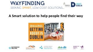
- 1. A Smart solution to help people find their way
- 2. Problem Statement: • Improve wayfinding in a manner that can transition seamlessly between indoor and outdoor environments and allow users to arrive to their destination or appointment on time. • Enhance the experience of visitors • Reduce challenges for the users
- 3. Main Street of Swords St. Anne’s Park and hinterlands Grangegorman Campus
- 4. Location specific problem statements Main Street of Swords, including County Hall, Swords Castle, and the Swords Cultural Quarter • Enable people of all abilities to navigate Main Street, Swords • Enhance the experience of visitors to Swords St. Anne’s Park and hinterlands • To enable people of all abilities to navigate St Anne’s Park • Highlight points of interest e.g. rose garden, playground, café, etc. Grangegorman Campus • Allow campus users of all abilities to identify and navigate to their destination/appointment/lecture on time or in a timely manner • Improve the campus’s openness and make it more inviting for visitors and the local community • Reduce the challenges of users in experiencing/navigating the environment
- 5. Solution Sought • Promote and facilitate efficient and effective stress free wayfinding • Holistic navigation system that will enable users of all ability to find their way seamlessly around urban and park environments (indoor/outdoor) to specific locations/rooms through a Universal Design Information and Communications Technology (ICT) system. • Encourage users/visitors to explore the environment and notify them of items of interest or events in the area. • No cost to the end users, low cost to operate and maintain by the stakeholder • Futureproof, resilient, secure, scalable and sustainable system. • An engaging, fun, easy to use for all abilities, multi-lingual and multi-modal interface. • Portable and mobile technology. • Adapt to the location and environment of the user and be capable of transitioning between indoor and outdoor spaces. • Allow the user to navigate/experience the environment virtually e.g. Virtual Reality or Augmented Reality • Be cognisant of new legislation and regulatory requirements.
- 6. Key Technologies and Data Sources • Any non-sensitive data from the stakeholder information management system • Dublin Dashboard www.dublinked.ie • Smart Mobile phones • Any location specific hardware specified by the team can be procured and install by the Stakeholder on their behalf • Building information models (BIM) 3D Digital information Model in IFC and RVT format (Grangegorman campus) • Help Points (Grangegorman campus) • Integrate with existing: o Stakeholder information applications e.g.’what’s on’/timetabling/appointments, etc. o Transport applications e.g. TFI app, google maps, Dublin bike, etc o Physical signage on site e.g. signposts, floor and room labels, etc. • Fingal County Council has developed an audio heritage trail for Swords: o Swords Heritage Trail audio guide is organised in a circular trail around Swords • Dublin City Council has developed two solutions to assist with way-finding: o “Walk Dublin” Wayfinding app, developed to compliment the normal wayfinding system. The Council worked with the National Council for the Blind to develop the audio element. o Dubline, a trail guiding people from College Green to Kilmainham through stories