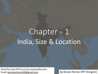
Chapter - 1, India: Size & Location, Geography, Social Science, Class 9
•
5 gefällt mir•13,662 views

I have expertise in making educational and other PPTs. Email me for more PPTs at a very reasonable price that perfectly fits in your budget. Email: parmarshivam105@gmail.com Chapter - 1, India: Size & Location, Geography, Social Science, Class 9 INTRODUCTION IMPORTANT TERMS SIZE (FACTS AND FIGURES OF INDIA) STANDARD MERIDIAN INDIA AND THE WORLD INDIA’S NEIGHBOURS Every topic of this chapter is well written concisely and visuals will help you in understanding and imagining the practicality of all the topics. By Shivam Parmar (PPT Designer)

Empfohlen
Weitere ähnliche Inhalte
Was ist angesagt?
Was ist angesagt? (20)
Ähnlich wie Chapter - 1, India: Size & Location, Geography, Social Science, Class 9
Ähnlich wie Chapter - 1, India: Size & Location, Geography, Social Science, Class 9 (20)
Mehr von Shivam Parmar
Mehr von Shivam Parmar (20)
Kürzlich hochgeladen
Kürzlich hochgeladen (20)
Chapter - 1, India: Size & Location, Geography, Social Science, Class 9
- 1. Chapter - 1 India, Size & Location Email for more PPTs at a very reasonable price. Email: parmarshivam105@gmail.com By Shivam Parmar (PPT Designer)
- 2. INTRODUCTION • India is one of the largest countries of the world. It has contributed significantly to the making of world history since long ago. • It has got various names like Aryavarta, Jamboodweep etc.
- 3. • It is the land of high mountains, mighty rivers, extensive plains and forests wide plateaus, beautiful hills, lovely water- falls and refreshing shores. So it is natural to find diversity in relief, climate, vegetation, animals and in ways of living of people in different regions.
- 4. LOCATION India is a vast country. Lying entirely in the Northern hemisphere the main land extends between latitudes 8°4´N and 37°6´N and longitudes 68°7´E and 97°25´E.
- 5. • The Tropic of Cancer (23° 30´N) divides the country into almost two equal parts. • To the southeast and southwest of the mainland, lie the Andaman and Nicobar islands and the Lakshadweep islands in Bay of Bengal and Arabian Sea respectively.
- 6. IMPORTANT TERMS 1. Subcontinent : • A part of the continent separated from the rest of the continent by natural features such as mountains and rivers. • It has its own specific climatic features and a distinct cultural identity.
- 7. 2. Longitude : It is the angular distance of a point on a earth's surface east or west of a central meridian. 3. Latitude: It is the angular distance of a point on the earth's surface along the meridian N or S of the equator.
- 8. 4. Indian Union: The federation of India comprising 28 states and 8 union territories. 5. Indian mainland: It refers to the contiguous stretch of landmass from Jammu and Kashmir to Kanyakumari and Gujarat to Arunachal Pradesh.
- 9. 6. Local Time: Time as reckoned in a particular region. Standard Time: When the local time is taken as the time for the whole country, it is called standard time of the country. 7. Indira Point : Southernmost point of the Indian Union. 8. Lanlocked : A term often used for states and countries completely surrounded by land with no coastline.
- 10. SIZE (FACTS AND FIGURES OF INDIA) 1. The land mass of India has an area of 3.28 million square km (3287263 km2). 2. India’s total area accounts for about 2.4 per cent of the total geographical area of the world. 3. India is the seventh largest country of the world. 4. India has a land boundary of about 15,200 km.
- 11. 5. The total length of the coast line of the main land including Andaman & Nicobar and Lakshadweep is 7,516.6 km. 6. India is bounded by the young fold mountains in the northwest, north and north east. 7. South of about 22° north latitude, it begins to taper, and extends towards the Indian Ocean, dividing it into two seas, the Arabian Sea on the west and the Bay of Bengal on its east.
- 12. STANDARD MERIDIAN • From Gujarat to Arunachal Pradesh there is a time lag of two hours. Hence, time along the Standard Meridian of India (82°30´E) passing through Mirzapur (in Uttar Pradesh) is taken as the standard time for the whole country. • The latitudinal extent influences the duration of the day and night, as one moves from South to North.
- 13. INDIA AND THE WORLD 1. The Indian landmass has a central location between the East and the West Asia. 2. India is a southward extension of the Asian Continent. The Trans Indian Ocean routes which connect the countries of Europe in the West and the countries of East Asia provide a strategic central location to India.
- 14. 3. Note that the Deccan Peninsula protrudes into the Indian Ocean, thus helping India to establish close contact with West-Asia, Africa and Europe from the western coast and with Southeast and East-Asia from the eastern coast. 4. No other country has a long coastline on the Indian Ocean as India has and indeed, it is India’s eminent position in the Indian Ocean which justifies the naming of an Ocean after it.
- 15. 5. Since the opening of the Suez Canal in 1869, distance between India and Europe has been reduced by 7000 km. 6. India is connected with Europe, North America and South America to both the roots. The Cape of Good Hope and Suez Canal.
- 16. • India’s contacts with the World have continued through the ages but the relationships through the land routes are much older than her maritime contacts. • The various passes (Khyber, Malkand, Gomal etc) across the mountains in the north have provided passages to the ancient travellers, while the oceans restricted such interaction for a long time.
- 17. 1. These routes have contributed in the exchange of ideas and commodities since ancient times. • The ideas of the Upanishads and the Ramayana, the stories of Panchtantra, the Indian numerals and the decimal system thus could reach many parts of the world.
- 18. 2. The spices, muslin and other merchandise were taken from India to different countries. 3. On the other hand, the influence of Greek sculpture, and the architectural styles of dome and minarets from West-Asia can be seen in different parts of our country.
- 19. INDIA’S NEIGHBOURS 1. India occupies an important strategic position in South-Asia. India has 28 states and 7 Union Territories. 2. India shares its land boundaries with Pakistan and Afghanistan in the northwest. 3. China (Tibet), Nepal and Bhutan in the north. 4. Myanmar and Bangladesh in the east. Our southern neighbours across the sea consist of the two island countries, namely Sri-Lanka and Maldives.
- 20. Sri Lanka is separated from India by a narrow channel Palk Strait.
- 21. I have expertise in making educational and other PPTs. Email me for more PPTs at a very reasonable price that perfectly fits in your budget. Email: parmarshivam105@gmail.com THANK YOU
- 22. • This PPT is for educational purposes only. If you find any infringement of your copyrighted content, email me directly and I will remove it. • If anyone is found using this PPT for commercial purposes, he/she will be solely responsible for the consequences.