Glacial landforms (geomorphology)
•Als PPTX, PDF herunterladen•
19 gefällt mir•11,569 views

GLACIAL FEATURES AND FORMATION OF LANDFORM

Empfohlen
Weitere ähnliche Inhalte
Was ist angesagt?
Was ist angesagt? (20)
Ähnlich wie Glacial landforms (geomorphology)
Ähnlich wie Glacial landforms (geomorphology) (20)
Mehr von Shivam Jain
Mehr von Shivam Jain (20)
Kürzlich hochgeladen
Kürzlich hochgeladen (20)
Glacial landforms (geomorphology)
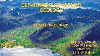
- 1. DEPARTMENT OF APPLIED GEOLOGY ASHUTOSH GOUTAM M.TECH 1ST SEMESTER Y18051032 SESSION 2018-19 GUIDED BY :- PROF. P.K. KATHAL “GLACIAL FEATURES”
- 2. Ice: The Water Mineral < Ice is solid water (H2O). < Forms when water cools below the freezing point. < Natural ice is a mineral; it grows in hexagonal forms.
- 3. Formation of Glacial Ice < Snow is transformed into ice. = Delicate flakes accumulate. = Snow is buried by later falls. = Compression expels air. = Burial pressure causes melting and recrystallization. = Snow turns into granular firn. = Over time, firn melds into interlocking crystals of ice.
- 4. Forming a Glacier < Glacier-sustaining elevation is controlled by latitude. = In polar regions, glaciers form at sea level. = In equatorial regions, glaciers form above 5 km elevation. < This elevation is marked by the “snow line.”
- 5. Mountain Glaciers < Flow from high to low elevation in mountain settings. < Include a variety of types. = Ice caps cover tall mountain peaks. = Cirque glaciers fill mountain top bowls.
- 6. Mountain Glaciers < Include a variety of types. = Valley glaciers flow like rivers down valleys. = E.g. Gangotri Glacier(25km), Siachen Glacier(72km)
- 7. Mountain Glaciers < Include a variety of types. = Piedmont glaciers spread out at the end of a valley.
- 8. Movement of Glacial Ice < Two types of mechanical behavior. = Brittle – Uppermost 60 m. Tension initiates cracking of the ice. Crevasses may open and close with movement. = Plastic – Lower than 60 m. Ductile flow occurs in deeper ice. Ice flow heals cracks.
- 9. Movement of Glacial Ice < Ice flows downhill via gravity.
- 10. Movement of Glacial Ice < Ice flows downhill via gravity. = Ice flows away from the thickest part of continental glaciers. Analogous to honey flowing away from thickest zone.
- 11. Glacial Advance and Retreat < Zone of accumulation – Area of net snow addition. = Colder temperatures prevent melting. = Snow remains across the summer months. < Zone of ablation – Area of net ice loss. < Zones abut at the equilibrium line.
- 12. Glacial Advance and Retreat < Toe position. = If accumulation > ablation, the glacial toe advances.
- 13. Glacial Advance and Retreat < Toe position. = If accumulation < ablation, the toe will retreat upslope.
- 14. Glacial Advance and Retreat < Toe position. = accIfumulation = ablation the toe stays in the same place.
- 15. Glacial Effects < Glaciers are important forces of landscape change. = Erosion. = Transport. = Deposition.
- 16. Glacial Erosion < Glaciers erode substrates in several ways. = Plucking – Ice breaks off and removes bedrock fragments. Ice melts by pressure against the up-ice side of an obstruction. Entering cracks in bedrock, this water re-freezes to the ice. Glacial movement plucks away bedrock chunks.
- 17. Glacial Erosion < Glacial abrasion – A “sandpaper” effect on substrate. = Substrate is pulverized to fine “rock flour.” = Sand in moving ice abrades and polishes bedrock.
- 18. Glacial Erosion < Erosional features of glaciated valleys. = Cirques. = Tarns. = Aretes. = Horns. = U-shaped valleys. = Hanging valleys. = Roche moutonnée. = Fjords.
- 19. Glacial Erosion < Cirque – Bowl-shaped basin high on a mountain. = Forms at the uppermost portion of a glacial valley. = Freeze-thaw mass wasting into the cirque headwall. = After ice melts, the cirque is often filled with a tarn lake. Cirque Glaciers
- 20. Glacial Erosion < Arête – A “knife-edge” ridge. = Formed by 2 cirques that have eroded toward one another. Arête Horn
- 21. Glacial Erosion < Horn – A pointed mountain peak. = Formed by 3 or more cirques that coalesce. = e.g. karakoram range, Nanda devi, Mt. Kailash
- 22. Glacial Erosion < U-shaped valleys. = Glacial erosion creates a distinctive trough. = Unlike V-shaped fluvial valleys.
- 23. Glacial Erosion < Hanging valleys. = The intersection of a tributary glacier with a trunk glacier. = Trunk glacier incises deeper into bedrock. = Troughs have different elevations. = A waterfall results.
- 24. Glacial Erosion < Fjords. = U-shaped glacial troughs flooded by the sea.
- 25. Glacial Sediment Transport < Glaciers carry sediment of all sizes – lots of it! = Some sediment falls onto the ice from adjacent cliffs. = Some sediment is entrained from erosion of the substrate. < When glacial ice melts, this material is dropped.
- 26. Glacial Sediment Transport < Moraines – Unsorted debris dumped by a glacier. = Lateral – Forms along the flank of a valley glacier. = Medial – Mid-ice moraine from merging lateral moraines.
- 27. Glacial Sediment Transport < Glaciers act as large-scale conveyor belts. = They pick up, transport, and deposit sediment. = Sediment transport is always in one direction (downhill). = Debris at the toe of a glacier is called an end moraine.
- 28. Glacial Deposition < Many types of sediment derive from glaciation. < Called glacial drift, these include... = Glacial till. = Erratics. = Glacial marine sediments. = Glacial outwash. = Glacial lake-bed sediment. = Loess. < Stratified drift is water- sorted; unstratified drift isn’t.
- 29. Glacial Deposition < Glacial till – Sediment dropped by glacial ice. = Consists of all grain sizes. = Also called “boulder clay.” = Unmodified by water, hence: Unsorted. Unstratified. = Accumulates… Beneath glacial ice. At the toe of a glacier. Along glacial flanks.
- 30. Glacial Deposition < Erratics – Boulders dropped by glacial ice. = These rocks are different than the underlying bedrock. = Often, they have been carried long distances in ice.
- 31. Glacial Deposition < Glacial marine – Sediments from an oceanic glacier. = Calving icebergs raft sediments away from the ice. = Melting bergs drop stones into bottom muds. = Drop stones… Differ from ambient sediment. Indicate glaciation.
- 32. Glacial Deposition < Glacial outwash – Sediment transported in meltwater. = Muds removed. = Size graded and stratified. = Abraded and rounded. < Outwash dominated by sand and gravel.
- 33. Glacial Deposition < Glacial lake-bed sediment. = Lakes are abundant in glaciated landscapes. = Fine rock flour settles out of suspension in deep lakes. = Muds display seasonal varve couplets. Finest silt and clay from frozen winter months. Coarser silt and sand from summer months.
- 34. Glacial Deposition < Loess – Wind-transported silt. Pronounced “luss.” = Glaciers produce abundant amounts of fine sediment. = Strong winds off ice blows the rock flour away. = This sediment settles out near glaciated areas as loess deposits.
- 35. Depositional Landforms < Glacial sediments create distinctive landforms. = End moraines and terminal moraines. = Recessional moraines. = Drumlins. = Ground moraine. = Kettle lakes. = Eskers.
- 36. Depositional Landforms < End moraines form at the stable toe of a glacier. < Terminal moraines form at the farthest edge of flow. < Recessional moraines form as retreating ice stalls.
- 37. Depositional Landforms < Drumlins – Long aligned hills of molded lodgment till. = Asymmetric form – Steep up-ice; tapered down-ice. = Common as swarms aligned parallel to ice flow direction.
- 38. Depositional Landforms < Kettles = Small depressions in the landscape, often filled with water post glaciation = Large blocks of ice are left by a retreating glacier = Outwash sediments deposited around the blocks, possible burial = Ice block melts, only a void or kettle remains. = Subsidence and melting can deepen the kettle. = Kettles lakes are sourced by rainfall or snowmelt.
- 39. Depositional Landforms < Eskers are long, sinuous ridges of sand and gravel. < They form as meltwater channels within or below ice. < Channel sediment is released when the ice melts.
- 40. Bibliography • Thornbury, W. D(1985),Principles of Geomorphology, pp. 345-358 • Huggett, R. J.(2007),Fundamentals of Geomorphology, pp. 246-274 • Savindra Singh (2014),Physical Geography, pp. 312-323