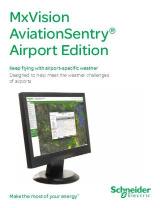
MxVision AviationSentry® Airport Edition: Designed to help meet the weather challenges

Designed specifically for airport ground operations, MxVision AviationSentry Online Airport Edition has everything you need to help mitigate the impact of weather, maintain safety, cut operational costs, and maximize your resources. Meteorological consultations Got a question? You can access our team of experienced meteorologists online from your computer or on your mobile device anywhere you go. Ask a question and receive an answer. Plus, you can see what’s on the mind of your industry peers by viewing other questions and answers. Our meteorologists also post twice-daily forecast briefings tailored to your region of the country. Advanced lightning protection Lightning Manager monitors strikes as they approach, based on custom advisory and warning zones — up to 60 miles out is available as an additional purchase — represented by colored rings around your locations. When strikes occur within these zones, audio and visual alerts* are triggered. No need to constantly monitor for lightning — this tool does it for you. An all-clear notification can also be set up to let you know when the danger has passed. In addition, a countdown feature is included to show you when you can expect to receive an all-clear notification. To help you better protect ground crews and ensure safer refueling and tarmac operations, our future lightning tool shows the threat level for lightning at your airport for the next hour, using a color-coded display.

Empfohlen
Weitere ähnliche Inhalte
Andere mochten auch
Andere mochten auch (17)
Mehr von Schneider Electric
Mehr von Schneider Electric (20)
Kürzlich hochgeladen
Kürzlich hochgeladen (20)
MxVision AviationSentry® Airport Edition: Designed to help meet the weather challenges
- 1. MxVision AviationSentry® Airport Edition Keep flying with airport-specific weather Designed to help meet the weather challenges of airports Make the most of your energySM
- 2. MxVision AviationSentry Airport Edition Designed specifically for airport ground operations, MxVision AviationSentry Online Airport Edition has everything you need to help mitigate the impact of weather, maintain safety, cut operational costs, and maximize your resources. Meteorological consultations Got a question? You can access our team of experienced meteorologists online from your computer or on your mobile device anywhere you go. Ask a question and receive an answer. Plus, you can see what’s on the mind of your industry peers by viewing other questions and answers. Our meteorologists also post twice-daily forecast briefings tailored to your region of the country. Advanced lightning protection Lightning Manager monitors strikes as they approach, based on custom advisory and warning zones — up to 60 miles out is available as an additional purchase — represented by colored rings around your locations. When strikes occur within these zones, audio and visual alerts* are triggered. No need to constantly monitor for lightning — this tool does it for you. An all-clear notification can also be set up to let you know when the danger has passed. In addition, a countdown feature is included to show you when you can expect to receive an all-clear notification. To help you better protect ground crews and ensure safer refueling and tarmac operations, our future lightning tool shows the threat level for lightning at your airport for the next hour, using a color-coded display. Very accurate runway forecasts Effective anti-icing programs require current and forecasted runway temperatures, and we deliver with our optional RoadCast® . It provides reliable, hourly frost and ice forecasts and alerts for your runway. With it, you’ll know the percentage chance of frost forming so you can adjust your chemical application rates. Current observations from your Runway Weather Information Systems (RWIS) can also be incorporated. View current and forecasted runway pavement temperatures side-by-side with radar and local forecasts for smarter, more effective runway maintenance decisions. For airports without RWIS, RoadCast can still provide reliable hourly frost and ice pavement forecasts by incorporating observed and forecasted local weather with your runway pavement profiles. We can also now help monitor the health of your RWIS system and dispatch crews with expanded quality control that incorporates sensor error codes. Business-class mobile weather apps Apple® iPhone® and all Android™ phone users can now get dynamic, location-based weather and lightning alerts for their current location. Our technology instantly delivers roaming weather information and customized notifications based on your 02 | MxVision AviationSentry Airport Edition For the sixth consecutive year, our temperature and precipitation forecasts outperformed others in the industry in an independent study by ForecastWatch.com
- 3. phone’s current GPS location. Pre-programmed locations are also supported, while layered, interactive maps enhance ease of use. MxVision WeatherSentry Mobile® is still available for other cell phones to provide on-the-go weather information. NOTAM access Airport Brief® provides access to NOTAM information for your airport or surrounding airports. You can also retrieve METARs, TAFs, and other information in decoded format. Anticipate changing conditions With MxVision AviationSentry Online Airport Edition you’ll know when weather will impact your operations. Know when to pretreat for freezing rain and when high winds will cause severe blowing and drifting. The system supplies accurate, detailed local forecasts for thousands of locations based on advanced model data technology and managed by experienced meteorologists 24 hours a day. Anticipate conditions up to 15 days out, with hourly outlooks for the first three days. Forecasts are updated every hour so you always have the best, most current look at what will happen. Forecasted wind speed, chance of precipitation, and more can be viewed as graphs. Set thresholds to automatically highlight items of concern. In 2012, for the sixth consecutive year, our temperature and precipitation forecasts outperformed others in the industry in an independent study by ForecastWatch.com. Customize your weather views Better assess threats with a full-screen interactive mode that provides unmatched visualization. With our layered viewing, you can select and display custom combinations of the weather, aviation, and map data most important to your operations. View radar, satellite, winds, observed weather, storm corridors, lightning, and more from national down to metro views. See real-time NWS watches, warnings, and advisories including Areas of Maximum Impact. MxVision AviationSentry Airport Edition | 03 We’ve also added an observed visibility layer that displays information from your sensors. Real-time, map-based local storm reports provide better visibility into high-impact weather in your area, via first-hand accounts. An exclusive, optional slide show can keep you and your team on top of current conditions while performing other tasks with full-screen, animated weather graphics on a centrally-located monitor. Active weather alerting* With the system’s Alert Manager® , you can receive critical weather information wherever you are. Custom alarms for temperature, wind, snow, or NWS watches and warnings can be set and displayed right on your desktop. With our newest customizable alerts, you can be notified of the percent chance of frost at your chosen location to help you better gauge the threat. In addition to wind speed, you can now also receive alerts for wind direction, helping you better determine the impact on roadways and local land features. Intelligent tools PrecipTimer® and Lightning Manager® monitor your location and alert you when threatening weather is imminent. You’ll know precisely what time dangerous storms will arrive and how long they’ll last. Additionally, you’ll know when rain, snow, or ice will start at your location and when it will end. Weather winter operations Receive accurate forecasts, maps, and data on snowfall, ice, wind chill, hazards, and temperatures critical to winter weather-related decisions. SnowPath® displays accumulation three days in advance using high-resolution model data enhanced by professional meteorologists. IcePath® provides the same for forecasted ice storms. In addition, PrecipPath® gives you a combined animation of all types of precipitation — snow, ice, and rain.
- 4. Schneider Electric USA, Inc. 9110 West Dodge Road Omaha NE 68114 Phone: +1-800-610-0777 Fax: +1-402-255-8125 http://www.schneider-electric.com/us September 2013 ©2013SchneiderElectric.Allrightsreserved. *Products mentioned may be covered by one or more of the following patents: U.S. Patent No. 6,753,784, or 7,602,285.