
Empfohlen
Weitere ähnliche Inhalte
Ähnlich wie ssc group activity.pptx
Ähnlich wie ssc group activity.pptx (20)
Kürzlich hochgeladen
Kürzlich hochgeladen (20)
ssc group activity.pptx
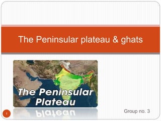
- 1. Group no. 3 The Peninsular plateau & ghats 1
- 2. Topography of peninsular plateau The peninsular plateau is a table land composed of old crystalline rocks. It was formed due to the breaking and drifting of the gondwana land. It was formed due to the breaking and drifting of the gondwana land and thus, making it a part of the oldest landmass. The plateau has broad and shallow valleys and rounded hills. This plateau consists of two broad divisions namely, the central highlands and the deccan plateau. 2
- 3. The Central Highlands 3 The part of the Peninsular plateau lying to the north of the Narmada river covering a major area of the Malwa plateau is known as the Central Highlands. The Vindhyan range is bounded by the Central Highlands on the south and the Aravalis on the northwest. The further westward extension gradually merges with the sandy and rocky desert of Rajasthan. The flow of the rivers draining this region, namely the Chambal, the Sind, the Betwa and Ken is from southwest to northeast, thus indicating the slope. The Central Highlands are wider in the west but narrower in the eastThe eastward extensions of this plateau are locally known as the Bundelkhand and Baghelkhand. The Chotanagpur plateau marks the further eastward extension, drained by the Damodar river.
- 4. The Deccan Plateau 4 The Deccan Plateau is a triangular landmass that lies to the south of the river Narmada. The Satpura range flanks its broad base in the north while the Mahadev, the Kaimur hills and the Maikal range form its eastern extensions. Locate these hills and ranges in the physical map of India. The Deccan Plateau is higher in the west and slopes gently eastwards. An extension of the Plateau is also visible in the northeast– locally known as the Meghalaya, Karbi-Anglong Plateau and North Cachar Hills. It is separated by a fault from the Chotanagpur Plateau. Three Prominent hill ranges from the west to east are the Garo, the Khasi and
- 5. The Western Ghats 5 They mark western edges of deccan platue. Western ghats lie parallel to the western coast. They are continuos and can be crossed through passes only. Their average elevation is 900-1600 metres. The western ghats cause orographic rain by facing the by facing the rain bearing moist winds to rise along the western slopes of the ghats. The western ghats are known by different local names. The height of western ghats progressively increases from north to south. Its highest peaks are
- 6. The Eastern Ghats 6 Eastern Ghats mark the eastern edges of Deccan Plateau. Their average elevation is 600 metres. The Eastern Ghats stretch from the Mahanadi Valley to the Nilgiris in south. The Eastern Ghats are discontinuous and irregular and dissected by rivers draining into the Bay of Bengal. Mahendragiri (1,501 m) is the highest peak of Eastern Ghats. Shevroy Hills and the Javadi Hills are located to the southeast of the Eastern Ghats.
- 7. The Deccan Trap 7 One of the distinct features of the peninsular plateau is the black soil area known as Decean Trap. This is of volcanic origin hence the rocks are igneous. Actually these rocks have denuded over time and are responsible for the formation of black soil. The Aravali Hills lie on the western and northwestern margins of the peninsular plateau. These are highly eroded hills and are found as broken hills. They extend from Gujarat to Delhi in a southwest-
- 8. Presentation by group no. 3 8 Group members- •Samridhi gupta •Krish panwar •Yashika singh •Daksh raj sigh •Manasvi dhingra •Samarth pandey