Reba - Field Scale Edge of Field Monitoring
•
1 gefällt mir•348 views

This document summarizes research on monitoring surface water quality in the lower Mississippi River basin. The research aims to quantify the impacts of agricultural conservation practices on nutrient and sediment runoff. Edge-of-field monitoring has found no significant differences between fields with cover crops and conventional fields. In-stream water quality is also monitored continuously and through grab samples to validate models of nutrient and sediment transport. The long-term goal is to inform strategies to reduce excess nutrients entering waterways from agricultural lands in the region.

Empfohlen
Empfohlen
Weitere ähnliche Inhalte
Was ist angesagt?
Was ist angesagt? (11)
Andere mochten auch
Andere mochten auch (7)
Ähnlich wie Reba - Field Scale Edge of Field Monitoring
Ähnlich wie Reba - Field Scale Edge of Field Monitoring (20)
Mehr von Soil and Water Conservation Society
Mehr von Soil and Water Conservation Society (20)
Kürzlich hochgeladen
Kürzlich hochgeladen (20)
Reba - Field Scale Edge of Field Monitoring
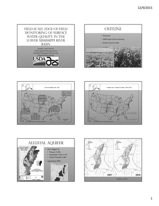
- 1. 12/9/2015 1 Field scale, edge-of-field monitoring of surface water quality in the lower mississippi river basin Michele L. Reba, PhD, PE USDA-Agricultural Research Service Delta Water Management Research Unit michele.reba@ars.usda.gov Outline • Motivation • MRBI Edge-of-field monitoring • Related research studies 4.804 M ac 8.297 M ac 7.862 M ac 4.489 M ac 2012 Census 4.461 M ac 5.010 M ac 8.559 M ac 8.016 M ac 2007 Census Arkansas Texas California Nebraska Alluvial Aquifer • 2012 (Mgal/d) • Pumped: 8,036 • Sustainable Yield: 3,374 • Unmet Demand: 4,462 • Agriculture 98% Source: Arkansas Natural Resources Commission 2015 Clark et al. (2011)
- 2. 12/9/2015 2 Water Quality • Excess Nutrients • Nitrogen • Phosphorus • Hypoxia • < 2 ppm DO • Sparrow model • (Rebich et al., 2011) • 32% N • 50% P Figure source: www.usepa.gov Motivation • Irrigation is key to reducing production variability • Irrigate smarter • Reduce inputs • Improve profit • Reduce excess nutrients • Challenge • Agro-economic • Environmental Mississippi River Basin Healthy watersheds Initiative (MRBI) • 13 states • Facilitate implementation of conservation practices • Avoid, control & trap nutrient runoff • Maintain productivity • Programs • Cooperative Conservation Partnership Initiative (CCPI) • Wetlands Reserve Enhancement Program (WREP) • Arkansas • Conservation Practices Conservation Practices • Monitoring • Nutrient management • Water management • Irrigation management • Cover crops • Conservation tillage • Grassed ways • Riparian buffer • Surface water storage • Shallow water development for wildlife Collaborators Statewide Network
- 3. 12/9/2015 3 Study Sites Edge-of-Field Data Collection • Velocity • Depth • Turbidity • Water sample • Sediment • Nutrients • Event trigger • Remote upload Nutrient Analysis • Sediment • TSS (APHA 2005 method 2540 D) • Suspended sediment cnc. (ASTM Method D3977-97) • Nitrate • APHA (2005) method 4500-NO3-E • Cd reduction & analyzed as NO2 colorimetric reaction • MDL: 0.02 mg N/L, Range: 0.2 – 5 mg N/L • Orthophosphate • APHA (2005) method 4500-P E • Ascorbic acid method • MDL: 0.01 mg/L, Range: 0.05 – 1.0 mg P/L Little River Ditches MRBI Caraway, AR • Cotton • One pair • Two 75-acre • Sandy Loam Cover crop Case study • 2011/2012 and 2012/2013 fallow season • P & K Fall application (Oct) • Plant cover crop wheat (Nov) • Terminate cover crop • (3-4 weeks before planting, ~early April) • Plant cotton (early May) • Nitrogen: liquid knife 120 units N per acre (early June) • Harvest (October) Photo Credit: Dr. Tina Gray Teague 0.0 0.5 1.0 1.5 2.0 2.5 3.0 3.5 4.0 4.5 5.0 11/17/11 11/22/11 12/5/11 11/12/12 1/30/13 2/19/13 2/22/13 2/26/13 DissolvedPO4(mg/L) Event Date Conservation Conventional Dissolved PO4
- 4. 12/9/2015 4 0 10 20 30 40 50 60 70 11/17/11 11/22/11 12/5/11 11/12/12 1/30/13 2/19/13 2/22/13 2/26/13 SuspendedSedimentConcentation(g/L) Event Date Conservation Conventional Suspended Sediment CNC 0.0 0.2 0.4 0.6 0.8 1.0 1.2 1.4 1.6 1.8 2.0 P04 Dis Total P N03 Dis N02 Dis Total N mg/L Conservation Conventional 0.0 5.0 10.0 15.0 20.0 25.0 30.0 P04 Dis Total P N03 Dis N02 Dis Total N Sediment Conservation Conventional 0.00 0.50 1.00 1.50 2.00 2.50 3.00 3.50 4.00 4.50 Conservation P04 Conventional P04 Conservation N03 Conventional N03 Conservation N02 Conventional N02 mg/L Nutrients Caraway 2012 & 2013 Winter 0 10 20 30 40 50 60 70 Conservation Sediment Conventional Sediment g/L Sediment Caraway 2012 & 2013 Winter • No statistical difference in any comparisons by t-test and Wilcoxon Rank-Sum test • Reduction in variability at conservation field Cotton Study Sites 2014 • Sandy Loam • Variable • 38 acre field split • Year 1 of 2 years of baseline • 2012/2013 winter cover crops • Practices • Oat cover crop (Nov) • Oat terminated (April) • Tillage-do all • Liquid N 35 lb/ac, Broadcast N 110 lb/ac, KO2 41 lb/ac (June 19) • Harvest (Oct 22) • Terra Till • Winter wheat cover crop (Nov) • Sharkey Clay • 3 field pair (40-acre) • Year 1 of 2 years of baseline • Rice/soybean rotation • Practices • Pre-plant N 30 lb/ac • Tandom disk till • Pre-flood N 86 lb/ac • Harvest 190 lb/ac (XL 753) • Burn stubble Rice Study Sites 2014 Nutrients 2014 0.000 0.100 0.200 0.300 0.400 0.500 0.600 0.700 DISSOLVED PO4 (lb/ac) TOTAL P (lb/ac) DISSOLVED NO3 (lb/ac) DISSOLVED NO2 (lb/ac) TOTAL N (lb/ac) Load(lb/ac) COTTON-CONTROL COTTON-TREATMENT RICE-CONTROL RICE-TREATMENT 1 RICE-TREATMENT 2 • No statistical difference in any comparisons for paired events by t-test and Wilcoxon Rank-Sum test • Sum of total N: 2 & 4.5% of applied N in rice (25 and 29 samples)
- 5. 12/9/2015 5 Ghg reduction irrigation mngmt Site • 4 new MRBI sites • Rice/soybean • NE Arkansas Alternate Wetting & Drying • GHG benefit • Reduce water use • Sustain yield & milling quality CEAP Watershed In-stream Water Quality Study • Monitor nutrients and sediments year round in-stream (drainage ditches). • Validate model simulations of nutrients and sediment transport in irrigated agricultural land in the Little River Ditches (080202040804) and Lower St. Francis (080202031301) basin using both EOF and in-stream monitoring (ISM) data. • Develop an improved understanding of nutrient and sediment transport, transformations and the hydrology in an irrigated landscape. In-stream Water Quality Study Little River Drainage Basin HUC 080202040804 Approximately 10,000 acres (4047 Ha) Ditch no. 14-Buffalo Creek Ditch Little River Ditches Basin W1 W9W5 W7 W3 Inlet ditch In-stream stations EOF stations In-stream Water Quality Study Lower St. Francis Basin HUC 080202031301 Approximately 5,000 acres (2023 Ha) Ditch no. 1-St. Francis River
- 6. 12/9/2015 6 M2 M8 M10 M6 Inlet ditch In-stream stations EOF stations M4 Lower St. Francis Basin Instrumentation Per watershed • 3 Isco autosamplers • 3 area-velocity sensors and modules • 2 trolls (water depth sensors) • 3 to 5 DS5X sondes • 2 OBS 500 sensors × 2 Edge-of field (5) Nutrients Grab,event Lab NO3, NO2, TN, TP, SP Sediments Grab, event Lab SSC, TDS, TSS Continuous OBS300 Turbidity Flow Continuous ISCO Rainfall, H, V, Q In-stream (10) Nutrients Grab, weekly Lab NO3, NO2, TN, TP, SP Continuous Sonde pH, NO3, NH4, DO, T Sediments Grab, weekly Lab SSC, TDS, TSS Continuous Sonde TDS, Turbidity Flow Continuous Isco H, V, Q Modeling APEX, AnnAGNPS Autosampler Area-velocity sensor Sonde deployed in ditch Laboratory calibration of sonde monitoring Select Data: Turbidity and nitrate LowerSt.FrancisBasin 0 10 20 30 4/6 5/6 6/5 7/5 8/4 9/3 10/3 Nitrate,mgN /l Date Downstrea m Upstream Select Data: Nitrate (grab) and nitrate (15 min) Grab samples Sonde measurement LowerSt.FrancisBasin 0 1 2 3 4 4/6 5/6 6/5 7/5 8/4 9/3 10/3 Nitrate,mgN /L Date Downstream Midstream Upstream Ceap effort • Nearly 1 full year of data • Modeling • AnnAGNPS • APEX • Sampling strategies • Grab • Passive • Continuous • Biological analysis
- 7. 12/9/2015 7 summary • Edge-of-field measurements • Cover crops • No statistical difference • Baseline Year 1 • No statistical difference • Off season spikes • Additional analysis • Long-term view • State-wide network • Future effort • Inform in-stream impacts • Co-benefits of management Thank you • Collaborators/Contributors • Nadine Straitt (funded through CIG-Daniels) • Dr. Niroj Aryal (funded through CEAP watersheds) • Delta Water Management Research Unit • Arkansas State University • Dr. Tina Gray Teague • Ecotoxicology Res. Lab • Conservation Districts • Producers Michele L. Reba, PhD, PE Research Hydrologist USDA-ARS Delta Water Management Research Unit michele.reba@ars.usda.gov