July 29-330-Michael Margo
•Als PPTX, PDF herunterladen•
0 gefällt mir•33 views

2019 SWCS International Annual Conference July 28-31, 2019 Pittsburgh, Pennsylvania

Empfohlen
Weitere ähnliche Inhalte
Was ist angesagt?
Was ist angesagt? (20)
Ähnlich wie July 29-330-Michael Margo
Ähnlich wie July 29-330-Michael Margo (20)
Mehr von Soil and Water Conservation Society
Mehr von Soil and Water Conservation Society (20)
Kürzlich hochgeladen
Kürzlich hochgeladen (20)
July 29-330-Michael Margo
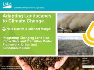
- 1. Adapting Landscapes to Climate Change Nels Barrett & Michael Margo* Integrating Changing Land Use into a State and Transition Model Framework: Urban and Subaqueous Sites USDA is an equal opportunity provider, employer, and lender.
- 2. Introduction • Expansion of ecological site concepts/STMs into new settings (urban landscapes and subaqueous environments). • Urban & subaqueous ecological sites are highly susceptible to climate change (impacts of weather extremes) • Urban ES are idiosyncratic • Subaqueous ES are atypical
- 3. Exploring Ecological Sites in an Urban Setting
- 4. Urban Parent Material Catena and Ecological Sites - NYC
- 5. Distributions of Major Ecological Sites in NYC (based on dominant soil component) 1:110,000
- 7. Vegetation Analysis Results Previously determined by NYC Natural Areas Conservancy: • 12 vegetation types were previous recognized as “native” veg- types and 16 were recognized as “successional” of which 6 were previously unknown “new” types. RESULTS: Using ArcMAP - Based on the frequencies of vegetation-types cross- referenced to PES demonstrated: • Urban ES lacked any reference site condition. • Urban ES had proportionately more successional vegetation-types (70%) vs Native ES had proportionately representative vegetation- types (59%). • *Clean Fill ES had the greatest variability of vegetation-types and most similar to well-drained Native ES types, but also contained the most restrictive successional vegetation-types.
- 8. Urban STMs Lack a Historic Reference
- 9. Exploring the Development of Subaqueous Ecological Sites
- 10. Current Extent of Subaqueous Map Units in Southern New England
- 11. Shore-to-Upland Ecological Sites, Landforms, Soils, and Hydropedology of Little Narragansett Bay
- 12. Images courtesy of USGS. https://coastal.er.usgs.gov/hurricanes/s andy/photo-comparisons/newjersey.php Impacts of Superstorm Sandy (New Jersey) Coastal planning decisions become evident A dataset of soils and ES along coastal zones will assist with : • Habitat protection • Prediction of erosion hazards • Water quality protection • Structural design planning • Other soil interpretations
- 13. Discussion: How STM framework can support novel Ecological Sites Reference conditions might be necessary to idealize restoration expectations but are not necessarily required for ecologically-based land management within urban settings and dynamic subaqueous soil conditions. In the face of uncertainty- STM can provide needed ecological context for: • Scenario-based Conservation Planning - Uses insight from climate change models to form a range of plausible conservation practice scenarios for a single ecological site. • Weighing the disparity-in-risks posed by different ecological sites or states and conservation activities – Be adaptive in the face of climate change. Consider evolving site-based limitations (DSP) and opportunities suggested by STM. • Managing the Matrix -uses insight from climate change models to apply the efficacy of each practice across multiple ecological sites. ESDs describe site characteristics, limitations, dynamics – critical information needed conservation planning and resilience based management (help systems absorb the impact of disturbances) The findings and conclusions in this presentation are those of the authors and should not be construed to represent any official USDA or U.S. Government determination or policy. This work was supported by the U.S. Department of Agriculture, Natural Resource Conservation Service, Soil and Plant Science Division.
Hinweis der Redaktion
- Adapting Landscapes to Climate Change I am presenting a brief talk by Nels Barrett and myself, Michael Margo. Dr. Barrett is an Ecologist at the Soils Survey Divisions Regional Office in Amherst, MA. I am located nearby in Tolland FO in CT. The talk is entitled “Integrating Changing Land Use into a State and Transition Model Framework: Urban and Subaqueous Sites”
- This slide is a rough outline of slides in my talk. Two novel ESs are featured and explored in this talk, Urban ES and Subaqueous Soils ES. Urban ESs are idiosyncratic because they lack a reference site altogether. Subaqueous Soils ES are atypical because they frequently lack reference vegetation. Both these novel ESs are undergoing considerable changes due to significant conditioning of the landscape by humans. Urban ES are subject to fragmentation and How can such novelties be represented in the STM? And how should conservation plans be structured given limitations in the STM? Suggestions: Scenario-based conservation planning? Weigh historical contingencies and disparities in risk? Manage the matrix.?
- Interest in urban ecosystems has expanded, and with that the need for specific ecological information provided in so-called “Urban” ecological site descriptions. Documenting the vegetation dynamics in urban settings is challenging due to affects of climate change such as accelerated runoff, heat island effects, coupled with soils derived from human-altered or human transported (HAHT) material (e.g., coal ash, construction debris, dredged materials, etc) which are often weedy and consisting of untypical vegetation. As a result, urban ecological sites seem quite different as you shall see. We developed “Provisional” level ES key for NYC’s 5 boroughs taking into consideration both native soils and “new” HAHT material. And developed a PES MAP Using data collected by and shared by New York City’s Natural Area Conservancy (NAC), we evaluated the coincidence of nearly 1200 vegetation plot data.
- Using the Catena approach (parent materials, texture, drainage) to derive 7 ES sites from NYC HAHT soils.
- This is a distribution map of 26 Provisional Ecological Sites in NYC. The first 7 ESs are strictly “Urban” based on HAHT materials the remaining 19 are derived from “Native” soils.
- This is just a close up of Central Park.
- Most striking results: Of the 28 vegetation types recognized, 6 were ‘New” previously undescribed types, e.g., Mugwort Fields dominated by Artemisia vulgaris. Urban sites lacked any reference site condition and were dominated by successional vegetation types. Hence, Urban sites are largely, idiosyncratic, unlike typical native ES. Weather extremes will be amplified due to the urban setting. Heat islands will amplify drought and impervious surface will amplify flooding and runoff.
- Urban Ecological Sites are “idiosyncratic”. (not ordinary, unusual) Looking at the STM concept diagrammatically, On the LEFT of the diagram you see: Lack any historical reference condition and other states are always of Urbans soils in urban settings. However, On the RIGHT of the diagram “Native” soils in urban settings may also have other urbanized states with successional replacement vegetation. Not having a reference will not prevent us from managing for ecological integrity and biodiversity as appropriate. The ESD will provide insight on site limitations
- The National Cooperative Soil Survey has been actively conducting soil survey activities in subaqueous environments for over a decade. A Coastal Zone Soil Survey Initiative has been established by the Natural Resources Conservation Service (NRCS) to promote the inventory and mapping of coastal soil and ecological resources, including near shore shallow water areas. Over 15,000 acres of subaqueous soils have been mapped in Connecticut and Rhode Island, the majority of which is in nearshore coastal estuaries, and a limited amount of freshwater lakes and ponds. Over a dozen new subaqueous soil series have been established and mapped to help guide the use and management of shallow water ecosystems. To utilize the new subaqueous soil survey mapping to its full potential subaqueous ecological site descriptions (ESD) need to be developed. Subaqueous soils from MLRA 144A were grouped into six draft ecological sites based on salinity, landform, and slope. Protocol on validating and characterizing the site concepts have yet to be determined.
- A distributional map of SAS to date. These are the subaqueous map units in southern New England to Date
- This cross-section illustrates the relationship among landform, soils, and ecological sites along a coastal zone. Increasing use of near-shore areas for aquaculture, offshore wind power and recreation are occurring in and adjacent to eelgrass meadows, salt marshes, and mangrove swamps which are some of the most productive ecosystems on earth. While ecological site information is fundamental to conservation planning along the coast, these coastal sites are sensitive to impacts of climate change such as intense coastal storms, sea level rise, and water quality.
- It is often not until major events like Superstorm Sandy that the large number of people affected by coastal planning decisions becomes evident. In this view, looking west along the New Jersey shore, storm waves and surge cut across the barrier island in NJ. A dataset of soils and ecological sites along coastal zones will assist habitat protection, prediction of erosion hazards, water quality protection and structural design planning among a variety of other soil interpretations.
- Scenario-based Conservation Planning Uses insight from climate change models to form a range of plausible conservation practice scenarios for a single ecological site. Weighing the disparity-in-risks posed by different states and conservation activities Be adaptive in the face of climate change. Use up to date information such as new climate tool etc. for site evaluation… also consider evolving site-based limitations (dynamic soil properties) and opportunities suggested by STM. Managing the Matrix – uses insight from climate change models to apply the efficacy of each practice across multiple ecological sites.