Changing water balances in and irrigated watershed
•Als PPTX, PDF herunterladen•
0 gefällt mir•33 views

2018 SWCS International Annual Conference July 29-August 1, 2018 Albuquerque Convention Center

Empfohlen
Empfohlen
Weitere ähnliche Inhalte
Was ist angesagt?
Was ist angesagt? (20)
Ähnlich wie Changing water balances in and irrigated watershed
Ähnlich wie Changing water balances in and irrigated watershed (20)
Mehr von Soil and Water Conservation Society
Mehr von Soil and Water Conservation Society (20)
Kürzlich hochgeladen
Kürzlich hochgeladen (20)
Changing water balances in and irrigated watershed
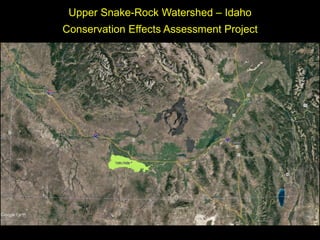
- 1. Upper Snake-Rock Watershed – Idaho Conservation Effects Assessment Project
- 3. Upper Snake Rock Watershed – Idaho 1. 82,000 ha (85% cropland). 2. Irrigation water diverted from Snake River by Twin Falls Canal Company since 1905. Water flows by gravity through 180 km of main canal and +1500 km of laterals. 3. TFCC has a natural flow water right. Project designed to evenly distribute river flow to all shareholders. (full allocation is 5.6 gpm/acre or 7.5 mm/day) 4. 250 mm annual precipitation, 90 mm May to Sept. All crop land is irrigated. 5. 5% of crop land sprinkler irrigated prior to 1990, 45% in 2006 and 60% in 2016.
- 4. Winter
- 5. Summer
- 6. • Irrigation return flow measured at 14 sites from 2006 to 2016 in cooperation with Idaho Department of Water Resources. • Irrigation canal (MLA) and an ephemeral stream (RCH) are the only inflow streams into the watershed.
- 8. Deep Creek Winter - 2017 Deep Creek Winter - 2015 Deep Creek – July, 2018
- 9. Perrine Coulee and Snake River Canyon at Twin Falls, Idaho
- 10. Drainage tunnels (man-made springs) flow all year.
- 11. Water Balance Inflow = Outflow Irrigation Water + Rock Creek + Precipitation = ET + Return Flow + Remainder Remainder includes all measurement errors, canal evaporation, canal seepage, deep percolation, unmeasured return flow and changes in soil water. Delivery Efficiency Annual ET/Annual Total Inflow
- 12. Irrigation: 1120 to 1290 mm (83 to 94% of Inflow) Precipitation: 70 to 220 mm Rock Creek: 7 to 30 mm ET: 770 to 850 mm (56 to 66% of Inflow) Return Flow: 260 to 380 mm (20 to 27% of Inflow) Remainder: 110 to 280 mm (8 to 19% of Inflow) Irrigation Season Water Balance (mm) April - October Inflow Outflow
- 13. Irrigation = 81% of the total (mean = 1200 mm) Precipitation = 17% of total (mean = 260 mm) ET = 61% of total inflow Return Flow = 31% of total (450 mm or 500 billion L) Remainder = 8% (120 mm or 130 billion L) Annual Water Balance (mm) Inflow Outflow
- 18. Conclusions • Increasing the amount of sprinkler irrigated has not improved water delivery efficiency in the watershed. • Large canal systems cannot match water delivery to irrigation demand. • Flow rate water allocation gives little incentive to use less water. • Sprinkler irrigation may be more efficient at the field scale but water rights and allocation schemes have a bigger impact at the watershed scale.
- 19. Questions?