UGC NET Paper 1 Mathematical Reasoning & Aptitude.pdf
Demos LSE presentation - Nature of The Suburbs
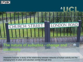
1. The nature of suburbia - change and
continuity
Adaptable Suburbs: a study of the relationship between networks of human activity and the
changing form of urban and suburban centres through time
2. Background
The UK‟s suburbs are overlooked and poorly understood.
The word „suburb‟ betrays their perceived status as places
that are subordinate to the centre.
Urban policy has tended to treat them simply as extensions
of towns and cities and as places where nothing changes,
rather than as separate entities we can learn from, with their
own particular characteristics.
3. Key research questions
• How does the urban design of suburbs contribute
to their success?
• Is the adaptability of these places contributing to
their sustaining over time?
• What is the influence of social interactions and
spatial movement on the economic vitality and
adaptability of places?
5. Defining suburbs
• The suburbs are not a recent
innovation.
• The stone carving of the ancient
Persian city of Madaktu shows
suburban domiciles situated
among the palm trees outside
the city walls.
• Peter Ackroyd has also
commented of London‟s
suburbs that they are “as old as
the city itself” (London: The
Relief of the Elamite city of Madaktu, Persia. The town
Biography , 2000, 727). itself, with its towered walls and its suburbs in which every
house is sheltered by a date tree, is figured in the centre
(668-627 BCE). Source: The Project Gutenberg EBook of
„A History of Art in Chaldæa & Assyria‟, v. 1, by Georges
Perrot and Charles Chipiez, page 332
5
8. Or town centres with residential hinterlands?
Wealdstone
Harrow
9. Photograph of High Road, Wealdstone c.1900
The suburban
environment as
sprawl? Or as a
place – generator
of activity – that
has been sustained
over time.
9
10. Conventional image 4: The suburban high
The suburban
environment as
street as a
sprawl? Or
• No generator this slide: photograph of busy high
place – text on
of activity – that is
street
more than just
retail
10
12. 2. KEY FINDINGS FROM PREVIOUS PROJECT
Multi-scale movement
and activity
Borehamwood is
functioning
simultaneously as local
centre, commuter route
and dormitory suburban
town centre
This is an outcome of its
multi-scale properties
Borehamwood, High Street
13. 2. KEY FINDINGS FROM PREVIOUS PROJECT
Long tail of activity 900000
113 outer London town centres ordered by commercial floorspace
Croydon
800000
700000
600000
Approx. top 15 centres 500000
Flr_Space_Sqm
account for 50% of
400000
Watford
300000
commercial floorspace; 200000
Uxbridge
approx. 100 account for 100000
the other 50% 0
Smaller centres
-100000
Observations
contribute to sustainable 113 outer London town centres ordered by commercial floorspace (excluding Croydon, Kingston, Watford, Bromley and Ealing)
urban life by supporting
300000
Romford
socio-economic and
250000
Uxbridge
cultural diversity across 200000
a wide range of activities
Flr_Space_Sqm
150000
Brent
and nurturing them at 100000
Cross
the local scale. Essential 50000
Surbiton Chipping
Barnet South
links in the chain 0
Norwood
-50000
Observations
14. Cities are very complex systems, but they grow from a simple idea: they are
large dense aggregates of buildings linked by space. The space takes the form
of a linear network, which we call a town plan or street network. It’s what we
see when we look down from above.
15. It is over 20 years since space syntax suggested this network might be of
interest in itself for understanding cities, by showing that the network had
certain potentials which could shape how cities worked. Here we see a
network model that calculates all potential movement to central London.
16. Holloway Road
Stoke Newington Road
Oxford Street
King’s Road
Our research shows if people moved from everywhere to
everywhere else by simplest routes, then some streets would
get more movement through them than others. With high
speed computers, this through movement potential of streets
can be calculated mathematically.
Integration
16
(segment global)
17. Holloway Road
Stoke Newington Road
Oxford Street
King’s Road
Some streets are also much easier to get to than others. It’s a
question of the complexity of routes from each street to all
others. These different degrees of accessibility for to-
movement can also be measured mathematically.
Some streets are also much easier to get to than others. It‟s a question of the complexity of
routes from each street to all others. These different degrees of accessibility for to-movement
can also be measured mathematically.
Choice
17
(segment global)
18. Through-movement potential at smaller scale highlights persistence of activity
beyond reaches of official town centre
Residents
Segment Log
Choice 800m
2000m
Non Residents 18
19. Land-use and choice
Small-scale spatial model
reveals long-tail of activity,
longevity of non-residential
presence in the area
Choice radius 400
23. Research programme: Space Syntax
Residents 74% (n=69);
Median route length: 982m
Segment Log
2000m
Choice 800m
Non Residents 26% (n=24);
Median route length: 389m
29. 4. RESEARCH IMPACT
4. Research Impact (Knowledge Transfer)
• Inform social-economic policy
• Advance analytic and modelling capabilities
• Benefit government agencies, civic society and the third
sector
• Raise the profile of suburbs as having a role to play in the
future of urban sustainability
30. Further information: http://www.sstc.ucl.ac.uk
Blog: http://uclsstc.wordpress.com/
Twitter: @AdaptableSuburb
5. QUESTIONS
Hinweis der Redaktion
The research made it clear that often ignored places can be models of flexible form, sustaining successful spatial networks over centuries, and basing their success on ‘invisible’ spaces, such as garages and backlands and ‘invisible’ uses such as small business, workshops and offices.UCL developed tools for planners to help them apply this knowledge to decisions about their places. Now a 3½ year successor project is underway, building on these findings to investigate how the shape of suburbs contributes to their success. Adaptable Suburbs is seeking to understand why the networks of street and spaces in 20 of the London suburbs already studied work well. Extensive, multi-disciplinary analysis will be used to explore the influence of social interactions and spatial movement on the economic vitality and adaptability of places. Key techniques will include space syntax analysis of street network accessibility; historical analysis of change over time; street-level ethnography, interviewing the people who use and trade in each centre and mapping their perceptions of their spatial networks; and detailed town centre analysis using socio-economic data. Local workshops will inform the development of a practical model for use by planners. In tough economic times, the era of large-scale, all-encompassing regeneration projects is probably over. Instead growth and positive change will come from small-scale, incremental change specific to each place, builds directly on individual strengths and assets. Adaptable Suburbs will make small suburban neighbourhoods visible to policymakers; provide new information and understanding on how to make place work better; and make this knowledge available to local authority planners so it can be applied and used where it is needed.
Second, local shopping street to the east, Ewell Road, used by residents. Non resident shopping routes are very limited.Shoppers: 29 (85.3%) residents (1061m); 5 (14.7%) non residents (916m)Non-shoppers: 36 (70.6%) residents (906); 15 (29.4%) non residents (487m)
UCL’s EPSRC-funded Towards Successful Suburban Town Centres project challenged policy assumptions about suburbs, revealing that they have a great deal to teach us. Looking at 26 suburban centres in outer London – places such as Barnet and Bexleyheath, South Norwood and South Harrow, Wallington and Whetstone, seen as both unfashionable and unremarkable – the research team delivered new findings about the extent of their adaptability and resilience. The research made it clear that often ignored places can be models of flexible form, sustaining successful spatial networks over centuries, and basing their success on ‘invisible’ spaces, such as garages and backlands and ‘invisible’ uses such as small business, workshops and offices.UCL developed tools for planners to help them apply this knowledge to decisions about their places. Now a 3½ year successor project is underway, building on these findings to investigate how the shape of suburbs contributes to their success. Adaptable Suburbs is seeking to understand why the networks of street and spaces in 20 of the London suburbs already studied work well. Extensive, multi-disciplinary analysis will be used to explore the influence of social interactions and spatial movement on the economic vitality and adaptability of places. Key techniques will include space syntax analysis of street network accessibility; historical analysis of change over time; street-level ethnography, interviewing the people who use and trade in each centre and mapping their perceptions of their spatial networks; and detailed town centre analysis using socio-economic data. Local workshops will inform the development of a practical model for use by planners. In tough economic times, the era of large-scale, all-encompassing regeneration projects is probably over. Instead growth and positive change will come from small-scale, incremental change specific to each place, builds directly on individual strengths and assets. Adaptable Suburbs will make small suburban neighbourhoods visible to policymakers; provide new information and understanding on how to make place work better; and make this knowledge available to local authority planners so it can be applied and used where it is needed.
Chipping Barnet market - March 2011
UCL’s EPSRC-funded Towards Successful Suburban Town Centres project challenged policy assumptions about suburbs, revealing that they have a great deal to teach us. Looking at 26 suburban centres in outer London – places such as Barnet and Bexleyheath, South Norwood and South Harrow, Wallington and Whetstone, seen as both unfashionable and unremarkable – the research team delivered new findings about the extent of their adaptability and resilience. The research made it clear that often ignored places can be models of flexible form, sustaining successful spatial networks over centuries, and basing their success on ‘invisible’ spaces, such as garages and backlands and ‘invisible’ uses such as small business, workshops and offices.UCL developed tools for planners to help them apply this knowledge to decisions about their places. Now a 3½ year successor project is underway, building on these findings to investigate how the shape of suburbs contributes to their success. Adaptable Suburbs is seeking to understand why the networks of street and spaces in 20 of the London suburbs already studied work well. Extensive, multi-disciplinary analysis will be used to explore the influence of social interactions and spatial movement on the economic vitality and adaptability of places. Key techniques will include space syntax analysis of street network accessibility; historical analysis of change over time; street-level ethnography, interviewing the people who use and trade in each centre and mapping their perceptions of their spatial networks; and detailed town centre analysis using socio-economic data. Local workshops will inform the development of a practical model for use by planners. In tough economic times, the era of large-scale, all-encompassing regeneration projects is probably over. Instead growth and positive change will come from small-scale, incremental change specific to each place, builds directly on individual strengths and assets. Adaptable Suburbs will make small suburban neighbourhoods visible to policymakers; provide new information and understanding on how to make place work better; and make this knowledge available to local authority planners so it can be applied and used where it is needed.
UCL’s EPSRC-funded Towards Successful Suburban Town Centres project challenged policy assumptions about suburbs, revealing that they have a great deal to teach us. Looking at 26 suburban centres in outer London – places such as Barnet and Bexleyheath, South Norwood and South Harrow, Wallington and Whetstone, seen as both unfashionable and unremarkable – the research team delivered new findings about the extent of their adaptability and resilience. The research made it clear that often ignored places can be models of flexible form, sustaining successful spatial networks over centuries, and basing their success on ‘invisible’ spaces, such as garages and backlands and ‘invisible’ uses such as small business, workshops and offices.UCL developed tools for planners to help them apply this knowledge to decisions about their places. Now a 3½ year successor project is underway, building on these findings to investigate how the shape of suburbs contributes to their success. Adaptable Suburbs is seeking to understand why the networks of street and spaces in 20 of the London suburbs already studied work well. Extensive, multi-disciplinary analysis will be used to explore the influence of social interactions and spatial movement on the economic vitality and adaptability of places. Key techniques will include space syntax analysis of street network accessibility; historical analysis of change over time; street-level ethnography, interviewing the people who use and trade in each centre and mapping their perceptions of their spatial networks; and detailed town centre analysis using socio-economic data. Local workshops will inform the development of a practical model for use by planners. In tough economic times, the era of large-scale, all-encompassing regeneration projects is probably over. Instead growth and positive change will come from small-scale, incremental change specific to each place, builds directly on individual strengths and assets. Adaptable Suburbs will make small suburban neighbourhoods visible to policymakers; provide new information and understanding on how to make place work better; and make this knowledge available to local authority planners so it can be applied and used where it is needed.