Mats Sandewall - An approach for assessing landscape changes, their drivers, and their impact to society and environment
•
0 gefällt mir•184 views

Mats Sandewall (Swedish University of Agricultural Sciences) on using a participatory field point sampling (pfps) method for assesing land use situation and trends in Southeast Asia

Empfohlen
Empfohlen
Weitere ähnliche Inhalte
Was ist angesagt?
Ähnlich wie Mats Sandewall - An approach for assessing landscape changes, their drivers, and their impact to society and environment
Ähnlich wie Mats Sandewall - An approach for assessing landscape changes, their drivers, and their impact to society and environment (20)
Mehr von SIANI
Mehr von SIANI (20)
Kürzlich hochgeladen
Kürzlich hochgeladen (20)
Mats Sandewall - An approach for assessing landscape changes, their drivers, and their impact to society and environment
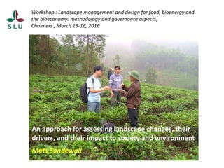
- 1. Workshop : Landscape management and design for food, bioenergy and the bioeconomy: methodology and governance aspects, Chalmers , March 15-16, 2016 An approach for assessing landscape changes, their drivers, and their impact to society and environment Mats Sandewall
- 2. The Swedish National Forest Inventory - a case of systematic sampling for environmental monitoring Mats Sandewall, (Mats.Sandewall@slu.se) Department of Forest Resource Management, Umeå
- 3. How to apply national inventories in the context of tropical/developing countries such as Laos ?
- 4. An assessment methodology which… objectively describes and quantifies land use changes over time considers farmers livelihoods and socio-economic changes explains change drivers, e.g. why do farmers do what they do? is comprehensible for farmers and officials (interactive/participatory) considers practical aspects of cost, rapidness and flexibility provides information useful for forest policy purposes
- 5. Components of the pfps approach
- 6. Pfps sampling, examples from Ethiopia and Vietnam The Pfps sampling idea: - To lay out/visit a systematic pattern of field points - Observe/record the land use, - Ask local owner on background and land use history on each point. - Describe historical trends in land use -Complementary data from interviews
- 7. Some core observations and their verification Observations for each sample point: Current land use and forest cover (1) Land owner/user incl. economic status (2) Details on crops, production, market etc. (2,3) Past land use at regular intervals (2,3,4) Formal official land status (5) Expected future changes (2,3,) Other (depending on study purpose) Verification 1. Direct observation in the field 2. Accompanying key informants 3. Other infomants/villagers 4. Remote sensing (to some extent) 5. Officials and records
- 8. Key output - The pfps ”rapidly” (in one go) traces/presents local historical land- use trends over a fairly long period in a statistically acceptable form. - It will then be presented, discussed and anchored first at local level and then at policy level. Land Use Trends in Doan Hung District, Ca Dinh Commune, Village No 5 0 10 20 30 40 50 60 1980 1985 1990 1995 2000 2005 2006 Year Percentoflandarea Forest plantation Agriculture crops Tea Natural forest Other
- 9. Accuracy of the pfps data It builds on information that can be verified to a certain extent but not entirely. Through the sampling approach the quantitative land use data (area data) of the pfps is basically unbiased and it is possible to (conservatively) estimate its precision. The qualitative information relies on the proper use of social science methods and requires persons trained with that background. One of its advantages is that it captures both quantitative and qualitative changes and assesses how those changes are perceived by the local actors and stakeholders
- 10. ”Why do farmers plant trees” , Northern Vietnam (2006-08)
- 11. Ham Yen 100 km from the industry Tea Fruit trees Styrax Acacia 0 5 10 15 20 25 30 35 1980 1985 1990 1995 2000 2005 2006 Year
- 12. Some applications of the approach 1997-2012 Country Purpose of study Laos Dynamics in shifting cultivation Vietnam Trends, drivers and local impacts of farmers tree plantation State vs local level planning/strategies Land use change and forest policy China Local level trends and patterns in forest cover change Ethiopia Land use and forest cover change /poverty Wood lot plantation, climate change and forest policy
- 13. In what situations could the approach be applicable ? Situations and ”pilot studies” in which you enter a new study area where you have limited knowledge/data on the past and current land use situation and need to produce that in a fairly short time. Land use and environmental policy contexts when the historical development trends, its driving forces and ´stakeholder perspectives are of concern. Food, bioenergy, climate change adaptation…..
- 14. Some methodological challenges Assessment related to landscapes, natural resources use, governance and policy require multi-disciplinary approaches and teams. Composing such teams, e.g. finding people from social science able and interested to interact and contribute to forest and land policy, is sometimes a challenge. Upscaling of studies - criteria for selecting ”study areas” and bridging the gap between national level policies and local level contexts. Sampling approaches are often useful or necessary but they are hard to explain in a broad group of stakeholders
- 15. Reference article: Sandewall, M. and Gebrehiwot, M. 2015. An Approach for Assessing Changes of Forest Land Use, their Drivers, and their Impact to Society and Environment. In: Precious Forests – Precious Earth. http://dx.doi.org/10.5772/61074 Thank you!