SlideShare ist ein Scribd-Unternehmen logo
1 von 43
19th Avenue Transit Study
Self-Guided Presentation and
Survey
September/October, 2013
www.sfcta.org/19thave | 415.522.4838 | liz@sfcta.org
Welcome to the 19th Avenue Transit Study Self-Guided Presentation and Survey! This
presentation has been designed to share the same content that will be shared at public
meetings and presentations during round two of outreach in Fall 2013. The 19th Avenue Transit
Study builds on recent planning efforts to develop plans for a west-side, grade-separated (i.e.
partial subway, tunnel, or bridge) alignment of the M-Ocean View light rail as it traverses the
neighborhoods surrounding 19th Avenue between St. Francis Circle and Broad at Orizaba. The
purpose of the Study is to determine the feasibility, benefits, and impacts of such an
investment, guided by a framework of eight goals all centered on improving conditions for all
19th Avenue travelers as well as neighboring residences, businesses, and institutions. After
reviewing this content, you will be asked to answer several questions. Your input is critical to
informing the Study’s recommendations and next steps! You can expect to spend 30 minutes
reviewing materials and answering the questions. You can also learn more at the Study website
at www.sfcta.org/19thave.
2
How We Got Here > What’s New > Next Steps
The origin of the Study dates back to land use decisions that were made several years ago. In
2008, the Board of Supervisors requested that the San Francisco Planning Department conduct
the 19th Avenue Corridor Study to analyze the cumulative impacts of plans for increased land
use intensity at San Francisco State University, Parkmerced and other potential future
developments in the vicinity of 19th Avenue. Corridor stakeholders, including community
members from West Portal, Lakeside, SF State, Parkmerced, Merced Heights, Merced Extension
Triangle, Ingleside Heights, and Ocean View helped the city set goals and infrastructure
investment priorities to improve existing conditions and support future plans.
Source left to right: SF State Campus Master Plan, SF Planning 19th Avenue Corridor Study, Parkmerced Transportation Plan
3
New locations where light rail crosses Highway 1
How We Got Here > What’s New > Next Steps
The city already committed to a version of these priorities in the Parkmerced Development
Agreement. The agreement calls for Parkmerced to build a new segment of the M-Ocean View by
crossing 19th Avenue at-grade twice: at 19th Avenue/ Holloway and at 19th Avenue/Junipero Serra,
an infrastructure investment valued at $70 million.
Source: Parkmerced Transportation Plan
4
Fourth Southbound Travel
Lane
How We Got Here > What’s New > Next Steps
While this investment would help address strong and safe transit access for SF State and
Parkmerced, it would also make travel time on the M-Ocean View longer, and increase traffic
congestion on 19th Avenue. To mitigate traffic congestion, the Development Agreement between
Parkmerced and San Francisco calls for the addition of a southbound lane on 19th Avenue between
Holloway and Junipero Serra and a third northbound left-turn lane at 19th/Junipero Serra.
During the Parkmerced transportation planning process, there was recognition that this funding
might be better spent in support of a project to take the M-Ocean View over or under the street in a
bridge or subway, avoiding the need to add lanes, providing faster transit, and allowing for a safer,
more attractive pedestrian environment. The Development Agreement set aside provisions to allow
a larger vision for the M-Ocean View and 19th Avenue to be studied before finalizing the decision
about how the $70 million will be invested. The current 19th Avenue Transit Study is the opportunity
to study such a larger investment. The Development Agreement gives San Francisco until July 2018
to complete environmental review of such a larger investment.
Credit: Top: Office of Cheryl Barton; Bottom: Parkmerced Transportation Plan
5
The San Francisco County Transportation Authority applied for and won a planning grant to
develop feasible options, and analyze potential benefits and impacts. The California Department
of Transportation (Caltrans) awarded funding to conduct the 19th Avenue Transit Study, with
local matching funds provided by the Prop K half-cent transportation sales tax, and
contributions from the major landowning stakeholders of Parkmerced, San Francisco State
University, and General Growth Properties (owners of Stonestown Galleria). The Study is a
collaboration between these funding partners, in close cooperation with the San Francisco
Municipal Transportation Agency (owners and operators of Muni), the San Francisco Planning
Department, the Mayor’s Office of Economic and Workforce Development, and BART.
A team of technical consultants have also assisted with the Study’s work: Arup (lead), Fehr &
Peers (traffic analysis), Office of Cheryl Barton (landscape architecture), Circlepoint (outreach)
How We Got Here > What’s New > Next Steps
6
How We Got Here > What’s New > Next Steps
The Study has been underway since Spring, 2012. After doing a comprehensive technical
assessment of needs, the team generated multiple conceptual alternatives. In February 2013,
the Study team hosted its first round of public outreach, sharing these alternatives for public
input. Since that time, some alternatives have been removed from consideration or modified
based on that input. The remaining alternatives have been carefully evaluated to understand
how well each would achieve the Study’s goals. With this information now available, the Study
team is seeking input on community preferences among these options.
7
Planning Goals Framework
How We Got Here > What’s New > Next Steps
Eight goals have
guided the
development and
evaluation of options.
19th
Avenue
Transit
Study
M-Ocean
View speed,
reliability,
capacity
M-Ocean
View
access,
passenger
experience
Bus shuttle
speed,
reliability,
access
Attractive,
safe,
walking
and cycling
conditions
Reliability
of private
vehicle
travel
Sense of
place,
neighbor-
hood
quality of
life
Transit-
oriented
land use
Community,
supported,
feasible
project
8
What we heard…. These ideas don’t work for
my neighborhood…
How We Got Here > What’s New > Next Steps
During the first round of outreach, a notable majority of those participating
voiced concern with one of the northern crossing options that would have built
a light rail bridge over the roadway (N4). In addition, a notable majority voiced
concern with one of the southern crossing options that would have tunneled
under Junipero Serra Boulevard and continue on the north side of Brotherhood
Way (S3).
9
How We Got Here > What’s New > Next Steps
What we did…
The Study team dropped these options from further consideration at the close of the first
round of outreach.
10
What we heard…. I don’t like one part of this
idea…
How We Got Here > What’s New > Next Steps
A common criticism of the longer subway option was that it considered a pedestrian
bridge over 19th Avenue to provide east-side connectivity from Wyton Lane to a new
northern location of the SF State station. Many expressed concern that such a structure
would not support the character of the existing neighborhood.
11
What we did….
How We Got Here > What’s New > Next Steps
We found that an at-grade, signalized crossing at this location would be feasible from a
traffic perspective, and have changed the option accordingly.
12
What we heard….
I have another
idea…
How We Got Here > What’s New > Next Steps
We received a lot of feedback on other ideas to explore. Four of the most common
suggestions included: 1) starting the subway in West Portal, 2) starting the subway
before St. Francis Circle, 3) including a subway station at Ocean Avenue, and 4)
continuing the subway through the entirety of SF State and Parkmerced.
13
What we did….
Highest-
Performing
Option
> Daly
City
1
2
3
4
5
How We Got Here > What’s New > Next Steps
The Study team completed a
preliminary assessment of
these common variants. The
Study team will be interested
in additional feedback on
these options to determine
whether a more
comprehensive evaluation of
any are merited in future
phases of this project or as
separate community planning
efforts.
14
Baseline Longer Subway and Bridge Shorter Subway and Tunnel
Below ground/subway
At grade/street level
Above ground/bridge
Tail track (used for trains running a shorter route between Downtown and Parkmerced)
Range of potential station location
How We Got Here > What’s New > Next Steps
Three alternatives are still under consideration.
15
Below ground/subway
At grade/street level
Above ground/bridge
Tail track (used for “short” trains to run only between Downtown and Parkmerced)
Longer Subway and Bridge
Range of potential station location
How We Got Here > What’s New > Next Steps
The Longer Subway and
Bridge alternative has
been to determined to
perform better again the
Study’s goals.
16
Longer Subway performs better than Shorter
Subway because:
• Faster and more reliable light rail, bus, shuttle travel time
• More space available to widen sidewalks and improve
pedestrian and bicycle comfort and safety
• Costs $90 million more in capital, but saves $1.1
million/year more in operating costs
Southern bridge, Parkmerced-Ingleside Hts
performs better than tunnel because:
• Faster light rail travel time
• Creates a new bike/ped link
• Costs $160 million less
How We Got Here > What’s New > Next Steps
17
Key Benefits
How We Got Here > What’s New > Next Steps
The Longer
Subway and
Bridge option
provides these
key benefits.
Longer
Subway
and Bridge
35-45%
faster M-
Ocean View
travel time
in corridor;
$2 million/
year
operating
cost
savings
30-50ft for
wider
sidewalks,
bus stops,
medians
Four new
places to
cross the
street
Distance
across the
street from
120 to
<80 ft
Enable 3-
car trains
through
Parkmerced;
future
flexibility
Reductions
in light rail,
traffic noise
in some
locations
More
reliable
vehicle
travel
18
Longer Subway and Bridge
Below ground/subway
At grade/street level
Above ground/bridge
Tail track (used for “short” trains to run only between Downtown and Parkmerced)
Range of potential station location
The next images show
visuals of the Longer
Subway and Bridge
alternative at various
points throughout the
corridor. Each green
shaded area has a
corresponding visual that
will be shown, from north
to south. The next slide will
show an images of the M-
Ocean View in the Lakeside
neighborhood between St.
Francis Circle and
Eucalyptus.
How We Got Here > What’s New > Next Steps
19
How We Got Here > What’s New > Next Steps
This image shows the M-Ocean View traveling through the Lakeside neighborhood today: St. Francis
Circle is in the bottom right corner, and 19th Avenue is just past the left extent of the photo.
Source: 2013 Microsoft Corporation Pictometry Bird’s Eye @2012 Pictometry International Corporation.
20
How We Got Here > What’s New > Next Steps
This image shows how a portal might be constructed to transition the M-Ocean View underground.
Note another option we will continue to study brings the M-Ocean View underground just before St.
Francis Circle, in which case the train would be fully underground in the Lakeside. This phase of the
Study will not make final decisions about how space freed up from the light rail will be re-purposed;
however, one idea that has been discussed is that the space freed up could be closed to public
access, eliminating the graffiti/vandalism issue that currently exists in the neighborhood.
Underlying source: 2013 Microsoft Corporation Pictometry Bird’s Eye @2012 Pictometry International Corporation.
21
Longer Subway and Bridge
Below ground/subway
At grade/street level
Above ground/bridge
Tail track (used for “short” trains to run only between Downtown and Parkmerced)
Range of potential station location
How We Got Here > What’s New > Next Steps
The next image shows a
concept for a new
Stonestown/Mercy High
School station moved north
from the current station at
Winston Drive.
22
How We Got Here > What’s New > Next Steps
Today 19th Avenue between Stonestown Galleria and Mercy High School has: 3 travel lanes in
each direction, a northbound turn lane, and two center-running light rail tracks.
23
How We Got Here > What’s New > Next Steps
With the Longer Subway and Bridge alternative, the light rail tracks move underground, with
station entry points from both sides of the street. The new station would also provide a direct
walking connection between Mercy High School and the Stonestown Galleria, a high demand
crossing location that is currently closed.
24
Longer Subway and Bridge
Below ground/subway
At grade/street level
Above ground/bridge
Tail track (used for “short” trains to run only between Downtown and Parkmerced)
Range of potential station location
How We Got Here > What’s New > Next Steps
The next images show
how the Longer Subway
and Bridge alternative
might look in front of
San Francisco State
University.
25
How We Got Here > What’s New > Next Steps
Today 19th Avenue and Holloway is a very high-activity pedestrian and transit node; riders must
cross 3 travel lanes and a bus loading area to get to/from campus. During peak hours crossing
guards enforce when transit riders can cross to reduce the temptation to run across the street
against the light to catch your train or get to class
Source: 2013 Digital Globe S Geological Survey, USDA Farm Service Agency: Map data 2013 Google
26
How We Got Here > What’s New > Next Steps
Range of potential station location
The change creates an opportunity for wider sidewalks, larger bus stops, and a landscaped, median
and pedestrian refuge. The SF State station could be located anywhere between the location
shown, and a location south, between Holloway and Crespi.
Underlying aerial source: 2013 Digital Globe S Geological Survey, USDA Farm Service Agency: Map data 2013 Google
27
The proposed also contemplates re-directing westbound Holloway traffic to a re-aligned Crespi east
of 19th Avenue. Vehicles traveling through the area would be directed to Crespi be able to connect
back to Holloway west of 19th. This change would make for a safer crossing across 19th Avenue at
Holloway because it would eliminate conflicts between pedestrians crossing 19th Avenue and
vehicles making northbound left-turns. It would also support faster light rail travel time.
27
How We Got Here > What’s New > Next Steps
28
How We Got Here > What’s New > Next Steps
In cross section view, the M-Ocean View at 19th Avenue in front of San Francisco State
University looks like this today.
29
How We Got Here > What’s New > Next Steps
It would change to look more like this in the future with the Northbound/Inbound track
underground.
30
Longer Subway and Bridge
Below ground/subway
At grade/street level
Above ground/bridge
Tail track (used for “short” trains to run only between Downtown and Parkmerced)
Range of potential station location
How We Got Here > What’s New > Next Steps
South of Junipero Serra, a
segment of 19th Avenue
that currently has light rail
on it would no longer have
it in the future.
31
How We Got Here > What’s New > Next Steps
The street would go from looking like this, as it does today…
Source: 2013 Google Image Date: April 2011, Google Street View
32
How We Got Here > What’s New > Next Steps
…To a different, calmed and greened look. This image contemplates a landscaped median and
narrowed travel-ways with angled parking. However, other options that will be explored further in
subsequent phases might include wider sidewalks and/or an improved bike lane or bike
treatment.
Underlying source: 2013 Google Image Date: April 2011, Google Street View
33
Longer Subway and Bridge
Below ground/subway
At grade/street level
Above ground/bridge
Tail track (used for “short” trains to run only between Downtown and Parkmerced)
Range of potential station location
How We Got Here > What’s New > Next Steps
The next image discusses the
bridge that would connect
Parkmerced and Ingleside
Heights.
34
Photo Credits: left, Arup; center: Craig Philpott; right: Melanie Curry
How We Got Here > What’s New > Next Steps
To build such a bridge, Junipero Serra would be lowered by about 10.5 feet (the red line shows the
current street level). The street lowering would reduce traffic noise nearby. The bridge would serve
both the M-Ocean View, as well as walkers and cyclists. In the next phase, the Study team will work
closely with the neighbors along Randolph to design the street where the bridge would land.
Technical work during this phase has indicated that the bridge would fit fully in the public right-of-
way, and vehicle access to all driveways would be maintained, although on-street parking would
need to be removed. The bridge is an opportunity to create an iconic visual treatment at the
southern entrance to San Francisco. The aesthetics of the bridge would be determined at a later
phase, through a community process.
35
Longer Subway and Bridge
Below ground/subway
At grade/street level
Above ground/bridge
Tail track (used for “short” trains to run only between Downtown and Parkmerced)
Range of potential station location
How We Got Here > What’s New > Next Steps
The last image shows a view
of Randolph near Arch
Street.
36
How We Got Here > What’s New > Next Steps
Today, the street looks like this.
Ssource: 2013 Google Image Date: April 2011, Google Street View
37
In the future, an upgraded station could extend the sidewalk out into the street, providing level
boarding for all users.
How We Got Here > What’s New > Next Steps
Underlying source: 2013 Google Image Date: April 2011, Google Street View
38
0.2
-1.8
-0.7
-2.0
-1.5
-1.0
-0.5
0.0
0.5
Baseline Longer Subway
+ Bridge
Shorter Subway
+ Tunnel
Net Change in Annual Operating Costs (in
millions of 2013 $) Capital Cost, millions
of 2013 $
Baseline $70
Longer Subway +
Bridge
$520 most likely
($420-$780)
*$90 mil. difference between shorter
and longer subway , $160 mil. difference
between bridge and tunnel
How We Got Here > What’s New > Next Steps
*Does not include: change/increase in fare revenue, reduction in capital cost
if fewer train sets are needed; systemwide average maintenance/station
staffing costs included in operating cost changes
The Longer Subway and Bridge alternative would reduce the annual cost to run the M-Ocean View
by about $2 million as compared to what it would cost to run the future Baseline alignment
through Parkmerced. Because a capital project explored here would come with a long useful
project life of 80-100 years, a savings every year starts to add up to be quite substantial. The most
likely capital cost for the Longer Subway and Bridge alternative is about $520 million. The Shorter
Subway is $90 million less expensive, but results in less than 50% of the operating cost savings as
the Longer Subway.
Source: Arup, Level 5 Rough Order of Magnitude Costs
developed in accordance with Association for the
Advancement of Cost Engineering Internal best practices,
+30% soft costs
Travel time
implication
Capital Cost
(2013 $)
Subway through
West Portal
-2:25 to
-2:50
+$400-800 M
St. Francis Circle
grade separation
-1:40 +$40-60 M
Subway station at
Ocean Ave
+0:25 +$40 M
Subway through
SF
State/Parkmerced
-0:25 to
-1:50
+$90-180 M
Create enhanced
connection to Daly
City BART
-0-8:00 $30 M-$300 M
39
How We Got Here > What’s New > Next Steps
For continued Study in next phase
Many project additions were suggested during
the first round of outreach as well as in past
planning efforts. Those outlined in blue will be
studied further in the next phase. The others
would require their own separate community
planning processes to advance because their
project boundaries are outside the Study area.
In the case of the West Portal subway, it is not
clear there is strong community support to
study such an improvement (this idea was
rejected when BART build the Muni Metro
subway), but if there is, a separate community
process would be needed to understand
benefits and impacts. In the case of enhanced
connections to Daly City BART, the M-Ocean
View grade-separation options all are consistent
with future enhanced connections to Daly City
BART. Because of the Development Agreement
timeline and large potential benefits of
grade-separation project, the next phase will
focus exclusively on this improvement. The next
slide shares more about different options for
such an enhanced connection.
40
LRT extension:
$200-300 m
Bus/Shuttle
Package: $30-40 m
How We Got Here > What’s New > Next Steps
Two options were considered. The first
would extend the M-Ocean View to
Daly City BART, traveling in a bridge in
the median of Junipero Serra and
rising over I-280 to land in the BART
parking lot. This alignment would
require removal or replacement of the
Alemany flyover ramp. The other
option would route buses through
Parkmerced to avoid future traffic
congestion forecast on Junipero Serra,
and create a bus-only lane on John
Daly Boulevard.
41
Rail Connection Criterion
Enhanced Bus
Connection
5 minutes
Travel time:
SF State to
Daly City
6-11 minutes
1-8 minutes
savings
Potential
Travel-Time
Savings
0-2 minutes
+$300k/year Muni;
Potential decrease
in shuttles
$800k/yr
Change in
Operating
Cost
Potential Muni
savings of
$400k/year
$200-300
million
Capital
Cost
$30-40
million
Travel time: SF State to Daly City Today: 6-13 minutes
How We Got Here > What’s New > Next Steps
Relative to the travel time it takes
buses/shuttles today (about 6-13
minutes depending on congestion), the
rail connection would decrease travel
time by 1-8 minutes (for a 5 minute
trip), while the enhanced bus
connection would only shave time off
the high-end time (for a 6-11 minute
trip). The light rail connection would
increase Muni’s operating costs by
about $300,000/year but potentially
save SF State and Parkmerced up to
$800,000/year if the new service were
to fully replace their private shuttles to
Daly City Station. Saving two
minutes/trip could save up to
$400,000 in Muni operations.
42
How We Got Here > What’s New > Next Steps
Open for Service
Environmental Review and
Preliminary Design
(3-3.5 years)
Conceptual
Design
(1 year)
Final Design and
Construction
(4-6.5 years)
Study
Completion
(by end of year)
Potential implementation pathway for Longer Subway and Bridge alternative
This phase of Study is expected to be complete around the end of the calendar year. The next
phase, conceptual design, will answer some questions this phase has not, as well as complete a
Project Study Report, a requirement for projects affecting the State Highway System. After, the
project will conduct a thorough analysis of the proposed project’s impacts on the environment,
identifying mitigations for any significant impacts. Then, the project would enter detailed design
and construction, with actual construction duration expected to last between two and three-and-a-
half years, after which the project would be ready to open for service.
43
And now… the survey!
Please visit
https://www.surveymonkey.com/s/19thsurvey
to share your input
How We Got Here > What’s New > Next Steps

Weitere ähnliche Inhalte

Was ist angesagt?

Urban transportation systems redesigning main street
Urban transportation systems redesigning main streetUrban transportation systems redesigning main street
Urban transportation systems redesigning main streetJulianne Crawford
 
South Park Blocks Parking - Portland Downtown Neighborhood Association
South Park Blocks Parking - Portland Downtown Neighborhood AssociationSouth Park Blocks Parking - Portland Downtown Neighborhood Association
South Park Blocks Parking - Portland Downtown Neighborhood Associationmazik
 
Sindiong Project Examples
Sindiong Project ExamplesSindiong Project Examples
Sindiong Project ExamplesSteveSindiong
 
ITE RP Presentation (Part 3 Of 3)
ITE RP Presentation (Part 3 Of 3)ITE RP Presentation (Part 3 Of 3)
ITE RP Presentation (Part 3 Of 3)jdaisa
 
20140818 downtown gateway stakeholder workshop
20140818 downtown gateway stakeholder workshop20140818 downtown gateway stakeholder workshop
20140818 downtown gateway stakeholder workshopJohn-Michael Cortez
 
Construction Choreography
Construction ChoreographyConstruction Choreography
Construction ChoreographyMichael Fishman
 
Park Lawn Lake Shore Transportation Master Plan Community Workshop 1 Display ...
Park Lawn Lake Shore Transportation Master Plan Community Workshop 1 Display ...Park Lawn Lake Shore Transportation Master Plan Community Workshop 1 Display ...
Park Lawn Lake Shore Transportation Master Plan Community Workshop 1 Display ...Toronto Public Consultation Unit
 
Kennedy Mobility Hub Presentation
Kennedy Mobility Hub PresentationKennedy Mobility Hub Presentation
Kennedy Mobility Hub PresentationCrosstown TO
 
Harbor Ring Campaign
Harbor Ring CampaignHarbor Ring Campaign
Harbor Ring CampaignNY_Bicycling
 

Was ist angesagt? (20)

Space 134 - FAQs
Space 134 - FAQsSpace 134 - FAQs
Space 134 - FAQs
 
Mobility and City Streets: From Roads for Cars to Streets for People
Mobility and City Streets: From Roads for Cars to Streets for PeopleMobility and City Streets: From Roads for Cars to Streets for People
Mobility and City Streets: From Roads for Cars to Streets for People
 
2013 Space 134 Vision Plan
2013 Space 134 Vision Plan2013 Space 134 Vision Plan
2013 Space 134 Vision Plan
 
TOD Presentation-PDF_-part-I
TOD Presentation-PDF_-part-ITOD Presentation-PDF_-part-I
TOD Presentation-PDF_-part-I
 
TOD Presentation-PDF_-part-II
TOD Presentation-PDF_-part-IITOD Presentation-PDF_-part-II
TOD Presentation-PDF_-part-II
 
Aloha Streets: Complete Streets and Complete Communities in Hawai`i
Aloha Streets: Complete Streets and Complete Communities in Hawai`iAloha Streets: Complete Streets and Complete Communities in Hawai`i
Aloha Streets: Complete Streets and Complete Communities in Hawai`i
 
Urban transportation systems redesigning main street
Urban transportation systems redesigning main streetUrban transportation systems redesigning main street
Urban transportation systems redesigning main street
 
2016 TOD brochure
2016 TOD brochure2016 TOD brochure
2016 TOD brochure
 
South Park Blocks Parking - Portland Downtown Neighborhood Association
South Park Blocks Parking - Portland Downtown Neighborhood AssociationSouth Park Blocks Parking - Portland Downtown Neighborhood Association
South Park Blocks Parking - Portland Downtown Neighborhood Association
 
Sindiong Project Examples
Sindiong Project ExamplesSindiong Project Examples
Sindiong Project Examples
 
ITE RP Presentation (Part 3 Of 3)
ITE RP Presentation (Part 3 Of 3)ITE RP Presentation (Part 3 Of 3)
ITE RP Presentation (Part 3 Of 3)
 
20140818 downtown gateway stakeholder workshop
20140818 downtown gateway stakeholder workshop20140818 downtown gateway stakeholder workshop
20140818 downtown gateway stakeholder workshop
 
Level of Service F for Grade A Streets--Cesar Chavez Street
Level of Service F for Grade A Streets--Cesar Chavez Street  Level of Service F for Grade A Streets--Cesar Chavez Street
Level of Service F for Grade A Streets--Cesar Chavez Street
 
Construction Choreography
Construction ChoreographyConstruction Choreography
Construction Choreography
 
Federal Funding for Active Transportation and Recreation
Federal Funding for Active Transportation and RecreationFederal Funding for Active Transportation and Recreation
Federal Funding for Active Transportation and Recreation
 
Park Lawn Lake Shore Transportation Master Plan Community Workshop 1 Display ...
Park Lawn Lake Shore Transportation Master Plan Community Workshop 1 Display ...Park Lawn Lake Shore Transportation Master Plan Community Workshop 1 Display ...
Park Lawn Lake Shore Transportation Master Plan Community Workshop 1 Display ...
 
A Systematic Approach to Bicycle Parking Planning for Cities-Level of Service...
A Systematic Approach to Bicycle Parking Planning for Cities-Level of Service...A Systematic Approach to Bicycle Parking Planning for Cities-Level of Service...
A Systematic Approach to Bicycle Parking Planning for Cities-Level of Service...
 
Janwani - LAPP JM Rd
Janwani - LAPP JM RdJanwani - LAPP JM Rd
Janwani - LAPP JM Rd
 
Kennedy Mobility Hub Presentation
Kennedy Mobility Hub PresentationKennedy Mobility Hub Presentation
Kennedy Mobility Hub Presentation
 
Harbor Ring Campaign
Harbor Ring CampaignHarbor Ring Campaign
Harbor Ring Campaign
 

Ähnlich wie 19th Ave Transit Study Fall 2013 Presentation and Survey

Corrine Drive Phase 2 Report
Corrine Drive Phase 2 ReportCorrine Drive Phase 2 Report
Corrine Drive Phase 2 ReportBrendan O'Connor
 
Reimagining yonge_street__pic_3_display_panels
Reimagining yonge_street__pic_3_display_panelsReimagining yonge_street__pic_3_display_panels
Reimagining yonge_street__pic_3_display_panelsknelischer
 
Phase 2-community-feedback-report-july-2018
Phase 2-community-feedback-report-july-2018Phase 2-community-feedback-report-july-2018
Phase 2-community-feedback-report-july-2018Brendan O'Connor
 
2.2 tri rail coastal link
2.2 tri rail coastal link2.2 tri rail coastal link
2.2 tri rail coastal linkascemiami-dade
 
2.2 tri rail coastal link
2.2 tri rail coastal link2.2 tri rail coastal link
2.2 tri rail coastal linkascemiami-dade
 
Ongoing broad ave initial improvement plan
Ongoing broad ave initial improvement planOngoing broad ave initial improvement plan
Ongoing broad ave initial improvement planBorough of Leonia
 
VC Research Final tcb
VC Research Final tcbVC Research Final tcb
VC Research Final tcbThomas Bothen
 
Center City Connector Executive Summary
Center City Connector Executive SummaryCenter City Connector Executive Summary
Center City Connector Executive SummaryZach Shaner
 
Planning And Decision Making In Transport Infrastructure Dev.
Planning And Decision Making In Transport Infrastructure Dev.Planning And Decision Making In Transport Infrastructure Dev.
Planning And Decision Making In Transport Infrastructure Dev.ceal2005
 
Factual analysis of the south fork conservancy proposal
Factual analysis of the south fork conservancy proposalFactual analysis of the south fork conservancy proposal
Factual analysis of the south fork conservancy proposalCharles Bayless
 
pt 3: The Quickway Proposal: Central Zone
pt 3: The Quickway Proposal: Central Zonept 3: The Quickway Proposal: Central Zone
pt 3: The Quickway Proposal: Central ZoneAlan Hoffman
 
North quarter vision study
North quarter vision studyNorth quarter vision study
North quarter vision studyBrendan O'Connor
 

Ähnlich wie 19th Ave Transit Study Fall 2013 Presentation and Survey (20)

Corrine Drive Phase 2 Report
Corrine Drive Phase 2 ReportCorrine Drive Phase 2 Report
Corrine Drive Phase 2 Report
 
Reimagining yonge_street__pic_3_display_panels
Reimagining yonge_street__pic_3_display_panelsReimagining yonge_street__pic_3_display_panels
Reimagining yonge_street__pic_3_display_panels
 
Task 3.b: EN TRIPS Priority Corridors - Preliminary Street Redesign Alternat...
Task 3.b:  EN TRIPS Priority Corridors - Preliminary Street Redesign Alternat...Task 3.b:  EN TRIPS Priority Corridors - Preliminary Street Redesign Alternat...
Task 3.b: EN TRIPS Priority Corridors - Preliminary Street Redesign Alternat...
 
05.ENTRIPS
05.ENTRIPS05.ENTRIPS
05.ENTRIPS
 
Phase 2-community-feedback-report-july-2018
Phase 2-community-feedback-report-july-2018Phase 2-community-feedback-report-july-2018
Phase 2-community-feedback-report-july-2018
 
2.2 tri rail coastal link
2.2 tri rail coastal link2.2 tri rail coastal link
2.2 tri rail coastal link
 
2.2 tri rail coastal link
2.2 tri rail coastal link2.2 tri rail coastal link
2.2 tri rail coastal link
 
convert_255356
convert_255356convert_255356
convert_255356
 
Crosstown apwa presentation2016 04-19
Crosstown apwa presentation2016 04-19Crosstown apwa presentation2016 04-19
Crosstown apwa presentation2016 04-19
 
Technical Report
Technical ReportTechnical Report
Technical Report
 
East Don Trail - Design Concepts
East Don Trail - Design ConceptsEast Don Trail - Design Concepts
East Don Trail - Design Concepts
 
Toronto Relief Line Public Meeting Presentation
Toronto Relief Line Public Meeting PresentationToronto Relief Line Public Meeting Presentation
Toronto Relief Line Public Meeting Presentation
 
Ongoing broad ave initial improvement plan
Ongoing broad ave initial improvement planOngoing broad ave initial improvement plan
Ongoing broad ave initial improvement plan
 
VC Research Final tcb
VC Research Final tcbVC Research Final tcb
VC Research Final tcb
 
Center City Connector Executive Summary
Center City Connector Executive SummaryCenter City Connector Executive Summary
Center City Connector Executive Summary
 
Maximizing Biking and Walking Access to Transit
Maximizing Biking and Walking Access to TransitMaximizing Biking and Walking Access to Transit
Maximizing Biking and Walking Access to Transit
 
Planning And Decision Making In Transport Infrastructure Dev.
Planning And Decision Making In Transport Infrastructure Dev.Planning And Decision Making In Transport Infrastructure Dev.
Planning And Decision Making In Transport Infrastructure Dev.
 
Factual analysis of the south fork conservancy proposal
Factual analysis of the south fork conservancy proposalFactual analysis of the south fork conservancy proposal
Factual analysis of the south fork conservancy proposal
 
pt 3: The Quickway Proposal: Central Zone
pt 3: The Quickway Proposal: Central Zonept 3: The Quickway Proposal: Central Zone
pt 3: The Quickway Proposal: Central Zone
 
North quarter vision study
North quarter vision studyNorth quarter vision study
North quarter vision study
 

Kürzlich hochgeladen

Unlocking the Secrets of Affiliate Marketing.pdf
Unlocking the Secrets of Affiliate Marketing.pdfUnlocking the Secrets of Affiliate Marketing.pdf
Unlocking the Secrets of Affiliate Marketing.pdfOnline Income Engine
 
Best Basmati Rice Manufacturers in India
Best Basmati Rice Manufacturers in IndiaBest Basmati Rice Manufacturers in India
Best Basmati Rice Manufacturers in IndiaShree Krishna Exports
 
Best VIP Call Girls Noida Sector 40 Call Me: 8448380779
Best VIP Call Girls Noida Sector 40 Call Me: 8448380779Best VIP Call Girls Noida Sector 40 Call Me: 8448380779
Best VIP Call Girls Noida Sector 40 Call Me: 8448380779Delhi Call girls
 
Regression analysis: Simple Linear Regression Multiple Linear Regression
Regression analysis:  Simple Linear Regression Multiple Linear RegressionRegression analysis:  Simple Linear Regression Multiple Linear Regression
Regression analysis: Simple Linear Regression Multiple Linear RegressionRavindra Nath Shukla
 
Mondelez State of Snacking and Future Trends 2023
Mondelez State of Snacking and Future Trends 2023Mondelez State of Snacking and Future Trends 2023
Mondelez State of Snacking and Future Trends 2023Neil Kimberley
 
Sales & Marketing Alignment: How to Synergize for Success
Sales & Marketing Alignment: How to Synergize for SuccessSales & Marketing Alignment: How to Synergize for Success
Sales & Marketing Alignment: How to Synergize for SuccessAggregage
 
The Coffee Bean & Tea Leaf(CBTL), Business strategy case study
The Coffee Bean & Tea Leaf(CBTL), Business strategy case studyThe Coffee Bean & Tea Leaf(CBTL), Business strategy case study
The Coffee Bean & Tea Leaf(CBTL), Business strategy case studyEthan lee
 
Call Girls Pune Just Call 9907093804 Top Class Call Girl Service Available
Call Girls Pune Just Call 9907093804 Top Class Call Girl Service AvailableCall Girls Pune Just Call 9907093804 Top Class Call Girl Service Available
Call Girls Pune Just Call 9907093804 Top Class Call Girl Service AvailableDipal Arora
 
Call Girls Navi Mumbai Just Call 9907093804 Top Class Call Girl Service Avail...
Call Girls Navi Mumbai Just Call 9907093804 Top Class Call Girl Service Avail...Call Girls Navi Mumbai Just Call 9907093804 Top Class Call Girl Service Avail...
Call Girls Navi Mumbai Just Call 9907093804 Top Class Call Girl Service Avail...Dipal Arora
 
Call Girls In Panjim North Goa 9971646499 Genuine Service
Call Girls In Panjim North Goa 9971646499 Genuine ServiceCall Girls In Panjim North Goa 9971646499 Genuine Service
Call Girls In Panjim North Goa 9971646499 Genuine Serviceritikaroy0888
 
Call Girls in Gomti Nagar - 7388211116 - With room Service
Call Girls in Gomti Nagar - 7388211116  - With room ServiceCall Girls in Gomti Nagar - 7388211116  - With room Service
Call Girls in Gomti Nagar - 7388211116 - With room Servicediscovermytutordmt
 
Progress Report - Oracle Database Analyst Summit
Progress  Report - Oracle Database Analyst SummitProgress  Report - Oracle Database Analyst Summit
Progress Report - Oracle Database Analyst SummitHolger Mueller
 
Value Proposition canvas- Customer needs and pains
Value Proposition canvas- Customer needs and painsValue Proposition canvas- Customer needs and pains
Value Proposition canvas- Customer needs and painsP&CO
 
Cash Payment 9602870969 Escort Service in Udaipur Call Girls
Cash Payment 9602870969 Escort Service in Udaipur Call GirlsCash Payment 9602870969 Escort Service in Udaipur Call Girls
Cash Payment 9602870969 Escort Service in Udaipur Call GirlsApsara Of India
 
Monte Carlo simulation : Simulation using MCSM
Monte Carlo simulation : Simulation using MCSMMonte Carlo simulation : Simulation using MCSM
Monte Carlo simulation : Simulation using MCSMRavindra Nath Shukla
 
A DAY IN THE LIFE OF A SALESMAN / WOMAN
A DAY IN THE LIFE OF A  SALESMAN / WOMANA DAY IN THE LIFE OF A  SALESMAN / WOMAN
A DAY IN THE LIFE OF A SALESMAN / WOMANIlamathiKannappan
 
Insurers' journeys to build a mastery in the IoT usage
Insurers' journeys to build a mastery in the IoT usageInsurers' journeys to build a mastery in the IoT usage
Insurers' journeys to build a mastery in the IoT usageMatteo Carbone
 
MONA 98765-12871 CALL GIRLS IN LUDHIANA LUDHIANA CALL GIRL
MONA 98765-12871 CALL GIRLS IN LUDHIANA LUDHIANA CALL GIRLMONA 98765-12871 CALL GIRLS IN LUDHIANA LUDHIANA CALL GIRL
MONA 98765-12871 CALL GIRLS IN LUDHIANA LUDHIANA CALL GIRLSeo
 

Kürzlich hochgeladen (20)

Unlocking the Secrets of Affiliate Marketing.pdf
Unlocking the Secrets of Affiliate Marketing.pdfUnlocking the Secrets of Affiliate Marketing.pdf
Unlocking the Secrets of Affiliate Marketing.pdf
 
Best Basmati Rice Manufacturers in India
Best Basmati Rice Manufacturers in IndiaBest Basmati Rice Manufacturers in India
Best Basmati Rice Manufacturers in India
 
Best VIP Call Girls Noida Sector 40 Call Me: 8448380779
Best VIP Call Girls Noida Sector 40 Call Me: 8448380779Best VIP Call Girls Noida Sector 40 Call Me: 8448380779
Best VIP Call Girls Noida Sector 40 Call Me: 8448380779
 
Regression analysis: Simple Linear Regression Multiple Linear Regression
Regression analysis:  Simple Linear Regression Multiple Linear RegressionRegression analysis:  Simple Linear Regression Multiple Linear Regression
Regression analysis: Simple Linear Regression Multiple Linear Regression
 
Mondelez State of Snacking and Future Trends 2023
Mondelez State of Snacking and Future Trends 2023Mondelez State of Snacking and Future Trends 2023
Mondelez State of Snacking and Future Trends 2023
 
Sales & Marketing Alignment: How to Synergize for Success
Sales & Marketing Alignment: How to Synergize for SuccessSales & Marketing Alignment: How to Synergize for Success
Sales & Marketing Alignment: How to Synergize for Success
 
Nepali Escort Girl Kakori \ 9548273370 Indian Call Girls Service Lucknow ₹,9517
Nepali Escort Girl Kakori \ 9548273370 Indian Call Girls Service Lucknow ₹,9517Nepali Escort Girl Kakori \ 9548273370 Indian Call Girls Service Lucknow ₹,9517
Nepali Escort Girl Kakori \ 9548273370 Indian Call Girls Service Lucknow ₹,9517
 
The Coffee Bean & Tea Leaf(CBTL), Business strategy case study
The Coffee Bean & Tea Leaf(CBTL), Business strategy case studyThe Coffee Bean & Tea Leaf(CBTL), Business strategy case study
The Coffee Bean & Tea Leaf(CBTL), Business strategy case study
 
Call Girls Pune Just Call 9907093804 Top Class Call Girl Service Available
Call Girls Pune Just Call 9907093804 Top Class Call Girl Service AvailableCall Girls Pune Just Call 9907093804 Top Class Call Girl Service Available
Call Girls Pune Just Call 9907093804 Top Class Call Girl Service Available
 
Call Girls Navi Mumbai Just Call 9907093804 Top Class Call Girl Service Avail...
Call Girls Navi Mumbai Just Call 9907093804 Top Class Call Girl Service Avail...Call Girls Navi Mumbai Just Call 9907093804 Top Class Call Girl Service Avail...
Call Girls Navi Mumbai Just Call 9907093804 Top Class Call Girl Service Avail...
 
Call Girls In Panjim North Goa 9971646499 Genuine Service
Call Girls In Panjim North Goa 9971646499 Genuine ServiceCall Girls In Panjim North Goa 9971646499 Genuine Service
Call Girls In Panjim North Goa 9971646499 Genuine Service
 
Call Girls in Gomti Nagar - 7388211116 - With room Service
Call Girls in Gomti Nagar - 7388211116  - With room ServiceCall Girls in Gomti Nagar - 7388211116  - With room Service
Call Girls in Gomti Nagar - 7388211116 - With room Service
 
VVVIP Call Girls In Greater Kailash ➡️ Delhi ➡️ 9999965857 🚀 No Advance 24HRS...
VVVIP Call Girls In Greater Kailash ➡️ Delhi ➡️ 9999965857 🚀 No Advance 24HRS...VVVIP Call Girls In Greater Kailash ➡️ Delhi ➡️ 9999965857 🚀 No Advance 24HRS...
VVVIP Call Girls In Greater Kailash ➡️ Delhi ➡️ 9999965857 🚀 No Advance 24HRS...
 
Progress Report - Oracle Database Analyst Summit
Progress  Report - Oracle Database Analyst SummitProgress  Report - Oracle Database Analyst Summit
Progress Report - Oracle Database Analyst Summit
 
Value Proposition canvas- Customer needs and pains
Value Proposition canvas- Customer needs and painsValue Proposition canvas- Customer needs and pains
Value Proposition canvas- Customer needs and pains
 
Cash Payment 9602870969 Escort Service in Udaipur Call Girls
Cash Payment 9602870969 Escort Service in Udaipur Call GirlsCash Payment 9602870969 Escort Service in Udaipur Call Girls
Cash Payment 9602870969 Escort Service in Udaipur Call Girls
 
Monte Carlo simulation : Simulation using MCSM
Monte Carlo simulation : Simulation using MCSMMonte Carlo simulation : Simulation using MCSM
Monte Carlo simulation : Simulation using MCSM
 
A DAY IN THE LIFE OF A SALESMAN / WOMAN
A DAY IN THE LIFE OF A  SALESMAN / WOMANA DAY IN THE LIFE OF A  SALESMAN / WOMAN
A DAY IN THE LIFE OF A SALESMAN / WOMAN
 
Insurers' journeys to build a mastery in the IoT usage
Insurers' journeys to build a mastery in the IoT usageInsurers' journeys to build a mastery in the IoT usage
Insurers' journeys to build a mastery in the IoT usage
 
MONA 98765-12871 CALL GIRLS IN LUDHIANA LUDHIANA CALL GIRL
MONA 98765-12871 CALL GIRLS IN LUDHIANA LUDHIANA CALL GIRLMONA 98765-12871 CALL GIRLS IN LUDHIANA LUDHIANA CALL GIRL
MONA 98765-12871 CALL GIRLS IN LUDHIANA LUDHIANA CALL GIRL
 

19th Ave Transit Study Fall 2013 Presentation and Survey

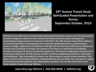
  • 1. 19th Avenue Transit Study Self-Guided Presentation and Survey September/October, 2013 www.sfcta.org/19thave | 415.522.4838 | liz@sfcta.org Welcome to the 19th Avenue Transit Study Self-Guided Presentation and Survey! This presentation has been designed to share the same content that will be shared at public meetings and presentations during round two of outreach in Fall 2013. The 19th Avenue Transit Study builds on recent planning efforts to develop plans for a west-side, grade-separated (i.e. partial subway, tunnel, or bridge) alignment of the M-Ocean View light rail as it traverses the neighborhoods surrounding 19th Avenue between St. Francis Circle and Broad at Orizaba. The purpose of the Study is to determine the feasibility, benefits, and impacts of such an investment, guided by a framework of eight goals all centered on improving conditions for all 19th Avenue travelers as well as neighboring residences, businesses, and institutions. After reviewing this content, you will be asked to answer several questions. Your input is critical to informing the Study’s recommendations and next steps! You can expect to spend 30 minutes reviewing materials and answering the questions. You can also learn more at the Study website at www.sfcta.org/19thave.
  • 2. 2 How We Got Here > What’s New > Next Steps The origin of the Study dates back to land use decisions that were made several years ago. In 2008, the Board of Supervisors requested that the San Francisco Planning Department conduct the 19th Avenue Corridor Study to analyze the cumulative impacts of plans for increased land use intensity at San Francisco State University, Parkmerced and other potential future developments in the vicinity of 19th Avenue. Corridor stakeholders, including community members from West Portal, Lakeside, SF State, Parkmerced, Merced Heights, Merced Extension Triangle, Ingleside Heights, and Ocean View helped the city set goals and infrastructure investment priorities to improve existing conditions and support future plans. Source left to right: SF State Campus Master Plan, SF Planning 19th Avenue Corridor Study, Parkmerced Transportation Plan
  • 3. 3 New locations where light rail crosses Highway 1 How We Got Here > What’s New > Next Steps The city already committed to a version of these priorities in the Parkmerced Development Agreement. The agreement calls for Parkmerced to build a new segment of the M-Ocean View by crossing 19th Avenue at-grade twice: at 19th Avenue/ Holloway and at 19th Avenue/Junipero Serra, an infrastructure investment valued at $70 million. Source: Parkmerced Transportation Plan
  • 4. 4 Fourth Southbound Travel Lane How We Got Here > What’s New > Next Steps While this investment would help address strong and safe transit access for SF State and Parkmerced, it would also make travel time on the M-Ocean View longer, and increase traffic congestion on 19th Avenue. To mitigate traffic congestion, the Development Agreement between Parkmerced and San Francisco calls for the addition of a southbound lane on 19th Avenue between Holloway and Junipero Serra and a third northbound left-turn lane at 19th/Junipero Serra. During the Parkmerced transportation planning process, there was recognition that this funding might be better spent in support of a project to take the M-Ocean View over or under the street in a bridge or subway, avoiding the need to add lanes, providing faster transit, and allowing for a safer, more attractive pedestrian environment. The Development Agreement set aside provisions to allow a larger vision for the M-Ocean View and 19th Avenue to be studied before finalizing the decision about how the $70 million will be invested. The current 19th Avenue Transit Study is the opportunity to study such a larger investment. The Development Agreement gives San Francisco until July 2018 to complete environmental review of such a larger investment. Credit: Top: Office of Cheryl Barton; Bottom: Parkmerced Transportation Plan
  • 5. 5 The San Francisco County Transportation Authority applied for and won a planning grant to develop feasible options, and analyze potential benefits and impacts. The California Department of Transportation (Caltrans) awarded funding to conduct the 19th Avenue Transit Study, with local matching funds provided by the Prop K half-cent transportation sales tax, and contributions from the major landowning stakeholders of Parkmerced, San Francisco State University, and General Growth Properties (owners of Stonestown Galleria). The Study is a collaboration between these funding partners, in close cooperation with the San Francisco Municipal Transportation Agency (owners and operators of Muni), the San Francisco Planning Department, the Mayor’s Office of Economic and Workforce Development, and BART. A team of technical consultants have also assisted with the Study’s work: Arup (lead), Fehr & Peers (traffic analysis), Office of Cheryl Barton (landscape architecture), Circlepoint (outreach) How We Got Here > What’s New > Next Steps
  • 6. 6 How We Got Here > What’s New > Next Steps The Study has been underway since Spring, 2012. After doing a comprehensive technical assessment of needs, the team generated multiple conceptual alternatives. In February 2013, the Study team hosted its first round of public outreach, sharing these alternatives for public input. Since that time, some alternatives have been removed from consideration or modified based on that input. The remaining alternatives have been carefully evaluated to understand how well each would achieve the Study’s goals. With this information now available, the Study team is seeking input on community preferences among these options.
  • 7. 7 Planning Goals Framework How We Got Here > What’s New > Next Steps Eight goals have guided the development and evaluation of options. 19th Avenue Transit Study M-Ocean View speed, reliability, capacity M-Ocean View access, passenger experience Bus shuttle speed, reliability, access Attractive, safe, walking and cycling conditions Reliability of private vehicle travel Sense of place, neighbor- hood quality of life Transit- oriented land use Community, supported, feasible project
  • 8. 8 What we heard…. These ideas don’t work for my neighborhood… How We Got Here > What’s New > Next Steps During the first round of outreach, a notable majority of those participating voiced concern with one of the northern crossing options that would have built a light rail bridge over the roadway (N4). In addition, a notable majority voiced concern with one of the southern crossing options that would have tunneled under Junipero Serra Boulevard and continue on the north side of Brotherhood Way (S3).
  • 9. 9 How We Got Here > What’s New > Next Steps What we did… The Study team dropped these options from further consideration at the close of the first round of outreach.
  • 10. 10 What we heard…. I don’t like one part of this idea… How We Got Here > What’s New > Next Steps A common criticism of the longer subway option was that it considered a pedestrian bridge over 19th Avenue to provide east-side connectivity from Wyton Lane to a new northern location of the SF State station. Many expressed concern that such a structure would not support the character of the existing neighborhood.
  • 11. 11 What we did…. How We Got Here > What’s New > Next Steps We found that an at-grade, signalized crossing at this location would be feasible from a traffic perspective, and have changed the option accordingly.
  • 12. 12 What we heard…. I have another idea… How We Got Here > What’s New > Next Steps We received a lot of feedback on other ideas to explore. Four of the most common suggestions included: 1) starting the subway in West Portal, 2) starting the subway before St. Francis Circle, 3) including a subway station at Ocean Avenue, and 4) continuing the subway through the entirety of SF State and Parkmerced.
  • 13. 13 What we did…. Highest- Performing Option > Daly City 1 2 3 4 5 How We Got Here > What’s New > Next Steps The Study team completed a preliminary assessment of these common variants. The Study team will be interested in additional feedback on these options to determine whether a more comprehensive evaluation of any are merited in future phases of this project or as separate community planning efforts.
  • 14. 14 Baseline Longer Subway and Bridge Shorter Subway and Tunnel Below ground/subway At grade/street level Above ground/bridge Tail track (used for trains running a shorter route between Downtown and Parkmerced) Range of potential station location How We Got Here > What’s New > Next Steps Three alternatives are still under consideration.
  • 15. 15 Below ground/subway At grade/street level Above ground/bridge Tail track (used for “short” trains to run only between Downtown and Parkmerced) Longer Subway and Bridge Range of potential station location How We Got Here > What’s New > Next Steps The Longer Subway and Bridge alternative has been to determined to perform better again the Study’s goals.
  • 16. 16 Longer Subway performs better than Shorter Subway because: • Faster and more reliable light rail, bus, shuttle travel time • More space available to widen sidewalks and improve pedestrian and bicycle comfort and safety • Costs $90 million more in capital, but saves $1.1 million/year more in operating costs Southern bridge, Parkmerced-Ingleside Hts performs better than tunnel because: • Faster light rail travel time • Creates a new bike/ped link • Costs $160 million less How We Got Here > What’s New > Next Steps
  • 17. 17 Key Benefits How We Got Here > What’s New > Next Steps The Longer Subway and Bridge option provides these key benefits. Longer Subway and Bridge 35-45% faster M- Ocean View travel time in corridor; $2 million/ year operating cost savings 30-50ft for wider sidewalks, bus stops, medians Four new places to cross the street Distance across the street from 120 to <80 ft Enable 3- car trains through Parkmerced; future flexibility Reductions in light rail, traffic noise in some locations More reliable vehicle travel
  • 18. 18 Longer Subway and Bridge Below ground/subway At grade/street level Above ground/bridge Tail track (used for “short” trains to run only between Downtown and Parkmerced) Range of potential station location The next images show visuals of the Longer Subway and Bridge alternative at various points throughout the corridor. Each green shaded area has a corresponding visual that will be shown, from north to south. The next slide will show an images of the M- Ocean View in the Lakeside neighborhood between St. Francis Circle and Eucalyptus. How We Got Here > What’s New > Next Steps
  • 19. 19 How We Got Here > What’s New > Next Steps This image shows the M-Ocean View traveling through the Lakeside neighborhood today: St. Francis Circle is in the bottom right corner, and 19th Avenue is just past the left extent of the photo. Source: 2013 Microsoft Corporation Pictometry Bird’s Eye @2012 Pictometry International Corporation.
  • 20. 20 How We Got Here > What’s New > Next Steps This image shows how a portal might be constructed to transition the M-Ocean View underground. Note another option we will continue to study brings the M-Ocean View underground just before St. Francis Circle, in which case the train would be fully underground in the Lakeside. This phase of the Study will not make final decisions about how space freed up from the light rail will be re-purposed; however, one idea that has been discussed is that the space freed up could be closed to public access, eliminating the graffiti/vandalism issue that currently exists in the neighborhood. Underlying source: 2013 Microsoft Corporation Pictometry Bird’s Eye @2012 Pictometry International Corporation.
  • 21. 21 Longer Subway and Bridge Below ground/subway At grade/street level Above ground/bridge Tail track (used for “short” trains to run only between Downtown and Parkmerced) Range of potential station location How We Got Here > What’s New > Next Steps The next image shows a concept for a new Stonestown/Mercy High School station moved north from the current station at Winston Drive.
  • 22. 22 How We Got Here > What’s New > Next Steps Today 19th Avenue between Stonestown Galleria and Mercy High School has: 3 travel lanes in each direction, a northbound turn lane, and two center-running light rail tracks.
  • 23. 23 How We Got Here > What’s New > Next Steps With the Longer Subway and Bridge alternative, the light rail tracks move underground, with station entry points from both sides of the street. The new station would also provide a direct walking connection between Mercy High School and the Stonestown Galleria, a high demand crossing location that is currently closed.
  • 24. 24 Longer Subway and Bridge Below ground/subway At grade/street level Above ground/bridge Tail track (used for “short” trains to run only between Downtown and Parkmerced) Range of potential station location How We Got Here > What’s New > Next Steps The next images show how the Longer Subway and Bridge alternative might look in front of San Francisco State University.
  • 25. 25 How We Got Here > What’s New > Next Steps Today 19th Avenue and Holloway is a very high-activity pedestrian and transit node; riders must cross 3 travel lanes and a bus loading area to get to/from campus. During peak hours crossing guards enforce when transit riders can cross to reduce the temptation to run across the street against the light to catch your train or get to class Source: 2013 Digital Globe S Geological Survey, USDA Farm Service Agency: Map data 2013 Google
  • 26. 26 How We Got Here > What’s New > Next Steps Range of potential station location The change creates an opportunity for wider sidewalks, larger bus stops, and a landscaped, median and pedestrian refuge. The SF State station could be located anywhere between the location shown, and a location south, between Holloway and Crespi. Underlying aerial source: 2013 Digital Globe S Geological Survey, USDA Farm Service Agency: Map data 2013 Google
  • 27. 27 The proposed also contemplates re-directing westbound Holloway traffic to a re-aligned Crespi east of 19th Avenue. Vehicles traveling through the area would be directed to Crespi be able to connect back to Holloway west of 19th. This change would make for a safer crossing across 19th Avenue at Holloway because it would eliminate conflicts between pedestrians crossing 19th Avenue and vehicles making northbound left-turns. It would also support faster light rail travel time. 27 How We Got Here > What’s New > Next Steps
  • 28. 28 How We Got Here > What’s New > Next Steps In cross section view, the M-Ocean View at 19th Avenue in front of San Francisco State University looks like this today.
  • 29. 29 How We Got Here > What’s New > Next Steps It would change to look more like this in the future with the Northbound/Inbound track underground.
  • 30. 30 Longer Subway and Bridge Below ground/subway At grade/street level Above ground/bridge Tail track (used for “short” trains to run only between Downtown and Parkmerced) Range of potential station location How We Got Here > What’s New > Next Steps South of Junipero Serra, a segment of 19th Avenue that currently has light rail on it would no longer have it in the future.
  • 31. 31 How We Got Here > What’s New > Next Steps The street would go from looking like this, as it does today… Source: 2013 Google Image Date: April 2011, Google Street View
  • 32. 32 How We Got Here > What’s New > Next Steps …To a different, calmed and greened look. This image contemplates a landscaped median and narrowed travel-ways with angled parking. However, other options that will be explored further in subsequent phases might include wider sidewalks and/or an improved bike lane or bike treatment. Underlying source: 2013 Google Image Date: April 2011, Google Street View
  • 33. 33 Longer Subway and Bridge Below ground/subway At grade/street level Above ground/bridge Tail track (used for “short” trains to run only between Downtown and Parkmerced) Range of potential station location How We Got Here > What’s New > Next Steps The next image discusses the bridge that would connect Parkmerced and Ingleside Heights.
  • 34. 34 Photo Credits: left, Arup; center: Craig Philpott; right: Melanie Curry How We Got Here > What’s New > Next Steps To build such a bridge, Junipero Serra would be lowered by about 10.5 feet (the red line shows the current street level). The street lowering would reduce traffic noise nearby. The bridge would serve both the M-Ocean View, as well as walkers and cyclists. In the next phase, the Study team will work closely with the neighbors along Randolph to design the street where the bridge would land. Technical work during this phase has indicated that the bridge would fit fully in the public right-of- way, and vehicle access to all driveways would be maintained, although on-street parking would need to be removed. The bridge is an opportunity to create an iconic visual treatment at the southern entrance to San Francisco. The aesthetics of the bridge would be determined at a later phase, through a community process.
  • 35. 35 Longer Subway and Bridge Below ground/subway At grade/street level Above ground/bridge Tail track (used for “short” trains to run only between Downtown and Parkmerced) Range of potential station location How We Got Here > What’s New > Next Steps The last image shows a view of Randolph near Arch Street.
  • 36. 36 How We Got Here > What’s New > Next Steps Today, the street looks like this. Ssource: 2013 Google Image Date: April 2011, Google Street View
  • 37. 37 In the future, an upgraded station could extend the sidewalk out into the street, providing level boarding for all users. How We Got Here > What’s New > Next Steps Underlying source: 2013 Google Image Date: April 2011, Google Street View
  • 38. 38 0.2 -1.8 -0.7 -2.0 -1.5 -1.0 -0.5 0.0 0.5 Baseline Longer Subway + Bridge Shorter Subway + Tunnel Net Change in Annual Operating Costs (in millions of 2013 $) Capital Cost, millions of 2013 $ Baseline $70 Longer Subway + Bridge $520 most likely ($420-$780) *$90 mil. difference between shorter and longer subway , $160 mil. difference between bridge and tunnel How We Got Here > What’s New > Next Steps *Does not include: change/increase in fare revenue, reduction in capital cost if fewer train sets are needed; systemwide average maintenance/station staffing costs included in operating cost changes The Longer Subway and Bridge alternative would reduce the annual cost to run the M-Ocean View by about $2 million as compared to what it would cost to run the future Baseline alignment through Parkmerced. Because a capital project explored here would come with a long useful project life of 80-100 years, a savings every year starts to add up to be quite substantial. The most likely capital cost for the Longer Subway and Bridge alternative is about $520 million. The Shorter Subway is $90 million less expensive, but results in less than 50% of the operating cost savings as the Longer Subway. Source: Arup, Level 5 Rough Order of Magnitude Costs developed in accordance with Association for the Advancement of Cost Engineering Internal best practices, +30% soft costs
  • 39. Travel time implication Capital Cost (2013 $) Subway through West Portal -2:25 to -2:50 +$400-800 M St. Francis Circle grade separation -1:40 +$40-60 M Subway station at Ocean Ave +0:25 +$40 M Subway through SF State/Parkmerced -0:25 to -1:50 +$90-180 M Create enhanced connection to Daly City BART -0-8:00 $30 M-$300 M 39 How We Got Here > What’s New > Next Steps For continued Study in next phase Many project additions were suggested during the first round of outreach as well as in past planning efforts. Those outlined in blue will be studied further in the next phase. The others would require their own separate community planning processes to advance because their project boundaries are outside the Study area. In the case of the West Portal subway, it is not clear there is strong community support to study such an improvement (this idea was rejected when BART build the Muni Metro subway), but if there is, a separate community process would be needed to understand benefits and impacts. In the case of enhanced connections to Daly City BART, the M-Ocean View grade-separation options all are consistent with future enhanced connections to Daly City BART. Because of the Development Agreement timeline and large potential benefits of grade-separation project, the next phase will focus exclusively on this improvement. The next slide shares more about different options for such an enhanced connection.
  • 40. 40 LRT extension: $200-300 m Bus/Shuttle Package: $30-40 m How We Got Here > What’s New > Next Steps Two options were considered. The first would extend the M-Ocean View to Daly City BART, traveling in a bridge in the median of Junipero Serra and rising over I-280 to land in the BART parking lot. This alignment would require removal or replacement of the Alemany flyover ramp. The other option would route buses through Parkmerced to avoid future traffic congestion forecast on Junipero Serra, and create a bus-only lane on John Daly Boulevard.
  • 41. 41 Rail Connection Criterion Enhanced Bus Connection 5 minutes Travel time: SF State to Daly City 6-11 minutes 1-8 minutes savings Potential Travel-Time Savings 0-2 minutes +$300k/year Muni; Potential decrease in shuttles $800k/yr Change in Operating Cost Potential Muni savings of $400k/year $200-300 million Capital Cost $30-40 million Travel time: SF State to Daly City Today: 6-13 minutes How We Got Here > What’s New > Next Steps Relative to the travel time it takes buses/shuttles today (about 6-13 minutes depending on congestion), the rail connection would decrease travel time by 1-8 minutes (for a 5 minute trip), while the enhanced bus connection would only shave time off the high-end time (for a 6-11 minute trip). The light rail connection would increase Muni’s operating costs by about $300,000/year but potentially save SF State and Parkmerced up to $800,000/year if the new service were to fully replace their private shuttles to Daly City Station. Saving two minutes/trip could save up to $400,000 in Muni operations.
  • 42. 42 How We Got Here > What’s New > Next Steps Open for Service Environmental Review and Preliminary Design (3-3.5 years) Conceptual Design (1 year) Final Design and Construction (4-6.5 years) Study Completion (by end of year) Potential implementation pathway for Longer Subway and Bridge alternative This phase of Study is expected to be complete around the end of the calendar year. The next phase, conceptual design, will answer some questions this phase has not, as well as complete a Project Study Report, a requirement for projects affecting the State Highway System. After, the project will conduct a thorough analysis of the proposed project’s impacts on the environment, identifying mitigations for any significant impacts. Then, the project would enter detailed design and construction, with actual construction duration expected to last between two and three-and-a- half years, after which the project would be ready to open for service.
  • 43. 43 And now… the survey! Please visit https://www.surveymonkey.com/s/19thsurvey to share your input How We Got Here > What’s New > Next Steps

Hinweis der Redaktion

  1. Welcome to the 19th Avenue Transit Study Self-Guided Presentation and Survey! This presentation has been designed to share the same content that will be shared at public meetings and presentations during round two of outreach in Fall 2013. The 19th Avenue Transit Study builds on recent planning efforts to develop plansfor a west-side, grade-separated (i.e. partial subway, tunnel, or bridge) alignment of the M-Ocean View light rail as it traverses 19th Avenue between St. Francis Circle and Broad at Orizaba. The purpose of the Study is to determine the feasibility, benefits, and impacts of such an investment, guided by a framework of eight goals that set out to benefit conditions for all 19th Avenue travelers as well as neighboring residences, businesses, and institutions. After reviewing this content, you will be asked to answer several questions. Your input is critical to informing the Study’s recommendations and next steps!You can also learn more at the Study website at www.sfcta.org/19thave.
  2. The origin of the Study dates back to some land use decisions that were made several years ago. In 2008, the Board of Supervisors requested the San Francisco Planning Department to conduct the 19th Avenue Corridor Study to analyze the cumulative impacts of plans for increased land use intensity at San Francisco State University, Parkmerced and other potential future developments in the vicinity of 19th Avenue. Corridor stakeholders, including community members from West Portal, Lakeside, SF State, Parkmerced, Merced Heights, Merced Extension Triangle, Ingleside Heights, and Ocean View helped the city set goals and infrastructure investment priorities to improve existing conditions and support future plans.
  3. A version of these priorities are already committed to in the Development Agreement between the City and County of San Francisco and Parkmerced. The agreement calls for Parkmerced to build a new segment of the M-Ocean View by crossing 19th Avenue at-grade twice: at 19th Avenue/ Holloway and at 19th Avenue/Junipero Serra, an infrastructure investment valued at $70 million.
  4. While this investment would help address strong and safe transit access for SF State and Parkmerced, it would also make travel time on the M-Ocean View slower, and increase traffic congestion on 19th Avenue. To mitigate traffic congestion, the Development Agreement between Parkmerced and the City and County of San Francisco calls for addition of travel and turn lanes on 19th Avenue between Holloway and Junipero Serra. During the Parkmerced transportation planning process, there was a recognition that this funding might be better spent in support of a bigger and better project that would require a collective investment to implement. In particular, the idea of taking the M-Ocean View over or under the street in a bridge or subway was thought to be a potential way to avoid adding lanes to the road, provide faster M-Ocean View travel time, and allow for a safer and more attractive pedestrian environment. The Development Agreement set aside provisions to allow a larger vision for the M-Ocean View and 19th Avenue to be studied before finalizing the decision about how the $70 million will be invested. The current 19th Avenue Transit Study is the opportunity to study such a larger investment. The Development Agreement gives San Francisco until July 2018 to complete environmental review of such a larger investment.
  5. As a result, the San Francisco County Transportation Authority applied for and won a planning grant to study and develop feasible options, as well as their potential benefits and impacts. The California Department of Transportation (Caltrans) awarded funding to conduct the 19th Avenue Transit Study, with local matching funds provided by the Prop K half-cent transportation sales tax, as well as contributions from the major landowning stakeholders of Parkmerced, San Francisco State University, and General Growth Properties (owners of Stonestown Galleria). The Study is a collaboration between these funding partners as well as in close cooperation with the San Francisco Municipal Transportation Agency (owners and operators of Muni), the San Francisco Planning Department, the Mayor’s Office of Economic and Workforce Development, and BART.The Study has been underway since Spring, 2012. After doing a comprehensive technical assessment of needs, the team generated multiple conceptual alternatives. In February 2013, the Study team hosted its first round of public outreach, sharing these alternatives for public input. Since that time, some alternatives have been removed from consideration or modified based on that input. The remaining alternatives have been carefully evaluated to understand how well each would achieve the Study’s goals. With this information now available, the Study team is seeking input on community preferences among these options.
  6. Eight goals have guided the development and evaluation of options.
  7. The conceptual alternatives evaluated benefited from a thorough round of community vetting in winter/spring 2013. While a more detailed account of the first round of community feedback is available in an Outreach Summary at www.sfcta.org/19thAve, the most common points of feedback that are reflected in the conceptual alternatives still under consideration include: “Some of these options do not work for my neighborhood.” During the first round of outreach, a notable majority of those participating voiced concern with one of the northern crossing options that would have built a light rail bridge over the roadway (N4). In addition, a notable majority voiced concern with one of the southern crossing options that would have tunneled under Junipero Serra Way and continue on the north side of Brotherhood Way (S3).
  8. The conceptual alternatives evaluated benefited from a thorough round of community vetting in winter/spring 2013. While a more detailed account of the first round of community feedback is available in an Outreach Summary at www.sfcta.org/19thAve, the most common points of feedback that are reflected in the conceptual alternatives still under consideration include: “Some of these options do not work for my neighborhood.” During the first round of outreach, a notable majority of those participating voiced concern with one of the northern crossing options that would have built a light rail bridge over the roadway (N4). In addition, a notable majority voiced concern with one of the southern crossing options that would have tunneled under Junipero Serra Way and continue on the north side of Brotherhood Way (S3).
  9. A common criticism of the longer subway option (N1) was that it considered a pedestrian bridge over 19th Avenue to provide east-side connectivity from Wyton Lane to a new northern location of the SF State station. Many expressed concern that such a structure would not support the character of the existing neighborhood.
  10. We found that an at-grade, signalized crossing at this location would be feasible from a traffic perspective, and have changed the option accordingly.
  11. We received a lot of feedback on other ideas to explore. Four of the most common suggestions included: 1) starting the subway in West Portal, 2) starting the subway before St. Francis Circle, 3) including a subway station at Ocean Avenue, and 4) continuing the subway through the entirety of SF State and Parkmerced.
  12. The Study team completed a preliminary assessment of these common variants. The Study team will be interested in additional feedback on these options to determine whether a more comprehensive evaluation of any are merited in future phases of this project or as separate community planning efforts.
  13. Two conceptual alternatives are under consideration in comparison to the Baseline that represents the currently agreed to plan to re-align the M-Ocean View through Parkmerced. In the northern part of the corridor, both alternatives travel as a subway from south of St. Francis Circle through Stonestown, but vary in the point at which they surface. In the southern part of the corridor, one option would go under the intersection of 19th Avenue and Junipero Serra Boulevard in a light rail tunnel and continue on 19th Avenue and Randolph Street. The other would follow Font Boulevard in Parkmerced to a light rail bridge over Junipero Serra Boulevard and continue on Randolph Street. The two northern and two southern options have been combined to create two full project alternatives for evaluation: Longer Subway and Bridge, and Shorter Subway and Tunnel.
  14. The Longer Subway and Bridge alternativehas been to determined to perform better again the Study’s goals.
  15. The Longer Subway and Bridge option provides these key benefits.
  16. The next images show visuals of the Longer Subway and Bridge alternative at various points throughout the corridor. Each green shaded area has a corresponding visual that will be shown, from north to south. The next slide will show an images of the M-Ocean View in the Lakeside neighborhood between St. Francis Circle and Eucalyptus.
  17. This image shows the M-Ocean View traveling through the Lakeside neighborhood today: St. Francis Circle is in the bottom right corner, and 19th Avenue is just past the left extent of the photo.
  18. This image shows how a portal might be constructed to transition the M-Ocean View underground. Note another option we will continue to study brings the M-Ocean View underground just before St. Francis Circle, in which case the train would be fully underground in the Lakeside. This phase of the Study will not make final decisions about how space freed up from the light rail will be re-purposed; however, one idea that has been discussed is that the space freed up could be closed to public access, eliminating the graffiti/vandalism issue that currently exists in the neighborhood.
  19. The next image shows a concept for a new Stonestown/Mercy High School station moved north from the current station at Winston Drive.
  20. Today 19th Avenue betweenStonestown Galleria and Mercy High School has: 3 travel lanes in each direction, a northbound turn lane, and two center-running light rail tracks.
  21. With the Longer Subway and Bridge alternative, the light rail tracks move underground, with station entry points from both sides of the street. The new station would also provide a direct walking connection between Mercy High School and the Stonestown Galleria, a high demand crossing location that is currently closed.
  22. The next images show how the Longer Subway and Bridge alternative might look in front of San Francisco State University.
  23. With removal of on-street parking and re-location of the M-Ocean View tracks, a lot of street space becomes available to re-purpose.
  24. This concept plan shows the space re-purposed for wider sidewalks, larger bus stops, and a landscaped, median and pedestrian refuge. The image also shows the SF State station moved somewhat north of Holloway, adjacent to new San Francisco State University (SF State) buildings that are planned to replace the HSS and Science buildings. However, the SF State station could be located anywhere between the location shown, and a location south, between Holloway and Crespi. Ultimately, the M-Ocean View/19th Avenue improvements are expected to precede the replacement of the SF State buildings.
  25. The proposed changes in front of San Francisco State University (SF State) also contemplate re-directing westbound Holloway traffic to a re-aligned Crespi east of 19th Avenue. This would make M-Ocean View travel faster and more reliable and support SF State’s desire to transform Holloway into a pedestrian-oriented campus main street. Vehicles traveling through the area would be directed to Crespi and ultimately be able to connect back to Holloway further west of campus. In addition, such a change would make for a safer crossing across 19th Avenue at Holloway because it would eliminate conflicts between pedestrians crossing 19th Avenue and vehicles making northbound left-turns.
  26. In cross section view, the M-Ocean View at 19th Avenue in front of San Francisco State University looks like this today.
  27. And would change to look more like this in the future with the Northbound/Inbound track underground.
  28. South of Junipero Serra, a segment of 19th Avenue that currently has light rail on it would no longer have it in the future.
  29. The street would go from looking like this, as it does today…
  30. …To a different, calmed and greened look. This image contemplates a landscaped median and narrowed travelways with angled parking. However, other options that will be explored further in subsequent phases might include wider sidewalks and/or an improved bike lane or bike treatment.
  31. The next image discusses the bridge that would connect Parkmerced and Ingleside Heights.
  32. To build such a bridge, Junipero Serra would be lowered by about 10.5 feet (the red line shows the current street level). The street lowering would reduce traffic noise nearby. The bridge would serve both the M-Ocean View, as well as walkers and cyclists. In the next phase, the Study team will work closely with the neighbors along Randolph to design the street where a bridge would land. Technical work during this phase has indicated that the bridge would fit fully in the public right-of-way, and vehicle access to all driveways would be maintained, although on-street parking would need to be removed. The bridge is an opportunity to create an iconic visual treatment at the southern entrance to San Francisco. The aesthetics of the bridge would be determined at a later phase, through a community process.
  33. The last image shows a view of Randolph near Arch Street.
  34. Today, the street looks like this.
  35. In the future, an upgraded station could extend the sidewalk out into the street, providing level boarding for all users.
  36. The Longer Subway and Bridge alternative would reduce the annual cost to run the M-Ocean View by about $2 million as compared to what it would cost to run the future Baseline alignment through Parkmerced. Because a capital project explored here would come with a long useful project life of 80-100 years, a savings every year starts to add up to be quite substantial. The most likely capital cost for the Longer Subway and Bridge alternative is about $520 million. The Shorter Subway is $90 million less expensive, but results in less than 50% of the operating cost savings as the Longer Subway.
  37. Project additions shown here were suggested during the first round of outreach as well as in past planning efforts. Those outlined in blue will be studied further in the next phase. The others would require their own separate community planning processes to advance because their project boundaries are outside the Study area the work is focused on. In the case of the West Portal subway, it is not yet clear there is strong community support for such an improvement (such an idea was rejected when BART build the Muni Metro subway), but if there is, a separate community process would be needed to understand benefits and impacts. In the case of enhanced connections to Daly City BART, the M-Ocean View grade-separation options all are consistent with future enhanced connections to Daly City BART. Because of the Development Agreement timeline and large potential benefits, the next phase will focus on the grade-separation project. The next slide shares more about different options for such an enhanced connection.
  38. Two options were considered. The first would extend the M-Ocean View to Daly City BART, traveling in a bridge in the median of Junipero Serra and rising over I-280 to land in the BART parking lot. This alignment would require removal or replacement of the Alemany flyover. The other option would route buses through Parkmerced to avoid future traffic congestion forecast on Junipero Serra, and create a bus-only lane on John Daly Boulevard.
  39. Relative to the travel time it takes buses/shuttles today (about 6-13 minutes depending on congestion), the rail connection would decrease travel time by 1-8 minutes (for a 5 minute trip), while the enhanced bus connection would only shave time off the high-end time (for a 6-11 minute trip). The light rail connection would increase Muni’s operating costs by about $300,000/year but potentially save SF State and Parkmreced up to $800,000/year if the new service allowed for shuttles to no longer need to run. Saving two minutes/day/trip could save up to $400,000 in Muni operations.
  40. This phase of Study is expected to be complete around the end of the calendar year. The next phase, conceptual design, will answer some questions this phase has not, as well as complete a Project Study Report, a requirement for projects affecting the State Highway System. After, the project will conduct a thorough analysis of the proposed project’s impacts on the environment, identifying mitigations for any significant impacts. Then, the project would entire detailed design and construction, with actual construction duration expected to last between two and three-and-a-half years, after which the project would be ready to open for service.
  41. This is the end of the slideshow.