SlideShare ist ein Scribd-Unternehmen logo
1 von 22
Downloaden Sie, um offline zu lesen
Geospatial Information Development
An International Perspective
Prepared by
Dr Bob Williams, Senior Research Scientist, Cartographer
24 August 2001
OS Visit
Singapore, France, Belgium, UK and USA
24th May – 8th June 2001
Itinerary and Agenda
Singapore, SN
Paris, FR
Mons, BE
Feltham, UK
Tolworth, UK
Bethesda, US
Reston, US
Boston, US
Multi-National body
Digital Geographic Information
Working Group
NATO SHAPE
Geographic officer
UK MOD
Defence Geographic & Imagery
Intelligence Agency
US DoD
National Imagery & Mapping
Agency
US Industry
Raytheon Marlborough
Paris, FR
• Standards and interoperability
Mons, BE
• Geographic information
requirements
Feltham & Tolworth, UK
Br High Commission, SN
• Mission and concept of ops
• Operational support
• Reference library, acquisition
• International boundaries
Bethesda & Reston, US
• International and policy
• International boundaries
• Research & development
• USIGS CONOPS
Marborough, US
• Company profile
• ADATS
• ADAMS
• FAA system development
Visit
DGIA Officer within British High Commission Singapore
Ø  Agenda
Ø  Significance
Role and function as a DGIA exchange officer
Map exchange and standards activities
The Asia-Pacific region and sources of geospatial information
Access to a vast array of maps, publications, and information from
Government and commercial sources across the Asia-Pacific region
Links already exist (to a minor extent) with DIGO via UK DGIA
Meeting
Digital Geographic Information Working Group
Ø  Participating nations
Ø  Agenda
Ø  Significance
Host nation
France
Australia, Belgium, Canada, Czech Republic, Denmark, France, Germany,
Greece, Italy, Netherlands, New Zealand, Norway, Poland, Portugal, Spain,
Sweden, Turkey, UK (Chair SC), US (Chair TC, Chair VaCWG), SHAPE,
Hungary
Review actions 32nd SC, Liaison reports, NATO initiatives, NATO
Requirements, TC reports, OGC updates, ISO TC211 updates, hydrography
updates, Strategy and re-organisation updates, national presentations,
Gateway services, softcopy catalog, JWID/CINC21, DIGEST the Next
Generation, Industry presentations
Ø Interoperability
• Key driving force
Ø Participation
• Too large for existing structure
• Conference and strategy groups
Ø Industry / other bodies
• DIGEST is mandatory for all French C3I systems
• Collaboration and involvement requires resources
Visit
NATO SHAPE Geographic Office
Ø  Participating nations
Ø  Agenda
Ø  Significance
Chief (COL Germany), LTCOL UK, Capt Spain, WO UK and Italy
Principles of NATO Geo policy,IGEOWG standards, Co-operation with
NATO HQ and SFOR/KFOR, briefing from RC North, meteorology and
Oceanography, GIS study, synthetic exercise environment, brief from
Germany
Totally dependent of national capabilities
GIS development parallels UK (and AS [1 Topo]) developments
Need to embrace commercial imagery
Need to adopt DIGEST standards
Welcome collaboration [AS it seen to have ‘neutral’ standing]
Host
Chief Geo SHAPE
Location
Mons, BE
Visit
UK DGIA – DGC (Feltham) & Map Library (Tolworth)
Ø  Agenda
Ø  Significance
Ø DGIA overview, Introduction to DGC, operations and plans, capability
Ø development, production briefing and tour, map depot
Ø MOD map library and holdings, acquisition activities (World’s largest)
Ø Boundary studies
Ø DGC is second largest [defence] mapping agency in [western] world
Ø Change in Conops to ‘acquire’ rather than ‘produce
Ø SF is now key operational ‘trigger’
Ø GII prototyping (foundation data – mission specific data)
Ø Migration from 27 legacy systems within DGIA
Ø Management of information is a major concern
(eg depot has 17,000 line items; library has 600,000 items)
Ø R&D support has been historically poor
Ø Border issues are increasing in importance
Ø Releasibility is of higher concern than security per se
Visit
National Imagery and Mapping Agency (Bethesda, Westfields, Reston)
Ø  Agenda
Ø  Significance
Ø  Concerns!!
Ø NIMA overview, International and Policy Office role,
Ø Border delineation discussions
Ø NPC tour, R&D discussions (Advanced Research and Development Division)
Ø USIGS CONOPS (after next), customer support
Ø NIMA is largest mapping agency in [western] world
Ø GII concept, multi-Int
Ø GI21 – “Geospatial Information that makes the difference”
Ø Border issues are increasing in importance (liaison with State Department)
Ø USIGS Conops has a weakness in spatial data modelling
Ø Geospatial science (re future data models) is a weakness – However!!
Ø Aeronautical information development seems constrained
Visit
Raytheon (C3I Systems)
Ø  Agenda
Ø  Significance
Ø  Concerns
Ø Overview of Raytheon organisation
Ø Review of ADATS and adaptation data
Ø Tour of ADATS/AutoTrav/STARS lab facilities
Ø Demo of Enhanced DMS
Ø ADATS (International Air Traffic Control, Integrated Systems, C3I Systems)
Ø Australia 13 sites – USA (FAA) 331 sites
Ø Raw adaptation data – spreadsheets , text files
Ø Raytheon seem to have minimal skills in ‘geospatial information and science’
Ø FAA seem committed to ‘digitising the manual process’
Ø FAA and Raytheon seem to be embracing radar navigation (cf GPS guidance)
Tabular files
Airport, significant point, airways,
FIR, standard routes
Graphical files
Maps (World vector shoreline)
Tiles
❖ Interoperability and Standards
Key Observations
Digital Geographic Information (DGI) has evolved into an essential element in the planning and conduct of civil and
military operations. The required data volume, demands, and data complexity dictate that multi-national agreements
for digital data standards be established to assure compatibility. In support of this aim, these standards define those
aspects necessary to the exchange of DGI. They are as follows:
- the data structures to be supported (including spatial structure and metadata);
- feature and attribute coding scheme;
- format;
- exchange media; and
- administrative procedures.
The type of data to be exchanged using these standards includes the digital representation of the following:
- geographic feature geometry and feature attribute information;
- information concerning the appearance and status of the Earth’s surface and its features in the
electromagnetic spectrum, e.g. radar, infra-red; and
- other geographic information.
The data will all be available on a common worldwide reference datum of World Geodetic System 1984 (WGS 84).
DIGEST
DIgital Geographic Information Exchange STandard
Digital Geographic Information Working Group
Interoperability and Standards
IHO
International Hydrographic Organization
Australian Spatial Data Infrastructure
Australian
Global Navigation
Satellite System
Coordination Committee
A broader context ö
ö The issues on this slide are not addressed in accompanying report
Military
Modelling and simulation
International
bodies
ISO/TC 211
Geographic information/Geomatics
National bodies
❖ Geospatial Database Management
George J.Tenet
Director of Central Intelligence Dr. John J. Hamre
Deputy Secretary of Defense
DCI Statement on the Belgrade Chinese Embassy Bombing
House Permanent Select Committee on Intelligence Open Hearing
22 July 1999
LTGEN James C.King
Director of National Imagery and
Mapping Agency
Key Observations
“It is important to understand that our ability to locate fixed-targets is no better
than the data bases, and the data bases in this case were wrong!”
Ø  Data base production and maintenance has been routinely accorded a low priority and often overlooked in
production planning and scheduling.
Ø  Data base production is often the first activity curtailed when resources are tight.
Ø  Data base production is widely viewed as low visibility, unrewarding, and unappreciated.
Ø  Leadership attention and emphasis on data base production is infrequent, episodic, and essentially reactive.
Geospatial Database Management
Ø  Acquisition / compilation
Ø  Production
Ø  Management
Ø  Dissemination
Acquiring (e.g. open-source) v. production UK DGIA (DGC)
Paper / Product CD
Internet (COTs)
Paper, film, CD, tape, catalogues,
publications
ISSUES:
• Maintenance and revision
• Accreditation
(effects of transformations and processing)
• Catalogues, electronic libraries,
gazetteers and borders
• Releasability and security
Acquiring GI
13% funding
Producing GI
21% funding
Managing GI
10% funding
GI infrastructure
38% funding
FD / MSDS (just-in-time / just-in-case)
1 degree cell – 1600 hours 15 minute cell – 468 hours + FD
Readiness / responsiveness
❖ Capability Development
Key Observations
Architecture’s focus !
Multi-Int focus !
Capability Development
Ø  Interoperability v. compliancy
Ø  Portal delivery
Ø  Broader user community
Information exchange v. ‘cloned’ system
Generic information / naïve user
Precision weapons, UUV, UAVs, robots
C2 systems, sensor and asset management
Air traffic control
Intelligent logistics and transportation
Eugene A.Conti, Jr.
US DoT
❖ Research and Development
Ø  Minimalist in-house R&D capabilities
Ø  Technology focus
Ø  Intelligence focus
Key Observations
ORTA
Technology Framework
NIMA Enabling
Technologies
Advance Technology
Developments
Technology
Programs
Challenges Strategic
Objectives
International Research &Development
NIMA University Research Initiatives
Historically Black Colleges & Universities
Small Business Innovative Research
Cooperative R&D Agreements
Industrial Research & Development
Research and Development
Ø  NIMA Enabling Technologies
Ø  Geospatial science
Ø  Computer science
Ø  Physical science
Ø  Image science
Ø  Mathematics
Ø  Visualization technology
Initiatives & Thrusts
1985 1990 1995 2000
1980
OS
France
UK US
1975
OS
Norway
UK US
DCW
R&D
Seminar
DES
Concept
Paper
Report
Workshop Report
Concept
Paper
Publication
2 years
10 years
21 years
¼ century
First digitisation
from stereo-photos
First GIS
for Ex planning
AUTOMAP
Future applications
MISTI
Recommendations
Interoperability and Standards
Ø  Knowledge Staff & DIGO
Ø  enforce policy and doctrine
Capability development
Ø  Specialist technical standards office
Standards advice
IHO
Acquisition & Services Group
Advanced Capabilities Group
Recommendations
Geospatial Information Management
Ø  Electronic library and catalogue service
Ø  Analysis of reference library, catalogues, agreements, etc
Ø  Global Information Grid
Ø  Analysis of analogue and
digital databases
incl. Schemas, datums, media, etc
Ø  Management Information System for Acquisition,
Compilation and Services
Ø  Analysis of production process
re: readiness - responsiveness
Geospatial Information Branch
Advanced Capabilities Group
Recommendations
Capability Development
Ø  Audacious goal – Future Air Traffic System
Ø  Amendment to JP2064 – service to ADATS
Ø  Experimentation
– From a publication paradigm to information service paradigm
Ø  Audacious goal – Future geo-political advisor
Ø  Experimentation
ADATS
Ø  Audacious goal Create a virtual Advanced Research and
Technology Division for Surveying and Mapping
Ø  People Matter
– review qualifications and expertise of staff within Defence
Ø  People Matter
– Mandatory requirement for liaison and exchange personnel to have
qualifications and expertise in a mapping science
Recommendations
Research and Development
Advanced
Capabilities
Group
Multi-lateral relationships
Quadripartite agreements
Bi-lateral arrangements
OS Defence Trends AS Defence Trends
Knowledge
Staff
Basic and applied
research
Defence industry
Prototype facility
Academia
Back to the Future
Dare to Change
VERSAILLES
Paintings Sculptures
Napoléon Bonaparte
1769-1821
Bataille de Wagram
1809
La Siége de la Rochelle
1628
Gérard Desargues
1591-1661
René Descartes
1596-1650
Pierre-Simon Laplace
1749-1827
6
3
1
5
4
1 Perspective painting
2 Introduced perspective geometry into mathematics
Technical advisor and engineer at Rochelle
3 Painting shows telescope in right hand and map in left hand
4 Battle against Austria
5 La Géométrie – invention of analytical geometry
6 Mathematician – differential equations and geodesy
Examiner at Royal Artillery Corps
Surveying and cartography
v  An intelligence focus
v  With engineering skills
2 Cogito ergo sum

Weitere ähnliche Inhalte

Was ist angesagt?

Eaa2021 476 izeta cattaneo idacordig and suquia
 Eaa2021 476 izeta cattaneo idacordig and suquia Eaa2021 476 izeta cattaneo idacordig and suquia
Eaa2021 476 izeta cattaneo idacordig and suquia
ariadnenetwork
 
INSPIRE in action
INSPIRE  in actionINSPIRE  in action
INSPIRE in action
inspireeu
 
18 mongontsetseg
18  mongontsetseg18  mongontsetseg
18 mongontsetseg
GeoMedeelel
 

Was ist angesagt? (7)

GSDI Liaison report on Earth Observation-related activities for the CEOS WGISS
GSDI Liaison report on Earth Observation-related activities for the CEOS WGISSGSDI Liaison report on Earth Observation-related activities for the CEOS WGISS
GSDI Liaison report on Earth Observation-related activities for the CEOS WGISS
 
Ima g ine2014_8c1report
Ima g ine2014_8c1reportIma g ine2014_8c1report
Ima g ine2014_8c1report
 
Eaa2021 476 izeta cattaneo idacordig and suquia
 Eaa2021 476 izeta cattaneo idacordig and suquia Eaa2021 476 izeta cattaneo idacordig and suquia
Eaa2021 476 izeta cattaneo idacordig and suquia
 
2011 Transportation Research Board - Participatory Sensing: Smart Phones as S...
2011 Transportation Research Board - Participatory Sensing: Smart Phones as S...2011 Transportation Research Board - Participatory Sensing: Smart Phones as S...
2011 Transportation Research Board - Participatory Sensing: Smart Phones as S...
 
A Conversation About Research Data
A Conversation About Research DataA Conversation About Research Data
A Conversation About Research Data
 
INSPIRE in action
INSPIRE  in actionINSPIRE  in action
INSPIRE in action
 
18 mongontsetseg
18  mongontsetseg18  mongontsetseg
18 mongontsetseg
 

Ähnlich wie Geospatial Information Development - 2001

Hydrographic Survey Technicians
Hydrographic Survey TechniciansHydrographic Survey Technicians
Hydrographic Survey Technicians
杰米 ­
 

Ähnlich wie Geospatial Information Development - 2001 (20)

[Day 3] Agcommons Quickwin: gRoads
[Day 3] Agcommons Quickwin: gRoads[Day 3] Agcommons Quickwin: gRoads
[Day 3] Agcommons Quickwin: gRoads
 
Status of global soil information, Adopting new technology and rebuilding ins...
Status of global soil information, Adopting new technology and rebuilding ins...Status of global soil information, Adopting new technology and rebuilding ins...
Status of global soil information, Adopting new technology and rebuilding ins...
 
Strengthening monitoring of the state of the Earth
Strengthening monitoring of the state of the EarthStrengthening monitoring of the state of the Earth
Strengthening monitoring of the state of the Earth
 
David Cowen UW-Madison Geospatial Summit 2015
David Cowen UW-Madison Geospatial Summit 2015David Cowen UW-Madison Geospatial Summit 2015
David Cowen UW-Madison Geospatial Summit 2015
 
Introduction to the GSDI Marine SDI Best Practice Webinar
Introduction to the GSDI Marine SDI Best Practice WebinarIntroduction to the GSDI Marine SDI Best Practice Webinar
Introduction to the GSDI Marine SDI Best Practice Webinar
 
C4.01: Overview of the Coastal Zone Community of Practice & Services for the ...
C4.01: Overview of the Coastal Zone Community of Practice & Services for the ...C4.01: Overview of the Coastal Zone Community of Practice & Services for the ...
C4.01: Overview of the Coastal Zone Community of Practice & Services for the ...
 
GEO101 FOSS4G August 2019
GEO101 FOSS4G August 2019GEO101 FOSS4G August 2019
GEO101 FOSS4G August 2019
 
SC7 Workshop 3: Copernicus Data and Information Access Services (DIAS)
SC7 Workshop 3: Copernicus Data and Information Access Services (DIAS)SC7 Workshop 3: Copernicus Data and Information Access Services (DIAS)
SC7 Workshop 3: Copernicus Data and Information Access Services (DIAS)
 
WILLIAMS Future GII in 2020
WILLIAMS Future GII in 2020WILLIAMS Future GII in 2020
WILLIAMS Future GII in 2020
 
Eo Community Vision Luigi Fusco
Eo Community Vision Luigi FuscoEo Community Vision Luigi Fusco
Eo Community Vision Luigi Fusco
 
RJW ReGIS 1994
RJW ReGIS 1994RJW ReGIS 1994
RJW ReGIS 1994
 
ReGIS 1994
ReGIS 1994ReGIS 1994
ReGIS 1994
 
GlobalSoilMap.net and the new Global Soil Information System by Neil McKenzie
GlobalSoilMap.net and the new Global Soil Information System by Neil McKenzieGlobalSoilMap.net and the new Global Soil Information System by Neil McKenzie
GlobalSoilMap.net and the new Global Soil Information System by Neil McKenzie
 
Keynote, Oman Geospatial Expo, Dec 2013
Keynote, Oman Geospatial Expo, Dec 2013Keynote, Oman Geospatial Expo, Dec 2013
Keynote, Oman Geospatial Expo, Dec 2013
 
Gresham - AFOSR International Science Program Office - Spring Review 2013
Gresham - AFOSR International Science Program Office - Spring Review 2013Gresham - AFOSR International Science Program Office - Spring Review 2013
Gresham - AFOSR International Science Program Office - Spring Review 2013
 
C0.5: CEOS and Oceans - Chu Ishida, Alex Held
C0.5: CEOS and Oceans - Chu Ishida, Alex HeldC0.5: CEOS and Oceans - Chu Ishida, Alex Held
C0.5: CEOS and Oceans - Chu Ishida, Alex Held
 
Hydrographic Survey Technicians
Hydrographic Survey TechniciansHydrographic Survey Technicians
Hydrographic Survey Technicians
 
Geospatial Metadata and Spatial Data: It's all Greek to me!
Geospatial Metadata and Spatial Data: It's all Greek to me!Geospatial Metadata and Spatial Data: It's all Greek to me!
Geospatial Metadata and Spatial Data: It's all Greek to me!
 
2009 09 19 Learning Unit Sdi
2009 09 19 Learning Unit Sdi2009 09 19 Learning Unit Sdi
2009 09 19 Learning Unit Sdi
 
Web tools for redd monitoring and planning
Web tools for redd monitoring and planning  Web tools for redd monitoring and planning
Web tools for redd monitoring and planning
 

Mehr von Robert (Bob) Williams

Mehr von Robert (Bob) Williams (20)

Dare to Change 1980Reflections of one of Australia's Military Mapmakers
Dare to Change 1980Reflections of one of Australia's Military MapmakersDare to Change 1980Reflections of one of Australia's Military Mapmakers
Dare to Change 1980Reflections of one of Australia's Military Mapmakers
 
An Overview of a Cartographic Package
An Overview of a Cartographic PackageAn Overview of a Cartographic Package
An Overview of a Cartographic Package
 
Dare to Change - Geographic Intelligence - 2002
Dare to Change - Geographic Intelligence - 2002Dare to Change - Geographic Intelligence - 2002
Dare to Change - Geographic Intelligence - 2002
 
Geospatial Intelligence in Support of the Australian Approach to Warfare
Geospatial Intelligence in Support of the Australian Approach to WarfareGeospatial Intelligence in Support of the Australian Approach to Warfare
Geospatial Intelligence in Support of the Australian Approach to Warfare
 
Land Information Systems and Terrain Intelligence
Land Information Systems and Terrain Intelligence Land Information Systems and Terrain Intelligence
Land Information Systems and Terrain Intelligence
 
Land Information Systems and Terrain Intelligence
Land Information Systems and Terrain IntelligenceLand Information Systems and Terrain Intelligence
Land Information Systems and Terrain Intelligence
 
Back to the future: A Personal Experience
Back to the future: A Personal ExperienceBack to the future: A Personal Experience
Back to the future: A Personal Experience
 
Back to the Future: Policy
Back to the Future: PolicyBack to the Future: Policy
Back to the Future: Policy
 
Back to the Future: Capability Development
Back to the Future: Capability DevelopmentBack to the Future: Capability Development
Back to the Future: Capability Development
 
Back to the Future: Rosetta
Back to the Future: RosettaBack to the Future: Rosetta
Back to the Future: Rosetta
 
Back to the Future: The Climate for Change and the Hydrographer of the Future
Back to the Future: The Climate for Change and the Hydrographer of the FutureBack to the Future: The Climate for Change and the Hydrographer of the Future
Back to the Future: The Climate for Change and the Hydrographer of the Future
 
Back to the Future: A proud heritage
Back to the Future: A proud heritageBack to the Future: A proud heritage
Back to the Future: A proud heritage
 
Regional Geospatial Information and Services (ReGIS)
Regional Geospatial Information and Services (ReGIS)Regional Geospatial Information and Services (ReGIS)
Regional Geospatial Information and Services (ReGIS)
 
Geographic intelligence 2002
Geographic intelligence 2002Geographic intelligence 2002
Geographic intelligence 2002
 
eGeoBriefAfghanistan facilities
eGeoBriefAfghanistan facilitieseGeoBriefAfghanistan facilities
eGeoBriefAfghanistan facilities
 
DCW Data Quality 1992
DCW Data Quality 1992DCW Data Quality 1992
DCW Data Quality 1992
 
Military Mapmakers of Fortuna
Military Mapmakers of FortunaMilitary Mapmakers of Fortuna
Military Mapmakers of Fortuna
 
Vision and innovation Bob Williams 1976 84
Vision and innovation Bob Williams 1976 84Vision and innovation Bob Williams 1976 84
Vision and innovation Bob Williams 1976 84
 
But what about IMAGINATION?
But what about IMAGINATION?But what about IMAGINATION?
But what about IMAGINATION?
 
Deciphering a historic image - Back to the Future
Deciphering a historic image - Back to the FutureDeciphering a historic image - Back to the Future
Deciphering a historic image - Back to the Future
 

Kürzlich hochgeladen

Bring back lost lover in USA, Canada ,Uk ,Australia ,London Lost Love Spell C...
Bring back lost lover in USA, Canada ,Uk ,Australia ,London Lost Love Spell C...Bring back lost lover in USA, Canada ,Uk ,Australia ,London Lost Love Spell C...
Bring back lost lover in USA, Canada ,Uk ,Australia ,London Lost Love Spell C...
amilabibi1
 
Proofreading- Basics to Artificial Intelligence Integration - Presentation:Sl...
Proofreading- Basics to Artificial Intelligence Integration - Presentation:Sl...Proofreading- Basics to Artificial Intelligence Integration - Presentation:Sl...
Proofreading- Basics to Artificial Intelligence Integration - Presentation:Sl...
David Celestin
 
Unlocking Exploration: Self-Motivated Agents Thrive on Memory-Driven Curiosity
Unlocking Exploration: Self-Motivated Agents Thrive on Memory-Driven CuriosityUnlocking Exploration: Self-Motivated Agents Thrive on Memory-Driven Curiosity
Unlocking Exploration: Self-Motivated Agents Thrive on Memory-Driven Curiosity
Hung Le
 
Uncommon Grace The Autobiography of Isaac Folorunso
Uncommon Grace The Autobiography of Isaac FolorunsoUncommon Grace The Autobiography of Isaac Folorunso
Uncommon Grace The Autobiography of Isaac Folorunso
Kayode Fayemi
 
Jual obat aborsi Jakarta 085657271886 Cytote pil telat bulan penggugur kandun...
Jual obat aborsi Jakarta 085657271886 Cytote pil telat bulan penggugur kandun...Jual obat aborsi Jakarta 085657271886 Cytote pil telat bulan penggugur kandun...
Jual obat aborsi Jakarta 085657271886 Cytote pil telat bulan penggugur kandun...
ZurliaSoop
 

Kürzlich hochgeladen (17)

Introduction to Artificial intelligence.
Introduction to Artificial intelligence.Introduction to Artificial intelligence.
Introduction to Artificial intelligence.
 
Bring back lost lover in USA, Canada ,Uk ,Australia ,London Lost Love Spell C...
Bring back lost lover in USA, Canada ,Uk ,Australia ,London Lost Love Spell C...Bring back lost lover in USA, Canada ,Uk ,Australia ,London Lost Love Spell C...
Bring back lost lover in USA, Canada ,Uk ,Australia ,London Lost Love Spell C...
 
Dreaming Music Video Treatment _ Project & Portfolio III
Dreaming Music Video Treatment _ Project & Portfolio IIIDreaming Music Video Treatment _ Project & Portfolio III
Dreaming Music Video Treatment _ Project & Portfolio III
 
Dreaming Marissa Sánchez Music Video Treatment
Dreaming Marissa Sánchez Music Video TreatmentDreaming Marissa Sánchez Music Video Treatment
Dreaming Marissa Sánchez Music Video Treatment
 
Digital collaboration with Microsoft 365 as extension of Drupal
Digital collaboration with Microsoft 365 as extension of DrupalDigital collaboration with Microsoft 365 as extension of Drupal
Digital collaboration with Microsoft 365 as extension of Drupal
 
Zone Chairperson Role and Responsibilities New updated.pptx
Zone Chairperson Role and Responsibilities New updated.pptxZone Chairperson Role and Responsibilities New updated.pptx
Zone Chairperson Role and Responsibilities New updated.pptx
 
My Presentation "In Your Hands" by Halle Bailey
My Presentation "In Your Hands" by Halle BaileyMy Presentation "In Your Hands" by Halle Bailey
My Presentation "In Your Hands" by Halle Bailey
 
Proofreading- Basics to Artificial Intelligence Integration - Presentation:Sl...
Proofreading- Basics to Artificial Intelligence Integration - Presentation:Sl...Proofreading- Basics to Artificial Intelligence Integration - Presentation:Sl...
Proofreading- Basics to Artificial Intelligence Integration - Presentation:Sl...
 
ICT role in 21st century education and it's challenges.pdf
ICT role in 21st century education and it's challenges.pdfICT role in 21st century education and it's challenges.pdf
ICT role in 21st century education and it's challenges.pdf
 
in kuwait௹+918133066128....) @abortion pills for sale in Kuwait City
in kuwait௹+918133066128....) @abortion pills for sale in Kuwait Cityin kuwait௹+918133066128....) @abortion pills for sale in Kuwait City
in kuwait௹+918133066128....) @abortion pills for sale in Kuwait City
 
Unlocking Exploration: Self-Motivated Agents Thrive on Memory-Driven Curiosity
Unlocking Exploration: Self-Motivated Agents Thrive on Memory-Driven CuriosityUnlocking Exploration: Self-Motivated Agents Thrive on Memory-Driven Curiosity
Unlocking Exploration: Self-Motivated Agents Thrive on Memory-Driven Curiosity
 
SOLID WASTE MANAGEMENT SYSTEM OF FENI PAURASHAVA, BANGLADESH.pdf
SOLID WASTE MANAGEMENT SYSTEM OF FENI PAURASHAVA, BANGLADESH.pdfSOLID WASTE MANAGEMENT SYSTEM OF FENI PAURASHAVA, BANGLADESH.pdf
SOLID WASTE MANAGEMENT SYSTEM OF FENI PAURASHAVA, BANGLADESH.pdf
 
Uncommon Grace The Autobiography of Isaac Folorunso
Uncommon Grace The Autobiography of Isaac FolorunsoUncommon Grace The Autobiography of Isaac Folorunso
Uncommon Grace The Autobiography of Isaac Folorunso
 
lONG QUESTION ANSWER PAKISTAN STUDIES10.
lONG QUESTION ANSWER PAKISTAN STUDIES10.lONG QUESTION ANSWER PAKISTAN STUDIES10.
lONG QUESTION ANSWER PAKISTAN STUDIES10.
 
AWS Data Engineer Associate (DEA-C01) Exam Dumps 2024.pdf
AWS Data Engineer Associate (DEA-C01) Exam Dumps 2024.pdfAWS Data Engineer Associate (DEA-C01) Exam Dumps 2024.pdf
AWS Data Engineer Associate (DEA-C01) Exam Dumps 2024.pdf
 
Jual obat aborsi Jakarta 085657271886 Cytote pil telat bulan penggugur kandun...
Jual obat aborsi Jakarta 085657271886 Cytote pil telat bulan penggugur kandun...Jual obat aborsi Jakarta 085657271886 Cytote pil telat bulan penggugur kandun...
Jual obat aborsi Jakarta 085657271886 Cytote pil telat bulan penggugur kandun...
 
Report Writing Webinar Training
Report Writing Webinar TrainingReport Writing Webinar Training
Report Writing Webinar Training
 

Geospatial Information Development - 2001

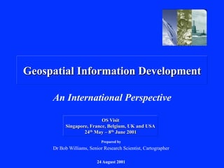
  • 1. Geospatial Information Development An International Perspective Prepared by Dr Bob Williams, Senior Research Scientist, Cartographer 24 August 2001 OS Visit Singapore, France, Belgium, UK and USA 24th May – 8th June 2001
  • 2. Itinerary and Agenda Singapore, SN Paris, FR Mons, BE Feltham, UK Tolworth, UK Bethesda, US Reston, US Boston, US Multi-National body Digital Geographic Information Working Group NATO SHAPE Geographic officer UK MOD Defence Geographic & Imagery Intelligence Agency US DoD National Imagery & Mapping Agency US Industry Raytheon Marlborough Paris, FR • Standards and interoperability Mons, BE • Geographic information requirements Feltham & Tolworth, UK Br High Commission, SN • Mission and concept of ops • Operational support • Reference library, acquisition • International boundaries Bethesda & Reston, US • International and policy • International boundaries • Research & development • USIGS CONOPS Marborough, US • Company profile • ADATS • ADAMS • FAA system development
  • 3. Visit DGIA Officer within British High Commission Singapore Ø  Agenda Ø  Significance Role and function as a DGIA exchange officer Map exchange and standards activities The Asia-Pacific region and sources of geospatial information Access to a vast array of maps, publications, and information from Government and commercial sources across the Asia-Pacific region Links already exist (to a minor extent) with DIGO via UK DGIA
  • 4. Meeting Digital Geographic Information Working Group Ø  Participating nations Ø  Agenda Ø  Significance Host nation France Australia, Belgium, Canada, Czech Republic, Denmark, France, Germany, Greece, Italy, Netherlands, New Zealand, Norway, Poland, Portugal, Spain, Sweden, Turkey, UK (Chair SC), US (Chair TC, Chair VaCWG), SHAPE, Hungary Review actions 32nd SC, Liaison reports, NATO initiatives, NATO Requirements, TC reports, OGC updates, ISO TC211 updates, hydrography updates, Strategy and re-organisation updates, national presentations, Gateway services, softcopy catalog, JWID/CINC21, DIGEST the Next Generation, Industry presentations Ø Interoperability • Key driving force Ø Participation • Too large for existing structure • Conference and strategy groups Ø Industry / other bodies • DIGEST is mandatory for all French C3I systems • Collaboration and involvement requires resources
  • 5. Visit NATO SHAPE Geographic Office Ø  Participating nations Ø  Agenda Ø  Significance Chief (COL Germany), LTCOL UK, Capt Spain, WO UK and Italy Principles of NATO Geo policy,IGEOWG standards, Co-operation with NATO HQ and SFOR/KFOR, briefing from RC North, meteorology and Oceanography, GIS study, synthetic exercise environment, brief from Germany Totally dependent of national capabilities GIS development parallels UK (and AS [1 Topo]) developments Need to embrace commercial imagery Need to adopt DIGEST standards Welcome collaboration [AS it seen to have ‘neutral’ standing] Host Chief Geo SHAPE Location Mons, BE
  • 6. Visit UK DGIA – DGC (Feltham) & Map Library (Tolworth) Ø  Agenda Ø  Significance Ø DGIA overview, Introduction to DGC, operations and plans, capability Ø development, production briefing and tour, map depot Ø MOD map library and holdings, acquisition activities (World’s largest) Ø Boundary studies Ø DGC is second largest [defence] mapping agency in [western] world Ø Change in Conops to ‘acquire’ rather than ‘produce Ø SF is now key operational ‘trigger’ Ø GII prototyping (foundation data – mission specific data) Ø Migration from 27 legacy systems within DGIA Ø Management of information is a major concern (eg depot has 17,000 line items; library has 600,000 items) Ø R&D support has been historically poor Ø Border issues are increasing in importance Ø Releasibility is of higher concern than security per se
  • 7. Visit National Imagery and Mapping Agency (Bethesda, Westfields, Reston) Ø  Agenda Ø  Significance Ø  Concerns!! Ø NIMA overview, International and Policy Office role, Ø Border delineation discussions Ø NPC tour, R&D discussions (Advanced Research and Development Division) Ø USIGS CONOPS (after next), customer support Ø NIMA is largest mapping agency in [western] world Ø GII concept, multi-Int Ø GI21 – “Geospatial Information that makes the difference” Ø Border issues are increasing in importance (liaison with State Department) Ø USIGS Conops has a weakness in spatial data modelling Ø Geospatial science (re future data models) is a weakness – However!! Ø Aeronautical information development seems constrained
  • 8. Visit Raytheon (C3I Systems) Ø  Agenda Ø  Significance Ø  Concerns Ø Overview of Raytheon organisation Ø Review of ADATS and adaptation data Ø Tour of ADATS/AutoTrav/STARS lab facilities Ø Demo of Enhanced DMS Ø ADATS (International Air Traffic Control, Integrated Systems, C3I Systems) Ø Australia 13 sites – USA (FAA) 331 sites Ø Raw adaptation data – spreadsheets , text files Ø Raytheon seem to have minimal skills in ‘geospatial information and science’ Ø FAA seem committed to ‘digitising the manual process’ Ø FAA and Raytheon seem to be embracing radar navigation (cf GPS guidance) Tabular files Airport, significant point, airways, FIR, standard routes Graphical files Maps (World vector shoreline) Tiles
  • 9. ❖ Interoperability and Standards Key Observations Digital Geographic Information (DGI) has evolved into an essential element in the planning and conduct of civil and military operations. The required data volume, demands, and data complexity dictate that multi-national agreements for digital data standards be established to assure compatibility. In support of this aim, these standards define those aspects necessary to the exchange of DGI. They are as follows: - the data structures to be supported (including spatial structure and metadata); - feature and attribute coding scheme; - format; - exchange media; and - administrative procedures. The type of data to be exchanged using these standards includes the digital representation of the following: - geographic feature geometry and feature attribute information; - information concerning the appearance and status of the Earth’s surface and its features in the electromagnetic spectrum, e.g. radar, infra-red; and - other geographic information. The data will all be available on a common worldwide reference datum of World Geodetic System 1984 (WGS 84). DIGEST DIgital Geographic Information Exchange STandard Digital Geographic Information Working Group
  • 10. Interoperability and Standards IHO International Hydrographic Organization Australian Spatial Data Infrastructure Australian Global Navigation Satellite System Coordination Committee A broader context ö ö The issues on this slide are not addressed in accompanying report Military Modelling and simulation International bodies ISO/TC 211 Geographic information/Geomatics National bodies
  • 11. ❖ Geospatial Database Management George J.Tenet Director of Central Intelligence Dr. John J. Hamre Deputy Secretary of Defense DCI Statement on the Belgrade Chinese Embassy Bombing House Permanent Select Committee on Intelligence Open Hearing 22 July 1999 LTGEN James C.King Director of National Imagery and Mapping Agency Key Observations “It is important to understand that our ability to locate fixed-targets is no better than the data bases, and the data bases in this case were wrong!” Ø  Data base production and maintenance has been routinely accorded a low priority and often overlooked in production planning and scheduling. Ø  Data base production is often the first activity curtailed when resources are tight. Ø  Data base production is widely viewed as low visibility, unrewarding, and unappreciated. Ø  Leadership attention and emphasis on data base production is infrequent, episodic, and essentially reactive.
  • 12. Geospatial Database Management Ø  Acquisition / compilation Ø  Production Ø  Management Ø  Dissemination Acquiring (e.g. open-source) v. production UK DGIA (DGC) Paper / Product CD Internet (COTs) Paper, film, CD, tape, catalogues, publications ISSUES: • Maintenance and revision • Accreditation (effects of transformations and processing) • Catalogues, electronic libraries, gazetteers and borders • Releasability and security Acquiring GI 13% funding Producing GI 21% funding Managing GI 10% funding GI infrastructure 38% funding FD / MSDS (just-in-time / just-in-case) 1 degree cell – 1600 hours 15 minute cell – 468 hours + FD Readiness / responsiveness
  • 13. ❖ Capability Development Key Observations Architecture’s focus ! Multi-Int focus !
  • 14. Capability Development Ø  Interoperability v. compliancy Ø  Portal delivery Ø  Broader user community Information exchange v. ‘cloned’ system Generic information / naïve user Precision weapons, UUV, UAVs, robots C2 systems, sensor and asset management Air traffic control Intelligent logistics and transportation Eugene A.Conti, Jr. US DoT
  • 15. ❖ Research and Development Ø  Minimalist in-house R&D capabilities Ø  Technology focus Ø  Intelligence focus Key Observations ORTA Technology Framework NIMA Enabling Technologies Advance Technology Developments Technology Programs Challenges Strategic Objectives International Research &Development NIMA University Research Initiatives Historically Black Colleges & Universities Small Business Innovative Research Cooperative R&D Agreements Industrial Research & Development
  • 16. Research and Development Ø  NIMA Enabling Technologies Ø  Geospatial science Ø  Computer science Ø  Physical science Ø  Image science Ø  Mathematics Ø  Visualization technology
  • 17. Initiatives & Thrusts 1985 1990 1995 2000 1980 OS France UK US 1975 OS Norway UK US DCW R&D Seminar DES Concept Paper Report Workshop Report Concept Paper Publication 2 years 10 years 21 years ¼ century First digitisation from stereo-photos First GIS for Ex planning AUTOMAP Future applications MISTI
  • 18. Recommendations Interoperability and Standards Ø  Knowledge Staff & DIGO Ø  enforce policy and doctrine Capability development Ø  Specialist technical standards office Standards advice IHO Acquisition & Services Group Advanced Capabilities Group
  • 19. Recommendations Geospatial Information Management Ø  Electronic library and catalogue service Ø  Analysis of reference library, catalogues, agreements, etc Ø  Global Information Grid Ø  Analysis of analogue and digital databases incl. Schemas, datums, media, etc Ø  Management Information System for Acquisition, Compilation and Services Ø  Analysis of production process re: readiness - responsiveness Geospatial Information Branch Advanced Capabilities Group
  • 20. Recommendations Capability Development Ø  Audacious goal – Future Air Traffic System Ø  Amendment to JP2064 – service to ADATS Ø  Experimentation – From a publication paradigm to information service paradigm Ø  Audacious goal – Future geo-political advisor Ø  Experimentation ADATS
  • 21. Ø  Audacious goal Create a virtual Advanced Research and Technology Division for Surveying and Mapping Ø  People Matter – review qualifications and expertise of staff within Defence Ø  People Matter – Mandatory requirement for liaison and exchange personnel to have qualifications and expertise in a mapping science Recommendations Research and Development Advanced Capabilities Group Multi-lateral relationships Quadripartite agreements Bi-lateral arrangements OS Defence Trends AS Defence Trends Knowledge Staff Basic and applied research Defence industry Prototype facility Academia
  • 22. Back to the Future Dare to Change VERSAILLES Paintings Sculptures Napoléon Bonaparte 1769-1821 Bataille de Wagram 1809 La Siége de la Rochelle 1628 Gérard Desargues 1591-1661 René Descartes 1596-1650 Pierre-Simon Laplace 1749-1827 6 3 1 5 4 1 Perspective painting 2 Introduced perspective geometry into mathematics Technical advisor and engineer at Rochelle 3 Painting shows telescope in right hand and map in left hand 4 Battle against Austria 5 La Géométrie – invention of analytical geometry 6 Mathematician – differential equations and geodesy Examiner at Royal Artillery Corps Surveying and cartography v  An intelligence focus v  With engineering skills 2 Cogito ergo sum