
Empfohlen
Empfohlen
Weitere ähnliche Inhalte
Was ist angesagt?
Was ist angesagt? (20)
Ähnlich wie Gary Land Use Plan Guide
Ähnlich wie Gary Land Use Plan Guide (20)
Kürzlich hochgeladen
Kürzlich hochgeladen (20)
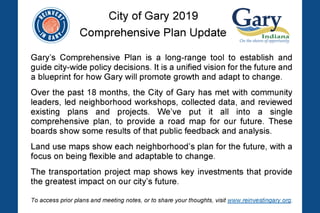
Gary Land Use Plan Guide
- 2. Gary Comprehensive Plan Land Use Type Description RESIDENTIAL Residential Stable residential neighborhood containing a mix of single family and multifamily buildings. Provides for the preservation and maintenance of the neighborhood. Flexible Residential Distressed residential neighborhood with high vacancy rates as well as residential homes that will continue over time. Allows higher levels of flexibility in re-use and could ultimately transition to another role over time. Transition to Employment Severely distressed residential neighborhood where attrition has passed a tipping point. No longer a viable residential area; will transition over time to serve another purpose for Gary’s future. COMMERCIAL Downtown Accommodates multi-story, mixed-use buildings at higher intensities. Provides for vertical and horizontal mixed-use development, class A office space, and walkable uses conducive to the city’s downtown area. Neighborhood Mixed-Use Corridor Provides for areas with a wide variety of existing residential, office, retail, dining, and institutional uses. Neighborhood Commercial & Services Allows for a variety of retail, service, dining, arts, and other supportive uses in low-rise buildings. Flexible Commercial Distressed commercial area, allows for higher level of flexibility and targeted investment around viable activity centers, transit stops, and commercial nodes. Transit-Oriented Development Supports a transit-oriented district around the Miller, Downtown and Clark Road transit stations with higher intensity, mixed-use development within walking distance of the train station, and lower intensity commercial and industrial uses around the periphery. Allows for a wide variety of commercial, service, residential, recreational, and institutional uses. Entertainment District Supports an entertainment area by accommodating multi-story buildings with a wide variety of uses. Highway Commercial Allows auto-oriented retail and services along I-80/94 and I-65 to capitalize on high traffic interstate corridors. EMPLOYMENT Light Industrial/ Employment Flex Provides an area for a wide variety of employment-generating activity, including office, light industrial and manufacturing, research and development, transportation and logistics, technology parks, and supportive commercial. Heavy Industrial Accommodates high-intensity, high-impact industrial activity. Use is buffered from other residential and commercial uses. Airport Allows for the continued use of the land supporting the further development of Gary-Chicago International Airport. Intermodal/Logistics Encourages growth around heavy industry, shipping, logistics, and intermodal port development. OPEN SPACE Managed Conservation Lands Preserves managed conservation land that provides for ecological preservation, public open space, recreation, and stormwater management. City Parks Maintains parks and open spaces that provide recreational benefits for residents. Parks are typically managed by the City of Gary parks department. Landscape Reserve Allows for areas that put vacant land back to use as productive uses, such as food and forest production, and/or natural landscapes, such as forests, or renewable energy development in low density areas. Larger landscape areas may be reused for other purposes in the future consistent with market demand and development opportunity. A portion of these areas will be used to manage stormwater. PUBLIC / INSTITUTIONAL Public Reserves areas for public and institutional uses, including hospitals libraries, and government buildings. Schools and Universities Reserves areas for schools, universities, and other educational uses. Land Use Designations
- 6. Redevelop with neighborhood services to complement new employment uses
- 7. Lake Michigan Complete Gary Green Link Trail
- 11. ! ! ! !( !( !( !( Lake Michigan Marquette Trail Green Link Trail Oak Savannah Trail Buchanan Street 35TH AV 11TH AV 21ST AV GRANTST 19TH AV TAFTST 37TH AV COLFAXST 8TH AV CENTRAL AV BURRST GEORGIAST INDUSTRIAL HW Y CHASEST CLARKRD 25TH AV 15TH AV ¬«55 ¬«312 ¬«51 ¬«912 ¬«53 £¤12 £¤20 §¨¦65 §¨¦80 §¨¦90 ")26 ")27 ")28 Gary/Chicago International Airport Downtown US Steel IUN Marquette Park Buffington Harbor ")25 ")28 ")26 ")27 ")24 ")30 ")29 ")13 ")15 ")22 ")3 ")10 ")11 ")4 ")16 ")23 ")19 ")21 ")12 ")14 ")2 ")17 ")20 ")1 ")5 ")18 ")6 ± Legend Planned/Programmed Projects Bike Lane Complete Street Road Diet Rehabilitation Roadway Improvement Road Realignment Truck Route !( Safety Improvement Transit Oriented Development Planned/Proposed Trail Planned/Proposed Bike Lane Active Railroad Inactive Railroad ! South Shore Station South Shore Line City of Gary Limits Managed Parks and Open Space Existing Trail City of Gary 0 2,000 4,000 Feet Planned / Programmed Projects")# Planned/Programmed Project ID Id Project Type Status 1 W 4th Ave Truck Route Planned 2 W 5th Ave Complete Street Planned 3 Grant St Complete Street Conceptual 4 Buchanan St Complete Street Planned 5 Massachusetts St Bike Lane Conceptual 6 Broadway Complete Street Programmed 7 Lake Street/Miller Station (SSL) Transit Oriented Development Programmed 8 Gary Metro/Adam Benjamin Station (SSL) Transit Oriented Development Conceptual 9 Clark Rd/Gary Chicago Airport Station (SSL) Transit Oriented Development Conceptual 10 Aetna St Road Diet Conceptual 11 Clay St Complete Street Conceptual 12 Lake St Complete Street Programmed 13 Miller Ave Complete Street Conceptual 14 Grand Blvd Complete Street Conceptual 15 Hemlock Ave Complete Street Conceptual 16 US 12/20 Realignment Road Realignment Programmed 17 11th Ave Road Diet Conceptual 18 15th Ave Complete Street Conceptual 19 25th Ave Road Diet Conceptual 20 35th Ave Complete Street Planned 21 Ridge Rd Rehabilitation Planned 22 Harrison St Rehabilitation Conceptual 23 Buffington Harbor Rd Roadway Improvement Planned 24 Buffington Harbor Rd Extension Roadway Improvement Planned 25 Lake St RR Crossing Safety Improvement Conceptual 26 Old Hobart RR Crossing Safety Improvement Conceptual 27 County Line Rd RR Crossing Safety Improvement Conceptual 28 Grant St and Ridge Rd RR Crossing Safey Improvement Conceptual 29 Marquette Trail Trail Planned 30 Green Link Trail Trail Planned