
Empfohlen
Weitere ähnliche Inhalte
Was ist angesagt?
Was ist angesagt? (20)
Andere mochten auch
Andere mochten auch (7)
Ähnlich wie Corridor concept for tod workshop herman
Ähnlich wie Corridor concept for tod workshop herman (20)
Kürzlich hochgeladen
Kürzlich hochgeladen (20)
Corridor concept for tod workshop herman
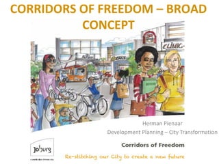
- 1. CORRIDORS OF FREEDOM – BROAD CONCEPT Herman Pienaar Development Planning – City Transformation
- 2. CONTENT • Background and overview of city development strategy • Corridors of Freedom concept and approach • Corridor focus areas
- 3. JOHANNESBURG DEMOGRAPHICS • Total Population – 4.4 million • 36% of Gauteng population • 8% of national population • Johanesburg is growing faster than the Gauteng Region • COJ population increase by 38% between 2001 and 2011.
- 5. Based on 5 indicators: •Income •Employment •Health •Education •Living Environment
- 6. THE CONCEPT – CORRIDORS OF FREEDOM • The City of Johannesburg is embarking on a new spatial vision for the city in line with the Growth and Development Strategy 2040, based on corridor Transit-oriented Development (TOD). • The shape of the future city will consist of well-planned transport arterials – the “Corridors of Freedom” – linked to interchanges where the focus will be on mixed-use development – high-density accommodation, supported by office buildings, retail development and opportunities for leisure and recreation.
- 9. SUSTAINABLE HUMAN SETTLEMENTS URBANISATION PLAN (SHSUP) STRATEGIC DEVELOPMENT AREA MODEL- LED YIELD 1In-situ Upgrading 26,500 2Nodes Within PPTN 75,500 3Nodes Outside PPTN 30,585 4TOD 74,117 5BRT 84,482 6Short-Term North 56,929 7Short-Term South 91,497 8Consolidation &Infill (North) 157,539 9Consolidation &Infill (Mining Belt) 70,461 10Redevelopment South Suburbs 23,775 Sub-Total 691,385 11Expansion North 78,662 12Expansion South 72,138 Sub-Total 150,800 13Rest of the City 293,970 Sub-Total 293,970 Total 1,136,155
- 10. Railways Motorway Gautrain_Rail Development_Corridors Industrial_Node_polygon Mixed_Use_Nodes_polygon Captital Invesment Prioirty Areas Significant_Open_Space CIPA_desc Inner City City Deep Empire_Perth_Corridor SowetoHighway_Corridor Turffontein_Corridor Soweto_Public_Transport_Corridor LouisBotha_Corridor Within UDB Areas_Beyond_UDB Cadastral Base !. Cross_Border_Nodes CoJ_boundary Capital Investment Priority Areas (CIPAs)
- 11. Addressing Deprivation Levels Through Spatial Restructuring
- 12. CORRIDORS OF FREEDOM OUTCOMES
- 13. Study Outline • Strategic analysis • Strategic Area Framework – Desired built form and spatial vision • Interventions for increased accessibility – Quantified development potential • Interventions to achieve density within a TOD/SHS framework • Cost benefit – Modelling current and future scenarios • Corridor Development Programme – Quantified interventions – Spatially defined with time and sequential events
- 14. DEDICATED PUBLIC TRANSPORT AS BACKBONE
- 16. Translating the Vision and Defining the Targets
- 18. THE STUDY AREA T S O L O R O A D
- 19. CORRIDORS OF FREEDOM APPROACH
- 21. CORRIDOR AS AN URBAN SYSTEM
- 22. Densification options Large Scale Precinct Development High Density Infill on Underutilised Land Consolidation and Redevelopment
- 23. CORRIDORS OF FREEDOM FOCUS
- 24. Empire Perth Corridor of Freedom
- 25. Proposed transit system Good quality North South linkages required Existing Metrorail Stations Existing Bus Terminals
- 26. Densification areas backbone for densification policies, land use zoning and development controls. Delineation of areas of densification
- 27. Vertical density
- 28. Louis Botha Corridor of Freedom
- 30. Proposed transit system Several of the streets in Turffontein used to be tramway reserves and consequently De Villiers-, Turf- and Turffontein Road have road reserve widths of more than 18m. These road reserve widths are suitable to accommodate a Bus Rapid Transit System.
- 31. Delineation of areas of densification areas Densification areas Backbone for densification policies, land use zoning and development controls.
- 32. 3D Visualization• Land Use
- 33. • How can we transform cities to be sustainable, efficient, beautiful, and invigorating to the human sole? • How can we bring together residents of diverse backgrounds, and empower and uplift the disenfranchised? • How can urban environments propel us to realise our healthiest bodies, strongest communities, and most creative minds? • And practically speaking, how do we get from here to there? CONCLUDING REMARKS