
Empfohlen
Empfohlen
Weitere ähnliche Inhalte
Was ist angesagt?
Was ist angesagt? (6)
Ähnlich wie Past_Present_Future_MEEM Spatial Data & GIS Mapping1
Ähnlich wie Past_Present_Future_MEEM Spatial Data & GIS Mapping1 (20)
Mehr von Razimulseye
Past_Present_Future_MEEM Spatial Data & GIS Mapping1
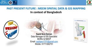
- 1. PAST PRESENT FUTURE : MEEM SPATIAL DATA & GIS MAPPING In context of Bangladesh Sazid Ibna Zaman Data Manager & GIS Specialist MORU & NMCP Email: sajidgeo1707@gmail.com Mobile: 01711262751
- 2. Bangladesh Overview Status of my work Success Challenges MEEM Should Focus on….
- 3. Use of DDT during Malaria Eradication Program (MEP)—two rounds/year for three years followed by focal spraying MEP Stopped in 1974 Formation of National Malaria Control Program in 1977 NMCP funded by GF & Partnership with a BRAC led 21 member NGO Consortium in 2007 Historical Malaria Cases 84690 cases in 2008 26891 cases in 2013 Pf: 95% of cases Pv: 5% of cases Contributor to decrease • Widespread use of ACT(Artemisinin Combination Therapy) • Use of Long-lasting Insecticide treated bednets • Vector control measure 57480 cases in 2014 Increase continuing up to June 2015 and Decrease rest of the year in compare with 2014. Contributor to Increase • Unclear • Investigation needed
- 4. MEEM NMCP
- 5. Increasing Rate (more than double from 2013 to 2014) Eastern parts of Rangamati (7976 to 17166) Eastern parts of Bandarban (9459 to 24418) Cox’s Bazar Bandarban Khagrachhari Rangamati MEEM MEEM
- 6. Proportionate spatial distribution of Bednet by Upazila from 2011 to 2013 and Plasmodium Falciparum Annual Incidence Rate by union in 2014 in Chittagong division MEEM MEEM Spatial Distribution of Monthly ACT Course Stock by district and Plasmodium Falciparum Incidence by union in Chittagong Division in 2014
- 7. MEEM MEEM
- 8. MEEM MEEM
- 9. NMCP NMCP High Endemic Area Medium Endemic Area Low Endemic Area Endemic Free Area 2010 2011 2012 2013 2014
- 10. NMCP NMCP Sylhet, Maulvibazar, Habiganj, Sunamganj
- 11. MEEM NMCP
- 12. MEEM NMCP Organizing data to prepare annual parasite incidence by Upazila/Union/Village for the year 2015 Creating complete & up to date village registry API = Cases/Per 1000 population DIV DIS UPA UNI MOU VILL Attending MEEM Workshop Proposal Writing Towards malaria control & elimination in Bangladesh Integrated Digital Malaria Surveillance System: Real Time Data Collection
- 13. MEEM NMCP
- 14. MEEM NMCP 1. Village Registry & Shapefile for entire country 2. Risk Mapping for Dengu & Malaria 3. Integrated Surveillance System 4. Real Time Mapping 5. Annual Parasite incidence of malaria by Upazila/Union/Village in 2015 6. Population Movement Studies (CDR Data Analysis & Mapping) 7. Cross Boarder Issue 8. Mosquito Mapping 9. Vector Behavior 10. Tribal & Non Tribal Issue 11. Bed Net Survey 12. Spatial distribution of IRS I n t e r v e n t i o n s Mathematical & Economic Modelling Spatio-Temporal Modelling Static Map Data Collection Real Time Map IntegratedModellingPlatform Visualization Interchange with adding/ subtracting information Editing Publish Share Print
- 15. MEEM NMCP
- 16. MEEM NMCP • Presentation, Workshop, Training, Skype meeting, Discussion, Scientific Seminar, Journal Club Communication Skill Development • In-depth knowledge, Literature review, Proposal Writing, Protocol develop, SOP Programmatic Understanding • Data Collection, manipulation, organize, Graphical representation, Map interpretation, Analysis Data Management and GIS Mapping • Insufficient stocks of ACT treatment • Reported low efficacy of old LLIN • Importation from India / Myanmar. Increase in malaria in Tripura State, India bordering Chittagong Division • Mid-season interruption in rainfall • Relaxation of efforts by health workers (govt & NGO) • Change in mosquito behavior • Less likely: • Antimalarial resistance: TES of ACT in 3 sentinel sites by NMCP in 2013-14 found 100% efficacy of ACT. Further TES is ongoing. • Insecticide resistance: susceptibility testing by NMCP in 2014: An. vagus showed reduced (80% to 97%) susceptibility to deltamethrine. Other species 100% susceptible.. Contributing factor to Malaria upsurge in 2014
- 17. MEEM NMCP • Consolidated cases data are provided once in every month. • Micro stratification data is captured only by NGO. Government part is missing. • Data can be input up to Upazila level through MIS System. • ACT stock can be tracked up to Upazila level. • There is no individual record of distribution of LLIN Malaria Cases Data, ACT stock, LLIN, IRS • Downloaded files are in pdf format • Amount of villages are different in between Bangladesh Bureau of Statistics & Bangladesh Government portal • As the amount is different, so there are lot of missing Geocode • There is no standard spelling of the name of the place. Different organizations are using different spelling. Village registry & Geo coding • Different organizations are using different shape file of administrative areas, Road network, Waterbodies and so on. Even they are using different shapefile of same feature in a single project. • There is no shape file with having up to date geocode • No village shape file. Data Management and GIS Mapping
- 18. MEEM MEEM Limitations of Existing Malaria Data Collection System Peripheral (in the field): 1. Hard copy reports 2. Lacking of accountability & transparency. 3. Time consuming Central (NMCP): 1. Provide monthly aggregated summaries instead of daily or immediate case notifications. 2. Consolidated data is provided from the Upazila statistician instead of the primary data collector. This may introduce errors in the data. 3. Data are mostly not delivered on time. 4. Time consuming to enter and process the data. Towards malaria control & elimination in Bangladesh Integrated Digital Malaria Surveillance System: Real Time Data Collection N.B. The fund is very limited
- 19. MEEM MEEM Real Time GIS Real time maps could predict and prevent the spread of malaria Make Better Decisions the Moment Something Happens Real-time GIS analyzes sensor data and other live feeds, then puts it on interactive maps for real-time decision-making.
- 20. MEEM MEEM Rael Time Rael Time Modelling Rael Time Analysis • Visualize both model in a single window • Interactively change both Data/Model/ Map • Make Decision • Send Recommendation • Facilitate Organization and enduser • Publish/Share/Print within organization or publicly
- 21. MEEM MEEM Intranet GIS & WebGIS INTRANET GIS TO IMPROVE INTERNAL COMMUNICATION AND BUILD RELATIONSHIPS WITHIN A LOCAL AUTHORITY • Departments share each others data • Centralized data storage and management • Services are ‘joined up’ • The data is viewed in the context of an entire organisation rather than in isolation • Decision making is improved • Money is saved or invested in a better way • Both the local authority staff and the citizens benefit WEB BASED GIS TO IMPROVE EXTERNAL COMMUNICATION AND BUILD RELATIONSHIPS WITH CITIZENS • Deliver ‘e’ services to citizens • Add value to authorities existing web pages / services • 24/7/365 access to service • Provide information for visitors and tourists
Hinweis der Redaktion
- Good Afternoon…There is nothing to introduce myself as you all know about me. Through this presentation I would like let to know about my work….What I did so far, What I am doing right now and What I will do in future.
- I will go through the mentioned topic……
- The Malaria Eradication Program in Bangladesh came close to eliminating malaria in the 1960s by widespread use of DDT (two rounds/year for three years followed by focal spraying) and active and passive case detection with radical treatment of confirmed cases (figure 1). However, during the liberation war in 1971 the eradication program was discontinued and malaria greatly resurged. MEP stopped in 1974 and merged with Primary Health Care. The National Malaria Control Program (NMCP) was formed in 1977 with the initial aim of control. Since 2007, NMCP activities have been greatly strengthened and accelerated with funding from the Global Fund and partnership with a BRAC-led 21 Member NGO Consortium and academic and research institutions. This was followed by a more than 3-fold decrease in annual confirmed malaria cases from 84,690 in 2008 to 26,891 in 2013 and there is now a plan for elimination. Since first tested by RDT in 2008, around 95% of cases in Bangladesh had P. falciparum and the rest P. vivax. Widespread use of artemisinin combination therapies (ACT), long-lasting insecticide treated bednets (LLIN) and vector control measures were major contributors to this decrease. However, in 2014 the number of confirmed cases in Bangladesh more than doubled to 57,480, the increase continuing into 2015.
- Lets talk about what I have done so far since my joining……The cause of the marked increase in malaria in 2014 was unclear and an urgent investigation was begun. The following maps present a preliminary analysis from this investigation.
- This is the first map I produced showing the comparison in between 2013 & 2014 malaria cases and spatial distribution of the annual parasite incidence of Plasmodium falciparum. You can see the affected areas as well. Mostly cases are there in south eastern part of the country specilally four district I mentioned here……Rangamati, khagra………Among these four district Bandarban & Rangamati are the mostly effected one….In eastern part of rangamati cases increased from 7976 in 2013 to 17166 in 2014 and in eastern part of Bandarban it was 9459 in 2013 to 24418 in 2014.
- 2nd map describes the proportionate spatial distribution of Bednets by Upazila from 2011 to 2013 on top of Plasmodium falciparum annual parasite incidence by union in 2014 in Chittagong district. Smallest circle represents less than 10% bednet coverage and largest circle represents in between greater than 60 and less than 70 % of bednet coverage. 3rd map defines the Spatial Distribution of Monthly ACT Course Stock and Plasmodium Falciparum annual parasite Incidence in Chittagong Division in 2014. With the decrease of the ACT stock the cases increase.
- I made a simulation map of monthly malaria cases in 2013 and 2014. White represents malaria free endemic area, green represents less than 50 cases and Red represents in between 700 to 900 cases per month.
- Actually I didn’t get much time to map with R. So far I made a map of community clinic of Ramu Upazila in single window long days before on the right side. On the left side I tried to show different health facilities like Community clinic……. In a single window. Even I delivered a presentation last time on How to read and write ESRI shape file by using R.
- I have done some maps for NMCP as well. First map is a simple map describes the endemicity of malaria endemic area in Bangladesh. The map is symbolized into four different categories like High medium low endemic area and Endemic free area. Second one is the comparative analysis of Annual parasite incidence by Upazila from 2010 to 2014. You know now a days cross boarder issue is coming front to discuss, investigate in the field of malaria. Its really needed to know the name and the location of the places around the boarder for cross boarder issue. So I prepared geographical location of Bangladesh for some issue on cross boarder.
- Recently Bangladesh declared the malaria pre elimination district of Bangladesh. Four Districts Sylhet……….mostly north eastern part of Bangladesh were declared.
- Lets talk about the future…..
- I think there are lot of issues needed to investigate and implement in future. So far I have prepared maps up to union level. I want to do some micro level mapping next year. So I need to get malaria data as well as shape file of village level so that I can do some precise analysis on spatial distribution. ……. …….. ……. I have got so far cases information up to Upazila level. After getting micro stratification report I will map by union and then by village. Richard & Amy visited Bangladesh regarding CDR data. We had a fruitful discussion with three mobile company in our country. They promised to provide us the data but there is a problem regarding data sharing policy of CDR data. So they need the permission from the Bangladesh Telecommunication Authority. Amy already sent us the documents to submit to BTCL for the approval. Hopefully we will get the approval soon. Christopher Plowe, MD, MPH, Director, the institution of global health came at NMCP to discuss about the Rohinga migration through Bangladesh-Myanmar boarder. I think they will start their investigation on Rohinga people very soon. …… I am going to attend a workshop associated with VectorBite Research Collaboration Network in florida, USA at the end of this month. I will share with you what they are doing with Vector behavior and what's their plan in future. In our country It is seen that tribal people are getting effected than non tribal people and the ratio is like 90% tribal and 10% non tribal as if the population is more or less equal in respected places.
- The more than doubling of malaria in Bangladesh from 2013 to 2014 was mostly in the Chittagong Hill Tracts, particularly Bandarban and Rangamati districts. Possible factors contributing to the increase include: Before joining here I was very afraid to present anything in front of the audience. Even Trembling hands and feet. I am really surprise to see me…I am delivering presentation! Is it real? My communication skill is becoming more stronger through presentation, workshop, training, discusstion……. After joining here I was afraid to whether I could understand the program or not as this is for the first time I started working in public health specially on disease. So obviously there would be some medical term, issue which was definitely difficult to understand. But after reviewing literature, discussion with you all regarding issues the things are getting much more clear. Now I am developing my skill in program related other issues like proposal writing, protocol develop, SOP develop and so on. I have been working on GIS field for around 9 years. But after meeting with steeve I discovered myself how back dated I am. I am learing how easily data can be managed, from where we should start which is the most important part. So I becoming good in data managing day by day
- So Meem should focus on……. Data is the life of data modelling.. Perfect data can ensure the perfect result. Wrong data can destroy your career sometimes. So we should be careful about data. I remember during the ESRI User conference steeve said you will see lot of WOW factor in ESRI product. But everything will be in vain unless there is a good data. So definitely we need to updrade the surveillance system if the system does not work well.
- So Meem should focus on……. Data is the life of data modelling.. Perfect data can ensure the perfect result. Wrong data can destroy your career sometimes. So we should be careful about data. I remember during the ESRI User conference steeve said you will see lot of WOW factor in ESRI product. But everything will be in vain unless there is a good data. So definitely we need to updrade the surveillance system if the system does not work well.