The Archwilio App: Marion Page (The Dyfed Archaeological Trust)
•Als PPTX, PDF herunterladen•
1 gefällt mir•1,559 views


Empfohlen
Empfohlen
Weitere ähnliche Inhalte
Andere mochten auch
Andere mochten auch (8)
Mehr von RCAHMW
Mehr von RCAHMW (20)
The Archwilio App: Marion Page (The Dyfed Archaeological Trust)
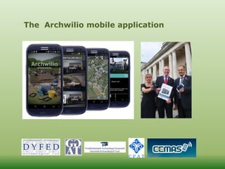
- 1. The Archwilio mobile application
- 2. Welsh Historic Environment Records online: www.archwilio.org.uk
- 8. images
Hinweis der Redaktion
- On start up the app performs several system checks related to the availability of GPS and WiFi or Mobile Data. If any of the tests fail then the implications for this are presented to the user. They can then choose to quit or to continue using the app with reduced functionality. A back end service keeps track of the device’s location via GPS. If GPS is not available the service listens for when it is enabled and resumes tracking GPS location. During use the screen indicates when GPS and Data become unavailable via a dialogue. On first time use the option to select a language preference is offered. Archwillio is a bi-lingual application in Welsh and English although HER site data remains in English, as this is the language in which the data was originally recorded.
- The application uses the open source OSM droid library for mapping. This was chosen because it supports offline caching and a variety of map providers - one of which is Bing, the mapping provider now used for both Archwilio and the Archwilio app. On start up the user’s location is indicated. Since 3G availability is patchy over much of Wales the app allows the user to view information while a WiFi or 3G signal is available; this is cached on the device and can be retrieved for access to HER information when out in an area with no access. If a connection to the internet is possible the date of the last HER update will be retrieved. The app then inspects the phone’s storage to see if this record has been downloaded. If it has then the date of the more recent HER update will be compared with the local copy. If the online HER record is newer than the one on the phone new data will be downloaded. This all happens in the background when this screen (right) is displayed. The user zooms in on the area they wish to investigate, or where they are currently located. Each archaeological site is indicated by a map marker that is either blank or contains a number when there is more than one site in the vicinity. This clustering prevents the map being obscured by hundreds of markers.
- Tapping a blank map marker causes a balloon to appear with basic site information. The user can then decide whether or not to progress to more detailed information and images. If a map marker indicates more than one site, then tapping it causes a list of those sites to appear. The user then selects a site to access more detailed information and images.
- Tapping on Details provides basic information – UID, type and period of site etc.
- Users can send the HERs additional information or corrections for existing site records, along with images
- Edit site screen
- The WATs have been sent almost 500 entries into this database since the app was launched. 193 GGAT, the rest pretty evenly divided between the other 3 trusts A mixture of images, information on sites and some duplication.
- 22397 on Archwilio html
- 22397 full size We now know that there are documents, photos and articles relating to Nant y Moch farmhouse in the Ceredigion Record office. The app has given us that knowledge as well as this image.
- A youth volunteering project in Blaenau Gwent is using the app to update records of existing sites and to record new sites like this hut and enclosure. The app is ideal for getting information into the public domain without having to go through the sometimes lengthy process of updating the HER from project reports. The user can see their efforts rewarded reasonably quickly, especially when uploading images. Initially the project was intended to have its own data entry volunteer, but use of the app means that all the volunteers can be engaged in fieldwork.
- In Gwynedd Archaeolegwyr Anturus Eryri is an HLF funded club for young people aged 14-21yrs that has been using the App out in the field.
- The app will be a useful and important tool for rapidly recording sites not previously seen, or not seen for several generations, such as the submerged forest on Newgale beach and the trackway at Llanrhystud, revealed by the recent storms.