
Empfohlen
Weitere ähnliche Inhalte
Was ist angesagt?
Was ist angesagt? (20)
Ähnlich wie Traffic Engineering And Drainage
Ähnlich wie Traffic Engineering And Drainage (20)
Kürzlich hochgeladen
Kürzlich hochgeladen (20)
Traffic Engineering And Drainage
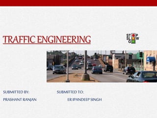
- 1. TRAFFICENGINEERING SUBMITTED BY: SUBMITTED TO: PRASHANT RANJAN ER IPANDEEP SINGH
- 2. WHAT IS TRAFFIC ENGINEERING...? Traffic engineering is a branch of civil engineering that uses engineering techniques to achieve the safe and efficient movement of people and goods on roadways It deals with the application of scientific principles, tools, techniques and findings for safe, rapid ,economical and efficient movement of people and goods. The basic object of traffic engineering is to achieve efficient, free and rapid flow of traffic with least no of accidents.
- 3. THE STUDY OF TRAFFIC ENGINEERING MAY BE DIVIDED INTO FOLLOWING SECTIONS.....! Traffic Characteristics Traffic Studies and Analysis Traffic operation-control and regulation Planning and analysis Geometric Design Administration and Management
- 4. TRAFFIC CHARACTERISTICS... Road user and Driver characteristics Vehicular characteristics
- 5. ROAD USER CHARACTERISTICS....! • Physical characteristics- • Vision, hearing, strength and reaction to traffic situation • Mental characteristics • Knowledge, skill, intelligence, experience, literacy • Psychological characteristics • Emotional factors such as fear, anger, anxiety • Environmental factors • Traffic stream conditions, roadside features , atmospheric conditions, facilities to the traffic locality etc.
- 7. VEHICULAR CHARACTERISTICS...! It consist of : Static characteristics Dimensions Weight Maximum turning angle. Dynamic characteristics Speed Acceleration Braking characteristics
- 8. CONTINUED… DIMENSIONS Effect of Width Width of traffic lanes Shoulders Parking facilities Effect of Height Clearance under over bridges, under bridges, electric & other service lines. Height of driver seat –provide clear vision of the road to his front & sides. Height of headlight- affects sight distances at valley curves.
- 9. CONTINUED…. Effect of Length Safe overtaking distance Capacity of road Extra widening Minimum turning radius Parking facilities Design of valley curves. EFFECT OF WEIGHT Design of pavement thickness Limiting gradients are governed by weight & power of vehicles. MINIMUM TURNING RADIUS Depends on length of wheel base and features of steering system Affects design of sharp curves.
- 10. TRAFFIC STUDIES... The process carried out for collecting traffic data is termed as traffic studies It is also called as traffic census or surveys When should a traffic study be conducted..? A new development is proposed and it will generate substantial new traffic; Financial assessments are implemented (transportation impact fees); A major roadway improvement or reconstruction project is proposed; Existing transportation problems are evident, such as a high crash location or at location with complex roadway geometrics; When a development is proposed for a sensitive area At the judgment or discretion of jurisdiction staff based on unusual circumstances
- 11. DIFFERENT TRAFFIC STUDIES..? Volume Studies Speed Studies O-D Surveys Parking Studies Accident Studies
- 12. TRAFFIC VOLUME STUDIES... It is the procedure to determine mainly the no. of vehicles moving on the roads at a particular section during a particular time. Purpose To establish relative importance of any route or road facility. To decide the priority for improvement and expansion of a road and to allot the funds accordingly. To plan and design the existing and new facilities of traffic operations on the road. To make analysis of traffic pattern and trends on the road. To do structural design of pavements and geometrically design of roads by classified traffic volume study. To plan one-way street and other regulatory measures by volume distribution study. To do design of road intersections, planning signal timings and channelization by turning movement study. To do planning of side walks, cross walks and pedestrian signals by pedestrian volume study. To do economic studies after estimating the highway user's revenue.
- 13. METHODS FOR CONDUCTING TRAFFIC VOLUME COUNTS Manual • Manual counts are recorded using one of three methods: tally sheets, mechanical counting boards, or electronic counting boards Determination of vehicle classification, Turning movements, Direction of travel, Pedestrian movements Vehicle occupancy Automatic • Automatic counts are recorded using one of three methods: portable counters permanent counters, and videotape. Vehicle hourly patterns Daily or seasonal variations and growth trends Annual traffic estimates
- 14. TALLEYSHEET ,ELECTRONIC AND MECHANICAL COUNTING BOARD
- 15. PORTABLE COUNTERS, PERMANENT COUNTERS, AND VIDEOTAPE
- 16. PASSENGER CAR UNIT {PCU} Different classes of vehicles such as cars, vans, buses, trucks, auto rickshaw, motor cycles, pedal cycles etc. are found to use the common roadway facilities without segregation. The flow of traffic with unrestricted mixing of different vehicle classes forms the Mixed Traffic Flow. In a mixed traffic condition, the traffic flow characteristics are very much complex when compared to homogeneous traffic consisting of passenger cars only. It is very difficult to estimate the traffic volume and capacity of roadway facilities under mixed traffic flow, hence the different vehicle classes are converted to one common standard vehicle unit.
- 17. PRESENTATION OF TRAFFIC VOLUME DATA • AADT • It is the total volume of vehicle traffic of a highway or road for a year divided by 365 days • ADT • It is normally calculated by determining the volume of vehicles during a given period and dividing that number by the number of days in that period. • Trend chart • Trend charts are also known as run charts, useful for planning future expansion, design and regulation. It are used to show trends in data over periods of years. • Variation chart • It shows hourly daily and seasonal variation. These help in deciding the facilities and regulations needed during peak traffic regulations. • Traffic flow map • It shows traffic volume of existing road at a glance. • Design hourly traffic volume • It is determined from the plot between hourly volume and the no of hours in a year that the traffic volume is exceeded
- 18. TREND AND VARIATION CHARTS
- 19. SPEED STUDIES Speed studies are necessary because the actual speed of vehicles over a particular may vary depending on various factors such as geometric features, traffic conditions, time, place, environment and driver. Speed studies can be studied under following heads- Travel time- it is the reciprocal of speed and is simple measure of how well road network is operating. Spot Speed- it Is the instantaneous speed of a vehicle at a specified section or location. Average speed- it is the average of the spot speeds of all the passing vehicles at a given point on the highway. Running speed- it is the average speed maintained by a vehicle over a particular stretch of road, while the vehicle is in first motion. Overall speed and travel speed- it Is the effective speed with which a vehicle transverses a particular route between two terminals. There are two types of speed studies carry out- Spot speed study Speed and delay study
- 20. SPOT SPEED STUDIES The speed at a particular moment of time at a point or cross section is termed as instantaneous or spot speed Uses Of Spot Speed Studies Planning traffic regulation and control measure such as speed limit etc. Design or redesign of various road geometry elements To design the speed In accident studies and preventive measure Study of traffic capacity To compare the behaviour of diverse type of driver and vehicles under specified set of conditions
- 21. CONTINUED... Factors Affecting Pavement width Horizontal curve Sight distance Gradient Summit and valley curves Pavement unevenness Road side development Weather visibility etc Measurement Method Of Spot Speed • By calculating time taken to cover a short distance • By graphic recorder, electronic meter, photo electric meter, radar speed meter etc Presentation Of Spot Speed • Speed distance table • Speed dispersion
- 22. SPEED STUDIES BY MEASURING DISTANCE AND BY RADARS
- 23. SPEED AND DELAY STUDIES It gives the particulars of running speed or fluctuation in speed the location and duration of delays or stoppages and the overall travel speed between two desired location along a road. It gives information such as time, location, cause, duration and frequency of delays Objectives To identify the location of congestion and its cause for better improvement To reduce delays and increase the travel time In benefit cost analysis
- 24. CONTINUED.... Causes Of Delays Turning vehicles Parking and unparking Pedestrian etc Method Of Conduction Floating car or riding check method Licence plate or vehicle number method Interview technique Elevated observation Photographic technique
- 25. PRESENTATION OF SPEED AND DELAY .
- 26. ORIGIN AND DESTINATION STUDIES It is the process of collecting information on the actual location and zone of origin of travel of vehicles or individual passenger trips and their destination It Provides: Direction of travel Selection of routes Trip length Frequency and no. Of such trips Method Of Conducting Road side interview License plate method Return post card method Tag-on-car method Home interview method Applications To judge the adequacy of existing roads To plan a new network of roads To establish design standards for the road bridges, and culverts To locate expressways To provide preferential routes for various category of vehicles including by pass To locate intermediate stops of public transport
- 27. PARKING STUDIES To bring a moving vehicle to halt or temporarily standing or static position is termed as parking of vehicle Parking is one of the major problems that is created by the increasing road traffic. It is an impact of transport development. The availability of less space in urban areas has increased the demand for parking space especially in areas like Central business district. This has a great economical impact.
- 28. . On-Street Parking It means parking your vehicle on the street, anywhere on or along the kerb of streets, in contrast to parking it in a parking garage. In some streets you can always park your vehicle on the street, but sometimes there are restrictions through traffic signs usually controlled by government agencies itself. Types Of On-street Parking Parallel parking 30 parking 45 parking 60 parking Right angle parking With increase of angle of parking the capacity of vehicles increases but it requires more kerb width Off-Street Parking It means parking your vehicle anywhere but not on the streets. These are usually parking facilities like garages and lots. Off-street parking also includes private lots, garages and driveways.
- 29. On- And Off- Street Parking .
- 30. EFFECTS OF PARKING Congestion: Parking takes considerable street space leading to the lowering of the road capacity. Hence, speed will be reduced, journey time and delay will also subsequently increase. Accidents While driving out a car from the parking area, Careless opening of the doors of parked cars, Bringing in the vehicle to lot for parking. Environmental Pollution Stopping and starting of vehicles while parking and unparking results in noise and fumes. Affect the aesthetic beauty of the buildings Obstruction To Fire Fighting Operations Parked vehicles may obstruct the movement of fire fighting vehicles.
- 31. Characteristics of On- and Off-Street parking...
- 32. ROAD ACCIDENTS It is the negative impact of transportation system. Road accident cannot be totally prevented, but by suitable traffic engineering and management measures, the accident rate can be decreased considerably. Objectives Of Accident Studies To study the causes of accidents and suggest corrective measures at potential location To evaluate existing design To compute the financial losses incurred To support the proposed design and provide economic justification to the improvement suggested by the traffic engineer To carry out before and after studies and to demonstrate the improvement in the problem.
- 33. CAUSES...!!
- 34. CAUSES OF ACCIDENTS Road users Excessive speed and rash driving, violation of traffic rules, failure to perceive traffic situation or sign or signal in adequate time, carelessness, fatigue, alcohol, sleep etc. Vehicle Defects such as failure of brakes, steering system, tyre burst, lighting system Road condition Skidding road surface, pot holes, ruts Road Design Defective geometric design like inadequate sight distance, inadequate width of shoulders, improper curve design, improper traffic control devices and improper lighting Environmental Factors Unfavourable weather conditions like mist, snow, smoke and heavy rainfall which restrict normal visibility and and makes driving unsafe. Other Causes Improper location of advertisement boards, gate of level crossing not closed when required etc.
- 35. TRAFFIC REGULATION AND CONTROL It is the law rules designed to control of the movement of vehicles and pedestrians, chiefly on city streets to prevent collisions. Objective of traffic regulation is safety of drivers, passengers, pedestrians, vehicles and goods Consequence Of Disobeying Traffic Rules Loss of life Injury to people involved Loss of some parts of body Traffic hold up Damage to the vehicle Methods Driver control Vehicle control Traffic flow regulation General controls
- 36. TRAFFIC CONTROLL DEVICES Traffic control devices are markers, signs and signal devices used to inform, guide and control traffic, including pedestrians, motor vehicle drivers and bicyclists These devices are usually placed adjacent, over or along the highways, roads, traffic facilities and other public areas that require traffic control It includes... Traffic signs Signals Markings Island
- 37. TRAFFIC SIGNS Traffic signs are signs which use words and/or symbols to convey information to road users. These devices are made with retro reflective materials that reflect light from headlights back towards the driver's eyes. This is to achieve maximum visibility especially at night. Types: Regulatory signs Used to convey traffic rules and regulations such as intersection controls, weight limit, speed limit, one way, no parking and others. Generally rectangular in shape and uses white, black and red/or as their primary colours. Warning signs Used to warn road users about a potential danger, usually diamond in shape black legends and borders on a yellow background. Crosswalk signs. Curve warning signs, intersection ahead signs, flagger signs, workers signs, or road machinery signs. Informatory or guide Help road users navigate to their destination., Generally rectangular in shape and have white text on green backgrounds. Street name signs, destination and distance signs, work zone guide
- 38. TRAFFIC SIGNS
- 39. TRAFFIC SIGNALS A set of automatically operated coloured lights, typically red, amber, and green, for controlling traffic at road junctions, pedestrian crossings, and roundabouts. Used to alternately assign right-of-way to traffic moving in conflicting directions at an intersection Advantages Provide for orderly movement of traffic Increase traffic-handling capacity of an intersection Reduce frequency and severity of certain types of crashes, especially right- angle collisions Provide for continuous movement of traffic at a definite speed along a given route Interrupt heavy traffic at intervals to permit other vehicles or pedestrians to cross Types Traffic control Pedestrian Special traffic
- 41. ROAD MARKINGS The road markings are defined as lines, patterns, words or other devices, except signs, attached to the carriageway or kerbs or to objects within or adjacent to the carriageway, for controlling, warning, guiding and informing the users The road markings are classified as: 1) Longitudinal markings Centre line Traffic lane lines No passing zones Warning lines Edge lines 2) Transverse markings Stop line Pedestrian crossings Directional arrows 3) Object markings Objects within the carriageway Objects adjacent to carriageway 4) Word messages marking for parking, marking at hazardous locations
- 42. MARKINGS
- 43. TRAFFIC ISLAND A small raised area in the middle of a road which provides a safe place for pedestrians to stand and marks a division between two opposing streams of traffic. A traffic island may be solid or painted object in a road that channelizes traffic. It can also be a narrow strip of island between roads that intersect at an acute angle Types Channelizing islands These are designed to control and direct traffic movement, usually turning. Divisional islands these are designed to divide opposing or same direction traffic streams, usually through movements Refuge or pedestrian islands Pedestrian islands are provided to serve as safety zones for the aid and protection of persons on foot. If a divisional island is located in an urban area where pedestrians are present, portions of each island can be considered a refuge island Rotary island A traffic circle is a type of intersection that directs both turning and through traffic onto a one-way circular roadway, usually built for the purposes of traffic calming or aesthetics
- 44. ISLAND
- 45. TRAFFIC ENVIRONMENT INTERACTION Impact Of Roads On Environment Air Pollution Hydrology Or Water Pollution Noise Pollution Wild Life Disturbance
- 46. . Air pollution Emissions of oxides of nitrogen, volatile organic compounds, carbon monoxide and various other hazardous air pollutants including benzene from diesel engine is main source of traffic air pollution Concentrations of air pollutants and adverse respiratory health effects are greater near the road than at some distance away from the road. Road dust kicked up by vehicles may trigger allergic reactions. Carbon dioxide major greenhouse gas and motor vehicle emissions are an important contributor to the growth of co2 concentrations in the atmosphere and therefore to global warming Water pollution Urban runoff from roads and other impervious surfaces is a major source of water pollution Rainwater and snowmelt running off of roads tends to pick up gasoline, motor oil, heavy metals, trash and other pollutants. Road runoff is a major source of nickel, copper, zinc, cadmium, lead and polycyclic aromatic hydrocarbons , which are created as combustion by-products of gasoline and other fossil fuels and harmful to water De-icing chemicals and sand can run off into roadsides, contaminate groundwater and pollute surface waters Road salts present in binders (primarily chlorides of sodium, calcium or magnesium) can be toxic to sensitive plants and animals Sand can alter stream bed environments, causing stress for the plants and animals that live there.
- 47. . NOISE POLLUTION Though traffic noise can contribute to numerous disturbances for wildlife. , Noise interrupt the calls of song birds, and their instinctive calls associated with mating, communication, migration, and other purposes Species abundance declined around major roads due to noise. Create nuisance if it impinges on population centres, especially near intersections Speed bumps, which are usually deployed in built- up areas, can increase noise pollution.
- 48. WILD LIFE DISTURBANCE Roads can act as barriers or filters to animal movement and lead to habitat fragmentation Many species will not cross the open space created by a road due to the threat of predation Increased animal mortality from traffic. Deforestation Hazardous to populations of amphibians and reptiles that migrate to vernal pools, or to the gravel on road verges that several species try to use as nest sites. Reptiles instinctive activities can lead them towards roads and lead to an increase in mortality rates: snakes, for example, may use roads as a source of heat for thermoregulation. Also some turtles have been noted to lay their eggs on road shoulders. Migratory patterns from season to season can also bring frogs and snakes into contact with roads and lead to an increase in their mortality rates
- 49. POLLUTION MITIGATION MEASURE Awareness Maintaining speed limits and being vigilant. Environment conservation group had initiated an awareness drive named path an acronym for provide animals safe transit on highways covering more than 17,000 km in India to high lighting the importance of safe driving on forest roads. Road permeability Allow animals to safely cross human-made barriers Wildlife crossings may include: underpass tunnels, viaducts, and overpasses. Habitat construction and planting Plantation of trees along road side Underpasses construction for animals to lower mortality rates and increase local species ability to adapt to a habitat along a major road. Recycling Materials removed from a road can be reused in construction within the same project or in other locations. Road construction can also use waste materials from other industries. Asphalt pavement is one of the most recycled materials It is estimated that over 80% of asphalt pavement removed from roadways is reused as construction aggregate it can be mixed into new pavement or used as a sub base or fill material. Concrete from road or building demolition can be an excellent source of aggregate
- 50. THANKYOU...!! .