SlideShare ist ein Scribd-Unternehmen logo
1 von 1
Downloaden Sie, um offline zu lesen
Introduction and Background
Extreme Rainfall Nonstationary Investigation and Evaluation of Nonstationary-based
Intensity-Duration-Frequency (IDF) Curves for Southern Ontario Region in a Changing Climate
Poulomi Ganguli*1, Paulin Coulibaly1
1Department of Civil Engineering, McMaster University, Hamilton, Ontario, Canada
Detection of Nonstationary TrendsMultiplicative Random Cascade (MRC) for Rainfall Disaggregation
 Global hydrological cycle is expected to intensify in a warming climate (Donat et al., 2016;
Lehmann et al., 2015)
*Contact Information: gangulip@mcmaster.ca1 McMaster Water Resources and Hydrologic Modeling Lab, McMaster University, http://www.hydrology.mcmaster.ca/
Study Area and Data
Development of Nonstationary IDF
 A relatively small perturbation in climate can result into a substantial changes into the frequency
of extremes: Changes in mean, variability, and skewness can complicate the process
Increase in land-
surface temp. anomaly
since 1880s’
Source: IPCC AR5 Chapter 1 (Fig. 1.8), Page 134
Annual average
precipitation in
Windsor (1941-2011)
Source: https://www.ncdc.noaa.gov/
Source: Climate Change Action
Plan: The City of Windsor’2012
Stations Hourly Daily
Hamilton 1971 - 2003 1960 - 2011
Oshawa 1970 - 1999 1970 - 2015
Toronto Person Intl. Airport 1960 - 2012 1940 - 2012
Windsor 1960 - 2007 1940 - 2014
Kingston 1961 - 2003 1960 - 2007
London 1961 - 2001 1940 - 2015
Process Flow to Develop Nonstationary IDF
• Starting box: Period in the
beginning of sequence,
proceeded by a dry period and
succeeded by a rainy period
• Enclosed box: Period within a
sequence, preceded and
succeeded by rainy period
• Ending box: Period in the end of
sequence, preceded by a rainy
period and succeeded by a dry
period
• Isolated box: Proceeded and
succeeded by dry period
Volume Classes Olsson (1998)
Performance Evaluation of MRC: A. McMaster Weather Station Data
Time Metrics Observed Simulated
Zero values (%) 91.92 91.50
# of extremes (> 25mm) 5 6
Individual RF volume (µ ± σ) mm 1.60 ± 2.95 1.45 ± 2.89
Hourly Event volume (µ ± σ) mm 4.52 ± 10.40 4.50 ± 8.82
Event Duration (µ ± σ) hour 2.83 ± 3.51 3.09 ± 2.69
Mean Interarrival time between event, hour 36.82 ± 64.70 37.33 ± 65.10
Mean Annual Maxima (µ ± σ) mm 39.97 ± 21.42 32.97 ± 12.33
Minute
(15-min)
Zero values (%) 94.43 95.35
Individual RF volume (µ ± σ) mm 0.032 ± 1.20 0.031 ± 1.28
Event volume (µ ± σ) mm 1.87 ± 6.28 1.96 ± 4.64
Event Duration (µ ± σ) min 3.15 ± 5.77 2.94 ± 3.47
Mean Interarrival time between event, min 59.54 ± 177.33 64.12 ± 182.01
Mean Annual Maxima (µ ± σ) mm 20.4 ± 10.22 23.4 ± 12.70
Performance Evaluation of MRC: B. Hourly Annual Maxima of
Pearson International Airport, Toronto
References
• Nonstationary GEV (Cheng et al., 2014)
• Model I: Nonstationary in location
• Model II: Nonstationary in location and scale
• Return level estimate
 
1
exp 1 , , 0
x
G x


   


    
           
    
  tt 10  
       0 1 0 1, exp ,t t t t t           
1 1
1 , 0;
ln 1
pq T
p p


 

  
           
Selection of Best Model for IDF Development
Models ξ σ1 σ2 µ1 µ0 AICc
Stationary (ML-based) -0.10 2.94 10.15 -85.53
Model I (50th percentile) -0.21 6.46 0.09 6.84 -101.79
Model II (50th percentile) 0.05 -0.0017 1.29 -0.01 11.54 -86.24
(ML)
Table: Selection of best fitted GEV distribution for 2-hour annual maximum rainfall
IDF Curves for Toronto International Airport (1950-2012)
Conclusions and Future Work
Conclusions
 Nonstationary trends are prominent in hourly annual maximum rainfall
 Nonstationary GEV models simulate extremes better than stationary models
 Significant difference in return level for short duration rainfall intensity at 2-year return period.
 The uncertainty in return level estimates grows higher with increase in return periods.
Future Work
 Develop IDF using nonstationary method for current and projected time period
 Compare difference in return level estimates in stationary and nonstationary models during
current and projected time periods
Acknowledgement
 Primary Funding Source: NSERC Canadian FloodNet
 Special thanks to Toronto Region Conservation Authority (TRCA) and Essex Region Conservation Authority
(ERCA) for sharing hourly rainfall data. The daily rainfall data is downloaded from Environment Canada website.
• M. G. Donat, A. L. Lowry, L. V. Alexander, P. A. O’Gorman,
N. Maher, Nat. Clim. Change. 6, 508–513 (2016).
• J. Lehmann, D. Coumou, K. Frieler, Clim. Change. 132,
501–515 (2015).
• “City of Windsor: Climate change adaptation plan” (2012),
pp. 1–21.
• T.F. Stocker et al. IPCC AR5 Working Group I: Phys.
Sci. Basis, 1535 (2013).
• J. Olsson, Hydrol. Earth Syst. Sci. Discuss. 2, 19–30
(1998).
• L. Cheng, A. AghaKouchak, Sci. Rep. 4 (2014), doi:
10.1038/srep07093.
Table: Model performance for daily to hourly and daily to sub-hourly rainfall disaggregation (2010 – 2013)

Weitere ähnliche Inhalte

Was ist angesagt?

ICLR Friday Forum: Mapping extreme rainfall statistics for Canada (March 11, ...
ICLR Friday Forum: Mapping extreme rainfall statistics for Canada (March 11, ...ICLR Friday Forum: Mapping extreme rainfall statistics for Canada (March 11, ...
ICLR Friday Forum: Mapping extreme rainfall statistics for Canada (March 11, ...
glennmcgillivray
 
DSD-INT 2015 - Global tide surge model - Martin Verlaan
DSD-INT 2015 - Global tide surge model - Martin VerlaanDSD-INT 2015 - Global tide surge model - Martin Verlaan
DSD-INT 2015 - Global tide surge model - Martin Verlaan
Deltares
 
05 modello idrologico_bacini_rocciosi_di_testata_en
05 modello idrologico_bacini_rocciosi_di_testata_en05 modello idrologico_bacini_rocciosi_di_testata_en
05 modello idrologico_bacini_rocciosi_di_testata_en
CIAT
 

Was ist angesagt? (20)

ICLR Friday Forum: Mapping extreme rainfall statistics for Canada (March 11, ...
ICLR Friday Forum: Mapping extreme rainfall statistics for Canada (March 11, ...ICLR Friday Forum: Mapping extreme rainfall statistics for Canada (March 11, ...
ICLR Friday Forum: Mapping extreme rainfall statistics for Canada (March 11, ...
 
DSD-INT 2014 - Symposium Next Generation Hydro Software (NGHS) - 2D hydrodyna...
DSD-INT 2014 - Symposium Next Generation Hydro Software (NGHS) - 2D hydrodyna...DSD-INT 2014 - Symposium Next Generation Hydro Software (NGHS) - 2D hydrodyna...
DSD-INT 2014 - Symposium Next Generation Hydro Software (NGHS) - 2D hydrodyna...
 
IUKWC Workshop Nov16: Developing Hydro-climatic Services for Water Security –...
IUKWC Workshop Nov16: Developing Hydro-climatic Services for Water Security –...IUKWC Workshop Nov16: Developing Hydro-climatic Services for Water Security –...
IUKWC Workshop Nov16: Developing Hydro-climatic Services for Water Security –...
 
River engineering flood design
River engineering flood designRiver engineering flood design
River engineering flood design
 
Flood
FloodFlood
Flood
 
Flood frequency analyses
Flood frequency analysesFlood frequency analyses
Flood frequency analyses
 
Dealing with uncertanties in hydrologic studies
Dealing with uncertanties in hydrologic studiesDealing with uncertanties in hydrologic studies
Dealing with uncertanties in hydrologic studies
 
IUKWC Workshop Nov16: Developing Hydro-climatic Services for Water Security –...
IUKWC Workshop Nov16: Developing Hydro-climatic Services for Water Security –...IUKWC Workshop Nov16: Developing Hydro-climatic Services for Water Security –...
IUKWC Workshop Nov16: Developing Hydro-climatic Services for Water Security –...
 
DSD-INT 2016 Yellow River - Schuurman
DSD-INT 2016 Yellow River - SchuurmanDSD-INT 2016 Yellow River - Schuurman
DSD-INT 2016 Yellow River - Schuurman
 
Updating the curve number method for rainfall runoff estimation
Updating the curve number method for rainfall runoff estimationUpdating the curve number method for rainfall runoff estimation
Updating the curve number method for rainfall runoff estimation
 
DSD-INT 2015 - Global tide surge model - Martin Verlaan
DSD-INT 2015 - Global tide surge model - Martin VerlaanDSD-INT 2015 - Global tide surge model - Martin Verlaan
DSD-INT 2015 - Global tide surge model - Martin Verlaan
 
Rainfall-Runoff Modelling
Rainfall-Runoff ModellingRainfall-Runoff Modelling
Rainfall-Runoff Modelling
 
DSD-INT 2016 Keynote Lecture 2016: From global to local: the latest developme...
DSD-INT 2016 Keynote Lecture 2016: From global to local: the latest developme...DSD-INT 2016 Keynote Lecture 2016: From global to local: the latest developme...
DSD-INT 2016 Keynote Lecture 2016: From global to local: the latest developme...
 
design of rain gauge network
design of rain gauge networkdesign of rain gauge network
design of rain gauge network
 
DSD-INT 2016 Hydrodynamic modeling and resource-device suitability analysis o...
DSD-INT 2016 Hydrodynamic modeling and resource-device suitability analysis o...DSD-INT 2016 Hydrodynamic modeling and resource-device suitability analysis o...
DSD-INT 2016 Hydrodynamic modeling and resource-device suitability analysis o...
 
05 modello idrologico_bacini_rocciosi_di_testata_en
05 modello idrologico_bacini_rocciosi_di_testata_en05 modello idrologico_bacini_rocciosi_di_testata_en
05 modello idrologico_bacini_rocciosi_di_testata_en
 
DSD-INT 2016 Integrating information sources for inland waters modelling - Ba...
DSD-INT 2016 Integrating information sources for inland waters modelling - Ba...DSD-INT 2016 Integrating information sources for inland waters modelling - Ba...
DSD-INT 2016 Integrating information sources for inland waters modelling - Ba...
 
poster_7.4_Sulskis
poster_7.4_Sulskisposter_7.4_Sulskis
poster_7.4_Sulskis
 
DSD-INT 2017 Global sandy shoreline dynamics derived from satellite imagery -...
DSD-INT 2017 Global sandy shoreline dynamics derived from satellite imagery -...DSD-INT 2017 Global sandy shoreline dynamics derived from satellite imagery -...
DSD-INT 2017 Global sandy shoreline dynamics derived from satellite imagery -...
 
DSD-INT 2019 3D model of the North Sea using Delft3D FM-Zijl
DSD-INT 2019 3D model of the North Sea using Delft3D FM-ZijlDSD-INT 2019 3D model of the North Sea using Delft3D FM-Zijl
DSD-INT 2019 3D model of the North Sea using Delft3D FM-Zijl
 

Ähnlich wie Poster AGM 2016_PG_09_09_2016

Michael Hutchinson_Topographic-dependent modelling of surface climate for ear...
Michael Hutchinson_Topographic-dependent modelling of surface climate for ear...Michael Hutchinson_Topographic-dependent modelling of surface climate for ear...
Michael Hutchinson_Topographic-dependent modelling of surface climate for ear...
TERN Australia
 
Hydrology/Hydraulic Model for South Boston CSO Project
Hydrology/Hydraulic Model for South Boston CSO Project Hydrology/Hydraulic Model for South Boston CSO Project
Hydrology/Hydraulic Model for South Boston CSO Project
dingfangliu
 
Terrace effects on soil erosion processes
Terrace effects on soil erosion processesTerrace effects on soil erosion processes
Terrace effects on soil erosion processes
Hui Shao
 
4 wajes-02687
4 wajes-026874 wajes-02687

Ähnlich wie Poster AGM 2016_PG_09_09_2016 (20)

Generation of intensity_duration_frequency_curves_for manvi taluk raichur dis...
Generation of intensity_duration_frequency_curves_for manvi taluk raichur dis...Generation of intensity_duration_frequency_curves_for manvi taluk raichur dis...
Generation of intensity_duration_frequency_curves_for manvi taluk raichur dis...
 
16 ijsrms-02614 (1)
16 ijsrms-02614 (1)16 ijsrms-02614 (1)
16 ijsrms-02614 (1)
 
Michael Hutchinson_Topographic-dependent modelling of surface climate for ear...
Michael Hutchinson_Topographic-dependent modelling of surface climate for ear...Michael Hutchinson_Topographic-dependent modelling of surface climate for ear...
Michael Hutchinson_Topographic-dependent modelling of surface climate for ear...
 
Master's course defense presentation in Water Resource Management and GIS
Master's course defense presentation in Water Resource Management and GIS  Master's course defense presentation in Water Resource Management and GIS
Master's course defense presentation in Water Resource Management and GIS
 
a3-4.park.pdf
a3-4.park.pdfa3-4.park.pdf
a3-4.park.pdf
 
Hydrology/Hydraulic Model for South Boston CSO Project
Hydrology/Hydraulic Model for South Boston CSO Project Hydrology/Hydraulic Model for South Boston CSO Project
Hydrology/Hydraulic Model for South Boston CSO Project
 
Terrace effects on soil erosion processes
Terrace effects on soil erosion processesTerrace effects on soil erosion processes
Terrace effects on soil erosion processes
 
IUKWC Workshop Nov16: Developing Hydro-climatic Services for Water Security –...
IUKWC Workshop Nov16: Developing Hydro-climatic Services for Water Security –...IUKWC Workshop Nov16: Developing Hydro-climatic Services for Water Security –...
IUKWC Workshop Nov16: Developing Hydro-climatic Services for Water Security –...
 
Robert Muir Extreme Rainfall Trends - NRC Workshop on urban rural storm flood...
Robert Muir Extreme Rainfall Trends - NRC Workshop on urban rural storm flood...Robert Muir Extreme Rainfall Trends - NRC Workshop on urban rural storm flood...
Robert Muir Extreme Rainfall Trends - NRC Workshop on urban rural storm flood...
 
UnitHydrograph.pptx
UnitHydrograph.pptxUnitHydrograph.pptx
UnitHydrograph.pptx
 
Abdel1
Abdel1Abdel1
Abdel1
 
4 wajes-02687
4 wajes-026874 wajes-02687
4 wajes-02687
 
Comparison of Raindrop Size Distribution Characteristics Across the Southeast...
Comparison of Raindrop Size Distribution Characteristics Across the Southeast...Comparison of Raindrop Size Distribution Characteristics Across the Southeast...
Comparison of Raindrop Size Distribution Characteristics Across the Southeast...
 
5 ijsrms-02617 (1)
5 ijsrms-02617 (1)5 ijsrms-02617 (1)
5 ijsrms-02617 (1)
 
Multi criteria decision-making-analysis
Multi criteria decision-making-analysisMulti criteria decision-making-analysis
Multi criteria decision-making-analysis
 
Initial Guidance to Obtain Representative Meteorological Observations at Urba...
Initial Guidance to Obtain Representative Meteorological Observations at Urba...Initial Guidance to Obtain Representative Meteorological Observations at Urba...
Initial Guidance to Obtain Representative Meteorological Observations at Urba...
 
CLIM: Transition Workshop - Advances in Understanding of Climate Extremes - K...
CLIM: Transition Workshop - Advances in Understanding of Climate Extremes - K...CLIM: Transition Workshop - Advances in Understanding of Climate Extremes - K...
CLIM: Transition Workshop - Advances in Understanding of Climate Extremes - K...
 
Peclet Number HDS Sizing Method for Stormwater Treatment
Peclet Number HDS Sizing Method for Stormwater TreatmentPeclet Number HDS Sizing Method for Stormwater Treatment
Peclet Number HDS Sizing Method for Stormwater Treatment
 
Estimation of clearness index from different meteorological parameters in IRAQ
Estimation of clearness index from different meteorological parameters in IRAQEstimation of clearness index from different meteorological parameters in IRAQ
Estimation of clearness index from different meteorological parameters in IRAQ
 
07 DSD-NL 2016 - D-HYDRO Symposium - Noordzee modellering - Firmijn Zijl, Del...
07 DSD-NL 2016 - D-HYDRO Symposium - Noordzee modellering - Firmijn Zijl, Del...07 DSD-NL 2016 - D-HYDRO Symposium - Noordzee modellering - Firmijn Zijl, Del...
07 DSD-NL 2016 - D-HYDRO Symposium - Noordzee modellering - Firmijn Zijl, Del...
 

Poster AGM 2016_PG_09_09_2016

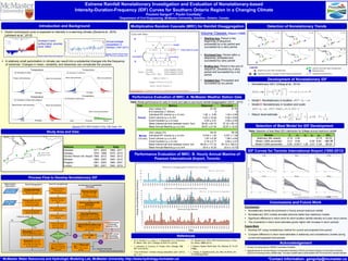
  • 1. Introduction and Background Extreme Rainfall Nonstationary Investigation and Evaluation of Nonstationary-based Intensity-Duration-Frequency (IDF) Curves for Southern Ontario Region in a Changing Climate Poulomi Ganguli*1, Paulin Coulibaly1 1Department of Civil Engineering, McMaster University, Hamilton, Ontario, Canada Detection of Nonstationary TrendsMultiplicative Random Cascade (MRC) for Rainfall Disaggregation  Global hydrological cycle is expected to intensify in a warming climate (Donat et al., 2016; Lehmann et al., 2015) *Contact Information: gangulip@mcmaster.ca1 McMaster Water Resources and Hydrologic Modeling Lab, McMaster University, http://www.hydrology.mcmaster.ca/ Study Area and Data Development of Nonstationary IDF  A relatively small perturbation in climate can result into a substantial changes into the frequency of extremes: Changes in mean, variability, and skewness can complicate the process Increase in land- surface temp. anomaly since 1880s’ Source: IPCC AR5 Chapter 1 (Fig. 1.8), Page 134 Annual average precipitation in Windsor (1941-2011) Source: https://www.ncdc.noaa.gov/ Source: Climate Change Action Plan: The City of Windsor’2012 Stations Hourly Daily Hamilton 1971 - 2003 1960 - 2011 Oshawa 1970 - 1999 1970 - 2015 Toronto Person Intl. Airport 1960 - 2012 1940 - 2012 Windsor 1960 - 2007 1940 - 2014 Kingston 1961 - 2003 1960 - 2007 London 1961 - 2001 1940 - 2015 Process Flow to Develop Nonstationary IDF • Starting box: Period in the beginning of sequence, proceeded by a dry period and succeeded by a rainy period • Enclosed box: Period within a sequence, preceded and succeeded by rainy period • Ending box: Period in the end of sequence, preceded by a rainy period and succeeded by a dry period • Isolated box: Proceeded and succeeded by dry period Volume Classes Olsson (1998) Performance Evaluation of MRC: A. McMaster Weather Station Data Time Metrics Observed Simulated Zero values (%) 91.92 91.50 # of extremes (> 25mm) 5 6 Individual RF volume (µ ± σ) mm 1.60 ± 2.95 1.45 ± 2.89 Hourly Event volume (µ ± σ) mm 4.52 ± 10.40 4.50 ± 8.82 Event Duration (µ ± σ) hour 2.83 ± 3.51 3.09 ± 2.69 Mean Interarrival time between event, hour 36.82 ± 64.70 37.33 ± 65.10 Mean Annual Maxima (µ ± σ) mm 39.97 ± 21.42 32.97 ± 12.33 Minute (15-min) Zero values (%) 94.43 95.35 Individual RF volume (µ ± σ) mm 0.032 ± 1.20 0.031 ± 1.28 Event volume (µ ± σ) mm 1.87 ± 6.28 1.96 ± 4.64 Event Duration (µ ± σ) min 3.15 ± 5.77 2.94 ± 3.47 Mean Interarrival time between event, min 59.54 ± 177.33 64.12 ± 182.01 Mean Annual Maxima (µ ± σ) mm 20.4 ± 10.22 23.4 ± 12.70 Performance Evaluation of MRC: B. Hourly Annual Maxima of Pearson International Airport, Toronto References • Nonstationary GEV (Cheng et al., 2014) • Model I: Nonstationary in location • Model II: Nonstationary in location and scale • Return level estimate   1 exp 1 , , 0 x G x                                 tt 10          0 1 0 1, exp ,t t t t t            1 1 1 , 0; ln 1 pq T p p                     Selection of Best Model for IDF Development Models ξ σ1 σ2 µ1 µ0 AICc Stationary (ML-based) -0.10 2.94 10.15 -85.53 Model I (50th percentile) -0.21 6.46 0.09 6.84 -101.79 Model II (50th percentile) 0.05 -0.0017 1.29 -0.01 11.54 -86.24 (ML) Table: Selection of best fitted GEV distribution for 2-hour annual maximum rainfall IDF Curves for Toronto International Airport (1950-2012) Conclusions and Future Work Conclusions  Nonstationary trends are prominent in hourly annual maximum rainfall  Nonstationary GEV models simulate extremes better than stationary models  Significant difference in return level for short duration rainfall intensity at 2-year return period.  The uncertainty in return level estimates grows higher with increase in return periods. Future Work  Develop IDF using nonstationary method for current and projected time period  Compare difference in return level estimates in stationary and nonstationary models during current and projected time periods Acknowledgement  Primary Funding Source: NSERC Canadian FloodNet  Special thanks to Toronto Region Conservation Authority (TRCA) and Essex Region Conservation Authority (ERCA) for sharing hourly rainfall data. The daily rainfall data is downloaded from Environment Canada website. • M. G. Donat, A. L. Lowry, L. V. Alexander, P. A. O’Gorman, N. Maher, Nat. Clim. Change. 6, 508–513 (2016). • J. Lehmann, D. Coumou, K. Frieler, Clim. Change. 132, 501–515 (2015). • “City of Windsor: Climate change adaptation plan” (2012), pp. 1–21. • T.F. Stocker et al. IPCC AR5 Working Group I: Phys. Sci. Basis, 1535 (2013). • J. Olsson, Hydrol. Earth Syst. Sci. Discuss. 2, 19–30 (1998). • L. Cheng, A. AghaKouchak, Sci. Rep. 4 (2014), doi: 10.1038/srep07093. Table: Model performance for daily to hourly and daily to sub-hourly rainfall disaggregation (2010 – 2013)