SlideShare ist ein Scribd-Unternehmen logo
1 von 37
Downloaden Sie, um offline zu lesen
COTTAGE GROVE OFFICE | 119 South Main Street, Cottage Grove, WI 53527 | 608-839-4422
MILWAUKEE OFFICE | 10437 Innovation Drive, Suite 305 | Wauwatosa, WI 53226 | 414-380-1044
Prepared by:
In collaboration with:
Tim Anderson Consulting, LLC
Amendment to
Comprehensive Development Plan
Previously Approved
Under Resolution R-12-14
Quarry Vista
Fitchburg, Wisconsin
Hamm Fam Land, LLC
Fitchburg, WI
February 17, 2015
Revised March 5, 2015
Revised March 11, 2015
Comprehensive Development Plan
Quarry Vista
Fitchburg Wisconsin
February 17, 2015
rev. March 11, 2015
Comprehensive Development Plan
Quarry Vista
Table of Contents
1 Introduction ......................................................................................................................... 1
2 Existing Conditions.............................................................................................................. 1
2.1 Site Location and Neighborhood Context..................................................................... 1
2.2 Zoning .......................................................................................................................... 2
2.3 Topography .................................................................................................................. 2
2.4 Surface Water Hydrology.............................................................................................. 3
2.5 Groundwater Hydrology................................................................................................ 3
2.6 Natural Features........................................................................................................... 4
2.7 Environmental Designations......................................................................................... 4
2.8 Transportation .............................................................................................................. 5
2.9 Availability of Water and Wastewater Services............................................................. 5
2.10 Parks ............................................................................................................................ 5
2.11 Schools......................................................................................................................... 5
3 Proposed Development....................................................................................................... 6
3.1 Proposed Site Plan....................................................................................................... 6
3.2 Proposed Planning Approach....................................................................................... 6
3.3 Proposed Housing Mix ................................................................................................. 6
3.4 Proposed Transportation Plan...................................................................................... 8
3.5 Proposed Park System............................................................................................... 10
3.6 Proposed Utility Service ............................................................................................. 11
3.7 Stormwater Management ........................................................................................... 11
3.8 Compatibility with Surrounding Land Uses................................................................. 12
3.9 Consistency with Adopted Plans ................................................................................ 12
3.10 Proposed Land Use Data ........................................................................................... 13
3.11 Development Schedule .............................................................................................. 14
3.12 Proposed Zoning ........................................................................................................ 14
4 Estimated Assessed Value ............................................................................................... 14
5 References........................................................................................................................ 15
Comprehensive Development Plan
Quarry Vista
Fitchburg Wisconsin
February 17, 2015
rev. March 11, 2015
Figures
Figure 1 Project Context
Figure 2 Existing Conditions
Figure 3 Environmental Designations
Figure 4 Project Plan and Conceptual Layout
Figure 5 Street Typical Sections
Figure 6 Utility Plan
Figure 7 Stormwater System Schematic Layout
Figure 8 Land Use Plan
Figure 9 Phasing Plan
Figure 10 Zoning Plan
Appendices
Appendix A Projected Stormwater Management Features
Comprehensive Development Plan
Quarry Vista
Fitchburg Wisconsin
February 17, 2015
rev. March 11, 2015
Project Contacts
Hamm Fam Land, LLC
c/o Mr. Phil Sveum
Coldwell Banker Success
5500 East Cheryl Parkway
Fitchburg, WI 53711
608-288-3339
psveum@cbsuccess.com
Montgomery Associates: Resource Solutions (MARS)
Project Manager
Deb Hatfield
Montgomery Associates, Resource Solutions, LLC
119 South Main Street
Cottage Grove, WI 53527
608-839-4422
debbie@ma-rs.org
Comprehensive Development Plan
Quarry Vista
Fitchburg Wisconsin
February 17, 2015 1
rev. March 11, 2015
1 Introduction
Hamm Fam Land, LLC first submitted a Comprehensive Development Plan (CDP) for the Quarry Vista
development in December 2013, and that plan was approved by the City in January 2014. A closed,
licensed landfill exists on the property. The City of Fitchburg did not know about the landfill at the
time of platting and zoning approvals. When the landfill became known in August and September
2014, inconsistencies between the plan and public dedications and improvements were discovered.
This revised CDP submittal addresses conflicts between an August 2014 DNR closure plan approval for
the licensed landfill on the property and City requirements for the project. Addressing the landfill
issue has required extensive communication and coordination between the City, the DNR and Hamm
Fam Land, as well as some redesign of the project. The result of that process is this revised CDP
submittal to the City, as well as a January 2015 revised landfill closure plan submittal to DNR.
The CDP will be used as the guide for reclaiming and redeveloping the former 72 acre Hammersley
Stone Quarry located at 6292 Lacy Road. Hamm Fam Land, LLC is proposing to develop a mixed
residential neighborhood that will include single family lots, duplex lots and condominiums along
with a higher density site that will possibly include apartment or assisted living units.
The Hammersley family has successfully operated a stone quarry at this location for over 60 years and
is nearing the final stage of reclaiming and restoring the property to prepare it for development. The
site has been designated by the City of Fitchburg for residential development since 1995 and it is within
the city’s Urban Service Area and Future Urban Development Area (FUDA) boundaries.
Detailed planning for this site was initiated by the Hammersley family in 2005. Since then, the Project
Team has met with neighboring property owners and has worked with city staff to resolve various
issues that affect development at this location and to design an attractive, environmentally friendly,
viable residential neighborhood.
This CDP is submitted for review and approval by the City of Fitchburg under Land Division
Ordinance Chapter 24.
2 Existing Conditions
2.1 Site Location and Neighborhood Context
The subject property consists of approximately 72 acres located at the northeast corner of Lacy Road
and Fitchrona Road in Section 7 of the City of Fitchburg. The northern boundary of the property abuts
the Quarry Ridge Recreation Area. Single family lots and Fitchrona Road form the western boundary
while Lacy Road defines the southern boundary. The eastern edge of the property abuts a working
quarry owned and operated by Payne & Dolan, Inc.
Comprehensive Development Plan
Quarry Vista
Fitchburg Wisconsin
February 17, 2015 2
rev. March 11, 2015
Figure 1 shows the project location and the surrounding neighborhood context. In the greater area
surrounding the site are:
· To the West: The Town of Verona’s Goose Lake and Wendelwood neighborhoods encompass
approximately 108 acres with 64 residences.
· To the North: The City of Fitchburg’s 52 acre Quarry Ridge Recreation Area, which includes 2.45
miles of hiking and off-road terrain bicycle trails. The park is also an access point to the
Military Ridge State Trail. The Quarry Ridge Wet Pond (constructed as part of the city’s
Jamestown stormwater management plan) is located in the central portion of the park.
· To the East: The 37.8 acre Payne & Dolan quarry is immediately east of the site, beyond which
the lands are in agricultural use. The North Stoner Prairie Neighborhood Plan, completed in
November 2013 recommends commercial and industrial uses for the area that directly adjoins
the eastern boundary of the proposed Hammersley Quarry Redevelopment.
· To the Southeast: The 56 acre Fitchburg Minerals quarry site.
2.2 Zoning
The property is currently zoned PD-SIP, P-R, R-LM, Rural Residential and Rural Development.
2.3 Topography
Figure 2 shows the current conditions on the project site. The topography of this site has been
substantially altered during the past 60 years of mining operations. Pre-quarry, this site was
dominated by a heavily wooded ridgeline running northeasterly from the Lacy Road – Fitchrona Road
intersection. This ridge crested at approximately elevation 1120 feet – nearly 160 feet above the
surrounding countryside. The quarry has been excavated along the centerline of the highest portions
of the ridge. The lowest elevation within the quarry is approximately 964 feet, which is approximately
16 feet below the elevation of the Lacy Road – Fitchrona Road intersection). Currently, there are two
main sections of quarry on the site: an eastern section that has active quarrying, crushing and loading
operations and a western section that is not active and is currently being filled with compacted soil.
The area between the two has already been filled in.
The quarry operations are largely obscured from view along Lacy and Fitchrona Roads and from the
city’s Quarry Ridge Recreation Area by the remaining steep wooded hillsides of the ridge. Figure 2
shows areas with 12% or greater slopes.
Final reclamation grades will need to tie to the elevations on Fitchrona Road centerline (approximate
elevation 985), the final excavation depth of the Payne & Dolan Quarry to the east (approximate
elevation 1060 feet), the centerline profile grades of Lacy Road (which rises from elevation 995 to 1045),
and the Quarry Ridge Recreation Area drainage way elevation (approximate elevation 965).
Comprehensive Development Plan
Quarry Vista
Fitchburg Wisconsin
February 17, 2015 3
rev. March 11, 2015
2.4 Surface Water Hydrology
The Quarry Vista site is located within the Goose Lake watershed, which is a closed depression. Goose
Lake, a 20 acre prairie-pothole, occupies the lowest portion of the watershed and is situated
approximately 700 feet to the west of the project site in the town of Verona (see Figure 1). The water
levels of Goose Lake fluctuate in response to runoff input, and were significantly elevated during the
heavy storms of 2008. If water levels in Goose Lake become extremely high, the lake overflows in a
southwesterly direction toward Badger Mill Creek, which drains to the Sugar River. Currently, the
central portion of the Hammersley Quarry site is internally drained to the East and West Quarry areas
of the site. In these areas, storm water runoff typically accumulates at low points on the quarry floor,
where it evaporates or infiltrates into the bedrock floor of the quarry. The southern slopes of the site
drain to the Lacy Road right-of-way. The westernmost portion of the site drains toward the Fitchrona
Road right-of-way, and the North-facing slopes of the site drain toward the Quarry Ridge Recreation
Area and the 630 acre Jamestown Watershed. Drainage from the redevelopment site reaches Goose
Lake via existing culverts beneath Fitchrona Road which include flow from Lacy Road as well. (See
Figure 7).
Prior to development, approximately 50 acres of the site drained to the north, towards the Quarry
Ridge Recreation Area and then drained westerly to Goose Lake. The southern 20 acres drained to the
south and southwest to a farm field swale and then northwesterly to the Lacy Road – Fitchrona Road
intersection and then northwesterly via roadside ditches to Goose Lake. Drainage from Goose Lake
drains westerly and feeds the Badger Mill Creek and its associated wetlands.
The City of Fitchburg established the Jamestown Stormwater Assessment District to create and
maintain a series of stormwater detention ponds along the drainage system discharging to Goose Lake.
These ponds control the peak rate of runoff and remove sediment from the surface water runoff
flowing to Goose Lake.
2.5 Groundwater Hydrology
In general, there are three groundwater systems in the area: a shallow aquifer comprised of glacial
deposits; an upper bedrock aquifer comprised of several Ordovician and Cambrian aged sandstones
and dolomites; and a lower sandstone aquifer comprised of the lower Eau Claire Formation and the Mt.
Simon Formation. A layer of shale approximately 10 feet thick in the Eau Claire Formation separates
the two bedrock aquifers. Most municipal wells in Dane County draw from both the shallow and deep
bedrock aquifers; however newer wells are typically open only to the deeper Mt. Simon sandstone
aquifer. Available information indicates that a groundwater divide is present in this area separating
groundwater flowing west to the Sugar River and groundwater flowing east toward the Yahara River,
and that groundwater in both bedrock aquifers below the project site flows northeast towards Nine
Springs Creek and the Yahara River.
Hammersley Quarry is situated near the top of the upper bedrock aquifer. The lowest bedrock exposed
is the St. Peter Sandstone, which has relatively high and uniform permeability. Above the St. Peter,
Comprehensive Development Plan
Quarry Vista
Fitchburg Wisconsin
February 17, 2015 4
rev. March 11, 2015
dolomites of the Galena, Decorah and Platteville Formations are exposed, particularly in the eastern
quarry area. These units are also highly permeable due to extensive horizontal and vertical fractures.
2.6 Natural Features
The Quarry Vista site contains approximately 20 acres that have not been disturbed by quarry
operations. These remaining areas of native vegetation are located in the northerly and southerly
hillsides and are comprised predominately of upland hardwood forest species. Each of these areas
includes several high quality old growth trees and vegetation including black oak, white oak and
hickory, but are dominated by lower quality woods with a predominantly weedy and brushy
understory. The disturbed portions of the site are covered with lower quality vegetation that has
invaded and established in areas where the active quarry and fill operations have ceased.
The northern wooded hillside and the adjacent Quarry Ridge Recreation Area (despite active
recreational use) provide habitat for diverse wildlife populations.
2.7 Environmental Designations
The environmental designations for the proposed development site and adjacent areas are shown on
Figure 3. Wetland designations were taken from the Wisconsin Wetland Inventory on the DNR Surface
Water Data Viewer, Environmental Corridors and areas of steep slopes from the Dane County online
mapping application and the Park and Conservancy area designations from the City of Fitchburg 2013
land-use plan. As Figure 3 illustrates, the previously-mapped designations on the proposed
development site include areas of steep slopes, and areas that were shown to be potential Park and
Conservancy lands in the city’s 2013 Land-Use Plan.
A small wetland area is located within the 66 foot wide “panhandle” of land that runs adjacent to the
Quarry Ridge Recreational Area and connects to Fitchrona Road. In October 2014 Eco-Resource
Consulting (ERC) evaluated the site and delineated a 203 SF wetland in an excavated pit. The character
of this wetland suggests that a 75 foot buffer is applicable. The buffer does not extend into the
proposed lots. The wetland will not be impacted by the proposed public improvements associated
with the plat. See Figure 3.
A small portion of the westernmost part of the project site could be subject to buffer constraints
associated with the existing wetlands to the West of Fitchrona road, if a 300-foot buffer was deemed to
apply to the area. However, the character of this wetland and the separation of the wetland from the
development site by Fitchrona road and associated drainage features suggests that the 75 foot buffer is
more applicable to the wetland area west of Fitchrona road. Wetland buffer widths of 75 feet do not
extend into the proposed development site from this wetland.
Figure 3 illustrates that, as discussed above, much of the area of the North-facing and South-facing
slopes of Quarry Vista are steeper than 12%. The potential Park and Conservancy areas noted in the
2013 land-use plan include the margin of the site adjacent to the Quarry Ridge Recreational Area, the
Comprehensive Development Plan
Quarry Vista
Fitchburg Wisconsin
February 17, 2015 5
rev. March 11, 2015
eastern portion of the site which includes active quarry operations, a small portion of the southeastern-
most portion of the site that is in residential and woodland use. Additionally, a “finger” of potential
parkland is shown on the westernmost margin of the site, crossing part of the existing residential lots
and Fitchrona Road, potentially indicating a desire for North-South pedestrian or bicycle transit,
although the designation does not extend into the Quarry Ridge Recreational Area (see Figure 3).
An inactive closed landfill is located within the central portion of the Quarry Vista site, as shown on
Figure 3. Based on a DNR file data, the landfill was licensed as a 5.0 acre site in 1972 for non-
combustible waste disposal but also permitted to accept wood matter, trash, and garbage. Based on
Owner and DNR information, the landfill primarily accepted construction demolition material from
highway projects and was operated as a private site until it received site closure status in 1980. While
the original landfill licensed area was 5.0 acres, a test pit investigation indicates that the actual filling
area was much smaller; about 1.5 acres (see Figure 3). No landfill activities have occurred since 1980.
Since 1980, there have been no DNR requirements for environmental monitoring or reporting at the
site.
2.8 Transportation
The main streets supporting development in this area of the city are Fitchrona Road and Lacy Road
with Nesbitt Road and Seminole Highway completing the overall network. Fitchrona Road is the
primary north-south route and is an important linkage between McKee Road/CTH PD to the North and
the City of Verona (via Whalen Road) to the south. Lacy Road is a major east-west arterial through the
city. Currently, the area is not served by a transit system. Access to the Military Ridge State Trail is 300
feet north of the subject site. Future bicycle routes are planned for both Lacy Road and Fitchrona Road.
2.9 Availability of Water and Wastewater Services
Sanitary sewer is readily available both in Fitchrona and Lacy Roads and an 8” main was previously
stubbed into the site from Fitchrona Road. Water service is from the Nesbitt Road/Fitchrona Road
intersection will be extended by Fitchburg to the Quarry Vista Drive – Fitchrona Road intersection.
2.10 Parks
The Quarry Ridge Recreation Area borders the north boundary of the subject site. This park consists of
a wooded are with steep slopes and an 11 acre wet pond that collects stormwater from the Jamestown
Neighborhood. This park provides for more than 3 miles of off-road mountain bike and hiking trails
and includes a picnic shelter and restrooms. This park provides direct access to the Military Ridge State
Trail.
2.11 Schools
The subject site is in the Verona School District.
Comprehensive Development Plan
Quarry Vista
Fitchburg Wisconsin
February 17, 2015 6
rev. March 11, 2015
3 Proposed Development
3.1 Proposed Site Plan
The Quarry Vista project proposes a mixed residential neighborhood with 322 units on 72.4 acres
including 124 single family lots, 12 single family condominium units, 30 duplex units and 156 multi-
family units for a gross density of 4.4 DU/Ac. Figure 4 illustrates the proposed plan including the
proposed layout of lots, roadways and connecting greenspace.
3.2 Proposed Planning Approach
The proposed Quarry Vista CDP primarily focuses development in the areas of the site disturbed by
quarry operations in order to preserve the site’s natural features (wooded vegetation and steep slopes)
that border the Quarry Ridge Recreation Area on the north and Lacy Road on the south. A small area of
woodland along Lacy Road will be disrupted by the proposed single family condo lot. The proposed
CDP provides an efficient system of streets organized in an east-west orientation to maximize solar
orientation for the majority of the housing units. The street system generally follows the site’s existing
topography which rises from a low point at Fitchrona Road to a high point on the site’s northeast
boundary with an approximate 80 foot elevation change. The orientation of the housing units and the
rising topography will allow for viewsheds to Blue Mounds to the west and the rural landscape to the
south and west.
The following points summarize the Quarry Vista CDP planning approach:
· Preservation of natural features.
· A range of housing choices, lot sizes and building types to promote diversity and affordability.
· An efficient street system that promotes a connected neighborhood.
· A system of active and passive recreation areas that includes large and small parks and
hiking/walking trails through the site’s natural areas.
· Preservation of quarry walls as design features for new parks and the use of quarried stone in the
site’s landscape design to promote the site’s quarry heritage.
· Solar orientation and viewsheds.
· Pedestrian and bicycle connectivity.
· Utilization of the site’s open space system to maximize stormwater infiltration.
· Consolidation of the landfill area in an environmentally responsible manner to create an area of
privately owned green space.
3.3 Proposed Housing Mix
The Quarry Vista CDP proposes a variety of lot sizes and building types which are identified on Figure
4 and include the following designations. Note: The sizes for each designation are averages and may
vary.
SF-A (16 lots) – 70’ x 125’ single family detached lots located on the both sides of Quarry Vista
Comprehensive Development Plan
Quarry Vista
Fitchburg Wisconsin
February 17, 2015 7
rev. March 11, 2015
Drive west of the phase line.
SF-B (56 lots) - 80’ x 125’ single family detached lots located on the north and south perimeters of
the development.
SF-C (52 lots) - 50’ x 110’ detached lots with rear alleys located in the center of the development.
SF-D (12 condos) - Detached single family condominiums served by a private drive located in the
wooded area in the southeast corner of the development. The 2,500 sf building sites and the private
drive will be located to preserve significant vegetation and minimize regrading of the natural
topography.
SF-E (15 lots) – 80’ x 110’ duplex lots located in the southwest portion of the development adjoining
Lacy Road that will provide a transition between the higher density multi-family (MF-1) and the
lower density single family neighborhood to the east.
MF-1 (up to 156 units) - Multi-family buildings located in the southwest corner of the development
with an approximately equal mix of one and two bedroom apartments or assisted living units and a
combination of enclosed and surface parking.
3.4 Landfill Area Management
As noted above, the presently inactive Hammersley Construction Co. landfill (Landfill) was
licensed as a 5.0 acre site in 1972 for non-combustible waste disposal but also permitted to accept
wood matter, trash, and garbage. However, based on Owner and DNR information, the landfill
primarily accepted construction demolition material from highway projects and was operated as a
private site until it received site closure status in 1980. While the landfill licensed area was 5.0
acres, the actual filling area was much smaller; about 1.5 acres (see Figure 3). Hammersley
submitted a closure plan modification request to DNR in May 2014 which called for excavating the
fill material within the existing landfill limits, sorting it to remove material that should be disposed
of off-site, and placing the balance of the material in a location occupying park and roadway right-
of-way areas proposed to be dedicated to the City. This closure plan modification was approved by
DNR in August 2014. However, it became apparent that the approved closure plan was
incompatible with the City development approvals and criteria for public land dedication.
Following a series of meetings in September 2014, Hamm Fam Land has worked with the City and
DNR to develop a project design and landfill closure plan that will be acceptable to all parties.
After several rounds of review with the City, the revised closure plan was submitted to DNR on
January 14, 2015. At this time, no formal approval has been granted. Key elements of the closure
plan activities will include:
1. The existing landfill area shown on Figure 3 will be excavated in phases. The excavated fill
Comprehensive Development Plan
Quarry Vista
Fitchburg Wisconsin
February 17, 2015 8
rev. March 11, 2015
material will be sorted, and woody material, municipal waste, ash waste or other waste will
be removed from the fill and disposed at suitable off-site facility, leaving only earth fill and
clean nonorganic construction debris to be placed in the 1.2 acre area shown as private green
space on Figure 4.
2. After the fill is removed, the base of the landfill area will be sampled and sample results
reviewed by DNR and the City.
3. The fill placed in the private green space area shown will have an even surface and will
have turf vegetation.
4. The private greenspace area will not be transferred to City ownership as part of the Final
Plat dedications.
5. Placement of acceptable fill material in the private green space shown on Figure 4 will be
monitored for conformance with the closure plan requirements by both City and DNR. A
full documentation report of activities will be prepared.
6. DNR will review the closure documentation report. If the work has been conducted
according to the approved plan and the test results from the area of existing fill placement
are acceptable, DNR will approve the plan and document that the area of fill placement
shown on figure 4 is the only extent of landfill on the Quarry Vista property.
The revised closure plan modification submittal (identified as Reference 5 to this plan) includes
many additional details regarding the specifics of material sorting procedures, analytical testing
procedures, and communication and coordination with the City and DNR.
3.5 Proposed Transportation Plan
The proposed development provides for multi-modal transportation. The street system has been
designed in a grid pattern to evenly distribute traffic volumes. A series of interconnected greenways
with off-street pathways provide for pedestrian and bicycle usage.
3.5.1 Automobile
The primary means of transportation will be by private automobile. The development will generate
approximately 2,700 trips per day. Because of the proposed grid system traffic will be distributed more
evenly over the street network. The primary transportation corridors are Fitchrona Road and Lacy
Road.
The street system proposed in the Quarry Vista CDP includes a mix of street types:
· A central E-W street (66’ row) that will move from the west at Fitchrona Road and connect with
Comprehensive Development Plan
Quarry Vista
Fitchburg Wisconsin
February 17, 2015 9
rev. March 11, 2015
the future North Stoner Prairie Neighborhood (Payne and Dolan Quarry) adjoining the site’s
eastern boundary. Driveways will be eliminated along this street because lots that border the
street will be served by rear alleys.
· Local E-W loop streets (66’ row) that parallel the central street on the north and the south.
· Local N-S connecting streets (66’ row) that connect the loop streets to the central street and divide
the development into 500” blocks.
· One 500’ cul-de-sac street (66’ row).
· 24’ rear alleys serving SF-C lots.
· A 24’ private drive serving the condominium cluster.
The Quarry Vista CDP proposes four entrances from the surrounding street system: one on Fitchrona
Road, two on Lacy Road and one future entrance at the development’s eastern boundary to connect
with the future North Stoner Prairie Neighborhood. Street gradients will be less than 5% on average
except for the easterly Lacy Road entrance which will be less than 8%.
Proposed street typical-sections are shown in Figure 5. The proposed street system consists of two
typical cross sections. The main east-west street will be 36 feet face of curb to face of curb with on-street
parking in a 66-foot right of way. The curvilinear nature of the street and on-street parking will provide
traffic-calming measures. The remaining of the streets will be 32 feet wide and provide on street
parking and two travel lanes within a 66-foot right of way. Public streets will include a minimum nine
foot terrace for street trees and lighting. The private alleys will be constructed in outlots and will be
designed in accordance with Chapter 27, Division 6.
To accommodate future widening of Fitchrona and Lacy Roads, additional right of way is proposed to
be dedicated along the north side of Lacy Road and east side of Fitchrona Road. The right of way
width on the north side of Lacy Road will be 40’. The right of way width on the east side of Fitchrona
Road will be 50’. The widths of these rights of way are sufficient to accommodate future improvements
by the city, including sidewalks, on-street bike lanes, travel lanes and turn lanes at intersections.
Additional right of way may also be dedicated in the northeast quadrant of the Lacy Road/Fitchrona
Road intersection to improve the intersection skew angle.
Initially, Lacy Road will be designed to accommodate a 40 mph design speed. Fitchrona Road and Lacy
Road improvements will include grading the expanded right of way to accommodate the future street
section and construction of a paved multi-purpose path along the east and north limits of the respective
rights of way. The location of the paved multi-purpose path will be confirmed with Public Works staff
during the platting process. The proposed intersections with Lacy Road and Fitchrona Road will be
designed to meet sight distances for a 50 mph design speed.
Comprehensive Development Plan
Quarry Vista
Fitchburg Wisconsin
February 17, 2015 10
rev. March 11, 2015
Entrance features and signage will be provided at all entryways into the development.
3.5.2 Pedestrian and Bicycle
The proposed street system will provide a pedestrian and bicycle network that will connect all parts of
the Quarry Vista neighborhood. This pedestrian/bike network will also connect to future ped/bike
facilities on Lacy Road and Fitchrona Road and provide connections to destinations in the surrounding
neighborhood and the community. A future bicycle route planned for Fitchrona Road will connect to
the Military Ridge State Trail which has an entrance 300’ north of the subject site. The Military Ridge
State Trail links to other local and regional trails to connect the subject site to area-wide and regional
destinations. The proposed pedestrian and trail system is consistent with the apparent transit objectives
of the Parks & Conservancy areas shown on the 2013 land-use plan.
3.5.3 Transit
Currently, the area is not served by a transit system. As the surrounding area develops, transit service
may become available along Lacy Road and/or Fitchrona Road
3.6 Proposed Park System
Quarry Vista proposes a variety of parks and open spaces to serve the recreation needs of the
neighborhood residents.
· A 1.6 Ac central park that will include playground and a multi-purpose open space. This south
facing park will incorporate a remnant of the existing quarry wall as a defining landscape
feature.
· A 3+ Ac south-facing park located in the northeast corner of the development. This park, which
will also incorporate an existing quarry wall as a defining landscape feature, will include a
soccer field, a ball diamond, play equipment and a sledding hill.
· The wooded area preserved on the north side of the development with a hiking/walking trail that
connects to the neighborhood’s street system and the Quarry Ridge Recreation Area.
· Wooded and open space buffers located on the east and south sides of the development.
The proposed Quarry Vista CDP includes approximately 21.4 Ac of parks and open spaces, about thirty
percent of the total site area. Approximately 18.1 Ac of this total will be dedicated to meet the city’s
park dedication requirements.
Note that the private open space area identified on Figure 4 will not be part of public park dedication.
Comprehensive Development Plan
Quarry Vista
Fitchburg Wisconsin
February 17, 2015 11
rev. March 11, 2015
3.7 Proposed Utility Service
The proposed layout of sanitary and water services are shown in Figure 6. The layout of utilities will
be finalized with input from Public Works staff during the platting process.
The sanitary sewer system serving the development will connect to an 8-inch sanitary sewer stubbed
into the property from Fitchrona Road. Within the development, 8-inch sanitary sewer mains will be
installed within the street rights of way or public utility easements. An 8-inch sanitary sewer, at
minimum grade, has a capacity of 0.77 cfs. The proposed development of 322 dwelling units will
generate a peak flow of 0.38 cfs using 150 gpd for multi-family units, 225 gpd for single family
residential units and a peak factor of 4.
Water service for the development will be provided from a 12-inch water main extended from Nesbitt
Road. The water main will be brought by the City to the Quarry Vista Drive – Fitchrona Road
intersection. Provisions for water service to lands east and south of the Quarry Vista site will be made
by extending the 12-inch water main in plat outlots adjacent to Lacy Road and Fitchrona Road.
Internally, the development will be served by a series of 8-inch water mains. The city’s ultimate water
distribution system plans indicate that this main will eventually be extended easterly to the future
extension of Commercial Drive and connect north to provide a looped system back to Water Tower E
located northeast of the Payne & Dolan Quarry.
3.8 Stormwater Management
The stormwater management system for the site will be designed to meet the following objectives:
1. Provide compliance with the City’s storm water management criteria, including limiting the
increase of post-development peak discharge rate to predevelopment rate for the 1, 2-year, 10-
year and 100-year storms, to provide 80% reduction in suspended solids release compared to
no controls, and to infiltrate sufficient runoff volume so that the post-development retention
of runoff is at least 90% of the predevelopment volume;
2. Provide compliance with State of Wisconsin stormwater management criteria described in
Administrative Code sections NR 216 and NR 151. Providing compliance with the City’s
criteria will (with minor exceptions that will be addressed) provide compliance with state of
Wisconsin criteria;
3. Address site-specific criteria that are currently being refined with City of Fitchburg staff.
These criteria are oriented toward providing a drainage system compatible with adjacent uses
along Lacy Road and Fitchrona Road, and to providing minimal impact to Goose Lake. The
majority of the site will drain to the Quarry Ridge Wet Pond, to utilize the detention routing
storage available and also to maximize the opportunity for water quality treatment and
seepage of water in the basin to the regional groundwater system. The development plan will
emphasize local (near-source) management of water quality and volume.
Comprehensive Development Plan
Quarry Vista
Fitchburg Wisconsin
February 17, 2015 12
rev. March 11, 2015
4. Integrate the storm water management design with local “pocket parks” and larger open
space areas to provide an attractive aesthetic consistent with the design of the residential area.
A schematic plan of the anticipated stormwater management system is shown on Figure 7. The
majority of the site will drain via storm sewer and graded pathways toward the Quarry Ridge Wet
Pond. The apartment lot in the southwest corner of the plat will address stormwater requirements with
it’s own on-site system.
Within the development area, stormwater management will be integrated into the site design at three
scales: a local streetscape scale where we anticipate placement of bioretention and possibly “ street
terrace infiltration areas within the public right-of-way, somewhat larger systems to be incorporated
within pocket parks to provide block-by-block storm water runoff volume reduction, and larger
systems that will receive runoff from multiple block areas to be located in public open space. The
streetscape and block-by-block stormwater features are anticipated to be vegetated. Design of the
systems will be driven by stormwater management criteria as well as the aesthetic and use functions of
the open spaces in which they are placed. This design approach is intended to make use of the results
of the recently completed Catalytic Project report prepared by EOR for the City of Fitchburg using the
McGaw Park area as an example.
Drainage features will also be incorporated into the connected open space plan for the project. The
drainage conveyance swale to be constructed within the Quarry Ridge recreation area will be designed
to meet Park aesthetic and functional objectives. Drainage on the perimeter of the project, along Lacy
Road and Fitchrona Road will be improved as part of the right-of-way improvements that will be
required for this project.
Example descriptions of design approaches, plant species sets, and performance trade-offs for storm
water management practices anticipated to be used in the project are included in Appendix A.
3.9 Compatibility with Surrounding Land Uses
The residential uses and densities, street patterns and parks and open spaces proposed for the Quarry
Vista CDP are compatible with surrounding land uses, both existing and future. These uses include
single family residential uses bordering the east side of the development, the Quarry Ridge Recreation
Area bordering the north side of the development, commercial and industrial uses proposed as part of
the future North Stoner Prairie Neighborhood on the east side of the development, and low density
residential uses recommended in the City of Fitchburg Comprehensive Plan for the area south of Lacy
Road.
3.10 Consistency with Adopted Plans
The proposed Quarry Vista CDP is consistent with the City of Fitchburg Comprehensive Plan which
designates the subject site as Low Density Residential with 2 – 5 dwelling units per acre. The CDP is
Comprehensive Development Plan
Quarry Vista
Fitchburg Wisconsin
February 17, 2015 13
rev. March 11, 2015
also consistent with City of Fitchburg’s Comprehensive Park, Open Space, and Recreation Plan. Open space
corridors are provided around all sides of the proposed development except for approximately 350’
along the west side of the cul de sac that adjoins the existing single family lots along Fitchrona Road. A
vegetation buffer will be provided to separate the existing and proposed lots.
The proposed development plan, including pedestrian and bicycle transit features, connected open
space and preservation of wooded slopes is consistent with the objectives of the Parks & Conservancy
areas shown on the 2013 Land-Use Plan. The development plan also is consistent with the objective of
the steep slope designations in that the steeply sloped wooded hillsides will generally not be developed
and will not be regraded.
3.11 Proposed Land Use Data
Figure 8 shows the proposed land uses.
Total Site Acreage 72.4 Acres
Proposed land use area and units Ac units
Low Density Single Family Residential 26.1 124
Low Density Condominiums 2.9 12
Duplex 3.3 30
High Density Apartments 3.7 156
Total Units 36.0 322
Projected Ownership
Total Ownership 166 52%
Total Rental 156 48%
Density
Net Density/Acre 8.9 DU/Ac
Gross Density/Acre 4.5 DU/Ac
Area by land use
Total Residential Development Acreage 36.0 Ac (49.7% of total site)
Total Open Space 21.4 Ac (29.6% of total site)
Proposed Parks 18.1 Ac
Private Stormwater Management Areas 2.1 Ac
Private Greenspace 1.2 Ac
Total Public Streets 15.0 Ac (20.7% of total site)
Comprehensive Development Plan
Quarry Vista
Fitchburg Wisconsin
February 17, 2015 14
rev. March 11, 2015
Dedications
Public Street Dedication 15.0 Ac
Park Dedication 18.1 Ac (21.4 Ac Required)
3.12 Development Schedule
The Hammersley Quarry Redevelopment project is anticipated to be developed over a 4-year time
frame in two phases as shown in Figures 9.1 and 9.2. The suggested development phases are:
· Phase One — 2015-2016
· Phase Two — 2017-2019
This timing may change due to market conditions, availability of infrastructure or other reasons.
3.13 Proposed Zoning
Figure 10 shows the proposed final zoning for Quarry Vista. The zoning will be phased per the
development schedule. The single family areas of Phase One has been rezoned to R-LM, the PD areas
have been rezoned to PDD-SIP while the multi-family lot has been rezoned to PDD-GIP. During Phase
One, the area within Phase Two will not be rezoned. During Phase Two development, the remaining
single family lots will be rezoned to the proposed final zoning and the Single Family Condo lot will be
rezoned to A-S. The single family condo lot will be rezoned when they are developed.
4 Estimated Assessed Value
Development Type
Estimated Assessed
Value
16 SF Homes @ $300,000 ("A" lots) $4,800,000
56 SF Homes @ $300,000 ("B" lots) $16,800,000
52 SF Homes @ $250,000 (“C” lots) $13,000,000
15 Duplex Units @ $500,000 (“E” lots) $7,500,000
156 Apartments @ $70,000 $10,920,000
12 Condominium Homes @ $275,000 $3,300,000
Total Estimated Assessed Value $56,320,000
Comprehensive Development Plan
Quarry Vista
Fitchburg Wisconsin
February 17, 2015 15
rev. March 11, 2015
5 References
1. City of Fitchburg Comprehensive Plan, Chapter Four: Land Use. adopted March 2009, rev. Dec 2013
2. Comprehensive Park, Open Space, and Recreation Plan, City of Fitchburg. January 2010
3. Dane County Parks & Open Space Plan, Chapter IX.6 Trails. March 2012
4. North Stoner Prairie Neighborhood Plan. November 2013
5. Revised Plan Modification for Hammersley Construction Co. landfill, submitted to the Wisconsin DNR
by Hammersley Stone Company, Inc. on January 14, 2015
Comprehensive Development Plan
Quarry Vista
Fitchburg Wisconsin
February 17, 2015 1
rev. March 11, 2015
Figures
Figure 1 Project Context
Figure 2 Existing Conditions
Figure 3 Environmental Designations
Figure 4 Project Plan and Conceptual Layout
Figure 5 Street Typical Sections
Figure 6 Utility Plan
Figure 7 Stormwater System Schematic Layout
Figure 8 Land Use Plan
Figure 9 Phasing Plan
Figure 10 Zoning Plan
DRAWN BY CHECKED BY
SCALE
PROJECT NO. DATE
.
MONTGOMERYASSOCIATES:
RESOURCESOLUTIONS,LLC
119SouthMainStreet|CottageGrove,WI53527
(608)839-4422|www.ma-rs.org
12/17/20131613
RDPACF
PROJECTCONTEXT
HammersleyQuarryRedevelopment
HammFamLandLLC
0 500 1,000
Feet
1 inch = 1,000 feet
1
§¨¦151
§¨¦12
VERONA
MIDDLETON
Madison
Fitchburg
Verona
Legend
Plat Boundary
Municipal Boundary
Urban Service Area
LOCATOR MAP: NOT TO SCALE
FIGURE
Rev 1 - 1/7/14
QUARRY RIDGE
WET POND
888
990
1000
1010
10201030
980
970
10401050
1060
1070
1080
1090
970
970
980
980990
980
980
980
980
980
980
990
1000
1010
1030
1020
1040
1050
1060 1070
980
970
970
1000
990
980
1000
1010
1020
1030
1040
1050
1020
1030
1040
1050
1060
1070
1080
1090
1100
1110
1000
1010
1020
1030
1040
1050
1060
1070
1080
1090
1100
1100
1100
1120
1030
1100
1110
1120
1130
1120
1120
1060
1070
1080
1070
1070
1080
1090
1090
1100
1070
1040
1050
1070
1080
1060
1070
1080
1090
1100
1080
1100
1070
970
Hamm Fam Land, LLC
c/o Mr. Phil Sveum
Coldwell Banker Success
5500 East Cheryl Parkway
Fitchburg, WI 53711
608-288-3339
psveum@cbsuccess.com
Montgomery Associates, Resource Solutions, LLC
Project Manager-Deborah Hatfield, P.E.
119 South Main Street
Cottage Grove, WI 53527
608-839-4422
debbie@ma-rs.org
Tim Anderson Consulting, LLC
Tim Anderson
2126 Yahara Place
Madison, WI 53704-5658
608-514-5402
tander2126@tds.net
Burse Surveying and Engineering, Inc.
President-Michelle L. Burse P.E., R.L.S.
Madison, WI 53703
608-250-9263
mburse@bse-inc.net
IF THIS BAR DOES NOT MEASURE 1"
THEN DRAWING IS NOT TO SCALE
PROJECT NO.
FIGURE NO.
DATE
SCALE
0 1
2 1
MONTGOMERYASSOCIATES:
RESOURCESOLUTIONS,LLC
119SOUTHMAINSTREET
SUITEA
COTTAGEGROVE,WI53527
www.ma-rs.org
DRAWN BY CHECKED BY
NO.DATEREVISION/ISSUE
1613
HAMMFAMLANDLLC
QUARRYVISTA
HAMMERSLEYQUARRY
FITCHBURG,WI
EXISTINGCONDITIONS
1"=120'
12/7/2013
2
LMS DJH
P:1613 - Hamm Farm Land Property DevelopmentDrawingsCDP Feb 2015CDP ex conditions modified.dwg
NOTES:
1. CONTOURS AND AERIAL PHOTO ARE FROM 2010 AND DO NOT REFLECT
CURRENT CONDITIONS.
2. ALL OF LOTS 1-3, CERTIFIED SURVEY MAP NUMBER 11159, AS RECORDED
IN VOLUME 67 OF CERTIFIED SURVEY MAPS, ON PAGES 152-154, AS
DOCUMENT NUMBER 3959694, DANE COUNTY REGISTRY, ALSO PART OF
THE NORTHEAST, SOUTHEAST AND SOUTHWEST QUARTERS OF THE
SOUTHWEST QUARTER OF SECTION 07, ALSO PART OF THE
NORTHWEST AND NORTHEAST QUARTERS OF THE NORTHWEST
QUARTER OF SECTION 18, ALL IN TOWNSHIP 06 NORTH, RANGE 09 EAST,
CITY OF FITCHBURG, DANE COUNTY, WISCONSIN.
1CDPREVISION1/7/14
1000
LEGEND
EXISTING CONTOURS (5-FOOT INTERVAL)
PLAT BOUNDARY
EXISTING PARCELS
LANDFILL BOUNDARY
2CDPRESUBMITTAL
Nesbitt Rd
QUARRY
VISTA
USH
151/18
Lacy Rd
FitchronaRd
DRAWN BY CHECKED BY
SCALE
PROJECT NO. DATE
.
MONTGOMERYASSOCIATES:
RESOURCESOLUTIONS,LLC
119SouthMainStreet|CottageGrove,WI53527
(608)839-4422|www.ma-rs.org
2/17/20151613
RDPACF
ENVIRONMENTALDESIGNATIONS
QuarryVista
HammFamLandLLC
0 100 200 300
Feet
1 inch = 300 feet
3
Legend
Plat Boundary
Delineated Wetland
  
   Wisconsin Wetlands Inventory (WWI)
Wetland 75-ft Buffer
Wetland 300-ft Buffer
WDNR Hydrography
Parks & Conservancy: 2013 Land Use Plan
Landfill
Slopes 12% and greater
Slopes 20% and greater
FIGURE
*
SF-B
SF-E
SF-D
SF-A
PARK
MF-1
PARK
HIKING
TRAIL
SF-B
SF-C
SF-C
SF-C
SF-C
SF-B
SF-A
SF-B
PARK
HIKINGTRAIL
SF-E
SF-B
SF-B
TRAIL
TRAIL
TRAIL
TRAIL
NORTH
STONER
PRAIRIE
NEIGHBORHOOD
QUARRY RIDGE
RECREATION AREA
POND
POND
PRIVATE
GREENSPACE*
IF THIS BAR DOES NOT MEASURE 1"
THEN DRAWING IS NOT TO SCALE
PROJECT NO.
FIGURE NO.
DATE
SCALE
MONTGOMERYASSOCIATES:
RESOURCESOLUTIONS,LLC
119SOUTHMAINSTREET
SUITEA
COTTAGEGROVE,WI53527
www.ma-rs.org
DRAWN BY CHECKED BY
NO.DATEREVISION/ISSUE
0
1613
HAMMFAMLANDLLC
QUARRYVISTA
HAMMERSLEYQUARRY
FITCHBURG,WI
PROJECTPLAN
4
1"=200'
RDP DJH
Unit Count - 72.3 Total Acres
Unit Type Count
SF-A 70' x 125' 16 lots
SF-B 80' x 125' 56 lots
SF-C 50' x 110' 52 lots
SF-D (condo cluster) 12 units
SF-E 80'x110' duplex 30 units
MF-1 (apartments) 156 units
Total Units 322
Density 4.5 DU/Ac.
100 200
The layout of individual lots and
buildings is preliminary.
PLAT
BORDER
1CDPRevisions1/7/14
1CDPResubmittal
* The private greenspace area will contain earthen
fill and acceptable construction debris from the
existing landfill area according to the criteria of the
approved DNR closure plan with city coordination
and review, as described in the CDP text.
.
MONTGOMERY ASSOCIATES:
RESOURCE SOLUTIONS, LLC
119 SOUTH MAIN ST
COTTAGE GROVE, WI 53527
www.ma-rs.orgIF THIS BAR DOES NOT MEASURE 1"
THEN DRAWING IS NOT TO SCALE
1
20 1
DATE
SCALE
PROJECT NO.
1613
HAMM FAM LAND, LLC
QUARRY VISTA
FIGURE 5
STREET TYPICAL SECTIONS
Dec 17, 2013
1"=10'
P:1613-HammFarmLandPropertyDevelopmentDrawingsCDPBase2015.dwg
4" CRUSHED AGGREGATE BASE COURSE
36' STREET WIDTH
66' RIGHT-OF-WAY
5" CONCRETE SIDEWALK
CL
18' 5'9'
33'
1/4
1/2 IN/FT
IN/FT
9' 18'
33'
5'
1/2 IN/FT
1/4
IN/FT
R/WR/W
CURB & GUTTER
30" CONCRETE
2% 2%
1' 1'
6" TOPSOIL, FERTILIZER,
SEED AND MULCH
6"
1 3/4" ASPH. CONC. SURFACE COURSE
2 3/4" ASPH. CONC. BASE COURSE
14"
IN/FT
SEED AND MULCH
6" TOPSOIL, FERTILIZER,
6"
DOT DENSE GRADED 3/4"
4" CRUSHED AGGREGATE BASE COURSE
5" CONCRETE SIDEWALK
R/W
1/4
IN/FT
1/2 IN/FT
5'1' 11'
32' STREET WIDTH
66' RIGHT-OF-WAY
16'
33'
LC
2%
CURB & GUTTER
30" CONCRETE
33'
2%
14"
5'
1/4
16' 11'
1/2 IN/FT
2 1/4" ASPH. CONC. BASE COURSE
1 3/4" ASPH. CONC. SURFACE COURSE
R/W
1'
DOT DENSE GRADED 3/4"
12" CRUSHED STONE BASE:
4-5" UPPER LAYER 11
4" STONE
7-8" LOWER LAYER 3" STONE
12" CRUSHED STONE BASE:
4-5" UPPER LAYER 11
4" STONE
7-8" LOWER LAYER 3" STONE
Revisions:
1 CDP Revisions 1/7/14
*
*
*
*
SAN
SAN
SAN
SAN
SAN
SAN
SAN
SANSAN
SANSANSAN
SAN
SAN
SAN
12"PVC
12" PVC
SAN
SAN
W
W
SAN
SAN
SAN
SAN
SAN
SAN
SAN
SAN
SAN
SAN
SAN
SAN
SAN
W
W
W
W
W
W
SAN
SAN
W
SAN
SAN
SAN
WWW
WW
W
W
W
W
W
W
W
W
W
W
W
W
SAN
SAN
W
W
W
W
W
W
W
W
W
W
W
W
SAN
W
SAN
W
SAN
W
SAN
SAN
W
W
SAN
SAN
W
SAN
W
W
W
W
W
W
W
W
W
******
*
SAN
SANSAN
SAN
SAN
8"PVC
12" PVC
8" PVC
8" PVC
12"PVC
12"PVC
12"PVC
WWW
WW
IF THIS BAR DOES NOT MEASURE 1"
THEN DRAWING IS NOT TO SCALE
PROJECT NO.
FIGURE NO.
DATE
SCALE
MONTGOMERYASSOCIATES:
RESOURCESOLUTIONS,LLC
119SOUTHMAINSTREET
SUITEA
COTTAGEGROVE,WI53527
www.ma-rs.org
DRAWN BY CHECKED BY
NO.DATEREVISION/ISSUE
0
1613
HAMMFAMLANDLLC
QUARRYVISTA
HAMMERSLEYQUARRY
FITCHBURG,WI
UTILITYLAYOUT
6
1"=200'
RDP DJH
100 200
CONNECT TO EX
WATER MAIN AT
NESBITT ROAD
NEW12"WATERMAIN
NEW12"WATERMAIN
EX12"SANITARY
SAN SAN
W W
SAN
SAN
PROPOSED WATER
PROPOSED SANITARY
EXISTING SANITARY
LEGEND
1CDPRevisions1/7/14
2CDPResubmittal
3UtilityChangeonQVD
P:1613-HammFarmLandPropertyDevelopmentDrawingsCDPBase2015.dwg,3/5/201510:26:16AM
STM
STMSTMSTM
STM
STM
STM
STM
STM
STM
STM
STM
STM
STM
STM
STM
STM
STM
STM
STM
STM
STM
STM
STMSTM
STM
STM
STM
STM
STM
STM
STM
STM
STM
STM
STM
STM
STM
STM
STM
STM
STM
STM
STM
STM
STM
STM
STM
STM
STM
Quarry
Ridge
Wet Pond
LACY ROAD
POST
DEVELOPMENT
NORTH
POST
DEVELOPMENT
SOUTHEAST
POST
DEVELOPMENT
WEST
STORMWATER FROM THESE
AREAS WILL BE CONTROLLED
BY FLOW SPLITTERS IN MANHOLES
TO HAVE SMALL EVENTS DRAIN
TO THE SOUTHEAST AND LARGE
EVENTS DRAIN TO THE NORTH.
NOTES:
1.) HATCHED AREA ON SOUTH REPRESENTS
PORTION OF LACY ROAD ROW OUTSIDE OF THE
PLAT BOUNDARY THAT DRAINED TO THE WEST IN
PREDEVELOPMENT CONDITIONS. THIS AREA WILL
BE DRAINED BY STORMSEWER AND DIRECTED TO
THE NORTH IN POST DEVELOPMENT CONDITIONS.
30 x 33 HERCP
LENGTH 97'
EAST ELEVATION 1028
WEST ELEVATION 1025
18" RCP
30"RCP
30"RCP
36"X60" CMP
18"CMP
18"
DETENTION BASIN FOR PEAK DISCHARGE CONTROL
TO BE PLACED ON HAMMERSLEY PROPERTY SOUTH
OF LACY ROAD TO RECIEVE STORMWATER FROM THE
POST DEVELOPMENT SOUTHEAST AREA. FINAL
CONFIGURATION OF DETENTION TO BE DESCRIBED IN
THE PHASE 2 PLAT CONSTRUCTION DRAWINGS.
OUTLOT 7
LOT 46
C-1
C-2
C-3
C-4A
C-5
C-6A
C-7
C-8
C-9
C-10
C-11
C-6B
C-4B
STORMWATER
MANAGEMENT FOR LOT
46 BY LOT DEVELOPER.
PROJECT NO.
FIGURE NO.
DATE
SCALE
200"
MONTGOMERYASSOCIATES:
RESOURCESOLUTIONS,LLC
119SOUTHMAINSTREET
SUITEA
COTTAGEGROVE,WI53527
www.ma-rs.org
DRAWN BY CHECKED BY
NO.DATEREVISION/ISSUE
0 400"
1613
HAMMFAMLAND,LLC
QUARRYVISTA
FITCHBURG,WI
STORMWATERSYSTEM
SCHEMATICLAYOUT
7
02/17/15
1"=300'
LMS DJH
P:1613 - Hamm Farm Land Property DevelopmentDrawingsCDP Feb 2015FIGURE 7.dwg
NOTES:
1. POTENTIAL STORMWATER FEATURES SHOWN ON
THIS MAP ARE SUBJECT TO CHANGE PENDING THE
FINAL STORMWATER DESIGN
CULVERT TABLE
CULVERT ID TYPE DIAMETER UPSTREAM INVERT
DOWNSTREAM
INVERT
LENGTH SLOPE
C-1 CMP 36"X60" 959.56 958.55 48.7 2.1%
C-2 CMP 18" 962.84 962.22 25.3 2.5%
C-3 CMP 54" 966.28 965.62 50.2 1.3%
C-4A CMP 48" 975.33 UNDERGROUND UNKNOWN UNKNOWN
C-4B CMP 48" 978.19 UNDERGROUND 17.0 UNKNOWN
C-5 CMP 12" 981.89 981.57 17.4 1.8%
C-6A RCP 40" ELLIPTICAL 979.42 979.22 66.5 0.3%
C-6B RCP 12" 981.42 JOINS C-6B 15.2 UNKNOWN
C-7 CMP 18" 981.40 981.33 9.3 0.8%
C-8 CMP 18" 983.2 982.4 40.9 2.0%
C-9 CMP 18" 981.86 981.72 31.9 0.4%
C-10 CMP 24" 1031.96 1030.32 43.9 3.7%
C-11 CMP 24" 1035.23 1032.58 40.5 6.5%
1CDPResubmittal
2StormAlign3
P:1613-HammFarmLandPropertyDevelopmentDrawingsCDPFeb2015FIGURE7.dwg,3/5/20158:43:06AM
*
P&C
IF THIS BAR DOES NOT MEASURE 1"
THEN DRAWING IS NOT TO SCALE
PROJECT NO.
FIGURE NO.
DATE
SCALE
MONTGOMERYASSOCIATES:
RESOURCESOLUTIONS,LLC
119SOUTHMAINSTREET
SUITEA
COTTAGEGROVE,WI53527
www.ma-rs.org
DRAWN BY CHECKED BY
NO.DATEREVISION/ISSUE
0
1613
HAMMFAMLANDLLC
QUARRYVISTA
HAMMERSLEYQUARRY
FITCHBURG,WI
LANDUSE
8
1"=200'
RDP DJH
100 200
NORTH
STONER
PRAIRIE
NEIGHBORHOOD
QUARRY RIDGE
RECREATION AREA
LAND USE
P&C - PARK & CONSERVANCY
LDR - LOW DENSITY RESIDENTIAL
I-C - INDUSTRIAL COMMERCIAL
R-D - RURAL DEVELOPMENT
ADJACENT DESIGNATIONS ARE
PER CITY OF FITCHBURG
PLANNING & ZONING, REV
12/2013
1CDPResubmittal
IF THIS BAR DOES NOT MEASURE 1"
THEN DRAWING IS NOT TO SCALE
PROJECT NO.
FIGURE NO.
DATE
SCALE
MONTGOMERYASSOCIATES:
RESOURCESOLUTIONS,LLC
119SOUTHMAINSTREET
SUITEA
COTTAGEGROVE,WI53527
www.ma-rs.org
DRAWN BY CHECKED BY
NO.DATEREVISION/ISSUE
0
1613
HAMMFAMLANDLLC
QUARRYVISTAPLAT
FITCHBURG,WI
PHASINGPLAN
9
1"=200'
RDP DJH
PHASE 1
PHASE 2
PHASE 3A
PHASE 3B
1CDPResubmittal
2PhaseIBoundary
*
R-LM
R-LM
R-LM
IF THIS BAR DOES NOT MEASURE 1"
THEN DRAWING IS NOT TO SCALE
PROJECT NO.
FIGURE NO.
DATE
SCALE
MONTGOMERYASSOCIATES:
RESOURCESOLUTIONS,LLC
119SOUTHMAINSTREET
SUITEA
COTTAGEGROVE,WI53527
www.ma-rs.org
DRAWN BY CHECKED BY
NO.DATEREVISION/ISSUE
0
1613
HAMMFAMLANDLLC
QUARRYVISTA
HAMMERSLEYQUARRY
FITCHBURG,WI
ZONINGPLAN
10
1"=200'
RDP DJH
100 200
NORTH
STONER
PRAIRIE
NEIGHBORHOOD
QUARRY RIDGE
RECREATION AREAPD 27 acres
R-LM 22 acres
P-R 23 acres
1CDPRevisions1/9/14
Comprehensive Development Plan
Quarry Vista
Fitchburg Wisconsin
February 17, 2015 A-1
rev. March 11, 2015
Appendix A
Projected Stormwater Management Features
Comprehensive Development Plan
Quarry Vista
Fitchburg Wisconsin
Appendix A
The following are photos and illustrations depicting various best management practices
(BMPs) for infiltrating stormwater runoff. BMPs shown include rain gardens, tree trenches,
and bio-retention devices.
 Example of bioretention area. Excerpted from City of Fitchburg’s Catalytic Project
prepared by EOR.
Comprehensive Development Plan
Quarry Vista
Fitchburg Wisconsin
Appendix A
 Examples of rain gardens in residential settings:
cityofmadison.com
ecologiadesign.com
Comprehensive Development Plan
Quarry Vista
Fitchburg Wisconsin
Appendix A
wiasla.com
EOR
Comprehensive Development Plan
Quarry Vista
Fitchburg Wisconsin
Appendix A
 Example of tree trench system:
nationalgeographic.com
Comprehensive Development Plan
Quarry Vista
Fitchburg Wisconsin
Appendix A
 Schematic for a tree trench system:
 Bioretention device:
strand.com
Comprehensive Development Plan
Quarry Vista
Fitchburg Wisconsin
Appendix A
 Schematic for bioretention device:
dnr.wi.gov

Weitere ähnliche Inhalte

Was ist angesagt?

Heritage Documentation- Vivekanandar IIlam
Heritage Documentation- Vivekanandar IIlamHeritage Documentation- Vivekanandar IIlam
Heritage Documentation- Vivekanandar IIlamhrudai11
 
Marina bay sands,singapore
Marina bay sands,singaporeMarina bay sands,singapore
Marina bay sands,singaporeSandeep Gupta
 
5.2 Thesis - The Dream Weaver - Reimagining A Stimulating Environment For The...
5.2 Thesis - The Dream Weaver - Reimagining A Stimulating Environment For The...5.2 Thesis - The Dream Weaver - Reimagining A Stimulating Environment For The...
5.2 Thesis - The Dream Weaver - Reimagining A Stimulating Environment For The...Ar. Ahnaf Ameer Ashraf
 
Dwarka -Developing Projects
Dwarka -Developing ProjectsDwarka -Developing Projects
Dwarka -Developing ProjectsOutlook Menia
 
Lake front development at kanelav Godhra
Lake front development at kanelav GodhraLake front development at kanelav Godhra
Lake front development at kanelav Godhraharshilshah546931
 
Amusement park industry in india
Amusement park industry in india Amusement park industry in india
Amusement park industry in india Gopal Sarkar
 
umaid bhawan palace jaipur rajasthan
umaid bhawan palace jaipur rajasthanumaid bhawan palace jaipur rajasthan
umaid bhawan palace jaipur rajasthanRahul Verma
 
Hauz khas tranformation
Hauz khas tranformation Hauz khas tranformation
Hauz khas tranformation Anuja Chavan
 
Garden of five senses
Garden of five sensesGarden of five senses
Garden of five sensesDhir Dhwaj
 
Navy yards central green
Navy yards central green  Navy yards central green
Navy yards central green MohamadSaleh30
 
The Park Planning Process
The Park Planning ProcessThe Park Planning Process
The Park Planning ProcessBill Lindley
 
Urban design
Urban designUrban design
Urban designBarsha
 

Was ist angesagt? (20)

Salt lake presentation
Salt lake presentationSalt lake presentation
Salt lake presentation
 
Heritage Documentation- Vivekanandar IIlam
Heritage Documentation- Vivekanandar IIlamHeritage Documentation- Vivekanandar IIlam
Heritage Documentation- Vivekanandar IIlam
 
Marina bay sands,singapore
Marina bay sands,singaporeMarina bay sands,singapore
Marina bay sands,singapore
 
Solar kitchen
Solar kitchenSolar kitchen
Solar kitchen
 
5.2 Thesis - The Dream Weaver - Reimagining A Stimulating Environment For The...
5.2 Thesis - The Dream Weaver - Reimagining A Stimulating Environment For The...5.2 Thesis - The Dream Weaver - Reimagining A Stimulating Environment For The...
5.2 Thesis - The Dream Weaver - Reimagining A Stimulating Environment For The...
 
Dwarka -Developing Projects
Dwarka -Developing ProjectsDwarka -Developing Projects
Dwarka -Developing Projects
 
Mount abu - ECO SENSITIVE ZONE
Mount abu - ECO SENSITIVE ZONEMount abu - ECO SENSITIVE ZONE
Mount abu - ECO SENSITIVE ZONE
 
Lake front development at kanelav Godhra
Lake front development at kanelav GodhraLake front development at kanelav Godhra
Lake front development at kanelav Godhra
 
Builders and developers
Builders and developers Builders and developers
Builders and developers
 
Millenium park
Millenium parkMillenium park
Millenium park
 
Amusement park industry in india
Amusement park industry in india Amusement park industry in india
Amusement park industry in india
 
umaid bhawan palace jaipur rajasthan
umaid bhawan palace jaipur rajasthanumaid bhawan palace jaipur rajasthan
umaid bhawan palace jaipur rajasthan
 
Hauz khas tranformation
Hauz khas tranformation Hauz khas tranformation
Hauz khas tranformation
 
Garden of five senses
Garden of five sensesGarden of five senses
Garden of five senses
 
Navy yards central green
Navy yards central green  Navy yards central green
Navy yards central green
 
Eco resorts-Indian Context
Eco resorts-Indian ContextEco resorts-Indian Context
Eco resorts-Indian Context
 
The Park Planning Process
The Park Planning ProcessThe Park Planning Process
The Park Planning Process
 
Urban design
Urban designUrban design
Urban design
 
Keemala resort
Keemala resortKeemala resort
Keemala resort
 
CHANDNI CHOWK REDEVELOPMENT
CHANDNI CHOWK REDEVELOPMENTCHANDNI CHOWK REDEVELOPMENT
CHANDNI CHOWK REDEVELOPMENT
 

Andere mochten auch

Andere mochten auch (12)

Updated SOCCSKSARGEN RDIP 2014-2016
Updated SOCCSKSARGEN RDIP 2014-2016Updated SOCCSKSARGEN RDIP 2014-2016
Updated SOCCSKSARGEN RDIP 2014-2016
 
Regional Development Report (RDR) of SOCCSKSARGEN for 2014
Regional Development Report (RDR) of SOCCSKSARGEN for 2014 Regional Development Report (RDR) of SOCCSKSARGEN for 2014
Regional Development Report (RDR) of SOCCSKSARGEN for 2014
 
Regional Physical Framework Plan, 2004 2030 of SOCCSKSARGEN
Regional Physical Framework Plan, 2004 2030 of SOCCSKSARGENRegional Physical Framework Plan, 2004 2030 of SOCCSKSARGEN
Regional Physical Framework Plan, 2004 2030 of SOCCSKSARGEN
 
Comprehensive development plan lila bohol
Comprehensive development plan lila boholComprehensive development plan lila bohol
Comprehensive development plan lila bohol
 
Marketing Plan Breakthrough_S6PEC Framework
Marketing Plan Breakthrough_S6PEC FrameworkMarketing Plan Breakthrough_S6PEC Framework
Marketing Plan Breakthrough_S6PEC Framework
 
Naga City Comprehensive Development Plan, 2011-20
Naga City Comprehensive  Development  Plan, 2011-20Naga City Comprehensive  Development  Plan, 2011-20
Naga City Comprehensive Development Plan, 2011-20
 
Comprehensive development plan
Comprehensive development planComprehensive development plan
Comprehensive development plan
 
CDP Quick Guide
CDP Quick GuideCDP Quick Guide
CDP Quick Guide
 
Local Planning and Budgeting Linkage
Local Planning and Budgeting LinkageLocal Planning and Budgeting Linkage
Local Planning and Budgeting Linkage
 
Local development planning
Local development planningLocal development planning
Local development planning
 
BUDGET PROCESS OF THE PHILIPPINE NATIONAL GOVERNMENT
BUDGET PROCESS OF THE PHILIPPINE NATIONAL GOVERNMENTBUDGET PROCESS OF THE PHILIPPINE NATIONAL GOVERNMENT
BUDGET PROCESS OF THE PHILIPPINE NATIONAL GOVERNMENT
 
Development Planning Workshop
Development Planning WorkshopDevelopment Planning Workshop
Development Planning Workshop
 

Ähnlich wie Comprehensive Development Plan | Quarry Vista

Planning and Zoning Board - Public HearingCity of Mesa.docx
Planning and Zoning Board - Public HearingCity of Mesa.docxPlanning and Zoning Board - Public HearingCity of Mesa.docx
Planning and Zoning Board - Public HearingCity of Mesa.docxrandymartin91030
 
Fall Real Estate Conference 2013 - Shinneman
Fall Real Estate Conference 2013 - ShinnemanFall Real Estate Conference 2013 - Shinneman
Fall Real Estate Conference 2013 - ShinnemanWRONG PERSON
 
Titusville FL Talking Points January 2017
Titusville FL Talking Points   January 2017Titusville FL Talking Points   January 2017
Titusville FL Talking Points January 2017Edyie McCall
 
2019 Comprehensive Plan and UDO Annual Review
2019 Comprehensive Plan and UDO Annual Review2019 Comprehensive Plan and UDO Annual Review
2019 Comprehensive Plan and UDO Annual ReviewCity of College Station
 
August 2023 Winter Springs Development Projects Summary
August 2023 Winter Springs Development Projects Summary August 2023 Winter Springs Development Projects Summary
August 2023 Winter Springs Development Projects Summary VictoriaColangelo
 
Dr phillips Area_2018 Orange County, FL Update
Dr phillips Area_2018 Orange County, FL UpdateDr phillips Area_2018 Orange County, FL Update
Dr phillips Area_2018 Orange County, FL UpdateJerryLewless
 
2014 12-04-mcpb-minutes
2014 12-04-mcpb-minutes2014 12-04-mcpb-minutes
2014 12-04-mcpb-minutesKevin Sitlick
 
Hunting Creek at Fairfield Stream Restoration
Hunting Creek at Fairfield Stream RestorationHunting Creek at Fairfield Stream Restoration
Hunting Creek at Fairfield Stream RestorationFairfax County
 
Two Fulton Market District Projects Approved!
Two Fulton Market District Projects Approved!Two Fulton Market District Projects Approved!
Two Fulton Market District Projects Approved!West Central Association
 
Public Comments on Zoning Bylaw Amendment - 1620 and 1636 maple grove road
Public Comments on Zoning Bylaw Amendment - 1620 and 1636 maple grove roadPublic Comments on Zoning Bylaw Amendment - 1620 and 1636 maple grove road
Public Comments on Zoning Bylaw Amendment - 1620 and 1636 maple grove roadStittsvilleCentral.ca
 
Informal Parish Council Meeting 150413 Final
Informal Parish Council Meeting 150413 FinalInformal Parish Council Meeting 150413 Final
Informal Parish Council Meeting 150413 FinalDavid Twigg
 
Armfield Farm Detention Basin Retrofit
Armfield Farm Detention Basin RetrofitArmfield Farm Detention Basin Retrofit
Armfield Farm Detention Basin RetrofitFairfax County
 
Land Use Change at Rock Prairie and Fitch
Land Use Change at Rock Prairie and FitchLand Use Change at Rock Prairie and Fitch
Land Use Change at Rock Prairie and FitchCity of College Station
 

Ähnlich wie Comprehensive Development Plan | Quarry Vista (20)

Planning and Zoning Board - Public HearingCity of Mesa.docx
Planning and Zoning Board - Public HearingCity of Mesa.docxPlanning and Zoning Board - Public HearingCity of Mesa.docx
Planning and Zoning Board - Public HearingCity of Mesa.docx
 
Fall Real Estate Conference 2013 - Shinneman
Fall Real Estate Conference 2013 - ShinnemanFall Real Estate Conference 2013 - Shinneman
Fall Real Estate Conference 2013 - Shinneman
 
the-haven-south-mdp
the-haven-south-mdpthe-haven-south-mdp
the-haven-south-mdp
 
Comp Plan - UDO Annual Review
Comp Plan - UDO Annual ReviewComp Plan - UDO Annual Review
Comp Plan - UDO Annual Review
 
City Council April 2, 2013 Planning
City Council April 2, 2013 PlanningCity Council April 2, 2013 Planning
City Council April 2, 2013 Planning
 
Titusville FL Talking Points January 2017
Titusville FL Talking Points   January 2017Titusville FL Talking Points   January 2017
Titusville FL Talking Points January 2017
 
2019 Comprehensive Plan and UDO Annual Review
2019 Comprehensive Plan and UDO Annual Review2019 Comprehensive Plan and UDO Annual Review
2019 Comprehensive Plan and UDO Annual Review
 
2015_Bridge_Road
2015_Bridge_Road2015_Bridge_Road
2015_Bridge_Road
 
August 2023 Winter Springs Development Projects Summary
August 2023 Winter Springs Development Projects Summary August 2023 Winter Springs Development Projects Summary
August 2023 Winter Springs Development Projects Summary
 
Dr phillips Area_2018 Orange County, FL Update
Dr phillips Area_2018 Orange County, FL UpdateDr phillips Area_2018 Orange County, FL Update
Dr phillips Area_2018 Orange County, FL Update
 
Greens Prairie Road Rezoning
Greens Prairie Road RezoningGreens Prairie Road Rezoning
Greens Prairie Road Rezoning
 
2014 12-04-mcpb-minutes
2014 12-04-mcpb-minutes2014 12-04-mcpb-minutes
2014 12-04-mcpb-minutes
 
Hunting Creek at Fairfield Stream Restoration
Hunting Creek at Fairfield Stream RestorationHunting Creek at Fairfield Stream Restoration
Hunting Creek at Fairfield Stream Restoration
 
Two Fulton Market District Projects Approved!
Two Fulton Market District Projects Approved!Two Fulton Market District Projects Approved!
Two Fulton Market District Projects Approved!
 
Fort Bend Area Council Meeting
Fort Bend Area Council MeetingFort Bend Area Council Meeting
Fort Bend Area Council Meeting
 
Public Comments on Zoning Bylaw Amendment - 1620 and 1636 maple grove road
Public Comments on Zoning Bylaw Amendment - 1620 and 1636 maple grove roadPublic Comments on Zoning Bylaw Amendment - 1620 and 1636 maple grove road
Public Comments on Zoning Bylaw Amendment - 1620 and 1636 maple grove road
 
Informal Parish Council Meeting 150413 Final
Informal Parish Council Meeting 150413 FinalInformal Parish Council Meeting 150413 Final
Informal Parish Council Meeting 150413 Final
 
Armfield Farm Detention Basin Retrofit
Armfield Farm Detention Basin RetrofitArmfield Farm Detention Basin Retrofit
Armfield Farm Detention Basin Retrofit
 
City Council January 22, 2013 Planning
City Council January 22, 2013 PlanningCity Council January 22, 2013 Planning
City Council January 22, 2013 Planning
 
Land Use Change at Rock Prairie and Fitch
Land Use Change at Rock Prairie and FitchLand Use Change at Rock Prairie and Fitch
Land Use Change at Rock Prairie and Fitch
 

Mehr von Phil Sveum

April 2017 Home Sales Report
April 2017 Home Sales ReportApril 2017 Home Sales Report
April 2017 Home Sales ReportPhil Sveum
 
March 2017 Home Sales Report
March 2017 Home Sales ReportMarch 2017 Home Sales Report
March 2017 Home Sales ReportPhil Sveum
 
February 2017 Home Sales Report
February 2017 Home Sales ReportFebruary 2017 Home Sales Report
February 2017 Home Sales ReportPhil Sveum
 
October 2016 Home Sales Report
October 2016 Home Sales ReportOctober 2016 Home Sales Report
October 2016 Home Sales ReportPhil Sveum
 
July 2016 Home Sales Report
July 2016 Home Sales ReportJuly 2016 Home Sales Report
July 2016 Home Sales ReportPhil Sveum
 
How to Avoid Home Buyer Mistakes Infographic
How to Avoid Home Buyer Mistakes InfographicHow to Avoid Home Buyer Mistakes Infographic
How to Avoid Home Buyer Mistakes InfographicPhil Sveum
 
January 2016 Home Sales Report
January 2016 Home Sales ReportJanuary 2016 Home Sales Report
January 2016 Home Sales ReportPhil Sveum
 
November 2015 Home Sales Report
November 2015 Home Sales ReportNovember 2015 Home Sales Report
November 2015 Home Sales ReportPhil Sveum
 
October 2015 Home Sales Report
October 2015 Home Sales ReportOctober 2015 Home Sales Report
October 2015 Home Sales ReportPhil Sveum
 
August 2015 Home Sales Report
August 2015 Home Sales ReportAugust 2015 Home Sales Report
August 2015 Home Sales ReportPhil Sveum
 
July 2015 Home Sales Report
July 2015 Home Sales ReportJuly 2015 Home Sales Report
July 2015 Home Sales ReportPhil Sveum
 
June 2015 Home Sales Report
June 2015 Home Sales ReportJune 2015 Home Sales Report
June 2015 Home Sales ReportPhil Sveum
 
Fitchburg, WI Bike Trail Map
Fitchburg, WI Bike Trail MapFitchburg, WI Bike Trail Map
Fitchburg, WI Bike Trail MapPhil Sveum
 
December 2014 Home Sales Report
December 2014 Home Sales ReportDecember 2014 Home Sales Report
December 2014 Home Sales ReportPhil Sveum
 
September 2014 Home Sales Report
September 2014 Home Sales ReportSeptember 2014 Home Sales Report
September 2014 Home Sales ReportPhil Sveum
 

Mehr von Phil Sveum (15)

April 2017 Home Sales Report
April 2017 Home Sales ReportApril 2017 Home Sales Report
April 2017 Home Sales Report
 
March 2017 Home Sales Report
March 2017 Home Sales ReportMarch 2017 Home Sales Report
March 2017 Home Sales Report
 
February 2017 Home Sales Report
February 2017 Home Sales ReportFebruary 2017 Home Sales Report
February 2017 Home Sales Report
 
October 2016 Home Sales Report
October 2016 Home Sales ReportOctober 2016 Home Sales Report
October 2016 Home Sales Report
 
July 2016 Home Sales Report
July 2016 Home Sales ReportJuly 2016 Home Sales Report
July 2016 Home Sales Report
 
How to Avoid Home Buyer Mistakes Infographic
How to Avoid Home Buyer Mistakes InfographicHow to Avoid Home Buyer Mistakes Infographic
How to Avoid Home Buyer Mistakes Infographic
 
January 2016 Home Sales Report
January 2016 Home Sales ReportJanuary 2016 Home Sales Report
January 2016 Home Sales Report
 
November 2015 Home Sales Report
November 2015 Home Sales ReportNovember 2015 Home Sales Report
November 2015 Home Sales Report
 
October 2015 Home Sales Report
October 2015 Home Sales ReportOctober 2015 Home Sales Report
October 2015 Home Sales Report
 
August 2015 Home Sales Report
August 2015 Home Sales ReportAugust 2015 Home Sales Report
August 2015 Home Sales Report
 
July 2015 Home Sales Report
July 2015 Home Sales ReportJuly 2015 Home Sales Report
July 2015 Home Sales Report
 
June 2015 Home Sales Report
June 2015 Home Sales ReportJune 2015 Home Sales Report
June 2015 Home Sales Report
 
Fitchburg, WI Bike Trail Map
Fitchburg, WI Bike Trail MapFitchburg, WI Bike Trail Map
Fitchburg, WI Bike Trail Map
 
December 2014 Home Sales Report
December 2014 Home Sales ReportDecember 2014 Home Sales Report
December 2014 Home Sales Report
 
September 2014 Home Sales Report
September 2014 Home Sales ReportSeptember 2014 Home Sales Report
September 2014 Home Sales Report
 

Kürzlich hochgeladen

Call Girls in laxmi Nagar Delhi 💯Call Us 🔝 9582086666🔝 South Delhi Escorts Se...
Call Girls in laxmi Nagar Delhi 💯Call Us 🔝 9582086666🔝 South Delhi Escorts Se...Call Girls in laxmi Nagar Delhi 💯Call Us 🔝 9582086666🔝 South Delhi Escorts Se...
Call Girls in laxmi Nagar Delhi 💯Call Us 🔝 9582086666🔝 South Delhi Escorts Se...delhimodel235
 
TENANT SCREENING REPORT SERVICES​ How Tenant Screening Reports Work
TENANT SCREENING REPORT SERVICES​ How Tenant Screening Reports WorkTENANT SCREENING REPORT SERVICES​ How Tenant Screening Reports Work
TENANT SCREENING REPORT SERVICES​ How Tenant Screening Reports WorkTurbo Tenant
 
call girls in ganesh nagar Delhi 8264348440 ✅ call girls ❤️
call girls in ganesh nagar Delhi 8264348440 ✅ call girls ❤️call girls in ganesh nagar Delhi 8264348440 ✅ call girls ❤️
call girls in ganesh nagar Delhi 8264348440 ✅ call girls ❤️soniya singh
 
Call Girls in Noida Sector 77 Noida 💯Call Us 🔝 9582086666 🔝 South Delhi Escor...
Call Girls in Noida Sector 77 Noida 💯Call Us 🔝 9582086666 🔝 South Delhi Escor...Call Girls in Noida Sector 77 Noida 💯Call Us 🔝 9582086666 🔝 South Delhi Escor...
Call Girls in Noida Sector 77 Noida 💯Call Us 🔝 9582086666 🔝 South Delhi Escor...delhimodel235
 
Call girls in new Ashok NagarDelhi꧁ 8447779280꧂ Escort Service Women Seeking ...
Call girls in new Ashok NagarDelhi꧁ 8447779280꧂ Escort Service Women Seeking ...Call girls in new Ashok NagarDelhi꧁ 8447779280꧂ Escort Service Women Seeking ...
Call girls in new Ashok NagarDelhi꧁ 8447779280꧂ Escort Service Women Seeking ...asmaqueen5
 
Mahindra Happinest Tathawade Pune Brochure.pdf
Mahindra Happinest Tathawade Pune Brochure.pdfMahindra Happinest Tathawade Pune Brochure.pdf
Mahindra Happinest Tathawade Pune Brochure.pdfBabyrudram
 
Call Girls In Laxmi Nagar Delhi +91-8447779280! !Best Woman Seeking Man Escor...
Call Girls In Laxmi Nagar Delhi +91-8447779280! !Best Woman Seeking Man Escor...Call Girls In Laxmi Nagar Delhi +91-8447779280! !Best Woman Seeking Man Escor...
Call Girls In Laxmi Nagar Delhi +91-8447779280! !Best Woman Seeking Man Escor...asmaqueen5
 
Purva Soukhyam in Guduvancheri Chennai.pdf
Purva Soukhyam in Guduvancheri Chennai.pdfPurva Soukhyam in Guduvancheri Chennai.pdf
Purva Soukhyam in Guduvancheri Chennai.pdfpritika141199
 
Call Girls In Vasant Vihar Delhi 💯Call Us 🔝8264348440🔝
Call Girls In Vasant Vihar Delhi 💯Call Us 🔝8264348440🔝Call Girls In Vasant Vihar Delhi 💯Call Us 🔝8264348440🔝
Call Girls In Vasant Vihar Delhi 💯Call Us 🔝8264348440🔝soniya singh
 
Properties for Sale in Istanbul with Schools and Parks | Antalya Development
Properties for Sale in Istanbul with Schools and Parks | Antalya DevelopmentProperties for Sale in Istanbul with Schools and Parks | Antalya Development
Properties for Sale in Istanbul with Schools and Parks | Antalya DevelopmentAntalya Development
 
9990771857 Call Girls in Dwarka Sector 3 Delhi (Call Girls) Delhi
9990771857 Call Girls in Dwarka Sector 3 Delhi (Call Girls) Delhi9990771857 Call Girls in Dwarka Sector 3 Delhi (Call Girls) Delhi
9990771857 Call Girls in Dwarka Sector 3 Delhi (Call Girls) Delhidelhimodel235
 
M3M The Line Brochure - Premium Investment Opportunity for Commercial Ventures
M3M The Line Brochure - Premium Investment Opportunity for Commercial VenturesM3M The Line Brochure - Premium Investment Opportunity for Commercial Ventures
M3M The Line Brochure - Premium Investment Opportunity for Commercial Venturessheltercareglobal
 
3D Architectural Rendering Company by Panoram CGI
3D Architectural Rendering Company by Panoram CGI3D Architectural Rendering Company by Panoram CGI
3D Architectural Rendering Company by Panoram CGIPanoram CGI
 
Girls in Kalyanpuri }Delhi↫8447779280↬Escort Service. In Delhi NCR
Girls in Kalyanpuri }Delhi↫8447779280↬Escort Service. In Delhi NCRGirls in Kalyanpuri }Delhi↫8447779280↬Escort Service. In Delhi NCR
Girls in Kalyanpuri }Delhi↫8447779280↬Escort Service. In Delhi NCRasmaqueen5
 
9990771857 Call Girls in Dwarka Sector 137 Noida (Call Girls) Delhi
9990771857 Call Girls in Dwarka Sector 137 Noida (Call Girls) Delhi9990771857 Call Girls in Dwarka Sector 137 Noida (Call Girls) Delhi
9990771857 Call Girls in Dwarka Sector 137 Noida (Call Girls) Delhidelhimodel235
 
Kolte Patil Kharadi Pune E Brochure.pdf
Kolte Patil Kharadi Pune E  Brochure.pdfKolte Patil Kharadi Pune E  Brochure.pdf
Kolte Patil Kharadi Pune E Brochure.pdfabbu831446
 
Call Girls in shastri nagar Delhi 8264348440 ✅ call girls ❤️
Call Girls in shastri nagar Delhi 8264348440 ✅ call girls ❤️Call Girls in shastri nagar Delhi 8264348440 ✅ call girls ❤️
Call Girls in shastri nagar Delhi 8264348440 ✅ call girls ❤️soniya singh
 
Call Girls In Chand Nagar (Delhi)+918447779280 Welcome To Vip Women Seeking M...
Call Girls In Chand Nagar (Delhi)+918447779280 Welcome To Vip Women Seeking M...Call Girls In Chand Nagar (Delhi)+918447779280 Welcome To Vip Women Seeking M...
Call Girls In Chand Nagar (Delhi)+918447779280 Welcome To Vip Women Seeking M...asmaqueen5
 
Maha Mauka Squarefeet Brochure |Maha Mauka Squarefeet PDF Brochure|
Maha Mauka Squarefeet Brochure |Maha Mauka Squarefeet PDF Brochure|Maha Mauka Squarefeet Brochure |Maha Mauka Squarefeet PDF Brochure|
Maha Mauka Squarefeet Brochure |Maha Mauka Squarefeet PDF Brochure|AkshayJoshi575980
 
Shapoorji Pallonji Joyville Vista Pune | Spend Your Family Time Together
Shapoorji Pallonji Joyville Vista Pune | Spend Your Family Time TogetherShapoorji Pallonji Joyville Vista Pune | Spend Your Family Time Together
Shapoorji Pallonji Joyville Vista Pune | Spend Your Family Time Togetheraidasheikh47
 

Kürzlich hochgeladen (20)

Call Girls in laxmi Nagar Delhi 💯Call Us 🔝 9582086666🔝 South Delhi Escorts Se...
Call Girls in laxmi Nagar Delhi 💯Call Us 🔝 9582086666🔝 South Delhi Escorts Se...Call Girls in laxmi Nagar Delhi 💯Call Us 🔝 9582086666🔝 South Delhi Escorts Se...
Call Girls in laxmi Nagar Delhi 💯Call Us 🔝 9582086666🔝 South Delhi Escorts Se...
 
TENANT SCREENING REPORT SERVICES​ How Tenant Screening Reports Work
TENANT SCREENING REPORT SERVICES​ How Tenant Screening Reports WorkTENANT SCREENING REPORT SERVICES​ How Tenant Screening Reports Work
TENANT SCREENING REPORT SERVICES​ How Tenant Screening Reports Work
 
call girls in ganesh nagar Delhi 8264348440 ✅ call girls ❤️
call girls in ganesh nagar Delhi 8264348440 ✅ call girls ❤️call girls in ganesh nagar Delhi 8264348440 ✅ call girls ❤️
call girls in ganesh nagar Delhi 8264348440 ✅ call girls ❤️
 
Call Girls in Noida Sector 77 Noida 💯Call Us 🔝 9582086666 🔝 South Delhi Escor...
Call Girls in Noida Sector 77 Noida 💯Call Us 🔝 9582086666 🔝 South Delhi Escor...Call Girls in Noida Sector 77 Noida 💯Call Us 🔝 9582086666 🔝 South Delhi Escor...
Call Girls in Noida Sector 77 Noida 💯Call Us 🔝 9582086666 🔝 South Delhi Escor...
 
Call girls in new Ashok NagarDelhi꧁ 8447779280꧂ Escort Service Women Seeking ...
Call girls in new Ashok NagarDelhi꧁ 8447779280꧂ Escort Service Women Seeking ...Call girls in new Ashok NagarDelhi꧁ 8447779280꧂ Escort Service Women Seeking ...
Call girls in new Ashok NagarDelhi꧁ 8447779280꧂ Escort Service Women Seeking ...
 
Mahindra Happinest Tathawade Pune Brochure.pdf
Mahindra Happinest Tathawade Pune Brochure.pdfMahindra Happinest Tathawade Pune Brochure.pdf
Mahindra Happinest Tathawade Pune Brochure.pdf
 
Call Girls In Laxmi Nagar Delhi +91-8447779280! !Best Woman Seeking Man Escor...
Call Girls In Laxmi Nagar Delhi +91-8447779280! !Best Woman Seeking Man Escor...Call Girls In Laxmi Nagar Delhi +91-8447779280! !Best Woman Seeking Man Escor...
Call Girls In Laxmi Nagar Delhi +91-8447779280! !Best Woman Seeking Man Escor...
 
Purva Soukhyam in Guduvancheri Chennai.pdf
Purva Soukhyam in Guduvancheri Chennai.pdfPurva Soukhyam in Guduvancheri Chennai.pdf
Purva Soukhyam in Guduvancheri Chennai.pdf
 
Call Girls In Vasant Vihar Delhi 💯Call Us 🔝8264348440🔝
Call Girls In Vasant Vihar Delhi 💯Call Us 🔝8264348440🔝Call Girls In Vasant Vihar Delhi 💯Call Us 🔝8264348440🔝
Call Girls In Vasant Vihar Delhi 💯Call Us 🔝8264348440🔝
 
Properties for Sale in Istanbul with Schools and Parks | Antalya Development
Properties for Sale in Istanbul with Schools and Parks | Antalya DevelopmentProperties for Sale in Istanbul with Schools and Parks | Antalya Development
Properties for Sale in Istanbul with Schools and Parks | Antalya Development
 
9990771857 Call Girls in Dwarka Sector 3 Delhi (Call Girls) Delhi
9990771857 Call Girls in Dwarka Sector 3 Delhi (Call Girls) Delhi9990771857 Call Girls in Dwarka Sector 3 Delhi (Call Girls) Delhi
9990771857 Call Girls in Dwarka Sector 3 Delhi (Call Girls) Delhi
 
M3M The Line Brochure - Premium Investment Opportunity for Commercial Ventures
M3M The Line Brochure - Premium Investment Opportunity for Commercial VenturesM3M The Line Brochure - Premium Investment Opportunity for Commercial Ventures
M3M The Line Brochure - Premium Investment Opportunity for Commercial Ventures
 
3D Architectural Rendering Company by Panoram CGI
3D Architectural Rendering Company by Panoram CGI3D Architectural Rendering Company by Panoram CGI
3D Architectural Rendering Company by Panoram CGI
 
Girls in Kalyanpuri }Delhi↫8447779280↬Escort Service. In Delhi NCR
Girls in Kalyanpuri }Delhi↫8447779280↬Escort Service. In Delhi NCRGirls in Kalyanpuri }Delhi↫8447779280↬Escort Service. In Delhi NCR
Girls in Kalyanpuri }Delhi↫8447779280↬Escort Service. In Delhi NCR
 
9990771857 Call Girls in Dwarka Sector 137 Noida (Call Girls) Delhi
9990771857 Call Girls in Dwarka Sector 137 Noida (Call Girls) Delhi9990771857 Call Girls in Dwarka Sector 137 Noida (Call Girls) Delhi
9990771857 Call Girls in Dwarka Sector 137 Noida (Call Girls) Delhi
 
Kolte Patil Kharadi Pune E Brochure.pdf
Kolte Patil Kharadi Pune E  Brochure.pdfKolte Patil Kharadi Pune E  Brochure.pdf
Kolte Patil Kharadi Pune E Brochure.pdf
 
Call Girls in shastri nagar Delhi 8264348440 ✅ call girls ❤️
Call Girls in shastri nagar Delhi 8264348440 ✅ call girls ❤️Call Girls in shastri nagar Delhi 8264348440 ✅ call girls ❤️
Call Girls in shastri nagar Delhi 8264348440 ✅ call girls ❤️
 
Call Girls In Chand Nagar (Delhi)+918447779280 Welcome To Vip Women Seeking M...
Call Girls In Chand Nagar (Delhi)+918447779280 Welcome To Vip Women Seeking M...Call Girls In Chand Nagar (Delhi)+918447779280 Welcome To Vip Women Seeking M...
Call Girls In Chand Nagar (Delhi)+918447779280 Welcome To Vip Women Seeking M...
 
Maha Mauka Squarefeet Brochure |Maha Mauka Squarefeet PDF Brochure|
Maha Mauka Squarefeet Brochure |Maha Mauka Squarefeet PDF Brochure|Maha Mauka Squarefeet Brochure |Maha Mauka Squarefeet PDF Brochure|
Maha Mauka Squarefeet Brochure |Maha Mauka Squarefeet PDF Brochure|
 
Shapoorji Pallonji Joyville Vista Pune | Spend Your Family Time Together
Shapoorji Pallonji Joyville Vista Pune | Spend Your Family Time TogetherShapoorji Pallonji Joyville Vista Pune | Spend Your Family Time Together
Shapoorji Pallonji Joyville Vista Pune | Spend Your Family Time Together
 

Comprehensive Development Plan | Quarry Vista

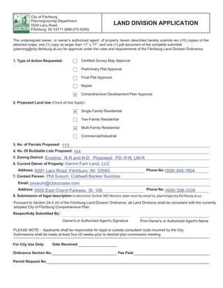
  • 1. COTTAGE GROVE OFFICE | 119 South Main Street, Cottage Grove, WI 53527 | 608-839-4422 MILWAUKEE OFFICE | 10437 Innovation Drive, Suite 305 | Wauwatosa, WI 53226 | 414-380-1044 Prepared by: In collaboration with: Tim Anderson Consulting, LLC Amendment to Comprehensive Development Plan Previously Approved Under Resolution R-12-14 Quarry Vista Fitchburg, Wisconsin Hamm Fam Land, LLC Fitchburg, WI February 17, 2015 Revised March 5, 2015 Revised March 11, 2015
  • 2. Comprehensive Development Plan Quarry Vista Fitchburg Wisconsin February 17, 2015 rev. March 11, 2015 Comprehensive Development Plan Quarry Vista Table of Contents 1 Introduction ......................................................................................................................... 1 2 Existing Conditions.............................................................................................................. 1 2.1 Site Location and Neighborhood Context..................................................................... 1 2.2 Zoning .......................................................................................................................... 2 2.3 Topography .................................................................................................................. 2 2.4 Surface Water Hydrology.............................................................................................. 3 2.5 Groundwater Hydrology................................................................................................ 3 2.6 Natural Features........................................................................................................... 4 2.7 Environmental Designations......................................................................................... 4 2.8 Transportation .............................................................................................................. 5 2.9 Availability of Water and Wastewater Services............................................................. 5 2.10 Parks ............................................................................................................................ 5 2.11 Schools......................................................................................................................... 5 3 Proposed Development....................................................................................................... 6 3.1 Proposed Site Plan....................................................................................................... 6 3.2 Proposed Planning Approach....................................................................................... 6 3.3 Proposed Housing Mix ................................................................................................. 6 3.4 Proposed Transportation Plan...................................................................................... 8 3.5 Proposed Park System............................................................................................... 10 3.6 Proposed Utility Service ............................................................................................. 11 3.7 Stormwater Management ........................................................................................... 11 3.8 Compatibility with Surrounding Land Uses................................................................. 12 3.9 Consistency with Adopted Plans ................................................................................ 12 3.10 Proposed Land Use Data ........................................................................................... 13 3.11 Development Schedule .............................................................................................. 14 3.12 Proposed Zoning ........................................................................................................ 14 4 Estimated Assessed Value ............................................................................................... 14 5 References........................................................................................................................ 15
  • 3. Comprehensive Development Plan Quarry Vista Fitchburg Wisconsin February 17, 2015 rev. March 11, 2015 Figures Figure 1 Project Context Figure 2 Existing Conditions Figure 3 Environmental Designations Figure 4 Project Plan and Conceptual Layout Figure 5 Street Typical Sections Figure 6 Utility Plan Figure 7 Stormwater System Schematic Layout Figure 8 Land Use Plan Figure 9 Phasing Plan Figure 10 Zoning Plan Appendices Appendix A Projected Stormwater Management Features
  • 4. Comprehensive Development Plan Quarry Vista Fitchburg Wisconsin February 17, 2015 rev. March 11, 2015 Project Contacts Hamm Fam Land, LLC c/o Mr. Phil Sveum Coldwell Banker Success 5500 East Cheryl Parkway Fitchburg, WI 53711 608-288-3339 psveum@cbsuccess.com Montgomery Associates: Resource Solutions (MARS) Project Manager Deb Hatfield Montgomery Associates, Resource Solutions, LLC 119 South Main Street Cottage Grove, WI 53527 608-839-4422 debbie@ma-rs.org
  • 5. Comprehensive Development Plan Quarry Vista Fitchburg Wisconsin February 17, 2015 1 rev. March 11, 2015 1 Introduction Hamm Fam Land, LLC first submitted a Comprehensive Development Plan (CDP) for the Quarry Vista development in December 2013, and that plan was approved by the City in January 2014. A closed, licensed landfill exists on the property. The City of Fitchburg did not know about the landfill at the time of platting and zoning approvals. When the landfill became known in August and September 2014, inconsistencies between the plan and public dedications and improvements were discovered. This revised CDP submittal addresses conflicts between an August 2014 DNR closure plan approval for the licensed landfill on the property and City requirements for the project. Addressing the landfill issue has required extensive communication and coordination between the City, the DNR and Hamm Fam Land, as well as some redesign of the project. The result of that process is this revised CDP submittal to the City, as well as a January 2015 revised landfill closure plan submittal to DNR. The CDP will be used as the guide for reclaiming and redeveloping the former 72 acre Hammersley Stone Quarry located at 6292 Lacy Road. Hamm Fam Land, LLC is proposing to develop a mixed residential neighborhood that will include single family lots, duplex lots and condominiums along with a higher density site that will possibly include apartment or assisted living units. The Hammersley family has successfully operated a stone quarry at this location for over 60 years and is nearing the final stage of reclaiming and restoring the property to prepare it for development. The site has been designated by the City of Fitchburg for residential development since 1995 and it is within the city’s Urban Service Area and Future Urban Development Area (FUDA) boundaries. Detailed planning for this site was initiated by the Hammersley family in 2005. Since then, the Project Team has met with neighboring property owners and has worked with city staff to resolve various issues that affect development at this location and to design an attractive, environmentally friendly, viable residential neighborhood. This CDP is submitted for review and approval by the City of Fitchburg under Land Division Ordinance Chapter 24. 2 Existing Conditions 2.1 Site Location and Neighborhood Context The subject property consists of approximately 72 acres located at the northeast corner of Lacy Road and Fitchrona Road in Section 7 of the City of Fitchburg. The northern boundary of the property abuts the Quarry Ridge Recreation Area. Single family lots and Fitchrona Road form the western boundary while Lacy Road defines the southern boundary. The eastern edge of the property abuts a working quarry owned and operated by Payne & Dolan, Inc.
  • 6. Comprehensive Development Plan Quarry Vista Fitchburg Wisconsin February 17, 2015 2 rev. March 11, 2015 Figure 1 shows the project location and the surrounding neighborhood context. In the greater area surrounding the site are: · To the West: The Town of Verona’s Goose Lake and Wendelwood neighborhoods encompass approximately 108 acres with 64 residences. · To the North: The City of Fitchburg’s 52 acre Quarry Ridge Recreation Area, which includes 2.45 miles of hiking and off-road terrain bicycle trails. The park is also an access point to the Military Ridge State Trail. The Quarry Ridge Wet Pond (constructed as part of the city’s Jamestown stormwater management plan) is located in the central portion of the park. · To the East: The 37.8 acre Payne & Dolan quarry is immediately east of the site, beyond which the lands are in agricultural use. The North Stoner Prairie Neighborhood Plan, completed in November 2013 recommends commercial and industrial uses for the area that directly adjoins the eastern boundary of the proposed Hammersley Quarry Redevelopment. · To the Southeast: The 56 acre Fitchburg Minerals quarry site. 2.2 Zoning The property is currently zoned PD-SIP, P-R, R-LM, Rural Residential and Rural Development. 2.3 Topography Figure 2 shows the current conditions on the project site. The topography of this site has been substantially altered during the past 60 years of mining operations. Pre-quarry, this site was dominated by a heavily wooded ridgeline running northeasterly from the Lacy Road – Fitchrona Road intersection. This ridge crested at approximately elevation 1120 feet – nearly 160 feet above the surrounding countryside. The quarry has been excavated along the centerline of the highest portions of the ridge. The lowest elevation within the quarry is approximately 964 feet, which is approximately 16 feet below the elevation of the Lacy Road – Fitchrona Road intersection). Currently, there are two main sections of quarry on the site: an eastern section that has active quarrying, crushing and loading operations and a western section that is not active and is currently being filled with compacted soil. The area between the two has already been filled in. The quarry operations are largely obscured from view along Lacy and Fitchrona Roads and from the city’s Quarry Ridge Recreation Area by the remaining steep wooded hillsides of the ridge. Figure 2 shows areas with 12% or greater slopes. Final reclamation grades will need to tie to the elevations on Fitchrona Road centerline (approximate elevation 985), the final excavation depth of the Payne & Dolan Quarry to the east (approximate elevation 1060 feet), the centerline profile grades of Lacy Road (which rises from elevation 995 to 1045), and the Quarry Ridge Recreation Area drainage way elevation (approximate elevation 965).
  • 7. Comprehensive Development Plan Quarry Vista Fitchburg Wisconsin February 17, 2015 3 rev. March 11, 2015 2.4 Surface Water Hydrology The Quarry Vista site is located within the Goose Lake watershed, which is a closed depression. Goose Lake, a 20 acre prairie-pothole, occupies the lowest portion of the watershed and is situated approximately 700 feet to the west of the project site in the town of Verona (see Figure 1). The water levels of Goose Lake fluctuate in response to runoff input, and were significantly elevated during the heavy storms of 2008. If water levels in Goose Lake become extremely high, the lake overflows in a southwesterly direction toward Badger Mill Creek, which drains to the Sugar River. Currently, the central portion of the Hammersley Quarry site is internally drained to the East and West Quarry areas of the site. In these areas, storm water runoff typically accumulates at low points on the quarry floor, where it evaporates or infiltrates into the bedrock floor of the quarry. The southern slopes of the site drain to the Lacy Road right-of-way. The westernmost portion of the site drains toward the Fitchrona Road right-of-way, and the North-facing slopes of the site drain toward the Quarry Ridge Recreation Area and the 630 acre Jamestown Watershed. Drainage from the redevelopment site reaches Goose Lake via existing culverts beneath Fitchrona Road which include flow from Lacy Road as well. (See Figure 7). Prior to development, approximately 50 acres of the site drained to the north, towards the Quarry Ridge Recreation Area and then drained westerly to Goose Lake. The southern 20 acres drained to the south and southwest to a farm field swale and then northwesterly to the Lacy Road – Fitchrona Road intersection and then northwesterly via roadside ditches to Goose Lake. Drainage from Goose Lake drains westerly and feeds the Badger Mill Creek and its associated wetlands. The City of Fitchburg established the Jamestown Stormwater Assessment District to create and maintain a series of stormwater detention ponds along the drainage system discharging to Goose Lake. These ponds control the peak rate of runoff and remove sediment from the surface water runoff flowing to Goose Lake. 2.5 Groundwater Hydrology In general, there are three groundwater systems in the area: a shallow aquifer comprised of glacial deposits; an upper bedrock aquifer comprised of several Ordovician and Cambrian aged sandstones and dolomites; and a lower sandstone aquifer comprised of the lower Eau Claire Formation and the Mt. Simon Formation. A layer of shale approximately 10 feet thick in the Eau Claire Formation separates the two bedrock aquifers. Most municipal wells in Dane County draw from both the shallow and deep bedrock aquifers; however newer wells are typically open only to the deeper Mt. Simon sandstone aquifer. Available information indicates that a groundwater divide is present in this area separating groundwater flowing west to the Sugar River and groundwater flowing east toward the Yahara River, and that groundwater in both bedrock aquifers below the project site flows northeast towards Nine Springs Creek and the Yahara River. Hammersley Quarry is situated near the top of the upper bedrock aquifer. The lowest bedrock exposed is the St. Peter Sandstone, which has relatively high and uniform permeability. Above the St. Peter,
  • 8. Comprehensive Development Plan Quarry Vista Fitchburg Wisconsin February 17, 2015 4 rev. March 11, 2015 dolomites of the Galena, Decorah and Platteville Formations are exposed, particularly in the eastern quarry area. These units are also highly permeable due to extensive horizontal and vertical fractures. 2.6 Natural Features The Quarry Vista site contains approximately 20 acres that have not been disturbed by quarry operations. These remaining areas of native vegetation are located in the northerly and southerly hillsides and are comprised predominately of upland hardwood forest species. Each of these areas includes several high quality old growth trees and vegetation including black oak, white oak and hickory, but are dominated by lower quality woods with a predominantly weedy and brushy understory. The disturbed portions of the site are covered with lower quality vegetation that has invaded and established in areas where the active quarry and fill operations have ceased. The northern wooded hillside and the adjacent Quarry Ridge Recreation Area (despite active recreational use) provide habitat for diverse wildlife populations. 2.7 Environmental Designations The environmental designations for the proposed development site and adjacent areas are shown on Figure 3. Wetland designations were taken from the Wisconsin Wetland Inventory on the DNR Surface Water Data Viewer, Environmental Corridors and areas of steep slopes from the Dane County online mapping application and the Park and Conservancy area designations from the City of Fitchburg 2013 land-use plan. As Figure 3 illustrates, the previously-mapped designations on the proposed development site include areas of steep slopes, and areas that were shown to be potential Park and Conservancy lands in the city’s 2013 Land-Use Plan. A small wetland area is located within the 66 foot wide “panhandle” of land that runs adjacent to the Quarry Ridge Recreational Area and connects to Fitchrona Road. In October 2014 Eco-Resource Consulting (ERC) evaluated the site and delineated a 203 SF wetland in an excavated pit. The character of this wetland suggests that a 75 foot buffer is applicable. The buffer does not extend into the proposed lots. The wetland will not be impacted by the proposed public improvements associated with the plat. See Figure 3. A small portion of the westernmost part of the project site could be subject to buffer constraints associated with the existing wetlands to the West of Fitchrona road, if a 300-foot buffer was deemed to apply to the area. However, the character of this wetland and the separation of the wetland from the development site by Fitchrona road and associated drainage features suggests that the 75 foot buffer is more applicable to the wetland area west of Fitchrona road. Wetland buffer widths of 75 feet do not extend into the proposed development site from this wetland. Figure 3 illustrates that, as discussed above, much of the area of the North-facing and South-facing slopes of Quarry Vista are steeper than 12%. The potential Park and Conservancy areas noted in the 2013 land-use plan include the margin of the site adjacent to the Quarry Ridge Recreational Area, the
  • 9. Comprehensive Development Plan Quarry Vista Fitchburg Wisconsin February 17, 2015 5 rev. March 11, 2015 eastern portion of the site which includes active quarry operations, a small portion of the southeastern- most portion of the site that is in residential and woodland use. Additionally, a “finger” of potential parkland is shown on the westernmost margin of the site, crossing part of the existing residential lots and Fitchrona Road, potentially indicating a desire for North-South pedestrian or bicycle transit, although the designation does not extend into the Quarry Ridge Recreational Area (see Figure 3). An inactive closed landfill is located within the central portion of the Quarry Vista site, as shown on Figure 3. Based on a DNR file data, the landfill was licensed as a 5.0 acre site in 1972 for non- combustible waste disposal but also permitted to accept wood matter, trash, and garbage. Based on Owner and DNR information, the landfill primarily accepted construction demolition material from highway projects and was operated as a private site until it received site closure status in 1980. While the original landfill licensed area was 5.0 acres, a test pit investigation indicates that the actual filling area was much smaller; about 1.5 acres (see Figure 3). No landfill activities have occurred since 1980. Since 1980, there have been no DNR requirements for environmental monitoring or reporting at the site. 2.8 Transportation The main streets supporting development in this area of the city are Fitchrona Road and Lacy Road with Nesbitt Road and Seminole Highway completing the overall network. Fitchrona Road is the primary north-south route and is an important linkage between McKee Road/CTH PD to the North and the City of Verona (via Whalen Road) to the south. Lacy Road is a major east-west arterial through the city. Currently, the area is not served by a transit system. Access to the Military Ridge State Trail is 300 feet north of the subject site. Future bicycle routes are planned for both Lacy Road and Fitchrona Road. 2.9 Availability of Water and Wastewater Services Sanitary sewer is readily available both in Fitchrona and Lacy Roads and an 8” main was previously stubbed into the site from Fitchrona Road. Water service is from the Nesbitt Road/Fitchrona Road intersection will be extended by Fitchburg to the Quarry Vista Drive – Fitchrona Road intersection. 2.10 Parks The Quarry Ridge Recreation Area borders the north boundary of the subject site. This park consists of a wooded are with steep slopes and an 11 acre wet pond that collects stormwater from the Jamestown Neighborhood. This park provides for more than 3 miles of off-road mountain bike and hiking trails and includes a picnic shelter and restrooms. This park provides direct access to the Military Ridge State Trail. 2.11 Schools The subject site is in the Verona School District.
  • 10. Comprehensive Development Plan Quarry Vista Fitchburg Wisconsin February 17, 2015 6 rev. March 11, 2015 3 Proposed Development 3.1 Proposed Site Plan The Quarry Vista project proposes a mixed residential neighborhood with 322 units on 72.4 acres including 124 single family lots, 12 single family condominium units, 30 duplex units and 156 multi- family units for a gross density of 4.4 DU/Ac. Figure 4 illustrates the proposed plan including the proposed layout of lots, roadways and connecting greenspace. 3.2 Proposed Planning Approach The proposed Quarry Vista CDP primarily focuses development in the areas of the site disturbed by quarry operations in order to preserve the site’s natural features (wooded vegetation and steep slopes) that border the Quarry Ridge Recreation Area on the north and Lacy Road on the south. A small area of woodland along Lacy Road will be disrupted by the proposed single family condo lot. The proposed CDP provides an efficient system of streets organized in an east-west orientation to maximize solar orientation for the majority of the housing units. The street system generally follows the site’s existing topography which rises from a low point at Fitchrona Road to a high point on the site’s northeast boundary with an approximate 80 foot elevation change. The orientation of the housing units and the rising topography will allow for viewsheds to Blue Mounds to the west and the rural landscape to the south and west. The following points summarize the Quarry Vista CDP planning approach: · Preservation of natural features. · A range of housing choices, lot sizes and building types to promote diversity and affordability. · An efficient street system that promotes a connected neighborhood. · A system of active and passive recreation areas that includes large and small parks and hiking/walking trails through the site’s natural areas. · Preservation of quarry walls as design features for new parks and the use of quarried stone in the site’s landscape design to promote the site’s quarry heritage. · Solar orientation and viewsheds. · Pedestrian and bicycle connectivity. · Utilization of the site’s open space system to maximize stormwater infiltration. · Consolidation of the landfill area in an environmentally responsible manner to create an area of privately owned green space. 3.3 Proposed Housing Mix The Quarry Vista CDP proposes a variety of lot sizes and building types which are identified on Figure 4 and include the following designations. Note: The sizes for each designation are averages and may vary. SF-A (16 lots) – 70’ x 125’ single family detached lots located on the both sides of Quarry Vista
  • 11. Comprehensive Development Plan Quarry Vista Fitchburg Wisconsin February 17, 2015 7 rev. March 11, 2015 Drive west of the phase line. SF-B (56 lots) - 80’ x 125’ single family detached lots located on the north and south perimeters of the development. SF-C (52 lots) - 50’ x 110’ detached lots with rear alleys located in the center of the development. SF-D (12 condos) - Detached single family condominiums served by a private drive located in the wooded area in the southeast corner of the development. The 2,500 sf building sites and the private drive will be located to preserve significant vegetation and minimize regrading of the natural topography. SF-E (15 lots) – 80’ x 110’ duplex lots located in the southwest portion of the development adjoining Lacy Road that will provide a transition between the higher density multi-family (MF-1) and the lower density single family neighborhood to the east. MF-1 (up to 156 units) - Multi-family buildings located in the southwest corner of the development with an approximately equal mix of one and two bedroom apartments or assisted living units and a combination of enclosed and surface parking. 3.4 Landfill Area Management As noted above, the presently inactive Hammersley Construction Co. landfill (Landfill) was licensed as a 5.0 acre site in 1972 for non-combustible waste disposal but also permitted to accept wood matter, trash, and garbage. However, based on Owner and DNR information, the landfill primarily accepted construction demolition material from highway projects and was operated as a private site until it received site closure status in 1980. While the landfill licensed area was 5.0 acres, the actual filling area was much smaller; about 1.5 acres (see Figure 3). Hammersley submitted a closure plan modification request to DNR in May 2014 which called for excavating the fill material within the existing landfill limits, sorting it to remove material that should be disposed of off-site, and placing the balance of the material in a location occupying park and roadway right- of-way areas proposed to be dedicated to the City. This closure plan modification was approved by DNR in August 2014. However, it became apparent that the approved closure plan was incompatible with the City development approvals and criteria for public land dedication. Following a series of meetings in September 2014, Hamm Fam Land has worked with the City and DNR to develop a project design and landfill closure plan that will be acceptable to all parties. After several rounds of review with the City, the revised closure plan was submitted to DNR on January 14, 2015. At this time, no formal approval has been granted. Key elements of the closure plan activities will include: 1. The existing landfill area shown on Figure 3 will be excavated in phases. The excavated fill
  • 12. Comprehensive Development Plan Quarry Vista Fitchburg Wisconsin February 17, 2015 8 rev. March 11, 2015 material will be sorted, and woody material, municipal waste, ash waste or other waste will be removed from the fill and disposed at suitable off-site facility, leaving only earth fill and clean nonorganic construction debris to be placed in the 1.2 acre area shown as private green space on Figure 4. 2. After the fill is removed, the base of the landfill area will be sampled and sample results reviewed by DNR and the City. 3. The fill placed in the private green space area shown will have an even surface and will have turf vegetation. 4. The private greenspace area will not be transferred to City ownership as part of the Final Plat dedications. 5. Placement of acceptable fill material in the private green space shown on Figure 4 will be monitored for conformance with the closure plan requirements by both City and DNR. A full documentation report of activities will be prepared. 6. DNR will review the closure documentation report. If the work has been conducted according to the approved plan and the test results from the area of existing fill placement are acceptable, DNR will approve the plan and document that the area of fill placement shown on figure 4 is the only extent of landfill on the Quarry Vista property. The revised closure plan modification submittal (identified as Reference 5 to this plan) includes many additional details regarding the specifics of material sorting procedures, analytical testing procedures, and communication and coordination with the City and DNR. 3.5 Proposed Transportation Plan The proposed development provides for multi-modal transportation. The street system has been designed in a grid pattern to evenly distribute traffic volumes. A series of interconnected greenways with off-street pathways provide for pedestrian and bicycle usage. 3.5.1 Automobile The primary means of transportation will be by private automobile. The development will generate approximately 2,700 trips per day. Because of the proposed grid system traffic will be distributed more evenly over the street network. The primary transportation corridors are Fitchrona Road and Lacy Road. The street system proposed in the Quarry Vista CDP includes a mix of street types: · A central E-W street (66’ row) that will move from the west at Fitchrona Road and connect with
  • 13. Comprehensive Development Plan Quarry Vista Fitchburg Wisconsin February 17, 2015 9 rev. March 11, 2015 the future North Stoner Prairie Neighborhood (Payne and Dolan Quarry) adjoining the site’s eastern boundary. Driveways will be eliminated along this street because lots that border the street will be served by rear alleys. · Local E-W loop streets (66’ row) that parallel the central street on the north and the south. · Local N-S connecting streets (66’ row) that connect the loop streets to the central street and divide the development into 500” blocks. · One 500’ cul-de-sac street (66’ row). · 24’ rear alleys serving SF-C lots. · A 24’ private drive serving the condominium cluster. The Quarry Vista CDP proposes four entrances from the surrounding street system: one on Fitchrona Road, two on Lacy Road and one future entrance at the development’s eastern boundary to connect with the future North Stoner Prairie Neighborhood. Street gradients will be less than 5% on average except for the easterly Lacy Road entrance which will be less than 8%. Proposed street typical-sections are shown in Figure 5. The proposed street system consists of two typical cross sections. The main east-west street will be 36 feet face of curb to face of curb with on-street parking in a 66-foot right of way. The curvilinear nature of the street and on-street parking will provide traffic-calming measures. The remaining of the streets will be 32 feet wide and provide on street parking and two travel lanes within a 66-foot right of way. Public streets will include a minimum nine foot terrace for street trees and lighting. The private alleys will be constructed in outlots and will be designed in accordance with Chapter 27, Division 6. To accommodate future widening of Fitchrona and Lacy Roads, additional right of way is proposed to be dedicated along the north side of Lacy Road and east side of Fitchrona Road. The right of way width on the north side of Lacy Road will be 40’. The right of way width on the east side of Fitchrona Road will be 50’. The widths of these rights of way are sufficient to accommodate future improvements by the city, including sidewalks, on-street bike lanes, travel lanes and turn lanes at intersections. Additional right of way may also be dedicated in the northeast quadrant of the Lacy Road/Fitchrona Road intersection to improve the intersection skew angle. Initially, Lacy Road will be designed to accommodate a 40 mph design speed. Fitchrona Road and Lacy Road improvements will include grading the expanded right of way to accommodate the future street section and construction of a paved multi-purpose path along the east and north limits of the respective rights of way. The location of the paved multi-purpose path will be confirmed with Public Works staff during the platting process. The proposed intersections with Lacy Road and Fitchrona Road will be designed to meet sight distances for a 50 mph design speed.
  • 14. Comprehensive Development Plan Quarry Vista Fitchburg Wisconsin February 17, 2015 10 rev. March 11, 2015 Entrance features and signage will be provided at all entryways into the development. 3.5.2 Pedestrian and Bicycle The proposed street system will provide a pedestrian and bicycle network that will connect all parts of the Quarry Vista neighborhood. This pedestrian/bike network will also connect to future ped/bike facilities on Lacy Road and Fitchrona Road and provide connections to destinations in the surrounding neighborhood and the community. A future bicycle route planned for Fitchrona Road will connect to the Military Ridge State Trail which has an entrance 300’ north of the subject site. The Military Ridge State Trail links to other local and regional trails to connect the subject site to area-wide and regional destinations. The proposed pedestrian and trail system is consistent with the apparent transit objectives of the Parks & Conservancy areas shown on the 2013 land-use plan. 3.5.3 Transit Currently, the area is not served by a transit system. As the surrounding area develops, transit service may become available along Lacy Road and/or Fitchrona Road 3.6 Proposed Park System Quarry Vista proposes a variety of parks and open spaces to serve the recreation needs of the neighborhood residents. · A 1.6 Ac central park that will include playground and a multi-purpose open space. This south facing park will incorporate a remnant of the existing quarry wall as a defining landscape feature. · A 3+ Ac south-facing park located in the northeast corner of the development. This park, which will also incorporate an existing quarry wall as a defining landscape feature, will include a soccer field, a ball diamond, play equipment and a sledding hill. · The wooded area preserved on the north side of the development with a hiking/walking trail that connects to the neighborhood’s street system and the Quarry Ridge Recreation Area. · Wooded and open space buffers located on the east and south sides of the development. The proposed Quarry Vista CDP includes approximately 21.4 Ac of parks and open spaces, about thirty percent of the total site area. Approximately 18.1 Ac of this total will be dedicated to meet the city’s park dedication requirements. Note that the private open space area identified on Figure 4 will not be part of public park dedication.
  • 15. Comprehensive Development Plan Quarry Vista Fitchburg Wisconsin February 17, 2015 11 rev. March 11, 2015 3.7 Proposed Utility Service The proposed layout of sanitary and water services are shown in Figure 6. The layout of utilities will be finalized with input from Public Works staff during the platting process. The sanitary sewer system serving the development will connect to an 8-inch sanitary sewer stubbed into the property from Fitchrona Road. Within the development, 8-inch sanitary sewer mains will be installed within the street rights of way or public utility easements. An 8-inch sanitary sewer, at minimum grade, has a capacity of 0.77 cfs. The proposed development of 322 dwelling units will generate a peak flow of 0.38 cfs using 150 gpd for multi-family units, 225 gpd for single family residential units and a peak factor of 4. Water service for the development will be provided from a 12-inch water main extended from Nesbitt Road. The water main will be brought by the City to the Quarry Vista Drive – Fitchrona Road intersection. Provisions for water service to lands east and south of the Quarry Vista site will be made by extending the 12-inch water main in plat outlots adjacent to Lacy Road and Fitchrona Road. Internally, the development will be served by a series of 8-inch water mains. The city’s ultimate water distribution system plans indicate that this main will eventually be extended easterly to the future extension of Commercial Drive and connect north to provide a looped system back to Water Tower E located northeast of the Payne & Dolan Quarry. 3.8 Stormwater Management The stormwater management system for the site will be designed to meet the following objectives: 1. Provide compliance with the City’s storm water management criteria, including limiting the increase of post-development peak discharge rate to predevelopment rate for the 1, 2-year, 10- year and 100-year storms, to provide 80% reduction in suspended solids release compared to no controls, and to infiltrate sufficient runoff volume so that the post-development retention of runoff is at least 90% of the predevelopment volume; 2. Provide compliance with State of Wisconsin stormwater management criteria described in Administrative Code sections NR 216 and NR 151. Providing compliance with the City’s criteria will (with minor exceptions that will be addressed) provide compliance with state of Wisconsin criteria; 3. Address site-specific criteria that are currently being refined with City of Fitchburg staff. These criteria are oriented toward providing a drainage system compatible with adjacent uses along Lacy Road and Fitchrona Road, and to providing minimal impact to Goose Lake. The majority of the site will drain to the Quarry Ridge Wet Pond, to utilize the detention routing storage available and also to maximize the opportunity for water quality treatment and seepage of water in the basin to the regional groundwater system. The development plan will emphasize local (near-source) management of water quality and volume.
  • 16. Comprehensive Development Plan Quarry Vista Fitchburg Wisconsin February 17, 2015 12 rev. March 11, 2015 4. Integrate the storm water management design with local “pocket parks” and larger open space areas to provide an attractive aesthetic consistent with the design of the residential area. A schematic plan of the anticipated stormwater management system is shown on Figure 7. The majority of the site will drain via storm sewer and graded pathways toward the Quarry Ridge Wet Pond. The apartment lot in the southwest corner of the plat will address stormwater requirements with it’s own on-site system. Within the development area, stormwater management will be integrated into the site design at three scales: a local streetscape scale where we anticipate placement of bioretention and possibly “ street terrace infiltration areas within the public right-of-way, somewhat larger systems to be incorporated within pocket parks to provide block-by-block storm water runoff volume reduction, and larger systems that will receive runoff from multiple block areas to be located in public open space. The streetscape and block-by-block stormwater features are anticipated to be vegetated. Design of the systems will be driven by stormwater management criteria as well as the aesthetic and use functions of the open spaces in which they are placed. This design approach is intended to make use of the results of the recently completed Catalytic Project report prepared by EOR for the City of Fitchburg using the McGaw Park area as an example. Drainage features will also be incorporated into the connected open space plan for the project. The drainage conveyance swale to be constructed within the Quarry Ridge recreation area will be designed to meet Park aesthetic and functional objectives. Drainage on the perimeter of the project, along Lacy Road and Fitchrona Road will be improved as part of the right-of-way improvements that will be required for this project. Example descriptions of design approaches, plant species sets, and performance trade-offs for storm water management practices anticipated to be used in the project are included in Appendix A. 3.9 Compatibility with Surrounding Land Uses The residential uses and densities, street patterns and parks and open spaces proposed for the Quarry Vista CDP are compatible with surrounding land uses, both existing and future. These uses include single family residential uses bordering the east side of the development, the Quarry Ridge Recreation Area bordering the north side of the development, commercial and industrial uses proposed as part of the future North Stoner Prairie Neighborhood on the east side of the development, and low density residential uses recommended in the City of Fitchburg Comprehensive Plan for the area south of Lacy Road. 3.10 Consistency with Adopted Plans The proposed Quarry Vista CDP is consistent with the City of Fitchburg Comprehensive Plan which designates the subject site as Low Density Residential with 2 – 5 dwelling units per acre. The CDP is
  • 17. Comprehensive Development Plan Quarry Vista Fitchburg Wisconsin February 17, 2015 13 rev. March 11, 2015 also consistent with City of Fitchburg’s Comprehensive Park, Open Space, and Recreation Plan. Open space corridors are provided around all sides of the proposed development except for approximately 350’ along the west side of the cul de sac that adjoins the existing single family lots along Fitchrona Road. A vegetation buffer will be provided to separate the existing and proposed lots. The proposed development plan, including pedestrian and bicycle transit features, connected open space and preservation of wooded slopes is consistent with the objectives of the Parks & Conservancy areas shown on the 2013 Land-Use Plan. The development plan also is consistent with the objective of the steep slope designations in that the steeply sloped wooded hillsides will generally not be developed and will not be regraded. 3.11 Proposed Land Use Data Figure 8 shows the proposed land uses. Total Site Acreage 72.4 Acres Proposed land use area and units Ac units Low Density Single Family Residential 26.1 124 Low Density Condominiums 2.9 12 Duplex 3.3 30 High Density Apartments 3.7 156 Total Units 36.0 322 Projected Ownership Total Ownership 166 52% Total Rental 156 48% Density Net Density/Acre 8.9 DU/Ac Gross Density/Acre 4.5 DU/Ac Area by land use Total Residential Development Acreage 36.0 Ac (49.7% of total site) Total Open Space 21.4 Ac (29.6% of total site) Proposed Parks 18.1 Ac Private Stormwater Management Areas 2.1 Ac Private Greenspace 1.2 Ac Total Public Streets 15.0 Ac (20.7% of total site)
  • 18. Comprehensive Development Plan Quarry Vista Fitchburg Wisconsin February 17, 2015 14 rev. March 11, 2015 Dedications Public Street Dedication 15.0 Ac Park Dedication 18.1 Ac (21.4 Ac Required) 3.12 Development Schedule The Hammersley Quarry Redevelopment project is anticipated to be developed over a 4-year time frame in two phases as shown in Figures 9.1 and 9.2. The suggested development phases are: · Phase One — 2015-2016 · Phase Two — 2017-2019 This timing may change due to market conditions, availability of infrastructure or other reasons. 3.13 Proposed Zoning Figure 10 shows the proposed final zoning for Quarry Vista. The zoning will be phased per the development schedule. The single family areas of Phase One has been rezoned to R-LM, the PD areas have been rezoned to PDD-SIP while the multi-family lot has been rezoned to PDD-GIP. During Phase One, the area within Phase Two will not be rezoned. During Phase Two development, the remaining single family lots will be rezoned to the proposed final zoning and the Single Family Condo lot will be rezoned to A-S. The single family condo lot will be rezoned when they are developed. 4 Estimated Assessed Value Development Type Estimated Assessed Value 16 SF Homes @ $300,000 ("A" lots) $4,800,000 56 SF Homes @ $300,000 ("B" lots) $16,800,000 52 SF Homes @ $250,000 (“C” lots) $13,000,000 15 Duplex Units @ $500,000 (“E” lots) $7,500,000 156 Apartments @ $70,000 $10,920,000 12 Condominium Homes @ $275,000 $3,300,000 Total Estimated Assessed Value $56,320,000
  • 19. Comprehensive Development Plan Quarry Vista Fitchburg Wisconsin February 17, 2015 15 rev. March 11, 2015 5 References 1. City of Fitchburg Comprehensive Plan, Chapter Four: Land Use. adopted March 2009, rev. Dec 2013 2. Comprehensive Park, Open Space, and Recreation Plan, City of Fitchburg. January 2010 3. Dane County Parks & Open Space Plan, Chapter IX.6 Trails. March 2012 4. North Stoner Prairie Neighborhood Plan. November 2013 5. Revised Plan Modification for Hammersley Construction Co. landfill, submitted to the Wisconsin DNR by Hammersley Stone Company, Inc. on January 14, 2015
  • 20. Comprehensive Development Plan Quarry Vista Fitchburg Wisconsin February 17, 2015 1 rev. March 11, 2015 Figures Figure 1 Project Context Figure 2 Existing Conditions Figure 3 Environmental Designations Figure 4 Project Plan and Conceptual Layout Figure 5 Street Typical Sections Figure 6 Utility Plan Figure 7 Stormwater System Schematic Layout Figure 8 Land Use Plan Figure 9 Phasing Plan Figure 10 Zoning Plan
  • 21. DRAWN BY CHECKED BY SCALE PROJECT NO. DATE . MONTGOMERYASSOCIATES: RESOURCESOLUTIONS,LLC 119SouthMainStreet|CottageGrove,WI53527 (608)839-4422|www.ma-rs.org 12/17/20131613 RDPACF PROJECTCONTEXT HammersleyQuarryRedevelopment HammFamLandLLC 0 500 1,000 Feet 1 inch = 1,000 feet 1 §¨¦151 §¨¦12 VERONA MIDDLETON Madison Fitchburg Verona Legend Plat Boundary Municipal Boundary Urban Service Area LOCATOR MAP: NOT TO SCALE FIGURE Rev 1 - 1/7/14
  • 22. QUARRY RIDGE WET POND 888 990 1000 1010 10201030 980 970 10401050 1060 1070 1080 1090 970 970 980 980990 980 980 980 980 980 980 990 1000 1010 1030 1020 1040 1050 1060 1070 980 970 970 1000 990 980 1000 1010 1020 1030 1040 1050 1020 1030 1040 1050 1060 1070 1080 1090 1100 1110 1000 1010 1020 1030 1040 1050 1060 1070 1080 1090 1100 1100 1100 1120 1030 1100 1110 1120 1130 1120 1120 1060 1070 1080 1070 1070 1080 1090 1090 1100 1070 1040 1050 1070 1080 1060 1070 1080 1090 1100 1080 1100 1070 970 Hamm Fam Land, LLC c/o Mr. Phil Sveum Coldwell Banker Success 5500 East Cheryl Parkway Fitchburg, WI 53711 608-288-3339 psveum@cbsuccess.com Montgomery Associates, Resource Solutions, LLC Project Manager-Deborah Hatfield, P.E. 119 South Main Street Cottage Grove, WI 53527 608-839-4422 debbie@ma-rs.org Tim Anderson Consulting, LLC Tim Anderson 2126 Yahara Place Madison, WI 53704-5658 608-514-5402 tander2126@tds.net Burse Surveying and Engineering, Inc. President-Michelle L. Burse P.E., R.L.S. Madison, WI 53703 608-250-9263 mburse@bse-inc.net IF THIS BAR DOES NOT MEASURE 1" THEN DRAWING IS NOT TO SCALE PROJECT NO. FIGURE NO. DATE SCALE 0 1 2 1 MONTGOMERYASSOCIATES: RESOURCESOLUTIONS,LLC 119SOUTHMAINSTREET SUITEA COTTAGEGROVE,WI53527 www.ma-rs.org DRAWN BY CHECKED BY NO.DATEREVISION/ISSUE 1613 HAMMFAMLANDLLC QUARRYVISTA HAMMERSLEYQUARRY FITCHBURG,WI EXISTINGCONDITIONS 1"=120' 12/7/2013 2 LMS DJH P:1613 - Hamm Farm Land Property DevelopmentDrawingsCDP Feb 2015CDP ex conditions modified.dwg NOTES: 1. CONTOURS AND AERIAL PHOTO ARE FROM 2010 AND DO NOT REFLECT CURRENT CONDITIONS. 2. ALL OF LOTS 1-3, CERTIFIED SURVEY MAP NUMBER 11159, AS RECORDED IN VOLUME 67 OF CERTIFIED SURVEY MAPS, ON PAGES 152-154, AS DOCUMENT NUMBER 3959694, DANE COUNTY REGISTRY, ALSO PART OF THE NORTHEAST, SOUTHEAST AND SOUTHWEST QUARTERS OF THE SOUTHWEST QUARTER OF SECTION 07, ALSO PART OF THE NORTHWEST AND NORTHEAST QUARTERS OF THE NORTHWEST QUARTER OF SECTION 18, ALL IN TOWNSHIP 06 NORTH, RANGE 09 EAST, CITY OF FITCHBURG, DANE COUNTY, WISCONSIN. 1CDPREVISION1/7/14 1000 LEGEND EXISTING CONTOURS (5-FOOT INTERVAL) PLAT BOUNDARY EXISTING PARCELS LANDFILL BOUNDARY 2CDPRESUBMITTAL
  • 23. Nesbitt Rd QUARRY VISTA USH 151/18 Lacy Rd FitchronaRd DRAWN BY CHECKED BY SCALE PROJECT NO. DATE . MONTGOMERYASSOCIATES: RESOURCESOLUTIONS,LLC 119SouthMainStreet|CottageGrove,WI53527 (608)839-4422|www.ma-rs.org 2/17/20151613 RDPACF ENVIRONMENTALDESIGNATIONS QuarryVista HammFamLandLLC 0 100 200 300 Feet 1 inch = 300 feet 3 Legend Plat Boundary Delineated Wetland Wisconsin Wetlands Inventory (WWI) Wetland 75-ft Buffer Wetland 300-ft Buffer WDNR Hydrography Parks & Conservancy: 2013 Land Use Plan Landfill Slopes 12% and greater Slopes 20% and greater FIGURE
  • 24. * SF-B SF-E SF-D SF-A PARK MF-1 PARK HIKING TRAIL SF-B SF-C SF-C SF-C SF-C SF-B SF-A SF-B PARK HIKINGTRAIL SF-E SF-B SF-B TRAIL TRAIL TRAIL TRAIL NORTH STONER PRAIRIE NEIGHBORHOOD QUARRY RIDGE RECREATION AREA POND POND PRIVATE GREENSPACE* IF THIS BAR DOES NOT MEASURE 1" THEN DRAWING IS NOT TO SCALE PROJECT NO. FIGURE NO. DATE SCALE MONTGOMERYASSOCIATES: RESOURCESOLUTIONS,LLC 119SOUTHMAINSTREET SUITEA COTTAGEGROVE,WI53527 www.ma-rs.org DRAWN BY CHECKED BY NO.DATEREVISION/ISSUE 0 1613 HAMMFAMLANDLLC QUARRYVISTA HAMMERSLEYQUARRY FITCHBURG,WI PROJECTPLAN 4 1"=200' RDP DJH Unit Count - 72.3 Total Acres Unit Type Count SF-A 70' x 125' 16 lots SF-B 80' x 125' 56 lots SF-C 50' x 110' 52 lots SF-D (condo cluster) 12 units SF-E 80'x110' duplex 30 units MF-1 (apartments) 156 units Total Units 322 Density 4.5 DU/Ac. 100 200 The layout of individual lots and buildings is preliminary. PLAT BORDER 1CDPRevisions1/7/14 1CDPResubmittal * The private greenspace area will contain earthen fill and acceptable construction debris from the existing landfill area according to the criteria of the approved DNR closure plan with city coordination and review, as described in the CDP text. .
  • 25. MONTGOMERY ASSOCIATES: RESOURCE SOLUTIONS, LLC 119 SOUTH MAIN ST COTTAGE GROVE, WI 53527 www.ma-rs.orgIF THIS BAR DOES NOT MEASURE 1" THEN DRAWING IS NOT TO SCALE 1 20 1 DATE SCALE PROJECT NO. 1613 HAMM FAM LAND, LLC QUARRY VISTA FIGURE 5 STREET TYPICAL SECTIONS Dec 17, 2013 1"=10' P:1613-HammFarmLandPropertyDevelopmentDrawingsCDPBase2015.dwg 4" CRUSHED AGGREGATE BASE COURSE 36' STREET WIDTH 66' RIGHT-OF-WAY 5" CONCRETE SIDEWALK CL 18' 5'9' 33' 1/4 1/2 IN/FT IN/FT 9' 18' 33' 5' 1/2 IN/FT 1/4 IN/FT R/WR/W CURB & GUTTER 30" CONCRETE 2% 2% 1' 1' 6" TOPSOIL, FERTILIZER, SEED AND MULCH 6" 1 3/4" ASPH. CONC. SURFACE COURSE 2 3/4" ASPH. CONC. BASE COURSE 14" IN/FT SEED AND MULCH 6" TOPSOIL, FERTILIZER, 6" DOT DENSE GRADED 3/4" 4" CRUSHED AGGREGATE BASE COURSE 5" CONCRETE SIDEWALK R/W 1/4 IN/FT 1/2 IN/FT 5'1' 11' 32' STREET WIDTH 66' RIGHT-OF-WAY 16' 33' LC 2% CURB & GUTTER 30" CONCRETE 33' 2% 14" 5' 1/4 16' 11' 1/2 IN/FT 2 1/4" ASPH. CONC. BASE COURSE 1 3/4" ASPH. CONC. SURFACE COURSE R/W 1' DOT DENSE GRADED 3/4" 12" CRUSHED STONE BASE: 4-5" UPPER LAYER 11 4" STONE 7-8" LOWER LAYER 3" STONE 12" CRUSHED STONE BASE: 4-5" UPPER LAYER 11 4" STONE 7-8" LOWER LAYER 3" STONE Revisions: 1 CDP Revisions 1/7/14
  • 26. * * * * SAN SAN SAN SAN SAN SAN SAN SANSAN SANSANSAN SAN SAN SAN 12"PVC 12" PVC SAN SAN W W SAN SAN SAN SAN SAN SAN SAN SAN SAN SAN SAN SAN SAN W W W W W W SAN SAN W SAN SAN SAN WWW WW W W W W W W W W W W W W SAN SAN W W W W W W W W W W W W SAN W SAN W SAN W SAN SAN W W SAN SAN W SAN W W W W W W W W W ****** * SAN SANSAN SAN SAN 8"PVC 12" PVC 8" PVC 8" PVC 12"PVC 12"PVC 12"PVC WWW WW IF THIS BAR DOES NOT MEASURE 1" THEN DRAWING IS NOT TO SCALE PROJECT NO. FIGURE NO. DATE SCALE MONTGOMERYASSOCIATES: RESOURCESOLUTIONS,LLC 119SOUTHMAINSTREET SUITEA COTTAGEGROVE,WI53527 www.ma-rs.org DRAWN BY CHECKED BY NO.DATEREVISION/ISSUE 0 1613 HAMMFAMLANDLLC QUARRYVISTA HAMMERSLEYQUARRY FITCHBURG,WI UTILITYLAYOUT 6 1"=200' RDP DJH 100 200 CONNECT TO EX WATER MAIN AT NESBITT ROAD NEW12"WATERMAIN NEW12"WATERMAIN EX12"SANITARY SAN SAN W W SAN SAN PROPOSED WATER PROPOSED SANITARY EXISTING SANITARY LEGEND 1CDPRevisions1/7/14 2CDPResubmittal 3UtilityChangeonQVD P:1613-HammFarmLandPropertyDevelopmentDrawingsCDPBase2015.dwg,3/5/201510:26:16AM
  • 27. STM STMSTMSTM STM STM STM STM STM STM STM STM STM STM STM STM STM STM STM STM STM STM STM STMSTM STM STM STM STM STM STM STM STM STM STM STM STM STM STM STM STM STM STM STM STM STM STM STM STM STM Quarry Ridge Wet Pond LACY ROAD POST DEVELOPMENT NORTH POST DEVELOPMENT SOUTHEAST POST DEVELOPMENT WEST STORMWATER FROM THESE AREAS WILL BE CONTROLLED BY FLOW SPLITTERS IN MANHOLES TO HAVE SMALL EVENTS DRAIN TO THE SOUTHEAST AND LARGE EVENTS DRAIN TO THE NORTH. NOTES: 1.) HATCHED AREA ON SOUTH REPRESENTS PORTION OF LACY ROAD ROW OUTSIDE OF THE PLAT BOUNDARY THAT DRAINED TO THE WEST IN PREDEVELOPMENT CONDITIONS. THIS AREA WILL BE DRAINED BY STORMSEWER AND DIRECTED TO THE NORTH IN POST DEVELOPMENT CONDITIONS. 30 x 33 HERCP LENGTH 97' EAST ELEVATION 1028 WEST ELEVATION 1025 18" RCP 30"RCP 30"RCP 36"X60" CMP 18"CMP 18" DETENTION BASIN FOR PEAK DISCHARGE CONTROL TO BE PLACED ON HAMMERSLEY PROPERTY SOUTH OF LACY ROAD TO RECIEVE STORMWATER FROM THE POST DEVELOPMENT SOUTHEAST AREA. FINAL CONFIGURATION OF DETENTION TO BE DESCRIBED IN THE PHASE 2 PLAT CONSTRUCTION DRAWINGS. OUTLOT 7 LOT 46 C-1 C-2 C-3 C-4A C-5 C-6A C-7 C-8 C-9 C-10 C-11 C-6B C-4B STORMWATER MANAGEMENT FOR LOT 46 BY LOT DEVELOPER. PROJECT NO. FIGURE NO. DATE SCALE 200" MONTGOMERYASSOCIATES: RESOURCESOLUTIONS,LLC 119SOUTHMAINSTREET SUITEA COTTAGEGROVE,WI53527 www.ma-rs.org DRAWN BY CHECKED BY NO.DATEREVISION/ISSUE 0 400" 1613 HAMMFAMLAND,LLC QUARRYVISTA FITCHBURG,WI STORMWATERSYSTEM SCHEMATICLAYOUT 7 02/17/15 1"=300' LMS DJH P:1613 - Hamm Farm Land Property DevelopmentDrawingsCDP Feb 2015FIGURE 7.dwg NOTES: 1. POTENTIAL STORMWATER FEATURES SHOWN ON THIS MAP ARE SUBJECT TO CHANGE PENDING THE FINAL STORMWATER DESIGN CULVERT TABLE CULVERT ID TYPE DIAMETER UPSTREAM INVERT DOWNSTREAM INVERT LENGTH SLOPE C-1 CMP 36"X60" 959.56 958.55 48.7 2.1% C-2 CMP 18" 962.84 962.22 25.3 2.5% C-3 CMP 54" 966.28 965.62 50.2 1.3% C-4A CMP 48" 975.33 UNDERGROUND UNKNOWN UNKNOWN C-4B CMP 48" 978.19 UNDERGROUND 17.0 UNKNOWN C-5 CMP 12" 981.89 981.57 17.4 1.8% C-6A RCP 40" ELLIPTICAL 979.42 979.22 66.5 0.3% C-6B RCP 12" 981.42 JOINS C-6B 15.2 UNKNOWN C-7 CMP 18" 981.40 981.33 9.3 0.8% C-8 CMP 18" 983.2 982.4 40.9 2.0% C-9 CMP 18" 981.86 981.72 31.9 0.4% C-10 CMP 24" 1031.96 1030.32 43.9 3.7% C-11 CMP 24" 1035.23 1032.58 40.5 6.5% 1CDPResubmittal 2StormAlign3 P:1613-HammFarmLandPropertyDevelopmentDrawingsCDPFeb2015FIGURE7.dwg,3/5/20158:43:06AM
  • 28. * P&C IF THIS BAR DOES NOT MEASURE 1" THEN DRAWING IS NOT TO SCALE PROJECT NO. FIGURE NO. DATE SCALE MONTGOMERYASSOCIATES: RESOURCESOLUTIONS,LLC 119SOUTHMAINSTREET SUITEA COTTAGEGROVE,WI53527 www.ma-rs.org DRAWN BY CHECKED BY NO.DATEREVISION/ISSUE 0 1613 HAMMFAMLANDLLC QUARRYVISTA HAMMERSLEYQUARRY FITCHBURG,WI LANDUSE 8 1"=200' RDP DJH 100 200 NORTH STONER PRAIRIE NEIGHBORHOOD QUARRY RIDGE RECREATION AREA LAND USE P&C - PARK & CONSERVANCY LDR - LOW DENSITY RESIDENTIAL I-C - INDUSTRIAL COMMERCIAL R-D - RURAL DEVELOPMENT ADJACENT DESIGNATIONS ARE PER CITY OF FITCHBURG PLANNING & ZONING, REV 12/2013 1CDPResubmittal
  • 29. IF THIS BAR DOES NOT MEASURE 1" THEN DRAWING IS NOT TO SCALE PROJECT NO. FIGURE NO. DATE SCALE MONTGOMERYASSOCIATES: RESOURCESOLUTIONS,LLC 119SOUTHMAINSTREET SUITEA COTTAGEGROVE,WI53527 www.ma-rs.org DRAWN BY CHECKED BY NO.DATEREVISION/ISSUE 0 1613 HAMMFAMLANDLLC QUARRYVISTAPLAT FITCHBURG,WI PHASINGPLAN 9 1"=200' RDP DJH PHASE 1 PHASE 2 PHASE 3A PHASE 3B 1CDPResubmittal 2PhaseIBoundary
  • 30. * R-LM R-LM R-LM IF THIS BAR DOES NOT MEASURE 1" THEN DRAWING IS NOT TO SCALE PROJECT NO. FIGURE NO. DATE SCALE MONTGOMERYASSOCIATES: RESOURCESOLUTIONS,LLC 119SOUTHMAINSTREET SUITEA COTTAGEGROVE,WI53527 www.ma-rs.org DRAWN BY CHECKED BY NO.DATEREVISION/ISSUE 0 1613 HAMMFAMLANDLLC QUARRYVISTA HAMMERSLEYQUARRY FITCHBURG,WI ZONINGPLAN 10 1"=200' RDP DJH 100 200 NORTH STONER PRAIRIE NEIGHBORHOOD QUARRY RIDGE RECREATION AREAPD 27 acres R-LM 22 acres P-R 23 acres 1CDPRevisions1/9/14
  • 31. Comprehensive Development Plan Quarry Vista Fitchburg Wisconsin February 17, 2015 A-1 rev. March 11, 2015 Appendix A Projected Stormwater Management Features
  • 32. Comprehensive Development Plan Quarry Vista Fitchburg Wisconsin Appendix A The following are photos and illustrations depicting various best management practices (BMPs) for infiltrating stormwater runoff. BMPs shown include rain gardens, tree trenches, and bio-retention devices.  Example of bioretention area. Excerpted from City of Fitchburg’s Catalytic Project prepared by EOR.
  • 33. Comprehensive Development Plan Quarry Vista Fitchburg Wisconsin Appendix A  Examples of rain gardens in residential settings: cityofmadison.com ecologiadesign.com
  • 34. Comprehensive Development Plan Quarry Vista Fitchburg Wisconsin Appendix A wiasla.com EOR
  • 35. Comprehensive Development Plan Quarry Vista Fitchburg Wisconsin Appendix A  Example of tree trench system: nationalgeographic.com
  • 36. Comprehensive Development Plan Quarry Vista Fitchburg Wisconsin Appendix A  Schematic for a tree trench system:  Bioretention device: strand.com
  • 37. Comprehensive Development Plan Quarry Vista Fitchburg Wisconsin Appendix A  Schematic for bioretention device: dnr.wi.gov