Ten Things You Need to Know About the Volcano in Your Backyard

Speakers: Cynthia Gardner, Research Geologist, U.S. Geological Survey Carolyn Dreidger, Hydrologist/Outreach Coordinator ; The 18 May 1980 eruption of Mount St. Helens awoke the Pacific Northwest to the reality that Cascade volcanoes erupt with significant consequences to communities downstream and downwind. What will you need to know when your community‟s backyard volcano showed signs of unrest? Do you know how you will be alerted? What kind of information you will receive? What hazards may confront you and for how long? At what point will you be required to make decisions? What are the sources of uncertainty during volcanic unrest and eruption? This session is intended as a dialogue between volcano scientists and emergency managers, infrastructure managers, and the business community. Scientists will present basic information about Cascade volcanoes, the hazards they pose, timescales of eruptive unrest and activity, the USGS alert-level system, and uncertainties in forecasting eruptive events.

Empfohlen
Weitere ähnliche Inhalte
Was ist angesagt?
Was ist angesagt? (17)
Andere mochten auch
Andere mochten auch (12)
Ähnlich wie Ten Things You Need to Know About the Volcano in Your Backyard
Ähnlich wie Ten Things You Need to Know About the Volcano in Your Backyard (20)
Mehr von Partners in Emergency Preparedness Conference
Mehr von Partners in Emergency Preparedness Conference (20)
Kürzlich hochgeladen
Kürzlich hochgeladen (20)
Ten Things You Need to Know About the Volcano in Your Backyard
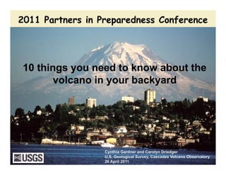
- 1. 2011 Partners in Preparedness Conference2011 Partners in Preparedness Conference 10 things you need to know about the10 things you need to know about the l i b k dl i b k dvolcano in your backyardvolcano in your backyard Cynthia Gardner and Carolyn Driedger U.S. Geological Survey, Cascades Volcano Observatory 26 April 2011
- 2. Course Outline 1 Your volcano will erupt again1. Your volcano will erupt again 2. You will get warning (monitoring, messages) 3. The warnings will not be black and white, i.e, there is a l t f t i t i d li ith l i ti itlot of uncertainty in dealing with volcanic activity 4. Emergency managers will need to make decisions and take actions long before outcomes are known 5. The types of hazards are known - IAVCEI video 6. Near-source hazards can develop rapidly - evacuation prior to an event will be necessary (issues about long-prior to an event will be necessary (issues about long term evacuation; funding for closures, etc.)
- 3. Course outline (cont.) 7. Lahars (volcanic mudflows) follow river valleys that start on volcanoes - affects may last long after eruption is overvolcanoes affects may last long after eruption is over 8 Tephra (volcanic ash) moves in the direction and at the speed of the wind - it will take time to get downwind 9 Th l l t t t b th l th t9. The volcano closest to you may not be the one only one that affects you 10. Volcanic eruptions can last for days to years and do not have to be large to be disruptive Bringing it home to your communityBringing it home to your community Scenario Do you have questions that you want answered in this course?Do you have questions that you want answered in this course?
- 4. Your volcano will erupt again Subduction is the process behind many hazards in the PNW 1 Subduction is the process behind many hazards in the PNW • Subduction earthquakes >>> volcanic earthquakes • Volcanic eruptions are rarely triggered by a subduction eqs
- 5. Your volcano will erupt again C d l h l lif d t hi t iCascade volcanoes have long life spans and recent histories
- 6. Your volcano will erupt againp g Not all volcanic eruptions occur at the big volcanoes By Jason Brewer, 1977
- 7. You will be warned2 Volcanoes often give days to months of warning As magma moves to the surface:As magma moves to the surface: Surface deformation •• It breaks a pathwayIt breaks a pathway •• It releases gasesIt releases gases •• The chamber or conduit mayThe chamber or conduit mayThe chamber or conduit mayThe chamber or conduit may increase or decrease in volumeincrease or decrease in volume These processes result in effectsThese processes result in effects that we can measure:that we can measure: •• EarthquakesEarthquakes •• Emission of magmatic gasesEmission of magmatic gasesEmission of magmatic gases,Emission of magmatic gases, principally COprincipally CO22 and S gasesand S gases •• Ground deformationGround deformation Input of magma Input of magma
- 8. You will be warned M it i i ti l t l d t ti f t tiMonitoring is essential to early detection of unrest, eruption and hazardous events
- 9. USGS mandate is to provide warningp g USGS alertUSGS alert--level system focuses on the state of the volcano with anlevel system focuses on the state of the volcano with an emphasis on ash for the aviation communityemphasis on ash for the aviation community TERM COLOR DESCRIPTIONDESCRIPTION Alert level Aviation Color Code Volcano is in normal non-eruptive state Volcano is exhibiting signs of elevated unrest GREEN YELLOWElevated unrest above known NORMAL ADVISORY Typical background, non-eruptive state Volcano is exhibiting signs of elevated unrest above known background levels Volcano is exhibiting heightened/escalating unrest with increased potential of eruption OR ti d ith YELLOW ORANGE Elevated unrest above known background activity Heightened/escalating unrest with increased potential for eruptive activity. timeframe variable OR minor eruption underway ADVISORY WATCH OR, eruption underway with no or minor ash emissions Eruption is forecasted to be imminent with significant emission of ash into the atmosphere likely OR,RED variable, OR, minor eruption underway that poses limited hazards Highly hazardous eruption underway or imminentWARNING p y Eruption is underway with significant ash into the atmosphere or imminent
- 10. You will be warned Know your communication links C ll DCall Downs ex. Mount St. Helens C ll d d hCall downs are used when changing alert-levels, to update officials about a significant change insignificant change in activity, or when eruptive activity ceases How do you fit into this call down?
- 11. You will be warned Know all of your sources of information and how youKnow all of your sources of information and how you will be informed Scientific information:Scientific information: • USGS and PNSN for volcanic activity •USGS for warning - Alert•USGS for warning - Alert Level System • USGS and NWS for ash fall and lahar warningsand lahar warnings Response Information • NIMS/ Unified Command Websites: http://volcanoes.usgs.gov S/ U ed Co a d • Interagency response plans Public information • Media • Social media
- 12. Alert Level Change - Normal to Advisory Probably most difficult step for scientists Diffic lt to pinpoint hen something is o t of the ordinar• Difficult to pinpoint when something is out of the ordinary • Likely to bring intense media scrutiny • Joint Information Center likely needed • Responders should start reviewing plans • Conference calls • No promise of that an eruption will occurNo promise of that an eruption will occur
- 13. Warnings will not be B&W3 Scientists cannot directly measure the magma system Like weather systems uncertainty Surface deformation Like weather systems, uncertainty about outcome (size, style, timing, eruption/no eruption, vent area) is high deformation high Unlike weather systems, we don’t yet have physics-based models to Everything we want to know is forecast outcome beneath ground and we don’t yet have instruments to directly measure what it is that we o ld like to kno Input of magma would like to knowmagma
- 14. Warnings will not be B&WWarnings will not be B&W All Cascade volcanoes show a range in eruptive size and style The 1980s eruption was about 5 times larger than the 2004 to 2008 eruption; largest MSH event about 6 to 8 times larger than the 1980- 86 event.
- 15. Warnings will not be B&WWarnings will not be B&W Vent location determines what areas will be affected
- 16. Warnings will not be B&W V l i t ll l t l th th t lV l i t ll l t l th th t lVolcanic unrest generally lasts longer than other naturalVolcanic unrest generally lasts longer than other natural hazardshazards Event DurationWarningHazardous Event Weeks to months Days Days Weeks to months Months to years Flood Hurricane y Earthquake/ tsunami Hurricane Wildfire Eruption Wildfire Hazardous events can occur during unrestHazardous events can occur during unrest
- 17. EMs will need to make decisions longEMs will need to make decisions long before outcomes are knownbefore outcomes are known 5 “Decision window” before outcomes are knownbefore outcomes are known for public officials Shape, character, arameters p , , duration very irregular Build-up suggests eruption is likely nitoringpa eruption is likely Cannot guarantee that eruption will not occur sityofmon e up o o occu Intens Time
- 18. EMs will need to make decisions long before outcomes are known Eruption1 before outcomes are knowns Decision window for Eruption1 Eruption 3 arameters public officials onitoringpansityofmo Back to sleepBack to sleep2 4 Inten Time
- 19. Decision making across cultures Scientists and public officials who understand eachScientists and public officials who understand each other’s culture beforehand, will likely work well together Scientists Public officials We all want to succeed, we all need to succeed
- 20. Volcano hazards N t thi ill ff t t 5 Not everything will affect you at once •• Proximal areas ( ≤15 mi) subjectProximal areas ( ≤15 mi) subject t lti l l th l h dt lti l l th l h d i tto multiple lethal hazards:to multiple lethal hazards: minutes to tens of minutes •• Intermediate areas (> 15 <100)Intermediate areas (> 15 <100) Lahars, tephra fall and floods affectLahars, tephra fall and floods affect river valleys:river valleys: tens of minutes to hours •• Distal hazards (>100 mi)Distal hazards (>100 mi) -- TephraTephra fall affects areas downwind:fall affects areas downwind: hour(s) to days( ) y •• Excess sediment in watershedsExcess sediment in watersheds reduces flood capacity:reduces flood capacity: week(s) to decadesdecades
- 21. Volcano Hazards IAVCEI videoIAVCEI video International Association for Volcanology and Chemistry of theVolcanology and Chemistry of the Earth’s Interior
- 22. Volcano hazards N t thi ill ff t tNot everything will affect you at once •• Proximal areas ( ≤15 mi) subjectProximal areas ( ≤15 mi) subject t lti l l th l h dt lti l l th l h d i tto multiple lethal hazards:to multiple lethal hazards: minutes to tens of minutes •• Intermediate areas (> 15 <100)Intermediate areas (> 15 <100) Lahars, tephra fall and floods affectLahars, tephra fall and floods affect river valleys:river valleys: tens of minutes to hours •• Distal hazards (>100 mi)Distal hazards (>100 mi) -- TephraTephra fall affects areas downwind:fall affects areas downwind: hour(s) to days( ) y •• Excess sediment in watershedsExcess sediment in watersheds reduces flood capacity:reduces flood capacity: week(s) to decadesdecades
- 23. Proximal hazards 6 Near source hazards can develop rapidly 30 i t l i ti30 minutes or less warning time too short to detect the activity, give warning and take action Officials have difficult decisions: • Limiting access • Road closures • Evacuations • Alternate escape routes • Warning system • Securing the closed area• Securing the closed area • Recovery issues Big questions -- duration,g quest o s du at o , resources and resiliency
- 24. Lahar hazards L h i ll th t t t th l 7 Lahars occur in valleys that start on the volcano; generally not all valleys affected Know which rivers start on your lvolcano Ask scientists where the most likely vent area will be and what rivers it might affect Have a plan to deal with reservoirs on potentially ff t d iaffected rivers
- 25. Lahar hazardsLahar hazards Hazards can persist long after an eruption is over
- 26. Lahar hazardsa a a a ds Hazards can persist long after an eruption is over Bridge crossing immediately affected by the eruption; months latermonths later Some communities in the Philippines were not affected untilPhilippines were not affected until years to a decade after the eruption
- 27. Tephra (ash) hazards 8 Tephra (ash) hazards Tephra moves in the direction(s) of and at the speed(s) of the wind How far downwind are you? In what direction?
- 28. Tephra (ash) hazardsep a (as ) a a ds Tephra affects aviation, which may impede recovery efforts • ~2000 flights over the Cascades daily • Ash can reach cruise altitudes in a matter of minutes How would reduced aviation affect your recovery?
- 29. Tephra (ash) hazards M i 1980Many more resources since 1980 http://volcanoes.usgs.gov/ash/
- 30. A distal volcano may affect you the most Tephra (ash) can affect communities far from sourceTephra (ash) can affect communities far from sourceTephra (ash) can affect communities far from sourceTephra (ash) can affect communities far from source 9
- 31. Eruption duration10 Volcanic events can last for weeks, months, decadesVolcanic events can last for weeks, months, decades Event DurationWarningHazardous Event Weeks to months Days Days Weeks to months Months to years Flood Hurricane y Earthquake/ tsunami Hurricane Wildfire Eruption Wildfire
- 32. Eruption durationEruption duration Your volcano may be above or below average Mount St. Helens, WA: 1980-86 Mount St. Helens: 2004-08 Kasatochi, AK 2008: 20 hours Okmok, AK 2008: 3 weeks Redoubt, AK: 1989-1990; 5 months C t P k AK 1992 3 5 th A d ti <6 Crater Peak, AK: 1992, 3.5 months Unzen Volcano, Japan: 1991-1994 Sourfriere Hills, Volcano, Montserrat: Average duration <6 mos , , 1995 - present Santa Maria Voclano, Guatemala: 1923 - present
- 33. Small eruptions can be disruptive Even small explosive eruptions have had world-wide affects E-15 eruption was small, but affected millions in Europe Lightning often occurs during ash eruptions; can affecteruptions; can affect nearby power and communications Re-suspension of ash affected Icelandic communities for months afterwards
- 34. Small eruptions can be destructivep Hot rocks interacting with snow and ice can generate large lahars 23 000 l l t th i li h23,000 people lost their lives hours after a small eruption at Nevado del Ruiz, Colombia in 1985 Above: Nevado del Ruiz Right: The town of Amero after the about 1 month after the catastropic er ption onthe catastropic eruption on 13 November 1985
- 35. Bringing it home to your community • Get to know the hazards in your communityyour community • Know the interagency response plan for your community • Know what materials are available for training yourg y CERT team • Include volcanoes in your multi hazard trainingmulti-hazard training • Know how to inform your community (learn, inquire, plan)
- 36. Bringing it home to your community K h t h d ff tKnow what hazards affect your area • Are you affected by lahars? • Do you have a regional lava flow hazard? • Are you directly or indirectly affected by volcanic events? H ld h ff t• How could ash affect your recovery plans/ability to help a neighboring jurisdiction?
- 37. Bringing it home to your community F ili i lf ith th h d d th thFamiliarize yourself with the hazards and the ways they could affect your community http://volcanoes.usgs.gov/publications /assessments.php
- 38. Bringing it home to your community F ili i lf ith ’ l dFamiliarize yourself with your agency’s response plan, and your role in unified command At the JIC - MSH crisis October 2004
- 39. Bringing it home to your communityg g y y Add volcano preparations to your CERT multi-hazard training materialsg
- 40. Bringing it home to your communityBringing it home to your community Messages USGS gives to the public • Learn—Become knowledgeable about volcano issues. Learn whether you live, work or go to school in a volcano hazard zone. • Inquire---Ask public officials how they advise you to respondto respond. • Plan---For how you and your family will respond in the event of any natural disaster.in the event of any natural disaster.
- 41. The goal of planning is to prevent natural processes from becomingnatural processes from becoming human disasters Cascades Volcano ObservatoryCascades Volcano Observatoryy 360-993-8973 www.vulcan.usgs.gov y 360-993-8973 www.vulcan.usgs.gov
- 42. Scenario - Mount HoodScenario Mount Hood
- 43. What’s at risk - Mount Hood • Community of Government Camp at base of volcano; other communities within 30 minutes of being affected by lahars • Hwys 26 and 35. Hwy 26, major route to central Oregon with over 8200 vehicles passing by Government Camp daily. •• Major air traffic route into Portland, flying at altitudes <25k; over 600Major air traffic route into Portland, flying at altitudes 25k; over 600 commercial flights/day = ~120,000 people/day; ~1700 tons/day air cargo; 30th largest airport in the U.S. • Bull Run watershed major water supply to Portland; some pipes still• Bull Run watershed, major water supply to Portland; some pipes still exposed in lahar hazard zone •• Four ski areas; summer training grounds for US Ski Team. Prime backcountry recreational area. • Iconic Timberline Lodge on flank of volcano; major tourist destination Potential to affect Col mbia Ri er ater a barging fish ater q alit• Potential to affect Columbia River waterway: barging, fish, water quality
- 44. Hazard zones - Mount HoodHazard zones Mount Hood
- 45. Mount Hood eruptive stylep y •Few sustained explosive events (>1Few sustained explosive events ( 1 hour) • Lava flow or lava dome growth and collapse collapses difficult tocollapse - collapses difficult to predict •Dome collapse results in hot rock interacting with snow and ice to produce lahars • Dome collapse results in ashp clouds lofting to altitudes of 15,000 to 30,000 feet and drifting downwind (normally eastward)
- 46. How are you being affected?How are you being affected? How are you getting information?y g g What information do you want? What actions are you taking? Unified Command/JIC? ?How are your resources holding up? How are you getting information out?y g g What questions are you getting from your community? From the media?From the media?
- 47. Notes or Action Items
- 48. Notes or Action Items
- 49. Mount Hood scenario: Days 1-14Mount Hood scenario: Days 1 14 • Day 1: USGS detects eq swarm; nothing unusual mentions swarm in weekly update • Day 3: Swarm continues; USGS releases Information Statement noting continued activity; picked up by some local media • Day 6 (Saturday night): Three mid-M3 eqs and 5 high M2 eqs rock volcano; felty ( y g ) q g q at TL and Govt. Camp; USGS changes Alert Level to Advisory early Sunday a.m. • Day 7: Poor weather, can’t see volcano; media calls increase considerably: eqs continuing mostly M1s and 2s but at higher rateq g y g • Day 9: Weather clears; detection of minor CO2 and H2S; no obvious changes at volcano, but eqs continue as do media inquiries • Day 10: Several more M3 eqs; mid-day under clear skys, steam and ash emission; higher gas output; USGS raises alert level to Watch; USFS closes down mountain • Day 14: First steam and ash emission to 25 000 ft ; last 10 minutes and• Day 14: First steam and ash emission to 25,000 ft.; last 10 minutes and drifts eastwards; vents located north of Devil’s kitchen area
- 50. Mount Hood scenario: Days 14-28Mount Hood scenario: Days 14 28 • Day 14: First steam and ash emission to 25,000 ft.; last 10 minutes and drifts eastwards; vents located north of Devil’s kitchen area; • Day 15: Another steam and ash emission to 20,000 ft lasting 25 minutes, moving westward; instrument placed on Crater Rock to look at movement: gas output increases; media and tourists flocking to areap g • Day 16-19: Poor weather and intense rain; instrument suggests movement of Crater Rock, but no confirmation due to weather; two more explosion signals; small lahar generated in White and ZigZag rivers • Day 20: Good weather; Gas output increased 2 fold since last measurement, with notable SO2; USGS indicates unrest increasing, but does not change alert level; lahars appear related to rain, not volcanic activity • Days 21-28: Good weather continues; gas measurements up, but steam and ash explosions cease; eqs continuing at moderate levels; public interest high; minor movement of Crater Rock
- 51. How are you being affected? No declaration - will you be able to maintain vigilance? What information do you need to make decisions? Are any areas closed?Are any areas closed? What pressures may be pushing back at you?
- 52. Mount Hood scenario: Days 28-49 • Days 21-28: Good weather continues; gas measurements up, but steam and ash explosions cease; eqs continuing at moderate levels; public interest high; minor movement of Crater Rockmovement of Crater Rock • Day 32, July 4th weekend: New seismic signal appears, USGS believes eruption imminent, raises alert level to highest level (Warning) • Day 35: No eruption has occurred, USGS decreases alert level back to intense unrest (Watch) •Day 40, late evening: size of eqs decreasing, but rate increasing; glow seen iny g q g g g Devil’s Kitchen area; Alert level raised to Warning • Day 41: Lava dome extrusion begins. Later in day, explosion destroys growing dome and sends ash to 35,000 feet drifting westward; small lahar generateddo e a d se ds as to 35,000 eet d t g est a d; s a a a ge e ated down White River • Day 49: Lava dome growth continues, grows rapidly, major failure in mid-day sends lahar down White and Sandy River: on White reaches confluence withsends lahar down White and Sandy River: on White reaches confluence with Deschutes, on Sandy reaches town of Sandy, 20 feet thick in Welches…
- 53. Friday, 29 August (3 years later) A small dome collapse yesterday was 200th collapse since the eruption began; ash cloudp p g reached 25k feet, ash drifting westward; Portland received light dusting Alert Level has been downgraded to Watch/Warning from Warning/Red as there is no longer any collapse activity Gas, seismicity still well above background In the past 3 years ago, > 90 ft of sediment has been deposited in former location of Timberline Lodge and in headwaters of Sandy River; river has aggraded over 45 ft in reach near Welches; air traffic has been disrupted for parts to all of 115 days out of past 1095 days since eruption beganparts to all of 115 days out of past 1095 days since eruption began
- 54. Notes or Action Items
- 55. Get to know the hazards in your community Mo nt BakerMount Baker
- 56. Get to know the hazards in your community Glacier PeakGlacier Peak
- 57. Get to know the hazards in your community Mount RainierMount Rainier
- 58. Get to know the hazards in your community Mount AdamsMount Adams
- 59. Get to know the hazards in your community Mount St HelensMount St. Helens
- 60. Get to know the hazards in your community Mount HoodMount Hood