Session 3 - Presentation by Sachiko Hayashida
•
1 gefällt mir•800 views

Session 3 - Presentation by Sachiko Hayashida

Empfohlen
Empfohlen
Weitere ähnliche Inhalte
Was ist angesagt?
Was ist angesagt? (19)
Andere mochten auch
Andere mochten auch (20)
Ähnlich wie Session 3 - Presentation by Sachiko Hayashida
Ähnlich wie Session 3 - Presentation by Sachiko Hayashida (20)
Mehr von OECD Environment
Mehr von OECD Environment (20)
Kürzlich hochgeladen
Kürzlich hochgeladen (20)
Session 3 - Presentation by Sachiko Hayashida
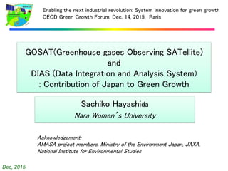
- 1. Dec, 2015 GOSAT(Greenhouse gases Observing SATellite) and DIAS (Data Integration and Analysis System) : Contribution of Japan to Green Growth Sachiko Hayashida Nara Women’s University Enabling the next industrial revolution: System innovation for green growth OECD Green Growth Forum, Dec. 14, 2015, Paris Acknowledgement: AMASA project members, Ministry of the Environment Japan, JAXA, National Institute for Environmental Studies
- 2. Dec, 2015 Recent Development of Global Observation • GEOSS: Global Earth Observation System of Systems (GEOSS) – The GEOSS 10-Year Implementation Plan was adopted in 2005. – Climate is one of the most important issues in the GEOSS plan. • Satellite – is one of the most innovative technology among the tools for Earth observation. – is a major component to promote GEOSS plan. – has been developed rapidly for the past several ten years. • Japanese major tasks for GEOSS include GOSAT and DIAS – GOSAT : Greenhouse gases Observing SATellite “IBUKI” which was launched in Jan. 2009. – DIAS: Data Integration and Analysis System
- 3. Dec, 2015 What is GOSAT? GOSAT(Greenhouse gases Observing SATellite) – GOSAT is the first satellite that dedicated to greenhouse-gas- monitoring. – Targets of GOSAT are CO2 and CH4 – Onboard sensor is named “TANSO-FTS” (Fourier Transform Spectrometer) – GOSAT collected more than 6-years of record as of 2015. 2009 2010 2011 2012 2013 2014 2015 - Milestone * Launch * * * * in operation in space Current ground-based observation network Advantage of GOSAT is its wide spatial coverage
- 4. Dec, 2015 GOSAT + In situ measurements Atmospheric tracer Transport Model (ATM) A priori flux datasets + posteriori (revised) flux datasets Source and Sink estimation: Method “first guess” Inverse analysis
- 5. Dec, 2015 GOSAT Achievement: Monthly CO2 Flux Estimates July 2011 Top: monthly-mean CO2 data (input to flux estimation) Squares: GOSAT XCO2 gridded to 5°×5° cells Circles: GLOBALVIEW data (212 sites) Middle: Monthly flux estimate (GOSAT Level 4A CO2) GOSAT + In situ measurements
- 6. Dec, 2015 Gap between present technology and scientific requirement column Most of optical measurements from space utilize the absorption of solar light Satellite sensors at SWIR (Short-wavelength InfraRed) can measure only column advances of the species (CO2, CH4) Air moves around Greenhouse gases have 3-D distribution TIR (Thermal InfraRed) wavelength is not sensitive to the lower part of atmosphere, though it can measure profiles. + GOSAT covers all over the globe, but.... no data
- 7. Dec, 2015 AMASA(Atmospheric methane from agriculture in South Asia) a project sponsored by the Environment Research and Technology Development Fund (ERTDF) :April 2015-March 2018 Leader: Sachiko Hayashida Application of GOSAT CH4 measurements to Agriculture Goal 1: Improvement of Methane Emission Estimate from South Asia using GOSAT Goal 2: Development of an Emission Mitigation Proposal 7 + A priori posteriori Emission estimate in regional scale Mitigation scenarios from rice fields by proper water management and/or fertilizer management Evaluation: realizable? detectable?
- 8. 8 Sonepat Comilla air sampling Laser long-path absorption instrument monitors CH4 over the rice field continuously Activity on Goal 1: Improvement of Methane Emission Estimate from South Asia using GOSAT Gas flask sampling in the pump house in the middle of farming areas in Sonepat
- 9. Dec, 2015 1 2 32-1 2-2 2-3 2-4 1-1 1-2 4-0 5-0 6-1 6-2 6-3 6-4 3-0 Typical rice paddies in Asia 13 regions to be investigated
- 10. Dec, 2015 Good correlation! Time series of xCH4 and other parameters Min. Max 1 2 32-1 2-2 2-3 2-4 1-1 1-2 4-0 5-0 6-1 6-2 6-3 6-4 3-0 CH4 Emission estimate from rice fields CH4 observed by Satellite Hayashida et al., Remote Sensing of Environment, 2013 Emission (bottom-up) Satellite CH4 concentration xCH4 = the column averaged mixing ratio of CH4
- 11. Dec, 2015 Time series of xCH4 :SCIA + GOSAT(NIES V2) 1 2 32-1 2-2 2-3 2-4 1-1 1-2 4-0 5-0 6-1 6-2 6-3 6-4 3-0 SCIAMACHY GOSAT Emission from Rice fields Good correlation! xCH4 = the column averaged mixing ratio of CH4
- 12. Dec, 2015 The GOSAT has potential to detect anthropogenic CH4 emissions. Observation of anthropogenic CH4 concentration and comparative analysis with emission data New Press Release from NIES and MOE on Nov. 27, 2015
- 13. 13 DB DB 0 50 100 150 200 250 300 350 19 92 19 94 19 96 19 98 20 00 20 02 20 04 20 06 20 08 20 10 20 12 20 14 20 16 20 18 20 20 A1:高度成長社会 A2:多元化型 B1:持続発展型 B2:地域共存型 DB DB DB DB DB 0 50 100 150 200 250 300 350 199 2 199 4 199 6 199 8 200 0 200 2 200 4 200 6 200 8 201 0 201 2 201 4 201 6 201 8 202 0 A1:高度成長社会 A2:多元化型 B1:持続発展型 B2:地域共存型 DB DB 0 50 100 150 200 250 300 350 199 2 199 4 199 6 199 8 200 0 200 2 200 4 200 6 200 8 201 0 201 2 201 4 201 6 201 8 202 0 A1:高度成長社会 A2:多元化型 B1:持続発展型 B2:地域共存型 DB DB D B Meteorology Ecosystem Agriculture Hydrology Land Use Climatology Health 农业 เกษตรกรร ม 농업 Where is data? How to access? Technical Terms among Different Disciplines Quality? Reliability?
- 14. Data Integration and Analysis System To create knowledge enabling us to solve the Earth environment problems and to generate socio-economic benefits… a legacy for Japan's contributions to GEOSS
- 15. Dec, 2015 Summary • GOSAT have observed CO2 and CH4 for six years. • Global budget (flux estimates) of CO2 and CH4 have been improved by using GOSAT. • Next challenge is to downscale to a regional scale. • Integration of satellite, on-site measurements and model outputs is essentially important. • To utilize all those data effectively, we need a tool to help us DIAS has been developed. • The technology at present is limited but the focus is to improve the technology to meet the needs for “green growth”.
Hinweis der Redaktion
- In February 2005, the GEOSS 10-Year Implementation Plan was adopted at the third Earth Observation Summit in Brussels. “Climate” is one of the most important issues in the GEOSS plan, ...and a Satellite is one of the most innovative technology among the tools for Earth observation . It is a major component to promote GEOSS plan. It has been developed rapidly for the past several ten years. Japanese major tasks for GEOSS include GOSAT and DIAS. GOSAT, Greenhouse gases Observing SATellite, “IBUKI” in Japanese is a satellite to observe CO2 and CH4 in a global scale, and it was launched in Jan. 2009. DIAS, “Data Integration and Analysis System”, is a database to utilize a huge amount of global observation data including satellite data. Today, I would like to focus on GOSAT and DIAS as a Japanese contribution to GEOSS and discuss on how they are important components to consider our green growth society.
- What is GOSAT? GOSAT is the first satellite that is dedicated to greenhouse-gas-monitoring. Targets of GOSAT are CO2 and CH4. The onboard Sensor to detect them is named TANSO-FTS. FTS means Fourier Transform Spectrometer that is very innovative technology as a sensor in space. For the past long years, CO2 measurement from satellite has been regarded to be almost impossible, but now we all know it is possible. Many validation studies revealed enough reliability of GOSAT data. I believe that was a great step toward new age of global observation for greenhouse gases. GOSAT has collected data for more than 6 years as of 2015 and GOSAT could follow the long-term trend of CO2 for these 6 years. This figure shows the trend of CO2 observed by GOSAT. The essential merit of satellite observation is wide spatial coverage compared with a ground-based station network. Current ground-based observation network is like this. In some areas, only limited number of the data are available. Advantage of GOSAT is its wide spatial coverage.
- This kind of global data can bring us important information on distribution of source and sink flux of greenhouse gases. We can utilize measurement data of greenhouse gases, whether they are obtained by satellite or ground-based instruments, by putting them into a computer model called atmospheric tracer transport model. We can improve our first guess of the geographic distribution of greenhouse-gas- emission and absorption flux by adding the information of observation. The output is called “posteriori”, this is the revised greenhouse gas flux dataset. This process is called “inverse analysis”, because the derivation of emission from gas concentration is an inverse process.
- I will show you an example. This figure shows a monthly estimate of CO2 flux by applying GOSAT data as well as ground-based data. The upper panel shows the observed data and the lower panel shows the result of CO2 emission and absorption flux in July 2011. Color indicates monthly mean amounts of sources and sinks. The red color shows CO2 emission. On the other hand, “green” over the land or “blue” over the ocean shows CO2 absorption. In this case, we found large CO2 emission in India and some part of North America and Africa in this month. In this way, we can now monitor the emission and absorption distribution in a monthly basis. GOSAT contributes emission estimate of CH4 in the same way.
- However, the capability of the satellite is not perfect. There is still a gap between present technology and scientific requirement. First of all, atmosphere moves around, goes up and down. Therefore we need to know the 3-dimensional distribution of greenhouse gases. However, most of optical measurements from space utilize the absorption of solar light. Therefore, satellite sensors at Short-wavelength InfraRed can measure only column advances of the species such as CO2 and CH4. On the other hand, Thermal InfraRed wavelength is not sensitive to the lower part of the atmosphere, though it can measure profiles. As I said before, the advantage of satellite measurement is wide coverage of the globe. However, we cannot see under the cloud actually. Then, we have only limited data over cloudy areas like over Asia in monsoon season. Then we need a great effort to combine SWIR and TIR data, or combine satellite measurements with ground-based measurements to get the whole picture of greenhouse gas distribution.
- Here, I would like to introduce my own challenge. AMASA is a project sponsored by the Ministry of the Environment Japan. we have two goals in this project. The first goal is to improve of CH4 emission estimate from South Asia by using GOSAT and ground-based data. The concept of the project is to downscale the emission estimate from a global scale into a regional scale. To accomplish this goal, we are now collaborating with many local scientists and farmers in India and Bangladesh. Our second goal is to develop an emission mitigation proposal. A large part of the methane emission from South Asia is from agriculture, mostly ruminant animals and rice cultivation. In this project, we are focusing on methane emission from rice fields. One approach to reduce methane emission from rice fields is an intermittent draining of water. Another approach is a proper fertilizer management. Based on local experimental works, we will arrange some mitigation scenarios and input the emission scenarios into a transport model and examine if it is realizable or detectable and so on.
- These are our latest activities. This slide shows atmospheric measurements that we are carrying out in Sonepat north of Delhi. We are collecting a bottle of air once a week in the pump house of local farmers. We are doing similar sampling in Comilla in Bangladesh, too. In Sonepat, a group of Nagoya University Japan is doing monitoring of ambient methane concentration by applying a laser long-path absorption instrument to monitor CH4 concentration continuously.
- Where are rice fields in Asia? This slide shows the typical rice fields in Asia. All these areas are dense rice paddy fields in South India, North India, Bangladesh, Myanmar, Thailand, and China, and so on.
- I will show you an example over the lower Ganges Basin. The red line shows CH4 concentration by a satellite sensor named SCIAMACHY that had measured CH4 concentration before the launch of GOSAT. The emission estimate from the rice field is shown here, and… The correlation between the observed CH4 concentration and the emission estimate from the rice field is shown in the normalized scale. You can see the correlation is very GOOD! The satellite, therefore, can observe CH4 concentrations which are really high over the area of an intense CH4 emission.
- We now have GOSAT data after 2009, and the observed CH4 maps are similar to that of SCIAMACHY. The methane spatial distribution is also corresponding to methane emissions as these figures show.
- Very recently, a new finding was reported by NIES and MOE. Not only the rice fields, in various places over the world, we can see such positive correlations between methane emission estimates and GOSAT high methane concentrations. These findings indicate the potential of GOSAT to detect anthropogenic CH4 emissions.
- 13
- To answer the request, DIAS, Data Integration and Analysis System, has been developed by Japanese scientists. (When they designed the database of meta data, they came up with various ideas to make the system easy to use.) Now many scientists from various disciplines are starting to input their data into DIAS. In the field of hydrology, a great amount of the data have been accumulated. Atmospheric data are still at the beginning stage, but DIAS will be a big help for people working on earth observation in the near future.
- Today I focused on GOSAT and DIAS as Japanese contributions for GEOSS and growing green society. GOSAT have observed CO2 and CH4 for six years and global budget of CO2 and CH4 have been improved by using GOSAT. Our next challenge is to downscale the budget estimate to a regional scale. Integration of satellite, on-site measurements and model outputs is essentially important, but to utilize all those data effectively, we need a tool to help us. DIAS will be helpful for us to use those data. The technology at present is limited but the focus is to improve the technology to meet the needs for “green growth”.