SlideShare ist ein Scribd-Unternehmen logo
1 von 21
Under Guidance of-
Dr.Suresh kumar
Submitted By-
Nanhe Lal Gupta
M.Sc. IInd Sem
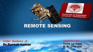
REMOTE SENSING
Introduction
Remote + Sensing
Remote sensing means acquiring information of things from a
distance with sensors. (without touching the things)
 Sensors may be cameras that are capable of wide range of EM
spectral ranges like UV, Vis, IR & Microwaves
 Remote sensing occurs at a variable
distance from the point of interest.
It could be 1000m or greater than 1
million metres.
 Nowadays, remote sensing is mainly
done from space using satellites.
ENVISAT: Launched 1 March 2002
Definition
 Remote Sensing is:
“The art and science of obtaining information about an object
without being in direct contact with the object” (Jensen
2000).
India’s National Remote Sensing Agency (NRSA) defined as :
“Remote sensing is the technique of deriving information
about objects on the surface of the earth without physically
coming into contact with them.”
Sea image, 26. Feb. 2000 by NASA (Source- google)
Sinnhuber & Bracher, Remote Sensing,
University of Bremen, Summer 2008
Source- google
Photo taken by
Crew of Apollo 17
7 Dec 1972
(Source- google
Remote Sensing Process
(A) Source of Illumination.
(B) Radiation from the source and sensors . . in
atmosphere .
(C) Interaction with the Target.
(D) Recording of Energy by the Sensor.
(E) Transmission, Reception, & Processing.
(F) Interpretation and Analysis.
(G) Application.
Source: Canadian Centre for Remote Sensing
Remote sensing platforms
Ground-based Airplane-based Satellite-based
(Source- CCRS pdf)
Ground-based sensors are often used to record earth surface data in detail
Aircrafts are often used to collect very detailed images and facilitate the
collection of data over virtually any portion of the earth’s surface at any time.
Satellite remote sensing is mainly used for digital imaging technique.
Remote sensing platforms
History of Remote Sensing
Aerial photography is the original form of
remote sensing (using visible spectrum) started
in 1909
Color infrared photography began 1931, then
was widely used in agriculture and forestry.
Development of RADAR based images
History of Remote Sensing
 After the first man-made satellite (Sputnik 1) was launched on 4 October
1957 by Soviet Union, remote sensing moved to outer space
 The United States' Explorer 6 transmitted the first space photograph of
the Earth in August 1959.
 Hyperspectral remote sensing emerged (1980), widely used in mineral,
oil, etc. exploration
 Since then, a large number and advanced types of remote sensing
systems have been developed.
NASA
Research
Spacecraft
(Source- google
Applications of remote sensing
(Source- CCRS pdf)
In Agriculture
Satellite and airborne images are used as
mapping tools to classify crops, examine
their health and viability, and monitor
farming practices. Agricultural applications
of remote sensing include the following:
crop type classification
crop condition assessment
crop yield estimation
mapping of soil characteristics
mapping of soil management practices
compliance monitoring (farming practices)
Canada Centre for Remote Sensing
In Forestry
International and domestic forestry
applications where remote sensing can
be utilized include
sustainable development,
 biodiversity monitoring
deforestation, reforestation monitoring and
managing,
 commercial logging operations,
shoreline and watershed protection,
 biophysical monitoring (wildlife habitat assessment)
etc.
Canada Centre for Remote Sensing
In Geology
Remote sensing is used as a tool to extract
information about the land surface structure,
composition or subsurface.
Radar provides an expression of surface topography
and roughness. Geological applications of remote
sensing include the following:
surficial deposit / bedrock mapping
lithological mapping
structural mapping
sand and gravel (aggregate) exploration/ exploitation
mineral exploration
(KS Geological Survey)
In Hydrology
Hydrology is the study of water on the
Earth's surface, whether flowing above
ground, frozen in ice or snow, or retained by
soil. Examples of hydrological applications
include:
wetlands mapping and monitoring,
soil moisture estimation,
measuring snow thickness.
determining snow-water equivalent,
river and lake ice monitoring,
flood mapping and monitoring,
glacier dynamics monitoring.
water on the Earth's surface
Sea Ice
Land Cover & Land Use
Land use applications involve both baseline
mapping and subsequent monitoring, since
timely information is required to know what
current quantity of land is in what type of use
and to identify the land use changes from
year to year.
Land use applications of remote sensing
include the following:
 natural resource management
wildlife habitat protection
 baseline mapping for GIS input
 urban expansion.
from maps.google.com
Applications of National Priority
Agricultural
Efficiency
Air Quality
Water
Management
Disaster Management
Carbon
Management
Aviation
Ecological ForecastingInvasive Species
Coastal ManagementHomeland
Security
Energy ManagementPublic Health
References
Remote Sensing and GIS - B. Bhatt
Fundamentals of Remote Sensing - A Canada Centre for Remote
Sensing Remote Sensing Tutorial.
Introduction to Remote Sensing - By Gregory Vandeberg
Assistant Professor of Geography (ND GIS Users Workshop
Bismarck).
Remote Sensing - Bjorn-Martin Sinnhuber and Astrid Bracher
THANK
YOU

Weitere ähnliche Inhalte

Was ist angesagt?

APPLICATION OF REMOTE SENSING AND GIS IN AGRICULTURE
APPLICATION OF REMOTE SENSING AND GIS IN AGRICULTUREAPPLICATION OF REMOTE SENSING AND GIS IN AGRICULTURE
APPLICATION OF REMOTE SENSING AND GIS IN AGRICULTURELagnajeetRoy
 
Principles of GIS unit 1
Principles of GIS unit 1Principles of GIS unit 1
Principles of GIS unit 1SanjanaKhemka1
 
Thermal remote sensing and its applications
Thermal remote sensing and its applicationsThermal remote sensing and its applications
Thermal remote sensing and its applicationschandan00781
 
Ppt on remote sensing system
Ppt on remote sensing systemPpt on remote sensing system
Ppt on remote sensing systemAlisha Korpal
 
spatial resolutionin remote sensing
 spatial resolutionin remote sensing spatial resolutionin remote sensing
spatial resolutionin remote sensingGhassan Hadi
 
Components of Remote Sensing
Components of Remote SensingComponents of Remote Sensing
Components of Remote SensingAbby Varghese
 
Chapter 1 (Introduction to remote sensing)
Chapter 1 (Introduction to remote sensing)Chapter 1 (Introduction to remote sensing)
Chapter 1 (Introduction to remote sensing)Shankar Gangaju
 
Multi Spectral Scanning Systems
Multi Spectral Scanning SystemsMulti Spectral Scanning Systems
Multi Spectral Scanning SystemsSenthamizhan M
 
Basics of Remote Sensing
Basics of Remote SensingBasics of Remote Sensing
Basics of Remote SensingAkash Tikhe
 
Band Combination of Landsat 8 Earth-observing Satellite Images
Band Combination of Landsat 8 Earth-observing Satellite ImagesBand Combination of Landsat 8 Earth-observing Satellite Images
Band Combination of Landsat 8 Earth-observing Satellite ImagesKabir Uddin
 
Microwave remote sensing
Microwave remote sensingMicrowave remote sensing
Microwave remote sensingMohsin Siddique
 
Chapter 5: Remote sensing
Chapter 5: Remote sensingChapter 5: Remote sensing
Chapter 5: Remote sensingShankar Gangaju
 
DIFFERENTIAL GPS (DGPS)
DIFFERENTIAL GPS (DGPS)DIFFERENTIAL GPS (DGPS)
DIFFERENTIAL GPS (DGPS)KU Leuven
 
Remote sensing by priyanshu kumar,9608684800
Remote sensing by priyanshu kumar,9608684800Remote sensing by priyanshu kumar,9608684800
Remote sensing by priyanshu kumar,9608684800PRIYANSHU KUMAR
 
Remote Sensing PPT
Remote Sensing PPTRemote Sensing PPT
Remote Sensing PPTAmal Murali
 

Was ist angesagt? (20)

APPLICATION OF REMOTE SENSING AND GIS IN AGRICULTURE
APPLICATION OF REMOTE SENSING AND GIS IN AGRICULTUREAPPLICATION OF REMOTE SENSING AND GIS IN AGRICULTURE
APPLICATION OF REMOTE SENSING AND GIS IN AGRICULTURE
 
Remote sensing
Remote sensingRemote sensing
Remote sensing
 
Principles of GIS unit 1
Principles of GIS unit 1Principles of GIS unit 1
Principles of GIS unit 1
 
Thermal remote sensing and its applications
Thermal remote sensing and its applicationsThermal remote sensing and its applications
Thermal remote sensing and its applications
 
Ppt on remote sensing system
Ppt on remote sensing systemPpt on remote sensing system
Ppt on remote sensing system
 
spatial resolutionin remote sensing
 spatial resolutionin remote sensing spatial resolutionin remote sensing
spatial resolutionin remote sensing
 
Components of Remote Sensing
Components of Remote SensingComponents of Remote Sensing
Components of Remote Sensing
 
Chapter 1 (Introduction to remote sensing)
Chapter 1 (Introduction to remote sensing)Chapter 1 (Introduction to remote sensing)
Chapter 1 (Introduction to remote sensing)
 
Multi Spectral Scanning Systems
Multi Spectral Scanning SystemsMulti Spectral Scanning Systems
Multi Spectral Scanning Systems
 
Remote Sensing
Remote Sensing Remote Sensing
Remote Sensing
 
Basics of Remote Sensing
Basics of Remote SensingBasics of Remote Sensing
Basics of Remote Sensing
 
Types of stereoscope
Types of stereoscopeTypes of stereoscope
Types of stereoscope
 
Band Combination of Landsat 8 Earth-observing Satellite Images
Band Combination of Landsat 8 Earth-observing Satellite ImagesBand Combination of Landsat 8 Earth-observing Satellite Images
Band Combination of Landsat 8 Earth-observing Satellite Images
 
Remote sensing
Remote sensingRemote sensing
Remote sensing
 
Optical remote sensing
Optical remote sensingOptical remote sensing
Optical remote sensing
 
Microwave remote sensing
Microwave remote sensingMicrowave remote sensing
Microwave remote sensing
 
Chapter 5: Remote sensing
Chapter 5: Remote sensingChapter 5: Remote sensing
Chapter 5: Remote sensing
 
DIFFERENTIAL GPS (DGPS)
DIFFERENTIAL GPS (DGPS)DIFFERENTIAL GPS (DGPS)
DIFFERENTIAL GPS (DGPS)
 
Remote sensing by priyanshu kumar,9608684800
Remote sensing by priyanshu kumar,9608684800Remote sensing by priyanshu kumar,9608684800
Remote sensing by priyanshu kumar,9608684800
 
Remote Sensing PPT
Remote Sensing PPTRemote Sensing PPT
Remote Sensing PPT
 

Ähnlich wie Remote sensing

Remote Sensing and its Application
Remote Sensing and its ApplicationRemote Sensing and its Application
Remote Sensing and its ApplicationRashmi Yadav
 
remotesensing-170114185354+(1)_abcdpdf_pdf_to_ppt.pptx
remotesensing-170114185354+(1)_abcdpdf_pdf_to_ppt.pptxremotesensing-170114185354+(1)_abcdpdf_pdf_to_ppt.pptx
remotesensing-170114185354+(1)_abcdpdf_pdf_to_ppt.pptxWalkerFincorp
 
Soil mapping , remote sensing and use of sensors in precision farming
Soil mapping , remote sensing and use of  sensors in precision farmingSoil mapping , remote sensing and use of  sensors in precision farming
Soil mapping , remote sensing and use of sensors in precision farmingDr. M. Kumaresan Hort.
 
Remote Sensing - by Ashwini
Remote Sensing - by AshwiniRemote Sensing - by Ashwini
Remote Sensing - by AshwiniSanthosh Sundar
 
Remote sensing ppt
Remote sensing pptRemote sensing ppt
Remote sensing pptcoolmridul92
 
Remote Sensing_2020-21 (1).pdf
Remote Sensing_2020-21  (1).pdfRemote Sensing_2020-21  (1).pdf
Remote Sensing_2020-21 (1).pdfBAGARAGAZAROMUALD2
 
Module 5 Remote Sensing in Civil Engineering.pptx
Module 5 Remote Sensing in Civil Engineering.pptxModule 5 Remote Sensing in Civil Engineering.pptx
Module 5 Remote Sensing in Civil Engineering.pptxsurekha1287
 
Remote sensing and application by Nikhil Pakwanne
Remote sensing and application by Nikhil PakwanneRemote sensing and application by Nikhil Pakwanne
Remote sensing and application by Nikhil PakwanneNIKHIL PAKWANNE
 
449879014-Remote-Sensing-Ppt.pptx
449879014-Remote-Sensing-Ppt.pptx449879014-Remote-Sensing-Ppt.pptx
449879014-Remote-Sensing-Ppt.pptxRoopa Santosh
 
Applications of remote sensing in geological aspects
Applications of remote sensing in geological aspectsApplications of remote sensing in geological aspects
Applications of remote sensing in geological aspectsPramoda Raj
 
applicationsofremotesensingingeologicalaspects-170606133459.pdf
applicationsofremotesensingingeologicalaspects-170606133459.pdfapplicationsofremotesensingingeologicalaspects-170606133459.pdf
applicationsofremotesensingingeologicalaspects-170606133459.pdfCIVIL48
 
REMOTE SENSING
REMOTE SENSINGREMOTE SENSING
REMOTE SENSINGijsrd.com
 
Remote sensing and its applications in environment
Remote sensing and its applications in environmentRemote sensing and its applications in environment
Remote sensing and its applications in environmentMuhammad Sajjad
 
Satellite Applications
Satellite ApplicationsSatellite Applications
Satellite ApplicationsSerhan
 
civil Remote Sensing ppt.pptx
civil Remote Sensing ppt.pptxcivil Remote Sensing ppt.pptx
civil Remote Sensing ppt.pptxHellGod3
 

Ähnlich wie Remote sensing (20)

Remote Sensing and its Application
Remote Sensing and its ApplicationRemote Sensing and its Application
Remote Sensing and its Application
 
remotesensing-170114185354+(1)_abcdpdf_pdf_to_ppt.pptx
remotesensing-170114185354+(1)_abcdpdf_pdf_to_ppt.pptxremotesensing-170114185354+(1)_abcdpdf_pdf_to_ppt.pptx
remotesensing-170114185354+(1)_abcdpdf_pdf_to_ppt.pptx
 
intro.pptx
intro.pptxintro.pptx
intro.pptx
 
Soil mapping , remote sensing and use of sensors in precision farming
Soil mapping , remote sensing and use of  sensors in precision farmingSoil mapping , remote sensing and use of  sensors in precision farming
Soil mapping , remote sensing and use of sensors in precision farming
 
Remote Sensing - by Ashwini
Remote Sensing - by AshwiniRemote Sensing - by Ashwini
Remote Sensing - by Ashwini
 
Remote sensing ppt
Remote sensing pptRemote sensing ppt
Remote sensing ppt
 
GIS FINAL REPORT.pdf
GIS FINAL REPORT.pdfGIS FINAL REPORT.pdf
GIS FINAL REPORT.pdf
 
Remote Sensing_2020-21 (1).pdf
Remote Sensing_2020-21  (1).pdfRemote Sensing_2020-21  (1).pdf
Remote Sensing_2020-21 (1).pdf
 
Module 5 Remote Sensing in Civil Engineering.pptx
Module 5 Remote Sensing in Civil Engineering.pptxModule 5 Remote Sensing in Civil Engineering.pptx
Module 5 Remote Sensing in Civil Engineering.pptx
 
Remote sensing and application by Nikhil Pakwanne
Remote sensing and application by Nikhil PakwanneRemote sensing and application by Nikhil Pakwanne
Remote sensing and application by Nikhil Pakwanne
 
449879014-Remote-Sensing-Ppt.pptx
449879014-Remote-Sensing-Ppt.pptx449879014-Remote-Sensing-Ppt.pptx
449879014-Remote-Sensing-Ppt.pptx
 
Concept of remote sensing
Concept of remote sensingConcept of remote sensing
Concept of remote sensing
 
Applications of remote sensing in geological aspects
Applications of remote sensing in geological aspectsApplications of remote sensing in geological aspects
Applications of remote sensing in geological aspects
 
applicationsofremotesensingingeologicalaspects-170606133459.pdf
applicationsofremotesensingingeologicalaspects-170606133459.pdfapplicationsofremotesensingingeologicalaspects-170606133459.pdf
applicationsofremotesensingingeologicalaspects-170606133459.pdf
 
Rs
RsRs
Rs
 
2014_Remote Sensing.pptx
2014_Remote Sensing.pptx2014_Remote Sensing.pptx
2014_Remote Sensing.pptx
 
REMOTE SENSING
REMOTE SENSINGREMOTE SENSING
REMOTE SENSING
 
Remote sensing and its applications in environment
Remote sensing and its applications in environmentRemote sensing and its applications in environment
Remote sensing and its applications in environment
 
Satellite Applications
Satellite ApplicationsSatellite Applications
Satellite Applications
 
civil Remote Sensing ppt.pptx
civil Remote Sensing ppt.pptxcivil Remote Sensing ppt.pptx
civil Remote Sensing ppt.pptx
 

Kürzlich hochgeladen

Concept of Vouching. B.Com(Hons) /B.Compdf
Concept of Vouching. B.Com(Hons) /B.CompdfConcept of Vouching. B.Com(Hons) /B.Compdf
Concept of Vouching. B.Com(Hons) /B.CompdfUmakantAnnand
 
Solving Puzzles Benefits Everyone (English).pptx
Solving Puzzles Benefits Everyone (English).pptxSolving Puzzles Benefits Everyone (English).pptx
Solving Puzzles Benefits Everyone (English).pptxOH TEIK BIN
 
Q4-W6-Restating Informational Text Grade 3
Q4-W6-Restating Informational Text Grade 3Q4-W6-Restating Informational Text Grade 3
Q4-W6-Restating Informational Text Grade 3JemimahLaneBuaron
 
Organic Name Reactions for the students and aspirants of Chemistry12th.pptx
Organic Name Reactions  for the students and aspirants of Chemistry12th.pptxOrganic Name Reactions  for the students and aspirants of Chemistry12th.pptx
Organic Name Reactions for the students and aspirants of Chemistry12th.pptxVS Mahajan Coaching Centre
 
_Math 4-Q4 Week 5.pptx Steps in Collecting Data
_Math 4-Q4 Week 5.pptx Steps in Collecting Data_Math 4-Q4 Week 5.pptx Steps in Collecting Data
_Math 4-Q4 Week 5.pptx Steps in Collecting DataJhengPantaleon
 
Call Girls in Dwarka Mor Delhi Contact Us 9654467111
Call Girls in Dwarka Mor Delhi Contact Us 9654467111Call Girls in Dwarka Mor Delhi Contact Us 9654467111
Call Girls in Dwarka Mor Delhi Contact Us 9654467111Sapana Sha
 
The Most Excellent Way | 1 Corinthians 13
The Most Excellent Way | 1 Corinthians 13The Most Excellent Way | 1 Corinthians 13
The Most Excellent Way | 1 Corinthians 13Steve Thomason
 
APM Welcome, APM North West Network Conference, Synergies Across Sectors
APM Welcome, APM North West Network Conference, Synergies Across SectorsAPM Welcome, APM North West Network Conference, Synergies Across Sectors
APM Welcome, APM North West Network Conference, Synergies Across SectorsAssociation for Project Management
 
MENTAL STATUS EXAMINATION format.docx
MENTAL     STATUS EXAMINATION format.docxMENTAL     STATUS EXAMINATION format.docx
MENTAL STATUS EXAMINATION format.docxPoojaSen20
 
How to Make a Pirate ship Primary Education.pptx
How to Make a Pirate ship Primary Education.pptxHow to Make a Pirate ship Primary Education.pptx
How to Make a Pirate ship Primary Education.pptxmanuelaromero2013
 
microwave assisted reaction. General introduction
microwave assisted reaction. General introductionmicrowave assisted reaction. General introduction
microwave assisted reaction. General introductionMaksud Ahmed
 
Contemporary philippine arts from the regions_PPT_Module_12 [Autosaved] (1).pptx
Contemporary philippine arts from the regions_PPT_Module_12 [Autosaved] (1).pptxContemporary philippine arts from the regions_PPT_Module_12 [Autosaved] (1).pptx
Contemporary philippine arts from the regions_PPT_Module_12 [Autosaved] (1).pptxRoyAbrique
 
A Critique of the Proposed National Education Policy Reform
A Critique of the Proposed National Education Policy ReformA Critique of the Proposed National Education Policy Reform
A Critique of the Proposed National Education Policy ReformChameera Dedduwage
 
Science 7 - LAND and SEA BREEZE and its Characteristics
Science 7 - LAND and SEA BREEZE and its CharacteristicsScience 7 - LAND and SEA BREEZE and its Characteristics
Science 7 - LAND and SEA BREEZE and its CharacteristicsKarinaGenton
 
mini mental status format.docx
mini    mental       status     format.docxmini    mental       status     format.docx
mini mental status format.docxPoojaSen20
 
Mastering the Unannounced Regulatory Inspection
Mastering the Unannounced Regulatory InspectionMastering the Unannounced Regulatory Inspection
Mastering the Unannounced Regulatory InspectionSafetyChain Software
 
Hybridoma Technology ( Production , Purification , and Application )
Hybridoma Technology  ( Production , Purification , and Application  ) Hybridoma Technology  ( Production , Purification , and Application  )
Hybridoma Technology ( Production , Purification , and Application ) Sakshi Ghasle
 

Kürzlich hochgeladen (20)

Concept of Vouching. B.Com(Hons) /B.Compdf
Concept of Vouching. B.Com(Hons) /B.CompdfConcept of Vouching. B.Com(Hons) /B.Compdf
Concept of Vouching. B.Com(Hons) /B.Compdf
 
Solving Puzzles Benefits Everyone (English).pptx
Solving Puzzles Benefits Everyone (English).pptxSolving Puzzles Benefits Everyone (English).pptx
Solving Puzzles Benefits Everyone (English).pptx
 
Model Call Girl in Bikash Puri Delhi reach out to us at 🔝9953056974🔝
Model Call Girl in Bikash Puri  Delhi reach out to us at 🔝9953056974🔝Model Call Girl in Bikash Puri  Delhi reach out to us at 🔝9953056974🔝
Model Call Girl in Bikash Puri Delhi reach out to us at 🔝9953056974🔝
 
Q4-W6-Restating Informational Text Grade 3
Q4-W6-Restating Informational Text Grade 3Q4-W6-Restating Informational Text Grade 3
Q4-W6-Restating Informational Text Grade 3
 
Organic Name Reactions for the students and aspirants of Chemistry12th.pptx
Organic Name Reactions  for the students and aspirants of Chemistry12th.pptxOrganic Name Reactions  for the students and aspirants of Chemistry12th.pptx
Organic Name Reactions for the students and aspirants of Chemistry12th.pptx
 
_Math 4-Q4 Week 5.pptx Steps in Collecting Data
_Math 4-Q4 Week 5.pptx Steps in Collecting Data_Math 4-Q4 Week 5.pptx Steps in Collecting Data
_Math 4-Q4 Week 5.pptx Steps in Collecting Data
 
Call Girls in Dwarka Mor Delhi Contact Us 9654467111
Call Girls in Dwarka Mor Delhi Contact Us 9654467111Call Girls in Dwarka Mor Delhi Contact Us 9654467111
Call Girls in Dwarka Mor Delhi Contact Us 9654467111
 
The Most Excellent Way | 1 Corinthians 13
The Most Excellent Way | 1 Corinthians 13The Most Excellent Way | 1 Corinthians 13
The Most Excellent Way | 1 Corinthians 13
 
APM Welcome, APM North West Network Conference, Synergies Across Sectors
APM Welcome, APM North West Network Conference, Synergies Across SectorsAPM Welcome, APM North West Network Conference, Synergies Across Sectors
APM Welcome, APM North West Network Conference, Synergies Across Sectors
 
MENTAL STATUS EXAMINATION format.docx
MENTAL     STATUS EXAMINATION format.docxMENTAL     STATUS EXAMINATION format.docx
MENTAL STATUS EXAMINATION format.docx
 
How to Make a Pirate ship Primary Education.pptx
How to Make a Pirate ship Primary Education.pptxHow to Make a Pirate ship Primary Education.pptx
How to Make a Pirate ship Primary Education.pptx
 
Código Creativo y Arte de Software | Unidad 1
Código Creativo y Arte de Software | Unidad 1Código Creativo y Arte de Software | Unidad 1
Código Creativo y Arte de Software | Unidad 1
 
microwave assisted reaction. General introduction
microwave assisted reaction. General introductionmicrowave assisted reaction. General introduction
microwave assisted reaction. General introduction
 
Contemporary philippine arts from the regions_PPT_Module_12 [Autosaved] (1).pptx
Contemporary philippine arts from the regions_PPT_Module_12 [Autosaved] (1).pptxContemporary philippine arts from the regions_PPT_Module_12 [Autosaved] (1).pptx
Contemporary philippine arts from the regions_PPT_Module_12 [Autosaved] (1).pptx
 
A Critique of the Proposed National Education Policy Reform
A Critique of the Proposed National Education Policy ReformA Critique of the Proposed National Education Policy Reform
A Critique of the Proposed National Education Policy Reform
 
Science 7 - LAND and SEA BREEZE and its Characteristics
Science 7 - LAND and SEA BREEZE and its CharacteristicsScience 7 - LAND and SEA BREEZE and its Characteristics
Science 7 - LAND and SEA BREEZE and its Characteristics
 
mini mental status format.docx
mini    mental       status     format.docxmini    mental       status     format.docx
mini mental status format.docx
 
Mastering the Unannounced Regulatory Inspection
Mastering the Unannounced Regulatory InspectionMastering the Unannounced Regulatory Inspection
Mastering the Unannounced Regulatory Inspection
 
TataKelola dan KamSiber Kecerdasan Buatan v022.pdf
TataKelola dan KamSiber Kecerdasan Buatan v022.pdfTataKelola dan KamSiber Kecerdasan Buatan v022.pdf
TataKelola dan KamSiber Kecerdasan Buatan v022.pdf
 
Hybridoma Technology ( Production , Purification , and Application )
Hybridoma Technology  ( Production , Purification , and Application  ) Hybridoma Technology  ( Production , Purification , and Application  )
Hybridoma Technology ( Production , Purification , and Application )
 

Remote sensing

  • 1. Under Guidance of- Dr.Suresh kumar Submitted By- Nanhe Lal Gupta M.Sc. IInd Sem REMOTE SENSING
  • 2. Introduction Remote + Sensing Remote sensing means acquiring information of things from a distance with sensors. (without touching the things)  Sensors may be cameras that are capable of wide range of EM spectral ranges like UV, Vis, IR & Microwaves
  • 3.  Remote sensing occurs at a variable distance from the point of interest. It could be 1000m or greater than 1 million metres.  Nowadays, remote sensing is mainly done from space using satellites. ENVISAT: Launched 1 March 2002
  • 4. Definition  Remote Sensing is: “The art and science of obtaining information about an object without being in direct contact with the object” (Jensen 2000). India’s National Remote Sensing Agency (NRSA) defined as : “Remote sensing is the technique of deriving information about objects on the surface of the earth without physically coming into contact with them.”
  • 5. Sea image, 26. Feb. 2000 by NASA (Source- google)
  • 6. Sinnhuber & Bracher, Remote Sensing, University of Bremen, Summer 2008 Source- google Photo taken by Crew of Apollo 17 7 Dec 1972 (Source- google
  • 7. Remote Sensing Process (A) Source of Illumination. (B) Radiation from the source and sensors . . in atmosphere . (C) Interaction with the Target. (D) Recording of Energy by the Sensor. (E) Transmission, Reception, & Processing. (F) Interpretation and Analysis. (G) Application. Source: Canadian Centre for Remote Sensing
  • 8. Remote sensing platforms Ground-based Airplane-based Satellite-based (Source- CCRS pdf)
  • 9. Ground-based sensors are often used to record earth surface data in detail Aircrafts are often used to collect very detailed images and facilitate the collection of data over virtually any portion of the earth’s surface at any time. Satellite remote sensing is mainly used for digital imaging technique. Remote sensing platforms
  • 10. History of Remote Sensing Aerial photography is the original form of remote sensing (using visible spectrum) started in 1909 Color infrared photography began 1931, then was widely used in agriculture and forestry. Development of RADAR based images
  • 11. History of Remote Sensing  After the first man-made satellite (Sputnik 1) was launched on 4 October 1957 by Soviet Union, remote sensing moved to outer space  The United States' Explorer 6 transmitted the first space photograph of the Earth in August 1959.  Hyperspectral remote sensing emerged (1980), widely used in mineral, oil, etc. exploration  Since then, a large number and advanced types of remote sensing systems have been developed.
  • 13. Applications of remote sensing (Source- CCRS pdf)
  • 14. In Agriculture Satellite and airborne images are used as mapping tools to classify crops, examine their health and viability, and monitor farming practices. Agricultural applications of remote sensing include the following: crop type classification crop condition assessment crop yield estimation mapping of soil characteristics mapping of soil management practices compliance monitoring (farming practices) Canada Centre for Remote Sensing
  • 15. In Forestry International and domestic forestry applications where remote sensing can be utilized include sustainable development,  biodiversity monitoring deforestation, reforestation monitoring and managing,  commercial logging operations, shoreline and watershed protection,  biophysical monitoring (wildlife habitat assessment) etc. Canada Centre for Remote Sensing Canada Centre for Remote Sensing
  • 16. In Geology Remote sensing is used as a tool to extract information about the land surface structure, composition or subsurface. Radar provides an expression of surface topography and roughness. Geological applications of remote sensing include the following: surficial deposit / bedrock mapping lithological mapping structural mapping sand and gravel (aggregate) exploration/ exploitation mineral exploration (KS Geological Survey)
  • 17. In Hydrology Hydrology is the study of water on the Earth's surface, whether flowing above ground, frozen in ice or snow, or retained by soil. Examples of hydrological applications include: wetlands mapping and monitoring, soil moisture estimation, measuring snow thickness. determining snow-water equivalent, river and lake ice monitoring, flood mapping and monitoring, glacier dynamics monitoring. water on the Earth's surface Sea Ice
  • 18. Land Cover & Land Use Land use applications involve both baseline mapping and subsequent monitoring, since timely information is required to know what current quantity of land is in what type of use and to identify the land use changes from year to year. Land use applications of remote sensing include the following:  natural resource management wildlife habitat protection  baseline mapping for GIS input  urban expansion. from maps.google.com
  • 19. Applications of National Priority Agricultural Efficiency Air Quality Water Management Disaster Management Carbon Management Aviation Ecological ForecastingInvasive Species Coastal ManagementHomeland Security Energy ManagementPublic Health
  • 20. References Remote Sensing and GIS - B. Bhatt Fundamentals of Remote Sensing - A Canada Centre for Remote Sensing Remote Sensing Tutorial. Introduction to Remote Sensing - By Gregory Vandeberg Assistant Professor of Geography (ND GIS Users Workshop Bismarck). Remote Sensing - Bjorn-Martin Sinnhuber and Astrid Bracher