Numbering system of topographical map
•Als PPTX, PDF herunterladen•
6 gefällt mir•5,382 views

Numbering System of Topographical Map

Empfohlen
Weitere ähnliche Inhalte
Was ist angesagt?
Was ist angesagt? (20)
Ähnlich wie Numbering system of topographical map
Ähnlich wie Numbering system of topographical map (20)
Mehr von Mithun Ray
Mehr von Mithun Ray (15)
Kürzlich hochgeladen
Kürzlich hochgeladen (20)
Numbering system of topographical map
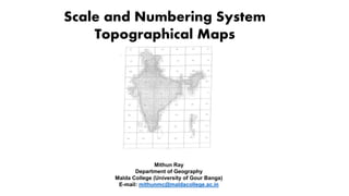
- 1. Scale and Numbering System Topographical Maps Mithun Ray Department of Geography Malda College (University of Gour Banga) E-mail: mithunmc@maldacollege.ac.in
- 2. Topographic Map Represents the relief of a region projected on a horizontal or plane surface. It also shows features like roads, railways, canals, water courses, towns, villages and so on.
- 3. Information on Topographical Maps Name of State and District Location in terms of latitude and Longitude Scale Magnetic declination Conventional signs Date of issue and revision of toposheet. Type of landforms such as general slope, hills, valleys etc. Drainage – Important rivers and tributaries , drainage pattern Vegetation – Type of forest and type of trees and their distribution. Forest location and area covered Land Use cultivated land, waste land and other uses Means of irrigation – Canal, wells and tanks etc Communication – Railway, roadways, Bridges, cart track, Telephone lines, Transmission lines, airport, seaport etc. Settlement – Urban centers, their sizes, rural settlement their pattern
- 4. Who prepares Topo Map in India ? Survey of India, The National Survey and Mapping Organization of the country under the Department of Science & Technology, is the OLDEST SCIENTIFIC DEPARTMENT OF THE GOVT. OF INDIA. It was set up in 1767 and has evolved rich traditions over the years. In its assigned role as the nation's Principal Mapping Agency, Survey of India bears a special responsibility to ensure that the country's domain is explored and mapped suitably, provide base maps for expeditious and integrated development and ensure that all resources contribute with their full measure to the progress, prosperity and security of our country now and for generations to come.
- 5. Scale and Numbering System Indian Topographical System India and Adjacent Country Series International Map of the World Series
- 6. India and Adjacent Country Series 4⁰N to 40⁰ N 44⁰E to 124⁰E Total 136 segments 106 segments surveyed 52 grids (40-92) lie in India 72,73, 78,79 lie in West Bengal
- 7. NAME SCALE EXTENSION CONTOUR INTERVAL REFERENCE NUMBER (EXAMPLE) MILLION SHEET 1:10,00,000 4⁰ × 4⁰ 500 m 73 DEGREE SHEET 1:2,50,000 1⁰ × 1⁰ 100 m 73 P QUADRANT SHEET 1:1,00,000 30′ × 30′ 50 m 73P/SE 15′ SHEET 1:50,000 15′ × 15′ 20 m 73D/16 SPECIAL SHEET 1:25,000 7′ 30″ × 7′ 30″ 10 m 73 D/16/SE 1:25,000 5′ × 7′ 30″ 10 m 73 D/16/1 LAYOUT
- 8. MILLION SHEET SCALE EXTENSION CONTOUR INTERVAL REFERENCE NUMBER (EXAMPLE) 1:10,00,000 4⁰ × 4⁰ 500 m 73
- 9. DEGREE SHEET SCALE EXTENSION CONTOUR INTERVAL REFERENCE NUMBER (EXAMPLE) 1:2,50,000 1⁰ × 1⁰ 100 m 73 P
- 10. QUADRANT SHEET NAME SCALE EXTENSION CONTOUR INTERVAL REFERENCE NUMBER (EXAMPLE) QUADRANT SHEET 1:1,00,000 30′ × 30′ 50 m 73P/SE
- 11. 15′ SHEET NAME SCALE EXTENSION CONTOUR INTERVAL REFERENCE NUMBER (EXAMPLE) 15′ SHEET 1:50,000 15′ × 15′ 20 m 73D/16
- 12. SPECIAL SHEET NAME SCALE EXTENSION CONTOUR INTERVAL REFERENCE NUMBER (EXAMPLE) SPECIAL SHEET 1:25,000 7′ 30″ × 7′ 30″ 10 m 73 D/16/SE 1:25,000 5′ × 7′ 30″ 10 m 73 D/16/1
- 13. India and Adjacent Country Series SOURCE: SARKAR, A. (2015): PRACTICAL GEOGRAPHY- A SYSTEMATIC APPROACH
- 14. AREA 1:50,000 = 700 SQ KM 1:25,000 = 175 SQ KM 1⁰ = 111.2 km (69.1 mile)
- 15. International Map of the World Series (Open Series) Open Series Maps have been introduced as per the National Map Policy of 2005 by Survey of India. The OSM numbering system based on International Map of the World (IMW) is used. The 'International Map of the World (IMW)' was a project which started in 1913 to create a complete map of the world as per internationally agreed and consistent specifications
- 16. NAME SCALE EXTENSION CONTOUR INTERVAL REFERENCE NUMBER (EXAMPLE) MILLION SHEET 1:10,00,000 6⁰ × 4⁰ 500 m D50 DEGREE SHEET 1:2,50,000 1⁰ × 1⁰ 100 m D50G 15′ SHEET 1:50,000 15′ × 15′ 20 m D50G10 QUADRANT SHEET 1:25,000 7′30″ × 7′30″ D50G10SE 3′ SHEET 1:10,000 3′ × 3′ D50G10X LAYOUT
- 17. The first letter is either 'N' or 'S' to denote the hemisphere (North/South) with respect to the equator. A second letter denotes the 4° latitude band with alphabet increasing as latitude moves away from equator. So sheets between 12°N to 8°N would be 'NC' and between 4°S to 8°S would be 'SB'. https://deeppradhan.heliohost.org/gis/map-numbering/imw.htm The next number denotes the 6° longitude band with numbering starting at 1 from 180°W (i.e. 1 between 180°W and 174°W) going on to 60 (i.e. between 174°E-180°E). So sheet between 72° to 78°E and 12°N to 8°N will be 'NC-43'. Similarly between 132°W to 126°W and 4°S to 8°S would be 'SB-9'. The longitude band span increased to 12° from 60° latitude and to 24° from 76° latitude due to the decrease in physical span of longitude band.
- 18. Each 6°×4° rectangle is further subdivided into 24 squares of 1°×1°. Each square is indicated serially by an alphabet increasing first towards east and then towards south, starting with 'A'. So for sheet between 74° to 75°E and 11°N to 10°N we get 'NC-43I' For sheet between 128°W to 127°W and 6°S to 7°S we get 'SB-9Q' https://deeppradhan.heliohost.org/gis/map-numbering/imw.htm
- 21. This Power Point Presentation (PPT) has been prepared only to deliver the lecture. The materials (Maps, Diagrams and Images) used in this presentation have been collected and compiled by the presenter from various academic blogs, research papers, books etc.
- 22. THANK YOU