Marcellus and Utica Shale Databook 2012 - Sample Pages for Vol. 2
•
0 gefällt mir•876 views

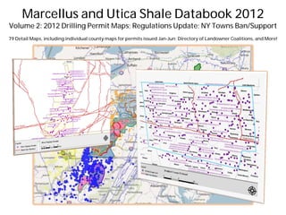
Preview pages for Volume 2 of the Marcellus and Utica Shale Databook 2012. This second volume features 79 detailed maps showing where Marcellus & Utica Shale well permits have been issued throughout PA, OH and WV for January through June of 2012. The Databook also features information on lease offers, state maps showing county names and the Marcellus and Utica Shale boundaries in those states, a list of New York towns who have voted either for or against drilling, and a comprehensive directory of landowner coalitions with contact details.

Empfohlen
Empfohlen
Weitere ähnliche Inhalte
Mehr von Marcellus Drilling News
Mehr von Marcellus Drilling News (20)
Kürzlich hochgeladen
Kürzlich hochgeladen (20)
Marcellus and Utica Shale Databook 2012 - Sample Pages for Vol. 2
- 1. Marcellus and Utica Shale Databook 2012 Volume 2: 2012 Drilling Permit Maps; Regulations Update; NY Towns Ban/Support 79 Detail Maps, including individual county maps for permits issued Jan-Jun; Directory of Landowner Coalitions, and More! Sample Pages
- 2. Table of Contents Section I - Overview Section II - Pennsylvania Permits (continued) Introduction 6 Centre County (map) 29 Regional Drilling Update 7-11 Clarion County (map) 30 Natural Gas Supply & Demand Clearfield County (map) 31 Commodity Price & Rig Counts Clinton County (map) 32 Marcellus & Utica Permit Trends Crawford County (map) 33 Where We’ve Been/Where We’re Going Elk County (map) 34 Regulatory Update 12-14 Fayette County (map) 35 PA, OH, WV, NY, MD, SRBC, DRBC, EPA, DOI Forest County (map) 36 PA Marcellus/Utica Shale Boundaries (map) 15 Greene County (map) 37 OH Marcellus/Utica Shale Boundaries (map) 16 Indiana County (map) 38 WV Marcellus/Utica Shale Boundaries (map) 17 Jefferson County (map) 39 NY Marcellus/Utica Shale Boundaries (map) 18 Lawrence County (map) 40 MD Marcellus/Utica Shale Boundaries (map) 19 Lycoming County (map) 41 Marcellus/Utica Lease Offers (map) 20 McKean County (map) 42 Guide to Using the County Maps (chart) 21 Mercer County (map) 43 Potter County (map) 44 Section II - Pennsylvania Permits Somerset County (map) 45 Sullivan County (map) 46 PA Gas Well Permits – Entire State (map) 22 Susquehanna County (map) 47 Allegheny County (map) 23 Tioga County (map) 48 Armstrong County (map) 24 Venango County (map) 49 Beaver County (map) 25 Warren County (map) 50 Bradford County (map) 26 Washington County (map) 51 Butler County (map) 27 Westmoreland County (map) 52 Cambria County (map) 28 Wyoming County (map) 53 ©Marcellus and Utica Shale Databook 2012 Volume 2 Sample Pages
- 3. Table of Contents Section III - Ohio Permits Section IV - West Virginia Permits OH Gas Well Permits – Entire State (map) 54 WV Gas Well Permits - Panhandle (map) 76 Athens County (map) 55 WV Gas Well Permits - Lower State (map) 77 Belmont County (map) 56 Barbour County (map) 78 Carroll County (map) 57 Brooke County (map) 79 Columbiana County (map) 58 Doddridge County (map) 80 Coshocton County (map) 59 Gilmer County (map) 81 Guernsey County (map) 60 Harrison County (map) 82 Harrison County (map) 61 Kanawha County (map) 83 Holmes County (map) 62 Marion County (map) 84 Jefferson County (map) 63 Marshall County (map) 85 Knox County (map) 64 Mingo County (map) 86 Mahoning County (map) 65 Monongalia County (map) 87 Monroe County (map) 66 Ohio County (map) 88 Morgan County (map) 67 Preston County (map) 89 Morrow County (map) 68 Ritchie County (map) 90 Muskingum County (map) 69 Taylor County (map) 91 Noble County (map) 70 Tyler County (map) 92 Portage County (map) 71 Upshur County (map) 93 Stark County (map) 72 Wetzel County (map) 94 Trumbull County (map) 73 Tuscarawas County (map) 74 Wayne County (map) 75 ©Marcellus and Utica Shale Databook 2012 Volume 2 Sample Pages
- 4. Table of Contents Section V - New York Town Votes Section VI - Directory of Landowner Coalitions Introduction & Background 95 How to Use this Directory 99 Town Votes to Ban or Support Fracking (table) 96-98 Landowner Groups by State/County 100-103 Landowner Group Detailed Info/Contacts 104-114 Methodology and Accuracy Information in this report is from a combination of publicly available databases, company press releases, news reports, and in-house proprietary information. While every effort was made to ensure the accuracy of the data, readers should be advised that there are no assurances of 100 percent accuracy. Information provided is only as accurate and comprehensive as the source documents. Maps found throughout the document provide pictures of data, that independently, show themes divided by county, state, or region, depending on the subject. At times, multiple “layers” are displayed in a single map to provide context where one layer might have impact or relate to another. Maps have been produced from the ShaleNavigator web-based mapping system and the Select Analytics desktop mapping programs. Use of information provided in this report is at your own risk. About ShaleNavigator ShaleNavigator (ShaleNavigator.com) is a web-based mapping solution that displays information specific to the leasing and development of shale plays in the United States, with particular focus on Marcellus and Utica development activity. Other U.S. Shale plays are available as well within the interface. ShaleNavigator’s Available Property listing service allows landowners to display their properties within the context of the development map, and ShaleNavigator's unique Newsboard locates and maps news, data, and deals on a daily basis. ShaleNavigator is a product of Select Analytics, LLC, a geospatial consulting firm that has served government, real estate development, environmental, and energy industries for over 15 years. Subscriptions are still available, and there is a free, 7 day trial account that can be activated by visiting www.shalenavigator.com. About Marcellus Drilling News Marcellus Drilling News (MarcellusDrilling.com) is an online news service dedicated to bringing news and resources to landowners and businesses in the Marcellus and Utica Shale (Appalachian) region of the United States. MDN scours the news daily, identifying and analyzing what’s happening with exploration, production, processing and delivery of Marcellus and Utica natural gas and its derivatives. We are blessed in the Marcellus region to have an abundant supply of clean energy beneath our feet, ready to be used. MDN chronicles the journey to energy independence by tapping the Marcellus Shale. ©Marcellus and Utica Shale Databook 2012 Volume 2 Sample Pages
- 5. Section I - Overview Pennsylvania Marcellus & Utica Shale Boundaries ©Marcellus and Utica Shale Databook 2012 Volume 2 Sample Pages
- 6. Section I - Overview GUIDE TO USING THE COUNTY MAPS #1 – The municipality or operator name is followed by two sets of numbers, with the second number in parentheses. Example: Hanover – 15 (7). The first number - “15” in this case - shows the number of permits issued. The second number - “(7)” in this case - indicates how many wells the permits were issued for. Usually a single well requires several permits during drilling, to allow the driller to continue to the next stage. #2 – A purple dot indicates where a well pad is located. Each well pad can have from one to ten wells on it. Typically a pad will contain 2-4 wells. Because of the size of the maps (vastly reduced to show an entire county), sometimes the purple dots will be “on top of each other.” In this example, Range Resources has 9 wells with activity Jan-Jun 2012, but only 4 purple dots, meaning some locations have more than one well drilled per pad, or that the pads are so close as to be indistinguishable on the map. #3 – The boundary of each county is indicated with a blue outline. County names are also in the same blue color. #4 – Major gas pipelines are indicated with red lines and the name of the pipeline somewhere along the line. ©Marcellus and Utica Shale Databook 2012 Volume 2 Sample Pages
- 7. Section II Pennsylvania Permits Beaver County By Municipality: Big Beaver – 2 (2) Brighton – 1 (1) Darlington – 3 (3) Greene – 2 (2) Hanover – 15 (7) Independence – 2 (2) Industry – 1 (1) Ohioville – 7 (7) South Beaver – 3 (3) By Operator: Chesapeake Energy – 19 (19) Range Resources – 17 (9) ©Marcellus and Utica Shale Databook 2012 Volume 2 Sample Pages
- 8. Section III Ohio Permits Carroll County By Municipality: Augusta – 7 (7) Brown – 5 (5) Center – 2 (2) East – 3 (3) Fox – 4 (4) Harrison – 3 (3) Lee – 7 (6) Loudon – 13 (12) Orange – 1 (1) Perry – 4 (4) Rose – 6 (5) Union – 6 (6) Washington – 15 (9) By Operator: Chesapeake Energy – 63 (58) Enervest – 7 (6) RE Gas – 6 (3) ©Marcellus and Utica Shale Databook 2012 Volume 2 Sample Pages
- 9. Section IV West Virginia Permits Preston County Entire County: 22 (4) By Operator: Enerplus Resources – 22 (4) ©Marcellus and Utica Shale Databook 2012 Volume 2 Sample Pages
- 10. Section V New York Town Votes NEW YORK DIVIDED EMPIRE STATE Towns and Cities Vote to Support or Ban Drilling (Y) = Voted to support drilling or wait for DEC | (N) = Voted for moratorium or outright ban All municipalities are townships unless otherwise noted Albany County Cayuga County Clinton County Fulton County Albany (N) Genoa (N) Chazy (Y) Oppenheim (N) Berne (N) Ledyard (N) Rensselaerville (N) Locke (N) Columbia County Greene County Moravia (N) Allegany County Niles (N) Germantown (N) Ashland (Y) Scipio (N) Alfred (N) Summerhill (N) Cortland County Herkimer County Amity (Y) Cattaraugus County Willet (Y) Little Falls (N) Broome County Manheim (N) Carrollton (Y) Delaware County Barker (Y) Lewis County Binghamton (Y) Chautauqua County Andes (N) Binghamton, City (N) Deposit (Y) New Bremen (Y) Chenango (Y) Busti (Y) Hancock (Y) Colesville (Y) Livingston County Conklin (Y) Chemung County Dutchess County Kirkwood (Y) Avon (N) Lisle (Y) Van Etten (Y) Beacon (N) Caledonia (N) Maine (Y) Conesus (N) Nanticoke (Y) Chenango County Erie County Geneseo (N) Sanford (Y) Leicester (Y) Windsor (Y) Afton (Y) Buffalo, City (N) Lima (N) Windsor, Village (Y) Bainbridge (Y) Colden (N) Livonia (N) Coventry (Y) Holland (Y) Mount Morris (N) Greene (Y) Wales (N) Nunda (N) Guilford (Y) Sparta (N) Preston (Y) Springwater (N) ©Marcellus and Utica Shale Databook 2012 Volume 2 Sample Pages
- 11. Section VI Landowner Coalitions DIRECTORY OF LANDOWNER COALITIONS Contact Details for Landowner Groups in the Marcellus/Utica Shale Coalitions by County Preston County, MD Cattaraugus County, NY Otsego County, NY Preston Gas Association 4-County Gas/Oil Leasing Group Hartwick Area Landowner's Coalition Western NY Gas & Oil Consortium Unatego Area Landowners Association Allegany County, NY Worcester Landowners Coalition 4-County Gas/Oil Leasing Group Chemung County, NY Allegany County Marcellus Shale Coalition Chemung County Gas Coalition Schuyler County, NY Western NY Gas & Oil Consortium Schuyler Landowners Coalition Chenango County, NY Broome County, NY Bainbridge Area Landowners Steuben County, NY 79-11 Landowners Coalition CNY Landowner's Coalition Steuben County Landowners Coalition Apalachin Landowners Group County Line Landowners Coalition Twin Tiers Landowner Coalition Binghamton Conklin Gas Lease Coalition North Sanford Landowners Association Central Broome Landowners Association Oxford Land Group Sullivan County, NY County Line Landowners Coalition Sapbush Road Group Rural Bethel Landowners Coalition Deposit Gas Group Sullivan Delaware Property Owners Association Kirkwood Gas Coalition Cortland County, NY Maine NY Gas Coalition County Line Landowners Coalition Tioga County, NY Mountain Valley Group Taylor Land Group Apalachin Landowners Group Nanticoke Gas Coaltion County Line Landowners Coalition North Sanford Landowners Association Delaware County, NY Nanticoke Gas Coaltion Northeastern Broome Landowners Association Deposit Gas Group Owego Gas Coalition Sanford Gas Coalition North Sanford Landowners Association Southern Tier Landowner’s Coalition Sapbush Road Group Sidney Area Landowners Tioga County Landowners Group South Maine Millennium Coalition Sullivan Delaware Property Owners Association The Friendsville Group Ashtabula County, OH Town of Lisle Erie County, NY Eastern Geauga Landowners Triangle Area Landowners Coalition Western NY Gas & Oil Consortium F&M Landowners Group #2 Union Center West Corners Coalition Mineral Rights Group North East Vestal Gas Coalition Madison County, NY Point Pleasant Landowner Group Western Barker Landowner Coalition Nelson Natural Gas Group Coalition Windsor & Colesville Oil & Gas Lease Coalition South Madison County Gas Coalition ©Marcellus and Utica Shale Databook 2012 Volume 2 Sample Pages
- 12. Section VI Landowner Coalitions DIRECTORY OF LANDOWNER COALITIONS Contact Details for Landowner Groups in the Marcellus/Utica Shale Coalition Details 4-County Gas/Oil Leasing Group Ames, Bern, Wesley Landowner Association Area covered: Cattaraugus/Allegany Counties, NY; Area covered: Northwestern Washington County, northeastern Athens McKean/Potter Counties, PA County, and southern Morgan County, OH – near the communities of Membership: About 250 people, About 25,000 acres & growing Bartlett and Sharpsburg (Wesley, Bern, Ames, Marion Townships) Contact: Janice L. Hancharick, 919-876-2917, jlhanch@nc.rr.com Membership: 2,500 acres and growing Contact: Southern Ohio Energy Consultants, 740-818-6091 5 STAR Landowners Group Contact: Michael Householder, michaelhouseholder76@gmail.com Area covered: Tyler County, WV Web: http://www.southernohioenergyconsultantsllc.com/ Membership: Not disclosed (only adding acres next to existing members) Contact: James Milleson (JRM Consulting), 740-658-3960, Apalachin Landowners Group jrmconsulting@ohioacres4u.com Area Covered: Apalachin, South Owego, Nichols and Campville, Web: http://www.ohioacres4u.com and Western Vestal in Broome & Tioga counties, NY Membership: Not disclosed 79-11 Landowners Coalition Contact: Loretta Sullivan, 607-625-4543, lorettas@stny.rr.com Area covered: Between RT 79 and RT 11 in the town of Barker in Web: http://www.apalachinlandowners.blogspot.com Broome County, NY Membership: About 2,500 acres Appalachian Landowners' Coalition Contact: Gary VanDriesen, 607-786-1229, gvandriesen@stny.rr.com Area covered: Clarion, Jefferson, Venango and Elk counties, PA Membership: 12,000 acres (6,000+ acres HBP) ABC Mineral Group LLC Contact: Bryan D. Huwar, 814-849-2959, bdh@clarionlawoffices.com Area covered: Armstrong, Butler and Clarion counties, PA Contact: Benjamin J. Vrobel, 814-849-2959, benjaminvrobel@gmail.com Membership: Over 360 members and 20,000 acres Web: http://www.leasemarcellus.com Contact: Steve Blauser, 724-443-8013, abcmineralgroup@gmail.com Web: http://abcmineralgroup.com Associated Landowners of Ohio Valley (ALOV) Area covered: Columbiana, Carroll, Jefferson, Mahoning, Trumbull, Allegany County Marcellus Shale Coalition Harrison, Tuscarawas, Portage and Stark counties, OH Area covered: southern townships of Allegany County, NY: Membership: 2,500+ landowners with a collective 200,000+ acres Genesee, Bolivar, Alma, Willing, Independence, West Union, Andover, Contact: ALOV has been closed for membership since July 2011 Wellsville, Scio, Wirt and Clarksville Web: http://www.alov.us Membership: 10,000 acres at inception Contact: Bill Gunner, 585-593-6105, gunner@alleganymarcellus.com Web: http://alleganymarcellus.com ©Marcellus and Utica Shale Databook 2012 Volume 2 Sample Pages
- 13. Marcellus and Utica Shale Databook 2012 Volume 1: 2011 Drilling Permits; 2012 Company Strategies, Contacts, Legislation Publish Date: March 2012 Volume 2: 2012 Drilling Permits (Jan-Jun), NY Bans/Support for Fracking, Landowner Coalition Directory Publish Date: July 2012 Volume 3: 2012 Drilling Permits (Jul-Dec), New Pipelines, Updated Strategies, 2013 Preview Publish Date: January 2013 Purchase Options Buy each volume individually for $149, or buy all three for $447 $298 Site licenses/volume discounts also available, contact us for details To purchase, contact: Marcellus Drilling News Web: marcellusdrilling.com/databook Email: databook@marcellusdrilling.com Phone: (607) 238-2500 ©Marcellus and Utica Shale Databook 2012 Volume 2 Sample Pages