GLOBE.pdf
•
0 gefällt mir•153 views

Globe : Latitudes and Longitudes 1.What is Globe? 2. Parallels of Latitudes and Longitudes 3.Heat zones of the Earth 4. Longitude and Time

Empfohlen
Weitere ähnliche Inhalte
Was ist angesagt?
Was ist angesagt? (20)
Ähnlich wie GLOBE.pdf
Ähnlich wie GLOBE.pdf (20)
Mehr von Manpreet Kaur
Mehr von Manpreet Kaur (11)
Kürzlich hochgeladen
Kürzlich hochgeladen (20)
GLOBE.pdf
- 1. GLOBE : LATITUDES AND LONGITUDES
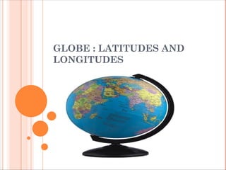
- 2. GLOBE A globe is a true model of the earth. The globes are of varying sizes and types. Globe can be rotated in the same way as a top spin or potter’s wheel is rotated. The countries, continents and oceans are shown in their respective sizes on the globe.
- 3. Axis-Is the imaginary line passing through the centre of the earth and joining the two points. A needle is fixed through the globe in a titled manner, which is called its axis. The two points on the globe where the needle passes through are North Pole and South Pole. The globe can be moved around this needle like the Earth from West to East. Another imaginary circular line running on the globe divides the earth into two equal parts. This line is called as Equator• The northern half of the earth is known as the Northern Hemisphere and the southern half is called the Southern Hemisphere.
- 4. PEER INSTRUCTIONS What is a globe? (a) Earth (b) True model of the earth (c) Both (a) and (b) (d) None of these Which of the following are shown on the globe in their true size? (a) Countries (b) Continents (d Oceans (d) All of these
- 5. What is called a needle fixed through the globe in a tilted manner? (a) Orbit (b) Axis (c) Latitude (d) Longitude ________ marks the location of the equator on Earth. 0 degree 90 degree 180 degree 20 degree
- 6. PARALLELS OF LATITUDES All parallel circles from the equator up to the poles are called parallels of latitudes. Latitudes are measured in degrees.
- 7. The equator represents the zero degree latitude. Since the distance from the equator to either of the poles is one-fourth of a circle round the earth, it will measure ¼th of 360 degrees, i.e. 90°. Thus, 90 degrees north latitude marks the North Pole and 90 degrees south latitude marks the South Pole. As such, all parallels north of the equator are called ‘north latitudes.’ Similarly all parallels south of the equator are called ‘south latitudes.’ For example, both Chandrapur in Maharashtra (India) and Belo Horizonte in Brazil (South America) are located on parallels of about 20° latitude. But the former is 20° north of the equator and the latter is 20° south of it. We, therefore, say that Chandrapur is situated at 20° N latitude and Belo Horizonte is situated at 20°S latitude
- 8. IMPORTANT PARALLELS OF LATITUDES Besides the equator (0°), the North Pole (90°N) and the South Pole (90° S), there are four important parallels of latitudes– (i) Tropic of Cancer (23½° N) in the Northern Hemisphere (ii) Tropic of Capricorn (23½° S) in the Southern Hemisphere (iii) Arctic Circle at 66½° north of the equator. (iv) Antarctic Circle at 66½° south of the equator
- 10. PEER INSTRUCTIONS What divides the earth into two equal parts. The northern hemisphere and the southern hemisphere? (a) Tropic of Capricorn (b) Tropic of Cancer (c) Equator (d) Arctic Circle Name one of the following parallels of latitudes as Tropic of Cancer. (a) 0° (b) 23° 30′ S (c) 23° 30′ N (d) 66° 30′ N
- 11. Latitudes are equal in length True False The tropic of cancer and tropic of Capricorn is of: a) Capricorn is shorter than the Cancer b) Equal length c) A big difference between these two d) Capricorn is bigger than the Cancer The total number of parallels across the globe is A180 B360 C90 D181
- 12. HEAT ZONES OF THE EARTH
- 13. HEAT ZONES OF THE EARTH i) The area between tropic of Cancer and tropic of Capricorn receives the maximum heat and is called the Torrid zone. (ii) The areas between the Arctic circle and tropic of Cancer in Northern hemisphere and the Antarctic Circle and tropic of Capricorn in the Southern Hemisphere, have moderate temperature. These are called Temperate Zones. (iii) The areas lying between the Arctic circle and the North pole in the Northern hemisphere and the Antarctic circle and the South pole in the Southern hemisphere remain very cold because the sun provides less heat due to its slanting rays. They are called Frigid Zones.
- 14. PEER INSTRUCTIONS Which of the following zone is situated between 66°30′ S and poles? (a) Torrid Zone (b) Temperate Zone (c) Frigid Zone (d) All of these Why does the Torrid Zone receive maximum amount of heat? A The mid day Sun is exactly overhead at least once in a year on all latitude in between the Arctic circle and Antarctic circle B The mid day Sun is exactly overhead at least once in a year on frigid zone C The mid day Sun is exactly overhead at least once in a year on all latitude in between the Tropic of Cancer and the Tropic of Capricorn D The mid day Sun is not exactly overhead at least once in a year on all latitude in between the Tropic of Cancer and the Tropic of Capricorn.
- 15. LONGITUDES
- 16. (i) Unlike parallels of latitude, all meridians are of equal length. These are semi-circles and the distance between them decreases while moving polewards and becomes zero at poles. (ii) Hence, all countries decided that the count should begin from the meridian which passed through Greenwich, where the British Royal Observatory is located. This meridian is called the Prime Meridian. (iii) The value of the meridian is 00 longitude and from it,1800Eastward and 1800Westward is counted. The earth is divided into two equal halves: one is the Eastern Hemisphere and other is Western Hemisphere.
- 17. GRID Tonga Islands (in the Pacific Ocean) and Mauritius Islands (in the Indian Ocean) are situated on the same latitude (i.e., 20° S). Now, in order to locate them precisely, we must find out how far east or west these places are from a given line of reference running from the North Pole to the South Pole.
- 18. PEER INSTRUTIONS What is meridian or longitude? The lines running from north pole to the west poles The lines running from north pole to the east poles The lines running from north pole to the south poles The lines running from east pole to the south poles The total number of meridians across the globe is ________. 360 90 181 180
- 19. What divides the earth into the eastern and the western hemispheres? (a) Equator (b) Prime Meridian (c) 82° 30′ E (d) None of these The distance between the longitude A Decreases towards South Poles only B Increases towards Poles C Decreases towards Poles D Decreases towards North Poles only
- 20. LONGITUDE AND TIME i) The best means of measuring time is by the movement of the earth, the moon and the planets. (ii) The sun regularly rises and sets every day, and naturally. It is the best time-keeper throughout the world. (iii) Local time can be reckoned by the shadow cast by the sun, which is the shortest at noon and longest at sunrise and sunset. (iv) When the prime meridian of Greenwich has the sun at the highest point in the sky, all the places along this meridian will have mid-day or noon. (v) As the earth rotates from west to east, those places east of Greenwich will be ahead of Greenwich time and those to the west will be behind it.
- 21. The earth rotates 360° in about 24 hours, which means 15° an hour or 1° in four minutes. Thus, when it is 12 noon at Greenwich, the time at 15° east of Greenwich will be 15 × 4 = 60 minutes, i.e., 1 hour ahead of Greenwich time, which means 1 p.m. But at 15° west of Greenwich, the time will be behind Greenwich time by one hour, i.e., it will be 11.00 a.m. Similarly, at 180°, it will be midnight when it is 12 noon at Greenwich.
- 22. PEER INSTRUCTIONS What time does earth take, rotating from one- degree longitude to next longitude? 10 minutes 15 minutes 4 minutes None of these
- 23. WHY DO WE HAVE STANDARD TIME? (i) The local time of places which are on different meridians are bound to differ. (ii) For example, in India there will be a difference of of about 1 hour and 45 minutes in the local times of Dwarka in Gujarat and Dibrugarh in Assam. (iii) In India, the longitude of (82 1/20 E )is treated as the standard meridian. The local time at this meridian is taken as the standard time for the whole country. It is called Indian Standard Time(IST) (iv) In some countries which have a great geographical extent they adopt more than one standard time.
- 25. PEER INSTRUCTIONS Match the Columns: Column A Column B (i) IST (a) 0o (ii) GMT (b) 82.1/2º (iii) Arctic circle (c) 66.1/2o S (iv) Antarctic circle (d) 66.1/2o N The central meridian of every country is called the standard meridian and its local time is the standard time. True false