SlideShare ist ein Scribd-Unternehmen logo
1 von 110
Downloaden Sie, um offline zu lesen
tapa ok.FH11 Mon Dec 03 10:33:53 2007 Page 1
Composite
PatrimoniodelaHumanidadPatrimoniodelaHumanidad
C I R C U I T O
MINISTERIODEBIENESNACIONALES
Ciudad de
Valparaíso
Ciudad de
Valparaíso
tapa ok.FH11 Mon Dec 03 10:33:53 2007 Page 2
Composite
RutaPatrimonialCiudaddeValparaís
Playa Ancha
Barrio
Puerto
Castillo
San José
Los
Inmigrantes
Barrio San
Juan de Dios
La Senda
del Poeta
B
La
UBICACION:
La Ciudad de Valparaíso está situada en los 33º 2´ de Latitud Sur y 71º 38´ de
Longitud Oeste, inserta en la Macrorregión Central de Chile.
Ocupa el fondo de una ensenada que se extiende por 3 kilómetros y que se ha
desarrollado arrebatando artificialmente espacio al mar, antecediendo al cordón
de cerros que forman el anfiteatro de la bahía, la cual se inicia por el norte en la
Punta de Osses, sector de Las Salinas de Viña del Mar, terminando en Punta
Ángeles, 7,5 millas al sur. Esta bahía es enteramente abierta y está expuesta a los
vientos del norte y noroeste.
tapa ok.FH11 Mon Dec 03 10:33:53 2007 Page 3
Composite
raíso:Patrimonio de la Humanidad
Barrio de
La Merced
Los Miradores
de las Delicias
LOCATION
The City of Valparaíso is located in 33º 2´ of South Latitude and 71º 38´ of West
Longitude, in the middle of Chile’s central Macro-Region.
It occupies the bottom of a 3 km cove which has been developed artificially gaining
land to the sea, preceding the hill range that give birth to the bay amphitheater,
which starts in Punta de Osses by the north, sector of Las Salinas of Viña del Mar,
and ends at Punta Ángeles, 7.5 miles to the south. This is an entirely open bay
which is exposed to north and north-west winds.
tapa ok.FH11 Mon Dec 03 10:33:53 2007 Page 4
Composite
ACCESS TO THE CITY
From Viña del Mar, located 9 km to the
north-east by the coast, you have to take
Avenida España, connecting toAvenida
Errázuriz traveling the city from east to
west and with Avenida Argentina, that
travels the road from north to south,
ending at the feet of O'Higgins and
Molino hills, that give birth to Avenida
Santos Ossa, connecting the city to the
capital, Santiago of Chile, located 119
km to the north-west.
Colón, Errázuriz, Victoria and Pedro
Montt Avenues end at Avenida
Argentina, and will allow you to travel
the urban range in which both
neighborhoods and scopes identified in
this topoguide are arranged.
CLIMATE
It has a coastal Mediterranean temperate
climate with winter-time rains and an
extended dry season.
Average temperatures over the year
are:
El mes más lluvioso es junio, con cifras
de hasta 28 milímetros, alcanzando un
total de 450 milímetros durante el año
y con un 75% de humedad media.
ACCESOS A LA CIUDAD
Desde Viña del Mar, que se encuentra
a 9 km al noroeste por la costa, se accede
porAvenida España, que se conecta con
Avenida Errázuriz, recorriendo la ciudad
de oriente a poniente y con Avenida
Argentina, que la recorre de norte a sur,
finalizando a los pies de los cerros
O'Higgins y Molino, donde nace la
Avenida Santos Ossa, que comunica a
la ciudad con la capital, Santiago de
Chile, distante a 119 km al norponiente.
En la Avenida Argentina culminan las
Avenidas Colón, Errázuriz, Victoria y
Pedro Montt, que le permitirán recorrer
el abanico urbano en el cual se ordenan
los barrios y ámbitos señalados en esta
topoguía.
CLIMA
Posee un clima templado de tipo
mediterráneo costero, con lluvias
invernales y estación seca prolongada.
Sus temperaturas medias durante el año
son:
Primavera / Spring
(septiembre – noviembre)
Máxima Mínima
20º C 10º C
Verano / Summer
(diciembre – febrero)
Máxima Mínima
23º C 13º
Otoño / Autumn
(marzo – mayo)
Máxima Mínima
15º C 10º C
Invierno / Winter
(junio – agosto)
Máxima Mínima
17° C 8° C
June is the most rainy month with up to
28 millimeters, totaling 450 millimeters
over the year, with 75% average
humidity.
tramos.FH11 Mon Jan 21 10:55:38 2008 Page 1
Ciudad de Valparaíso:
Patrimonio de la Humanidad
…allí el mar "no contenido
por toscos pretiles,
penetraba con las mareas
hasta besar el pié de los
quillayes y los boldos…
... mientras en las desnudas
colinas, como un ejército de
gigantes en atalaya, mecían
sus esbeltas copas, agitadas
por el viento, las palmas
reales"...
Valparaíso, que no tuvo funda­
ción, es una ciudad adherida al
mar, configurada por largas calles
que, de oriente a poniente, van
uniendo distintos núcleos y espa­
cios urbanos, con plazas estable­
cidas al final de las quebradas,
las cuales imponen la diferencia
que existe entre un barrio o
“cerro” y otro.
El antiguo Valle de Quintil, actual
Valparaíso, es hoy una gran ciu­
dad que a pasar de su aparente
desorden urbano, es fácil de reco­
rrer.Aprimera vista, su topografía
intrincada se nos presenta como
un laberinto imposible de resolver,
pero al mismo tiempo las reglas
del juego son tan simples que uno
puede orientarse fácilmente. Se
aprende rápidamente que a un
lado está el mar y al otro los ce­
rros, los dos límites de la ciudad.
“Es una ciudad con frente y con
espaldas, con horizontes muy
definidos. Nadie se pierde en
Valparaíso.”
(Citado por
Renzo Pecchenino “Lukas”
en Apuntes Porteños).
Valparaíso, which was never
founded, is a city adhered to the sea,
configured by long streets which
connect different urban communities
and spaces to squares established
at the end of streams, from east to
west, imposing the difference
existing between a neighborhood
or “hill” and the other.
The old Valley of Quintil, now
called Valparaíso, is today a big
city which, in spite of its apparent
urban disorder, is easy to travel. Its
entangled topography may seem a
labyrinth impossible to solve at first
sight, but game rules are at the same
time so simple that you will orient
yourself easily. You will quickly
realize that you have the sea on one
side and the hills on the other, which
are the two limits of the city.
“This is a city with a front and
a rear part, with very-well defined
horizons. None gets lost in
Valparaíso”
(quoted by Renzo Pecchenino
“Lukas” in Apuntes Porteños).
… there the sea "not
contained by rough stone
railing, penetrated with tides
until kissing the feet of quillais
and boldos …
... while at nude hills, as an
army of giants in a
watchtower, the royal palms,
waved by the wind, rocking
their graceful crowns“ ...
tramos.FH11 Mon Jan 21 10:55:38 2008 Page 2
Recorrer la Ruta Patrimonial
Ciudad de Valparaíso es una
invitación a ser testigo de las diver­
sas etapas de la vida de esta ciudad.
Desde el mar hacia los cerros
nacieron, se desarrollaron y con­
centraron, las diversas actividades
humanas, disemi-nándose en torno
a la bahía las huellas del progreso
de esta ciudad y el país.
De esta forma se constituye
en la actualidad un verdadero polo
del patrimonio nacional, que desde
su epicentro en el Barrio Puerto y
más precisamente en la Iglesia de
La Matriz, muestra los testimonios
que dan cuenta de las oleadas de
vida que le ganaron espacio al mar
y fueron transformando a Valparaí­
so en lo que es hoy, una ciudad
Patrimonio de la Humanidad.
La Organización de las Na­
ciones Unidas para la Educación,
la Ciencia y la Cultura (UNESCO)
declaró como Patrimonio Cultural
de la Humanidad el Casco Histórico
de la Ciudad de Valparaíso con un
área de protección de 24 hectáreas
desde la Iglesia la Matriz hasta el
Traveling the City of Valparaí­
so Heritage Route is an invitation
to witness the different stages of
life in this city.
Different human activities were
born, developed and concentrated
from the sea to the hills, spreading
progress marks of both this city
and the country around the bay.
It is thus currently a true pole
of national heritage, which from
its epicenter at Barrio Puerto (Port
Neighborhood) and, specifically, at
Iglesia de La Matriz (The Matrix
Church), shows the testimonies that
talk about waves of life that took
space from the sea and transformed
Valparaíso into what it is today, a
World Heritage City.
TheUnitedNationsEducational,
Scientific and Cultural Organization
(UNESCO) declared the Historical
Area of the City of Valparaíso as
World Cultural Heritage with a 24
hectare protected zone from The Ma­
trix Church to Concepción Hill, and
with a 43 hectare buffer zone, from
Wheelwright Square to Aníbal Pinto
Square.
tramos.FH11 Mon Jan 21 10:55:38 2008 Page 3
Cerro Concepción, y con un área
de amortiguación de 43 hectáreas,
desde la Plaza Wheelwright hasta
la Plaza Aníbal Pinto.
Además,laCiudaddeValparaí­
so contiene una gran cantidad de
elementos urbanos declarados como
Monumentos Nacionales, siendo
estos destacados en los contenidos
de esta topoguía, señalando su año
de declaración como Monumentos
Nacional.
DESCRIPCION GENERAL
DE LA RUTA
La Ciudad de Valparaíso era
hasta el siglo XX el punto de con­
tacto con el exterior de un país
confinado por su ubicación en el
extremo sur de América.
Entre los hielos australes, los
desiertos del norte y la cordillera
andina, su peculiar emplazamiento
permite apreciar la inmensidad del
Océano Pacífico. Es
Es una de las ciudades más an­
tiguas de Chile. Sus orígenes se re­
montan a 1536 y por su calidad de
Inaddition,theCityofValparaí­
socontainsalargenumberofurban
elements declared National Monu­
ments, which are highlighted in
thesetopoguidecontents,indicating
theyearinwhichtheyweredeclared
National Monuments.
GENERAL DESCRIPTION
OF THE ROAD
The City of Valparaíso was
until the XXth century the contact
point with abroad for a country
confined for being located in the
southern end of America.
Its peculiar location, among
austral ices, northern deserts, and
Andean cordillera, allows to ap­
preciate the imvastedadmensity
of the Pacific Ocean.
This is one of the oldest cities
in Chile. Its origin dates back to
1536 and, due to its status of main
port of the kingdom, it played a
crucial part in the process of na­
tional emancipation.
As the heir of an historical
past that provides it with a
tramos.FH11 Mon Jan 21 10:55:38 2008 Page 4
principal puerto del reino ejerció un
papel determinante en el proceso de
emancipación nacional.
Heredera de un pasado histórico
que le confiere una identidad única.
En el siglo XIX acogió a sucesivas
oleadas de inmigrantes, principal­
mente europeos, lo que le confirió
un carácter cosmopolita y pluralista.
Testimonio de esta riqueza es la het­
erogénea arquitectura que se observa
al recorrer el plan y los cerros.
Capital de la Quinta Región de
Valparaíso y de la Provincia del mis­
mo nombre, forma parte de la
conurbación del Gran Valparaíso que
incluye además a Viña del Mar,
Concón, Quilpué y Villa Alemana.
Sucascohistóricofuedeclaradocomo
Patrimonio de la Humanidad por la
UNESCO en el año 2003. Es sede
del Poder Legislativo de la República
de Chile, además de otras reparti­
cionesestatalescomolaComandancia
en Jefe de la Armada de Chile, el
Servicio Nacional de Aduanas y el
Consejo Nacional de la Cultura y las
Artes. Cuenta con cuatros univer­
sidades tradicionales, con el diario en
habla hispana más antiguo del mun­
do, El Mercurio de Valparaíso, y con
unique identity, it received suc­
cessive waves of immigrants in
the XIXth century, mostly from
Europe, that determined its cos­
mopolitan and pluralist nature.
The heterogeneous architecture
that may be seen when traveling
both the plan and the hills is a
testimony of this richness.
Capital of Region Five of
Valparaíso and of the Province
de Valparaíso of the same name,
it is part of Gran Valparaíso
conurbation, that also includes
Viña del Mar, Concón, Quilpue
Quilpué, and Villa Alemana. Its
historical area was declared
World Heritage by UNESCO in
2003. It lodges the headquarters
of the Legislature of the Repub­
lic La ciudad es of Chile, as well
as other state divisions, such as,
the Command-in-Chief of the
Chilean Navy, the National Cus­
toms House Service, and the Na­
tional Council for Culture and
Arts. It houses four traditional
universities, and the world’s old­
est newspaper in Spanish, as
well as the second oldest profes­
sional soccer team in South-
tramos.FH11 Mon Jan 21 10:55:38 2008 Page 5
AMBITO / SCOPE HITO / GUIDE POST ELEMENTOS
URBANOS
PLAYA ANCHA CASAS DE GRAN BRETAÑA 14
PLAZA WADDINGTON 4
PASEO 21 DE MAYO 5
BARRIO PUERTO
PLAZA WHEELWRIGHT 4
PLAZUELA LA MATRIZ 5
SENDAS DE SANTO DOMINGO 4
PLAZA ECHAURREN 7
CASTILLO SAN JOSE
CALLE SERRANO Y PASAJES
BARRIO PUERTO 5
PLAZA ELEUTERIO RAMIREZ 7
UNION OBRERA 6
PLAZA JUSTICIA 5
PLAZA SOTOMAYOR 10
LOS INMIGRANTES
PASEO YUGOESLAVO 8
CALLE PRAT 12
PLAZA SAN LUIS 10
IGLESIA ANGLICANA Y
PASEO DE LOS 14 ASIENTOS 7
PASEO GERVASONI 6
PASEO ATKINSON 9
BARRIO SAN JUAN
DE DIOS
PLAZA ANIBAL PINTO 6
PARQUE CULTURAL
EX CARCEL DE VALPARAISO 6
PLAZUELA ECUADOR 5
PLAZA BELLAVISTA 5
LA SENDA DEL POETA
PLAZA DE LA VICTORIA 9
CALLE CONDELL 8
MUSEO A CIELO ABIERTO 11
LA SEBASTIANA 4
BARRIO DE
LA MERCED
ASCENSOR FLORIDA 5
ASCENSORES MARIPOSAS
Y MONJAS 4
PARQUE ITALIA 9
CALLE HONTANEDA 8
PLAZA O'HIGGINS 11
MUELLE BARON 6
LOS MIRADORES
DE LAS DELICIAS
ASCENSORES LECHEROS
Y BARON 6
ASCENSOR LARRAIN 4
ASCENSOR POLANCO 3
8 35 238
el segundo equipo de fútbol pro­
fesional más antiguo de América
delSur,SantiagoWanderersfunda­
do el 15 de agosto de 1892.
La topoguia de la Ruta Pat­
rimonial Ciudad de Valparaíso
entrega en sus contenidos una gal­
ería de 238 elementos urbanos que
demuestran la riqueza cultural y
arquitectónica de este patrimonio
mundial, donde se exhiben agru­
pados en 35 hitos ordenados a su
vez en 8 ámbitos, que se pueden
recorrer a pie durante todo el año.
Además es posible disfrutar
de recorridos en lancha por toda
la bahía y viajar por subidas y
caminos en buses urbanos por los
cerros del anfiteatro natural de la
Ciudad de Valparaíso.
La siguiente tabla describe
los ámbitos que conforman la ruta,
indicando a su vez cada hito con
sus correspondiente cantidad de
elementos urbanos.
America - Santiago Wanderers,
founded on August 15, 1892.
The City of Valparaíso Her­
itage Route topoguide contains
a gallery of 238 urban elements
that show both cultural and ar­
chitectural richness of this world
heritage, arranged in 35 guide­
posts divided in turn into 8
scopes, which may be walked
all year round.
You may also take boat
tours across the bay and travel
by lifts and roads in urban buses
by the hills of City of Valparaíso
natural amphitheater.
The table shown below de­
scribes the scopes that make up
the route, indicating in turn each
guidepost with its corresponding
number of urban elements:
tramos.FH11 Mon Jan 21 10:55:38 2008 Page 6
Playa Ancha
Ambito 1
Entre los sectores de mayor
identidad urbana de la Ciudad
de Valparaíso encontramos al
Cerro Playa Ancha, cuyo centro
fundacional se encuentra en lo
que hoy conocemos como Cerro
Artillería, que debe su nombre a
los fuertes y baterías de defensa
localizados en este sector. Es un
sector tradicional muy relaciona­
do a los usos que nuestro puerto
ha dedicado a las funciones de
defensa nacional, encontrándose
en reparticiones del Ejército y la
Armada, dado que en 1885 se
construye el antiguo edificio de
la Escuela Naval, hoy Museo Na­
val, junto con el Ascensor Artill­
ería (Monumento Histórico 1998),
construido posteriormente. La
actual Avenida Gran Bretaña es
el primer tramo de la construcción
del Camino Cintura y la Avenida
Alemania, lo que facilita recorrer
Among the sectors of higher
urban identity of the City of Val­
paraiso we find Hill PlayaAncha,
which foundation center locates
where we currently know as Ar­
tillería Hill, which name is due
to fortress deand defense bat­
teries located in this sector. It is
a traditional sector closely relat­
ed to the uses dedicated by our
port to national defense
parafunctions and where you
can find divisions of the Army
and Navy as in Ejercito1885 the
old building of the Naval School
- currently Naval Museum - was
constructed together with the
Artillería Lift (Historical Monu­
ment 1998), of later construc­
tionel. The current Gran Bretaña
Avenue is the first segment of
the construction of Cintura Road
and Alemania Avenue, facilitat­
ing the transversal tour through
Plaza
Waddington
Casas de
Gran Bretaña
Paseo
21 de Mayo
tramos.FH11 Mon Jan 21 10:55:38 2008 Page 7
transversalmente los cerros
de Valparaíso. Destacan de
la Avenida Gran Bretaña su
arquitectura influenciada por
estilos europeos, con sus
construcciones materializa­
das casi completamente en
madera, y la Plaza Wad­
dington, la cual evoca a la
familia propietaria de los
terrenos que permitieron el
inicio del desarrollo urbano
en el Cerro Playa Ancha.
En este sector aprecia­
remos la arquitectura tradi­
cional de las Casas de Gran
Bretaña, las cuales se dis­
tribuyen desde el Paseo 21
de Mayo, pasando por el
entorno de Plaza Wadding­
ton hasta llegar al extremo
de la península de Playa
Ancha en la Escuela Naval.
PlayaAncha
the hills of de la Ciudad
Valparaíso. Gran Bretaña
Avenue highlights for its ar­
chitecture influenced by Eu­
ropean styles with its con­
structions materialized
almost totally in wood, and
Waddington Square, that
evokes the family owner of
those lands who enabled
the urban development in
Playa Ancha Hill.
In this sector we appre­
ciate traditional architecture
of Gran Bretaña Houses,
which distribute from 21 of
Mayo Promenade passing
through the surroundings
of Waddington Square until
arriving to the end of a
laPlaya Ancha peninsula in
the Naval School.
tramos.FH11 Mon Jan 21 10:55:38 2008 Page 8
CASAS DE GRAN
BRETAÑA
Alo largo de laAvenida Gran
Bretaña es posible apreciar un
conjunto de viviendas que
caracterizan un tradicional estilo
arquitectónico propio del barrio
de Playa Ancha. Predominando
el uso de madera importada tanto
en las estructuras de pino oregón
como en los revestimientos en
madera de lingue, los
constructores de principios de
siglo, recrearon a la perfección el
estilo neogótico europeo. Este
conjunto de viviendas en particular,
fueron construidas con
posterioridad al terremoto de 1906,
aproximadamente alrededor de
1912 y responden al periodo de
mayor bonanza económica del
puerto gracias a las crecientes
exportaciones del salitre en el
norte de Chile.
GREAT BRITAIN
HOUSES
You may see a group of houses
that characterize the traditional
and inherent architectural style of
Playa Ancha Neighborhood along
Gran Bretaña Avenue. With a
predominant use of imported wood
both in Oregon pine structures and
in Lingue wood coatings,
constructions of the beginning of
the century were perfect recreations
of the European neoghotic. In
particular, this group of houses was
built after the earthquake of 1906,
around 1912 and respond to the
period of highest economic
prosperity in the port thanks to
increasing saltpeter exports in the
north of Chile.
N` CONTENIDO
1 FUERTEESMERALDAMH-1963
2 MIRADORAVENIDAERRAZURIZECHAURREN
3 CASA Av.ERRAZURIZECHAURREN518
4 CASA Av.ERRAZURIZECHAURREN489
5 CASACALLESANTAMARIA251-253
6 CASA Av.ERRAZURIZECHAURREN405-415
7 CASAGRANBRETAÐA766
8 CASAGRANBRETAÐA761
9 REGISTROELECTORAL
10 SERV.HIDROGRAFICOYOCEANOGRAFICODELAARMADA
11 PASAJEHARRINGTON
12 COMPLEJOUNIVERSITARIO
13 ESCUELANAVALARTUROPRAT
Plaza
Waddington
Casas deGran Bretaña
tramos.FH11 Mon Jan 21 10:55:38 2008 Page 9
PlayaAncha
tramos.FH11 Mon Jan 21 10:55:38 2008 Page 10
PLAZA WADDINGTON
Esta Plaza se encuentra en el
epicentro del barrio tradicional de
Playa Ancha y debe su nombre a
uno de los porteños más ricos del
siglo XIX, Don Joshua Waddington.
Este empresario inglés, dueño no
solo de los terrenos colindantes a
esta plaza sino que de gran parte
de los terrenos del puerto, formaba
parte de la creciente élite de
inmigrantes que a mediados del
siglo XIX llegaba a este lejano país
en busca de fortuna. Una de sus
más notables obras fue ser parte
del grupo inversionista que impulsó
la construcción del primer
ferrocarril a vapor que, inaugurado
en 1863, unía al puerto con la
capital.
Esta plaza fue un lugar
importante de encuentro, ya que
contaba con el Teatro Iris y el
Odeón, famosos por las
exhibiciones de obras de teatro,
zarzuela y posteriormente por las
primeras películas amenizadas con
piano.
WADDINGTON SQUARE
This Square is located at the
epicenter of traditional
neighborhood of Playa Ancha
and was named out of the richest
man from Valparaíso in the XIXth
century, Mr. Joshua Waddington.
This English businessman, who
was not only the owner of the
lands adjacent to this square, but
also of most of port lands, was
part of the increasing immigrant
elite who arrived to this remote
country looking for fortune mid
the XIXth century. One of his
major legacies was being a
member of the investor group that
promoted the construction of the
first steam railroad that
connected the port to the capital
and was inaugurated in 1863.
This square was an
important meeting place, since it
housed Theater Iris and the
Odeon, famous for exhibitions of
plays, zarzuela and – later – the
first piano-animated movies.
Casas de
Gran Bretaña
Plaza
Waddington
a Paseo 21 de Mayo
tramos.FH11 Mon Jan 21 10:55:38 2008 Page 11
PlayaAncha
Nº CONTENIDO
1 CASA HABITACION GRAN BRETAÑA
3 CASA HABITACION CALLE PEDRO LEON GALLO 413
4 ASCENSOR VILLASECA - MH 1998
tramos.FH11 Mon Jan 21 10:55:38 2008 Page 12
PASEO 21 DE MAYO
Ubicado en el cerro Artillería,
constituye un espacio abierto de
privilegiada ubicación sobre la bahía,
desde él se aprecian los antiguos
almacenes fiscales, las bodegas
portuarias, y el movimiento del
puerto, así como la vida artística que
bajo el tupido follaje de pitosporos
y jacarandas expone sus obras.
Este largo paseo peatonal, se
articula entre pérgolas que se asoman
a la bahía, el ascensor Artillería y el
acceso al Museo Naval.
Este hermoso edificio fue
construido en 1884 para albergar la
Escuela Naval hasta 1967. Hoy
alberga a la Escuela de Abaste-
cimientos, el Museo Naval, el Centro
de Estudios Históricos y otras
dependencias.
MAY 21 PROMENADE
At Cerro Artillería, this is an
open space of a privileged location
over the bay, from which you may
watch the old fiscal storehouses,
port warehouses, and port
movements, as well as artistic life
displaying its works under pitosporo
and jacaranda dense foliage.
This long pedestrian
promenade is articulated among
pergolas that lean out to the bay,
Artillería lift and access to the Naval
Museum.
This beautiful building was
built in 1884 to lodge the Navy
School until 1967. It currently
houses the School of Supplies, the
Naval Museum, the Center for
Historical Studies, and other
facilities.
tramos.FH11 Mon Jan 21 10:55:38 2008 Page 13
PlayaAncha
Nº CONTENIDO
1 CASA ARTILLERIA 156
2 MUSEO NAVAL
3 ASCENSOR ARTILLERIA - MH 1998
4 VIEJOS ALMACENES
Paseo
21 de Mayo
a Plaza Waddington
Plaza
Aduna
tramos.FH11 Mon Jan 21 10:55:38 2008 Page 14
Barrio Puerto
Ambito 2
La bahía de Valparaíso, an­
teriormente conocida como Bahía
de Quintil, fue descubierta en los
primeros días de septiembre de
1536 por el capitán Juan de
Saavedra, al separarse de las
filas comandadas por Don Diego
de Almagro, primer conquistador
español en llegar a estos parajes.
El núcleo original de la Ciu­
dad de Valparaíso se encuentra
en lo que hoy denominamos Ba­
rrio Puerto (Zona Típica 2001),
donde destaca la localización de
su primer muelle, su primera igle­
sia y sus primeras rutas de co­
nexión con el país. Este núcleo
original nace en el sector bajo de
la quebrada de San Francisco,
lo que hoy corresponde a la Plaza
Echaurren y el entorno de la Igle­
sia de La Matriz (Monumento His­
tórico 1971). En 1818 se fundó
la Escuela Naval con el nombre
The bay of Valparaíso, pre­
viously known as Quintil Bay,
was discovered during the first
days of September, 1536 by the
Captain Juan of Saavedra, upon
separating from the rows com­
manded by Mister Diego of Al­
magro, first Spanish conqueror
arriving to these lands.
The original core of Valpa­
raíso City locates where we cu­
rrently call Barrio Puerto (Typi­
cal Zone 2001. The location of
its first pier, first church and first
connection roads with the coun­
try are noticed here. This original
core generates in the lower sec­
tor of the San Francisco stream,
which currently corresponds to
Echaurren Square and the su­
rroundings of La Matriz Church
(Historical Monument 1971). In
1818, the Naval School was
founded with the name of Mari­
Plazuela
La Matriz
Sendas de
Santo Domingo
tramos.FH11 Mon Jan 21 10:55:38 2008 Page 15
BarrioPuerto
de Academia de Jóvenes
Guardiamarinas y en el año
1827 el Diario El Mercurio,
saca su primera impresión,
en una vieja casona ubicada
en la subida La Matriz, sien­
do hoy el periódico de habla
hispana más antiguo del
mundo..
No podemos dejar de
visitar en este sector la Pla­
zaAduana, donde comienza
desde el poniente nuestro
Barrio Puerto, descubriendo
los rincones y pasadizos de
las Sendas de Santo Domin­
go, llegando hasta la majes­
tuosidad de la Plazuela de
La Matriz y encontrando el
origen de esta ciudad en el
entorno de la Plaza Echau­
rren.
ne Guard Youth Academy
and in the year 1827, El
Mercurio Newspaper pu­
blished its first printing in
an old large house located
in the ascension of La Ma­
triz and being today the
oldest Spanish–speaking
newspaper around the
world.
We cannot omit the vi­
sit of Aduana Square in this
sector. It is the origin of our
Port Neighborhood from
the west, discovering re­
mote places and alleys in
the Tracks of Santo Domin­
go, arriving to the majesty
of La Matriz Small Square
and finding the origin of this
city in the surrounding of
Echaurren Square.
Plaza
Aduana
Plaza
Echaurren
tramos.FH11 Mon Jan 21 10:55:38 2008 Page 16
WHEELWRIGHT
SQUARE
Also know as Plaza Aduana
(Customs House Square), this
square is located at the feet of
Juan Gómez stream, currently
named Carampangue street,
between Cerro Artillería and
Cerro Arrayán. Strategic location
of this square has made it play key
roles in different epochs of this
port. Since 1552, when the first
berthing place of the bay was
installed here, a precarious
construction that probably had
more warehouses than houses.
Later, in 1594, started there the
construction of the first colonial
fortified redoubt named Fort San
Antonio, which mid XVIIth century
was named “Castillo Viejo” (Old
Castle), since it was practically
on the point of collapsing. This
place was afterwards used as the
first rooster coliseum, and much
later – in 1848 – fiscal storehouses
were built, which together with
the new Customs House building
– designed by Juan Brown and
finished in 1855 – become a
vigorous pole of urban activity
where horse cars (the city
tramway) arrived, and the first
diligence departed to Santiago.
This traditional 55 m front
building of colonial style, with
thick 1.2 m brick walls, is still
standing today. It lodges the
Customs House Directorship, and
was declared National Monument
in 1976.
Finally, Wheelwright Square,
named in honor of the outstanding
English engineer William
Wheelwright, who brought the
most state-of-the-art technology
of mid XIXth century to Chile:
telegraph, railroad, and steam
navigation. A statue placed in the
center of the square reminds us of
the stay of this renowned English
citizen by this port.
PLAZA
WHEELWRIGHT
También conocida como
plaza Aduana, esta plaza se ubica
a los pies de la quebrada de Juan
Gómez hoy calle Carampangue,
entre los cerros Artillería y
Arrayán. La estratégica ubicación
de esta plaza la ha situado como
protagonista en diversas épocas
de la vida de este puerto. Desde
1552 cuando se instala en el lugar
el primer fondeadero de la bahía,
precaria construcción que contaba
probablemente con más bodegas
que viviendas, mas tarde en 1594
allí se inició la construcción del
primer reducto fortificado colonial
llamado fuerte San Antonio, que
a mediados del siglo XVII pasó
a llamarse el “Castillo Viejo”,
pues se encontraba prácticamente
en ruinas. Luego funcionó en el
lugar el primer coliseo de gallos
y mucho más tarde en 1848 se
construyeron los almacenes
fiscales que junto al nuevo edificio
de la Aduana diseñado por Juan
Brown y terminado en 1855, se
convirtió en un vigoroso sitio de
actividad urbana donde llegaban
los carros de sangre, el tranvía de
la ciudad, y partía la primera
diligencia a Santiago.
Actualmente aun se puede
apreciar el tradicional edificio, de
estilo colonial, con sus 55 m de
frente, sus gruesos muros de 1.2
m de ladrillos, que alberga a la
dirección de Aduanas y fue
declarado Monumento Nacional
en 1976.
Por ultimo la Plaza
Wheelwright, llamada así en
honor al destacado ingeniero
inglés William Wheelwright,
quien a mediados del siglo XIX
introdujo en Chile los últimos
avances tecnológicos de la época;
el telégrafo, el ferrocarril y la
navegación a vapor, cuenta en su
centro, con una estatua que nos
recuerda el paso por este puerto,
de este ilustre ciudadano ingles.
tramos.FH11 Mon Jan 21 10:55:38 2008 Page 17
BarrioPuerto
Plaza
Aduana
a Paseo 21 de Mayo
a plazuela de
La Matriz
a plaza
Echaurren
Nº CONTENIDO
1 EDIFICIO ADUANA - MH 1976
2 EDIFICIO PLAZA ADUANA 157
3 MIRADORES Y PASAJE ALMIRANTE RIVEROS
tramos.FH11 Mon Jan 21 10:55:38 2008 Page 18
PLAZUELA DE LA
MATRIZ
Una pequeña capilla con techo
de paja, donde hoy se ubica el atrio
de la Iglesia La Matriz del
Salvador (Monumento Histórico
1971), fue levantada alrededor de
1559, a partir de ella se crearía el
primer núcleo urbano de
Valparaíso. Se cuenta que en 1688,
con motivo de un terremoto, el
mar habría comenzado a subir y
se detuvo al llegar a las gradas del
atrio de la iglesia.
Desde entonces se ha
reconstruido esta iglesia en el
mismo lugar unas cinco veces,
dando forma a una de las plazas
mejor logradas del puerto. La
caracterizan también los edificios
construidos a su alrededor a fines
del siglo XIX y principios del siglo
XX, algunos de los cuales han sido
rehabilitados con fines de vivienda
e instituciones particulares.
El 12 de septiembre de
1827 en un inmueble ubicado a
un costado de esta iglesia don
Pedro Félix Vicuña instala la
imprenta de la cual saldrá la
primera edición del Mercurio de
Valparaíso, que a la fecha es el
mas antiguo diario de habla
hispana.
THE MATRIX
SMALL SQUARE
A straw roofed small chapel,
that lodges the atrium of La
Matriz del Salvador Church
(Historical Monument 1971), was
erected around 1559, and the first
urban community of Valparaíso
was developed from this site. The
story tells that in 1688, by reason
of an earthquake, the sea started
to go up and stopped when
arriving to the stairs of the church
atrium.
This church has been
reconstructed in the same place
around five times, giving shape
to one of the best squares of the
port. It is also characterized by
the buildings built around it late
the XIXth century and early XXth
century, some of which have been
rehabilitated for housing
purposes and to lodge private
institutions.
On September 12, 1827 in a
building located at one side of
this church, Don Pedro Félix
Vicuña installed the printshop
that would give birth to the first
edition of El Mercurio de
Valparaíso, which is the oldest
newspaper in Spanish.
tramos.FH11 Mon Jan 21 10:55:38 2008 Page 19
BarrioPuerto
Plazuela de
La Matriz
Plaza
Echaurren
Sendas de
Santo Domingo
a Plaza Aduana
Nº CONTENIDO
1 IGLESIA LA MATRIZ - MH 1971
2 CENTRO DE ESTUDIOS DUC
3 CASA SANTO DOMINGO
4 POBLACION MARQUEZ
tramos.FH11 Mon Jan 21 10:55:38 2008 Page 20
SENDAS DE SANTO
DOMINGO
En torno a la iglesia de La
Matriz se instaló a su llegada, la
orden de los jesuitas. El terreno que
ocuparon, actualmente corresponde
al edificio de la Ex 2º Comisaria de
Puerto que aun permanece en el lugar.
En un comienzo en 1730 los
religiosos construyeron su templo,
el cual fue conocido como la
Rotonda por su forma circular.
Luego en el año 1767 tras la
expulsión de los jesuitas de todos
los territorios españoles, el lugar
queda en manos de la administración
real de ese momento, quienes se lo
ceden a los padres de la
congregación Santo Domingo, de
donde toma el nombre el cerro
contiguo.
Mas adelante durante 1828 y ya
sin los padres dominicos en el lugar,
la deteriorada estructura que sufrió
el terremoto de 1822, acoge al
congreso nacional Constituyente,
que presidido por don Francisco
Ramón Vicuña sanciona un 4 de
julio la constitución nacional de 1828.
Desde entonces y hasta 1906 la
esquina de calle Santiago Severin y
Santo Domingo se asoció al orden
público. En sucesivos edificios que
los terremotos se encargaban de botar,
los Guardias Cívicos y la Policía
tuvieron sus cuarteles, hasta que en
1910, luego de otro terremoto, el
destacado arquitecto chileno Manuel
Aldunate construye el actual edificio
para los Carabineros de Chile. El
nuevo edificio de rasgos europeos
y estilo neo – clásico constituye el
umbral del Cerro Santo Domingo.
Este cerro se destacó por ser el
primero en poblarse, lo cual es
posible apreciar al recorrer sus
intrincados pasajes y paseos
peatonales, recientemente
recuperados, es un ejemplo de
espacio público determinado a partir
de la morfología de los cerros y
quebradas, donde además se
ubicaron las añosas residencias que
se aprecian hoy.
SANTO DOMINGO
PATHS
The Order of the Jesuits was
installed at its arrival around La
Matriz Church. The land they
occupied is now the building of
the Ex 2nd Port Commissioner’s
Office that is still there. At the
beginning, the priests built their
temple in 1730, which was known
as La Rotonda (the rotunda) for
his round shape. In 1767, after
the expulsion of the Jesuits from
all the Spanish territories, the
place was left in the hands of the
Royal Administration, that
assigned it to the priests of Santo
Domingo congregation, out of
which the adjacent hill was named.
Over 1828, when Dominican
priests were no longer in this place,
the structure quite damaged by
the earthquake of 1822, received
the National Constituent Congress
which, presided by Don Francisco
Ramón Vicuña, approved the
National Constitution of 1828 on
July the 4th.
Since then and to 1906, the
corner of Santiago Severin and
Santo Domingo streets was
connected to public order. The
Civic Guards and the Police had
their headquarters in successive
buildings that were torn down by
earthquakes, until 1910, when
after another earthquake, the
renowned Chilean architect
Manuel Aldunate built the current
building of Carabineros de Chile
(the Chilean Police). The new
building of European features and
neo-classic style, constitutes the
lintel of Santo Domingo Hill.
This hill was the first one in
being settled, what can be
appreciated when traveling its
recently recovered complex alleys
and pedestrian promenades. This
is an example of public space
determined by hill and stream
morphology, which also lodges
aged residences still in use.
tramos.FH11 Mon Jan 21 10:55:38 2008 Page 21
BarrioPuerto
Nº CONTENIDO
1 PLAZA SAN FRANCISCO
2 CALLE CAJILLA Y PASAJE MATRIZ
3 PASAJE JUVENAL Y POSADA O'HIGGINS
Plazuela de
La Matriz
Sendas de
Santo Domingo
aPlazaEchaurren
tramos.FH11 Mon Jan 21 10:55:38 2008 Page 22
PLAZA ECHAURREN
Esta plaza (Zona Típica 2001)
nació como una pequeña explanada
junto a la playa que recibía las aguas
de la quebrada San Francisco. Frente
a ella vararon los primeros barcos y
partían las diligencias a Santiago
por el llamado “Camino de las
carretas” que subía desde el puerto
por la actual calle Echaurren.
Durante el siglo XVIII, estando
todavía la línea de alta marea en la
calle Cochrane y la playa hasta calle
Serrano, esta explanada que ya
contaba con un embarcadero en la
desembocadura de la quebrada, pasó
a llamarse la Plaza del Gobernador
o Plaza de Armas, pues allí se
encontraba la casa del gobernador
a la cual se accedía por la esquina
de la plaza cruzando la “Puerta del
Caracol”, hoy llamada calle Castillo.
Mas tarde aquí sesionó por primera
vez el cabildo de Valparaíso, un 17
de Abril de 1791, desde entonces en
esta fecha se celebra el aniversario
de la ciudad.
ECHAURREN SQUARE
This square (Typical Zone 2001)
was born as a small esplanade by the
beach that was bathed by San
Francisco stream waters. The first
ships ran aground in front of the
square, and was also the place from
which diligences departed to Santiago
by the so-called “Cart Road” that
climbed up from the port by the
current Echaurren street. Over the
XVIIIth century, the high tide line was
still at Cochrane street and the beach
arrived to Serrano street, this
esplanade that was already provided
with a quay at the stream outlet, was
then called Plaza del Gobernador or
Plaza de Armas (Governor’s Square
or Central Square), since it lodged
the governor’s house, that was
accessed by the corner of the square,
crossing “Puerta del Caracol” (Snail
Door), today called Castillo street.
The Town Hall of Valparaíso held
here its first session on April 17, 1791,
and this is the date in which the
anniversary of the city is celebrated.
Nº CONTENIDO
1 EDIFICIO TASSARA O EDIFICIO LIBERTY
2 EDIFICIO DEL CASTILLO
3 EDIFICIO CAJA DE CREDITO HIPOTECARIO
4 EDIFICIO ASTORECA
5 MERCADO PUERTO
6 EDIFICIO BUSTAMANTE 99
Plazuela de
La Matriz
Plaza
Echaurren
a Plaza
Eleuterio Ramírez a Calle Serrano
a Plaza Aduana
tramos.FH11 Mon Jan 21 10:55:38 2008 Page 23
BarrioPuerto
tramos.FH11 Mon Jan 21 10:55:38 2008 Page 24
Ambito 3
Este sector lleva el nombre
del antiguo Castillo San José,
fortificación levantada en el ac­
tual cerro Cordillera (Zona Típica
2001), cuya construcción se
realizo entre los años 1682 y
1692. Este fuerte poseía bate­
rías emplazadas a diferentes
niveles y el conjunto se desarro­
llaba escalonándose en la
abrupta ladera del cerro. En el
período colonial de nuestro
país, este fuerte ya presentaba
un gran deterioro, colapsando
finalmente por la acción del te­
rremoto del 19 de Noviembre
de 1822. En la Era Republicana,
los terrenos dejados por el anti­
guo fuerte fueron loteados para
su posterior poblamiento, siendo
habitado, entre otros, por la fa­
milia Mouat, de origen escocés,
quienes levantaron una casona
que albergó el primer observa­
torio astronómico del país. Esta
Castillo San Jos
This sector has the name
of the old San José Castle, a
fortress constructed in the cu­
rrent Cordillera Hill (Typical
Zone 2001), which construc­
tion was made between the
years 1682 and 1692. This
fortress had batteries placed
at different levels and the who­
le group developed with an
arrangement at different inter­
vals in the abrupt hillside. In
the Colonial period of our
country, this fortress already
showed great damages, finally
collapsing with the earthquake
action in November 19, 1822.
In the Republican Age, lands
left by the old fortress were
subdivided to further populate
them. They were finally inha­
bited, among others, by the
Mouat family, of Scottish ori­
gin, who constructed a large
house that housed the first
Calle Serrano
Pasajes Barrio Puerto
Plaza
Eleuterio Ramírez
Plaza
Justicia
Plaza
Justicia
tramos.FH11 Mon Jan 21 10:55:38 2008 Page 25
construcción, conocida actual­
mente como Museo Lord Co­
chrane (Monumento Histórico
1963), es una de las viviendas
más antiguas que posee en
la actualidad la Ciudad de Val­
paraíso.
Para conocer este sector
debemos recorrer la calle Se­
rrano y el sistema de pasajes
que le acompañan, subir hasta
la plaza Eleuterio Ramírez, la
cual es acompañada por el
ascensor Cordillera y por her­
mosos miradores, hasta llegar
al entorno de la Unión Obrera,
imponente construcción colec­
tiva característica de la historia
porteña. Posteriormente des­
cenderemos por el ascensor
San Agustín hasta la plaza de
Justicia, la cual sirve de ante­
sala para alcanzar la plaza
Sotomayor (Zona Típica 1982)
y el Muelle Prat.
CastilloSanJosé
osé
astronomical observatory in
the country. This construc­
tion, currently known as
Lord Cochrane Museum
(Historical Monument 1963),
is one of the oldest housing
of Valparaíso City at the pre­
sent.
To know this sector, we
must run Serrano street and
the alley system beside it;
go upwards to Eleuterio Ra­
mírez square, which is next
to the Cordillera lift and
beautiful miradors, until arri­
ving to the surrounding of
Unión Obrera, a grandiose
collective construction typi­
cal in the port history. Later,
we go downwards in San
Agustín lift until Justicia
Square, which is the ante­
room before arriving at So­
tomayor Square (Typical Zo­
ne 1982) and the Prat Pier.
Plaza
Sotomayor
tramos.FH11 Mon Jan 21 10:55:38 2008 Page 26
CALLE SERRANO
A los pies del fuerte San José
se encontraba una de las calles
mas importantes del puerto que
concentraba prácticamente todo
el comercio de la naciente ciudad,
era conocida como la Planchada
y para 1822 era la única vía
adoquinada del puerto. Debido a
la apertura del libre comercio
mundial se instalaron allí las
familias adineradas, quienes
construyeron verdaderos palacios
para los nuevos usos comerciales,
portuarios y residenciales,
transformando esta arteria en una
de las más prestigiosas de la
ciudad. Allí se instalaron los más
finos hoteles de América del Sur,
como el Hotel Rolff, que ocupó
el edificio construido en 1897 para
la familia Lyon, junto al ascensor
Cordillera, a un costado de la
conocida escalera Cienfuegos.
SERRANO STREET
One of the most important
streets in the port, that
concentrated practically all the
business activity of the emerging
city, was located at the feet of
San José Fort. It was known as
La Planchada and was, by 1822,
the only paved way in the port.
Wealthy families, that had
arrived to the port as a result of
the opening of world free trade,
settled there and built true
palaces for these new business,
port-related and residential
purposes, transforming this road
into one of the most prestigious
in the city. The finest hotels in
America were installed there,
such as, Rolff Hotel, that
occupied a building built in 1897
for the Lyon family, next to
Cordillera lift, on one side of the
popular Cienfuegos stair.
tramos.FH11 Mon Jan 21 10:55:38 2008 Page 27
CastilloSanJosé
Calle Serrano
y Pasajes Barrio Puerto
Plaza
Sotomayor
Plaza
Eleuterio
Ramírez
a Plaza Echaurren
Nº CONTENIDO
1 EDIFICIO GUILLERMO RIVERA
2 EDIFICIO ATALAH - CALLE SERRANO
3 EDIFICIO LA NAVE
tramos.FH11 Mon Jan 21 10:55:38 2008 Page 28
PLAZA ELEUTERIO
RAMIREZ
Este importante lugar de en­
cuentro se caracteriza por, estar
ubicado a mitad del Cerro Cordi­
llera, por la llegada de la escalera
Cienfuegos y elAscensor Cordille­
ra (Monumento Histórico 1998).
Destacan en su entorno edificios
de significativa arquitectura, ade­
más del Museo Lord Cochrane.
Todo esto conformó los terrenos
del Castillo San José, el cual fue
construido en 1684, considerando
que el puerto no poseía defensa
suficiente. Destacaba dentro del
conjunto una fortaleza blanca don­
de se encontraba el centro adminis­
trativo, la casa del Gobernador de
Armas de la ciudad, la capilla mi­
litar, la cárcel y los cuarteles. Las
más importantes tertulias de la
ciudad se desarrollaron en estas
dependencias.
ELEUTERIO RAMÍREZ
SQUARE
This important meeting place
is located in the middle of Cerro
Cordillera, and you can get here
by Cienfuegos stair and
Cordillera Lift (Historical
Monument 1998). It is
surrounded by buildings of a
magnificent architecture, as well
as by the Lord Cochrane Museum.
All of it corresponded to San José
Castle lands, built in 1684,
considering that the port was not
protected enough. Among the
group, it is worth mentioning a
white fortress where the
administrative center was
installed, the house of the
Governor of Arms of the city, the
military chapel, the prison and
the headquarters. The most
important social gatherings of
the city took place there.
tramos.FH11 Mon Jan 21 10:55:38 2008 Page 29
CastilloSanJosé
Calle Serrano
y Pasajes Barrio Puerto
Plaza
Eleuterio
Ramírez
a Plaza Echaurren
a Unión Obrera
Nº CONTENIDO
1 ASCENSOR CORDILLERA - MH 1998
2 CONDOMINIO LA IGUALDAD
3 MIRADOR PURCELL
4 CASA HABITACION CALLE SOCRATES
5 SUBIDA CASTILLO
6 CASA MUSEO LORD COCHRANE - MH 1963
tramos.FH11 Mon Jan 21 10:55:38 2008 Page 30
UNION OBRERA
La Población Unión Obrera
corresponde a una iniciativa que
intentaba dar alojamiento a las clases
obreras del puerto. Del conjunto de
edificios proyectados para este fin,
sólo se construyó éste y fue
inaugurado en 1898 gracias al
financiamiento donado por doña
Juana Ross de Edwards. El edificio
en si está constituido por un cuerpo
sólido de albañilería de tres pisos con
departamentos dispuestos
perimetralmente, que dejan un patio
interior común con lavaderos y baños
comunes. Su importancia histórica
radica en que es el único edificio de
su tipo actualmente vigente en
Valparaíso cumpliendo aún su misión
original lo que lo convierte en fiel
testimonio de una época en que el
desarrollo económico del comercio
y la industria lograba manifestarse
en expresiones arquitectónicas
destinadas a solucionar carencias en
el mundo social.
WORKER’S UNION
The neighborhood called
Unión Obrera was an initiative
intending to provide housing to
port worker classes. Of the group
of buildings projected for this pur­
pose, only this one was inaugura­
ted in 1898 thanks to the funds
granted by Doña Juana Ross de
Edwards. The building itself con­
sists of a three-floor solid masonry
body with apartments arranged
at the perimeters, leaving a com­
mon interior yard with common
washing places and bathrooms.
It is historically important because
it is the only building of its kind
which is currently in use in Valpa­
raíso, still accomplishing its ori­
ginal mission, being transformed
in a true testimony of an epoch
when economic development of
business and industry was expre­
ssed through architectural mani­
festations aimed at solving defi­
ciencies in the social world.
tramos.FH11 Mon Jan 21 10:55:38 2008 Page 31
CastilloSanJosé
a Plaza Eleuterio Ramírez
Unión Obrera
Nº CONTENIDO
1 ESCUELA REPUBLICA DEL SALVADOR
2 CAPILLA SANTA ANA
3 HOGAR MARIA GORETTI
4 IGLESIA DEL PERPETUO SOCORRO
5 TALLER DE ACCION CORDILLERA
aPlazaJusticia
tramos.FH11 Mon Jan 21 10:55:38 2008 Page 32
PLAZA JUSTICIA
Ubicada en la desembocadura
de la quebrada Tomás Ramos.
Comenzó siendo una explanada
junto a la playa a los pies del
Castillo San José entre La
Planchada y una batería de cañones
que existía allí. A través de ésta era
posible llegar hasta un segundo
barrio denominado Los Agustinos.
Este barrio ubicado entre El
Almendral y el puerto, debe su
nombre a la llegada en 1627 de los
monjes Agustinos, que recibieron
en donación terrenos en el cerro
Alegre. Luego instalaron el
convento San Nicolás de Tolenino
frente al mar, en los terrenos que
hoy ocupa el Tribunal de Justicia,
junto a la desembocadura de la
quebrada que adoptaría en su honor
el nombre de SanAgustín, hoy calle
Tomás Ramos. En torno al convento,
comenzó a desarrollarse este nuevo
barrio, que se prolongaba por la
costa hasta el Peñón del Cabo hoy
calle Prat.
JUSTICE SQUARE
Located at Tomás Ramos
stream outlet. It started as an
esplanade by the beach at the feet
of San José Castle, between La
Planchada and a battery of
cannons existing there. Through
this esplanade, it was possible to
arrive to a second neighborhood
called Los Agustinos. This
neighborhood, located between
El Almendral and the port, was
baptized in honor of the arrival
of the Augustinian monks in 1627,
who were granted lands in Cerro
Alegre. Later, they installed the
San Nicolás de Tolenino convent
in front of the sea, in the lands
currently occupied by the Court
of Justice, by the outlet of the
stream that would be named out
of San Agustín, today Tomás
Ramos street. This new
neighborhood started to develop
around the convent, that extended
by the coast to Peñón del Cabo,
today Prat street.
tramos.FH11 Mon Jan 21 10:55:38 2008 Page 33
CastilloSanJosé
Plaza Justicia
Nº CONTENIDO
1 ASCENSOR SAN AGUSTIN - MH 1998
2 TRIBUNALES DE JUSTICIA
3 SERVICIO DE SALUD PLAZA JUSTICIA
4 EDIFICIO INTEROCEANICA
Plaza
Sotomayor
Paseo
Yugoeslavo
aUniónObrera
tramos.FH11 Mon Jan 21 10:55:38 2008 Page 34
PLAZA SOTOMAYOR
Construida sobre terrenos ganados
al mar, es la plaza cívica más importante
de Valparaíso. Originalmente se denomi­
naba Plaza de laAduana, pues en el terre­
no que hoy ocupa la Primera Zona Naval
(Monumento Histórico 1979), se constru­
yó entre 1831 y 1833 el edificio de la
Aduana, obra del arquitecto inglés John
Stevenson.
En la década de 1840 ya se habían
consolidado las calles Cochrane y Blanco
que corren paralelamente a la línea de
marea. Con ello el espacio entre la aduana
y la playa deja de ser una mera explanada
y pasa a ser una verdadera plaza urbana,
que cuenta con un nuevo muelle (el ante­
rior construido para evitar el desembarco
en la arena puede ser visitado en el museo
in situ bajo la plaza). En torno a ella se
instalan prestigiosas empresas e institu­
ciones del país: el primer Banco de Chile,
la Bolsa de Comercio, el primer Correo
y el edificio del Cuerpo de Bomberos.
Mas tarde se construyó el edificio de la
Bolsa de Comercio y se instaló en la plaza
la estatua en homenaje a Lord Thomas
Cochrane, quien dirigió la expedición
libertadora del Perú en 1879, pero debió
ser trasladada a la actual calle Bellavista,
para instalar en su lugar el monumento
a los héroes de la Guerra del Pacífico,
que murieron en el Combate Naval de
Iquique.
También el muelle Prat evolucionó
hasta convertirse en un paseo turístico
desde el cual es posible embarcarse para
recorrer la rada y apreciar una réplica del
Santiaguillo, pequeño velero que fue la
primera nave española en recalar en esta
bahía.
SOTOMAYOR SQUARE
Built on lands reclaimed from the
sea, is the most important civic square
of Valparaíso. It was originally called
Plaza de La Aduana (Customs Square),
because at the terrain that is now occu­
pied by the First Naval Zone (Historical
Monument1979)wasbuiltbetween1831
to 1833 the Customs House by the En­
glish architect John Stevenson.
Cochrane and Blanco streets, that
runparalleltothetideline,werealready
consolidated by the 1840s. Thus, the
space between the customs house and
thebeachisnolongerasimpleesplanade
and becomes a real urban square, that
is equipped with a new pier.
Since then, prestigious companies
and institutions of the country, such as,
thefirstBankofChile,theStockExchan­
ge building, the first Post, and the Fire
Departmentbuilding,havebeeninstalled
around the square. At the same time,
the railroad started crossing by the
waterfrontfacingthepier,travelingalong
the now Errázuriz street.
The statue to the English sailor
who directed the liberating expedition
ofPeruin1879,LordThomasCochrane,
wouldbeinstalledtherelater.Thissculp­
ture had to be moved to the current Be­
llavista street and the Stock Exchange
building was demolished to install there
thenowexistingmonumenttotheheroes
ofthePacificWarwhodiedintheNaval
Battle of Iquique.
MuellePrat(PratPier)evolvedas
well until becoming the current tourism
promenade from which you may take a
boat to travel Valparaíso bay by sea and
see a copy of Santiaguillo, a small sail­
boat that was the first Spanish vessel in
sighting land in this bay.
tramos.FH11 Mon Jan 21 10:55:38 2008 Page 35
CastilloSanJosé
Calle Serrano
y Pasajes Barrio Puerto
Plaza
Justicia
Plaza
Sotomayor
a Paseo Yugoeslavo
Nº CONTENIDO
1 MUELLEPRAT-ANTIGUOMUELLEDEPASAJEROS
2 ADMINISTRACIONDEADUANAYESTACIONPUERTO
3 COMANDANCIACUERPODEBOMBEROS
4 MUSEOARQUEOLOGICODESITIO
5 CJO.NAC.DELACULTURAYDELASARTES-EXCORREO
6 COMANDANCIADELAARMADA-EXINTENDENCIA-MH1979
7 EDIFICIOSOTOMAYOR250
8 HOTELREINAVICTORIA
9 EDIFICIOSUDAMERICANADEVAPORES-EXGRACE
tramos.FH11 Mon Jan 21 10:55:38 2008 Page 36
Al ser ocupada casi en su
totalidad la zona del sector por­
tuario, los cerros de esta bahía
se transformaron en lugares para
habitar. Dos de ellos, limitados
por las quebradas de Elías (ac­
tual calle Almirante Montt), del
Almendro (actual calle Urriola) y
San Agustín (actual calle José
Tomás Ramos), posteriormente
denominados como los cerros
Concepción y Alegre (Zona Típi­
ca 1979), recibieron a principios
del siglo XIX una marcada in­
fluencia europea. En la segunda
década de este siglo el inglés,
William Bateman, adquiere un
sitio en el cerro Alegre dondeÊ
edificó una solitaria casa. Actitud
que fue imitada por otros extran­
jeros, generando un barrio resi­
dencial cuyas expresiones arqui­
tectónicas superaban la calidad
que tenían en la época otros sec­
tores de la ciudad.
Este sector se caracteriza
por los miradores y paseos. En
el cerro Alegre podemos encon­
When the port sector zone was
almost completely occupied, the
local inhabitant imagined a possible
place to live in the hills of this bay.
Among all the slopes that looked
out therein, commonly known as
“hills”, there were two limited by the
streams of Elías (current Almirante
Montt street), delAlmendro (current
Urriola street ) and San Agustín
(current José Tomás Ramos street),
later called Concepción and Alegre
Hills (Typical Zone 1979). These
sectors received a marked foreign
influence, since European immi­
grant families performed an occu­
pation process at the beginning of
the XIXth century. In the second
decade of this century an English
merchandiser, William Bateman,
purchased a site in the Alegre Hill
where he built an isolated house.
This attitude was imitated by his
fellow-citizens and other foreign
colonies in the sector and the city,
such as Italians, Yugoslavians,
French, Portuguese and Spaniards,
among others, generating a resi­
Los Inmigrante
Ambito 4
Paseo
Yugoeslavo
Paseo
Gervasoni
Calle Prat
Iglesia Anglicana
y Paseo de los 14 Asientos
Plaza
San Luis
tramos.FH11 Mon Jan 21 10:55:38 2008 Page 37
LosInmigrantestrar el paseo Yugoslavo, ubica­
do entre la estación superior
del ascensor El Peral (Monu­
mento Histórico 1998) y la plaza
Joaquín Edwards Bello. En la
parte alta del mismo cerro se
encuentra la plaza San Luis,
original explanada en donde
confluyen seis calles. Bajando
hacia el cerro Concepción lle­
gamos a la Iglesia Anglicana y
su paseo de los 14 Asientos
(Monumento Histórico 1979),
acompañados por el nacimiento
de la calles Almirante Montt, y
de la calle Urriola, las cuales
demarcan los límites del cerro
Concepción, donde se encuen­
tra el paseo Gervasoni y el as­
censor Concepción (Monumen­
to Histórico 1998), que sirve de
conexión entre el cerro y el sec­
tor bancario de calle Prat (Zona
Típica 2001), arteria que conti­
núa hacia el Almendral como
calle Esmeralda, donde por la
escala Concepción podemos
acceder al paseo Atkinson.
dential neighborhood, which
architectonic expressions ex­
ceeded the common quality
other sectors of the city had at
that time.
This sector was characte­
rized by miradors and alleys of
their hills. In the Alegre Hill we
can find the Yugoslavo Prome­
nade, sited on a rocky headland
between the upper station of El
Peral lift (Historical Monument
1998) and Joaquín Edwards
Bello square. San Luis square
locates in the upper part of the
Alegre Hill. This was an original
esplanade where six streets
converge, an anecdotal situa­
tion of the port urban fra­
mework. Going down to Con­
cepción Hill we arrive to the
Anglican Church and its alley
of its 14 Seats (Historical Mo­
nument 1979), next to the origin
of Almirante Montt street, that
goes down through the old Elías
stream, and the origin of Urriola
street, that goes down through
the old Almendro stream. They
mark the limits of Concepción
Hill, where we find the Gerva­
soni promenade and Concep­
ción lift (Historical Monument
1998), that serves as connec­
tion between the hill and the
banking sector of Prat street
(Typical Zone 2001), a road that
continues to El Almendral with
the name of Esmeralda, where
we can accessAtkinson prome­
nade through the stair of Con­
cepción.
tes
Paseo
Atkinson
tramos.FH11 Mon Jan 21 10:55:38 2008 Page 38
PASEO YUGOESLAVO
En 1928, Pascual Baburizza
hace construir un muro destinado
a contener la erosión del suelo y
la presión de su palacio
(Monumento Histórico 1979)
sobre el terreno. Este muro que
se extendía alrededor de la
vivienda, constituía un largo
mirador sobre la ciudad que al
poco tiempo Don Pascual donó
a la comunidad. En la actualidad
este mirador situado a 45 metros
sobre el nivel del mar está
comunicado con el puerto
directamente a través del ascensor
El Peral y la escalera Apolo, que
se desprenden de él. Antes de
tomar su nombre actual se llamó
paseo Americano, siendo
rebautizado conforme a la
nacionalidad de la familia
Baburizza, quienes aportaron al
progreso local y al enri-
quecimiento cultural de la región.
YUGOSLAV PROMENADE
In 1928, Pascual Baburizza
entrusted the construction of a
wall aimed at containing soil
erosion and pressure of his palace
(Historical Monument 1979) on
the terrain. This wall, that
extended around the house,
consisted of a long mirador to the
city, that was donated some time
later by Don Pascual to the
community. This mirador is
currently located 45 meters above
the sea level and is directly
communicated to the port through
El Peral lift and Apolo stair, which
are detached from it. Before being
baptized with its current name, it
was known as Paseo Americano
(American Promenade), being re-
named according to the
Baburizza’s family citizenship,
who made a contribution to local
progress and cultural enrichment
of the region.
tramos.FH11 Mon Jan 21 10:55:38 2008 Page 39
LosInmigrantes
Nº CONTENIDO
1 ASCENSOR ELPERAL- MH 1998
2 PALACIO BABURIZZA- MH 1979
3 PASAJEYESCALERAAPOLO
4 PLAZAJOAQUIN EDWARDS BELLO
5 PALACIOASTORECA
6 PASAJE BAVESTRELLO
7 CASAPROAALVARO BESA
Paseo
Yugoeslavo
Calle Prat
a Plaza San Luis
a Plaza Sotomayor
tramos.FH11 Mon Jan 21 10:55:38 2008 Page 40
CALLE PRAT
El desarrollo del comercio expor­
tador había ido creando condiciones
para el surgimiento de servicios de
bodegaje junto a la larga playa de Val­
paraíso, en 1660 habían algunas bode­
gas hasta el crucero de Reyes, actual
Reloj Turri, llamada así por el comer­
ciante Gaspar Reyes cuyo negocio se
encontraba en este lugar y que dio su
apellido a esta esquina. Por esos días
la calle Prat era conocida como Calle
Aduana, pues comunicaba la Aduana
y el barrio del puerto con las bodegas
al borde de la playa. Luego se interrum­
pía por la presencia del Peñón del Cabo,
montículo rocoso ubicado donde hoy
se emplaza el Edificio del Mercurio,
contra el cual reventaban las olas y
que en condiciones de alta marea era
necesario sortear subiendo por la actual
calle Urriola bajando luego por la
quebrada de Elías, actual calle Almi­
rante Montt, para llegar a la plaza del
Orden.
En 1832 se dinamita el peñón y
se construye la calle del Cabo (actual
Esmeralda), posibilitando la conexión
permanente entre el puerto y el sector
del Almendral. Con ello el barrio entre
la plaza del Orden (Aníbal Pinto) y la
Plaza Orrego (Plaza de la Victoria)
adquieren el protagonismo de las acti­
vidades sociales de la ciudad y el Al­
mendral se integra en una planta urbana
única con el puerto.
En la actualidad la calle Prat se
caracteriza por la monumentalidad de
las edificaciones de gran valor arqui­
tectónico.
PRAT STREET
Export business development had
gradually created conditions for imple­
mentation of new warehousing services
by the long beach of Valparaíso. By
1660,thereweresomewarehousesuntil
Crucero de Reyes, current Turri Clock,
named like that by the businessman
Gaspar Reyes, whose business was
located there and gave the name to the
corner. By those days, Prat street was
known as Aduana Street, since it con­
nected the Customs House and the port
neighborhood to the warehouses on the
beach shore. It was then interrupted
by the presence of Peñón del Cabo, a
rocky knoll located where is today El
Mercurio Building, against which
waves broke and which has to be avoi­
ded during high tide climbing up by
current Urriola street, climbing down
afterwards by Elías stream, current
Almirante Montt street, after which you
arrived to Plaza del Orden
The rock was blasted in 1832 and
Cabo street was built (now called Es­
meralda), enabling a permanent con­
nection between the port and ElAlmen­
dral sector. With this, the district
between Plaza de la Orden (Aníbal
Pinto) and Plaza Orrego (Plaza de la
Victoria)acquiredamajorroleinsocial
activities of the city and El Almendral
is integrated in a single urban plan
with the port.
Prat street is currently characte­
rized by the monumentality of its buil­
dings of a significant architectural
value.
tramos.FH11 Mon Jan 21 10:55:38 2008 Page 41
LosInmigrantes
Nº CONTENIDO
1 BOLSADEVALORES
2 BANCODECHILE
3 EDIFICIOCCU
4 EDIFICIOCAJADEEMPLEADOSPARTICULARES
5 EDIFICOAGUNSA
6 EMPRESAMARITIMADELESTADO
7 EDIFICIOEXBANCOCENTRALDEVALPARAISO
8 EDIFICIOREGISTROCIVIL
9 RELOJTURRI-EDIFICIOEDWARDS
10 EDIFICIOBANCOSANTANDERSANTIAGO
11 DIFICIOBBVA-EXCAJADELAMARINAMERCANTE
Paseo
Yugoeslavo
Calle Prat
a Plaza Sotomayor
a Iglesia Anglicana
tramos.FH11 Mon Jan 21 10:55:38 2008 Page 42
PLAZA SAN LUIS
Debe su nombre a la Iglesia
San Luis Gonzaga ubicada
próxima a la plaza. En este lugar
típico del Cerro Alegre convergen
las calles Montealegre, Almirante
Montt, Avenida Alemania, subida
Estanque y la calle Guillermo
Munich que conduce al Hospital
Alemán, distribuyendo el tránsito
hacia distintos sectores del plan y
de los cerros vecinos. Los
adoquines originales del centro
fueron removidos y reubicados en
forma de rotonda, creándose un
lugar de encuentro para los
habitantes del lugar.
SAN LUIS SQUARE
It was named out of the
Church San Luis Gonzaga lo­
cated next to the square. This
typical place of Cerro Alegre
is the confluence of Monteale­
gre, Almirante Montt, Avenida
Alemania, Estanque slope, and
Guillermo Munich street, that
leads to the German Hospital,
distributing traffic to different
sectors of the plan and of ad­
jacent hills. Original paving
blocks of the center were remo­
ved and relocated as a rotunda,
creating a meeting point for
neighbors of the surroundings.
tramos.FH11 Mon Jan 21 10:55:38 2008 Page 43
LosInmigrantes
Nº CONTENIDO
1 IGLESIASANLUISGONZAGA
2 HOTELCASASOMERSCALES
3 CALLEGALOSYMONTEALEGRE
4 VIVIENDASDECALLEMIRAMAR
5 CONDOMINIOMIRAMAR-EXCONVENTO
6 VILLATOSCANA
7 UNIVERSIDADARCIS
8 CALLELAUTAROROSAS
9 CASALAUTAROROSAS
Plaza
San Luis
a Paseo
Gervasoni
Iglesia
Anglicana
a Paseo Yugoeslavo
tramos.FH11 Mon Jan 21 10:55:38 2008 Page 44
IGLESIA ANGLICANA
Y PASEO DE LOS 14
ASIENTOS
La Iglesia Anglicana de San
Pablo representa un valor histórico
excepcional, primero por que fue
construida en la época en que el
ejercicio público de cultos
diferentes al católico estaba
prohibido y además por sus rasgos
arquitectónicos que corresponden
al neorománico y neogótico. Se
proyectó con un perfil
dominantemente horizontal, sin
torre, con accesos laterales y un
cerco circundante. Elemento
fundamental del templo es su
valioso órgano, adquirido por la
comunidad en 1903 y los vitrales
instalados a fines del siglo XIX y
comienzos del siglo XX. En sus
muros interiores al costado del
baptisterio hay dos placas de
bronce recordatorias de los
porteños de origen ingles caídos
en las dos guerras mundiales.
La iglesia, se mimetiza con la
arquitectura que la rodea,
incorporándose al acogedor
entorno del Paseo de los Catorce
Asientos, donde los vecinos del
sector descansan y disfrutan de
este espacio público armonizado
por los conciertos de órgano, que
se escuchan desde el interior del
templo.
ANGLICAN CHURCH
AND 14 SEAT
PROMENADE
Saint Paul’s Anglican
Church has an exceptional
historical value, first because it
was built in the time in which
public exercise of cults other
than Catholic was forbidden,
and also for its architectural
features corresponding to
neoromanic and neogothic. It
was projected with a tower-less
predominantly horizontal profile,
with lateral access ways, and a
surrounding fence. A key
element of the temple is its
valuable organ, purchased by
the community in 1903, and its
vitraux installed late the XIXth
century and early the XXth
century. In its inner walls, next
to the baptistery, there are two
brass plates in honor of
Porteños of English origin fallen
in both World Wars.
The church mimics with the
architecture that surrounds it,
being incorporated to the cozy
environment of Paseo de los
Catorce Asientos, where
neighbors of the sector rest and
enjoy this public space enliven
by organ concerts that may be
heard from the temple.
tramos.FH11 Mon Jan 21 10:55:38 2008 Page 45
LosInmigrantes
Nº CONTENIDO
1 PASAJE DIMALOW Y CALLE CAPILLA
2 ASCENSOR REINA VICTORIA - MH 1998
3 IGLESIA LUTERANA
4 COLEGIO ALEMAN
5 PASAJE PIERRE LOTI
a Plaza
San Luis
a Paseo
Gervasoni
Iglesia
Anglicana
a Plaza
Aníbal Pinto
tramos.FH11 Mon Jan 21 10:55:38 2008 Page 46
PASEO GERVASONI
Este Paseo mirador conforma
un conjunto urbano de viviendas
de dos pisos, con antejardines más
bien pequeños, finas terminaciones
e n m a d e r a y a l g u n a s
ornamentaciones que realzan un
estilo más bien ecléctico. Entre
éstas se destaca la de la Fundación
Lukas, destacado artista y
dibujante que retrató los diversos
aspectos de la vida de Valparaíso.
Remata este paseo mirador en el
Café – Restorán Turri, junto al
ascensor Concepción, que ostenta
ser él mas antiguo de todos ya que
fue inaugurado en 1841, prestando
servicios desde entonces para
quienes viven en los cerros y
trabajaban en el puerto. Al otro
extremo del paseo se encuentra la
entrada al típico e intrincado pasaje
Gálvez, que contiene una serie de
viviendas del siglo XIX.
GERVASONI PROMENADE
This mirador Promenade
makes up an urban group of two-
floor urban houses, with small
foregardens, fine wood finishings
and some ornamentation that
highlight a rather eclectic style.
Among these, we can mention such
of Fundación Lukas, an
outstanding artist and sketcher
who portrayed the different
aspects of life in Valparaíso. This
mirador promenade ends at Turri
Coffee Shop - Restaurant, by
Concepción lift , which is the
oldest of all, since it was opened
in 1841, providing services since
then to those who live in the hills
and work at the port. At the other
end of the promenade, we have
the entrance to the typical and
intricate Gálvez alley, lodging a
number of houses from the XIXth
century.
tramos.FH11 Mon Jan 21 10:55:38 2008 Page 47
LosInmigrantes
Nº CONTENIDO
1 CASA MUSEO LUKAS
2 ASCENSOR CONCEPCION - MH 1998
3 PASAJES DEL CERRO CONCEPCION
4 CASA EN PASAJE GALVES Y PASAJE FISCHER
5 CASA PROA EN PASAJE TEMPLEMAN
a Plaza
San Luis
Paseo
Gervasoni
Iglesia
Anglicana
a Calle Prat
tramos.FH11 Mon Jan 21 10:55:38 2008 Page 48
PASEO ATKINSON
Este paseo ubicado en la ladera
del cerro Concepción y que sirve
de mirador de la PlazaAníbal Pinto,
debe su existencia a la construcción
del fuerte Concepción alrededor de
1678. Si bien el fuerte ya no existe,
el lugar comenzó a evolucionar
alrededor de 1825 cuando Joshua
Waddington adquiere la totalidad
de este cerro. Desde entonces las
viviendas con sus antejardines
empiezan a constituir un conjunto
arquitectónico importante.
Alrededor de 1900 ya aparecen las
viviendas ubicadas en la subida
Concepción, que responden a una
arquitectura residencial tradicional
de los Cerros Alegre y Concepción,
e incorporan estilos propios de la
arquitectura de los lugares de origen
de sus primeros ocupantes,
inmigrantes ingleses y alemanes.
Es así como es posible apreciar
terminaciones de gran calidad,
como vitrales, vidrios biselados,
quincallería ornamentada de madera
labrada, entre otros elementos.
ATKINSON PROMENADE
This promenade located at
the hillside of Cerro Concepción,
which is used as a mirador of
Plaza Aníbal Pinto, owes its
existence to the construction of
Fuerte Concepción around 1678.
Although the fort does no longer
exist, the place started evolving
around 1825 when Joshua
Waddington purchased the entire
hill. Since then, the houses and
their foregardens became a
significant architectural group.
The houses located at Subida
Concepción appeared by 1900,
corresponding to the traditional
housing architecture of Cerro
Alegre and Cerro Concepción,
adding proper architectural styles
of the places of origin of their
first residents, who were English
and German immigrants.
Thus, they are provided with
high quality finishings, such as,
vitraux, chamfered glasses,
carved wood-ornamented
hardware, among other elements.
tramos.FH11 Mon Jan 21 10:55:38 2008 Page 49
LosInmigrantes
Nº CONTENIDO
1 HOTELBRIGHTON
2 EDIFICIO OPTICAHAMMERSLEY- MH 1976
3 EDIFICIO EX HOTELCOLON
4 EDIFICIO EX HOTELROYAL
5 EX EDIFICIO COUSIÑO
6 EDIFICIO LUIS COUSIÑO - MH 1994
7 EDIFICIO CAMARADE COMERCIO
8 EDIFICIO DIARIO ELMERCURIO
Plaza
Aníbal Pinto
Paseo
Gervasoni
a Iglesia
Anglicana
Paseo
Atkinson
tramos.FH11 Mon Jan 21 10:55:38 2008 Page 50
Este barrio está constitui­
do por los cerros Panteón y
Cárcel. Sus orígenes se re­
montan a la primera mitad
del siglo XIX, donde hacen
ocupación de estos terrenos
la Orden de Santo Domingo,
que posteriormente se trasla­
do al sector de La Matriz.
Estos terrenos comprendían
a su vez algunas bodegas,
las cuales cumplieron un rol
importante en la activación
del comercio del trigo. En
estos terrenos y después del
terremoto de 1751, la Orden
de Santo Domingo levanta
su templo y convento, los
cuales contribuyeron al desa­
rrollo urbano del sector, loca­
lizándose posteriormente los
tres cementerios actuales y
la cárcel pública, que en la
This neighborhood is
comprised by Panteón and Hills.
Their origins go back to the first half
of the XIXth century, where the
order of Santo Domingo occupied
these lands. It later moved to the
sector of La Matriz. These lands
comprised, in turn, some
warehouses, that played an
important role during the activation
of the wheat commerce. In these
lands and after the earthquake of
1751, the Order of Santo Domingo
built its temple and convent, which
helped to urban development of the
sector. Later three current
cemeteries located here and the
public jail, which is currently used
as cultural park.
To know San Juan de Dios
Neighborhood we must arrive to the
Aníbal Pinto square (Typical Zone
1976), an urban element that has
Barrio San Jua
Ambito 5
Plaza
Aníbal Pinto
Plazuela
Ecuador
Parque Cultural
Ex cárcel de Valparaíso
tramos.FH11 Mon Jan 21 10:55:38 2008 Page 51
BarrioSanJuandeDios
actualidad está siendo utilizada
como un parque cultural.
Para conocer el Barrio San
Juan de Dios debemos llegar
hasta la plaza Aníbal Pinto (Zo­
na Típica 1976), elemento ur­
bano que se ha inmortalizado
en diversas postales de nuestra
ciudad. Subiendo por calle
Cumming alcanzaremos la pla­
zoleta El Descanso, la cual nos
servirá de aliciente para conti­
nuar hasta llegar al parque cul­
tural Ex Cárcel Pública de Val­
paraíso. Bajando por el Cerro
San Juan de Dios encontramos
diversas manifestaciones arqui­
tectónicas que se relacionan
espacialmente con la plazuela
Ecuador, la cual antecede, de
cerro a mar, a la plaza Bellavis­
ta y su entorno.
been immortalized in diverse
post cards of our city. Going
up through Cumming street
we will arrive to El Descanso
small square, which will be
our incentive to continue
until reaching the Cultural
Park of the Former Public
Jail of Valparaíso. Going
downwards through San
Juan de Dios Hill we will find
diverse architectonic
manifestations that shares
a common space with
Ecuador small square, which
is the anteroom from hill to
sea, to Bellavista Square
and its surroundings.
uan de Dios
Plaza
Bellavista
tramos.FH11 Mon Jan 21 10:55:38 2008 Page 52
PLAZA ANIBAL PINTO
Antigua Plaza del Orden,
llamada Aníbal Pinto desde 1884
en recuerdo al Presidente del
mismo nombre que fallece ese año
en su residencia de calle del Teatro,
hoy Salvador Donoso. La plaza
actualmente uno de los centros
comerciales de la ciudad, era
anteriormente una pequeña playa
inundada por el mar, donde llegaba
la estrecha calle Esmeralda, lugar
de pasada entre el sector del puerto
y el Almendral. Cerca de la plaza
se produjeron durante el siglo XIX
varios naufragios, que dieron lugar
a los rellenos financiados por don
Joshua Waddington en 1840.
Gracias a esto la plazoleta empezó
a tomar forma instalándose
destacados edificios como el de la
joyería Klickmann, construido
hacia 1850 que actualmente
alberga a la Librería Ivens. Otra
características de esta plaza son
las palmeras que junto a la fuente
del dios Neptuno se instalaron
hacia 1885, también destacan las
columnas de diversos estilos
romanos presentes en las fachadas
de los edificios que la circundan.
ANIBAL PINTO SQUARE
Old Plaza de la Orden, called
Aníbal Pinto since 1884 in memory
of the President of the same name
who died that year in his residence
of El Teatro street, now Salvador
Donoso. The square, that is
currently one of the shopping
centers of the city, was previously
a small beach flooded by the sea,
where arrived the narrow
Esmeralda street, the passage
between the port sector and El
Almendral. Several shipwrecks
took place near the square over
the XIXth century, that gave rise
to backfills financed by Mr. Joshua
Waddington in 1840. Thanks to this,
the small square was gradually
consolidated with the installation
of important buildings, such as, the
one of Klickmann jewelry shop,
built by 1850, which currently
lodges Ivens Bookstore. Palms are
another characteristic element of
this square which were installed
by 1885 next to the God Neptune
Fountain. It is also worth
mentioning the columns of different
Roman styles placed at the facades
of adjacent buildings.
tramos.FH11 Mon Jan 21 10:55:38 2008 Page 53
BarrioSanJuandeDios
Nº CONTENIDO
1 EX HOTEL DIMMIER
2 EDIFICIO CAFE RIQUET
3 EDIFICIO LIBRERIA IVENS
4 EDIFICIO COOPERATIVA VITALICIA
5 EDIFICIO ART DECO
Paseo Atkinson
Plaza
Aníbal Pinto
Parque Cultural
Ex cárcel de Valparaíso
Plaza
Bellavista
a Calle Prat
a Calle Condell
tramos.FH11 Mon Jan 21 10:55:38 2008 Page 54
PARQUE CULTURAL EX
CARCEL DE VALPARAISO
Hasta 1846 los prisioneros eran
encerradosenloscalabozosdelCastillo
de San José, desde entonces fueron
llevados a un lugar donde existía una
construcción llamada el “Polvorín”, el
cual empezó a ser utilizado como pre­
sidio. Esta es una de las mayores reli­
quias que existe al interior del añoso
penal, construido en el año 1808 como
parte de la estructura de defensa del
puerto. Sus muros de un metro de es­
pesor aproximadamente, están cons­
truidos con ladrillos superpuestos,
unidos con argamasa (cal, arena y
agua).
El edificio que lo circunda si bien
es posterior no deja de tener su historia.
Construido en 1846, en los límites de
la ciudad de ese entonces, a un costado
del cementerio, contaba con dos largas
galerías de prisioneros, una de las cua­
les sería demolida décadas más tarde,
y una plazoleta de acceso que consti­
tuyó el espacio público de la ex Cárcel.
En 1907 fue fusilado en un paredón
de esta cárcel el mítico asesino en serie
Emile Dubois, que llegó a ser venerado
como un santo popular.
Una vez construido el nuevo re­
cinto penitenciario en las afueras de la
ciudad, este espacio reabrió sus puertas
el año 2000 para ser utilizado para
actividades culturales.Actualmente el
recinto se ha transformado en un espa­
cio donde se ofrecen obras de teatro,
recitales musicales, retrospectivas pic­
tóricas y fotográficas, y otras expresio­
nes del arte y la cultura.
CULTURAL PARK OF
FORMER VALPARAISO JAIL
Until 1846 prisoners were
imprisoned in jails of Castillo of San
José. From then on, they were brought
toaplaceweretherewasaconstruction
called “Polvorín”, gan to be used as
prison. This was one of the highest relic
inside the aged prison, it was
constructed in the year 1808 as part of
the port defense structure. Its walls of
approximately one meter thick, are
constructed with overlapped bricks,
joined with mortar (lime, sand and
water).
Althoughthebuildingsurrounding
it is newest, it has its own history. It
was constructed in 1846, in the limits
of the city of that time at one side of
the cemetery; it had two long aisles of
prisoner, one of which would be
demolished decades later, and a small
access square that was the public space
of the former Jail. In 1907, the mythic
series killer Emile Dubois was shot on
a large thick wall of this jail, and who
venerated like a popular saint.
Once the new penitentiary
facilities were constructed in the
suburbs of the city, this space reopened
its doors in the year 2000 to be used
for cultural activities. Currently, the
precinct has become a space which
offers theater works music recitals,
pictorial and photographic
retrospections, and other expressions
of art and culture.
tramos.FH11 Mon Jan 21 10:55:38 2008 Page 55
BarrioSanJuandeDios
Nº CONTENIDO
1 PLAZOLETA DEL DESCANSO
2 CONJUNTO DANERI
3 EL PANTEON
4 VIVIENDA CALLE DINAMARCA
5 COLECTIVO HERMANOS MONTGOLFIER
a Plaza
Aníbal Pinto
Parque Cultural
Ex cárcel Pública
de Valparaíso
Plazuela
Ecuador
tramos.FH11 Mon Jan 21 10:55:38 2008 Page 56
PLAZUELA ECUADOR
Ubicada a los pie de los cerros
San Juan de Dios y Panteón, al
inicio de la quebrada que se forma
entre ellos, esta plaza constituye
el remate del eje transversal
Bellavista, uno de los mas
transitados de la ciudad. Debe su
importancia a la convergencia de
las calles que llegan a ella, tanto
desde los cerros como desde el
plan. Es así como desde este punto
es posible visitar el Parque Cultural,
el Cementerio, la Sebastiana o
acceder a la Avenida Alemania,
gracias a la abundante oferta de
transporte público que pasa por
el lugar. Entre el bullante ajetreo
comercial que la caracteriza
comienza la calle Subida Ecuador,
en cuyas primeras cuadras se
pueden encontrar una serie de pubs
y bares ubicados en los primeros
pisos de los antiguos edificios que
remontan el cerro San Juan de Dios.
SMALLSQUAREECUADOR
It is located on foot of hills
San Juan de Dios and Panteón,
at the beginning of the stream
formed between them, this square
is the finish of the Bellavista
transversal axle, one of the most
transited in the city. Its
importance is due to the
convergence of the streets arriving
thereto, both from hills and the
plan. In consequence, from this
point it is possible to visit the
Cultural Park, Cemetery, La
Sebastiana or access to Alemania
Avenue, thanks to an abundant
offer of public transport that
passes by this place. Subida
Ecuador street begins in the
sensational commercial bustle
characterizing it, and in the first
blocks you can find a series of
pubs and bars located in first
floors of old buildings remounting
the San Juan de Dios hill.
tramos.FH11 Mon Jan 21 10:55:38 2008 Page 57
BarrioSanJuandeDios
Nº CONTENIDO
1 SUBIDA ECUADOR Y SISTEMA DE PASAJES
2 TRES VIVIENDAS Y ESCALERA POBLACION COCHRANE
3 EDIFICIO PROA ESQUINA CALLE BERNARDO VERA
4 CONJUNTO POBLACION COCHRANE
Parque Cultural
Ex cárcel Pública
de Valparaíso
Plazuela
Ecuador
tramos.FH11 Mon Jan 21 10:55:38 2008 Page 58
PLAZA BELLAVISTA
A diferencia de la mayoría de
las plazas de Valparaíso que surgen
como consecuencia del escurrimien­
to de las quebradas, ésta se trata de
una plaza nueva, que históricamente
no existió como tal. Originalmente
este sector era parte de la gran playa
que corría a lo largo de la actual
Avenida Brasil. Más tarde en 1868
por la ampliación de la línea férrea
hasta el puerto, se construyó en el
lugar la estación Bellavista. Con
el tiempo este espacio se fue poblan­
do con la instalación de los monu­
mentos a Lord Thomas Cochrane
y el arco británico, legado de la
colonia inglesa, donado para el
primer centenario de la república.
Durante la década del 80 se constru­
yeron en el lugar los Edificios Es­
meralda y Centenario. Tanto el pri­
mero que alberga al Gobierno
Regional y a casi la totalidad de los
servicios públicos, como el segundo,
se destacan por su altura, confor­
mando el remate de laAvenida Bra­
sil y la actual plaza cívica donde se
realizan actos oficiales y otras acti­
vidades. De esta forma la Avenida
Brasil se configura crecientemente
como un eje cultural y universitario,
adornado en gran parte por sus dos
hileras de palmeras que llegan hasta
laAvenidaArgentina. Esta avenida
que corre paralela al mar se llamó
en un comienzo Gran Avenida, y
fue construida en la segunda mitad
del siglo XIX como paseo frente al
mar.Aún conserva ese aire calmado
y algunas edificaciones que han
resistido al tiempo.
BELLAVISTA SQUARE
Unlike most squares of
Valparaíso arising as a consequence
of stream draining, this is a new
square, which historically does not
exist as such. Originally this sector
was part of the large beach running
throughout the current Brasil Avenue.
Later, in 1868, due to the extension
of the railway line to the port,
Bellavista Station was built in that
place. With time, this space started
getting populated with the
installation of monuments to Lord
Thomas Cochrane and the British
arc, a legacy of the British colony,
donated for the first centenary of the
republic. During the decade of the
80, Esmeralda and Centenario
Buldings were constructed in that
place. Both the first one that houses
the Regional Government and almost
all public services, and the second
highlight for their height forming
the finish of Brasil Avenue and the
current civic square , where official
acts and other activities take place.
Thus, Brasil Avenue is increasingly
forming as a cultural and university
axle, mostly decorated by its two
rows of palms that arrive to
Argentina Avenue. This avenue that
runs parallel to the sea was firstly
called Gran Avenida, and was
constructed in the second half of the
XIXth century as promenade in front
of the sea. It still keeps that quiet
environment and some buildings that
have been time-resistant.
tramos.FH11 Mon Jan 21 10:55:38 2008 Page 59
BarrioSanJuandeDios
Nº CONTENIDO
1 EDIFICIO INP
2 PALACIO ROSS
3 CAPREDENA
4 GEMELO CAPREDENA
Plaza
Bellavista
Plazuela
Ecuador
a Plaza
Victoriaa Plazuela
Ecuador
aPlazaAníbalPinto
tramos.FH11 Mon Jan 21 10:55:38 2008 Page 60
De todos los premios a que
un poeta puede optar en vida,
importante es el apreciable Pre­
mio Nobel de Literatura. En
toda nuestra historia este pre­
mio ha sido otorgado a dos
chilenos, Gabriela Mistral y Pa­
blo Neruda, siendo este último
recordado en este ámbito que
invitamos a recorrer.
En este entorno conocere­
mos lugares de encuentro ciu­
dadano, como las Plazas Si­
món Bolivar y de la Victoria.
Disfrutaremos de la historia y
la arquitectura que presenta la
Calle Condell y el ascensor
Espíritu Santo, el de menor
longitud entre todos, que nos
llevara a conocer el museo a
CieloAbierto, el cual se confun­
de entre las hermosas vivien­
das del cerro Bellavista. Pasan­
From all the awards a poet
can opt in life, the appreciable
Nobel Prize of Literature is very
important. In all our history, this
prize has been awarded to two
Chileans, Gabriela Mistral and
Pablo Neruda, being the latter
remembered in this scope and
we invite you to run over it.
In this surrounding we will
know citizen meeting points,
such as Simón Bolivar Square
and La Victoria Square. We will
enjoy the history and architec­
ture shown by Condell Street
and Espíritu Santo lift, which is
the shortest in relation to others
and that will lead us visit the
Museum Under the Open Sky,
which mixes among the beauti­
ful houses of Bellavista Hill. Pas­
sing through the silhouette of
Las Carmelitas Church, we will
La Senda del P
Ambito 6
Plaza
de la
Victoria
Plaza
Condell
La Sebastiana
Museo a
Cielo Abierto
tramos.FH11 Mon Jan 21 10:55:38 2008 Page 61
LaSendadelPoeta
do por la silueta de la Iglesia
de las Carmelitas, llegaremos
finalmente a la cima de este
recorrido, el museo La Sebas­
tiana, que fuera una de las
casas del poeta, la cual guarda
en su interior importantes de­
talles de su vida y obra.
finally arrive to the peak
of this tour, the La Se­
bastiana Museum, whi­
ch was one of the
houses of the poet. Its
inside still keeps impor­
tant details of his life and
work.
Poeta
tramos.FH11 Mon Jan 21 10:55:38 2008 Page 62
PLAZA DE LA VICTORIA
LaplazadelAlmendral,posteriormente
plaza Orrego y actualmente plaza Vic­
toria, era la mayor explanada con que
contaba el incipiente Valparaíso. Era
un terreno frente al mar que recibía las
aguas de la quebrada Edwards hoy
calle Ferrari. En ella se ubicaban las
carretas durante la noche y ocurrían
las grandes fiestas. Fue la principal
plaza de toros de la ciudad durante el
siglo XVIII. Desde ella continuaba el
camino a Santiago, que iba a lo largo
de lo que hoy es calle Victoria y se
empinabaporlaquebradadelasZorras.
Este nuevo ámbito urbano rápidamente
sefuerodeandodeviviendasyelsector
adoptó la configuración de un pueblo,
del cual ésta explanada se presentaba
como su principal plaza, adoptando
su actual nombre tras el triunfo chileno
deYungaysobrelaConfederaciónPerú
Boliviana.
En 1855 se trasladó a un costado
de esta plaza la orden de losAgustinos.
Mas tarde doña Juana Ross ordena
construir frente a la plaza, en los terre­
nos que actualmente ocupa la Catedral,
un elegante edificio que estuvo termi­
nado en 1885, al año siguiente, el mis­
mo arquitecto construye en los terrenos
de la actual Plaza Simón Bolívar el
Gran Teatro Victoria, soberbio coliseo
en el que se presentaron las más afa­
madas compañías mundiales de ópera
y teatro, Ambos se derrumbarían por
completo en el terremoto 1906. En el
costado norte de la plaza, fue inaugu­
rado en 1922 el hermoso edificio de
estilo clásico conocido como biblioteca
Santiago Severin, que hoy alberga una
importante colección de textos, foto­
grafías y revistas.
LA VICTORIA SQUARE
The so-called Plaza delAlmendral
(Del Almendral Square), later called
Orrego Square and currently, La Vic­
toria Square, was the highest esplanade
of the incipient Valparaíso. It was a
land in front of the sea receiving waters
from the Edwards stream, today – Fe­
rrari street.At night, carts parked there
and big parties took place. It was the
main square of bulls of the city during
the XVIIIth century. The road to San­
tiago continued from there, it went
throughout the current Victoria street
and raised high through Las Zorras
stream. This new urban scope was ra­
pidly surrounded by housing and Del
Almendral sector acquired a town con­
figuration, of which this esplanade
presented as its main square, adopting
its current name after the Chilean
triumph of Yungay over the Peruvian
- Bolivian Confederation.
Los Agustinos Order moved later
to one side of this square, which in
1855. Afterwards, Ms. Juana Ross or­
dered to construct the most elegant
building ever seen in Valparaiso in
front of the square on the lands curren­
tly used by the Cathedral. The palace
was finished in 1885, and the next year,
thesamearchitectconstructedtheGran
Teatro Victoria on the lands of the cu­
rrent Simón Bolivar Square. It was a
magnificent coliseum where the most
famous opera and theater companies
in the world performed. Both buildings
were completely destroyed in the ear­
thquake of 1906. Finally, in the north
side of the square locates the beautiful
building of classic style known as San­
tiago Severin Library. Today, it com­
prises an important collection of texts,
photos and magazines.
tramos.FH11 Mon Jan 21 10:55:38 2008 Page 63
LaSendadelPoeta
Nº CONTENIDO
1 ED.DERENTASCOOPERATIVAVITALICIA
2 CATEDRALDEVALPARAISO-MH2003
3 OBISPADODEVALPO.-EXDIARIOLAUNION
4 PLAZASIMONBOLIVAR
5 BIBLIOTECASEVERIN-MH1998
6 ARCOBRITANICO-MH1998
7 ED. BRASILESQ.MOLINA
8 ED. MOLINAESQ.SALVADORDONOSO
Plaza de la Victoria
Calle
Condell
aPlazaBellavista
a Ascensor Florida
tramos.FH11 Mon Jan 21 10:55:38 2008 Page 64
CALLE CONDELL
La calle Condell forma parte
de una de las arterias más extensas
de la bahía. Determinando el borde
mar un trazado sinuoso y complejo,
este eje histórico - urbano se inicia
en el Barrio Puerto, antigua bahía
de Quintil, con el nombre de calle
Bustamante, luego se denomina
Serrano o la antigua Planchada, la
primera calle comercial del Puerto.
Desde la plaza Sotomayor se
denomina calle Prat y luego calle
Esmeralda, antigua calle del Cabo
que conectó por primera vez el
antiguo barrio con el naciente
Almendral. Desde la plaza Aníbal
Pinto comienza a llamarse calle
Condell y concentra en este tramo
importantes edificios como el
Municipio deValparaíso, el palacio
Lyon (Museo de Hist oria Natural,
Monumento Histórico 1979), la
iglesia Presbiteriana Unión Church
(Monumento Histórico 2003) y el
Club Naval, entre otros. Esta calle
remata a su vez en la antes
nombrada Plaza Victoria, y
después de esta pausa retoma su
continuo trazado por calle
Independencia que entre plazas,
iglesias y cités, termina en la
Avenida Argentina.
CONDELL STREET
Condell street is part of one
of the largest avenues of the bay.
With the waterfront determining a
sinuous and complex layout, this
historical – urban axis starts at
Barrio Puerto, old Bay of Quintil,
with the name of Bustamante street,
afterwards called Serrano or the
old Planchada, the first business
street of the Port. From Sotomayor
square, it is called Prat street and
then Esmeralda street, old Calle
del Cabo, that connected the old
neighborhood to the emerging El
Almendral for the first time. It is
called Condell street from Aníbal
Pinto square and concentrates in
this segment significant buildings,
such as, the Municipality of
Valparaíso, the Lyon Palace
(Museum of National History,
Historical Monument 1979), the
Presbyterian Union Church
(Historical Monument 2003), and
the Naval Club, among others. This
street ends, in turn, at the above
mentioned La Victoria Square, and
takes again, after this break, its
c o n t i n u o u s l a y o u t b y
Independencia street which ends,
among squares, churches and cités,
at Avenida Argentina.
tramos.FH11 Mon Jan 21 10:55:38 2008 Page 65
LaSendadelPoeta
Nº CONTENIDO
1 CLUBNAVAL
2 EDIFICIODECALLECONDELLESQUINAHUITO
3 PALACIOLYON-MUSEODEHIST.NAT.-MH1979
4 IGLESIAPRESBITERIANA-MH2003
5 EDIFICIOCONSISTORIALDEVALPARAISO
6 EDIFICIO1908CONDELLESQUINAHUITO
7 GALERIACONDELL
a Museo a
Cielo Abierto
Calle
Condell
aPlazadelaVictoria
a Plazuela Ecuador
tramos.FH11 Mon Jan 21 10:55:38 2008 Page 66
MUSEO A CIELO
ABIERTO
El Museo a Cielo Abierto lo
constituyen veinte murales, que
forman parte de un recorrido por
la cultura inserta en el cotidiano
vivir del barrio. Pintados al alcance
de la mano en distintas fachadas,
paredes y muros de contención en
los faldeos del Cerro Bellavista y
a la salida del ascensor Espíritu
Santo.
Los motivos han sido pintados
sobre muros y fachadas de las
casas del cerro Bellavista y se
encuentran entre las calles Ferrari,
Rudolph, Pasteur y pasaje Guimera.
Esta iniciativa nació en el
Instituto deArte de la Universidad
Católica de Valparaíso y se
desarrollo entre 1969 y 1973 fecha
en la que fueron pintados los
murales de conocidos artistas
chilenos como Mario Toral,
Matilde Pérez, Ricardo Irarrázabal,
Roberto Matta, Roser Bru, José
Balmes y Nemesio Antúnez, y un
mosaico de la artista María Martner.
MUSEUM UNDER THE
OPEN SKY
The Museum Under the Open
Sky consists of twenty mural pain­
tings forming part of a run through
the culture insert on the
neighborhood’s daily living. They
are painted within hand’s reach on
different facades, walls and retai­
ning walls in the mountain slopes
of Bellavista Hill and exit of Espí­
ritu Santo lift.
Motives have been painted on
housing walls and facades of Be­
llavista Hill and locate among Fe­
rrari, Rudolph, Pasteur Streets and
Guimera alley.
This initiative originated in
the Institute of Art of the Catholic
University of Valparaíso and deve­
loped between 1969 and 1973, pe­
riod when mural paintings of fa­
mous Chilean artists were painted,
such as Mario Toral, Matilde Pé­
rez, Ricardo Irarrázabal, Roberto
Matta, Roser Bru, José Balmes and
Nemesio Antúnez, and a mosaic of
the artist María Martner.
tramos.FH11 Mon Jan 21 10:55:38 2008 Page 67
LaSendadelPoeta
Nº CONTENIDO
1 ED.CALLEMOLINACONALDUNATE
2 ASCENSORESPIRITUSANTO-MH1998
3 MONUMENTOCRISTOREY
4 CASASPASAJEGUIMERA
5 FUNDACIONVALPARAISO
6 IGLESIALASCARMELITAS-MH2003
7 CASARACIONALISTA
8 EDIFICIOPARETTIS.A.
9 PLAZACAMILOMORI
10 CONJUNTOHABITACIONALCOLON
Museo a Cielo Abierto a Calle Condell
a La Sebastiana
Ascensor
Florida
tramos.FH11 Mon Jan 21 10:55:38 2008 Page 68
LA SEBASTIANA
Tres años se demoró el
constructor de esta particular casa
en terminarla. Se llamaba
Sebastián Collao Mauri y en su
honor, el poeta Pablo Neruda que
adoptó esta construcción como
refugio desde 1961, la bautizo
como Sebastiana. Desde entonces
La Sebastiana se convirtió en un
barco que mira desde el cerro
Bellavista al mar. Actualmente es
una de las tres Casa-Museo que
administra la Fundación Pablo
Neruda conservando los diversos
juguetes y objetos que el poeta
recolectó en su interminable
búsqueda por anticuarios,
demoliciones, mercado de las
pulgas de los rincones más
excéntricos del mundo.
“Yo construí la casa, la hice
primero de aire, luego subí en el
aire la bandera y la dejé colgada
del firmamento, de la estrella de
la claridad y de la oscuridad”.
La Sebastiana fue abierta al
público como Museo en enero de
1992.
LA SEBASTIANA
Three years lasted the
constructor to finish this
particular house. It was called
Sebastián Collao Mauri and in
his honor, the poet Pablo Neruda
who adopted this building as
shelter from 1961, baptized it
Sebastiana. From then on, La
Sebastiana became a ship looking
from the Bellavista hill to the sea.
Currently, it is one of the three
Museum-Houses administered by
Fundación Pablo Neruda keeping
the different toys and objects
collected by the poet during his
endless search for antiquarians,
demolitions, flea markets of the
most eccentric remote places
around the world.
“I constructed the house.
Firstly, I made it of air, then I
hoisted the flag into the air and
left it hung from the firmament,
from the star of clarity and
darkness”.
La Sebastiana was opened to
the public as Museum in January,
1992.
tramos.FH11 Mon Jan 21 10:55:38 2008 Page 69
LaSendadelPoeta
Nº CONTENIDO
1 VILLA HISPANA
2 TEATRO MAURI
3 POBLACION YERBAS BUENAS
a Museo a Cielo Abierto
tramos.FH11 Mon Jan 21 10:55:38 2008 Page 70
Destaca en la Ciudad de
Valparaíso, el sector del Al­
mendral, cuyos orígenes se
deben al emplazamiento de la
Congregación de los Sagrados
Corazones de Jesús y de María
lo que permitió un marcado cre­
cimiento urbano debido al fun­
cionamiento de edificios de uso
religioso y educacional hacia
el año 1840, abarcando incluso
lo que hoy conocemos como
los cerros Monjas, Mariposas
y Florida. Dado este crecimien­
to hacia los cerros que experi­
mentaba la ciudad se necesita­
ba comunicar estos sectores
con el plan, surgiendo así los
funiculares o “ascensores”, que
se sumaron a los “carros de
sangre” o tranvías que reco­
rrían todo el plan de la ciudad.
En el extremo oriental del Al­
mendral, el cual correspondía
a un área rural de chacras y
bodegas, se encontraba el es­
In the configuration of the Val­
paraíso City the Almendral sector
is highlighted. Its origins are due
to the settlement of the Congrega­
tion of Los Sagrados Corazones
de Jesús y de María. This congre­
gation allowed a marked urban
growth due to the functioning of
buildings with religious and educa­
tional purposes towards the year
1840. The chapel that at that time
housed the congregation was re­
constructed due to its narrow spa­
ces, originating thus the construc­
tion of a large temple in the year
1868, next to the current Italia park.
The marked influence of the con­
gregation in the neighborhood allo­
wed the development of housing
and equipment sites for the com­
munity even comprising what today
we know as Monjas, Mariposas
and Florida Hills.
With the growth experienced
by the city to the hills, it was ne­
cessary to communicate them with
the plan, thus suggesting cable
cars or “lifts”, integrating them to
“carros de sangre” or trolley cars
Barrio de la Me
Ambito 7
Parque
Italia
Plaza
O'Higgins
Calle Hontaneda
Ascensor Monjas
Ascensor Mariposas
Ascensor Florida
tramos.FH11 Mon Jan 21 10:55:38 2008 Page 71
BarriodelaMerced
tero de las Delicias, donde
en el año 1717 se instala la
Congregación de los Merce­
darios, tomando el barrio el
nombre de la Merced. Para
conocerlo se debe partir ini­
cialmente desde lo alto, para
lo cual sugerimos usar los
ascensore,s muestras de in­
calculable valor histórico, acá
podremos disfrutar del ascen­
sor Florida (Monumento His­
tórico 1998), de atractivos
colores, el ascensor Maripo­
sas (Monumento Histórico
1998), el cual a través de su
trayecto pasa por debajo de
la avenida Baquedano, y el
ascensor Monjas (Monumen­
to Histórico 1998), el cual tie­
ne su estación inferior enAve­
nida Baquedano, pasando
por sobre la calle Dieciocho.
Como espacios urbanos rele­
vantes en el Barrio de la Mer­
ced debemos destacar el par­
que Italia, la plaza O´Higgins
that run over the whole city
plan. In the east end of El
Almendral, corresponding to
a rural area of small farms
and warehouses, located Las
Delicias stream, where in
1717 Mister Diego de Ulloa
donated some lands to the
Congregation of Los Merce­
darios for the purpos es of
said religious group, after whi­
ch the neighborhood was ca­
lled La Merced.
To know the Neighborho­
od of La Merced we must ini­
tially do it from the upper side
for which we suggest to us
the typical means of transpor­
tation of Valparaíso City, na­
mely, the lifts. As a sample of
these elements of incalculable
historical value, here we can
enjoy the Florida lift (Historical
Monument 1998) of attractive
colors; the Mariposas lift (His­
torical Monument 1998), whi­
ch passes under the Baque­
dano avenue, and the Monjas
lift (Historical Monument
1998), which lower station lo­
cates in Baquedano Avenue,
passing over Dieciocho street.
We must highlight Italia Park,
O´Higgins Square and Barón
Pier as relevant urban spaces
in La Merced Neighborhood.
Merced
tramos.FH11 Mon Jan 21 10:55:38 2008 Page 72
ASCENSOR FLORIDA
Construido en 1906 tiene una
longitud de 138 metros,
comunicando la calle Carrera en
el plan, con la calle Marconi sobre
el cerro Florida. Su estación baja
se encuentra en el remate de la
calle Carrera, donde se ubica un
gran portal desde donde se
proyecta el ascenso junto a la
escalera Murillo, la cual sube de
forma paralela al ascensor. El
recorrido por esta típica escalinata
es algo único, con tramos
escalonados y una pasarela por la
que se puede observar el paso de
los carros y la curiosa topografía
del cerro. Su llegada es a pleno
barrio y su estación alta pasa
desapercibida, constituyéndose en
una vivienda más del sector.
FLORIDA LIFT
This construction from 1906
is 138 meters long and commu­
nicates Carrera street in the plan
to Marconi street in the Florida
hill. Its lower station locates in
the finish of Carrera street. A
large portal locates there from
where ascension is projected to­
gether with the Murillo stair,
which climbs parallel to the lift.
The run through this typical
staircase is something unique,
with stepped segments and a
footbridge through which you
can watch the traffic of wagons
and the curious hill topography.
It arrives to the middle of a
neighborhood and its higher sta­
tion is unnoticed being one hous­
ing more in the sector.
tramos.FH11 Mon Jan 21 10:55:38 2008 Page 73
BarriodelaMerced
Nº CONTENIDO
1 CALLE CARRERA CON CALLE LASTRA
2 POBLACION FAVERO
3 CASA PERAGALLO
4 POBLACION PREFECTO LAZO
a Plaza Victoria
Ascensor Florida
aAscensorMariposas
Guia de valparaiso
Guia de valparaiso
Guia de valparaiso
Guia de valparaiso
Guia de valparaiso
Guia de valparaiso
Guia de valparaiso
Guia de valparaiso
Guia de valparaiso
Guia de valparaiso
Guia de valparaiso
Guia de valparaiso
Guia de valparaiso
Guia de valparaiso
Guia de valparaiso
Guia de valparaiso
Guia de valparaiso
Guia de valparaiso
Guia de valparaiso
Guia de valparaiso
Guia de valparaiso
Guia de valparaiso
Guia de valparaiso
Guia de valparaiso
Guia de valparaiso
Guia de valparaiso
Guia de valparaiso
Guia de valparaiso
Guia de valparaiso
Guia de valparaiso
Guia de valparaiso
Guia de valparaiso
Guia de valparaiso

Weitere ähnliche Inhalte

Was ist angesagt?

Destinos (asturias) power point
Destinos (asturias) power pointDestinos (asturias) power point
Destinos (asturias) power pointdondevayaelsol
 
Accidentes GeográFicos
Accidentes GeográFicosAccidentes GeográFicos
Accidentes GeográFicoscasaga
 
9 b manuel platon sucre
9 b manuel platon sucre9 b manuel platon sucre
9 b manuel platon sucresantotomas2
 
Presentacion sobre andalucia
Presentacion sobre andaluciaPresentacion sobre andalucia
Presentacion sobre andaluciasextocanada
 
Andalucia (comunidad autonoma)
Andalucia (comunidad autonoma)Andalucia (comunidad autonoma)
Andalucia (comunidad autonoma)Anastacia Golets
 
El medio físico de Andalucía (3 ESO)
El medio físico de Andalucía (3 ESO)El medio físico de Andalucía (3 ESO)
El medio físico de Andalucía (3 ESO)anabel sánchez
 
Ciudades declaradas patrimonio cultural nacional historico
Ciudades declaradas patrimonio cultural nacional historicoCiudades declaradas patrimonio cultural nacional historico
Ciudades declaradas patrimonio cultural nacional historicoANAHI
 
Presentación estado anzoategui
Presentación estado anzoateguiPresentación estado anzoategui
Presentación estado anzoateguialanisvgarciac
 
Realidad Nacional
Realidad NacionalRealidad Nacional
Realidad Nacionalupse
 
ESTADO MIRANDAPresentacion jorge estado miranda
ESTADO MIRANDAPresentacion jorge estado mirandaESTADO MIRANDAPresentacion jorge estado miranda
ESTADO MIRANDAPresentacion jorge estado mirandachefmay
 

Was ist angesagt? (20)

Destinos (asturias) power point
Destinos (asturias) power pointDestinos (asturias) power point
Destinos (asturias) power point
 
Valencia
ValenciaValencia
Valencia
 
Accidentes GeográFicos
Accidentes GeográFicosAccidentes GeográFicos
Accidentes GeográFicos
 
La Comunidad Valenciana
La Comunidad ValencianaLa Comunidad Valenciana
La Comunidad Valenciana
 
9 b manuel platon sucre
9 b manuel platon sucre9 b manuel platon sucre
9 b manuel platon sucre
 
Africa (1)
Africa (1)Africa (1)
Africa (1)
 
Presentacion sobre andalucia
Presentacion sobre andaluciaPresentacion sobre andalucia
Presentacion sobre andalucia
 
Andalucia (comunidad autonoma)
Andalucia (comunidad autonoma)Andalucia (comunidad autonoma)
Andalucia (comunidad autonoma)
 
El medio físico de Andalucía (3 ESO)
El medio físico de Andalucía (3 ESO)El medio físico de Andalucía (3 ESO)
El medio físico de Andalucía (3 ESO)
 
Ciudades declaradas patrimonio cultural nacional historico
Ciudades declaradas patrimonio cultural nacional historicoCiudades declaradas patrimonio cultural nacional historico
Ciudades declaradas patrimonio cultural nacional historico
 
Presentación estado anzoategui
Presentación estado anzoateguiPresentación estado anzoategui
Presentación estado anzoategui
 
Catalonia
CataloniaCatalonia
Catalonia
 
Murcia
MurciaMurcia
Murcia
 
Sudamerica
SudamericaSudamerica
Sudamerica
 
Clima oceánico
Clima oceánicoClima oceánico
Clima oceánico
 
Leyendas vargas la guaira.
Leyendas vargas la guaira.Leyendas vargas la guaira.
Leyendas vargas la guaira.
 
Realidad Nacional
Realidad NacionalRealidad Nacional
Realidad Nacional
 
Canarias
CanariasCanarias
Canarias
 
Los océanos del mundo
Los océanos del mundoLos océanos del mundo
Los océanos del mundo
 
ESTADO MIRANDAPresentacion jorge estado miranda
ESTADO MIRANDAPresentacion jorge estado mirandaESTADO MIRANDAPresentacion jorge estado miranda
ESTADO MIRANDAPresentacion jorge estado miranda
 

Ähnlich wie Guia de valparaiso

Los ríos españoles y el número pi - 1 - Curso 2010/11
Los ríos españoles y el número pi - 1 - Curso 2010/11Los ríos españoles y el número pi - 1 - Curso 2010/11
Los ríos españoles y el número pi - 1 - Curso 2010/11Mates y + Estalmat
 
Independencia Estados Unidos
Independencia Estados UnidosIndependencia Estados Unidos
Independencia Estados UnidosJAMM10
 
Mar Del Plata Tp Power Point Vieja
Mar Del Plata Tp Power Point ViejaMar Del Plata Tp Power Point Vieja
Mar Del Plata Tp Power Point Viejamanuelmuniz
 
trabajo de power poin
trabajo de power pointrabajo de power poin
trabajo de power poinpaola
 
Los ríos españoles y el número pi - 5 - Curso 2010/11
Los ríos españoles y el número pi - 5 - Curso 2010/11Los ríos españoles y el número pi - 5 - Curso 2010/11
Los ríos españoles y el número pi - 5 - Curso 2010/11Mates y + Estalmat
 
Juan griego - Municipio Marcano
Juan griego - Municipio MarcanoJuan griego - Municipio Marcano
Juan griego - Municipio MarcanoGuadalupeTavares
 
Los ríos españoles y el número pi - 3 - Curso 2010/11
Los ríos españoles y el número pi - 3 - Curso 2010/11Los ríos españoles y el número pi - 3 - Curso 2010/11
Los ríos españoles y el número pi - 3 - Curso 2010/11Mates y + Estalmat
 
Ficha Municipal El Crucero (Managua, Nicaragua)
Ficha Municipal El Crucero (Managua, Nicaragua)Ficha Municipal El Crucero (Managua, Nicaragua)
Ficha Municipal El Crucero (Managua, Nicaragua)Donald García Ramos
 
Asunción Madre de Ciudades
Asunción Madre de CiudadesAsunción Madre de Ciudades
Asunción Madre de CiudadesEnriqAlegre
 
Sitios tursticos de santa marta
Sitios tursticos de santa martaSitios tursticos de santa marta
Sitios tursticos de santa martaneylavargas
 
Trabajo de cono valencia y murcia realll Paola Y Noelia
Trabajo de cono valencia y murcia realll Paola Y NoeliaTrabajo de cono valencia y murcia realll Paola Y Noelia
Trabajo de cono valencia y murcia realll Paola Y NoeliaAntonio Ureña
 
Plaias
PlaiasPlaias
Plaiascarlos
 

Ähnlich wie Guia de valparaiso (20)

Power point sociales
Power point socialesPower point sociales
Power point sociales
 
Los ríos españoles y el número pi - 1 - Curso 2010/11
Los ríos españoles y el número pi - 1 - Curso 2010/11Los ríos españoles y el número pi - 1 - Curso 2010/11
Los ríos españoles y el número pi - 1 - Curso 2010/11
 
Un vistazo a panamá3
Un vistazo a panamá3Un vistazo a panamá3
Un vistazo a panamá3
 
Independencia Estados Unidos
Independencia Estados UnidosIndependencia Estados Unidos
Independencia Estados Unidos
 
Huelva
HuelvaHuelva
Huelva
 
Mar Del Plata Tp Power Point Vieja
Mar Del Plata Tp Power Point ViejaMar Del Plata Tp Power Point Vieja
Mar Del Plata Tp Power Point Vieja
 
trabajo de power poin
trabajo de power pointrabajo de power poin
trabajo de power poin
 
Colombia turística
Colombia turísticaColombia turística
Colombia turística
 
Presentación
PresentaciónPresentación
Presentación
 
Los ríos españoles y el número pi - 5 - Curso 2010/11
Los ríos españoles y el número pi - 5 - Curso 2010/11Los ríos españoles y el número pi - 5 - Curso 2010/11
Los ríos españoles y el número pi - 5 - Curso 2010/11
 
Juan griego - Municipio Marcano
Juan griego - Municipio MarcanoJuan griego - Municipio Marcano
Juan griego - Municipio Marcano
 
Los ríos españoles y el número pi - 3 - Curso 2010/11
Los ríos españoles y el número pi - 3 - Curso 2010/11Los ríos españoles y el número pi - 3 - Curso 2010/11
Los ríos españoles y el número pi - 3 - Curso 2010/11
 
Nancy
NancyNancy
Nancy
 
Uruguay
UruguayUruguay
Uruguay
 
Ficha Municipal El Crucero (Managua, Nicaragua)
Ficha Municipal El Crucero (Managua, Nicaragua)Ficha Municipal El Crucero (Managua, Nicaragua)
Ficha Municipal El Crucero (Managua, Nicaragua)
 
Asunción Madre de Ciudades
Asunción Madre de CiudadesAsunción Madre de Ciudades
Asunción Madre de Ciudades
 
Sitios tursticos de santa marta
Sitios tursticos de santa martaSitios tursticos de santa marta
Sitios tursticos de santa marta
 
Trabajo de cono valencia y murcia realll Paola Y Noelia
Trabajo de cono valencia y murcia realll Paola Y NoeliaTrabajo de cono valencia y murcia realll Paola Y Noelia
Trabajo de cono valencia y murcia realll Paola Y Noelia
 
Plaias
PlaiasPlaias
Plaias
 
Soci Nigranlisto
Soci NigranlistoSoci Nigranlisto
Soci Nigranlisto
 

Guia de valparaiso

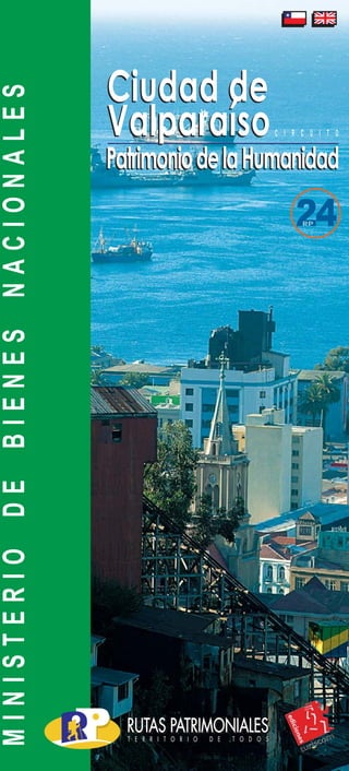
  • 1. tapa ok.FH11 Mon Dec 03 10:33:53 2007 Page 1 Composite PatrimoniodelaHumanidadPatrimoniodelaHumanidad C I R C U I T O MINISTERIODEBIENESNACIONALES Ciudad de Valparaíso Ciudad de Valparaíso
  • 2. tapa ok.FH11 Mon Dec 03 10:33:53 2007 Page 2 Composite RutaPatrimonialCiudaddeValparaís Playa Ancha Barrio Puerto Castillo San José Los Inmigrantes Barrio San Juan de Dios La Senda del Poeta B La UBICACION: La Ciudad de Valparaíso está situada en los 33º 2´ de Latitud Sur y 71º 38´ de Longitud Oeste, inserta en la Macrorregión Central de Chile. Ocupa el fondo de una ensenada que se extiende por 3 kilómetros y que se ha desarrollado arrebatando artificialmente espacio al mar, antecediendo al cordón de cerros que forman el anfiteatro de la bahía, la cual se inicia por el norte en la Punta de Osses, sector de Las Salinas de Viña del Mar, terminando en Punta Ángeles, 7,5 millas al sur. Esta bahía es enteramente abierta y está expuesta a los vientos del norte y noroeste.
  • 3. tapa ok.FH11 Mon Dec 03 10:33:53 2007 Page 3 Composite raíso:Patrimonio de la Humanidad Barrio de La Merced Los Miradores de las Delicias LOCATION The City of Valparaíso is located in 33º 2´ of South Latitude and 71º 38´ of West Longitude, in the middle of Chile’s central Macro-Region. It occupies the bottom of a 3 km cove which has been developed artificially gaining land to the sea, preceding the hill range that give birth to the bay amphitheater, which starts in Punta de Osses by the north, sector of Las Salinas of Viña del Mar, and ends at Punta Ángeles, 7.5 miles to the south. This is an entirely open bay which is exposed to north and north-west winds.
  • 4. tapa ok.FH11 Mon Dec 03 10:33:53 2007 Page 4 Composite ACCESS TO THE CITY From Viña del Mar, located 9 km to the north-east by the coast, you have to take Avenida España, connecting toAvenida Errázuriz traveling the city from east to west and with Avenida Argentina, that travels the road from north to south, ending at the feet of O'Higgins and Molino hills, that give birth to Avenida Santos Ossa, connecting the city to the capital, Santiago of Chile, located 119 km to the north-west. Colón, Errázuriz, Victoria and Pedro Montt Avenues end at Avenida Argentina, and will allow you to travel the urban range in which both neighborhoods and scopes identified in this topoguide are arranged. CLIMATE It has a coastal Mediterranean temperate climate with winter-time rains and an extended dry season. Average temperatures over the year are: El mes más lluvioso es junio, con cifras de hasta 28 milímetros, alcanzando un total de 450 milímetros durante el año y con un 75% de humedad media. ACCESOS A LA CIUDAD Desde Viña del Mar, que se encuentra a 9 km al noroeste por la costa, se accede porAvenida España, que se conecta con Avenida Errázuriz, recorriendo la ciudad de oriente a poniente y con Avenida Argentina, que la recorre de norte a sur, finalizando a los pies de los cerros O'Higgins y Molino, donde nace la Avenida Santos Ossa, que comunica a la ciudad con la capital, Santiago de Chile, distante a 119 km al norponiente. En la Avenida Argentina culminan las Avenidas Colón, Errázuriz, Victoria y Pedro Montt, que le permitirán recorrer el abanico urbano en el cual se ordenan los barrios y ámbitos señalados en esta topoguía. CLIMA Posee un clima templado de tipo mediterráneo costero, con lluvias invernales y estación seca prolongada. Sus temperaturas medias durante el año son: Primavera / Spring (septiembre – noviembre) Máxima Mínima 20º C 10º C Verano / Summer (diciembre – febrero) Máxima Mínima 23º C 13º Otoño / Autumn (marzo – mayo) Máxima Mínima 15º C 10º C Invierno / Winter (junio – agosto) Máxima Mínima 17° C 8° C June is the most rainy month with up to 28 millimeters, totaling 450 millimeters over the year, with 75% average humidity.
  • 5. tramos.FH11 Mon Jan 21 10:55:38 2008 Page 1 Ciudad de Valparaíso: Patrimonio de la Humanidad …allí el mar "no contenido por toscos pretiles, penetraba con las mareas hasta besar el pié de los quillayes y los boldos… ... mientras en las desnudas colinas, como un ejército de gigantes en atalaya, mecían sus esbeltas copas, agitadas por el viento, las palmas reales"... Valparaíso, que no tuvo funda­ ción, es una ciudad adherida al mar, configurada por largas calles que, de oriente a poniente, van uniendo distintos núcleos y espa­ cios urbanos, con plazas estable­ cidas al final de las quebradas, las cuales imponen la diferencia que existe entre un barrio o “cerro” y otro. El antiguo Valle de Quintil, actual Valparaíso, es hoy una gran ciu­ dad que a pasar de su aparente desorden urbano, es fácil de reco­ rrer.Aprimera vista, su topografía intrincada se nos presenta como un laberinto imposible de resolver, pero al mismo tiempo las reglas del juego son tan simples que uno puede orientarse fácilmente. Se aprende rápidamente que a un lado está el mar y al otro los ce­ rros, los dos límites de la ciudad. “Es una ciudad con frente y con espaldas, con horizontes muy definidos. Nadie se pierde en Valparaíso.” (Citado por Renzo Pecchenino “Lukas” en Apuntes Porteños). Valparaíso, which was never founded, is a city adhered to the sea, configured by long streets which connect different urban communities and spaces to squares established at the end of streams, from east to west, imposing the difference existing between a neighborhood or “hill” and the other. The old Valley of Quintil, now called Valparaíso, is today a big city which, in spite of its apparent urban disorder, is easy to travel. Its entangled topography may seem a labyrinth impossible to solve at first sight, but game rules are at the same time so simple that you will orient yourself easily. You will quickly realize that you have the sea on one side and the hills on the other, which are the two limits of the city. “This is a city with a front and a rear part, with very-well defined horizons. None gets lost in Valparaíso” (quoted by Renzo Pecchenino “Lukas” in Apuntes Porteños). … there the sea "not contained by rough stone railing, penetrated with tides until kissing the feet of quillais and boldos … ... while at nude hills, as an army of giants in a watchtower, the royal palms, waved by the wind, rocking their graceful crowns“ ...
  • 6. tramos.FH11 Mon Jan 21 10:55:38 2008 Page 2 Recorrer la Ruta Patrimonial Ciudad de Valparaíso es una invitación a ser testigo de las diver­ sas etapas de la vida de esta ciudad. Desde el mar hacia los cerros nacieron, se desarrollaron y con­ centraron, las diversas actividades humanas, disemi-nándose en torno a la bahía las huellas del progreso de esta ciudad y el país. De esta forma se constituye en la actualidad un verdadero polo del patrimonio nacional, que desde su epicentro en el Barrio Puerto y más precisamente en la Iglesia de La Matriz, muestra los testimonios que dan cuenta de las oleadas de vida que le ganaron espacio al mar y fueron transformando a Valparaí­ so en lo que es hoy, una ciudad Patrimonio de la Humanidad. La Organización de las Na­ ciones Unidas para la Educación, la Ciencia y la Cultura (UNESCO) declaró como Patrimonio Cultural de la Humanidad el Casco Histórico de la Ciudad de Valparaíso con un área de protección de 24 hectáreas desde la Iglesia la Matriz hasta el Traveling the City of Valparaí­ so Heritage Route is an invitation to witness the different stages of life in this city. Different human activities were born, developed and concentrated from the sea to the hills, spreading progress marks of both this city and the country around the bay. It is thus currently a true pole of national heritage, which from its epicenter at Barrio Puerto (Port Neighborhood) and, specifically, at Iglesia de La Matriz (The Matrix Church), shows the testimonies that talk about waves of life that took space from the sea and transformed Valparaíso into what it is today, a World Heritage City. TheUnitedNationsEducational, Scientific and Cultural Organization (UNESCO) declared the Historical Area of the City of Valparaíso as World Cultural Heritage with a 24 hectare protected zone from The Ma­ trix Church to Concepción Hill, and with a 43 hectare buffer zone, from Wheelwright Square to Aníbal Pinto Square.
  • 7. tramos.FH11 Mon Jan 21 10:55:38 2008 Page 3 Cerro Concepción, y con un área de amortiguación de 43 hectáreas, desde la Plaza Wheelwright hasta la Plaza Aníbal Pinto. Además,laCiudaddeValparaí­ so contiene una gran cantidad de elementos urbanos declarados como Monumentos Nacionales, siendo estos destacados en los contenidos de esta topoguía, señalando su año de declaración como Monumentos Nacional. DESCRIPCION GENERAL DE LA RUTA La Ciudad de Valparaíso era hasta el siglo XX el punto de con­ tacto con el exterior de un país confinado por su ubicación en el extremo sur de América. Entre los hielos australes, los desiertos del norte y la cordillera andina, su peculiar emplazamiento permite apreciar la inmensidad del Océano Pacífico. Es Es una de las ciudades más an­ tiguas de Chile. Sus orígenes se re­ montan a 1536 y por su calidad de Inaddition,theCityofValparaí­ socontainsalargenumberofurban elements declared National Monu­ ments, which are highlighted in thesetopoguidecontents,indicating theyearinwhichtheyweredeclared National Monuments. GENERAL DESCRIPTION OF THE ROAD The City of Valparaíso was until the XXth century the contact point with abroad for a country confined for being located in the southern end of America. Its peculiar location, among austral ices, northern deserts, and Andean cordillera, allows to ap­ preciate the imvastedadmensity of the Pacific Ocean. This is one of the oldest cities in Chile. Its origin dates back to 1536 and, due to its status of main port of the kingdom, it played a crucial part in the process of na­ tional emancipation. As the heir of an historical past that provides it with a
  • 8. tramos.FH11 Mon Jan 21 10:55:38 2008 Page 4 principal puerto del reino ejerció un papel determinante en el proceso de emancipación nacional. Heredera de un pasado histórico que le confiere una identidad única. En el siglo XIX acogió a sucesivas oleadas de inmigrantes, principal­ mente europeos, lo que le confirió un carácter cosmopolita y pluralista. Testimonio de esta riqueza es la het­ erogénea arquitectura que se observa al recorrer el plan y los cerros. Capital de la Quinta Región de Valparaíso y de la Provincia del mis­ mo nombre, forma parte de la conurbación del Gran Valparaíso que incluye además a Viña del Mar, Concón, Quilpué y Villa Alemana. Sucascohistóricofuedeclaradocomo Patrimonio de la Humanidad por la UNESCO en el año 2003. Es sede del Poder Legislativo de la República de Chile, además de otras reparti­ cionesestatalescomolaComandancia en Jefe de la Armada de Chile, el Servicio Nacional de Aduanas y el Consejo Nacional de la Cultura y las Artes. Cuenta con cuatros univer­ sidades tradicionales, con el diario en habla hispana más antiguo del mun­ do, El Mercurio de Valparaíso, y con unique identity, it received suc­ cessive waves of immigrants in the XIXth century, mostly from Europe, that determined its cos­ mopolitan and pluralist nature. The heterogeneous architecture that may be seen when traveling both the plan and the hills is a testimony of this richness. Capital of Region Five of Valparaíso and of the Province de Valparaíso of the same name, it is part of Gran Valparaíso conurbation, that also includes Viña del Mar, Concón, Quilpue Quilpué, and Villa Alemana. Its historical area was declared World Heritage by UNESCO in 2003. It lodges the headquarters of the Legislature of the Repub­ lic La ciudad es of Chile, as well as other state divisions, such as, the Command-in-Chief of the Chilean Navy, the National Cus­ toms House Service, and the Na­ tional Council for Culture and Arts. It houses four traditional universities, and the world’s old­ est newspaper in Spanish, as well as the second oldest profes­ sional soccer team in South-
  • 9. tramos.FH11 Mon Jan 21 10:55:38 2008 Page 5 AMBITO / SCOPE HITO / GUIDE POST ELEMENTOS URBANOS PLAYA ANCHA CASAS DE GRAN BRETAÑA 14 PLAZA WADDINGTON 4 PASEO 21 DE MAYO 5 BARRIO PUERTO PLAZA WHEELWRIGHT 4 PLAZUELA LA MATRIZ 5 SENDAS DE SANTO DOMINGO 4 PLAZA ECHAURREN 7 CASTILLO SAN JOSE CALLE SERRANO Y PASAJES BARRIO PUERTO 5 PLAZA ELEUTERIO RAMIREZ 7 UNION OBRERA 6 PLAZA JUSTICIA 5 PLAZA SOTOMAYOR 10 LOS INMIGRANTES PASEO YUGOESLAVO 8 CALLE PRAT 12 PLAZA SAN LUIS 10 IGLESIA ANGLICANA Y PASEO DE LOS 14 ASIENTOS 7 PASEO GERVASONI 6 PASEO ATKINSON 9 BARRIO SAN JUAN DE DIOS PLAZA ANIBAL PINTO 6 PARQUE CULTURAL EX CARCEL DE VALPARAISO 6 PLAZUELA ECUADOR 5 PLAZA BELLAVISTA 5 LA SENDA DEL POETA PLAZA DE LA VICTORIA 9 CALLE CONDELL 8 MUSEO A CIELO ABIERTO 11 LA SEBASTIANA 4 BARRIO DE LA MERCED ASCENSOR FLORIDA 5 ASCENSORES MARIPOSAS Y MONJAS 4 PARQUE ITALIA 9 CALLE HONTANEDA 8 PLAZA O'HIGGINS 11 MUELLE BARON 6 LOS MIRADORES DE LAS DELICIAS ASCENSORES LECHEROS Y BARON 6 ASCENSOR LARRAIN 4 ASCENSOR POLANCO 3 8 35 238 el segundo equipo de fútbol pro­ fesional más antiguo de América delSur,SantiagoWanderersfunda­ do el 15 de agosto de 1892. La topoguia de la Ruta Pat­ rimonial Ciudad de Valparaíso entrega en sus contenidos una gal­ ería de 238 elementos urbanos que demuestran la riqueza cultural y arquitectónica de este patrimonio mundial, donde se exhiben agru­ pados en 35 hitos ordenados a su vez en 8 ámbitos, que se pueden recorrer a pie durante todo el año. Además es posible disfrutar de recorridos en lancha por toda la bahía y viajar por subidas y caminos en buses urbanos por los cerros del anfiteatro natural de la Ciudad de Valparaíso. La siguiente tabla describe los ámbitos que conforman la ruta, indicando a su vez cada hito con sus correspondiente cantidad de elementos urbanos. America - Santiago Wanderers, founded on August 15, 1892. The City of Valparaíso Her­ itage Route topoguide contains a gallery of 238 urban elements that show both cultural and ar­ chitectural richness of this world heritage, arranged in 35 guide­ posts divided in turn into 8 scopes, which may be walked all year round. You may also take boat tours across the bay and travel by lifts and roads in urban buses by the hills of City of Valparaíso natural amphitheater. The table shown below de­ scribes the scopes that make up the route, indicating in turn each guidepost with its corresponding number of urban elements:
  • 10. tramos.FH11 Mon Jan 21 10:55:38 2008 Page 6 Playa Ancha Ambito 1 Entre los sectores de mayor identidad urbana de la Ciudad de Valparaíso encontramos al Cerro Playa Ancha, cuyo centro fundacional se encuentra en lo que hoy conocemos como Cerro Artillería, que debe su nombre a los fuertes y baterías de defensa localizados en este sector. Es un sector tradicional muy relaciona­ do a los usos que nuestro puerto ha dedicado a las funciones de defensa nacional, encontrándose en reparticiones del Ejército y la Armada, dado que en 1885 se construye el antiguo edificio de la Escuela Naval, hoy Museo Na­ val, junto con el Ascensor Artill­ ería (Monumento Histórico 1998), construido posteriormente. La actual Avenida Gran Bretaña es el primer tramo de la construcción del Camino Cintura y la Avenida Alemania, lo que facilita recorrer Among the sectors of higher urban identity of the City of Val­ paraiso we find Hill PlayaAncha, which foundation center locates where we currently know as Ar­ tillería Hill, which name is due to fortress deand defense bat­ teries located in this sector. It is a traditional sector closely relat­ ed to the uses dedicated by our port to national defense parafunctions and where you can find divisions of the Army and Navy as in Ejercito1885 the old building of the Naval School - currently Naval Museum - was constructed together with the Artillería Lift (Historical Monu­ ment 1998), of later construc­ tionel. The current Gran Bretaña Avenue is the first segment of the construction of Cintura Road and Alemania Avenue, facilitat­ ing the transversal tour through Plaza Waddington Casas de Gran Bretaña Paseo 21 de Mayo
  • 11. tramos.FH11 Mon Jan 21 10:55:38 2008 Page 7 transversalmente los cerros de Valparaíso. Destacan de la Avenida Gran Bretaña su arquitectura influenciada por estilos europeos, con sus construcciones materializa­ das casi completamente en madera, y la Plaza Wad­ dington, la cual evoca a la familia propietaria de los terrenos que permitieron el inicio del desarrollo urbano en el Cerro Playa Ancha. En este sector aprecia­ remos la arquitectura tradi­ cional de las Casas de Gran Bretaña, las cuales se dis­ tribuyen desde el Paseo 21 de Mayo, pasando por el entorno de Plaza Wadding­ ton hasta llegar al extremo de la península de Playa Ancha en la Escuela Naval. PlayaAncha the hills of de la Ciudad Valparaíso. Gran Bretaña Avenue highlights for its ar­ chitecture influenced by Eu­ ropean styles with its con­ structions materialized almost totally in wood, and Waddington Square, that evokes the family owner of those lands who enabled the urban development in Playa Ancha Hill. In this sector we appre­ ciate traditional architecture of Gran Bretaña Houses, which distribute from 21 of Mayo Promenade passing through the surroundings of Waddington Square until arriving to the end of a laPlaya Ancha peninsula in the Naval School.
  • 12. tramos.FH11 Mon Jan 21 10:55:38 2008 Page 8 CASAS DE GRAN BRETAÑA Alo largo de laAvenida Gran Bretaña es posible apreciar un conjunto de viviendas que caracterizan un tradicional estilo arquitectónico propio del barrio de Playa Ancha. Predominando el uso de madera importada tanto en las estructuras de pino oregón como en los revestimientos en madera de lingue, los constructores de principios de siglo, recrearon a la perfección el estilo neogótico europeo. Este conjunto de viviendas en particular, fueron construidas con posterioridad al terremoto de 1906, aproximadamente alrededor de 1912 y responden al periodo de mayor bonanza económica del puerto gracias a las crecientes exportaciones del salitre en el norte de Chile. GREAT BRITAIN HOUSES You may see a group of houses that characterize the traditional and inherent architectural style of Playa Ancha Neighborhood along Gran Bretaña Avenue. With a predominant use of imported wood both in Oregon pine structures and in Lingue wood coatings, constructions of the beginning of the century were perfect recreations of the European neoghotic. In particular, this group of houses was built after the earthquake of 1906, around 1912 and respond to the period of highest economic prosperity in the port thanks to increasing saltpeter exports in the north of Chile. N` CONTENIDO 1 FUERTEESMERALDAMH-1963 2 MIRADORAVENIDAERRAZURIZECHAURREN 3 CASA Av.ERRAZURIZECHAURREN518 4 CASA Av.ERRAZURIZECHAURREN489 5 CASACALLESANTAMARIA251-253 6 CASA Av.ERRAZURIZECHAURREN405-415 7 CASAGRANBRETAÐA766 8 CASAGRANBRETAÐA761 9 REGISTROELECTORAL 10 SERV.HIDROGRAFICOYOCEANOGRAFICODELAARMADA 11 PASAJEHARRINGTON 12 COMPLEJOUNIVERSITARIO 13 ESCUELANAVALARTUROPRAT Plaza Waddington Casas deGran Bretaña
  • 13. tramos.FH11 Mon Jan 21 10:55:38 2008 Page 9 PlayaAncha
  • 14. tramos.FH11 Mon Jan 21 10:55:38 2008 Page 10 PLAZA WADDINGTON Esta Plaza se encuentra en el epicentro del barrio tradicional de Playa Ancha y debe su nombre a uno de los porteños más ricos del siglo XIX, Don Joshua Waddington. Este empresario inglés, dueño no solo de los terrenos colindantes a esta plaza sino que de gran parte de los terrenos del puerto, formaba parte de la creciente élite de inmigrantes que a mediados del siglo XIX llegaba a este lejano país en busca de fortuna. Una de sus más notables obras fue ser parte del grupo inversionista que impulsó la construcción del primer ferrocarril a vapor que, inaugurado en 1863, unía al puerto con la capital. Esta plaza fue un lugar importante de encuentro, ya que contaba con el Teatro Iris y el Odeón, famosos por las exhibiciones de obras de teatro, zarzuela y posteriormente por las primeras películas amenizadas con piano. WADDINGTON SQUARE This Square is located at the epicenter of traditional neighborhood of Playa Ancha and was named out of the richest man from Valparaíso in the XIXth century, Mr. Joshua Waddington. This English businessman, who was not only the owner of the lands adjacent to this square, but also of most of port lands, was part of the increasing immigrant elite who arrived to this remote country looking for fortune mid the XIXth century. One of his major legacies was being a member of the investor group that promoted the construction of the first steam railroad that connected the port to the capital and was inaugurated in 1863. This square was an important meeting place, since it housed Theater Iris and the Odeon, famous for exhibitions of plays, zarzuela and – later – the first piano-animated movies. Casas de Gran Bretaña Plaza Waddington a Paseo 21 de Mayo
  • 15. tramos.FH11 Mon Jan 21 10:55:38 2008 Page 11 PlayaAncha Nº CONTENIDO 1 CASA HABITACION GRAN BRETAÑA 3 CASA HABITACION CALLE PEDRO LEON GALLO 413 4 ASCENSOR VILLASECA - MH 1998
  • 16. tramos.FH11 Mon Jan 21 10:55:38 2008 Page 12 PASEO 21 DE MAYO Ubicado en el cerro Artillería, constituye un espacio abierto de privilegiada ubicación sobre la bahía, desde él se aprecian los antiguos almacenes fiscales, las bodegas portuarias, y el movimiento del puerto, así como la vida artística que bajo el tupido follaje de pitosporos y jacarandas expone sus obras. Este largo paseo peatonal, se articula entre pérgolas que se asoman a la bahía, el ascensor Artillería y el acceso al Museo Naval. Este hermoso edificio fue construido en 1884 para albergar la Escuela Naval hasta 1967. Hoy alberga a la Escuela de Abaste- cimientos, el Museo Naval, el Centro de Estudios Históricos y otras dependencias. MAY 21 PROMENADE At Cerro Artillería, this is an open space of a privileged location over the bay, from which you may watch the old fiscal storehouses, port warehouses, and port movements, as well as artistic life displaying its works under pitosporo and jacaranda dense foliage. This long pedestrian promenade is articulated among pergolas that lean out to the bay, Artillería lift and access to the Naval Museum. This beautiful building was built in 1884 to lodge the Navy School until 1967. It currently houses the School of Supplies, the Naval Museum, the Center for Historical Studies, and other facilities.
  • 17. tramos.FH11 Mon Jan 21 10:55:38 2008 Page 13 PlayaAncha Nº CONTENIDO 1 CASA ARTILLERIA 156 2 MUSEO NAVAL 3 ASCENSOR ARTILLERIA - MH 1998 4 VIEJOS ALMACENES Paseo 21 de Mayo a Plaza Waddington Plaza Aduna
  • 18. tramos.FH11 Mon Jan 21 10:55:38 2008 Page 14 Barrio Puerto Ambito 2 La bahía de Valparaíso, an­ teriormente conocida como Bahía de Quintil, fue descubierta en los primeros días de septiembre de 1536 por el capitán Juan de Saavedra, al separarse de las filas comandadas por Don Diego de Almagro, primer conquistador español en llegar a estos parajes. El núcleo original de la Ciu­ dad de Valparaíso se encuentra en lo que hoy denominamos Ba­ rrio Puerto (Zona Típica 2001), donde destaca la localización de su primer muelle, su primera igle­ sia y sus primeras rutas de co­ nexión con el país. Este núcleo original nace en el sector bajo de la quebrada de San Francisco, lo que hoy corresponde a la Plaza Echaurren y el entorno de la Igle­ sia de La Matriz (Monumento His­ tórico 1971). En 1818 se fundó la Escuela Naval con el nombre The bay of Valparaíso, pre­ viously known as Quintil Bay, was discovered during the first days of September, 1536 by the Captain Juan of Saavedra, upon separating from the rows com­ manded by Mister Diego of Al­ magro, first Spanish conqueror arriving to these lands. The original core of Valpa­ raíso City locates where we cu­ rrently call Barrio Puerto (Typi­ cal Zone 2001. The location of its first pier, first church and first connection roads with the coun­ try are noticed here. This original core generates in the lower sec­ tor of the San Francisco stream, which currently corresponds to Echaurren Square and the su­ rroundings of La Matriz Church (Historical Monument 1971). In 1818, the Naval School was founded with the name of Mari­ Plazuela La Matriz Sendas de Santo Domingo
  • 19. tramos.FH11 Mon Jan 21 10:55:38 2008 Page 15 BarrioPuerto de Academia de Jóvenes Guardiamarinas y en el año 1827 el Diario El Mercurio, saca su primera impresión, en una vieja casona ubicada en la subida La Matriz, sien­ do hoy el periódico de habla hispana más antiguo del mundo.. No podemos dejar de visitar en este sector la Pla­ zaAduana, donde comienza desde el poniente nuestro Barrio Puerto, descubriendo los rincones y pasadizos de las Sendas de Santo Domin­ go, llegando hasta la majes­ tuosidad de la Plazuela de La Matriz y encontrando el origen de esta ciudad en el entorno de la Plaza Echau­ rren. ne Guard Youth Academy and in the year 1827, El Mercurio Newspaper pu­ blished its first printing in an old large house located in the ascension of La Ma­ triz and being today the oldest Spanish–speaking newspaper around the world. We cannot omit the vi­ sit of Aduana Square in this sector. It is the origin of our Port Neighborhood from the west, discovering re­ mote places and alleys in the Tracks of Santo Domin­ go, arriving to the majesty of La Matriz Small Square and finding the origin of this city in the surrounding of Echaurren Square. Plaza Aduana Plaza Echaurren
  • 20. tramos.FH11 Mon Jan 21 10:55:38 2008 Page 16 WHEELWRIGHT SQUARE Also know as Plaza Aduana (Customs House Square), this square is located at the feet of Juan Gómez stream, currently named Carampangue street, between Cerro Artillería and Cerro Arrayán. Strategic location of this square has made it play key roles in different epochs of this port. Since 1552, when the first berthing place of the bay was installed here, a precarious construction that probably had more warehouses than houses. Later, in 1594, started there the construction of the first colonial fortified redoubt named Fort San Antonio, which mid XVIIth century was named “Castillo Viejo” (Old Castle), since it was practically on the point of collapsing. This place was afterwards used as the first rooster coliseum, and much later – in 1848 – fiscal storehouses were built, which together with the new Customs House building – designed by Juan Brown and finished in 1855 – become a vigorous pole of urban activity where horse cars (the city tramway) arrived, and the first diligence departed to Santiago. This traditional 55 m front building of colonial style, with thick 1.2 m brick walls, is still standing today. It lodges the Customs House Directorship, and was declared National Monument in 1976. Finally, Wheelwright Square, named in honor of the outstanding English engineer William Wheelwright, who brought the most state-of-the-art technology of mid XIXth century to Chile: telegraph, railroad, and steam navigation. A statue placed in the center of the square reminds us of the stay of this renowned English citizen by this port. PLAZA WHEELWRIGHT También conocida como plaza Aduana, esta plaza se ubica a los pies de la quebrada de Juan Gómez hoy calle Carampangue, entre los cerros Artillería y Arrayán. La estratégica ubicación de esta plaza la ha situado como protagonista en diversas épocas de la vida de este puerto. Desde 1552 cuando se instala en el lugar el primer fondeadero de la bahía, precaria construcción que contaba probablemente con más bodegas que viviendas, mas tarde en 1594 allí se inició la construcción del primer reducto fortificado colonial llamado fuerte San Antonio, que a mediados del siglo XVII pasó a llamarse el “Castillo Viejo”, pues se encontraba prácticamente en ruinas. Luego funcionó en el lugar el primer coliseo de gallos y mucho más tarde en 1848 se construyeron los almacenes fiscales que junto al nuevo edificio de la Aduana diseñado por Juan Brown y terminado en 1855, se convirtió en un vigoroso sitio de actividad urbana donde llegaban los carros de sangre, el tranvía de la ciudad, y partía la primera diligencia a Santiago. Actualmente aun se puede apreciar el tradicional edificio, de estilo colonial, con sus 55 m de frente, sus gruesos muros de 1.2 m de ladrillos, que alberga a la dirección de Aduanas y fue declarado Monumento Nacional en 1976. Por ultimo la Plaza Wheelwright, llamada así en honor al destacado ingeniero inglés William Wheelwright, quien a mediados del siglo XIX introdujo en Chile los últimos avances tecnológicos de la época; el telégrafo, el ferrocarril y la navegación a vapor, cuenta en su centro, con una estatua que nos recuerda el paso por este puerto, de este ilustre ciudadano ingles.
  • 21. tramos.FH11 Mon Jan 21 10:55:38 2008 Page 17 BarrioPuerto Plaza Aduana a Paseo 21 de Mayo a plazuela de La Matriz a plaza Echaurren Nº CONTENIDO 1 EDIFICIO ADUANA - MH 1976 2 EDIFICIO PLAZA ADUANA 157 3 MIRADORES Y PASAJE ALMIRANTE RIVEROS
  • 22. tramos.FH11 Mon Jan 21 10:55:38 2008 Page 18 PLAZUELA DE LA MATRIZ Una pequeña capilla con techo de paja, donde hoy se ubica el atrio de la Iglesia La Matriz del Salvador (Monumento Histórico 1971), fue levantada alrededor de 1559, a partir de ella se crearía el primer núcleo urbano de Valparaíso. Se cuenta que en 1688, con motivo de un terremoto, el mar habría comenzado a subir y se detuvo al llegar a las gradas del atrio de la iglesia. Desde entonces se ha reconstruido esta iglesia en el mismo lugar unas cinco veces, dando forma a una de las plazas mejor logradas del puerto. La caracterizan también los edificios construidos a su alrededor a fines del siglo XIX y principios del siglo XX, algunos de los cuales han sido rehabilitados con fines de vivienda e instituciones particulares. El 12 de septiembre de 1827 en un inmueble ubicado a un costado de esta iglesia don Pedro Félix Vicuña instala la imprenta de la cual saldrá la primera edición del Mercurio de Valparaíso, que a la fecha es el mas antiguo diario de habla hispana. THE MATRIX SMALL SQUARE A straw roofed small chapel, that lodges the atrium of La Matriz del Salvador Church (Historical Monument 1971), was erected around 1559, and the first urban community of Valparaíso was developed from this site. The story tells that in 1688, by reason of an earthquake, the sea started to go up and stopped when arriving to the stairs of the church atrium. This church has been reconstructed in the same place around five times, giving shape to one of the best squares of the port. It is also characterized by the buildings built around it late the XIXth century and early XXth century, some of which have been rehabilitated for housing purposes and to lodge private institutions. On September 12, 1827 in a building located at one side of this church, Don Pedro Félix Vicuña installed the printshop that would give birth to the first edition of El Mercurio de Valparaíso, which is the oldest newspaper in Spanish.
  • 23. tramos.FH11 Mon Jan 21 10:55:38 2008 Page 19 BarrioPuerto Plazuela de La Matriz Plaza Echaurren Sendas de Santo Domingo a Plaza Aduana Nº CONTENIDO 1 IGLESIA LA MATRIZ - MH 1971 2 CENTRO DE ESTUDIOS DUC 3 CASA SANTO DOMINGO 4 POBLACION MARQUEZ
  • 24. tramos.FH11 Mon Jan 21 10:55:38 2008 Page 20 SENDAS DE SANTO DOMINGO En torno a la iglesia de La Matriz se instaló a su llegada, la orden de los jesuitas. El terreno que ocuparon, actualmente corresponde al edificio de la Ex 2º Comisaria de Puerto que aun permanece en el lugar. En un comienzo en 1730 los religiosos construyeron su templo, el cual fue conocido como la Rotonda por su forma circular. Luego en el año 1767 tras la expulsión de los jesuitas de todos los territorios españoles, el lugar queda en manos de la administración real de ese momento, quienes se lo ceden a los padres de la congregación Santo Domingo, de donde toma el nombre el cerro contiguo. Mas adelante durante 1828 y ya sin los padres dominicos en el lugar, la deteriorada estructura que sufrió el terremoto de 1822, acoge al congreso nacional Constituyente, que presidido por don Francisco Ramón Vicuña sanciona un 4 de julio la constitución nacional de 1828. Desde entonces y hasta 1906 la esquina de calle Santiago Severin y Santo Domingo se asoció al orden público. En sucesivos edificios que los terremotos se encargaban de botar, los Guardias Cívicos y la Policía tuvieron sus cuarteles, hasta que en 1910, luego de otro terremoto, el destacado arquitecto chileno Manuel Aldunate construye el actual edificio para los Carabineros de Chile. El nuevo edificio de rasgos europeos y estilo neo – clásico constituye el umbral del Cerro Santo Domingo. Este cerro se destacó por ser el primero en poblarse, lo cual es posible apreciar al recorrer sus intrincados pasajes y paseos peatonales, recientemente recuperados, es un ejemplo de espacio público determinado a partir de la morfología de los cerros y quebradas, donde además se ubicaron las añosas residencias que se aprecian hoy. SANTO DOMINGO PATHS The Order of the Jesuits was installed at its arrival around La Matriz Church. The land they occupied is now the building of the Ex 2nd Port Commissioner’s Office that is still there. At the beginning, the priests built their temple in 1730, which was known as La Rotonda (the rotunda) for his round shape. In 1767, after the expulsion of the Jesuits from all the Spanish territories, the place was left in the hands of the Royal Administration, that assigned it to the priests of Santo Domingo congregation, out of which the adjacent hill was named. Over 1828, when Dominican priests were no longer in this place, the structure quite damaged by the earthquake of 1822, received the National Constituent Congress which, presided by Don Francisco Ramón Vicuña, approved the National Constitution of 1828 on July the 4th. Since then and to 1906, the corner of Santiago Severin and Santo Domingo streets was connected to public order. The Civic Guards and the Police had their headquarters in successive buildings that were torn down by earthquakes, until 1910, when after another earthquake, the renowned Chilean architect Manuel Aldunate built the current building of Carabineros de Chile (the Chilean Police). The new building of European features and neo-classic style, constitutes the lintel of Santo Domingo Hill. This hill was the first one in being settled, what can be appreciated when traveling its recently recovered complex alleys and pedestrian promenades. This is an example of public space determined by hill and stream morphology, which also lodges aged residences still in use.
  • 25. tramos.FH11 Mon Jan 21 10:55:38 2008 Page 21 BarrioPuerto Nº CONTENIDO 1 PLAZA SAN FRANCISCO 2 CALLE CAJILLA Y PASAJE MATRIZ 3 PASAJE JUVENAL Y POSADA O'HIGGINS Plazuela de La Matriz Sendas de Santo Domingo aPlazaEchaurren
  • 26. tramos.FH11 Mon Jan 21 10:55:38 2008 Page 22 PLAZA ECHAURREN Esta plaza (Zona Típica 2001) nació como una pequeña explanada junto a la playa que recibía las aguas de la quebrada San Francisco. Frente a ella vararon los primeros barcos y partían las diligencias a Santiago por el llamado “Camino de las carretas” que subía desde el puerto por la actual calle Echaurren. Durante el siglo XVIII, estando todavía la línea de alta marea en la calle Cochrane y la playa hasta calle Serrano, esta explanada que ya contaba con un embarcadero en la desembocadura de la quebrada, pasó a llamarse la Plaza del Gobernador o Plaza de Armas, pues allí se encontraba la casa del gobernador a la cual se accedía por la esquina de la plaza cruzando la “Puerta del Caracol”, hoy llamada calle Castillo. Mas tarde aquí sesionó por primera vez el cabildo de Valparaíso, un 17 de Abril de 1791, desde entonces en esta fecha se celebra el aniversario de la ciudad. ECHAURREN SQUARE This square (Typical Zone 2001) was born as a small esplanade by the beach that was bathed by San Francisco stream waters. The first ships ran aground in front of the square, and was also the place from which diligences departed to Santiago by the so-called “Cart Road” that climbed up from the port by the current Echaurren street. Over the XVIIIth century, the high tide line was still at Cochrane street and the beach arrived to Serrano street, this esplanade that was already provided with a quay at the stream outlet, was then called Plaza del Gobernador or Plaza de Armas (Governor’s Square or Central Square), since it lodged the governor’s house, that was accessed by the corner of the square, crossing “Puerta del Caracol” (Snail Door), today called Castillo street. The Town Hall of Valparaíso held here its first session on April 17, 1791, and this is the date in which the anniversary of the city is celebrated. Nº CONTENIDO 1 EDIFICIO TASSARA O EDIFICIO LIBERTY 2 EDIFICIO DEL CASTILLO 3 EDIFICIO CAJA DE CREDITO HIPOTECARIO 4 EDIFICIO ASTORECA 5 MERCADO PUERTO 6 EDIFICIO BUSTAMANTE 99 Plazuela de La Matriz Plaza Echaurren a Plaza Eleuterio Ramírez a Calle Serrano a Plaza Aduana
  • 27. tramos.FH11 Mon Jan 21 10:55:38 2008 Page 23 BarrioPuerto
  • 28. tramos.FH11 Mon Jan 21 10:55:38 2008 Page 24 Ambito 3 Este sector lleva el nombre del antiguo Castillo San José, fortificación levantada en el ac­ tual cerro Cordillera (Zona Típica 2001), cuya construcción se realizo entre los años 1682 y 1692. Este fuerte poseía bate­ rías emplazadas a diferentes niveles y el conjunto se desarro­ llaba escalonándose en la abrupta ladera del cerro. En el período colonial de nuestro país, este fuerte ya presentaba un gran deterioro, colapsando finalmente por la acción del te­ rremoto del 19 de Noviembre de 1822. En la Era Republicana, los terrenos dejados por el anti­ guo fuerte fueron loteados para su posterior poblamiento, siendo habitado, entre otros, por la fa­ milia Mouat, de origen escocés, quienes levantaron una casona que albergó el primer observa­ torio astronómico del país. Esta Castillo San Jos This sector has the name of the old San José Castle, a fortress constructed in the cu­ rrent Cordillera Hill (Typical Zone 2001), which construc­ tion was made between the years 1682 and 1692. This fortress had batteries placed at different levels and the who­ le group developed with an arrangement at different inter­ vals in the abrupt hillside. In the Colonial period of our country, this fortress already showed great damages, finally collapsing with the earthquake action in November 19, 1822. In the Republican Age, lands left by the old fortress were subdivided to further populate them. They were finally inha­ bited, among others, by the Mouat family, of Scottish ori­ gin, who constructed a large house that housed the first Calle Serrano Pasajes Barrio Puerto Plaza Eleuterio Ramírez Plaza Justicia Plaza Justicia
  • 29. tramos.FH11 Mon Jan 21 10:55:38 2008 Page 25 construcción, conocida actual­ mente como Museo Lord Co­ chrane (Monumento Histórico 1963), es una de las viviendas más antiguas que posee en la actualidad la Ciudad de Val­ paraíso. Para conocer este sector debemos recorrer la calle Se­ rrano y el sistema de pasajes que le acompañan, subir hasta la plaza Eleuterio Ramírez, la cual es acompañada por el ascensor Cordillera y por her­ mosos miradores, hasta llegar al entorno de la Unión Obrera, imponente construcción colec­ tiva característica de la historia porteña. Posteriormente des­ cenderemos por el ascensor San Agustín hasta la plaza de Justicia, la cual sirve de ante­ sala para alcanzar la plaza Sotomayor (Zona Típica 1982) y el Muelle Prat. CastilloSanJosé osé astronomical observatory in the country. This construc­ tion, currently known as Lord Cochrane Museum (Historical Monument 1963), is one of the oldest housing of Valparaíso City at the pre­ sent. To know this sector, we must run Serrano street and the alley system beside it; go upwards to Eleuterio Ra­ mírez square, which is next to the Cordillera lift and beautiful miradors, until arri­ ving to the surrounding of Unión Obrera, a grandiose collective construction typi­ cal in the port history. Later, we go downwards in San Agustín lift until Justicia Square, which is the ante­ room before arriving at So­ tomayor Square (Typical Zo­ ne 1982) and the Prat Pier. Plaza Sotomayor
  • 30. tramos.FH11 Mon Jan 21 10:55:38 2008 Page 26 CALLE SERRANO A los pies del fuerte San José se encontraba una de las calles mas importantes del puerto que concentraba prácticamente todo el comercio de la naciente ciudad, era conocida como la Planchada y para 1822 era la única vía adoquinada del puerto. Debido a la apertura del libre comercio mundial se instalaron allí las familias adineradas, quienes construyeron verdaderos palacios para los nuevos usos comerciales, portuarios y residenciales, transformando esta arteria en una de las más prestigiosas de la ciudad. Allí se instalaron los más finos hoteles de América del Sur, como el Hotel Rolff, que ocupó el edificio construido en 1897 para la familia Lyon, junto al ascensor Cordillera, a un costado de la conocida escalera Cienfuegos. SERRANO STREET One of the most important streets in the port, that concentrated practically all the business activity of the emerging city, was located at the feet of San José Fort. It was known as La Planchada and was, by 1822, the only paved way in the port. Wealthy families, that had arrived to the port as a result of the opening of world free trade, settled there and built true palaces for these new business, port-related and residential purposes, transforming this road into one of the most prestigious in the city. The finest hotels in America were installed there, such as, Rolff Hotel, that occupied a building built in 1897 for the Lyon family, next to Cordillera lift, on one side of the popular Cienfuegos stair.
  • 31. tramos.FH11 Mon Jan 21 10:55:38 2008 Page 27 CastilloSanJosé Calle Serrano y Pasajes Barrio Puerto Plaza Sotomayor Plaza Eleuterio Ramírez a Plaza Echaurren Nº CONTENIDO 1 EDIFICIO GUILLERMO RIVERA 2 EDIFICIO ATALAH - CALLE SERRANO 3 EDIFICIO LA NAVE
  • 32. tramos.FH11 Mon Jan 21 10:55:38 2008 Page 28 PLAZA ELEUTERIO RAMIREZ Este importante lugar de en­ cuentro se caracteriza por, estar ubicado a mitad del Cerro Cordi­ llera, por la llegada de la escalera Cienfuegos y elAscensor Cordille­ ra (Monumento Histórico 1998). Destacan en su entorno edificios de significativa arquitectura, ade­ más del Museo Lord Cochrane. Todo esto conformó los terrenos del Castillo San José, el cual fue construido en 1684, considerando que el puerto no poseía defensa suficiente. Destacaba dentro del conjunto una fortaleza blanca don­ de se encontraba el centro adminis­ trativo, la casa del Gobernador de Armas de la ciudad, la capilla mi­ litar, la cárcel y los cuarteles. Las más importantes tertulias de la ciudad se desarrollaron en estas dependencias. ELEUTERIO RAMÍREZ SQUARE This important meeting place is located in the middle of Cerro Cordillera, and you can get here by Cienfuegos stair and Cordillera Lift (Historical Monument 1998). It is surrounded by buildings of a magnificent architecture, as well as by the Lord Cochrane Museum. All of it corresponded to San José Castle lands, built in 1684, considering that the port was not protected enough. Among the group, it is worth mentioning a white fortress where the administrative center was installed, the house of the Governor of Arms of the city, the military chapel, the prison and the headquarters. The most important social gatherings of the city took place there.
  • 33. tramos.FH11 Mon Jan 21 10:55:38 2008 Page 29 CastilloSanJosé Calle Serrano y Pasajes Barrio Puerto Plaza Eleuterio Ramírez a Plaza Echaurren a Unión Obrera Nº CONTENIDO 1 ASCENSOR CORDILLERA - MH 1998 2 CONDOMINIO LA IGUALDAD 3 MIRADOR PURCELL 4 CASA HABITACION CALLE SOCRATES 5 SUBIDA CASTILLO 6 CASA MUSEO LORD COCHRANE - MH 1963
  • 34. tramos.FH11 Mon Jan 21 10:55:38 2008 Page 30 UNION OBRERA La Población Unión Obrera corresponde a una iniciativa que intentaba dar alojamiento a las clases obreras del puerto. Del conjunto de edificios proyectados para este fin, sólo se construyó éste y fue inaugurado en 1898 gracias al financiamiento donado por doña Juana Ross de Edwards. El edificio en si está constituido por un cuerpo sólido de albañilería de tres pisos con departamentos dispuestos perimetralmente, que dejan un patio interior común con lavaderos y baños comunes. Su importancia histórica radica en que es el único edificio de su tipo actualmente vigente en Valparaíso cumpliendo aún su misión original lo que lo convierte en fiel testimonio de una época en que el desarrollo económico del comercio y la industria lograba manifestarse en expresiones arquitectónicas destinadas a solucionar carencias en el mundo social. WORKER’S UNION The neighborhood called Unión Obrera was an initiative intending to provide housing to port worker classes. Of the group of buildings projected for this pur­ pose, only this one was inaugura­ ted in 1898 thanks to the funds granted by Doña Juana Ross de Edwards. The building itself con­ sists of a three-floor solid masonry body with apartments arranged at the perimeters, leaving a com­ mon interior yard with common washing places and bathrooms. It is historically important because it is the only building of its kind which is currently in use in Valpa­ raíso, still accomplishing its ori­ ginal mission, being transformed in a true testimony of an epoch when economic development of business and industry was expre­ ssed through architectural mani­ festations aimed at solving defi­ ciencies in the social world.
  • 35. tramos.FH11 Mon Jan 21 10:55:38 2008 Page 31 CastilloSanJosé a Plaza Eleuterio Ramírez Unión Obrera Nº CONTENIDO 1 ESCUELA REPUBLICA DEL SALVADOR 2 CAPILLA SANTA ANA 3 HOGAR MARIA GORETTI 4 IGLESIA DEL PERPETUO SOCORRO 5 TALLER DE ACCION CORDILLERA aPlazaJusticia
  • 36. tramos.FH11 Mon Jan 21 10:55:38 2008 Page 32 PLAZA JUSTICIA Ubicada en la desembocadura de la quebrada Tomás Ramos. Comenzó siendo una explanada junto a la playa a los pies del Castillo San José entre La Planchada y una batería de cañones que existía allí. A través de ésta era posible llegar hasta un segundo barrio denominado Los Agustinos. Este barrio ubicado entre El Almendral y el puerto, debe su nombre a la llegada en 1627 de los monjes Agustinos, que recibieron en donación terrenos en el cerro Alegre. Luego instalaron el convento San Nicolás de Tolenino frente al mar, en los terrenos que hoy ocupa el Tribunal de Justicia, junto a la desembocadura de la quebrada que adoptaría en su honor el nombre de SanAgustín, hoy calle Tomás Ramos. En torno al convento, comenzó a desarrollarse este nuevo barrio, que se prolongaba por la costa hasta el Peñón del Cabo hoy calle Prat. JUSTICE SQUARE Located at Tomás Ramos stream outlet. It started as an esplanade by the beach at the feet of San José Castle, between La Planchada and a battery of cannons existing there. Through this esplanade, it was possible to arrive to a second neighborhood called Los Agustinos. This neighborhood, located between El Almendral and the port, was baptized in honor of the arrival of the Augustinian monks in 1627, who were granted lands in Cerro Alegre. Later, they installed the San Nicolás de Tolenino convent in front of the sea, in the lands currently occupied by the Court of Justice, by the outlet of the stream that would be named out of San Agustín, today Tomás Ramos street. This new neighborhood started to develop around the convent, that extended by the coast to Peñón del Cabo, today Prat street.
  • 37. tramos.FH11 Mon Jan 21 10:55:38 2008 Page 33 CastilloSanJosé Plaza Justicia Nº CONTENIDO 1 ASCENSOR SAN AGUSTIN - MH 1998 2 TRIBUNALES DE JUSTICIA 3 SERVICIO DE SALUD PLAZA JUSTICIA 4 EDIFICIO INTEROCEANICA Plaza Sotomayor Paseo Yugoeslavo aUniónObrera
  • 38. tramos.FH11 Mon Jan 21 10:55:38 2008 Page 34 PLAZA SOTOMAYOR Construida sobre terrenos ganados al mar, es la plaza cívica más importante de Valparaíso. Originalmente se denomi­ naba Plaza de laAduana, pues en el terre­ no que hoy ocupa la Primera Zona Naval (Monumento Histórico 1979), se constru­ yó entre 1831 y 1833 el edificio de la Aduana, obra del arquitecto inglés John Stevenson. En la década de 1840 ya se habían consolidado las calles Cochrane y Blanco que corren paralelamente a la línea de marea. Con ello el espacio entre la aduana y la playa deja de ser una mera explanada y pasa a ser una verdadera plaza urbana, que cuenta con un nuevo muelle (el ante­ rior construido para evitar el desembarco en la arena puede ser visitado en el museo in situ bajo la plaza). En torno a ella se instalan prestigiosas empresas e institu­ ciones del país: el primer Banco de Chile, la Bolsa de Comercio, el primer Correo y el edificio del Cuerpo de Bomberos. Mas tarde se construyó el edificio de la Bolsa de Comercio y se instaló en la plaza la estatua en homenaje a Lord Thomas Cochrane, quien dirigió la expedición libertadora del Perú en 1879, pero debió ser trasladada a la actual calle Bellavista, para instalar en su lugar el monumento a los héroes de la Guerra del Pacífico, que murieron en el Combate Naval de Iquique. También el muelle Prat evolucionó hasta convertirse en un paseo turístico desde el cual es posible embarcarse para recorrer la rada y apreciar una réplica del Santiaguillo, pequeño velero que fue la primera nave española en recalar en esta bahía. SOTOMAYOR SQUARE Built on lands reclaimed from the sea, is the most important civic square of Valparaíso. It was originally called Plaza de La Aduana (Customs Square), because at the terrain that is now occu­ pied by the First Naval Zone (Historical Monument1979)wasbuiltbetween1831 to 1833 the Customs House by the En­ glish architect John Stevenson. Cochrane and Blanco streets, that runparalleltothetideline,werealready consolidated by the 1840s. Thus, the space between the customs house and thebeachisnolongerasimpleesplanade and becomes a real urban square, that is equipped with a new pier. Since then, prestigious companies and institutions of the country, such as, thefirstBankofChile,theStockExchan­ ge building, the first Post, and the Fire Departmentbuilding,havebeeninstalled around the square. At the same time, the railroad started crossing by the waterfrontfacingthepier,travelingalong the now Errázuriz street. The statue to the English sailor who directed the liberating expedition ofPeruin1879,LordThomasCochrane, wouldbeinstalledtherelater.Thissculp­ ture had to be moved to the current Be­ llavista street and the Stock Exchange building was demolished to install there thenowexistingmonumenttotheheroes ofthePacificWarwhodiedintheNaval Battle of Iquique. MuellePrat(PratPier)evolvedas well until becoming the current tourism promenade from which you may take a boat to travel Valparaíso bay by sea and see a copy of Santiaguillo, a small sail­ boat that was the first Spanish vessel in sighting land in this bay.
  • 39. tramos.FH11 Mon Jan 21 10:55:38 2008 Page 35 CastilloSanJosé Calle Serrano y Pasajes Barrio Puerto Plaza Justicia Plaza Sotomayor a Paseo Yugoeslavo Nº CONTENIDO 1 MUELLEPRAT-ANTIGUOMUELLEDEPASAJEROS 2 ADMINISTRACIONDEADUANAYESTACIONPUERTO 3 COMANDANCIACUERPODEBOMBEROS 4 MUSEOARQUEOLOGICODESITIO 5 CJO.NAC.DELACULTURAYDELASARTES-EXCORREO 6 COMANDANCIADELAARMADA-EXINTENDENCIA-MH1979 7 EDIFICIOSOTOMAYOR250 8 HOTELREINAVICTORIA 9 EDIFICIOSUDAMERICANADEVAPORES-EXGRACE
  • 40. tramos.FH11 Mon Jan 21 10:55:38 2008 Page 36 Al ser ocupada casi en su totalidad la zona del sector por­ tuario, los cerros de esta bahía se transformaron en lugares para habitar. Dos de ellos, limitados por las quebradas de Elías (ac­ tual calle Almirante Montt), del Almendro (actual calle Urriola) y San Agustín (actual calle José Tomás Ramos), posteriormente denominados como los cerros Concepción y Alegre (Zona Típi­ ca 1979), recibieron a principios del siglo XIX una marcada in­ fluencia europea. En la segunda década de este siglo el inglés, William Bateman, adquiere un sitio en el cerro Alegre dondeÊ edificó una solitaria casa. Actitud que fue imitada por otros extran­ jeros, generando un barrio resi­ dencial cuyas expresiones arqui­ tectónicas superaban la calidad que tenían en la época otros sec­ tores de la ciudad. Este sector se caracteriza por los miradores y paseos. En el cerro Alegre podemos encon­ When the port sector zone was almost completely occupied, the local inhabitant imagined a possible place to live in the hills of this bay. Among all the slopes that looked out therein, commonly known as “hills”, there were two limited by the streams of Elías (current Almirante Montt street), delAlmendro (current Urriola street ) and San Agustín (current José Tomás Ramos street), later called Concepción and Alegre Hills (Typical Zone 1979). These sectors received a marked foreign influence, since European immi­ grant families performed an occu­ pation process at the beginning of the XIXth century. In the second decade of this century an English merchandiser, William Bateman, purchased a site in the Alegre Hill where he built an isolated house. This attitude was imitated by his fellow-citizens and other foreign colonies in the sector and the city, such as Italians, Yugoslavians, French, Portuguese and Spaniards, among others, generating a resi­ Los Inmigrante Ambito 4 Paseo Yugoeslavo Paseo Gervasoni Calle Prat Iglesia Anglicana y Paseo de los 14 Asientos Plaza San Luis
  • 41. tramos.FH11 Mon Jan 21 10:55:38 2008 Page 37 LosInmigrantestrar el paseo Yugoslavo, ubica­ do entre la estación superior del ascensor El Peral (Monu­ mento Histórico 1998) y la plaza Joaquín Edwards Bello. En la parte alta del mismo cerro se encuentra la plaza San Luis, original explanada en donde confluyen seis calles. Bajando hacia el cerro Concepción lle­ gamos a la Iglesia Anglicana y su paseo de los 14 Asientos (Monumento Histórico 1979), acompañados por el nacimiento de la calles Almirante Montt, y de la calle Urriola, las cuales demarcan los límites del cerro Concepción, donde se encuen­ tra el paseo Gervasoni y el as­ censor Concepción (Monumen­ to Histórico 1998), que sirve de conexión entre el cerro y el sec­ tor bancario de calle Prat (Zona Típica 2001), arteria que conti­ núa hacia el Almendral como calle Esmeralda, donde por la escala Concepción podemos acceder al paseo Atkinson. dential neighborhood, which architectonic expressions ex­ ceeded the common quality other sectors of the city had at that time. This sector was characte­ rized by miradors and alleys of their hills. In the Alegre Hill we can find the Yugoslavo Prome­ nade, sited on a rocky headland between the upper station of El Peral lift (Historical Monument 1998) and Joaquín Edwards Bello square. San Luis square locates in the upper part of the Alegre Hill. This was an original esplanade where six streets converge, an anecdotal situa­ tion of the port urban fra­ mework. Going down to Con­ cepción Hill we arrive to the Anglican Church and its alley of its 14 Seats (Historical Mo­ nument 1979), next to the origin of Almirante Montt street, that goes down through the old Elías stream, and the origin of Urriola street, that goes down through the old Almendro stream. They mark the limits of Concepción Hill, where we find the Gerva­ soni promenade and Concep­ ción lift (Historical Monument 1998), that serves as connec­ tion between the hill and the banking sector of Prat street (Typical Zone 2001), a road that continues to El Almendral with the name of Esmeralda, where we can accessAtkinson prome­ nade through the stair of Con­ cepción. tes Paseo Atkinson
  • 42. tramos.FH11 Mon Jan 21 10:55:38 2008 Page 38 PASEO YUGOESLAVO En 1928, Pascual Baburizza hace construir un muro destinado a contener la erosión del suelo y la presión de su palacio (Monumento Histórico 1979) sobre el terreno. Este muro que se extendía alrededor de la vivienda, constituía un largo mirador sobre la ciudad que al poco tiempo Don Pascual donó a la comunidad. En la actualidad este mirador situado a 45 metros sobre el nivel del mar está comunicado con el puerto directamente a través del ascensor El Peral y la escalera Apolo, que se desprenden de él. Antes de tomar su nombre actual se llamó paseo Americano, siendo rebautizado conforme a la nacionalidad de la familia Baburizza, quienes aportaron al progreso local y al enri- quecimiento cultural de la región. YUGOSLAV PROMENADE In 1928, Pascual Baburizza entrusted the construction of a wall aimed at containing soil erosion and pressure of his palace (Historical Monument 1979) on the terrain. This wall, that extended around the house, consisted of a long mirador to the city, that was donated some time later by Don Pascual to the community. This mirador is currently located 45 meters above the sea level and is directly communicated to the port through El Peral lift and Apolo stair, which are detached from it. Before being baptized with its current name, it was known as Paseo Americano (American Promenade), being re- named according to the Baburizza’s family citizenship, who made a contribution to local progress and cultural enrichment of the region.
  • 43. tramos.FH11 Mon Jan 21 10:55:38 2008 Page 39 LosInmigrantes Nº CONTENIDO 1 ASCENSOR ELPERAL- MH 1998 2 PALACIO BABURIZZA- MH 1979 3 PASAJEYESCALERAAPOLO 4 PLAZAJOAQUIN EDWARDS BELLO 5 PALACIOASTORECA 6 PASAJE BAVESTRELLO 7 CASAPROAALVARO BESA Paseo Yugoeslavo Calle Prat a Plaza San Luis a Plaza Sotomayor
  • 44. tramos.FH11 Mon Jan 21 10:55:38 2008 Page 40 CALLE PRAT El desarrollo del comercio expor­ tador había ido creando condiciones para el surgimiento de servicios de bodegaje junto a la larga playa de Val­ paraíso, en 1660 habían algunas bode­ gas hasta el crucero de Reyes, actual Reloj Turri, llamada así por el comer­ ciante Gaspar Reyes cuyo negocio se encontraba en este lugar y que dio su apellido a esta esquina. Por esos días la calle Prat era conocida como Calle Aduana, pues comunicaba la Aduana y el barrio del puerto con las bodegas al borde de la playa. Luego se interrum­ pía por la presencia del Peñón del Cabo, montículo rocoso ubicado donde hoy se emplaza el Edificio del Mercurio, contra el cual reventaban las olas y que en condiciones de alta marea era necesario sortear subiendo por la actual calle Urriola bajando luego por la quebrada de Elías, actual calle Almi­ rante Montt, para llegar a la plaza del Orden. En 1832 se dinamita el peñón y se construye la calle del Cabo (actual Esmeralda), posibilitando la conexión permanente entre el puerto y el sector del Almendral. Con ello el barrio entre la plaza del Orden (Aníbal Pinto) y la Plaza Orrego (Plaza de la Victoria) adquieren el protagonismo de las acti­ vidades sociales de la ciudad y el Al­ mendral se integra en una planta urbana única con el puerto. En la actualidad la calle Prat se caracteriza por la monumentalidad de las edificaciones de gran valor arqui­ tectónico. PRAT STREET Export business development had gradually created conditions for imple­ mentation of new warehousing services by the long beach of Valparaíso. By 1660,thereweresomewarehousesuntil Crucero de Reyes, current Turri Clock, named like that by the businessman Gaspar Reyes, whose business was located there and gave the name to the corner. By those days, Prat street was known as Aduana Street, since it con­ nected the Customs House and the port neighborhood to the warehouses on the beach shore. It was then interrupted by the presence of Peñón del Cabo, a rocky knoll located where is today El Mercurio Building, against which waves broke and which has to be avoi­ ded during high tide climbing up by current Urriola street, climbing down afterwards by Elías stream, current Almirante Montt street, after which you arrived to Plaza del Orden The rock was blasted in 1832 and Cabo street was built (now called Es­ meralda), enabling a permanent con­ nection between the port and ElAlmen­ dral sector. With this, the district between Plaza de la Orden (Aníbal Pinto) and Plaza Orrego (Plaza de la Victoria)acquiredamajorroleinsocial activities of the city and El Almendral is integrated in a single urban plan with the port. Prat street is currently characte­ rized by the monumentality of its buil­ dings of a significant architectural value.
  • 45. tramos.FH11 Mon Jan 21 10:55:38 2008 Page 41 LosInmigrantes Nº CONTENIDO 1 BOLSADEVALORES 2 BANCODECHILE 3 EDIFICIOCCU 4 EDIFICIOCAJADEEMPLEADOSPARTICULARES 5 EDIFICOAGUNSA 6 EMPRESAMARITIMADELESTADO 7 EDIFICIOEXBANCOCENTRALDEVALPARAISO 8 EDIFICIOREGISTROCIVIL 9 RELOJTURRI-EDIFICIOEDWARDS 10 EDIFICIOBANCOSANTANDERSANTIAGO 11 DIFICIOBBVA-EXCAJADELAMARINAMERCANTE Paseo Yugoeslavo Calle Prat a Plaza Sotomayor a Iglesia Anglicana
  • 46. tramos.FH11 Mon Jan 21 10:55:38 2008 Page 42 PLAZA SAN LUIS Debe su nombre a la Iglesia San Luis Gonzaga ubicada próxima a la plaza. En este lugar típico del Cerro Alegre convergen las calles Montealegre, Almirante Montt, Avenida Alemania, subida Estanque y la calle Guillermo Munich que conduce al Hospital Alemán, distribuyendo el tránsito hacia distintos sectores del plan y de los cerros vecinos. Los adoquines originales del centro fueron removidos y reubicados en forma de rotonda, creándose un lugar de encuentro para los habitantes del lugar. SAN LUIS SQUARE It was named out of the Church San Luis Gonzaga lo­ cated next to the square. This typical place of Cerro Alegre is the confluence of Monteale­ gre, Almirante Montt, Avenida Alemania, Estanque slope, and Guillermo Munich street, that leads to the German Hospital, distributing traffic to different sectors of the plan and of ad­ jacent hills. Original paving blocks of the center were remo­ ved and relocated as a rotunda, creating a meeting point for neighbors of the surroundings.
  • 47. tramos.FH11 Mon Jan 21 10:55:38 2008 Page 43 LosInmigrantes Nº CONTENIDO 1 IGLESIASANLUISGONZAGA 2 HOTELCASASOMERSCALES 3 CALLEGALOSYMONTEALEGRE 4 VIVIENDASDECALLEMIRAMAR 5 CONDOMINIOMIRAMAR-EXCONVENTO 6 VILLATOSCANA 7 UNIVERSIDADARCIS 8 CALLELAUTAROROSAS 9 CASALAUTAROROSAS Plaza San Luis a Paseo Gervasoni Iglesia Anglicana a Paseo Yugoeslavo
  • 48. tramos.FH11 Mon Jan 21 10:55:38 2008 Page 44 IGLESIA ANGLICANA Y PASEO DE LOS 14 ASIENTOS La Iglesia Anglicana de San Pablo representa un valor histórico excepcional, primero por que fue construida en la época en que el ejercicio público de cultos diferentes al católico estaba prohibido y además por sus rasgos arquitectónicos que corresponden al neorománico y neogótico. Se proyectó con un perfil dominantemente horizontal, sin torre, con accesos laterales y un cerco circundante. Elemento fundamental del templo es su valioso órgano, adquirido por la comunidad en 1903 y los vitrales instalados a fines del siglo XIX y comienzos del siglo XX. En sus muros interiores al costado del baptisterio hay dos placas de bronce recordatorias de los porteños de origen ingles caídos en las dos guerras mundiales. La iglesia, se mimetiza con la arquitectura que la rodea, incorporándose al acogedor entorno del Paseo de los Catorce Asientos, donde los vecinos del sector descansan y disfrutan de este espacio público armonizado por los conciertos de órgano, que se escuchan desde el interior del templo. ANGLICAN CHURCH AND 14 SEAT PROMENADE Saint Paul’s Anglican Church has an exceptional historical value, first because it was built in the time in which public exercise of cults other than Catholic was forbidden, and also for its architectural features corresponding to neoromanic and neogothic. It was projected with a tower-less predominantly horizontal profile, with lateral access ways, and a surrounding fence. A key element of the temple is its valuable organ, purchased by the community in 1903, and its vitraux installed late the XIXth century and early the XXth century. In its inner walls, next to the baptistery, there are two brass plates in honor of Porteños of English origin fallen in both World Wars. The church mimics with the architecture that surrounds it, being incorporated to the cozy environment of Paseo de los Catorce Asientos, where neighbors of the sector rest and enjoy this public space enliven by organ concerts that may be heard from the temple.
  • 49. tramos.FH11 Mon Jan 21 10:55:38 2008 Page 45 LosInmigrantes Nº CONTENIDO 1 PASAJE DIMALOW Y CALLE CAPILLA 2 ASCENSOR REINA VICTORIA - MH 1998 3 IGLESIA LUTERANA 4 COLEGIO ALEMAN 5 PASAJE PIERRE LOTI a Plaza San Luis a Paseo Gervasoni Iglesia Anglicana a Plaza Aníbal Pinto
  • 50. tramos.FH11 Mon Jan 21 10:55:38 2008 Page 46 PASEO GERVASONI Este Paseo mirador conforma un conjunto urbano de viviendas de dos pisos, con antejardines más bien pequeños, finas terminaciones e n m a d e r a y a l g u n a s ornamentaciones que realzan un estilo más bien ecléctico. Entre éstas se destaca la de la Fundación Lukas, destacado artista y dibujante que retrató los diversos aspectos de la vida de Valparaíso. Remata este paseo mirador en el Café – Restorán Turri, junto al ascensor Concepción, que ostenta ser él mas antiguo de todos ya que fue inaugurado en 1841, prestando servicios desde entonces para quienes viven en los cerros y trabajaban en el puerto. Al otro extremo del paseo se encuentra la entrada al típico e intrincado pasaje Gálvez, que contiene una serie de viviendas del siglo XIX. GERVASONI PROMENADE This mirador Promenade makes up an urban group of two- floor urban houses, with small foregardens, fine wood finishings and some ornamentation that highlight a rather eclectic style. Among these, we can mention such of Fundación Lukas, an outstanding artist and sketcher who portrayed the different aspects of life in Valparaíso. This mirador promenade ends at Turri Coffee Shop - Restaurant, by Concepción lift , which is the oldest of all, since it was opened in 1841, providing services since then to those who live in the hills and work at the port. At the other end of the promenade, we have the entrance to the typical and intricate Gálvez alley, lodging a number of houses from the XIXth century.
  • 51. tramos.FH11 Mon Jan 21 10:55:38 2008 Page 47 LosInmigrantes Nº CONTENIDO 1 CASA MUSEO LUKAS 2 ASCENSOR CONCEPCION - MH 1998 3 PASAJES DEL CERRO CONCEPCION 4 CASA EN PASAJE GALVES Y PASAJE FISCHER 5 CASA PROA EN PASAJE TEMPLEMAN a Plaza San Luis Paseo Gervasoni Iglesia Anglicana a Calle Prat
  • 52. tramos.FH11 Mon Jan 21 10:55:38 2008 Page 48 PASEO ATKINSON Este paseo ubicado en la ladera del cerro Concepción y que sirve de mirador de la PlazaAníbal Pinto, debe su existencia a la construcción del fuerte Concepción alrededor de 1678. Si bien el fuerte ya no existe, el lugar comenzó a evolucionar alrededor de 1825 cuando Joshua Waddington adquiere la totalidad de este cerro. Desde entonces las viviendas con sus antejardines empiezan a constituir un conjunto arquitectónico importante. Alrededor de 1900 ya aparecen las viviendas ubicadas en la subida Concepción, que responden a una arquitectura residencial tradicional de los Cerros Alegre y Concepción, e incorporan estilos propios de la arquitectura de los lugares de origen de sus primeros ocupantes, inmigrantes ingleses y alemanes. Es así como es posible apreciar terminaciones de gran calidad, como vitrales, vidrios biselados, quincallería ornamentada de madera labrada, entre otros elementos. ATKINSON PROMENADE This promenade located at the hillside of Cerro Concepción, which is used as a mirador of Plaza Aníbal Pinto, owes its existence to the construction of Fuerte Concepción around 1678. Although the fort does no longer exist, the place started evolving around 1825 when Joshua Waddington purchased the entire hill. Since then, the houses and their foregardens became a significant architectural group. The houses located at Subida Concepción appeared by 1900, corresponding to the traditional housing architecture of Cerro Alegre and Cerro Concepción, adding proper architectural styles of the places of origin of their first residents, who were English and German immigrants. Thus, they are provided with high quality finishings, such as, vitraux, chamfered glasses, carved wood-ornamented hardware, among other elements.
  • 53. tramos.FH11 Mon Jan 21 10:55:38 2008 Page 49 LosInmigrantes Nº CONTENIDO 1 HOTELBRIGHTON 2 EDIFICIO OPTICAHAMMERSLEY- MH 1976 3 EDIFICIO EX HOTELCOLON 4 EDIFICIO EX HOTELROYAL 5 EX EDIFICIO COUSIÑO 6 EDIFICIO LUIS COUSIÑO - MH 1994 7 EDIFICIO CAMARADE COMERCIO 8 EDIFICIO DIARIO ELMERCURIO Plaza Aníbal Pinto Paseo Gervasoni a Iglesia Anglicana Paseo Atkinson
  • 54. tramos.FH11 Mon Jan 21 10:55:38 2008 Page 50 Este barrio está constitui­ do por los cerros Panteón y Cárcel. Sus orígenes se re­ montan a la primera mitad del siglo XIX, donde hacen ocupación de estos terrenos la Orden de Santo Domingo, que posteriormente se trasla­ do al sector de La Matriz. Estos terrenos comprendían a su vez algunas bodegas, las cuales cumplieron un rol importante en la activación del comercio del trigo. En estos terrenos y después del terremoto de 1751, la Orden de Santo Domingo levanta su templo y convento, los cuales contribuyeron al desa­ rrollo urbano del sector, loca­ lizándose posteriormente los tres cementerios actuales y la cárcel pública, que en la This neighborhood is comprised by Panteón and Hills. Their origins go back to the first half of the XIXth century, where the order of Santo Domingo occupied these lands. It later moved to the sector of La Matriz. These lands comprised, in turn, some warehouses, that played an important role during the activation of the wheat commerce. In these lands and after the earthquake of 1751, the Order of Santo Domingo built its temple and convent, which helped to urban development of the sector. Later three current cemeteries located here and the public jail, which is currently used as cultural park. To know San Juan de Dios Neighborhood we must arrive to the Aníbal Pinto square (Typical Zone 1976), an urban element that has Barrio San Jua Ambito 5 Plaza Aníbal Pinto Plazuela Ecuador Parque Cultural Ex cárcel de Valparaíso
  • 55. tramos.FH11 Mon Jan 21 10:55:38 2008 Page 51 BarrioSanJuandeDios actualidad está siendo utilizada como un parque cultural. Para conocer el Barrio San Juan de Dios debemos llegar hasta la plaza Aníbal Pinto (Zo­ na Típica 1976), elemento ur­ bano que se ha inmortalizado en diversas postales de nuestra ciudad. Subiendo por calle Cumming alcanzaremos la pla­ zoleta El Descanso, la cual nos servirá de aliciente para conti­ nuar hasta llegar al parque cul­ tural Ex Cárcel Pública de Val­ paraíso. Bajando por el Cerro San Juan de Dios encontramos diversas manifestaciones arqui­ tectónicas que se relacionan espacialmente con la plazuela Ecuador, la cual antecede, de cerro a mar, a la plaza Bellavis­ ta y su entorno. been immortalized in diverse post cards of our city. Going up through Cumming street we will arrive to El Descanso small square, which will be our incentive to continue until reaching the Cultural Park of the Former Public Jail of Valparaíso. Going downwards through San Juan de Dios Hill we will find diverse architectonic manifestations that shares a common space with Ecuador small square, which is the anteroom from hill to sea, to Bellavista Square and its surroundings. uan de Dios Plaza Bellavista
  • 56. tramos.FH11 Mon Jan 21 10:55:38 2008 Page 52 PLAZA ANIBAL PINTO Antigua Plaza del Orden, llamada Aníbal Pinto desde 1884 en recuerdo al Presidente del mismo nombre que fallece ese año en su residencia de calle del Teatro, hoy Salvador Donoso. La plaza actualmente uno de los centros comerciales de la ciudad, era anteriormente una pequeña playa inundada por el mar, donde llegaba la estrecha calle Esmeralda, lugar de pasada entre el sector del puerto y el Almendral. Cerca de la plaza se produjeron durante el siglo XIX varios naufragios, que dieron lugar a los rellenos financiados por don Joshua Waddington en 1840. Gracias a esto la plazoleta empezó a tomar forma instalándose destacados edificios como el de la joyería Klickmann, construido hacia 1850 que actualmente alberga a la Librería Ivens. Otra características de esta plaza son las palmeras que junto a la fuente del dios Neptuno se instalaron hacia 1885, también destacan las columnas de diversos estilos romanos presentes en las fachadas de los edificios que la circundan. ANIBAL PINTO SQUARE Old Plaza de la Orden, called Aníbal Pinto since 1884 in memory of the President of the same name who died that year in his residence of El Teatro street, now Salvador Donoso. The square, that is currently one of the shopping centers of the city, was previously a small beach flooded by the sea, where arrived the narrow Esmeralda street, the passage between the port sector and El Almendral. Several shipwrecks took place near the square over the XIXth century, that gave rise to backfills financed by Mr. Joshua Waddington in 1840. Thanks to this, the small square was gradually consolidated with the installation of important buildings, such as, the one of Klickmann jewelry shop, built by 1850, which currently lodges Ivens Bookstore. Palms are another characteristic element of this square which were installed by 1885 next to the God Neptune Fountain. It is also worth mentioning the columns of different Roman styles placed at the facades of adjacent buildings.
  • 57. tramos.FH11 Mon Jan 21 10:55:38 2008 Page 53 BarrioSanJuandeDios Nº CONTENIDO 1 EX HOTEL DIMMIER 2 EDIFICIO CAFE RIQUET 3 EDIFICIO LIBRERIA IVENS 4 EDIFICIO COOPERATIVA VITALICIA 5 EDIFICIO ART DECO Paseo Atkinson Plaza Aníbal Pinto Parque Cultural Ex cárcel de Valparaíso Plaza Bellavista a Calle Prat a Calle Condell
  • 58. tramos.FH11 Mon Jan 21 10:55:38 2008 Page 54 PARQUE CULTURAL EX CARCEL DE VALPARAISO Hasta 1846 los prisioneros eran encerradosenloscalabozosdelCastillo de San José, desde entonces fueron llevados a un lugar donde existía una construcción llamada el “Polvorín”, el cual empezó a ser utilizado como pre­ sidio. Esta es una de las mayores reli­ quias que existe al interior del añoso penal, construido en el año 1808 como parte de la estructura de defensa del puerto. Sus muros de un metro de es­ pesor aproximadamente, están cons­ truidos con ladrillos superpuestos, unidos con argamasa (cal, arena y agua). El edificio que lo circunda si bien es posterior no deja de tener su historia. Construido en 1846, en los límites de la ciudad de ese entonces, a un costado del cementerio, contaba con dos largas galerías de prisioneros, una de las cua­ les sería demolida décadas más tarde, y una plazoleta de acceso que consti­ tuyó el espacio público de la ex Cárcel. En 1907 fue fusilado en un paredón de esta cárcel el mítico asesino en serie Emile Dubois, que llegó a ser venerado como un santo popular. Una vez construido el nuevo re­ cinto penitenciario en las afueras de la ciudad, este espacio reabrió sus puertas el año 2000 para ser utilizado para actividades culturales.Actualmente el recinto se ha transformado en un espa­ cio donde se ofrecen obras de teatro, recitales musicales, retrospectivas pic­ tóricas y fotográficas, y otras expresio­ nes del arte y la cultura. CULTURAL PARK OF FORMER VALPARAISO JAIL Until 1846 prisoners were imprisoned in jails of Castillo of San José. From then on, they were brought toaplaceweretherewasaconstruction called “Polvorín”, gan to be used as prison. This was one of the highest relic inside the aged prison, it was constructed in the year 1808 as part of the port defense structure. Its walls of approximately one meter thick, are constructed with overlapped bricks, joined with mortar (lime, sand and water). Althoughthebuildingsurrounding it is newest, it has its own history. It was constructed in 1846, in the limits of the city of that time at one side of the cemetery; it had two long aisles of prisoner, one of which would be demolished decades later, and a small access square that was the public space of the former Jail. In 1907, the mythic series killer Emile Dubois was shot on a large thick wall of this jail, and who venerated like a popular saint. Once the new penitentiary facilities were constructed in the suburbs of the city, this space reopened its doors in the year 2000 to be used for cultural activities. Currently, the precinct has become a space which offers theater works music recitals, pictorial and photographic retrospections, and other expressions of art and culture.
  • 59. tramos.FH11 Mon Jan 21 10:55:38 2008 Page 55 BarrioSanJuandeDios Nº CONTENIDO 1 PLAZOLETA DEL DESCANSO 2 CONJUNTO DANERI 3 EL PANTEON 4 VIVIENDA CALLE DINAMARCA 5 COLECTIVO HERMANOS MONTGOLFIER a Plaza Aníbal Pinto Parque Cultural Ex cárcel Pública de Valparaíso Plazuela Ecuador
  • 60. tramos.FH11 Mon Jan 21 10:55:38 2008 Page 56 PLAZUELA ECUADOR Ubicada a los pie de los cerros San Juan de Dios y Panteón, al inicio de la quebrada que se forma entre ellos, esta plaza constituye el remate del eje transversal Bellavista, uno de los mas transitados de la ciudad. Debe su importancia a la convergencia de las calles que llegan a ella, tanto desde los cerros como desde el plan. Es así como desde este punto es posible visitar el Parque Cultural, el Cementerio, la Sebastiana o acceder a la Avenida Alemania, gracias a la abundante oferta de transporte público que pasa por el lugar. Entre el bullante ajetreo comercial que la caracteriza comienza la calle Subida Ecuador, en cuyas primeras cuadras se pueden encontrar una serie de pubs y bares ubicados en los primeros pisos de los antiguos edificios que remontan el cerro San Juan de Dios. SMALLSQUAREECUADOR It is located on foot of hills San Juan de Dios and Panteón, at the beginning of the stream formed between them, this square is the finish of the Bellavista transversal axle, one of the most transited in the city. Its importance is due to the convergence of the streets arriving thereto, both from hills and the plan. In consequence, from this point it is possible to visit the Cultural Park, Cemetery, La Sebastiana or access to Alemania Avenue, thanks to an abundant offer of public transport that passes by this place. Subida Ecuador street begins in the sensational commercial bustle characterizing it, and in the first blocks you can find a series of pubs and bars located in first floors of old buildings remounting the San Juan de Dios hill.
  • 61. tramos.FH11 Mon Jan 21 10:55:38 2008 Page 57 BarrioSanJuandeDios Nº CONTENIDO 1 SUBIDA ECUADOR Y SISTEMA DE PASAJES 2 TRES VIVIENDAS Y ESCALERA POBLACION COCHRANE 3 EDIFICIO PROA ESQUINA CALLE BERNARDO VERA 4 CONJUNTO POBLACION COCHRANE Parque Cultural Ex cárcel Pública de Valparaíso Plazuela Ecuador
  • 62. tramos.FH11 Mon Jan 21 10:55:38 2008 Page 58 PLAZA BELLAVISTA A diferencia de la mayoría de las plazas de Valparaíso que surgen como consecuencia del escurrimien­ to de las quebradas, ésta se trata de una plaza nueva, que históricamente no existió como tal. Originalmente este sector era parte de la gran playa que corría a lo largo de la actual Avenida Brasil. Más tarde en 1868 por la ampliación de la línea férrea hasta el puerto, se construyó en el lugar la estación Bellavista. Con el tiempo este espacio se fue poblan­ do con la instalación de los monu­ mentos a Lord Thomas Cochrane y el arco británico, legado de la colonia inglesa, donado para el primer centenario de la república. Durante la década del 80 se constru­ yeron en el lugar los Edificios Es­ meralda y Centenario. Tanto el pri­ mero que alberga al Gobierno Regional y a casi la totalidad de los servicios públicos, como el segundo, se destacan por su altura, confor­ mando el remate de laAvenida Bra­ sil y la actual plaza cívica donde se realizan actos oficiales y otras acti­ vidades. De esta forma la Avenida Brasil se configura crecientemente como un eje cultural y universitario, adornado en gran parte por sus dos hileras de palmeras que llegan hasta laAvenidaArgentina. Esta avenida que corre paralela al mar se llamó en un comienzo Gran Avenida, y fue construida en la segunda mitad del siglo XIX como paseo frente al mar.Aún conserva ese aire calmado y algunas edificaciones que han resistido al tiempo. BELLAVISTA SQUARE Unlike most squares of Valparaíso arising as a consequence of stream draining, this is a new square, which historically does not exist as such. Originally this sector was part of the large beach running throughout the current Brasil Avenue. Later, in 1868, due to the extension of the railway line to the port, Bellavista Station was built in that place. With time, this space started getting populated with the installation of monuments to Lord Thomas Cochrane and the British arc, a legacy of the British colony, donated for the first centenary of the republic. During the decade of the 80, Esmeralda and Centenario Buldings were constructed in that place. Both the first one that houses the Regional Government and almost all public services, and the second highlight for their height forming the finish of Brasil Avenue and the current civic square , where official acts and other activities take place. Thus, Brasil Avenue is increasingly forming as a cultural and university axle, mostly decorated by its two rows of palms that arrive to Argentina Avenue. This avenue that runs parallel to the sea was firstly called Gran Avenida, and was constructed in the second half of the XIXth century as promenade in front of the sea. It still keeps that quiet environment and some buildings that have been time-resistant.
  • 63. tramos.FH11 Mon Jan 21 10:55:38 2008 Page 59 BarrioSanJuandeDios Nº CONTENIDO 1 EDIFICIO INP 2 PALACIO ROSS 3 CAPREDENA 4 GEMELO CAPREDENA Plaza Bellavista Plazuela Ecuador a Plaza Victoriaa Plazuela Ecuador aPlazaAníbalPinto
  • 64. tramos.FH11 Mon Jan 21 10:55:38 2008 Page 60 De todos los premios a que un poeta puede optar en vida, importante es el apreciable Pre­ mio Nobel de Literatura. En toda nuestra historia este pre­ mio ha sido otorgado a dos chilenos, Gabriela Mistral y Pa­ blo Neruda, siendo este último recordado en este ámbito que invitamos a recorrer. En este entorno conocere­ mos lugares de encuentro ciu­ dadano, como las Plazas Si­ món Bolivar y de la Victoria. Disfrutaremos de la historia y la arquitectura que presenta la Calle Condell y el ascensor Espíritu Santo, el de menor longitud entre todos, que nos llevara a conocer el museo a CieloAbierto, el cual se confun­ de entre las hermosas vivien­ das del cerro Bellavista. Pasan­ From all the awards a poet can opt in life, the appreciable Nobel Prize of Literature is very important. In all our history, this prize has been awarded to two Chileans, Gabriela Mistral and Pablo Neruda, being the latter remembered in this scope and we invite you to run over it. In this surrounding we will know citizen meeting points, such as Simón Bolivar Square and La Victoria Square. We will enjoy the history and architec­ ture shown by Condell Street and Espíritu Santo lift, which is the shortest in relation to others and that will lead us visit the Museum Under the Open Sky, which mixes among the beauti­ ful houses of Bellavista Hill. Pas­ sing through the silhouette of Las Carmelitas Church, we will La Senda del P Ambito 6 Plaza de la Victoria Plaza Condell La Sebastiana Museo a Cielo Abierto
  • 65. tramos.FH11 Mon Jan 21 10:55:38 2008 Page 61 LaSendadelPoeta do por la silueta de la Iglesia de las Carmelitas, llegaremos finalmente a la cima de este recorrido, el museo La Sebas­ tiana, que fuera una de las casas del poeta, la cual guarda en su interior importantes de­ talles de su vida y obra. finally arrive to the peak of this tour, the La Se­ bastiana Museum, whi­ ch was one of the houses of the poet. Its inside still keeps impor­ tant details of his life and work. Poeta
  • 66. tramos.FH11 Mon Jan 21 10:55:38 2008 Page 62 PLAZA DE LA VICTORIA LaplazadelAlmendral,posteriormente plaza Orrego y actualmente plaza Vic­ toria, era la mayor explanada con que contaba el incipiente Valparaíso. Era un terreno frente al mar que recibía las aguas de la quebrada Edwards hoy calle Ferrari. En ella se ubicaban las carretas durante la noche y ocurrían las grandes fiestas. Fue la principal plaza de toros de la ciudad durante el siglo XVIII. Desde ella continuaba el camino a Santiago, que iba a lo largo de lo que hoy es calle Victoria y se empinabaporlaquebradadelasZorras. Este nuevo ámbito urbano rápidamente sefuerodeandodeviviendasyelsector adoptó la configuración de un pueblo, del cual ésta explanada se presentaba como su principal plaza, adoptando su actual nombre tras el triunfo chileno deYungaysobrelaConfederaciónPerú Boliviana. En 1855 se trasladó a un costado de esta plaza la orden de losAgustinos. Mas tarde doña Juana Ross ordena construir frente a la plaza, en los terre­ nos que actualmente ocupa la Catedral, un elegante edificio que estuvo termi­ nado en 1885, al año siguiente, el mis­ mo arquitecto construye en los terrenos de la actual Plaza Simón Bolívar el Gran Teatro Victoria, soberbio coliseo en el que se presentaron las más afa­ madas compañías mundiales de ópera y teatro, Ambos se derrumbarían por completo en el terremoto 1906. En el costado norte de la plaza, fue inaugu­ rado en 1922 el hermoso edificio de estilo clásico conocido como biblioteca Santiago Severin, que hoy alberga una importante colección de textos, foto­ grafías y revistas. LA VICTORIA SQUARE The so-called Plaza delAlmendral (Del Almendral Square), later called Orrego Square and currently, La Vic­ toria Square, was the highest esplanade of the incipient Valparaíso. It was a land in front of the sea receiving waters from the Edwards stream, today – Fe­ rrari street.At night, carts parked there and big parties took place. It was the main square of bulls of the city during the XVIIIth century. The road to San­ tiago continued from there, it went throughout the current Victoria street and raised high through Las Zorras stream. This new urban scope was ra­ pidly surrounded by housing and Del Almendral sector acquired a town con­ figuration, of which this esplanade presented as its main square, adopting its current name after the Chilean triumph of Yungay over the Peruvian - Bolivian Confederation. Los Agustinos Order moved later to one side of this square, which in 1855. Afterwards, Ms. Juana Ross or­ dered to construct the most elegant building ever seen in Valparaiso in front of the square on the lands curren­ tly used by the Cathedral. The palace was finished in 1885, and the next year, thesamearchitectconstructedtheGran Teatro Victoria on the lands of the cu­ rrent Simón Bolivar Square. It was a magnificent coliseum where the most famous opera and theater companies in the world performed. Both buildings were completely destroyed in the ear­ thquake of 1906. Finally, in the north side of the square locates the beautiful building of classic style known as San­ tiago Severin Library. Today, it com­ prises an important collection of texts, photos and magazines.
  • 67. tramos.FH11 Mon Jan 21 10:55:38 2008 Page 63 LaSendadelPoeta Nº CONTENIDO 1 ED.DERENTASCOOPERATIVAVITALICIA 2 CATEDRALDEVALPARAISO-MH2003 3 OBISPADODEVALPO.-EXDIARIOLAUNION 4 PLAZASIMONBOLIVAR 5 BIBLIOTECASEVERIN-MH1998 6 ARCOBRITANICO-MH1998 7 ED. BRASILESQ.MOLINA 8 ED. MOLINAESQ.SALVADORDONOSO Plaza de la Victoria Calle Condell aPlazaBellavista a Ascensor Florida
  • 68. tramos.FH11 Mon Jan 21 10:55:38 2008 Page 64 CALLE CONDELL La calle Condell forma parte de una de las arterias más extensas de la bahía. Determinando el borde mar un trazado sinuoso y complejo, este eje histórico - urbano se inicia en el Barrio Puerto, antigua bahía de Quintil, con el nombre de calle Bustamante, luego se denomina Serrano o la antigua Planchada, la primera calle comercial del Puerto. Desde la plaza Sotomayor se denomina calle Prat y luego calle Esmeralda, antigua calle del Cabo que conectó por primera vez el antiguo barrio con el naciente Almendral. Desde la plaza Aníbal Pinto comienza a llamarse calle Condell y concentra en este tramo importantes edificios como el Municipio deValparaíso, el palacio Lyon (Museo de Hist oria Natural, Monumento Histórico 1979), la iglesia Presbiteriana Unión Church (Monumento Histórico 2003) y el Club Naval, entre otros. Esta calle remata a su vez en la antes nombrada Plaza Victoria, y después de esta pausa retoma su continuo trazado por calle Independencia que entre plazas, iglesias y cités, termina en la Avenida Argentina. CONDELL STREET Condell street is part of one of the largest avenues of the bay. With the waterfront determining a sinuous and complex layout, this historical – urban axis starts at Barrio Puerto, old Bay of Quintil, with the name of Bustamante street, afterwards called Serrano or the old Planchada, the first business street of the Port. From Sotomayor square, it is called Prat street and then Esmeralda street, old Calle del Cabo, that connected the old neighborhood to the emerging El Almendral for the first time. It is called Condell street from Aníbal Pinto square and concentrates in this segment significant buildings, such as, the Municipality of Valparaíso, the Lyon Palace (Museum of National History, Historical Monument 1979), the Presbyterian Union Church (Historical Monument 2003), and the Naval Club, among others. This street ends, in turn, at the above mentioned La Victoria Square, and takes again, after this break, its c o n t i n u o u s l a y o u t b y Independencia street which ends, among squares, churches and cités, at Avenida Argentina.
  • 69. tramos.FH11 Mon Jan 21 10:55:38 2008 Page 65 LaSendadelPoeta Nº CONTENIDO 1 CLUBNAVAL 2 EDIFICIODECALLECONDELLESQUINAHUITO 3 PALACIOLYON-MUSEODEHIST.NAT.-MH1979 4 IGLESIAPRESBITERIANA-MH2003 5 EDIFICIOCONSISTORIALDEVALPARAISO 6 EDIFICIO1908CONDELLESQUINAHUITO 7 GALERIACONDELL a Museo a Cielo Abierto Calle Condell aPlazadelaVictoria a Plazuela Ecuador
  • 70. tramos.FH11 Mon Jan 21 10:55:38 2008 Page 66 MUSEO A CIELO ABIERTO El Museo a Cielo Abierto lo constituyen veinte murales, que forman parte de un recorrido por la cultura inserta en el cotidiano vivir del barrio. Pintados al alcance de la mano en distintas fachadas, paredes y muros de contención en los faldeos del Cerro Bellavista y a la salida del ascensor Espíritu Santo. Los motivos han sido pintados sobre muros y fachadas de las casas del cerro Bellavista y se encuentran entre las calles Ferrari, Rudolph, Pasteur y pasaje Guimera. Esta iniciativa nació en el Instituto deArte de la Universidad Católica de Valparaíso y se desarrollo entre 1969 y 1973 fecha en la que fueron pintados los murales de conocidos artistas chilenos como Mario Toral, Matilde Pérez, Ricardo Irarrázabal, Roberto Matta, Roser Bru, José Balmes y Nemesio Antúnez, y un mosaico de la artista María Martner. MUSEUM UNDER THE OPEN SKY The Museum Under the Open Sky consists of twenty mural pain­ tings forming part of a run through the culture insert on the neighborhood’s daily living. They are painted within hand’s reach on different facades, walls and retai­ ning walls in the mountain slopes of Bellavista Hill and exit of Espí­ ritu Santo lift. Motives have been painted on housing walls and facades of Be­ llavista Hill and locate among Fe­ rrari, Rudolph, Pasteur Streets and Guimera alley. This initiative originated in the Institute of Art of the Catholic University of Valparaíso and deve­ loped between 1969 and 1973, pe­ riod when mural paintings of fa­ mous Chilean artists were painted, such as Mario Toral, Matilde Pé­ rez, Ricardo Irarrázabal, Roberto Matta, Roser Bru, José Balmes and Nemesio Antúnez, and a mosaic of the artist María Martner.
  • 71. tramos.FH11 Mon Jan 21 10:55:38 2008 Page 67 LaSendadelPoeta Nº CONTENIDO 1 ED.CALLEMOLINACONALDUNATE 2 ASCENSORESPIRITUSANTO-MH1998 3 MONUMENTOCRISTOREY 4 CASASPASAJEGUIMERA 5 FUNDACIONVALPARAISO 6 IGLESIALASCARMELITAS-MH2003 7 CASARACIONALISTA 8 EDIFICIOPARETTIS.A. 9 PLAZACAMILOMORI 10 CONJUNTOHABITACIONALCOLON Museo a Cielo Abierto a Calle Condell a La Sebastiana Ascensor Florida
  • 72. tramos.FH11 Mon Jan 21 10:55:38 2008 Page 68 LA SEBASTIANA Tres años se demoró el constructor de esta particular casa en terminarla. Se llamaba Sebastián Collao Mauri y en su honor, el poeta Pablo Neruda que adoptó esta construcción como refugio desde 1961, la bautizo como Sebastiana. Desde entonces La Sebastiana se convirtió en un barco que mira desde el cerro Bellavista al mar. Actualmente es una de las tres Casa-Museo que administra la Fundación Pablo Neruda conservando los diversos juguetes y objetos que el poeta recolectó en su interminable búsqueda por anticuarios, demoliciones, mercado de las pulgas de los rincones más excéntricos del mundo. “Yo construí la casa, la hice primero de aire, luego subí en el aire la bandera y la dejé colgada del firmamento, de la estrella de la claridad y de la oscuridad”. La Sebastiana fue abierta al público como Museo en enero de 1992. LA SEBASTIANA Three years lasted the constructor to finish this particular house. It was called Sebastián Collao Mauri and in his honor, the poet Pablo Neruda who adopted this building as shelter from 1961, baptized it Sebastiana. From then on, La Sebastiana became a ship looking from the Bellavista hill to the sea. Currently, it is one of the three Museum-Houses administered by Fundación Pablo Neruda keeping the different toys and objects collected by the poet during his endless search for antiquarians, demolitions, flea markets of the most eccentric remote places around the world. “I constructed the house. Firstly, I made it of air, then I hoisted the flag into the air and left it hung from the firmament, from the star of clarity and darkness”. La Sebastiana was opened to the public as Museum in January, 1992.
  • 73. tramos.FH11 Mon Jan 21 10:55:38 2008 Page 69 LaSendadelPoeta Nº CONTENIDO 1 VILLA HISPANA 2 TEATRO MAURI 3 POBLACION YERBAS BUENAS a Museo a Cielo Abierto
  • 74. tramos.FH11 Mon Jan 21 10:55:38 2008 Page 70 Destaca en la Ciudad de Valparaíso, el sector del Al­ mendral, cuyos orígenes se deben al emplazamiento de la Congregación de los Sagrados Corazones de Jesús y de María lo que permitió un marcado cre­ cimiento urbano debido al fun­ cionamiento de edificios de uso religioso y educacional hacia el año 1840, abarcando incluso lo que hoy conocemos como los cerros Monjas, Mariposas y Florida. Dado este crecimien­ to hacia los cerros que experi­ mentaba la ciudad se necesita­ ba comunicar estos sectores con el plan, surgiendo así los funiculares o “ascensores”, que se sumaron a los “carros de sangre” o tranvías que reco­ rrían todo el plan de la ciudad. En el extremo oriental del Al­ mendral, el cual correspondía a un área rural de chacras y bodegas, se encontraba el es­ In the configuration of the Val­ paraíso City the Almendral sector is highlighted. Its origins are due to the settlement of the Congrega­ tion of Los Sagrados Corazones de Jesús y de María. This congre­ gation allowed a marked urban growth due to the functioning of buildings with religious and educa­ tional purposes towards the year 1840. The chapel that at that time housed the congregation was re­ constructed due to its narrow spa­ ces, originating thus the construc­ tion of a large temple in the year 1868, next to the current Italia park. The marked influence of the con­ gregation in the neighborhood allo­ wed the development of housing and equipment sites for the com­ munity even comprising what today we know as Monjas, Mariposas and Florida Hills. With the growth experienced by the city to the hills, it was ne­ cessary to communicate them with the plan, thus suggesting cable cars or “lifts”, integrating them to “carros de sangre” or trolley cars Barrio de la Me Ambito 7 Parque Italia Plaza O'Higgins Calle Hontaneda Ascensor Monjas Ascensor Mariposas Ascensor Florida
  • 75. tramos.FH11 Mon Jan 21 10:55:38 2008 Page 71 BarriodelaMerced tero de las Delicias, donde en el año 1717 se instala la Congregación de los Merce­ darios, tomando el barrio el nombre de la Merced. Para conocerlo se debe partir ini­ cialmente desde lo alto, para lo cual sugerimos usar los ascensore,s muestras de in­ calculable valor histórico, acá podremos disfrutar del ascen­ sor Florida (Monumento His­ tórico 1998), de atractivos colores, el ascensor Maripo­ sas (Monumento Histórico 1998), el cual a través de su trayecto pasa por debajo de la avenida Baquedano, y el ascensor Monjas (Monumen­ to Histórico 1998), el cual tie­ ne su estación inferior enAve­ nida Baquedano, pasando por sobre la calle Dieciocho. Como espacios urbanos rele­ vantes en el Barrio de la Mer­ ced debemos destacar el par­ que Italia, la plaza O´Higgins that run over the whole city plan. In the east end of El Almendral, corresponding to a rural area of small farms and warehouses, located Las Delicias stream, where in 1717 Mister Diego de Ulloa donated some lands to the Congregation of Los Merce­ darios for the purpos es of said religious group, after whi­ ch the neighborhood was ca­ lled La Merced. To know the Neighborho­ od of La Merced we must ini­ tially do it from the upper side for which we suggest to us the typical means of transpor­ tation of Valparaíso City, na­ mely, the lifts. As a sample of these elements of incalculable historical value, here we can enjoy the Florida lift (Historical Monument 1998) of attractive colors; the Mariposas lift (His­ torical Monument 1998), whi­ ch passes under the Baque­ dano avenue, and the Monjas lift (Historical Monument 1998), which lower station lo­ cates in Baquedano Avenue, passing over Dieciocho street. We must highlight Italia Park, O´Higgins Square and Barón Pier as relevant urban spaces in La Merced Neighborhood. Merced
  • 76. tramos.FH11 Mon Jan 21 10:55:38 2008 Page 72 ASCENSOR FLORIDA Construido en 1906 tiene una longitud de 138 metros, comunicando la calle Carrera en el plan, con la calle Marconi sobre el cerro Florida. Su estación baja se encuentra en el remate de la calle Carrera, donde se ubica un gran portal desde donde se proyecta el ascenso junto a la escalera Murillo, la cual sube de forma paralela al ascensor. El recorrido por esta típica escalinata es algo único, con tramos escalonados y una pasarela por la que se puede observar el paso de los carros y la curiosa topografía del cerro. Su llegada es a pleno barrio y su estación alta pasa desapercibida, constituyéndose en una vivienda más del sector. FLORIDA LIFT This construction from 1906 is 138 meters long and commu­ nicates Carrera street in the plan to Marconi street in the Florida hill. Its lower station locates in the finish of Carrera street. A large portal locates there from where ascension is projected to­ gether with the Murillo stair, which climbs parallel to the lift. The run through this typical staircase is something unique, with stepped segments and a footbridge through which you can watch the traffic of wagons and the curious hill topography. It arrives to the middle of a neighborhood and its higher sta­ tion is unnoticed being one hous­ ing more in the sector.
  • 77. tramos.FH11 Mon Jan 21 10:55:38 2008 Page 73 BarriodelaMerced Nº CONTENIDO 1 CALLE CARRERA CON CALLE LASTRA 2 POBLACION FAVERO 3 CASA PERAGALLO 4 POBLACION PREFECTO LAZO a Plaza Victoria Ascensor Florida aAscensorMariposas