Marcia rasmussen2015masccc
•
1 gefällt mir•520 views

Presentation at 2015 Massachusetts Sustainable Communities and Campuses Conference

Empfohlen
Empfohlen
Weitere ähnliche Inhalte
Andere mochten auch
Andere mochten auch (20)
Ähnlich wie Marcia rasmussen2015masccc
Ähnlich wie Marcia rasmussen2015masccc (20)
Mehr von GWT
Mehr von GWT (20)
Kürzlich hochgeladen
Kürzlich hochgeladen (20)
Marcia rasmussen2015masccc
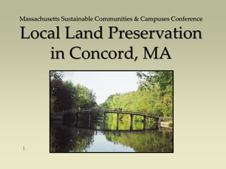
- 1. Massachusetts Sustainable Communities & Campuses Conference Local Land Preservation in Concord, MA
- 2. Federal land (MMNHP & GMWR): 637 acres. State land (Walden Pond & DOC): 387 acres. Town-owned land: 1,360 acres. Private land trusts: 1,018 acres. Privately owned land subject to Conservation Restriction or Agricultural Preservation Restriction: 2,500 acres. TOTAL: 5,900+ acres of 16,541 acres Approximately 35% of the land in Concord is permanently protected:
- 3. Map A patchwork quilt of permanently protected land. Each patch has a story to tell.
- 4. First Inland Settlement in 1632 – the Great Meadow and Great Field – sustainable farming practices. Land Owners committed to the ‚greater good‛ by gifting their land to Town, State and Federal Government (late 1800’s to 1940’s). Long Range Planning efforts after W.W. II (1950 to present) and adoption of a Land Acquisition Policy. Partnerships between public and private entities (1960 to present). Zoning and land uses that promote preservation of open space (1975 to present). Concord’s Legacy of Land Preservation:
- 5. Egg Rock is located at the confluence of the Assabet and Sudbury Rivers, which then becomes the Concord River – a sacred site of the Musketaquid and other Native American tribes.
- 6. Map Egg Rock at the confluence of the Assabet, Sudbury and Concord Rivers.
- 7. Concord was the first inland settlement in 1632 The Great Meadow and Great Field – sustainable farming practices. Great Meadows Wildlife Refuge Maplewood Farm Barrett House
- 8. Hutchins Farm – organic farming practices on land adjacent to the Concord River. Family sold the development rights to the Town so the land is now subject to an agricultural preservation restriction (APR).
- 9. Bay Circuit Trail and the Emerson-Thoreau Amble
- 10. The Emerson-Thoreau Amble links Concord Center to Walden Pond Reservation over publicly and privately owned land.
- 11. Emerson-Thoreau Amble – pattern of land ownership.
- 12. Brister’s Hill land – owned by the Walden Woods Project – interpretive walk with connections to Town land and ‘assessed’ trail Hapgood Wright Town Forest – staff meeting to assess potential to create handicapped accessible parking spaces
- 13. Battle Road Trail – Minute Man National Historical Park
- 14. Minuteman National Historic Park established in 1960 - the Battle Road Trail constructed early 2000’s Kaveski Farm – purchased in 1976 Breen Farm/Thoreau Birthplace – purchased in 1998 Quail Run Residential Cluster– developed in 1999 Pine Hill Rezoning and transfer of land to Concord Land Conservation Trust – 2001 Elm Brook Lane PRD– developed in 2001 Hanscom Airfield conservation restriction – 2012 A Work in Progress The East Quarter
- 15. Battle Road Trail and future connections… The Battle Road Trail brings visitors through an agrarian landscape that evokes Colonial Concord.
- 16. Battle Road Trail – Minute Man National Historical Park
- 17. Destination: Virginia Road, one of the oldest roads in Concord where people can find Gaining Ground, the Thoreau Birthplace and Hanscom Airfield
- 18. Aerial view of Elm Brook Lane PRD and adjacent parcels.
- 19. Elm Brook Lane Planned Residential Development – 12 units of affordable housing developed by the Concord Housing Trust.
- 20. Thoreau School site – purchased in 1945 Harrington Park – purchased in 1974 Cousins Park – purchased in 1975 Westvale Meadow PRD – developed in 1990 Concord Riverwalk PRD – developed in 2010 Rogers Land – purchased in 2011 Stetson/Spinelli easements – purchased in 2014 A Work in Progress Trails along the Assabet River
- 21. The Assabet River – a federally designated Wild & Scenic River.
- 22. Assabet River Walk – Harrington Park, Cousins Park, Rogers land, Riverwalk PRD, Westvale Meadow PRD.
- 23. Harrington Park (open space and historic home site), Cousins Park (community garden, recreation and open space) and the Rogers Land (open space, access to the Assabet River and future community garden)
- 24. ‘Westvale Meadow’ PRD: a 16-unit residential development with garden space for residents and public parking for canoe and fishing access to the Assabet River.
- 25. Concord Riverwalk PRD – a cottage development with 13 residential units, garden space for residents and public walking trails to the Assabet River, which may connect to other trails in the future.
- 26. Get involved - join the local land trust or form a new land trust; volunteer at local events; get appointed or elected to a Town board or committee such as the Conservation Commission, Planning Board or Zoning Board of Appeals. Serve on the Open Space and Recreation Plan update committee. Talk with Town officials about the importance of trails and open space to enhance the quality of life for the community. Support efforts to adopt zoning that helps protect open space. Support the purchase of open space. Where to start?
- 27. Review your community’s Open Space and Recreation Plan – find a map that shows open space in your community. Visualize the connections between existing parcels of Open Space and how you might achieve those connections. Identify property owners of important parcels. Identify the people who know those property owners to explore their interest in keeping their land open. Research every possible funding mechanism for acquiring open space protection – through outright ownership or through conservation restriction. If you’re already involved:
- 28. Community Preservation Funds. Town-supported bond for purchase of land, development rights or conservation restriction. State Self-help funds. Federal funds (such as the Forest Legacy Program). Grants. Private donations and gifts. Partnerships with private and public entities. Potential Funding Sources?
- 29. Local Land Trusts. Nearby Land Trusts e.g., Sudbury Valley Trustees and Trustees of Reservations. Trust for Public Land. State Dept. of Recreation and Conservation. Federal partners – Dept. of the Interior. Local businesses – banks, corporations, etc. Private schools. Developers (use alternative development options to encourage open space protection). And many, many others who share your goal, such as Mass Audubon and others. Who are your Potential Partners?
- 30. Massachusetts Sustainable Communities & Campuses Conference April 16, 2015 Come visit and enjoy a walk in Concord. Marcia Rasmussen, Director of Planning & Land Management For more information, please visit www.concordma.gov