SlideShare ist ein Scribd-Unternehmen logo
1 von 10
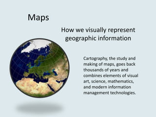
Maps
       How we visually represent
        geographic information

              Cartography, the study and
              making of maps, goes back
              thousands of years and
              combines elements of visual
              art, science, mathematics,
              and modern information
              management technologies.
Section of the 5th
century Roman map
Tabula
Peutingeriana, a
predecessor of the
modern road map.
Types of Maps: different maps answer different kinds of questions

• Road: shows roads, other transit routes, and related points of interest
• Topographic: describes the physical surface shape of an area, typically using
   contour lines to depict relief
• Nautical chart: may indicate water depth, tides, currents, and other maritime
   features
• Geological: for geological features including strata and faults
• Topological: displays only an abstracted set of information frequently without
   regard to scale or distance; commonly used for subway maps and map-based data
   visualization applications
• Political: indicates territorial borders; frequently used with road maps
• Historical: describes historical changes in territory, population, and other topics
• And more…
Google Maps: political, road, and topographical map
Atlases:
collections of related
         maps


                                            Typically focused on a
                                            geographic or thematic
                                            subject (i.e. South
                                            America, ecology, The Civil
                                            War, etc.)


 Background: title page illustration from Theatrum Orbis Terrarum, sive, Atlas
 Novus, an early atlas published in Amsterdam
Assessing the Value of a Map

• Scale: How much detail does a map provide? A map with a scale of
   1 : 50,000 will have much more information than one with a scale of
   1 : 1,000,000.

• Projection: How accurately does represented space on the map
   correspond to real life space? Librarians should be aware of how much
   distortion there is in a given map as a result of how curved surfaces are
   rendered in two dimensions.

• Currency: For maps without historical value, how recently were they
   updated?

• Usability: How effective is a given format? Does a digital resource
   have a confusing user interface, or is an atlas well indexed?
Physical maps can be very expensive, as well as difficult
to store and maintain. However, libraries of all sizes can
benefit from the many maps that are available for free
on the Internet.


   Claudius Ptolemaeus (above) did not have access to the World Wide Web
Most common are the commercial sources that specialize in
current, comprehensive maps, which work very well for
directional or distance-related questions. They also offer
aerial views and a growing number of new features.


 •   Bing Maps
 •   MapQuest
 •   Google Maps/Google Earth
 •   Yahoo! Maps
Some organizations have digitized their collections
of rare and historically significant maps

• Library of Congress: the maps of the vast American Memory
  collection memory.loc.gov/ammem/gmdhtml/
• Old Maps Online: a brilliant portal that links to collections
  around the world www.oldmapsonline.org/
• Map History: links to digital collections, great for early maps
  www.maphistory.info
• David Rumsey Collection: focused on rare 18th and 19th
  century North American and South American maps
  www.davidrumsey.com
Geographic Information Systems: the Future of Maps

A GIS is capable of processing digital data and presenting it as
something that we would recognize as a map


                                    These websites combine census
                                    and demographic information
                                    with mapping tools :

                                    National Historical Geographic
                                    Information System
                                    www.nhgis.org

                                    Social Explorer
                                    www.socialexplorer.com

Weitere ähnliche Inhalte

Was ist angesagt? (19)

Maps
MapsMaps
Maps
 
A new Social Atlas of Europe
A new Social Atlas of EuropeA new Social Atlas of Europe
A new Social Atlas of Europe
 
Types of Maps
Types of MapsTypes of Maps
Types of Maps
 
Chapter map
Chapter mapChapter map
Chapter map
 
Practical work in geography
Practical work in geographyPractical work in geography
Practical work in geography
 
Maps and GIS
Maps and GISMaps and GIS
Maps and GIS
 
Use of Maps and Charts in Research
Use of Maps and Charts in ResearchUse of Maps and Charts in Research
Use of Maps and Charts in Research
 
Types of maps
Types of mapsTypes of maps
Types of maps
 
Types of-maps - part 2
Types of-maps - part 2Types of-maps - part 2
Types of-maps - part 2
 
Introduction to Maps
Introduction to MapsIntroduction to Maps
Introduction to Maps
 
Mapping concepts unit II
Mapping concepts unit IIMapping concepts unit II
Mapping concepts unit II
 
Cartography
CartographyCartography
Cartography
 
Chapter 6 maps
Chapter 6  mapsChapter 6  maps
Chapter 6 maps
 
Map Elements
Map ElementsMap Elements
Map Elements
 
Interpreting maps
Interpreting mapsInterpreting maps
Interpreting maps
 
Cartographic map design
Cartographic map designCartographic map design
Cartographic map design
 
History and impact of sci vis
History and impact of sci visHistory and impact of sci vis
History and impact of sci vis
 
Maps project1
Maps project1Maps project1
Maps project1
 
People Powered Maps
People Powered MapsPeople Powered Maps
People Powered Maps
 

Andere mochten auch

Pg cert lthe induction part two 2013
Pg cert lthe induction part two 2013Pg cert lthe induction part two 2013
Pg cert lthe induction part two 2013ClareVMilsom
 
Money dirty patrick
Money dirty   patrickMoney dirty   patrick
Money dirty patrickEr Ick
 
Git yo'self video lit'rit (annotated)
Git yo'self video lit'rit (annotated)Git yo'self video lit'rit (annotated)
Git yo'self video lit'rit (annotated)David Evan Harris
 
Finnish The First of May
Finnish The First of MayFinnish The First of May
Finnish The First of Maykahopelto
 
Caillou y el gran tobogan
Caillou y el gran toboganCaillou y el gran tobogan
Caillou y el gran toboganASDV
 

Andere mochten auch (10)

Pg cert lthe induction part two 2013
Pg cert lthe induction part two 2013Pg cert lthe induction part two 2013
Pg cert lthe induction part two 2013
 
Money dirty patrick
Money dirty   patrickMoney dirty   patrick
Money dirty patrick
 
Git yo'self video lit'rit (annotated)
Git yo'self video lit'rit (annotated)Git yo'self video lit'rit (annotated)
Git yo'self video lit'rit (annotated)
 
PA
PAPA
PA
 
Slideshare
SlideshareSlideshare
Slideshare
 
Finnish The First of May
Finnish The First of MayFinnish The First of May
Finnish The First of May
 
1 to1 testing
1 to1 testing1 to1 testing
1 to1 testing
 
posicionar pagina web
posicionar pagina webposicionar pagina web
posicionar pagina web
 
Caillou y el gran tobogan
Caillou y el gran toboganCaillou y el gran tobogan
Caillou y el gran tobogan
 
The need for solidarity
The need for solidarityThe need for solidarity
The need for solidarity
 

Ähnlich wie Rodriguez geo maps

History of Data Visualization
History of Data VisualizationHistory of Data Visualization
History of Data VisualizationManimaran A
 
Geographical Sources Governmental Publications/ Documents Continuing Resour...
Geographical Sources  Governmental Publications/ Documents  Continuing Resour...Geographical Sources  Governmental Publications/ Documents  Continuing Resour...
Geographical Sources Governmental Publications/ Documents Continuing Resour...Janecatalla
 
Geographical sources 1
Geographical sources 1Geographical sources 1
Geographical sources 1Iqra tasifali
 
DSH Week 3 – Storytelling with Place.pdf
DSH Week 3 – Storytelling with Place.pdfDSH Week 3 – Storytelling with Place.pdf
DSH Week 3 – Storytelling with Place.pdfStefanAngelDx
 
Chapter 1: True Maps, False Impressions
Chapter 1: True Maps, False ImpressionsChapter 1: True Maps, False Impressions
Chapter 1: True Maps, False Impressionsjstubblefield
 
Staff Luncheon Geosources
Staff Luncheon GeosourcesStaff Luncheon Geosources
Staff Luncheon Geosourcesroycekitts
 
Geographical sources by Aman Kr Kushwaha
Geographical sources by Aman Kr KushwahaGeographical sources by Aman Kr Kushwaha
Geographical sources by Aman Kr KushwahaAMAN KUMAR KUSHWAHA
 
Applying map presentation principles.pdf
Applying map presentation principles.pdfApplying map presentation principles.pdf
Applying map presentation principles.pdfDanilign Mekonnen
 
03 b-maps&diagrams
03 b-maps&diagrams03 b-maps&diagrams
03 b-maps&diagramsPaul Kahn
 
Crowdsourcing and Participation in Cartography (G572 Guest Lecture)
Crowdsourcing and Participation in Cartography (G572 Guest Lecture)Crowdsourcing and Participation in Cartography (G572 Guest Lecture)
Crowdsourcing and Participation in Cartography (G572 Guest Lecture)Carl Sack
 
Maps, Diagrams and Timelines, Inspiration for Interactive Design - Webinar 20...
Maps, Diagrams and Timelines, Inspiration for Interactive Design - Webinar 20...Maps, Diagrams and Timelines, Inspiration for Interactive Design - Webinar 20...
Maps, Diagrams and Timelines, Inspiration for Interactive Design - Webinar 20...Mad*Pow
 
Geographical sources
Geographical sourcesGeographical sources
Geographical sourcesJohan Koren
 
Exploring our geographic world by tessie calimag bb.
Exploring our geographic world by tessie calimag bb.Exploring our geographic world by tessie calimag bb.
Exploring our geographic world by tessie calimag bb.Tessie Calimag
 
Maps: a "Must Have" for Genealogists
Maps: a "Must Have" for GenealogistsMaps: a "Must Have" for Genealogists
Maps: a "Must Have" for GenealogistsKatherine Rankin
 
diss-lesson-3-introducing-geography-and-history-200805022056.pptx
diss-lesson-3-introducing-geography-and-history-200805022056.pptxdiss-lesson-3-introducing-geography-and-history-200805022056.pptx
diss-lesson-3-introducing-geography-and-history-200805022056.pptxDan Lhery Gregorious
 
Geographical Sources
Geographical SourcesGeographical Sources
Geographical SourcesJohan Koren
 
Exploring our geographic world by tessie calimag bb.
Exploring our geographic world by tessie calimag bb.Exploring our geographic world by tessie calimag bb.
Exploring our geographic world by tessie calimag bb.Tessie Calimag
 

Ähnlich wie Rodriguez geo maps (20)

History of Data Visualization
History of Data VisualizationHistory of Data Visualization
History of Data Visualization
 
Maps2
Maps2Maps2
Maps2
 
Geographical Sources Governmental Publications/ Documents Continuing Resour...
Geographical Sources  Governmental Publications/ Documents  Continuing Resour...Geographical Sources  Governmental Publications/ Documents  Continuing Resour...
Geographical Sources Governmental Publications/ Documents Continuing Resour...
 
Geographical sources 1
Geographical sources 1Geographical sources 1
Geographical sources 1
 
DSH Week 3 – Storytelling with Place.pdf
DSH Week 3 – Storytelling with Place.pdfDSH Week 3 – Storytelling with Place.pdf
DSH Week 3 – Storytelling with Place.pdf
 
Chapter 1: True Maps, False Impressions
Chapter 1: True Maps, False ImpressionsChapter 1: True Maps, False Impressions
Chapter 1: True Maps, False Impressions
 
MapMaker.pdf
MapMaker.pdfMapMaker.pdf
MapMaker.pdf
 
Staff Luncheon Geosources
Staff Luncheon GeosourcesStaff Luncheon Geosources
Staff Luncheon Geosources
 
Geographical sources by Aman Kr Kushwaha
Geographical sources by Aman Kr KushwahaGeographical sources by Aman Kr Kushwaha
Geographical sources by Aman Kr Kushwaha
 
Applying map presentation principles.pdf
Applying map presentation principles.pdfApplying map presentation principles.pdf
Applying map presentation principles.pdf
 
03 b-maps&diagrams
03 b-maps&diagrams03 b-maps&diagrams
03 b-maps&diagrams
 
Crowdsourcing and Participation in Cartography (G572 Guest Lecture)
Crowdsourcing and Participation in Cartography (G572 Guest Lecture)Crowdsourcing and Participation in Cartography (G572 Guest Lecture)
Crowdsourcing and Participation in Cartography (G572 Guest Lecture)
 
Maps, Diagrams and Timelines, Inspiration for Interactive Design - Webinar 20...
Maps, Diagrams and Timelines, Inspiration for Interactive Design - Webinar 20...Maps, Diagrams and Timelines, Inspiration for Interactive Design - Webinar 20...
Maps, Diagrams and Timelines, Inspiration for Interactive Design - Webinar 20...
 
Geographical sources
Geographical sourcesGeographical sources
Geographical sources
 
Exploring our geographic world by tessie calimag bb.
Exploring our geographic world by tessie calimag bb.Exploring our geographic world by tessie calimag bb.
Exploring our geographic world by tessie calimag bb.
 
Unit I - Introduction to Maps.pptx
Unit I - Introduction to Maps.pptxUnit I - Introduction to Maps.pptx
Unit I - Introduction to Maps.pptx
 
Maps: a "Must Have" for Genealogists
Maps: a "Must Have" for GenealogistsMaps: a "Must Have" for Genealogists
Maps: a "Must Have" for Genealogists
 
diss-lesson-3-introducing-geography-and-history-200805022056.pptx
diss-lesson-3-introducing-geography-and-history-200805022056.pptxdiss-lesson-3-introducing-geography-and-history-200805022056.pptx
diss-lesson-3-introducing-geography-and-history-200805022056.pptx
 
Geographical Sources
Geographical SourcesGeographical Sources
Geographical Sources
 
Exploring our geographic world by tessie calimag bb.
Exploring our geographic world by tessie calimag bb.Exploring our geographic world by tessie calimag bb.
Exploring our geographic world by tessie calimag bb.
 

Rodriguez geo maps

  • 1. Maps How we visually represent geographic information Cartography, the study and making of maps, goes back thousands of years and combines elements of visual art, science, mathematics, and modern information management technologies.
  • 2. Section of the 5th century Roman map Tabula Peutingeriana, a predecessor of the modern road map.
  • 3. Types of Maps: different maps answer different kinds of questions • Road: shows roads, other transit routes, and related points of interest • Topographic: describes the physical surface shape of an area, typically using contour lines to depict relief • Nautical chart: may indicate water depth, tides, currents, and other maritime features • Geological: for geological features including strata and faults • Topological: displays only an abstracted set of information frequently without regard to scale or distance; commonly used for subway maps and map-based data visualization applications • Political: indicates territorial borders; frequently used with road maps • Historical: describes historical changes in territory, population, and other topics • And more…
  • 4. Google Maps: political, road, and topographical map
  • 5. Atlases: collections of related maps Typically focused on a geographic or thematic subject (i.e. South America, ecology, The Civil War, etc.) Background: title page illustration from Theatrum Orbis Terrarum, sive, Atlas Novus, an early atlas published in Amsterdam
  • 6. Assessing the Value of a Map • Scale: How much detail does a map provide? A map with a scale of 1 : 50,000 will have much more information than one with a scale of 1 : 1,000,000. • Projection: How accurately does represented space on the map correspond to real life space? Librarians should be aware of how much distortion there is in a given map as a result of how curved surfaces are rendered in two dimensions. • Currency: For maps without historical value, how recently were they updated? • Usability: How effective is a given format? Does a digital resource have a confusing user interface, or is an atlas well indexed?
  • 7. Physical maps can be very expensive, as well as difficult to store and maintain. However, libraries of all sizes can benefit from the many maps that are available for free on the Internet. Claudius Ptolemaeus (above) did not have access to the World Wide Web
  • 8. Most common are the commercial sources that specialize in current, comprehensive maps, which work very well for directional or distance-related questions. They also offer aerial views and a growing number of new features. • Bing Maps • MapQuest • Google Maps/Google Earth • Yahoo! Maps
  • 9. Some organizations have digitized their collections of rare and historically significant maps • Library of Congress: the maps of the vast American Memory collection memory.loc.gov/ammem/gmdhtml/ • Old Maps Online: a brilliant portal that links to collections around the world www.oldmapsonline.org/ • Map History: links to digital collections, great for early maps www.maphistory.info • David Rumsey Collection: focused on rare 18th and 19th century North American and South American maps www.davidrumsey.com
  • 10. Geographic Information Systems: the Future of Maps A GIS is capable of processing digital data and presenting it as something that we would recognize as a map These websites combine census and demographic information with mapping tools : National Historical Geographic Information System www.nhgis.org Social Explorer www.socialexplorer.com