SlideShare ist ein Scribd-Unternehmen logo
1 von 30
Downloaden Sie, um offline zu lesen
Victoria M Gammino, PhD., MPH
Chief Science Officer
International Meeting on Emerging Diseases, ISID
Vienna, Austria 10 Nov. 2018
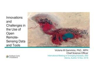
Innovations
and
Challenges in
the Use of
Open
Remote-
Sensing Data
and Tools https://earthobservatory.nasa.gov/images/91291/the-ups-and-downs-of-lake-chad 2017
REMOTE SENSING: The science and at of identifying, observing
and measuring an object without coming into direct contact (NASA)
Not Just
Another
Pretty Picture
https://www.cdc.gov/lyme/stats/maps.html
Varies by satellite
and describes the
time it takes for an
individual satellite to
orbit and revisit a
specific area.
Spatial Resolution
Spatial resolution refers to the pixel size
of the satellite image. The lower the
number (e.g., 1m) the finer the clarity of
image)
OPPORTUNITIES
Dramatic Increase In Imagery Supply
Satellite
Drone
Aircraft
https://www.ucsusa.org
Earth Observation Satellites
Internet of Things
RFID
Bluetooth
Biosensors
Mobiles and
Tablets
Cloud Computing
Machine Learning
New Tools for Processing and Analysis
Computer Vision
Viral
Hemorrhagic
Fevers
Influenza
Malaria
Disease
Surveillance
BiosecurityOne-Health
Dengue Climate Change
Nipah
The Public Health Context
CHALLENGES
Data producers vs consumers
Widening technology divide
Differential access despite “open”
N
S
The Dual Contexts of Earth Observation
Data Discovery
 Innumerable sources of data
 Velocity and volume
 Storage space and costs
 Inherent complexity
 Data standards
 Catalogs/tagging
 Time, software, expertise
Data
Silos
Ground
Truth
ICT Infrastructure
https://www.fastmetrics.com/internet-connection-speed-by-country.php
Upload/download speeds
limit cloud computing
1GB via 14.4 modem ~ 167
hours
GSDI equally poor or non-
existent
LEADERS CHALLENGERS ASPIRANTS
Advanced NSDI NSDI focused on collection
and aggregation
Basic NSDI, under
development or in planning
National Mapping Agency Thematic layers (cadastral,
topography, utilities and
transport infrastructure)
available every 6-12
months)
Thematic layers of lower
resolution; updates lag 3-5
years
Space Agency EO imagery generally above
3m
Little or no current EO data
Provides general access
Integrated data centers and
data clearinghouses
https://geobuiz.com/geobuiz-2018-report.html
http://apps.who.int/iris/handle/10665/204368
WHAT NEXT
1 Invest in GDSI.
2 Calculate the return on investment.
3 Codify it.
4 Lean further into open data.
DATA
HOARDING
6 WELCOME FAILURE.
ADDITIONAL RESOURCES
https://www.radiant.earth/ ; http://geopode.world/ ;
Resources for Finding and Using Satellite Images by Toby McIntyre (Global Investigative Journalism Network)
https://gijn.org/resources-for-finding-and-using-satellite-images/
Satellite Journalism: The Big Picture by Mark Corcoran (Reuters) https://reutersinstitute.politics.ox.ac.uk/our-
research/satellite-journalism-big-picture
WORKSHOP : Sunday Nov 11th 2018, 1145- 1345 hrs. Klimt1
Additional Slides,
Instructional & Contact Information
Victoria M Gammino, PhD, MPH
Chief Science Officer
Radiant Earth Foundation
p: (202) 986-5471
w: www.radiant.earth
https://medium.com/radiant-earth-insights
https://twitter.com/OurRadiantEarth
https://twitter.com/VictoriaGammino
Webinars and Tutorials
https://www.youtube.com/channel/UCfEmhf6e_y
Ozvh5FzVDmZPg
https://www.facebook.com/OurRadiantEarth/
https://unstats.un.org/unsd/demographic/sources/census/censusdates.htm
Census Conducted Between 2005-2014
https://geobuiz.com/geobuiz-2018-report.html
Country Geospatial Readiness Index-
Assessment Pillars

Weitere ähnliche Inhalte

Was ist angesagt?

Geoinformatics ppt
Geoinformatics pptGeoinformatics ppt
Geoinformatics pptRevathy1993
 
Module 10 - Section 4: ICTs for understanding and monitoring the environment ...
Module 10 - Section 4: ICTs for understanding and monitoring the environment ...Module 10 - Section 4: ICTs for understanding and monitoring the environment ...
Module 10 - Section 4: ICTs for understanding and monitoring the environment ...Richard Labelle
 
Introduction to Geoinformatics
Introduction to GeoinformaticsIntroduction to Geoinformatics
Introduction to GeoinformaticsKU Leuven
 
Remote sensing and gps
Remote sensing and gpsRemote sensing and gps
Remote sensing and gpsmsfbi1521
 
Geographic information system(gis)
Geographic information system(gis)Geographic information system(gis)
Geographic information system(gis)MapQuest.Inc
 
Advantages and disadvantages of Remote Sensing
Advantages and disadvantages of Remote SensingAdvantages and disadvantages of Remote Sensing
Advantages and disadvantages of Remote SensingEr Abhi Vashi
 
REMOTE SENSING AND GEOGRAPHIC INFORMATION SYSTEMS
REMOTE SENSING AND GEOGRAPHIC INFORMATION SYSTEMS REMOTE SENSING AND GEOGRAPHIC INFORMATION SYSTEMS
REMOTE SENSING AND GEOGRAPHIC INFORMATION SYSTEMS AM Publications
 
Remote sensing with drones: The challenges of obtaining truly quantitative da...
Remote sensing with drones: The challenges of obtaining truly quantitative da...Remote sensing with drones: The challenges of obtaining truly quantitative da...
Remote sensing with drones: The challenges of obtaining truly quantitative da...ARDC
 
How can drone data be used in modelling?
How can drone data be used in modelling?How can drone data be used in modelling?
How can drone data be used in modelling?ARDC
 
Remote sensing concept and applications
Remote sensing   concept and applicationsRemote sensing   concept and applications
Remote sensing concept and applicationsMegha Majoe
 
Better Hackathon 2020 ETHZ - Comparing Static And Dynamic Effects Of Earthquakes
Better Hackathon 2020 ETHZ - Comparing Static And Dynamic Effects Of EarthquakesBetter Hackathon 2020 ETHZ - Comparing Static And Dynamic Effects Of Earthquakes
Better Hackathon 2020 ETHZ - Comparing Static And Dynamic Effects Of EarthquakesPRBETTER
 
Drones in the Earth Sciences - Opportunities and issues
Drones in the Earth Sciences - Opportunities and issuesDrones in the Earth Sciences - Opportunities and issues
Drones in the Earth Sciences - Opportunities and issuesARDC
 

Was ist angesagt? (20)

Geoinformatics ppt
Geoinformatics pptGeoinformatics ppt
Geoinformatics ppt
 
Geoinformatics (1)
Geoinformatics (1)Geoinformatics (1)
Geoinformatics (1)
 
Module 10 - Section 4: ICTs for understanding and monitoring the environment ...
Module 10 - Section 4: ICTs for understanding and monitoring the environment ...Module 10 - Section 4: ICTs for understanding and monitoring the environment ...
Module 10 - Section 4: ICTs for understanding and monitoring the environment ...
 
What is GIS?
What is GIS?What is GIS?
What is GIS?
 
Introduction to Geoinformatics
Introduction to GeoinformaticsIntroduction to Geoinformatics
Introduction to Geoinformatics
 
Remote sensing and gis env bio
Remote sensing and gis  env bioRemote sensing and gis  env bio
Remote sensing and gis env bio
 
Basic remote sensing and gis
Basic remote sensing and gisBasic remote sensing and gis
Basic remote sensing and gis
 
Introduction to geomatics
Introduction to geomaticsIntroduction to geomatics
Introduction to geomatics
 
Geomatics
Geomatics Geomatics
Geomatics
 
Remote sensing and gps
Remote sensing and gpsRemote sensing and gps
Remote sensing and gps
 
Geographic information system(gis)
Geographic information system(gis)Geographic information system(gis)
Geographic information system(gis)
 
Remote Sensing ppt
Remote Sensing pptRemote Sensing ppt
Remote Sensing ppt
 
Future direction of geoinfomatics
Future direction of geoinfomaticsFuture direction of geoinfomatics
Future direction of geoinfomatics
 
Advantages and disadvantages of Remote Sensing
Advantages and disadvantages of Remote SensingAdvantages and disadvantages of Remote Sensing
Advantages and disadvantages of Remote Sensing
 
REMOTE SENSING AND GEOGRAPHIC INFORMATION SYSTEMS
REMOTE SENSING AND GEOGRAPHIC INFORMATION SYSTEMS REMOTE SENSING AND GEOGRAPHIC INFORMATION SYSTEMS
REMOTE SENSING AND GEOGRAPHIC INFORMATION SYSTEMS
 
Remote sensing with drones: The challenges of obtaining truly quantitative da...
Remote sensing with drones: The challenges of obtaining truly quantitative da...Remote sensing with drones: The challenges of obtaining truly quantitative da...
Remote sensing with drones: The challenges of obtaining truly quantitative da...
 
How can drone data be used in modelling?
How can drone data be used in modelling?How can drone data be used in modelling?
How can drone data be used in modelling?
 
Remote sensing concept and applications
Remote sensing   concept and applicationsRemote sensing   concept and applications
Remote sensing concept and applications
 
Better Hackathon 2020 ETHZ - Comparing Static And Dynamic Effects Of Earthquakes
Better Hackathon 2020 ETHZ - Comparing Static And Dynamic Effects Of EarthquakesBetter Hackathon 2020 ETHZ - Comparing Static And Dynamic Effects Of Earthquakes
Better Hackathon 2020 ETHZ - Comparing Static And Dynamic Effects Of Earthquakes
 
Drones in the Earth Sciences - Opportunities and issues
Drones in the Earth Sciences - Opportunities and issuesDrones in the Earth Sciences - Opportunities and issues
Drones in the Earth Sciences - Opportunities and issues
 

Ähnlich wie IMED 2018: Innovations and Challenges in the Use of Open-source Remote Sensing Data and Tools.

SC7 Workshop 3: Space-based applications and Big Data
SC7 Workshop 3: Space-based applications and Big DataSC7 Workshop 3: Space-based applications and Big Data
SC7 Workshop 3: Space-based applications and Big DataBigData_Europe
 
Foresight conversation
Foresight conversationForesight conversation
Foresight conversationsuresh sood
 
SC7 Workshop 3: The BDE pilot for secure societies
SC7 Workshop 3: The BDE pilot for secure societiesSC7 Workshop 3: The BDE pilot for secure societies
SC7 Workshop 3: The BDE pilot for secure societiesBigData_Europe
 
AI for Earth: Analyzing Global Data with Azure
AI for Earth: Analyzing Global Data with AzureAI for Earth: Analyzing Global Data with Azure
AI for Earth: Analyzing Global Data with AzureMicrosoft Tech Community
 
ISU | Space-enabled Big Data
ISU | Space-enabled Big DataISU | Space-enabled Big Data
ISU | Space-enabled Big DataValery Komissarov
 
Applying Photonics to User Needs: The Application Challenge
Applying Photonics to User Needs: The Application ChallengeApplying Photonics to User Needs: The Application Challenge
Applying Photonics to User Needs: The Application ChallengeLarry Smarr
 
NASA Web World Wind: welcome to the new era of virtual globes
NASA Web World Wind: welcome to the new era of virtual globes NASA Web World Wind: welcome to the new era of virtual globes
NASA Web World Wind: welcome to the new era of virtual globes Maria Antonia Brovelli
 
Introduction to Digital Mapping for UG Students
Introduction to Digital Mapping for UG StudentsIntroduction to Digital Mapping for UG Students
Introduction to Digital Mapping for UG StudentsAbhijitZende3
 
Godiva2 Overview
Godiva2 OverviewGodiva2 Overview
Godiva2 Overviewjonblower
 
Roelof Pieters (Overstory) – Tackling Forest Fires and Deforestation with Sat...
Roelof Pieters (Overstory) – Tackling Forest Fires and Deforestation with Sat...Roelof Pieters (Overstory) – Tackling Forest Fires and Deforestation with Sat...
Roelof Pieters (Overstory) – Tackling Forest Fires and Deforestation with Sat...Codiax
 
Bigdatacooltools
BigdatacooltoolsBigdatacooltools
Bigdatacooltoolssuresh sood
 
Big Data, Data and Information Mining for Earth Observation
Big Data, Data and Information Mining for Earth ObservationBig Data, Data and Information Mining for Earth Observation
Big Data, Data and Information Mining for Earth ObservationPier Giorgio Marchetti
 
Satellite and Land Cover Image Classification using Deep Learning
Satellite and Land Cover Image Classification using Deep LearningSatellite and Land Cover Image Classification using Deep Learning
Satellite and Land Cover Image Classification using Deep Learningijtsrd
 
INTRODUCTION TO GIS
INTRODUCTION TO GISINTRODUCTION TO GIS
INTRODUCTION TO GISHamzaAhmad91
 
Intern report final
Intern report finalIntern report final
Intern report finalFazlul wahid
 
Smart Data fo the Smart Cities and Smart Factories in the future
Smart Data fo the Smart Cities and Smart Factories in the futureSmart Data fo the Smart Cities and Smart Factories in the future
Smart Data fo the Smart Cities and Smart Factories in the futureYear of the X
 
GIS 2.0 and Neogeography
GIS 2.0 and NeogeographyGIS 2.0 and Neogeography
GIS 2.0 and NeogeographyJoshua Campbell
 
Traffic Congestion Detection Using Deep Learning
Traffic Congestion Detection Using Deep LearningTraffic Congestion Detection Using Deep Learning
Traffic Congestion Detection Using Deep Learningijtsrd
 

Ähnlich wie IMED 2018: Innovations and Challenges in the Use of Open-source Remote Sensing Data and Tools. (20)

Sentinel-2 Semantic Data & Information Cube Austria
Sentinel-2 Semantic Data & Information Cube AustriaSentinel-2 Semantic Data & Information Cube Austria
Sentinel-2 Semantic Data & Information Cube Austria
 
SC7 Workshop 3: Space-based applications and Big Data
SC7 Workshop 3: Space-based applications and Big DataSC7 Workshop 3: Space-based applications and Big Data
SC7 Workshop 3: Space-based applications and Big Data
 
Foresight conversation
Foresight conversationForesight conversation
Foresight conversation
 
SC7 Workshop 3: The BDE pilot for secure societies
SC7 Workshop 3: The BDE pilot for secure societiesSC7 Workshop 3: The BDE pilot for secure societies
SC7 Workshop 3: The BDE pilot for secure societies
 
AI for Earth: Analyzing Global Data with Azure
AI for Earth: Analyzing Global Data with AzureAI for Earth: Analyzing Global Data with Azure
AI for Earth: Analyzing Global Data with Azure
 
ISU | Space-enabled Big Data
ISU | Space-enabled Big DataISU | Space-enabled Big Data
ISU | Space-enabled Big Data
 
Applying Photonics to User Needs: The Application Challenge
Applying Photonics to User Needs: The Application ChallengeApplying Photonics to User Needs: The Application Challenge
Applying Photonics to User Needs: The Application Challenge
 
NASA Web World Wind: welcome to the new era of virtual globes
NASA Web World Wind: welcome to the new era of virtual globes NASA Web World Wind: welcome to the new era of virtual globes
NASA Web World Wind: welcome to the new era of virtual globes
 
Introduction to Digital Mapping for UG Students
Introduction to Digital Mapping for UG StudentsIntroduction to Digital Mapping for UG Students
Introduction to Digital Mapping for UG Students
 
Lect 4
Lect 4Lect 4
Lect 4
 
Godiva2 Overview
Godiva2 OverviewGodiva2 Overview
Godiva2 Overview
 
Roelof Pieters (Overstory) – Tackling Forest Fires and Deforestation with Sat...
Roelof Pieters (Overstory) – Tackling Forest Fires and Deforestation with Sat...Roelof Pieters (Overstory) – Tackling Forest Fires and Deforestation with Sat...
Roelof Pieters (Overstory) – Tackling Forest Fires and Deforestation with Sat...
 
Bigdatacooltools
BigdatacooltoolsBigdatacooltools
Bigdatacooltools
 
Big Data, Data and Information Mining for Earth Observation
Big Data, Data and Information Mining for Earth ObservationBig Data, Data and Information Mining for Earth Observation
Big Data, Data and Information Mining for Earth Observation
 
Satellite and Land Cover Image Classification using Deep Learning
Satellite and Land Cover Image Classification using Deep LearningSatellite and Land Cover Image Classification using Deep Learning
Satellite and Land Cover Image Classification using Deep Learning
 
INTRODUCTION TO GIS
INTRODUCTION TO GISINTRODUCTION TO GIS
INTRODUCTION TO GIS
 
Intern report final
Intern report finalIntern report final
Intern report final
 
Smart Data fo the Smart Cities and Smart Factories in the future
Smart Data fo the Smart Cities and Smart Factories in the futureSmart Data fo the Smart Cities and Smart Factories in the future
Smart Data fo the Smart Cities and Smart Factories in the future
 
GIS 2.0 and Neogeography
GIS 2.0 and NeogeographyGIS 2.0 and Neogeography
GIS 2.0 and Neogeography
 
Traffic Congestion Detection Using Deep Learning
Traffic Congestion Detection Using Deep LearningTraffic Congestion Detection Using Deep Learning
Traffic Congestion Detection Using Deep Learning
 

Mehr von Louisa Diggs

Workshop: Quantifying Error in Training Data for Mapping and Monitoring the E...
Workshop: Quantifying Error in Training Data for Mapping and Monitoring the E...Workshop: Quantifying Error in Training Data for Mapping and Monitoring the E...
Workshop: Quantifying Error in Training Data for Mapping and Monitoring the E...Louisa Diggs
 
Using Active Learning to Quantify how Training Data Errors Impact Classificat...
Using Active Learning to Quantify how Training Data Errors Impact Classificat...Using Active Learning to Quantify how Training Data Errors Impact Classificat...
Using Active Learning to Quantify how Training Data Errors Impact Classificat...Louisa Diggs
 
Generating Training Data from Noisy Measrements
Generating Training Data from Noisy MeasrementsGenerating Training Data from Noisy Measrements
Generating Training Data from Noisy MeasrementsLouisa Diggs
 
Cropped Field Boundaries, Food Systems, & Fire
Cropped Field Boundaries, Food Systems, & FireCropped Field Boundaries, Food Systems, & Fire
Cropped Field Boundaries, Food Systems, & FireLouisa Diggs
 
Challenges to Large Scale Mapping: Can Data Geometry Help?
Challenges to Large Scale Mapping: Can Data Geometry Help?Challenges to Large Scale Mapping: Can Data Geometry Help?
Challenges to Large Scale Mapping: Can Data Geometry Help?Louisa Diggs
 
A Random Walk of Issues Related to Training Data and Land Cover Mapping
A Random Walk of Issues Related to Training Data and Land Cover MappingA Random Walk of Issues Related to Training Data and Land Cover Mapping
A Random Walk of Issues Related to Training Data and Land Cover MappingLouisa Diggs
 
Assessing Land Cover Change using Uncertain Data
Assessing Land Cover Change using Uncertain DataAssessing Land Cover Change using Uncertain Data
Assessing Land Cover Change using Uncertain DataLouisa Diggs
 
Informal Settlements and Cadastral Mapping
Informal Settlements and Cadastral MappingInformal Settlements and Cadastral Mapping
Informal Settlements and Cadastral MappingLouisa Diggs
 
Sources of Map Error in Public Health Activities and Operations Research
Sources of Map Error in Public Health Activities and Operations ResearchSources of Map Error in Public Health Activities and Operations Research
Sources of Map Error in Public Health Activities and Operations ResearchLouisa Diggs
 
Measuring the impact of label noise on semantic segmentation using rastervision
Measuring the impact of label noise on semantic segmentation using rastervisionMeasuring the impact of label noise on semantic segmentation using rastervision
Measuring the impact of label noise on semantic segmentation using rastervisionLouisa Diggs
 
Mapping Smallholder Yields Using Micro-Satellite Data
Mapping Smallholder Yields Using Micro-Satellite DataMapping Smallholder Yields Using Micro-Satellite Data
Mapping Smallholder Yields Using Micro-Satellite DataLouisa Diggs
 
Crowdsourcing Land Cover and Land Use Data: Experiences from IIASA
Crowdsourcing Land Cover and Land Use Data: Experiences from IIASACrowdsourcing Land Cover and Land Use Data: Experiences from IIASA
Crowdsourcing Land Cover and Land Use Data: Experiences from IIASALouisa Diggs
 
IMED 2018: The use of remote sensing, geostatistical and machine learning met...
IMED 2018: The use of remote sensing, geostatistical and machine learning met...IMED 2018: The use of remote sensing, geostatistical and machine learning met...
IMED 2018: The use of remote sensing, geostatistical and machine learning met...Louisa Diggs
 
IMED 2018: Predicting the environmental suitability of podoconiosis in Ethiopia
IMED 2018: Predicting the environmental suitability of podoconiosis in EthiopiaIMED 2018: Predicting the environmental suitability of podoconiosis in Ethiopia
IMED 2018: Predicting the environmental suitability of podoconiosis in EthiopiaLouisa Diggs
 
IMED 2018: Landcover/habitat
IMED 2018: Landcover/habitatIMED 2018: Landcover/habitat
IMED 2018: Landcover/habitatLouisa Diggs
 
IMED 2018: Modeled Population Estimates from Satellite Imagery and Microcensu...
IMED 2018: Modeled Population Estimates from Satellite Imagery and Microcensu...IMED 2018: Modeled Population Estimates from Satellite Imagery and Microcensu...
IMED 2018: Modeled Population Estimates from Satellite Imagery and Microcensu...Louisa Diggs
 
IMED 2018: Mapping Monkeypox risk in the Congo Basin using Remote Sensing and...
IMED 2018: Mapping Monkeypox risk in the Congo Basin using Remote Sensing and...IMED 2018: Mapping Monkeypox risk in the Congo Basin using Remote Sensing and...
IMED 2018: Mapping Monkeypox risk in the Congo Basin using Remote Sensing and...Louisa Diggs
 
IMED 2018: Predicting spatiotemporal risk of yellow fever using a machine lea...
IMED 2018: Predicting spatiotemporal risk of yellow fever using a machine lea...IMED 2018: Predicting spatiotemporal risk of yellow fever using a machine lea...
IMED 2018: Predicting spatiotemporal risk of yellow fever using a machine lea...Louisa Diggs
 

Mehr von Louisa Diggs (18)

Workshop: Quantifying Error in Training Data for Mapping and Monitoring the E...
Workshop: Quantifying Error in Training Data for Mapping and Monitoring the E...Workshop: Quantifying Error in Training Data for Mapping and Monitoring the E...
Workshop: Quantifying Error in Training Data for Mapping and Monitoring the E...
 
Using Active Learning to Quantify how Training Data Errors Impact Classificat...
Using Active Learning to Quantify how Training Data Errors Impact Classificat...Using Active Learning to Quantify how Training Data Errors Impact Classificat...
Using Active Learning to Quantify how Training Data Errors Impact Classificat...
 
Generating Training Data from Noisy Measrements
Generating Training Data from Noisy MeasrementsGenerating Training Data from Noisy Measrements
Generating Training Data from Noisy Measrements
 
Cropped Field Boundaries, Food Systems, & Fire
Cropped Field Boundaries, Food Systems, & FireCropped Field Boundaries, Food Systems, & Fire
Cropped Field Boundaries, Food Systems, & Fire
 
Challenges to Large Scale Mapping: Can Data Geometry Help?
Challenges to Large Scale Mapping: Can Data Geometry Help?Challenges to Large Scale Mapping: Can Data Geometry Help?
Challenges to Large Scale Mapping: Can Data Geometry Help?
 
A Random Walk of Issues Related to Training Data and Land Cover Mapping
A Random Walk of Issues Related to Training Data and Land Cover MappingA Random Walk of Issues Related to Training Data and Land Cover Mapping
A Random Walk of Issues Related to Training Data and Land Cover Mapping
 
Assessing Land Cover Change using Uncertain Data
Assessing Land Cover Change using Uncertain DataAssessing Land Cover Change using Uncertain Data
Assessing Land Cover Change using Uncertain Data
 
Informal Settlements and Cadastral Mapping
Informal Settlements and Cadastral MappingInformal Settlements and Cadastral Mapping
Informal Settlements and Cadastral Mapping
 
Sources of Map Error in Public Health Activities and Operations Research
Sources of Map Error in Public Health Activities and Operations ResearchSources of Map Error in Public Health Activities and Operations Research
Sources of Map Error in Public Health Activities and Operations Research
 
Measuring the impact of label noise on semantic segmentation using rastervision
Measuring the impact of label noise on semantic segmentation using rastervisionMeasuring the impact of label noise on semantic segmentation using rastervision
Measuring the impact of label noise on semantic segmentation using rastervision
 
Mapping Smallholder Yields Using Micro-Satellite Data
Mapping Smallholder Yields Using Micro-Satellite DataMapping Smallholder Yields Using Micro-Satellite Data
Mapping Smallholder Yields Using Micro-Satellite Data
 
Crowdsourcing Land Cover and Land Use Data: Experiences from IIASA
Crowdsourcing Land Cover and Land Use Data: Experiences from IIASACrowdsourcing Land Cover and Land Use Data: Experiences from IIASA
Crowdsourcing Land Cover and Land Use Data: Experiences from IIASA
 
IMED 2018: The use of remote sensing, geostatistical and machine learning met...
IMED 2018: The use of remote sensing, geostatistical and machine learning met...IMED 2018: The use of remote sensing, geostatistical and machine learning met...
IMED 2018: The use of remote sensing, geostatistical and machine learning met...
 
IMED 2018: Predicting the environmental suitability of podoconiosis in Ethiopia
IMED 2018: Predicting the environmental suitability of podoconiosis in EthiopiaIMED 2018: Predicting the environmental suitability of podoconiosis in Ethiopia
IMED 2018: Predicting the environmental suitability of podoconiosis in Ethiopia
 
IMED 2018: Landcover/habitat
IMED 2018: Landcover/habitatIMED 2018: Landcover/habitat
IMED 2018: Landcover/habitat
 
IMED 2018: Modeled Population Estimates from Satellite Imagery and Microcensu...
IMED 2018: Modeled Population Estimates from Satellite Imagery and Microcensu...IMED 2018: Modeled Population Estimates from Satellite Imagery and Microcensu...
IMED 2018: Modeled Population Estimates from Satellite Imagery and Microcensu...
 
IMED 2018: Mapping Monkeypox risk in the Congo Basin using Remote Sensing and...
IMED 2018: Mapping Monkeypox risk in the Congo Basin using Remote Sensing and...IMED 2018: Mapping Monkeypox risk in the Congo Basin using Remote Sensing and...
IMED 2018: Mapping Monkeypox risk in the Congo Basin using Remote Sensing and...
 
IMED 2018: Predicting spatiotemporal risk of yellow fever using a machine lea...
IMED 2018: Predicting spatiotemporal risk of yellow fever using a machine lea...IMED 2018: Predicting spatiotemporal risk of yellow fever using a machine lea...
IMED 2018: Predicting spatiotemporal risk of yellow fever using a machine lea...
 

Kürzlich hochgeladen

PossibleEoarcheanRecordsoftheGeomagneticFieldPreservedintheIsuaSupracrustalBe...
PossibleEoarcheanRecordsoftheGeomagneticFieldPreservedintheIsuaSupracrustalBe...PossibleEoarcheanRecordsoftheGeomagneticFieldPreservedintheIsuaSupracrustalBe...
PossibleEoarcheanRecordsoftheGeomagneticFieldPreservedintheIsuaSupracrustalBe...Sérgio Sacani
 
Spermiogenesis or Spermateleosis or metamorphosis of spermatid
Spermiogenesis or Spermateleosis or metamorphosis of spermatidSpermiogenesis or Spermateleosis or metamorphosis of spermatid
Spermiogenesis or Spermateleosis or metamorphosis of spermatidSarthak Sekhar Mondal
 
9654467111 Call Girls In Raj Nagar Delhi Short 1500 Night 6000
9654467111 Call Girls In Raj Nagar Delhi Short 1500 Night 60009654467111 Call Girls In Raj Nagar Delhi Short 1500 Night 6000
9654467111 Call Girls In Raj Nagar Delhi Short 1500 Night 6000Sapana Sha
 
Botany 4th semester file By Sumit Kumar yadav.pdf
Botany 4th semester file By Sumit Kumar yadav.pdfBotany 4th semester file By Sumit Kumar yadav.pdf
Botany 4th semester file By Sumit Kumar yadav.pdfSumit Kumar yadav
 
Pests of cotton_Sucking_Pests_Dr.UPR.pdf
Pests of cotton_Sucking_Pests_Dr.UPR.pdfPests of cotton_Sucking_Pests_Dr.UPR.pdf
Pests of cotton_Sucking_Pests_Dr.UPR.pdfPirithiRaju
 
Presentation Vikram Lander by Vedansh Gupta.pptx
Presentation Vikram Lander by Vedansh Gupta.pptxPresentation Vikram Lander by Vedansh Gupta.pptx
Presentation Vikram Lander by Vedansh Gupta.pptxgindu3009
 
Zoology 4th semester series (krishna).pdf
Zoology 4th semester series (krishna).pdfZoology 4th semester series (krishna).pdf
Zoology 4th semester series (krishna).pdfSumit Kumar yadav
 
Labelling Requirements and Label Claims for Dietary Supplements and Recommend...
Labelling Requirements and Label Claims for Dietary Supplements and Recommend...Labelling Requirements and Label Claims for Dietary Supplements and Recommend...
Labelling Requirements and Label Claims for Dietary Supplements and Recommend...Lokesh Kothari
 
VIRUSES structure and classification ppt by Dr.Prince C P
VIRUSES structure and classification ppt by Dr.Prince C PVIRUSES structure and classification ppt by Dr.Prince C P
VIRUSES structure and classification ppt by Dr.Prince C PPRINCE C P
 
Unlocking the Potential: Deep dive into ocean of Ceramic Magnets.pptx
Unlocking  the Potential: Deep dive into ocean of Ceramic Magnets.pptxUnlocking  the Potential: Deep dive into ocean of Ceramic Magnets.pptx
Unlocking the Potential: Deep dive into ocean of Ceramic Magnets.pptxanandsmhk
 
Biopesticide (2).pptx .This slides helps to know the different types of biop...
Biopesticide (2).pptx  .This slides helps to know the different types of biop...Biopesticide (2).pptx  .This slides helps to know the different types of biop...
Biopesticide (2).pptx .This slides helps to know the different types of biop...RohitNehra6
 
Hubble Asteroid Hunter III. Physical properties of newly found asteroids
Hubble Asteroid Hunter III. Physical properties of newly found asteroidsHubble Asteroid Hunter III. Physical properties of newly found asteroids
Hubble Asteroid Hunter III. Physical properties of newly found asteroidsSérgio Sacani
 
Asymmetry in the atmosphere of the ultra-hot Jupiter WASP-76 b
Asymmetry in the atmosphere of the ultra-hot Jupiter WASP-76 bAsymmetry in the atmosphere of the ultra-hot Jupiter WASP-76 b
Asymmetry in the atmosphere of the ultra-hot Jupiter WASP-76 bSérgio Sacani
 
Raman spectroscopy.pptx M Pharm, M Sc, Advanced Spectral Analysis
Raman spectroscopy.pptx M Pharm, M Sc, Advanced Spectral AnalysisRaman spectroscopy.pptx M Pharm, M Sc, Advanced Spectral Analysis
Raman spectroscopy.pptx M Pharm, M Sc, Advanced Spectral AnalysisDiwakar Mishra
 
Chemistry 4th semester series (krishna).pdf
Chemistry 4th semester series (krishna).pdfChemistry 4th semester series (krishna).pdf
Chemistry 4th semester series (krishna).pdfSumit Kumar yadav
 
Disentangling the origin of chemical differences using GHOST
Disentangling the origin of chemical differences using GHOSTDisentangling the origin of chemical differences using GHOST
Disentangling the origin of chemical differences using GHOSTSérgio Sacani
 
Nanoparticles synthesis and characterization​ ​
Nanoparticles synthesis and characterization​  ​Nanoparticles synthesis and characterization​  ​
Nanoparticles synthesis and characterization​ ​kaibalyasahoo82800
 
GBSN - Biochemistry (Unit 1)
GBSN - Biochemistry (Unit 1)GBSN - Biochemistry (Unit 1)
GBSN - Biochemistry (Unit 1)Areesha Ahmad
 
Pests of mustard_Identification_Management_Dr.UPR.pdf
Pests of mustard_Identification_Management_Dr.UPR.pdfPests of mustard_Identification_Management_Dr.UPR.pdf
Pests of mustard_Identification_Management_Dr.UPR.pdfPirithiRaju
 

Kürzlich hochgeladen (20)

The Philosophy of Science
The Philosophy of ScienceThe Philosophy of Science
The Philosophy of Science
 
PossibleEoarcheanRecordsoftheGeomagneticFieldPreservedintheIsuaSupracrustalBe...
PossibleEoarcheanRecordsoftheGeomagneticFieldPreservedintheIsuaSupracrustalBe...PossibleEoarcheanRecordsoftheGeomagneticFieldPreservedintheIsuaSupracrustalBe...
PossibleEoarcheanRecordsoftheGeomagneticFieldPreservedintheIsuaSupracrustalBe...
 
Spermiogenesis or Spermateleosis or metamorphosis of spermatid
Spermiogenesis or Spermateleosis or metamorphosis of spermatidSpermiogenesis or Spermateleosis or metamorphosis of spermatid
Spermiogenesis or Spermateleosis or metamorphosis of spermatid
 
9654467111 Call Girls In Raj Nagar Delhi Short 1500 Night 6000
9654467111 Call Girls In Raj Nagar Delhi Short 1500 Night 60009654467111 Call Girls In Raj Nagar Delhi Short 1500 Night 6000
9654467111 Call Girls In Raj Nagar Delhi Short 1500 Night 6000
 
Botany 4th semester file By Sumit Kumar yadav.pdf
Botany 4th semester file By Sumit Kumar yadav.pdfBotany 4th semester file By Sumit Kumar yadav.pdf
Botany 4th semester file By Sumit Kumar yadav.pdf
 
Pests of cotton_Sucking_Pests_Dr.UPR.pdf
Pests of cotton_Sucking_Pests_Dr.UPR.pdfPests of cotton_Sucking_Pests_Dr.UPR.pdf
Pests of cotton_Sucking_Pests_Dr.UPR.pdf
 
Presentation Vikram Lander by Vedansh Gupta.pptx
Presentation Vikram Lander by Vedansh Gupta.pptxPresentation Vikram Lander by Vedansh Gupta.pptx
Presentation Vikram Lander by Vedansh Gupta.pptx
 
Zoology 4th semester series (krishna).pdf
Zoology 4th semester series (krishna).pdfZoology 4th semester series (krishna).pdf
Zoology 4th semester series (krishna).pdf
 
Labelling Requirements and Label Claims for Dietary Supplements and Recommend...
Labelling Requirements and Label Claims for Dietary Supplements and Recommend...Labelling Requirements and Label Claims for Dietary Supplements and Recommend...
Labelling Requirements and Label Claims for Dietary Supplements and Recommend...
 
VIRUSES structure and classification ppt by Dr.Prince C P
VIRUSES structure and classification ppt by Dr.Prince C PVIRUSES structure and classification ppt by Dr.Prince C P
VIRUSES structure and classification ppt by Dr.Prince C P
 
Unlocking the Potential: Deep dive into ocean of Ceramic Magnets.pptx
Unlocking  the Potential: Deep dive into ocean of Ceramic Magnets.pptxUnlocking  the Potential: Deep dive into ocean of Ceramic Magnets.pptx
Unlocking the Potential: Deep dive into ocean of Ceramic Magnets.pptx
 
Biopesticide (2).pptx .This slides helps to know the different types of biop...
Biopesticide (2).pptx  .This slides helps to know the different types of biop...Biopesticide (2).pptx  .This slides helps to know the different types of biop...
Biopesticide (2).pptx .This slides helps to know the different types of biop...
 
Hubble Asteroid Hunter III. Physical properties of newly found asteroids
Hubble Asteroid Hunter III. Physical properties of newly found asteroidsHubble Asteroid Hunter III. Physical properties of newly found asteroids
Hubble Asteroid Hunter III. Physical properties of newly found asteroids
 
Asymmetry in the atmosphere of the ultra-hot Jupiter WASP-76 b
Asymmetry in the atmosphere of the ultra-hot Jupiter WASP-76 bAsymmetry in the atmosphere of the ultra-hot Jupiter WASP-76 b
Asymmetry in the atmosphere of the ultra-hot Jupiter WASP-76 b
 
Raman spectroscopy.pptx M Pharm, M Sc, Advanced Spectral Analysis
Raman spectroscopy.pptx M Pharm, M Sc, Advanced Spectral AnalysisRaman spectroscopy.pptx M Pharm, M Sc, Advanced Spectral Analysis
Raman spectroscopy.pptx M Pharm, M Sc, Advanced Spectral Analysis
 
Chemistry 4th semester series (krishna).pdf
Chemistry 4th semester series (krishna).pdfChemistry 4th semester series (krishna).pdf
Chemistry 4th semester series (krishna).pdf
 
Disentangling the origin of chemical differences using GHOST
Disentangling the origin of chemical differences using GHOSTDisentangling the origin of chemical differences using GHOST
Disentangling the origin of chemical differences using GHOST
 
Nanoparticles synthesis and characterization​ ​
Nanoparticles synthesis and characterization​  ​Nanoparticles synthesis and characterization​  ​
Nanoparticles synthesis and characterization​ ​
 
GBSN - Biochemistry (Unit 1)
GBSN - Biochemistry (Unit 1)GBSN - Biochemistry (Unit 1)
GBSN - Biochemistry (Unit 1)
 
Pests of mustard_Identification_Management_Dr.UPR.pdf
Pests of mustard_Identification_Management_Dr.UPR.pdfPests of mustard_Identification_Management_Dr.UPR.pdf
Pests of mustard_Identification_Management_Dr.UPR.pdf
 

IMED 2018: Innovations and Challenges in the Use of Open-source Remote Sensing Data and Tools.